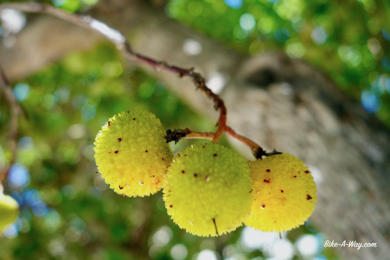
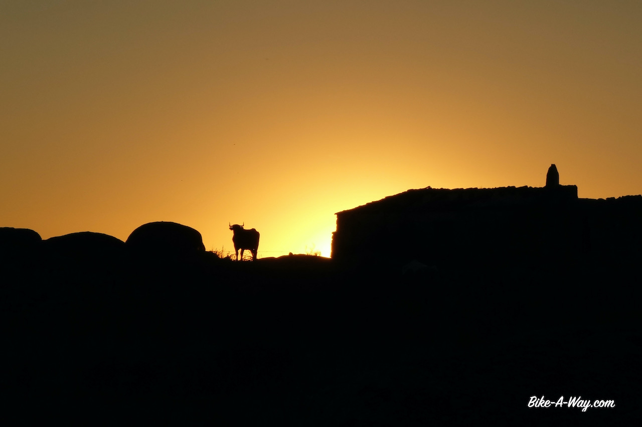
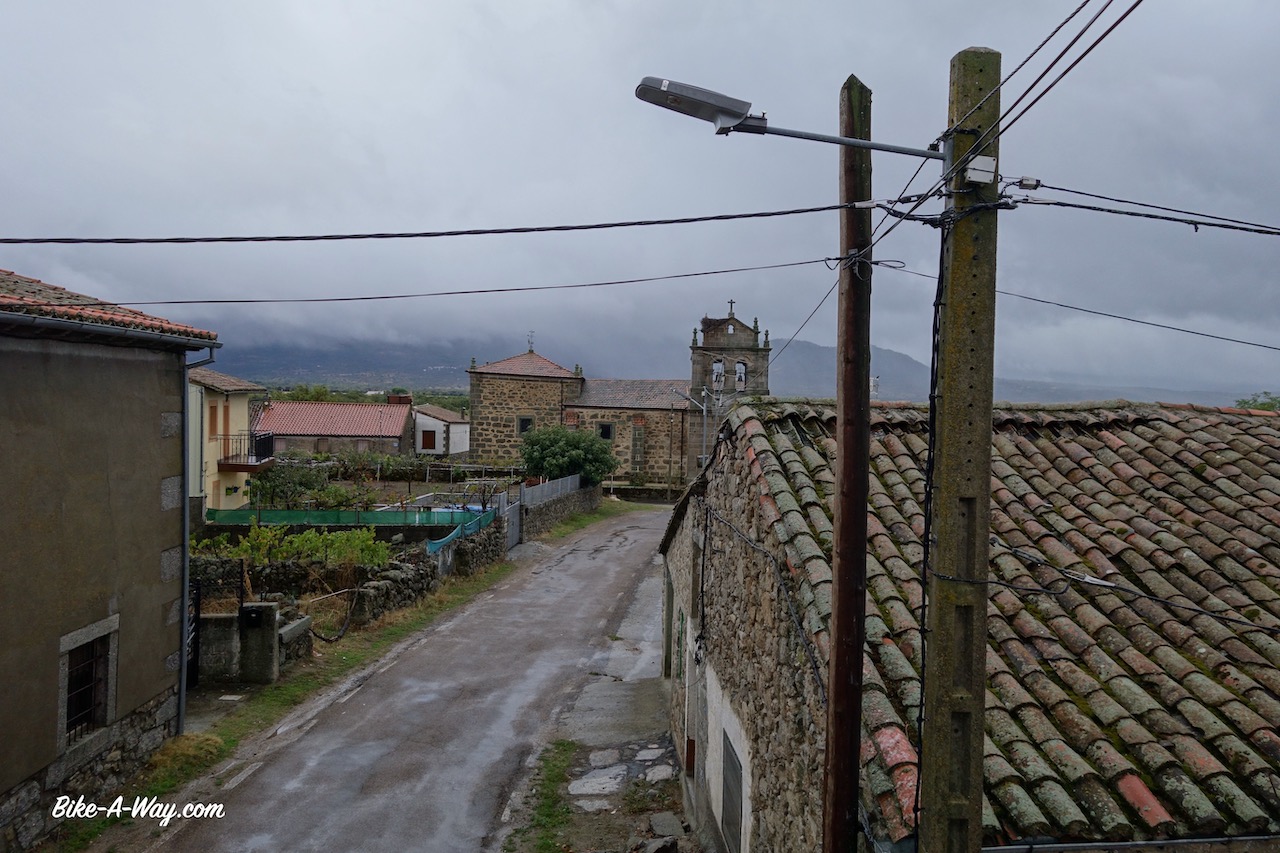
I made a couple of day trips in the ‘El Comtat’, a region bordering the north of Alicante province and the south of Valencia province. El Comtat, together with Marina Alta and Marina Baja is a region where a lot of the professional cycling peloton tends to spend their winters for training rides. Understandable because the climate is smooth most of the times and with multiple mountains over 1.300 meters, they can train their climbing legs.
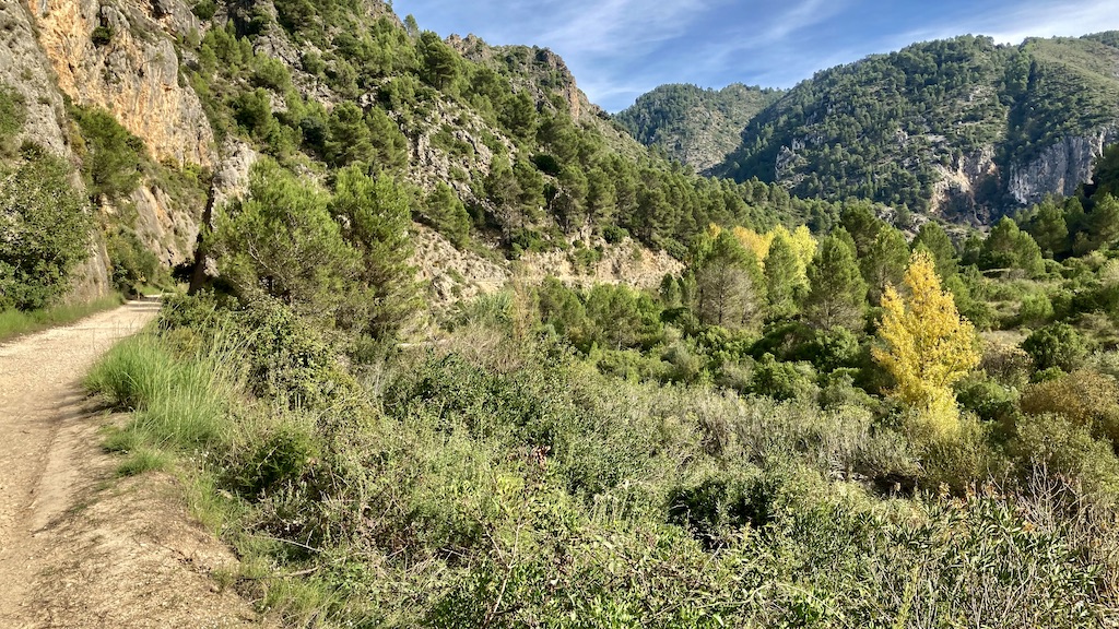
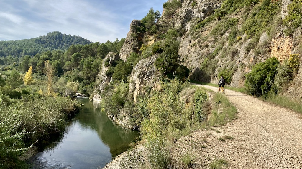
Via Verde del Serpis:
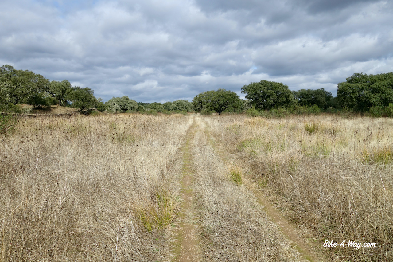
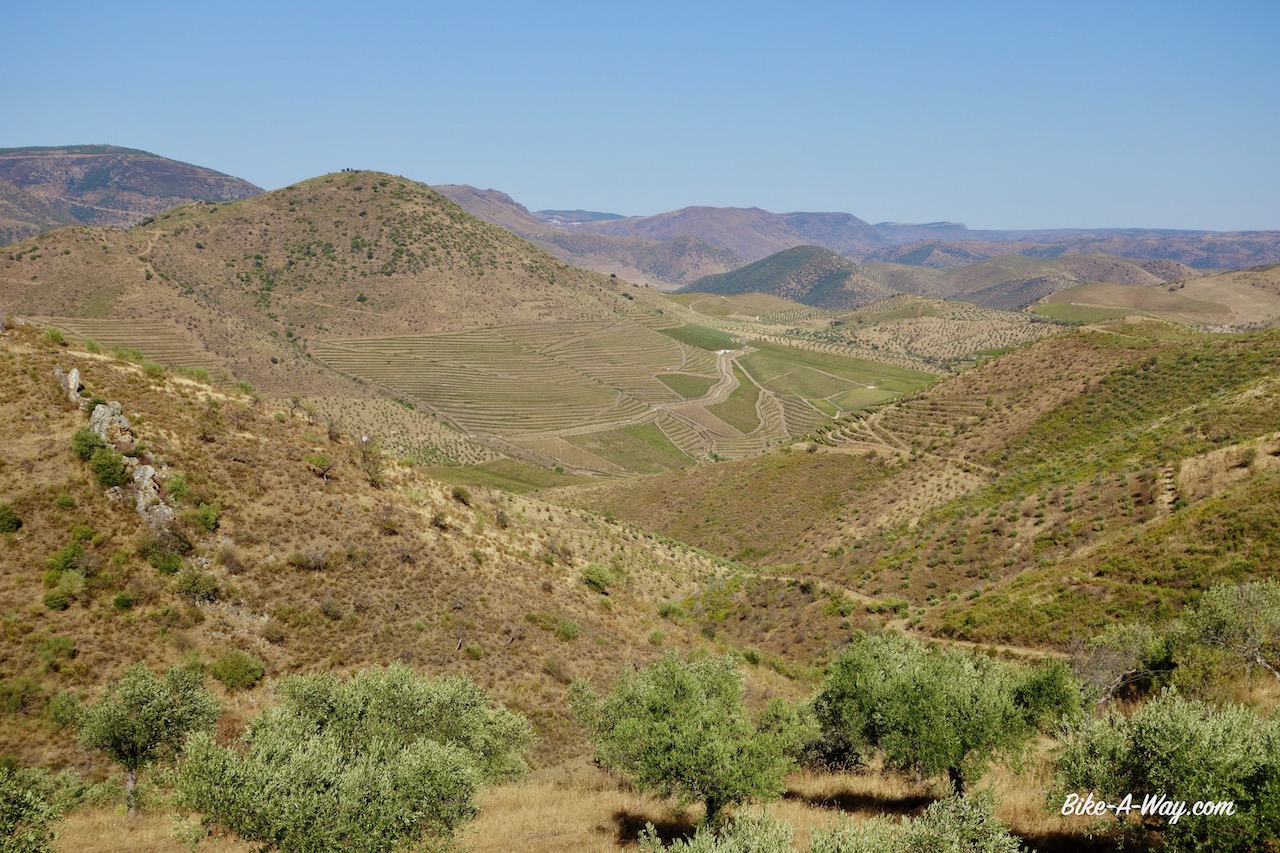
But it doesn’t have to be climbing. There ’s a via verde from Cocentaina, near Alcoy, towards the coastal town Gandia. I rode it up and down, starting in Muro de Alcoy down to Villalonga (about 15 km before Gandia) and back to Muro de Alcoy.
Upon leaving Muro, you first descend towards the Rio D’Agres and a short steep climb back out of it’s little valley. Now I’m riding a quiet paved country road towards Gaianes. To my left (north) is the Sierra de Benicadell.
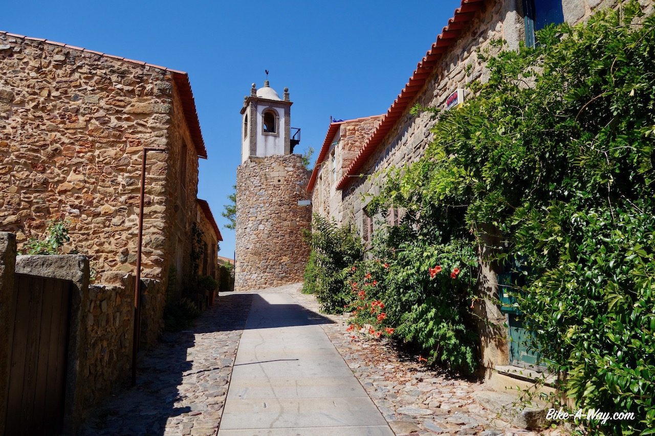
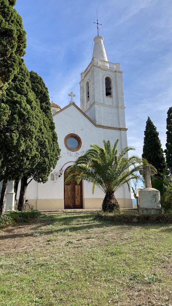
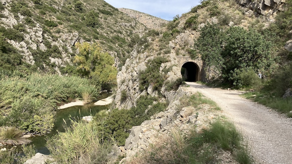
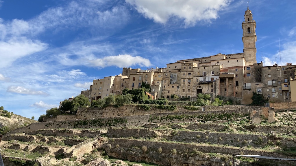
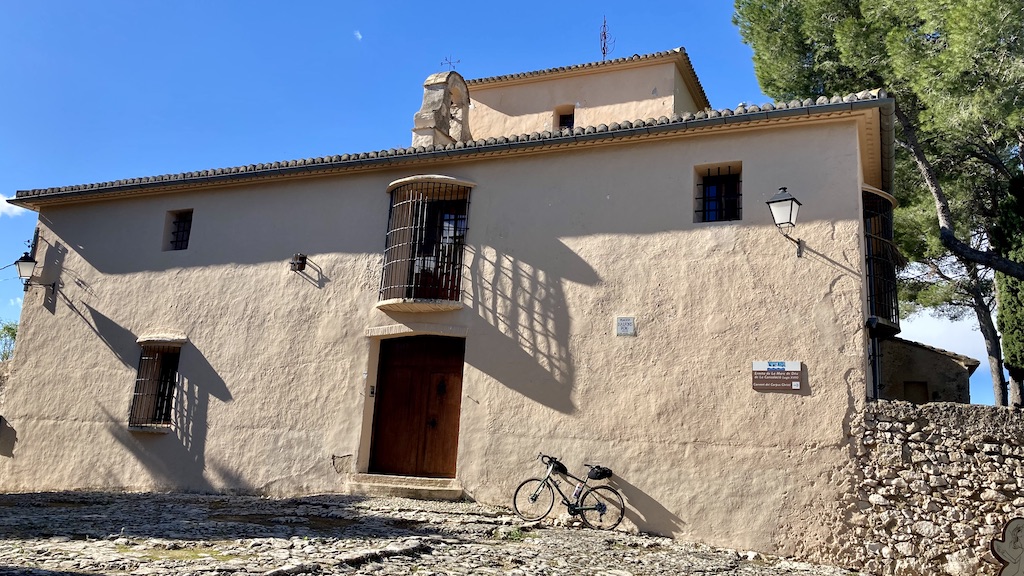
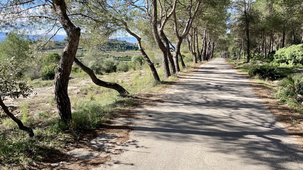
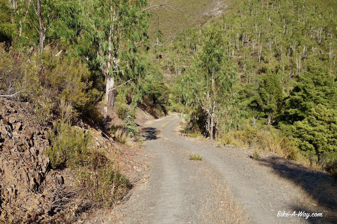
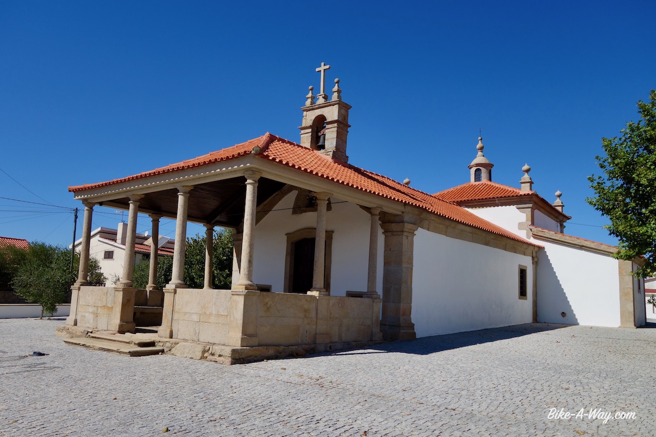
Arriving in the next little town, Beniarrés, I ride to the highest point in town where you’ll find the Ermita Del Santo Cristo, a beautiful white church. From Beniarrés, you could take the cv-705, the road over the Sierra the Benicadell, but that’s for another time. Here, the via verde starts for real. I immediately have to ride through the first old railway tunnel. It’s still a paved, narrow road where in theory you could encounter a car or a tractor going to the fields, but I never saw one.
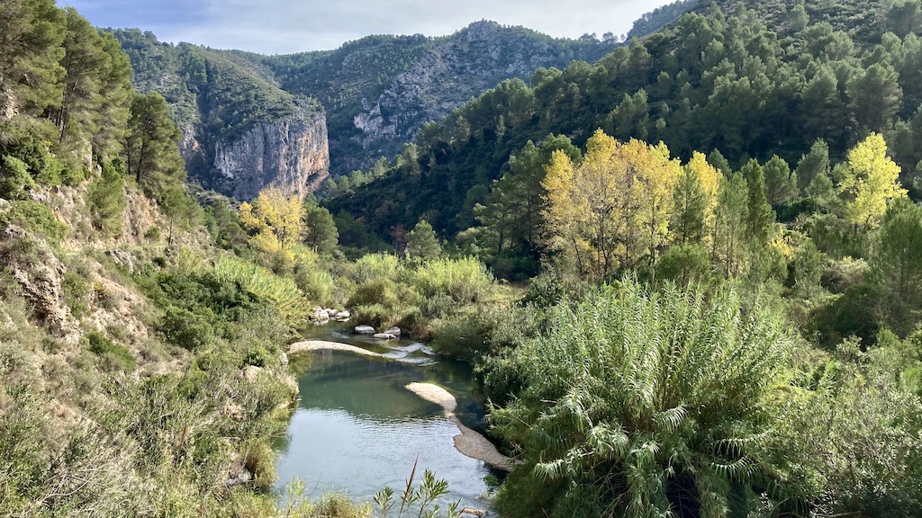
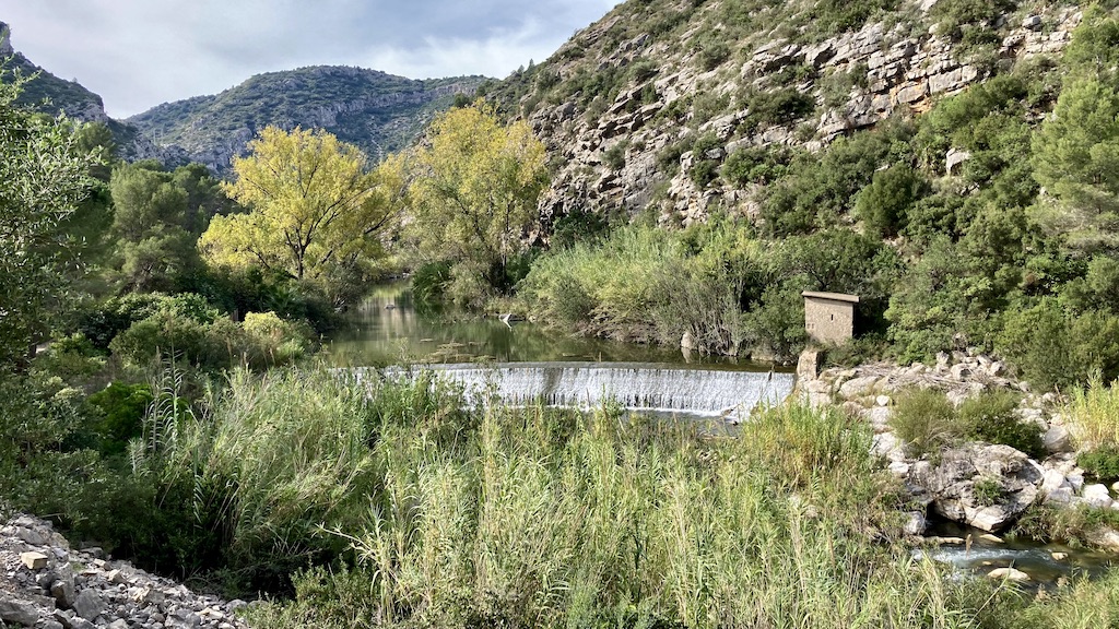
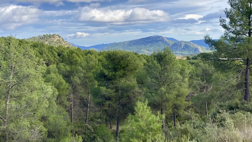
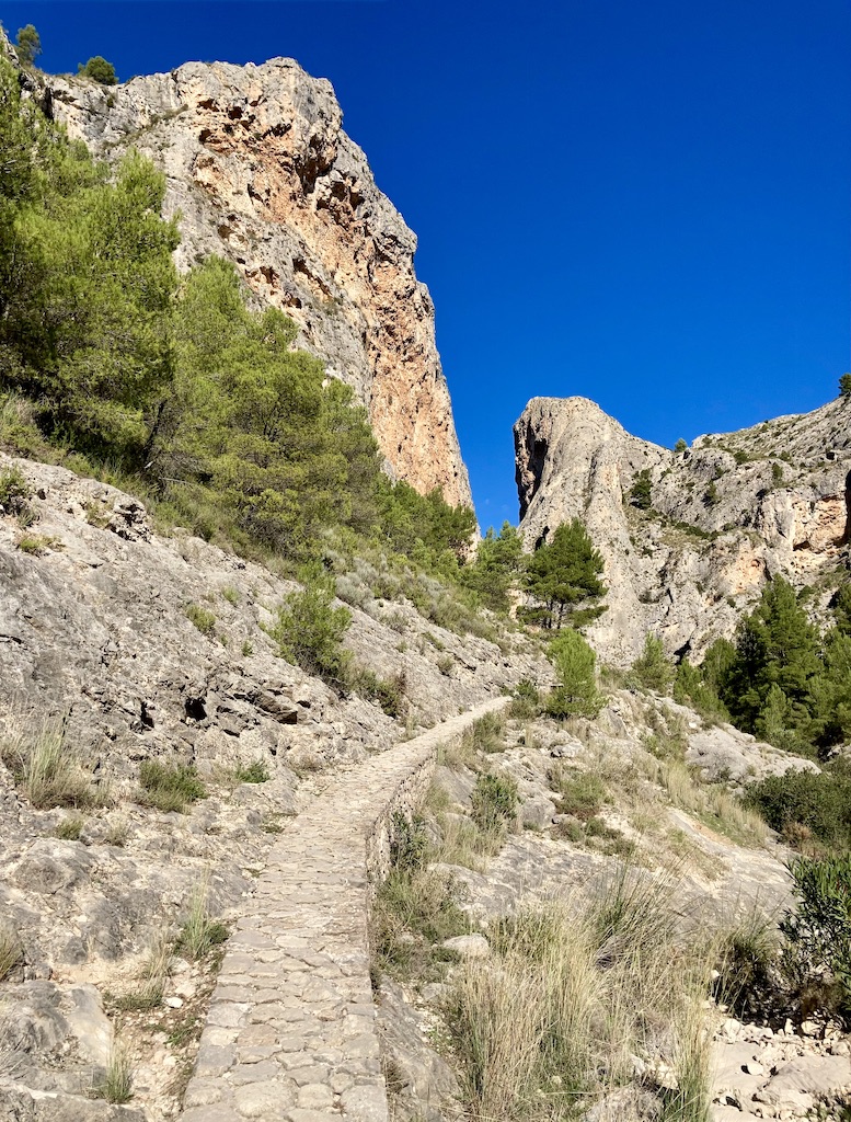
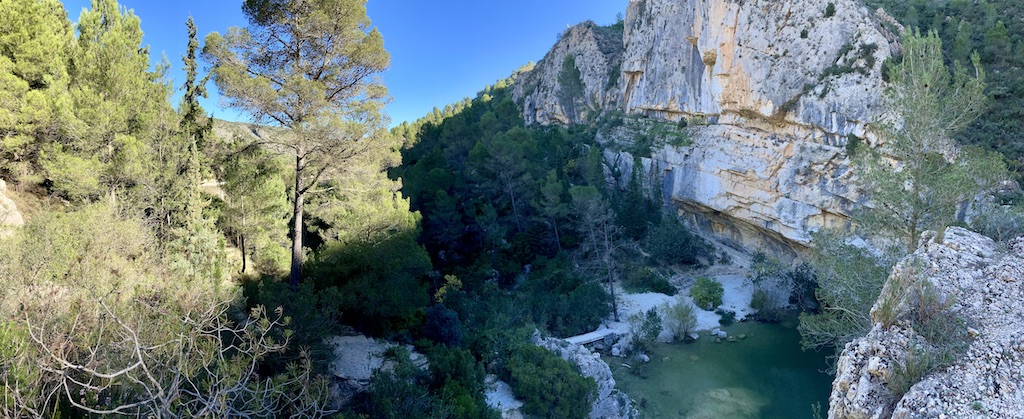
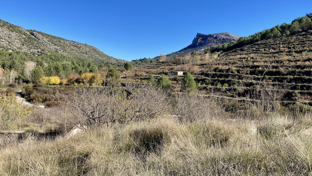
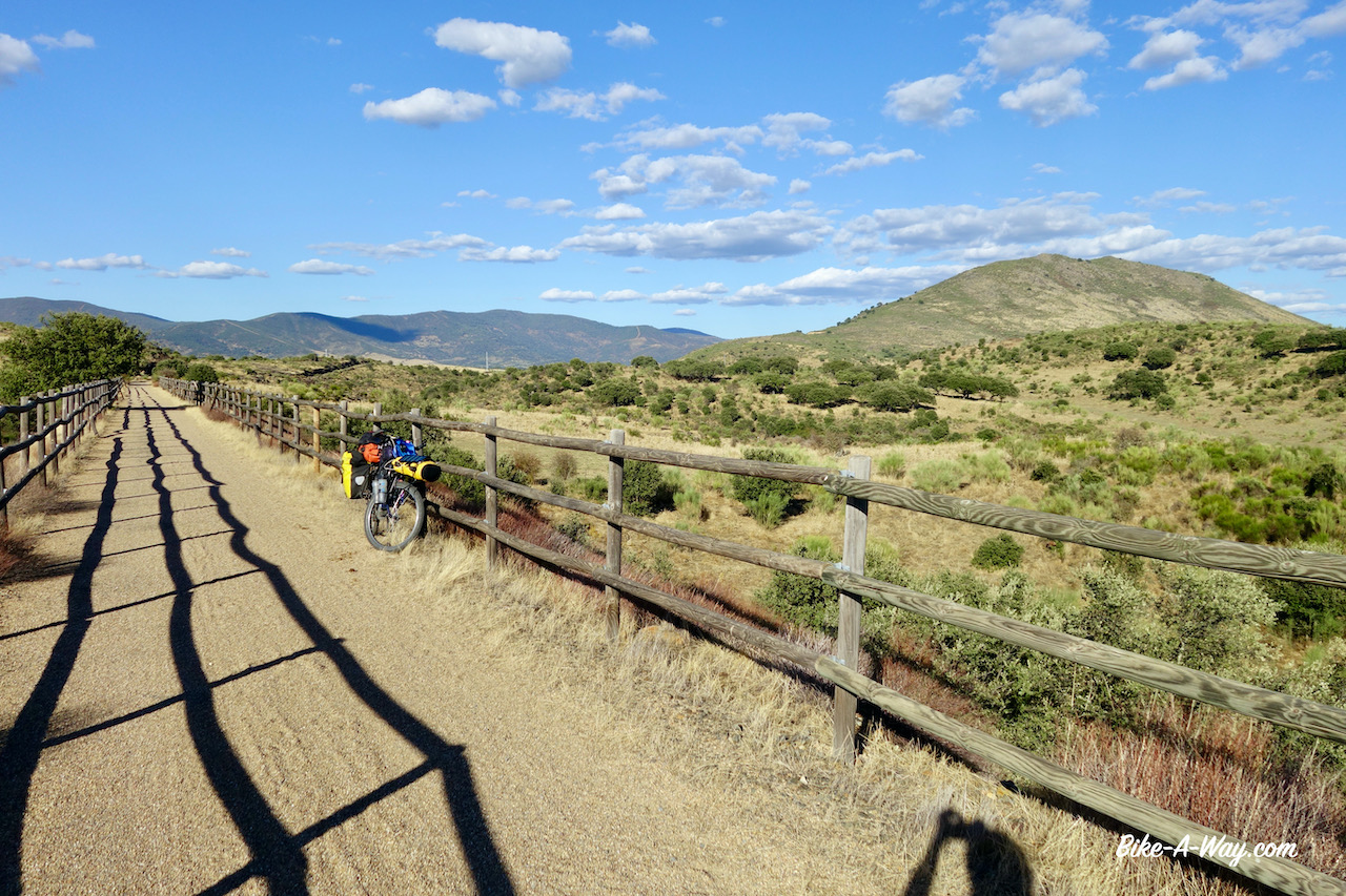
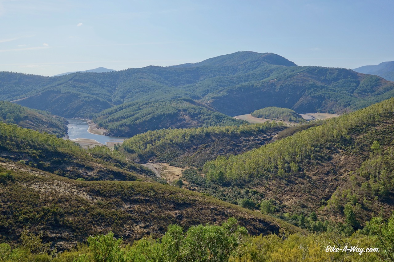
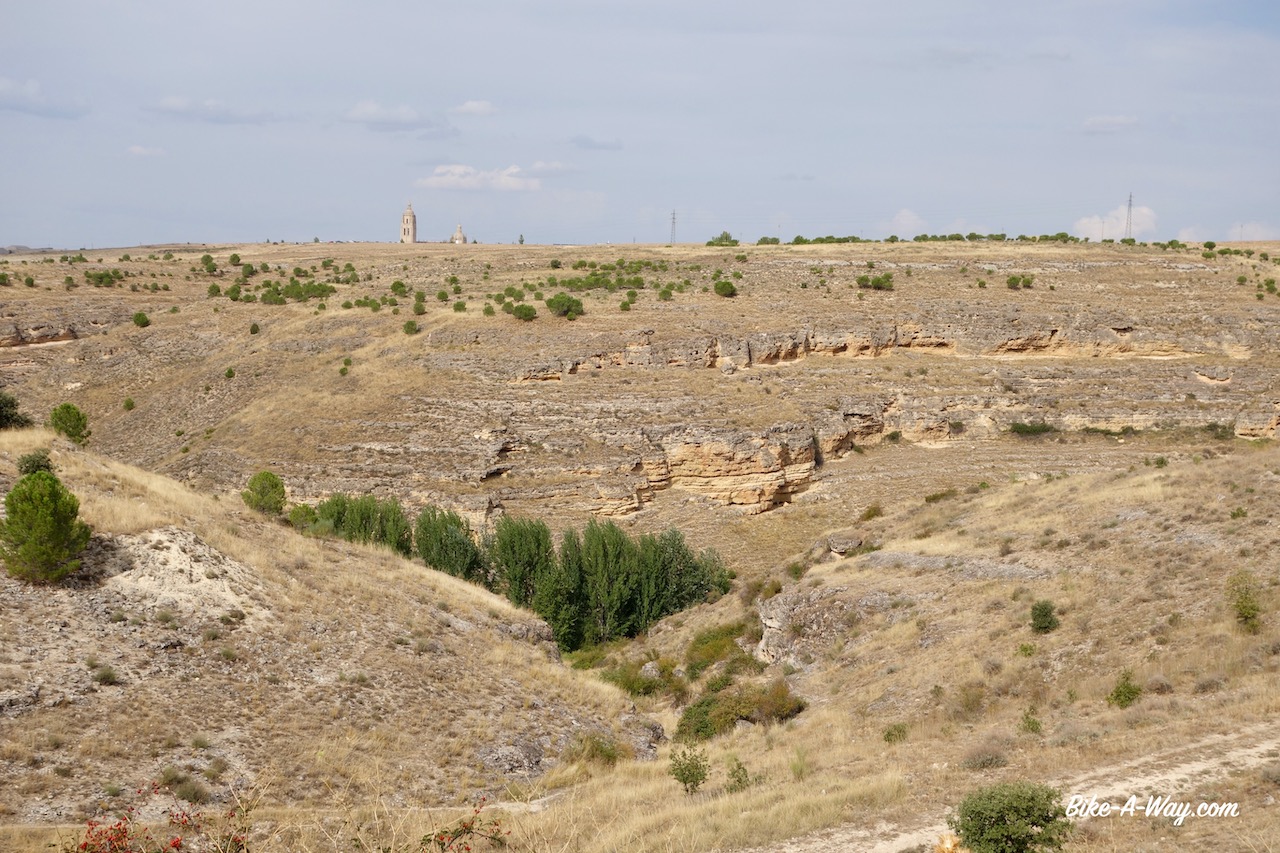
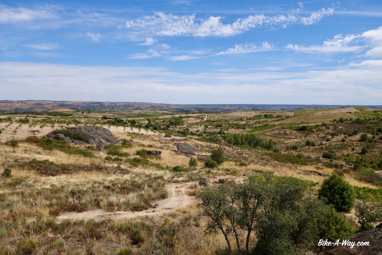
Near the town of L’Orxa it starts to get really spectacular. First I get views to the Castillo de Perputxent. Continuing on the gravel road I soon reach the borders of the Rio Serpis. From here, all the way towards Villalonga it is really spectacular, cycling through the barranc de l’Infern.
Via Verde del Serpis. On the left, on top of the hill, the Castillo de Perputxent.
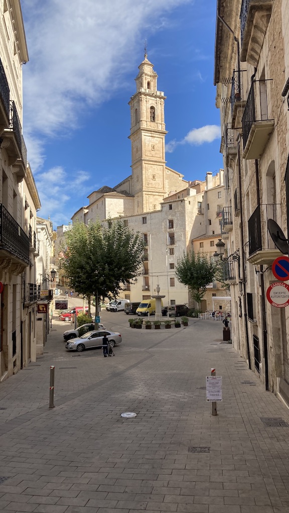
A trip to Bocairent:
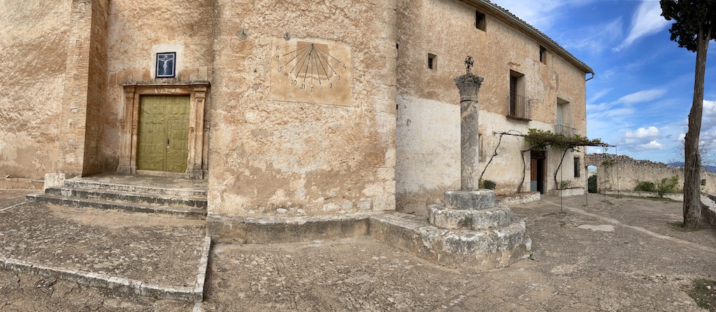
Bocairent is a small medieval town, north of the Sierra de Mariola National Parc. I first visited the towns’ bull ring. Dating back to 1843, it is the oldest one in the Valencia region.
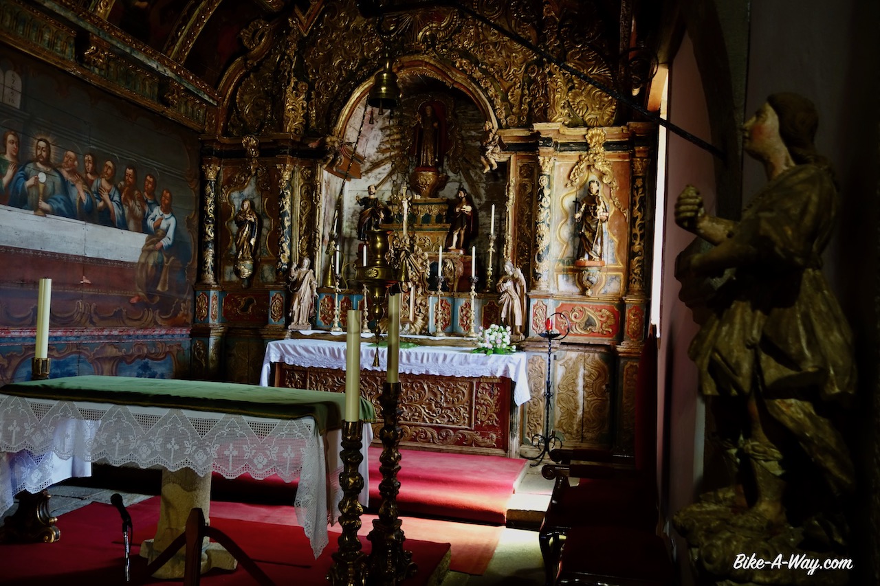
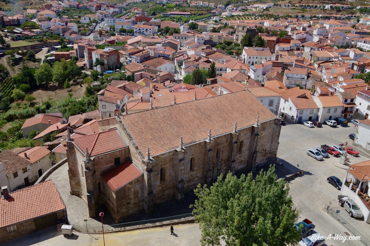
Arriving at the ‘Placa de Ajuntament’, the main square, I could admire already the impressive church ‘Santa Maria de l’ Assumpcio’. Unfortunately it was closed, so the interior will be for another time.
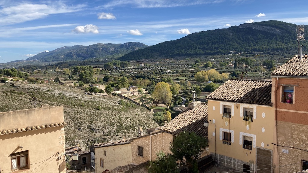
View towards the Sierra de Mariola.Historical center of Bocairent.
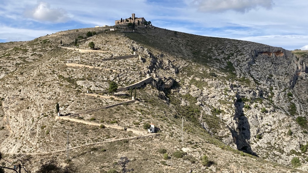
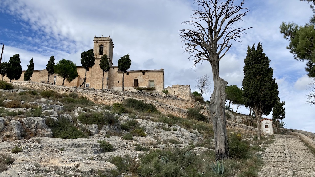
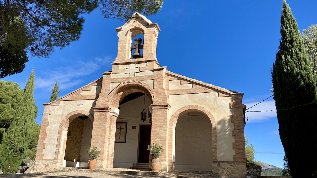
From the city walls I have a good view towards ‘Les Covetes dels Moros’, human made caves and corridors carved out of the mountains. They just dropped three buses with school kids at the bottom of the hill to visit these caves, so I decided to skip it and instead hike to the top of the hill to have a look a the monastery ‘Ermita del Santo Cristo’.
You can see the caves carved out of the mountain.View towards Bocairent from down at the stream
The steep zigzag path with on top the monastery.
Ermita del Santo Cristo, Bocairent
Via Verde del Xixarra and the Sierra de Mariola:
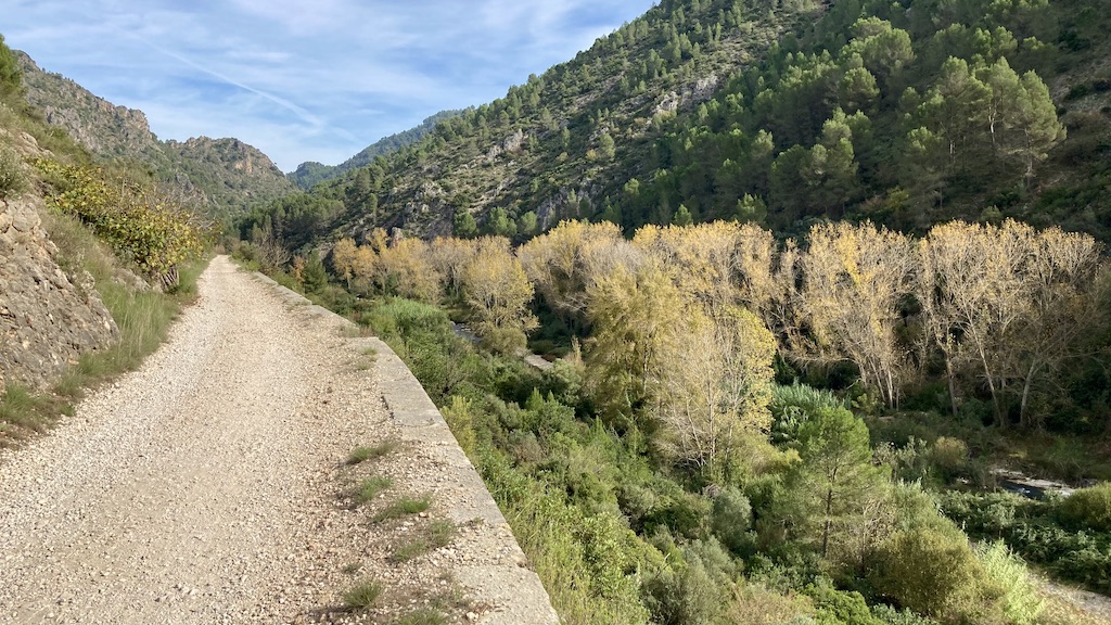
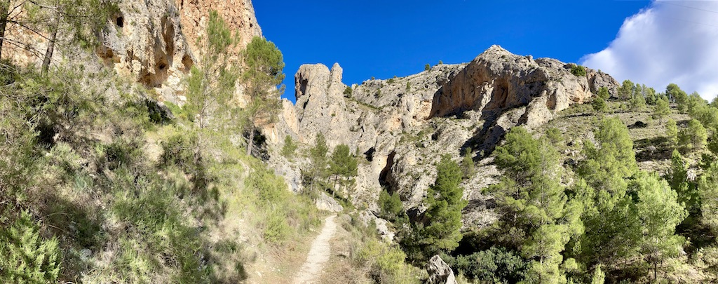
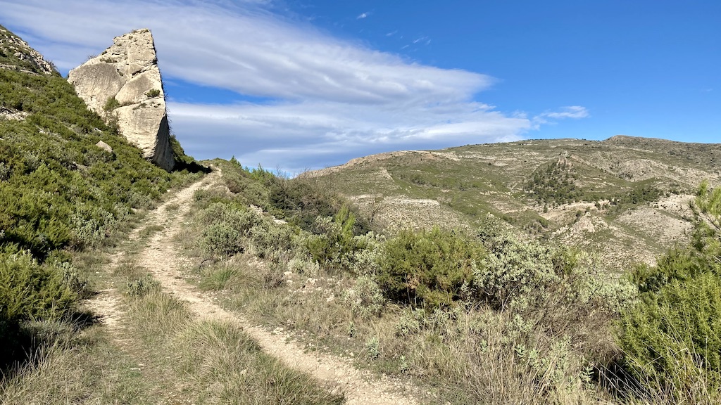
From the town of Cocentaina, I took the Via Verde del Xixarra. The greenway is not paved. Sometimes gravel, sometimes bigger stones, the going is slow, but the scenery nice and free of traffic. Close to town I still see another cyclist or runner from time to time, but after a few kilometer, I’m on my own.
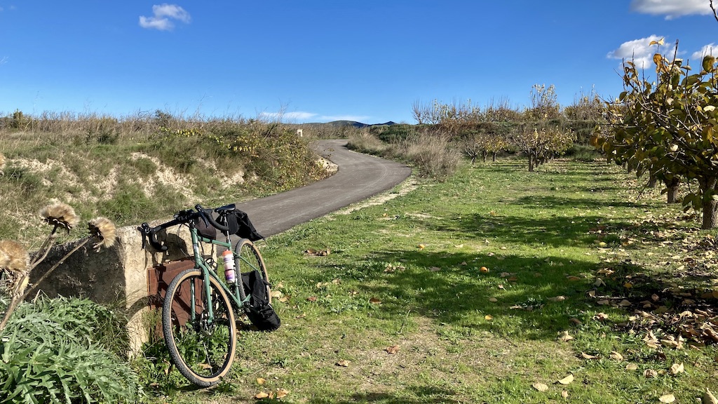
The greenway, heading west is passing Bocairent which I visited the day before. Here I leave the via verde behind and turn south on the Cv-794 which crosses the natural park. A short steep climbs follows, but after that it’s all easy riding all the way back to Alcoy.
View towards Bocairent. You can also see the Ermita del Santo Cristo on top of the hill.
At the junction with the sandy road towards Banyeres de Mariola, but that’s for another time.
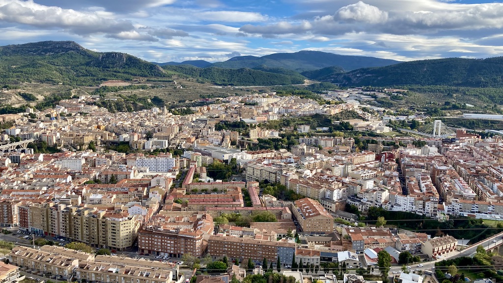
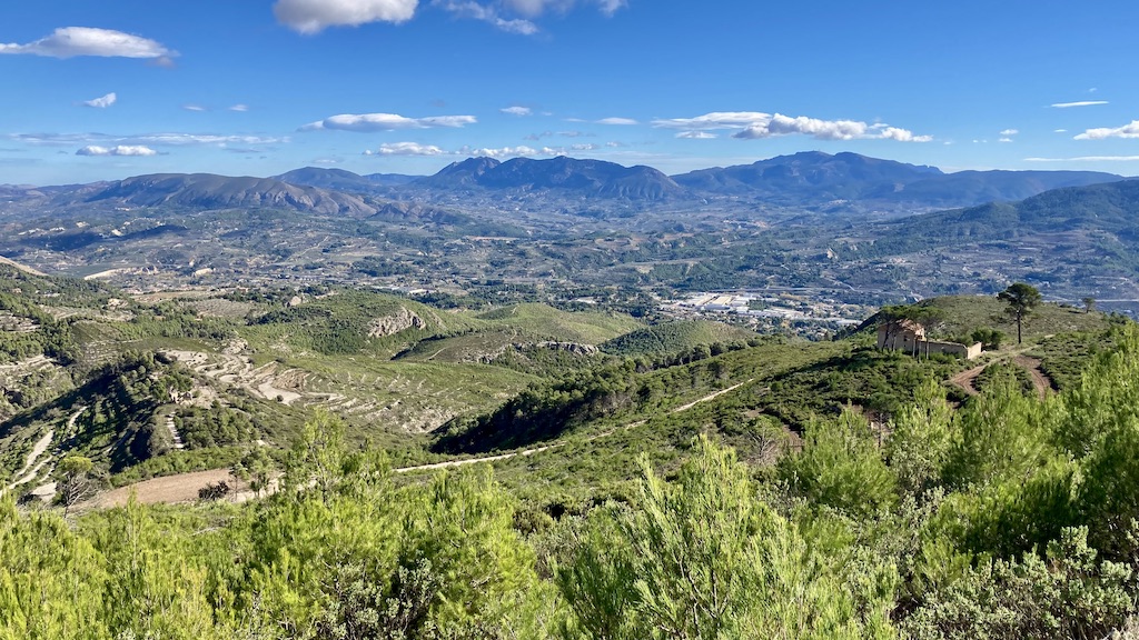
After passing the Preventorio, You get a magnificent view towards Alcoy and the surrounding mountains.
Dayhike ‘Barranc del Sinc’:
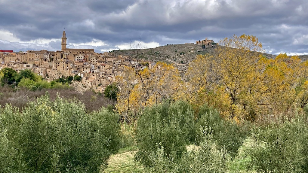
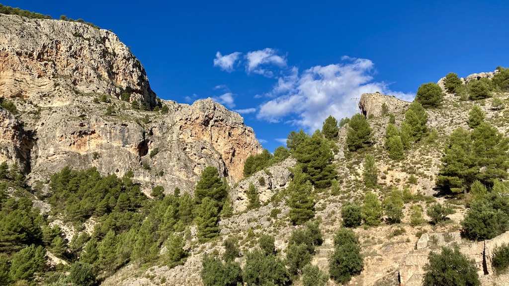
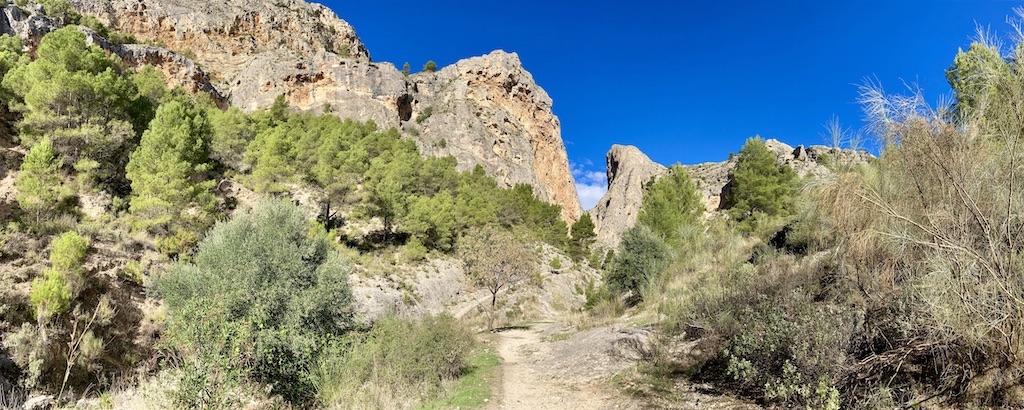
Upon riding down towards Alcoy, I saw a spectacular rock formation just out of the town. I took a quick look around and decided to hike the circuit one of the following days. The ‘Barranc del Sinc’ hike is 11,3 km long with an altitude gain of about 600 meter in total.
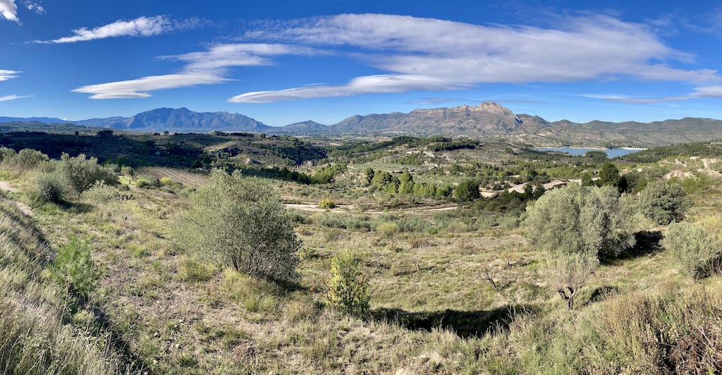
View from the Sierra de Mariola towards Alcoy in the valley and behind the Sierre d’Almudaina, La Serrella and Sierra d’Aitaina.
Bike trip north of the Sierra de Benicadell:
As I’m not in the best of shape right now, I decided to go from the north of Alicante province to the south of Valencia province and make a day ride in the flatter lands here. I started in ‘La Pobla Del Duc’ and via small roads and tracks I went via Benicolet to Llutxent. Just north of this town I first passed the ‘Ermita de la Mare De Déu de la Consolació’, founded in 1772 by Catalan pilgrims.
Ermita de la Mare De Déu de la Consolació
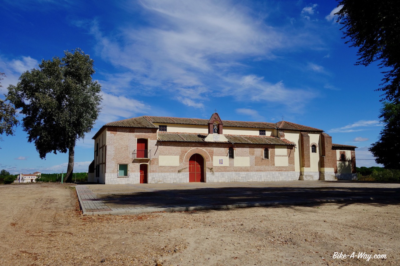
A bit further up the road is the Monestir Corpus Cristi, built in 1422
Monestir Corpus Cristi
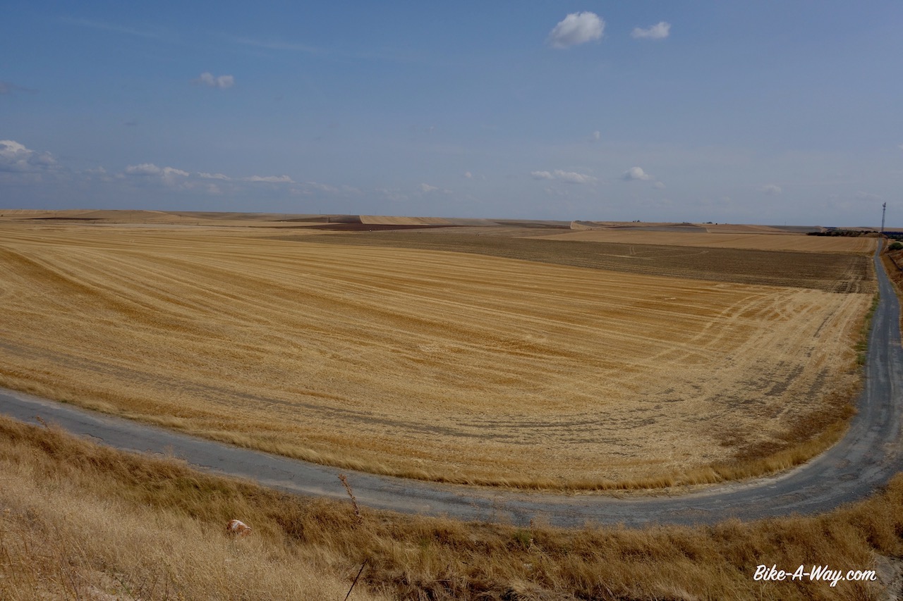
Further on the route is nothing too special, just easy riding.
Church in Beniganim.
Convent in Montaverner.
Dayhike in Planes, Circuito Ermito de Santo Cristo:
My last trip was a beautiful 10 km dayhike , starting a bit outside of Planes. Walking first alongside a small olive grove, I soon arrive at the Barranco de L’Encantada.
Barranco de L’EncantadaIt’s a gorgeous area.But some complete imbeciles were here before I was. They should be tortured and killed.
After the barranco, I hike for a long time on a single track with fantastic views towards the Sierra de l’Albureca. Turning around the corner of the Sierra del Cantalar I’m back on a small asphalt road. The views towards the reservoir ‘Embalse de Beniarrés’, constructed in 1958. Behind the reservoir the Sierra de Benicadell.
To the right the reservoir ‘Embalse de Beniarrés, in the middle the Sierra de Benicadell and to the left the Sierra de Mariola. What a view !
Shortly after joining the main road, the track goos steep up towards the Ermita del Santo Cristo. Would be a good track to run up and down for your daily work out.
The small town planes with in the back the Sierra d’ Almudaina.Ermita del Santo Cristo, PlanesSomebody needs olives ?Planes
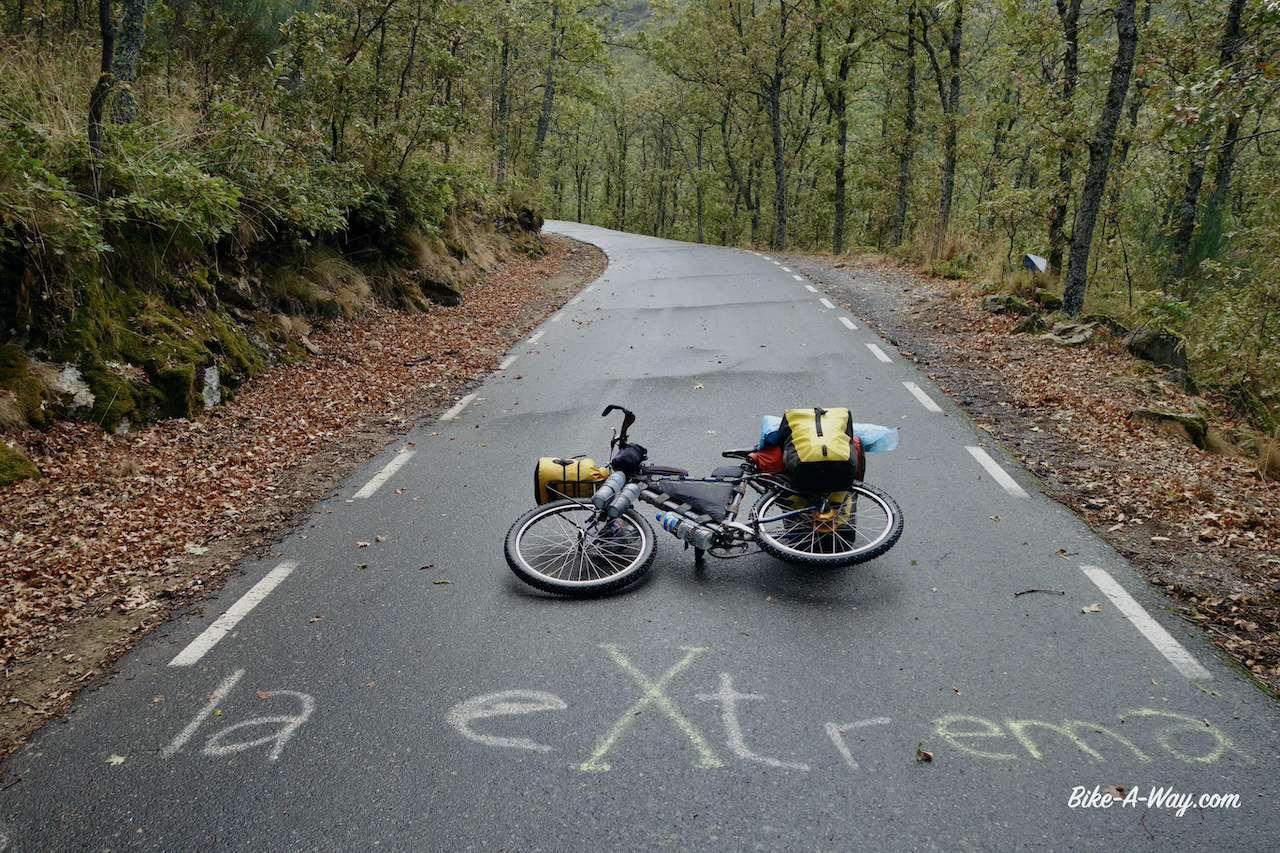
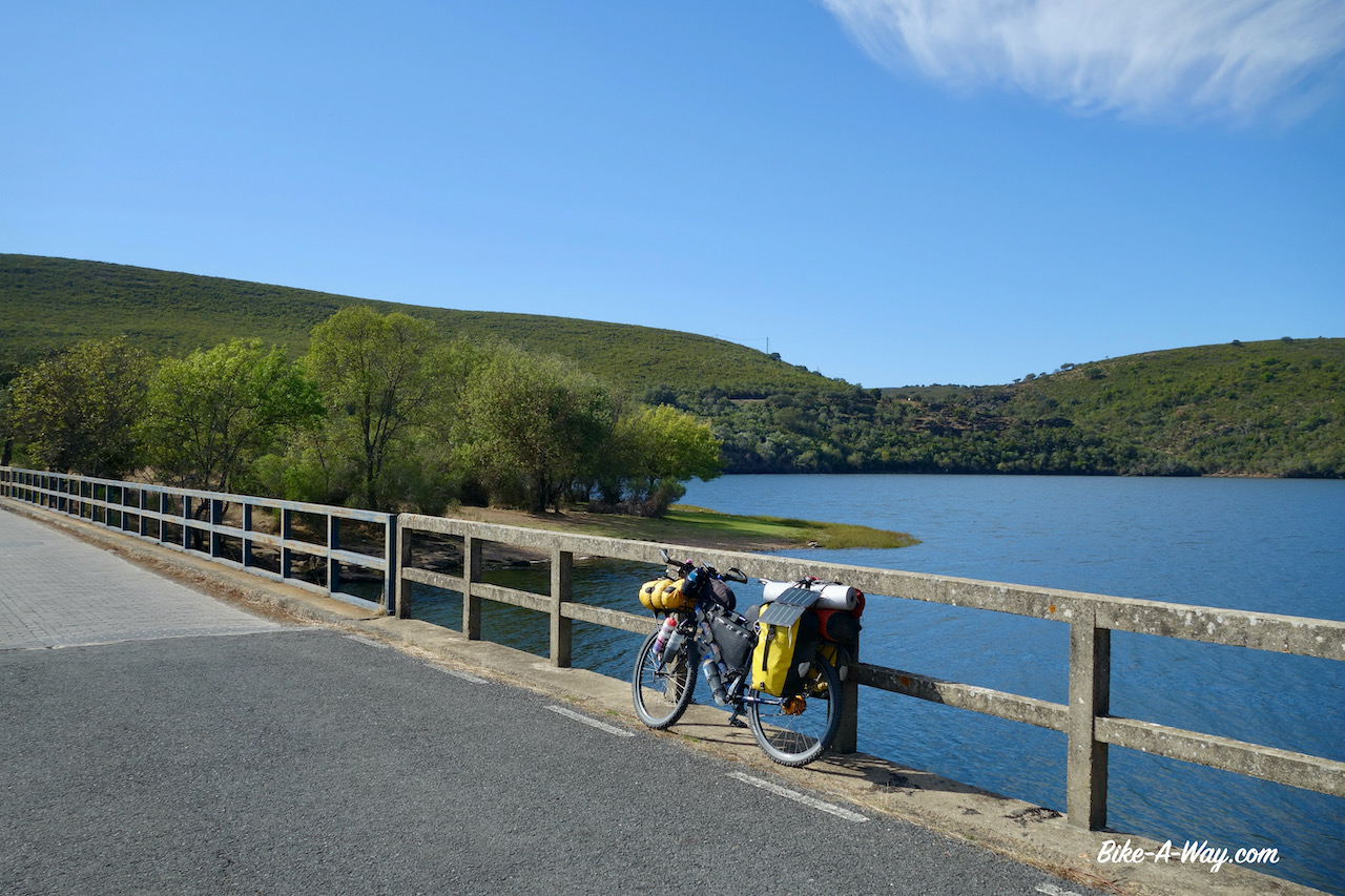
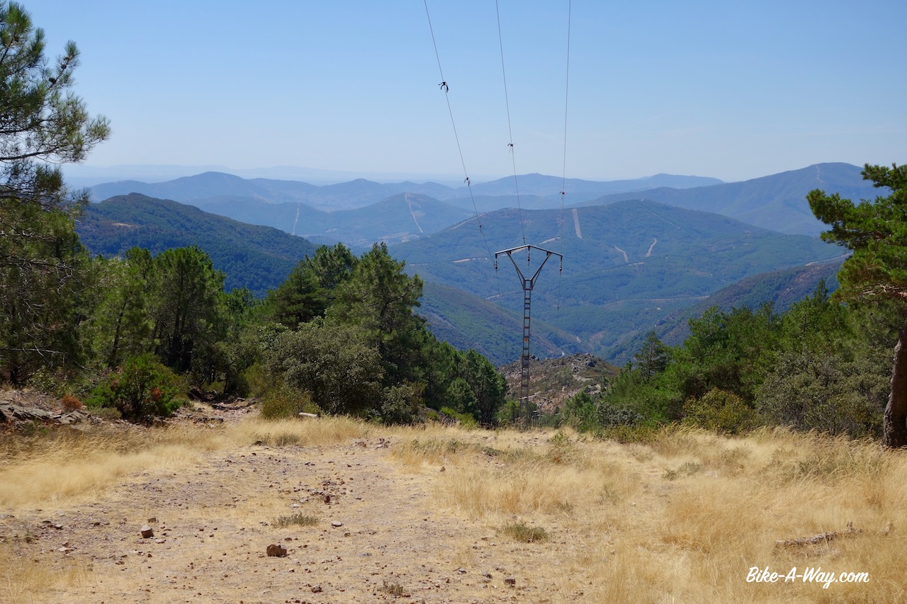
From Hervás, where I collected my long awaited package, I planned to ride the Cicloextremeña, a mostly off-road route along the borders of the Extremadura region, about 1.300 km. The makers have made a nice website with more info and links to download the tracks here.
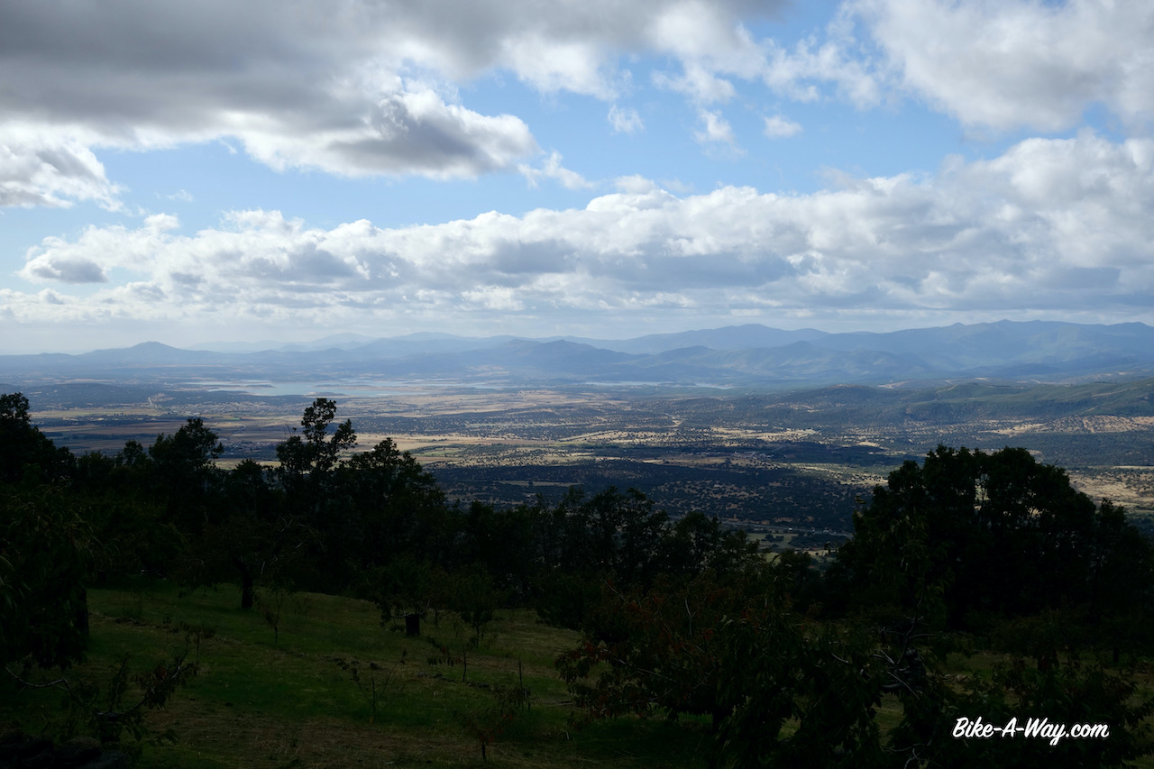
I had to start climbing immediately to the highest point of the whole route, the Puerto de Honduras at 1.440 meter.
Approaching Hervás. Sierra de Béjar in the clouds.The old railway station in Hervas with the rail trail.
Down in Hervás, temperature was a mere 8 degrees Celsius.I can only imagine what it will be up there.Luckily it had stopped raining.Still, I was wearing four pants.My cycling pants, long cycling pants, running shorts and my rain pants.For the body, I wear a long sleeved t-shirt, my new soft shell and a rain jacket in ‘Gore-Tex pro’, the strongest kind.On my head a bandana and the hood of the soft shell + the hood of the rain jacket and my helmet on top of it.At my hands some sturdy gloves I bought in Norway.
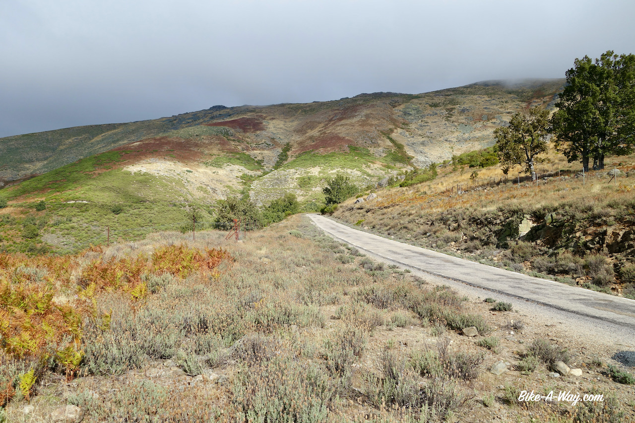
The climb is super easy.An average of 5% maybe.
On the climb towards Puerto de Honduras. Looking back over the flatlands towards the huge Embalse (reservoir) de Gabriel y Galán.
Through a forest of chestnut trees I’m leaving the valley of Rio Ambroz.The violent wind has littered the road with lots of tree branches and thousands and thousands of chestnuts.The old folks of Hervas were out to gather them.
Having started late afternoon in Hervás, I arrived at the Puerto de Honduras at 6 pm.
A bitter cold wind was blowing over the pass.
There was nowhere on the climb to pitch a tent.I would normally never pitch my tent close to the road, but only two cars passed me on the way up and the grassy field next to the closed stone hut on the top seemed the only place behind which one could pitch a tent and have some break from the stormy winds.
It got bitterly cold and the wind kept blowing violently all night.I was surprised to see a thick fog in the morning, in combination with such winds.
After a cold and windy night, the weather had improved considerably compared to the previous day.
Since a couple of days, my knees hurt again.All night the upper legs hurt as well and kept me awake.I wonder wether it could be an infection because of the cold ?To spare the legs a bit, I skipped a visit to the town of Plasencia.I’d have to descend to an elevation of 340 m asl.
Instead I chose the shortcut to Cabezuela Del Valle at 520 m asl.I’m now in the valley of the Rio Jerte and can start climbing the next hill top without the stress of going all the way to Plasencia, shop for provisions there, and get out again with probably not much time to spare to find a camping spot before dusk.
Well, talking about taking a that short cut to spare the knees….. the climb out of the valley was between 10 & 17% for some kilometers until it flattened out to a more doable 5 – 6%.Just like in the Valle de Ambroz, also in the Valle de Jerte I’m cycling between the chestnut trees.And also camping between them.I made it a short day and save the next hill top for tomorrow.
Next morning, I could barely walk.I had to move like an octogenarian with two wooden legs.The pain is on the inside of the knees.I had some knee pain in the past as well, but I always ignored it and then it disappeared automatically, so I thought it was best to continue this proven approach.
But it is different now.It is both knees and the pain is almost unbearable when I have to walk or do stairs.Laying down, I can move the knees without pain or problems.Cycling gives only a bit of pain.walking almost impossible.
In Piornal, almost at the top of the next climb, I took a side road towards Jaraiz de la Vera where I booked a hotel for three nights, but ended up staying there for a week.
A visit to the local Centro de Salud (medical center) didn’t clarify much.Unfortunately doctors seem to be able to graduate from university without having the slightest knowledge of basic English.I’ve noticed that before in Spain.That’s a pity.
I got some pils, a creme and pain killers.
This trip seems to stand under a bad omen.The problem with my package and the broken mattress are nothing.They are solved with a bit of patience and at a small cost.This knee problem is more serious…
After a couple of days I started to investigate what medication I was actually taking.The prescription leaflet is uniquely in Spanish, so internet had to help me.Even online I could only find a Spanish explanation which didn’t make anything clear to me.I suppose it’s against inflammation.
I was surprised to find out the pills, of which I hoped they would have a curing effect, were pain killers as well, just like the Paracetamol.
I stopped the latter immediately.I normally never take pain killers, cause they do nothing to cure you, just mask the problem, potentially making it worse, if I think logically.
After a week I left the hotel.Still, only 10% improvement maybe, but I just had to go out.
I had redrawn my route, again, with a lot of pain in my hearth leaving the Cicloextremeña and going for a smaller loop, avoiding climbs as much as possible.
First I headed to a stretch along the Camino Natural del Rio Tajo, which I rode in 2017 and where I made some waypoints with good wild camping spots.Loaded up with food for three days from the supermarket in Jaraiz de la Vera I head out.
On the main road.
Not my favorite thing, but ok.
In the village Casatejada I visited the Ermita de Soledad.Definitely worth a look from both the inside and outside !
Ermita De Nuestra Señora De La Soledad in Casatejada.
From here, after mending a front flat tyre, I took the main road to Serrejón where the water tap in the park is disconnected, but the one at the Ermita de San Antonia, more or less at the highest point in town, was still functional.
Ermita de San Antonio in Serrejón, 18th century.
Just rolling down the hill with sixteen liter of water, on the camino to my first possible campsite.
Yeah, I remember this one.
I pitched the tent not exactly at the same place as 3,5 years ago.This time I would not break camp in the morning, so I needed something with shade during the day to avoid sauna-like temperatures in the tent.
An excellent quiet first night was followed by a surprise on day two.Suddenly a herd of about twenty five cows came near my tent.A farm must have relocated them.As big as this place is…. they wouldn’t go away too far from my tent and unlike Belgian cows, these beasts with big horns are not stopped by a simple wire or some branches around your tent.I saw them braking through bushes and knocking down small trees.They were just grazing, walking slowly forward, knocking down everything in their path. I feared a bit for my tent.
Only one of the cows had a bell around her neck.
The beast didn’t stop moving for a single second throughout the night !
I had to leave my tent at least twenty times during the night to chase them away, always leaving the tunnel tent in an awkward way, avoid sitting on my knees for even the briefest moment.
I did it once by accident and it felt like a boiling hot dagger was pushed violently into my knee.
Hilleberg Nallo 2, 21st century.
At dawn, hunters were shooting at… I don’t know what… fifty meters away from my tent.I was a bit below them, so I think they never saw me, but let’s say it’s not the most comfortable situation when you try to relax, rest and heal.
The little village Toril has a nice information center about the Monfraguë National Park and a very helpful and friendly employee.You can also rent mtb’s there which seemed to be brand new.
I am still following my own tracks of 2017 through the park.First up is the spectacular Mirador (viewpoint)Portilla Del Tiétar.Tiétar is the river leading me into the park.It rises in the Gredos mountains, that spectacular range I had to my east when leaving Jaraiz de la Vera.It is a main tributary of the Tajo River.
The view point where I’m standing is a popular place with bird watchers because the big rock face at the opposite site of the river houses dozens of vultures and other birds.Last time I was here there were many bird watchers, most of them with lenses with which I’m sure you could spot a mouse on Mars.Now, there was only one other guy.With a modest lens 🙂
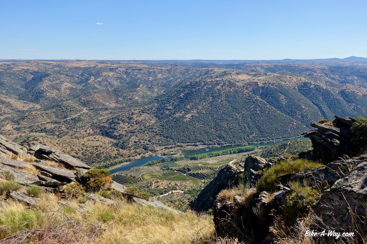
Next up is the Mirador la Higuerilla from where I have a good view to a bend in the Tiétar river.
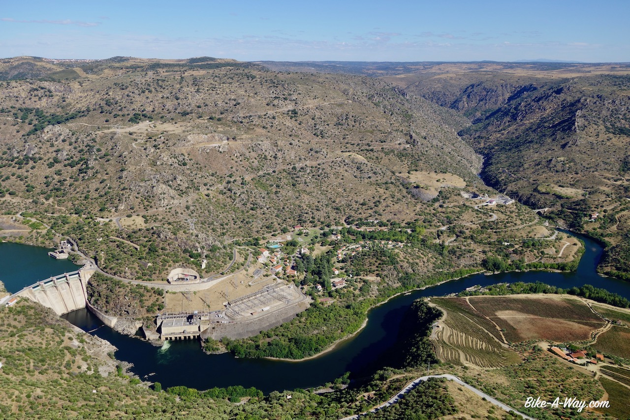
Monfragüe National Park. The bend in the Tiétar river, seen from La Higuerilla viewpoint. This is an interesting story: Just before the confluence of the Tiétar and Tajo River, each river has a dam, the Torrejón Tajo and the Torrejón Tiétar. Both dams are connected by a central tunnel with a width of 20 meters, 100 meters in length and a maximum height of 40 meter ! The development is formed of two reservoirs and two dams, one on each river, with the power plant in-between. The water impounded by the Tajus Dam flows towards the power plant’s turbines, makes them rotate and converts the stored waters’ potential energy into kinetic energy. The turbines turn the generator as they rotate to produce electricity that is transported by power lines to consumer areas. The particular thing about this power plant is that it is reversible ! This means that besides transforming the potential energy of the water into electricity, it can also do the opposite. In other words, it can increase the waters’ potential energy by pumping it from the Tiéjar Reservoir to the Tajus Reservoir, located 20 meter above it, using electricity. This method helps meet demand for power at peak times and store power during off-peak hours. Pretty ingenious, no ? In the picture is the dam on the Tiéjar River.
The little climb to a higher point before Villareal de San Carlos hurt my knees a lot.It’s not good.I keep going slowly and ride short distances, but I’m full of doubt wether I can continue or not.For now, I have no choice.Can’t stop here.
I roll down to more interesting spots like the Mirador del Puente Cardinal, an old bridge which I crossed three years ago but seems to be closed now.On leaving the park, a last spectacular viewpoint, Mirador Salto Del Gitano awaits me.
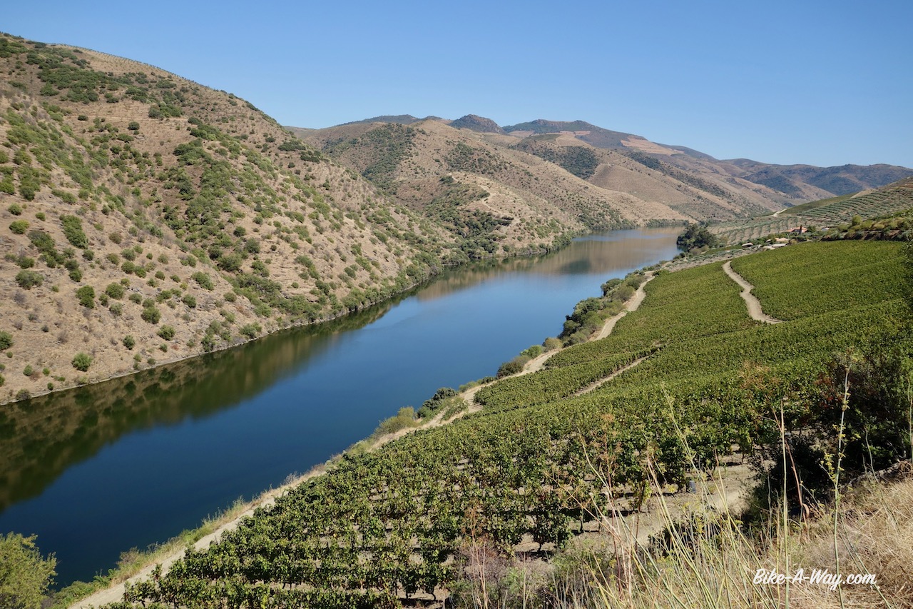
Mirador Salto Del Gitano. This picture has not been edited. The Tajo River really is that green here.
I pitch my tent just beyond Torrejon El Rubbio. From this village it would only be 50 kilometer to Caceres, the capital of Extremadura where I could find decent medical facilities to get my knees checked.But lets first wait and see what the night does.
Eating diner in front of my tent with sunsets like this….. not a bad life eh.
It felt slightly better in the morning so I decided to try and go on.A bit of a boring asphalt road all the way to Trujillo.This is a little gem of a town where I spend the afternoon having a look at the historical centre and pushing the bike up to the castle.Really smart in this condition.
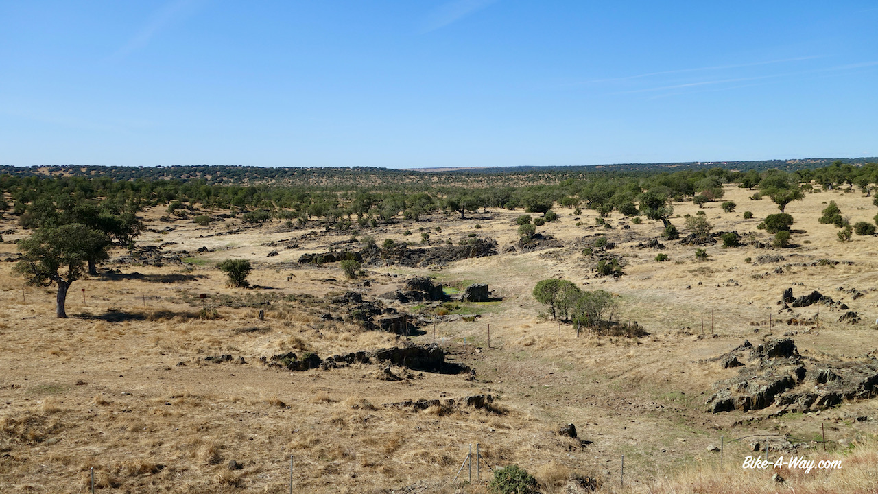
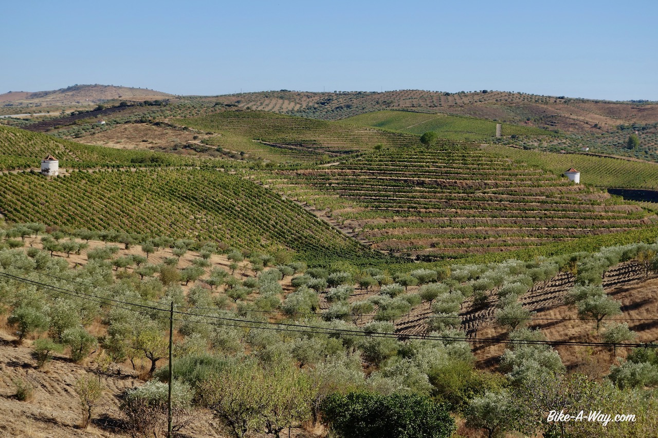
Typical Extremadura landscape between Monfragüe National Park and Trujillo.
Church of San Martin, Trujillo. To the left the statue of Francisco Pizarro who was born here in 1476. If that name rings a bell, that’s because you remember him from history class. Pizarro was a famous explorer and the man who captured & killed the last Inca emperor Atahulpa in Peru and conquered that part of the world. In 1535 he founded the city of Lima, current capital of Peru. Narrow streets in Trujillo. In the distance, you can see Risco de San Gregorio already.
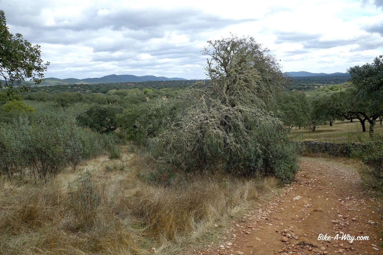
From Trujillo you can see the lonely rock Risco de San Gregorio already south of town.Being sick of the asphalt, I check and find an off-road possibility over a track (Canada Real Del Puerto de Miravete) going south and skirting the Risco de San Gregorio (838 m asl). Much more enjoyable riding again.
The off-road tracks I enjoy so much more as the asphalt. Heading towards Risco de San Gregorio.Good wild camping spot outside Trujillo.The temperatures drop very quickly after sunset, but who wouldn’t stay outside his tent to admire this ?
From Zorita I ride for twenty kilometer on the main road towards Logrosan.A beautiful mountain range to my left, the Sierra de Las Villuercas, part of the Montes de Toledo mountain range.The reason of coming to Logrosan is the via verde that goes all the way to Villanueva de la Serena 56 km from here.
Unlike other via verdes that seems heavily used in late afternoon by the local towns folk for running or making small bike trips, I’m all alone here.
Anybody knows what this is ?Views from the rail trail towards the Sierra de Las Villuercas.@ the Vía Verde Vegas del Guadiana (rail trail).
A lot of the land next to the track is fenced off for cattle farming, but after a while there’s some open land and I find a nice spot for the night.
The second half of the via verde is often totally unmaintained.Luckily I bought two new slime tubes in the bike shop in Trujillo, or I would have flats without a doubt.
Old railway station. As you can see, the rail trail is not maintained too good here. And it gets worse further on.
I didn’t see anything interesting in Don Benito and rode on towards Medellín where I took a nice hotel for the night so I could gives the knees a long, long hot shower. Medellin turned out to be a attractive little town.The Roman theatre and the castle are really worth a visit.On the town square is a statue of its most famous resident, Hernan Cortes, the man who conquered Mexico. He was born here in Medellín in 1485 and become governor of the former Aztec territories.
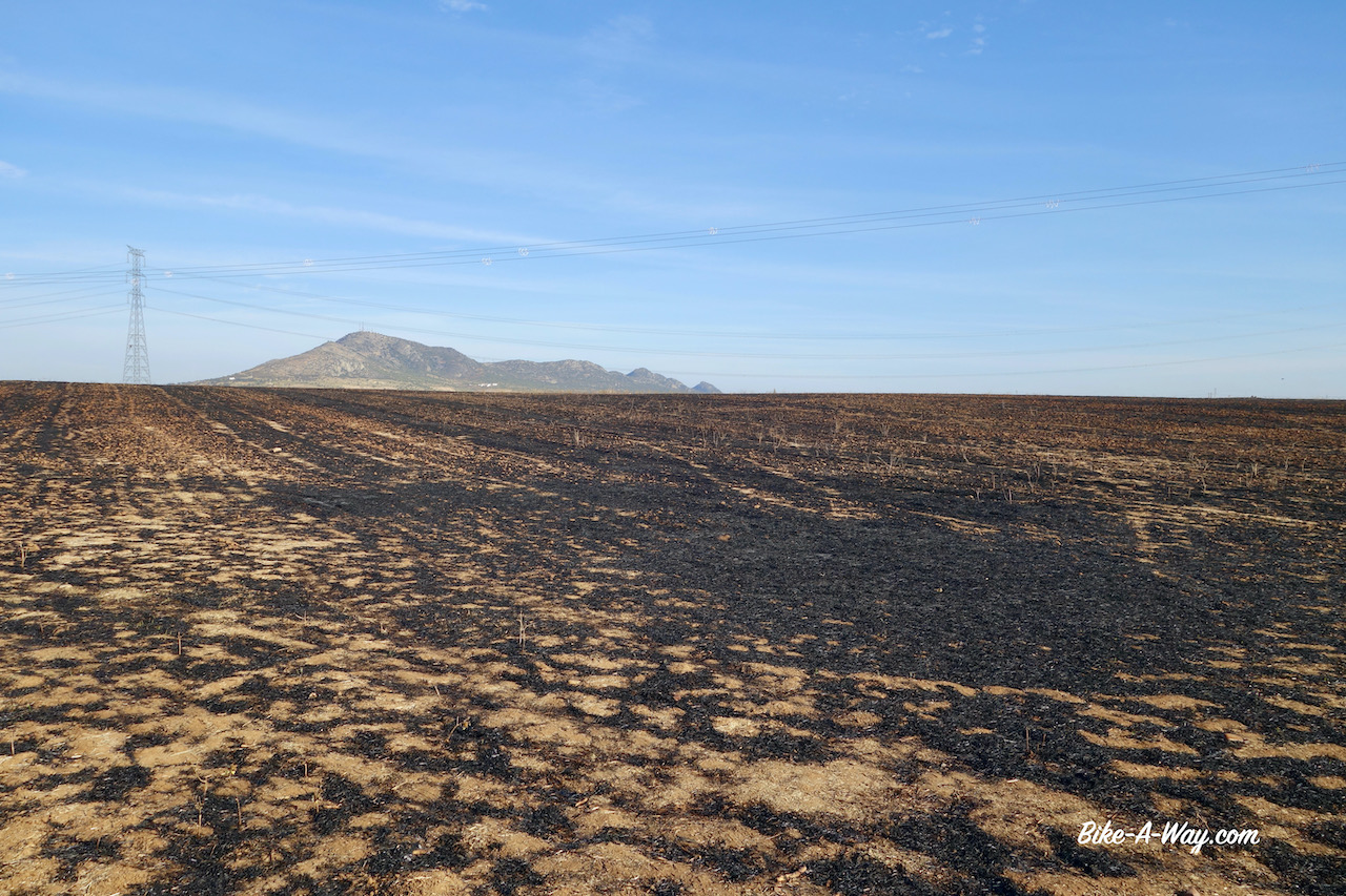
Approaching Medellín.View towards the castle from the Roman theatre. First references to this fortress are from the 10th century but the castle reached its present forms between the 14th and 16th century.And a view to the Roman theatre (a construction from the 1st century B.C.) and the city below, seen from the castle.Below the castle, you can see the Guadiana River and the Puente (bridge) de los Austrias, of which construction was completed in 1630 under the reign of Felipe IV.. The structure is 430 meters long and has 20 arches.From the walls of the castle in Medellín, you can see how the fields are burned down and an unhealthy smog is created for the whole region.
I left the town following dirt roads always close to the Guadiana.I passed rather quickly through Mérida, a town I visited extensively in 2017.It is a super nice town that deserves a second thorough visit, but that’s for later.I plan to ride on to Badajoz, then up to Cáceres where I plan to pick up the Via de la Plate back down to Merida and further down to Andalusia.
So, first direction Badajoz, still along the Guadiana River.With winter getting nearer, the farmers are burning down their fields.It’s terrible.I cycle in a big haze which makes it hard to breath.I thought this slash and burn agriculture was something they did in some developing countries, but it’s happening here as well.Hard to believe, in 2020, with all the air pollution we’re trying to limit.
Also between Mérida and Badajoz, fields are burned down everywhere.
Above scene is from the banks of the Guadiana River. I don’t know which large group of fools had taken residence here and left it like this. They deserve 40 years in prison.
Badajoz, close to the Portugese border, was in the year 1812 the scene of one of the bloodiest sieges of the Napoleonic Wars.Again, we had to thank the Duke of Wellington for this.The allied Anglo-Portugese army consisted of some 27.000 troops and they outnumbered the French garrison in the city by around five to one.
Although the Brits won, it was a costly victory.Some 4.800 allied soldiers were killed and around 1.500 French died.
With success came mass looting and disorder and the Brits turned to drink and reprisals. The sacking of Badajoz has been noted by many historians as a particularly atrocious conduct committed by the British Army: many homes were broken into, property vandalized or stolen, Spanish civilians of all ages and backgrounds raped and killed.
Wellington waited fifteen to eighteen hours to issue an order that the sack of Badajoz should cease.It took eventually seventy two hours before order was restored and another 250 up to 300 Spanish civilians were killed.Not a good guy, this Wellington.
The Plaza Cervantes (Cervantes is the man who wrote Don Quichote, one of the first novels written in a modern European language and generally considered one of the greatest literary classics).Here, my bike is parked against the ‘Capitania’ in Badajoz, the military headquarters where I visited an exposition.
The knees were hurting again, so I rented an apartment for a few days in Badajoz.I went to the hospital, hoping for a better diagnosis.They made me wait between people who were there for covid tests.When, finally after many hours it was my turn, the doctor looked from afar to my knee, prescribed more pain killers and more cream.It’s clear my problem is not going to be solved like this.
In the local Decathlon store, I bought a camping chair so I wouldn’t have to sit on my knees too much when camping.I assume the pain I have is not a result of cycling but fromall this crawling around on my knees and sitting cross-legged in the morning and evenings while eating.
Spending days on the couch in the apartment I rented, hoping for improvement.
Leaving Badajoz in the direction of Cáceres, I followed the Camino Natural Del Coredor Cáceres – Badajoz.The first section was often too muddy which forced me to the asphalt.After Villar Del Rey, the land became a bit hillier, and the track, called ‘Ruta Cañada Real Sancha Brava’ here was mostly perfectly rideable and very enjoyable.But as much as I enjoyed the scenery, the pain in my knees that came back instantly when I had to climb worried me.
Camping right next to the track. Nobody comes here anyway. You can see the new camping chair I will be carrying from now. Pretty luxurious. Should’ve done this much earlier.Perfectly enjoyable track between Badajoz and Cáceres.
No big mountains here, just hills, sometimes short and steep but always with good views to my surroundings.
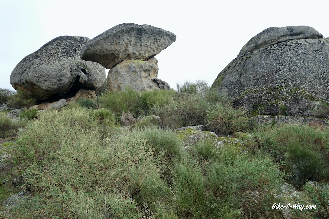
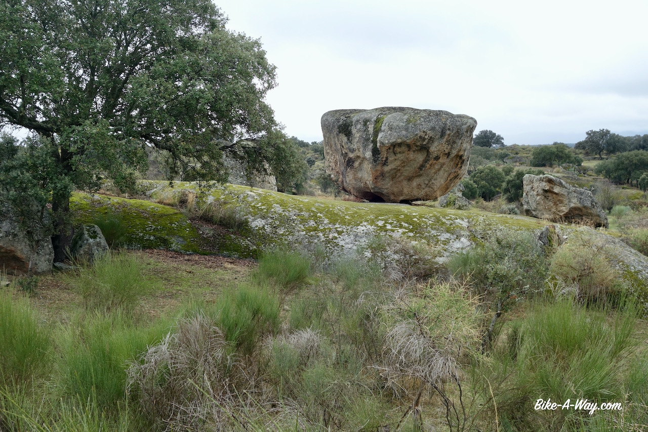
Just before entering the village Malpartida de Cáceres, I visited the Los Barruecos nature park with lots of bizar rock formation.I wandered around a bit and wondered how many storks would be here in spring.Their huge nests are everywhere.
The special rock formations in Los Barruecos Nature Park.
This rock is called Peña de la Horca.
The last camping spot on this trip was a good one, far away from the main road, sheltered from the wind.Only a few kilometer outside Cáceres.
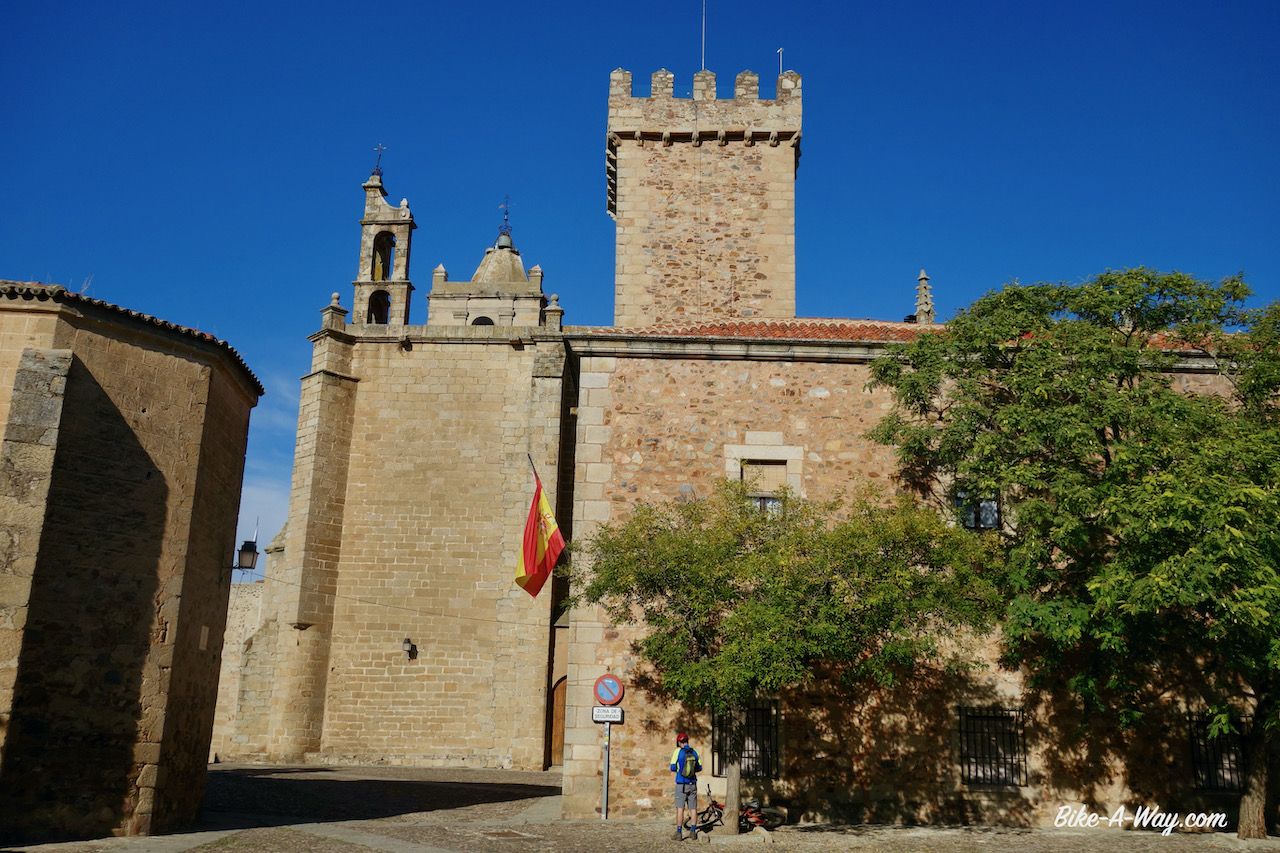
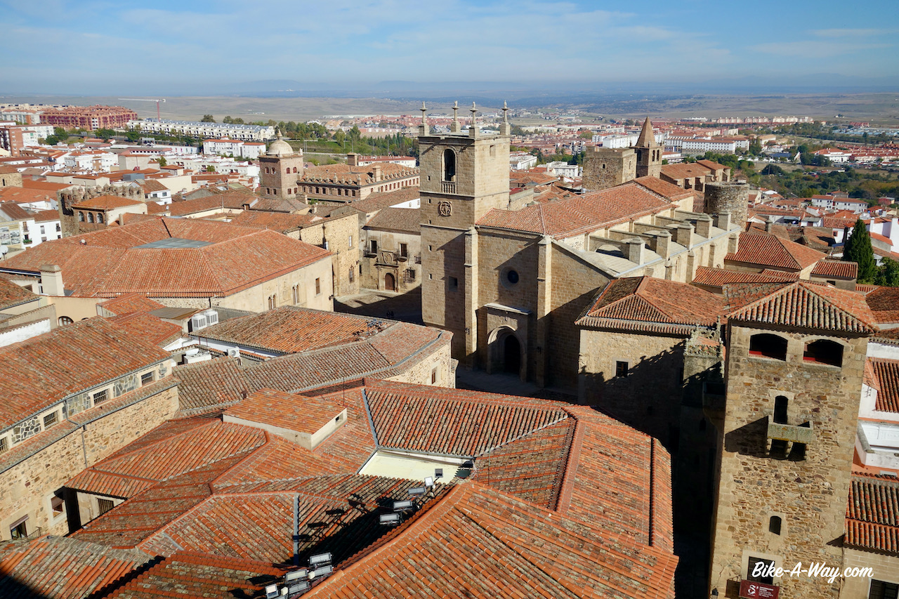
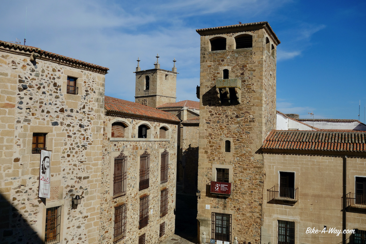
Back in Cáceres I rented again an apartment, in the old town at the Plaza de Santa Clara. Cáceres, capital of the Extremadura region is a very interesting historical town, declared a World Heritage City by Unesco in 1986.I think that at the time I was there, Extremadura was also the region with still the most relaxed covid rules on the Spanish mainland, due to the reasonable ok figures.The terraces of bars and restaurants were still open.Not that I used them.I’m too careful for that, but at least it still created some atmosphere in the town.
View from my bedroom. Due to covid, there was a curfew between midnight and 6 am, which I loved. As much as I like Spain and the Spanish, they tend to be a bit loud, definitely at night, so if it’s up to me, they can keep this curfew forever.Only 100 meter from my apartment was the Church of San Mateo, built at the highest point of the ‘Ciudad Monumental’, built between the 16th and 17th centuries. The tower is from the 18th century.Iglesia San Mateo from the front. It has a mix of Gothic, Renaissance and Baroque features.Santa Maria’s Co-Cathedral, the main religious building in Caceres. Construction began in 1229 by king Alfonso IX. It was added and added until reaching its current state around 1550. It’s the first time I heard of a “Co-Cathedral”. Wikipedia has this to say about it: “A co-cathedral is a cathedral church which shares the function of being a bishop’s seat, or cathedra, with another cathedral, often in another city.”Inside Santa Maria Co-Cathedral.I could also climb to the top of both towers, enjoying nice views over the old town.
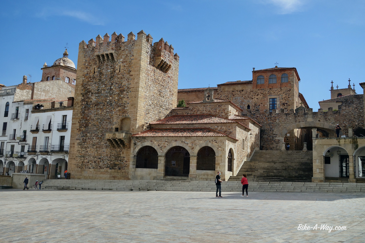
Plaza Mayor (main square) with the Torre del Bujaco the most famous of thirty towers from the islamic period still standing in the town.
Sunning the legs on my balcony, hoping these sun rays have magical powers. In vain.
After taking more rest, the acute pain in the knees was gone, but walking up the hill in the old town center, I felt it coming back with the slightest effort I made.With deep regret, I decided to return home and hope to find a good knee specialist to fix things.So instead of the planned winter on the Canary Islands, where I intended to stay 7 – 10 days on each island, it’s back to dreary Belgium.
Hope to resume cycling in spring.
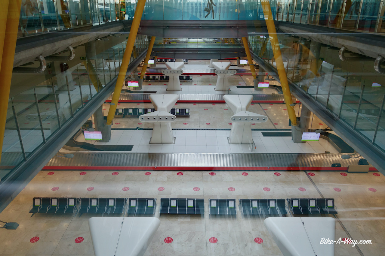
Madrid-Barajas airport. By size the second biggest in Europe. By passengers, it’s the fifth busiest. Now during covid, I wander around all alone. Surreal.The baggage claim….. completely empty. That guy you think you see walking at the top is just a sticker at the window.
Some figures about this trip from Belgium to Spain: Total distance: 5.142,17 km Total altimeter: 62.162 meter
Highest maximum speed: 78,96 km/hr
Most altimeter in one day: 1.799 m (Asturia, Spain) Highest point: 1.955 m (Montes de Leon) Longest day in the saddle: 7 hrs 41 minutes (France)
Route: Valladolid – Palencia – Alar Del Rey – Medina de Rioseco – Tordesillas – Salamanca – Puerto de Béjar
My route in this part of the blog, going first north from Valladolid, then south through Salamanca back towards the Extremadura.
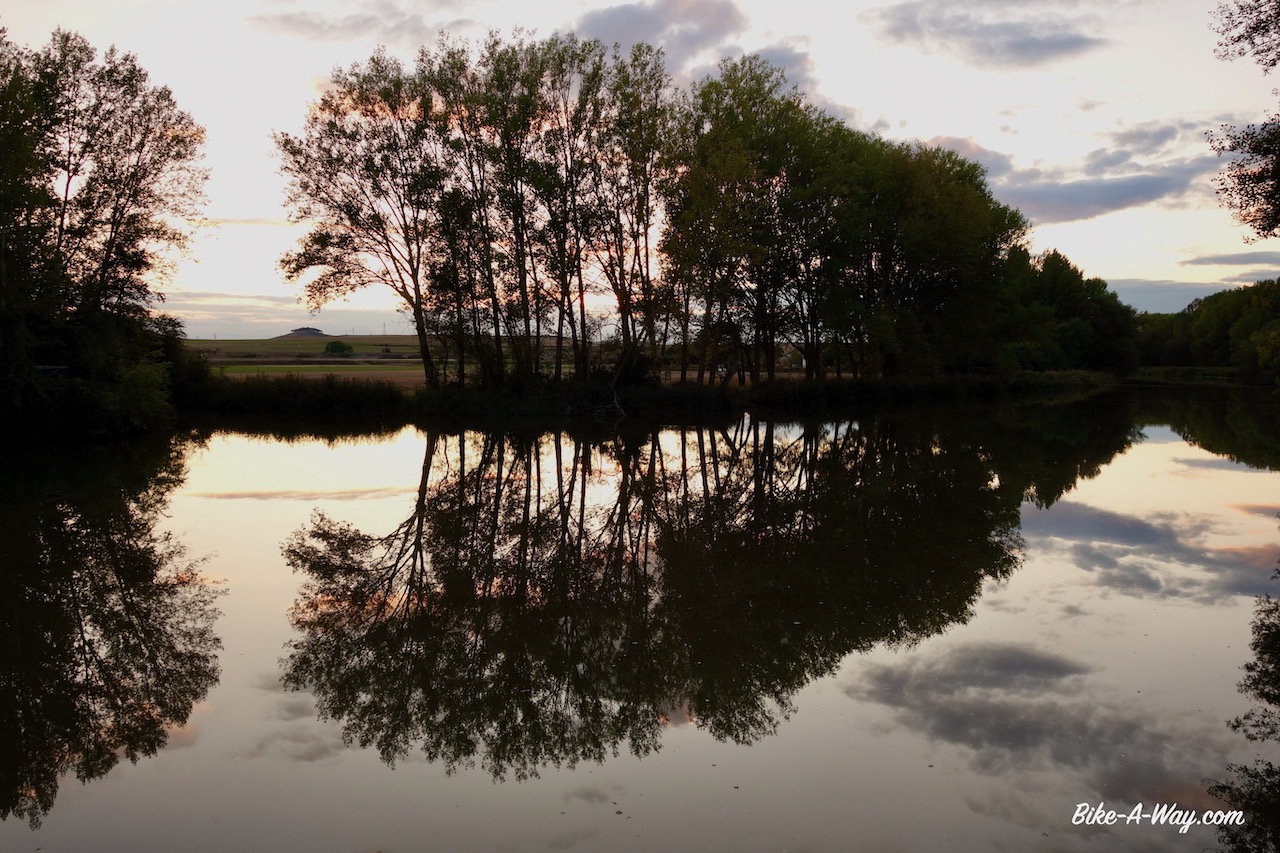
Leaving Castilla y Leóns capital Valladolid, I may have found the easier terrain to cycle, along the Castilla Canal, but now the weather conditions turned against me. The weather forecast predicted seven days of almost continuous rain. The path along the canal is just gravel, so it could become a dirty mess.
Typical stretch of the path along the Castilla Canal.
A map of the Castilla Canals. I started with the southern fork in Valladolid, then cycled to the northern tip in Alar Del Rey, returned the same way towards Grijota and then the northern fork towards Medina de Rioseco.
The canal on my left side, I only had to look to the right for a possible camping spot. But there is the railway line from Madrid to Irun. As the sky got darker and darker, I took a right turn, away from the canal in Las Ventas, hoping to find a spot for the night. It’s all fields here and in the end I settled for a field which was recently mowed and plowed and with a line of trees protecting me for the strong winds.
Just after I pitched the tent, the downpour started, with more winds.
Next morning I found the tent to be surrounded completely by mud, the tent pegs could barely hold the tent up in the soft stuff. I packed as carefully as possible, trying to get everything more or less clean. The bike was leaning against a tree, with a flat tyre in the back. Oh, perfect, this is the exact time and place I dream of to change tubes.
I rode on to Palencia and was lucky to have a window of two hours without rain and settled down in a hotel for two nights. Went around a bit on the second day to look at the town.
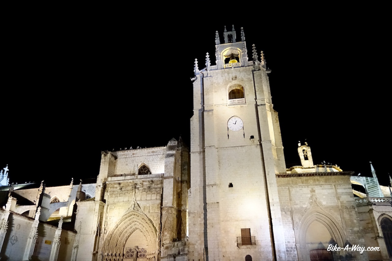
Catédral de San Antolin, Palencia
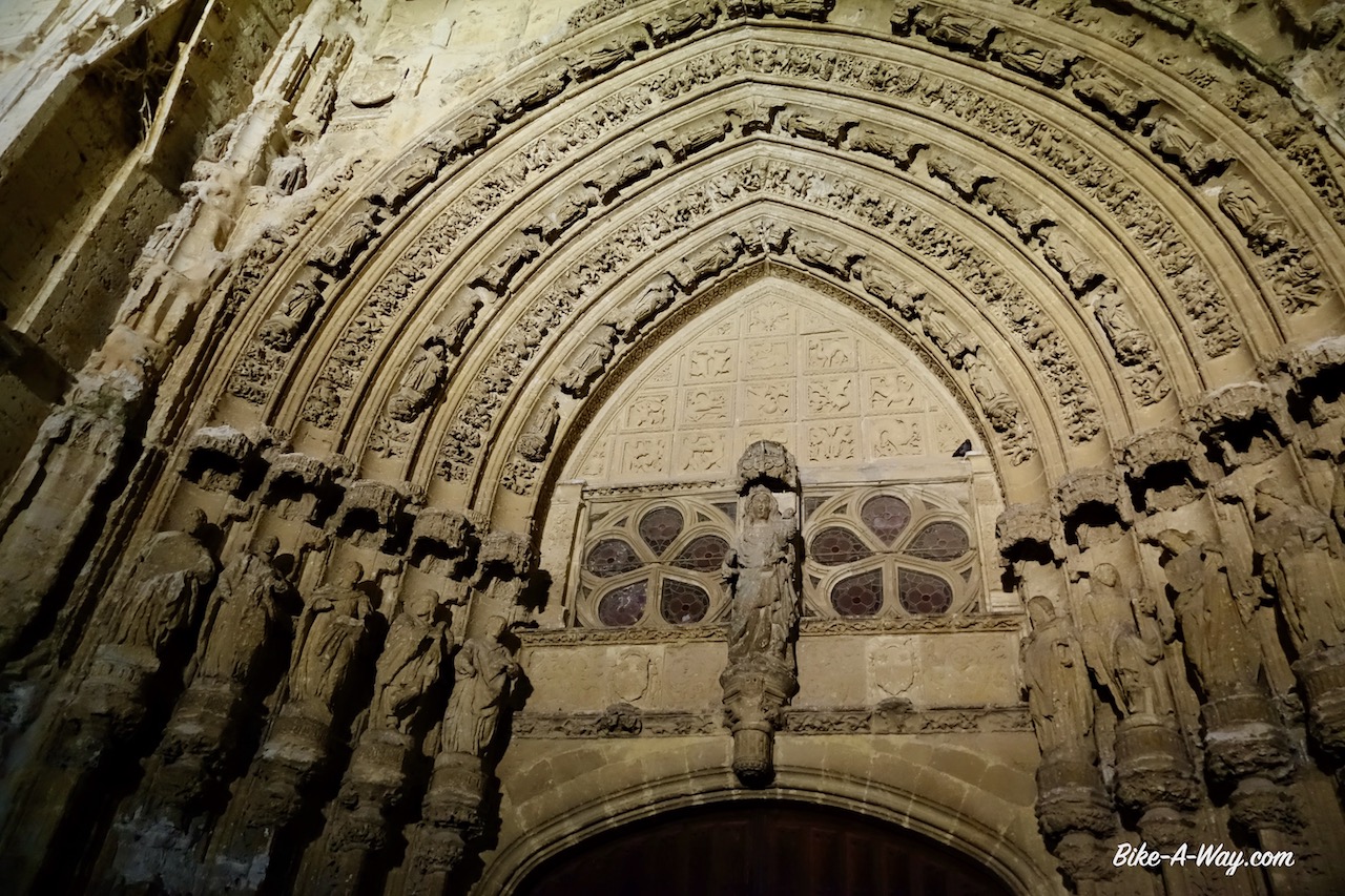
Above the entrance door of the cathedral.
Continuing along the Castilla Canal, it forks a bit after the village Grijota. I take the right fork, going north. For a while, I ride just next to the small ‘Canal de la Retencion’. Behind a line of trees, fifty meters further on runs the Canal de Castilla parallel to it. The path is muddy, spongy from all the rain. I cross the Rio Carrion, that same river I already met in the Cordillera Cantabrica, where they dammed it to create the Embalse de Camporredondo and the Embalse de Compuerto. With all these damming, diverting the water into into irrigation channels, etc…. not much is left of the natural flow of the river and I guess no serious fish life can survive that way. But I did see a polecat, or something similar from the marten family today.
One of the locks in the canal.
At the crossing of the Castilla Canal and the Rio Carrion, where the river is feeding the canal and the ‘Acequia de Palencia’.
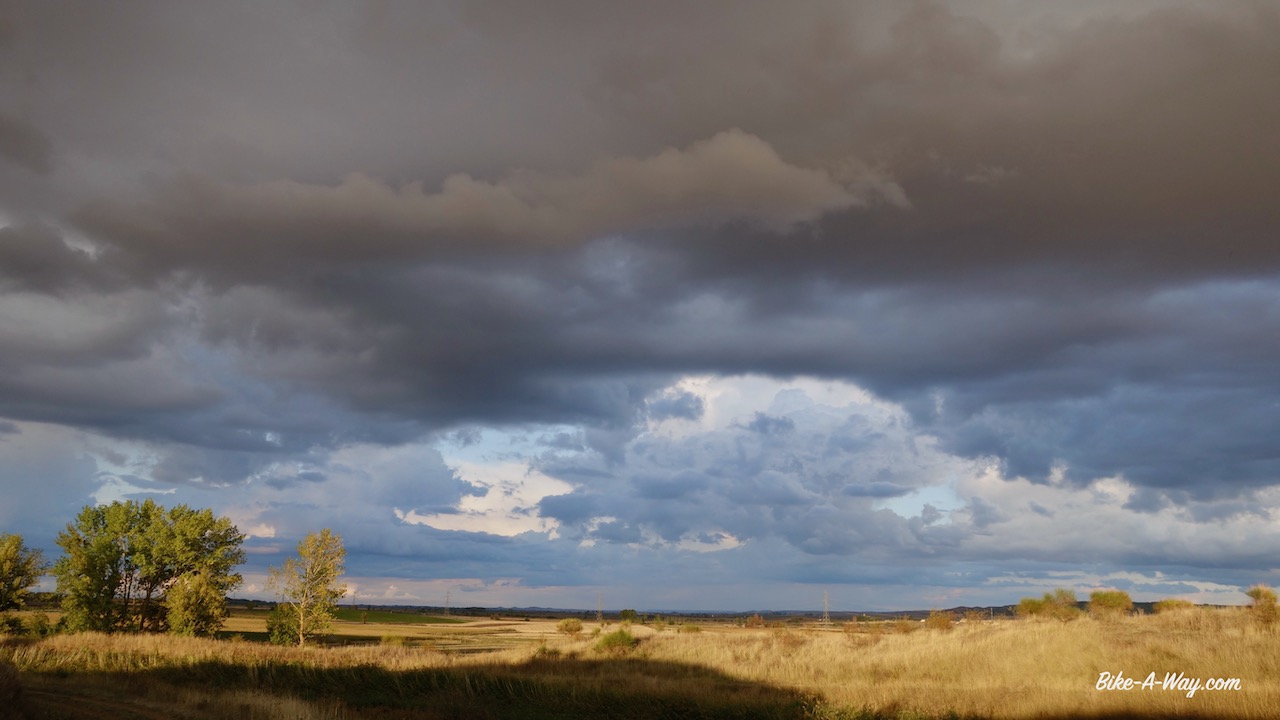
Impressive evening skies….
…. and misty mornings. This was actually not a bad place to camp at the ‘Puente Del Gallo’. The bridge may look impressive, but it is just on a dirt road leading into the fields
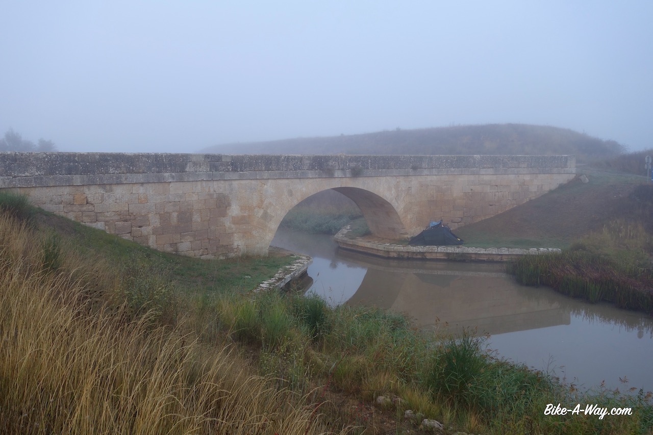
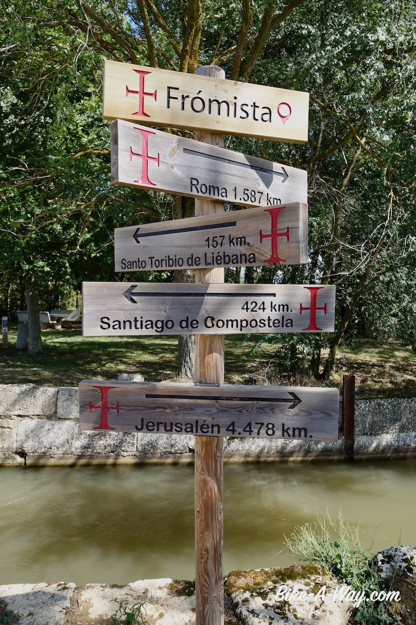
I left the canal to have a look at the village of Fromista, only a kilometer or so to the west. On my ride into town I saw another cyclist coming from the opposite direction. He was riding a BMC mountainbike. Together we went to have a look at the Roman San Pedro church in town.
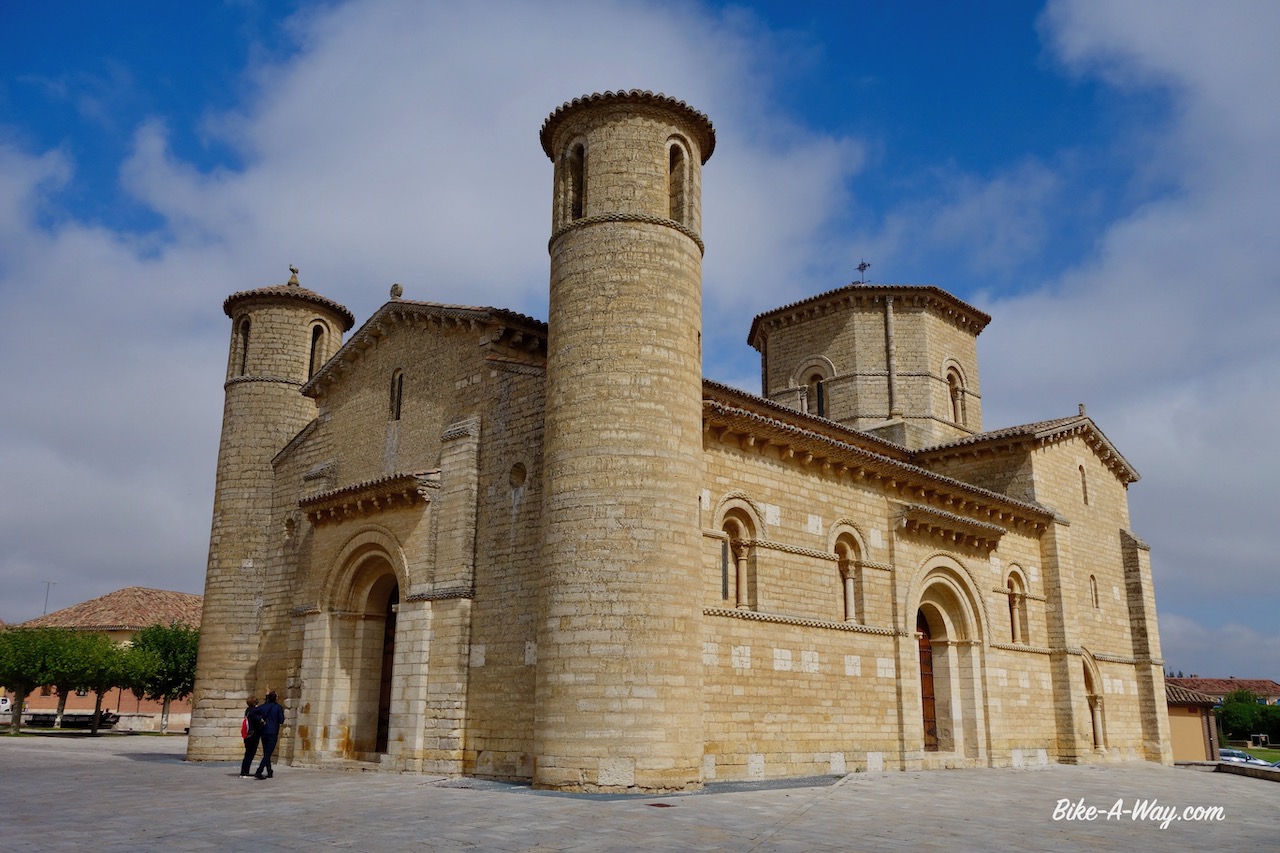
The beautiful Roman church of San Martin in Fromista. the church was constructed around 1066 and restored between 1896 and 1904. It is one of the most perfect preserved Romaneque buildings.
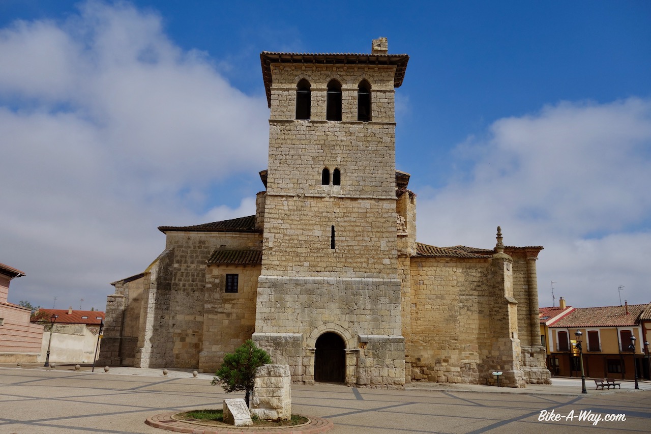
The church of San Pedro, also in Fromista. This one is in Gothic style and founded in the 15th century.
After a visit to the local panaderia, the small supermarket and the gas station to top of my fuel bottle, we rode together back to the canal.
The most popular Camino de Santiago, the ‘Camino Frances’ is following the Castilla Canal here for three kilometer and of course I was not really visiting Fromista or riding along the canal with another cyclist, but with my virtual self in May 2017, when I rode this stretch on my way from Galician coast to the Mediterranean Sea. You can read all about that here.
Lock just outside Fromista. I gues you can control the water level further downstream with this kind of lock, but a barge will never be able to go through something like this 🙂
Choose your pilgrims way.
In 2017, I took the path to right, this time I will go straight along the canal.
I continued north along the canal all the way to the northern terminus at Alar Del Rey, not a very appealing place with sixties styles apartment blocks of eight floors or so. After a quick refill of the water bottles and a visit to the local tiny supermarket, I headed straight back the way I came. I had seen an electricity building with a nice awning under which I thought I could pitch the tent. Lots of rain was predicted. When I arrived, the space appeared to be too small and I had to settle for something less protected. I went down some dirt paths to the river Pisuergo where I saw some trees which might give shelter, but just like the fields, all the ground between the trees had been plowed and was a bumpy, muddy mess. Good camping spots are pretty hard to find along this canal.
Aqueducto de Abanades. Below is the Rio Valdavia, on top the Castilla Canal.
Suspension bridge for hikers and bikers, a few kilometer before the northern terminus of the canal.
Riding late into the sunset.
Apart from a few drops, rain didn’t bother me too much on the 90 kilometer stretch back to the junction where I now took the northern fork of the canal towards Medina de Rioseco. There was that climatological nuisance every cyclists hates. A head wind and it became harder and harder every day. Easy riding along canals to give the legs a rest ? Forget it !
Autumn is in full swing. Chilly morning with lots of humidity.
And not only that, even though the temperatures have dropped to a few degrees above freezing at night, and don’t reach the twenties anymore during the day, an incredible amount of flies, mosquitos and wasps make life impossible when you stop. At this moment, with an intense wind outside, there are at least 50 flies on my panniers outside, just as much on the outer tent, and again that many between the outer and inner tent. This are really becoming Australian situations. This is not normal and something I have never seen anywhere in Europe, also never in Spain in the past. They also have the behaviour of the Australian bush fly, i.e., they come and sit on you, go for your eyes and ears.
It is horrible.
But of course, autumn also equals beautiful colors once the sun is out.
Two more interesting villages I visited along the canal were Becerril de Campos and Paredes de Nava. The former was apparently elected as most beautiful village of Spain in 2016. It had some nice old buildings, but I preferred the latter. More spectacular than the villages was the +/- 1,4 meter long snake I saw today.
The beautiful little town of Medina de Rioseco is the terminus of de Castilla canal.Honestly, I’m not sad it’s over.While I cannot say anything ‘bad’ about it, it was the least interesting part of this trip so far.
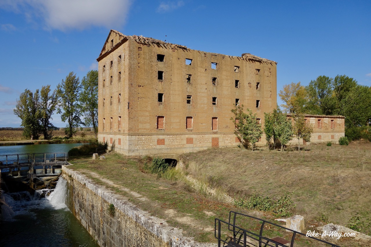
Most locks had such a dilapidated building next to it.
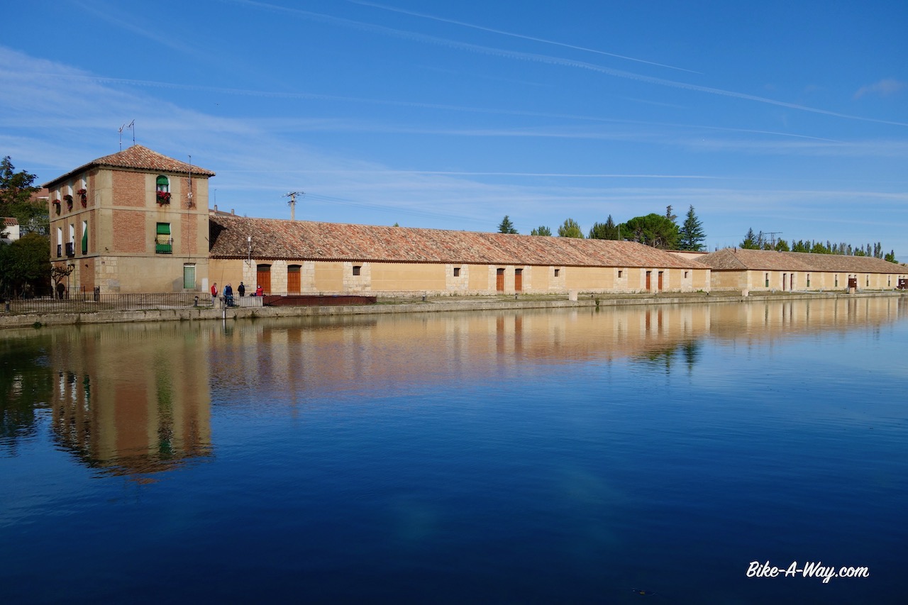
The basin near the terminus of the canal at Medina de Rioseco.
The main street in the historical center of Medina de Rioseco was all in this style.
The hat (capirote). It is worn during the Easter period and has something to do with atoning for the sins.
Iglesia de Santa Cruz in Medina de Rioseco.
Iglesia de Santa Maria. There is also a third impressive church in the little town for Santiago.
Church of ‘San Ginés’ in the village Villabragima.
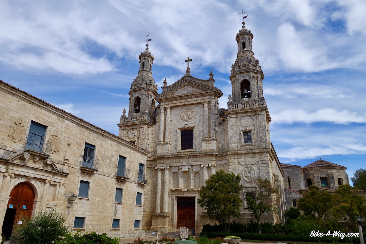
From Castromonte I took a little detour to La Santa Espina, to visit the monastery, built in 1147 by Doña Sancha de Castilla, the sister of King Alfonso VII. Originally it was a Cistercian abbey but nowadays it is a center for agricultural education.
The monastery in La Santa Espina.
‘Castillo de los Enriquez’. There are plenty of castles in Castilly y Leon and this ‘Castle of the Enriquez family’ in the village Torrelobaton is a fine example. It was built around 1420 and reconstructed in 1538 after it was attacked during the Revolt of the Comuneros in 1521.
Being ‘freed’ from the canal, I can start looking for camping places both sides off the road or track again. I pitched the tent in a pine forest three kilometer before Tordesillas, a place which rings a bell with everybody, no doubt.
We all remember it of course from history class ! Tordesillas is the place where in 1494 a treaty was signed between Spain and Portugal, which divided the then known non-European world (basically South America) in Spanish (Castillian) and Portugese spheres. More than five hundred years down the road we still see the effect of this, with a Portugese speaking Brazil and Spanish speaking rest of South-America.
There is a great museum with interesting maps about it all in Tordesillas.
It was closed (Monday). Sigh.
Tordesillas.
In Tordesillas I also meet the Douro River again. I follow the ‘Senda Del Duero’, a hiking trail along the river, for a while. It is not always close to the river.
The trail is mostly good, sometimes bumpy or sandy with from time to time great vistas to the river.
Rio Doura, near Castronuño.
After crossing the river over the Presa de San Jose near Castronuño, I leave the Douro which flows towards Zamora and further on to Portugal. Me, I take a good, quiet asphalt to La Bovéda de Torro.
After this town, I made my way over some fantastic gravel further south.
I camped on a hill top, about 930 m from where one has fantastic view to the outlines of the Sierra Guadarrama and Sierra Bejar.
Entering the province of Zamora again. Remember, that’s the same province I entered weeks ago after crossing the Montes de Leon, on my way to Portugal.
Excellent gravel roads.
My mattress started delaminating near the foot end about a week ago and I urgently need a new one. I thought about taking asphalt to speed up to Salamanca, where I can find one, but first starting riding a bit more gravel roads.
Soon I was thinking “Why would I go and ride between cars and trucks when I have so much fun on the gravel ?”
The Decathlon website stated they had only one Therm-A-Rest mattress left in Salamanca, so on the one hand I was in a hurry to grab it, but on the other hand I experienced that the information on Decathlons website can’t be trusted, so I decided to give riding fun priority over buying mattresses.
Just before entering Salamanca. Not a pleasant welcome into town. I can’t comprehend people do this. I have a feeling I see it less frequent then a few years ago, but still you have morons doing it. Giving them a fine is no solution, because officially they have nothing, so they won’t pay. I guess no sane person can think this kind of behaviour is ok, so only severe punishment is justifed. I propose cutting off an arm, and show it on tv. I have a slight feeling people will think twice before doing this again.
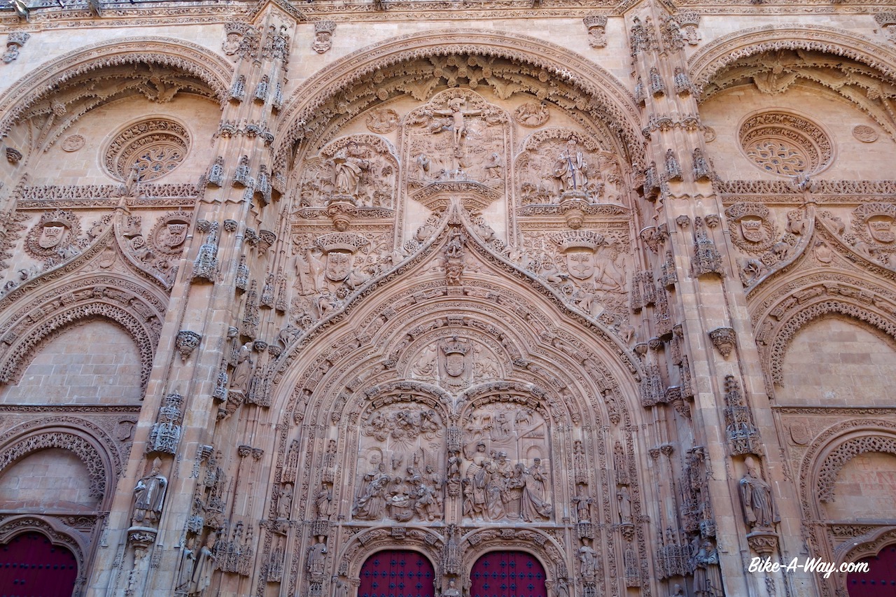
Two kilometer before Salamanca, I could see the towers of the cathedral already, I had a flat. Multiple punctures from a steel wire out of a car tyre. Here in Salamanca, I cross again my own tracks, this time from April 2017. At that time there were a lot of people near the cathedral.
Now, corona times…. I was standing here all alone. I visited the cathedral this time (6 € entry fee !)
Also here, I was all alone.
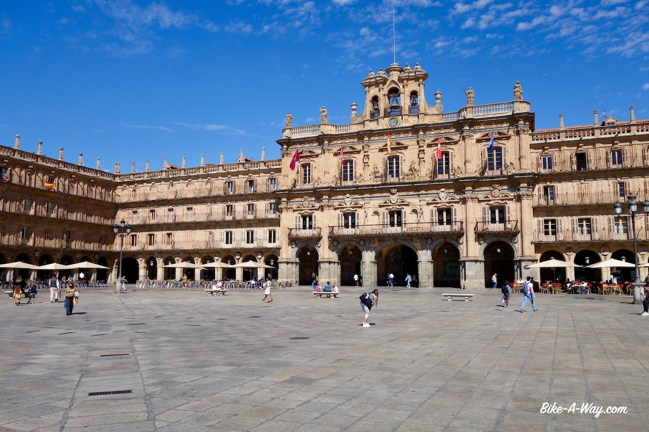
Plaza Mayor, Salamanca. Impressive.
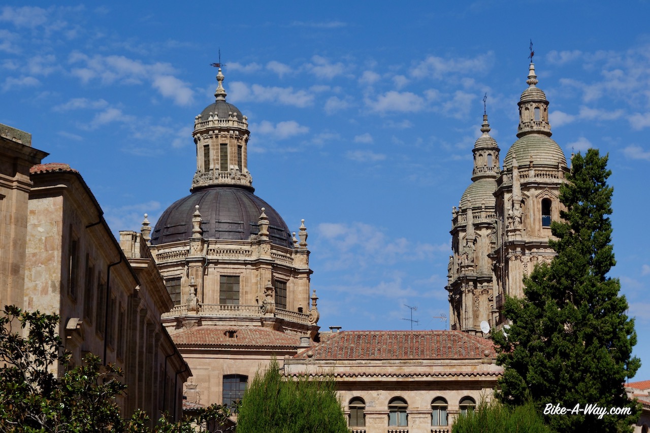
Towers of the Iglesia de la Clerecia.
Tower of the Salamanca Cathedral.
The famous entrance. It is a hundred times more spectacular as in this picture, taken in the shade.
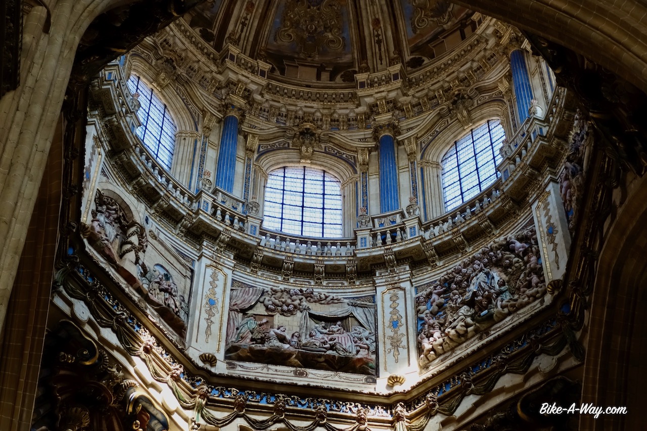
Inside the cathedral, the ceiling of the tower.
Also the tower.
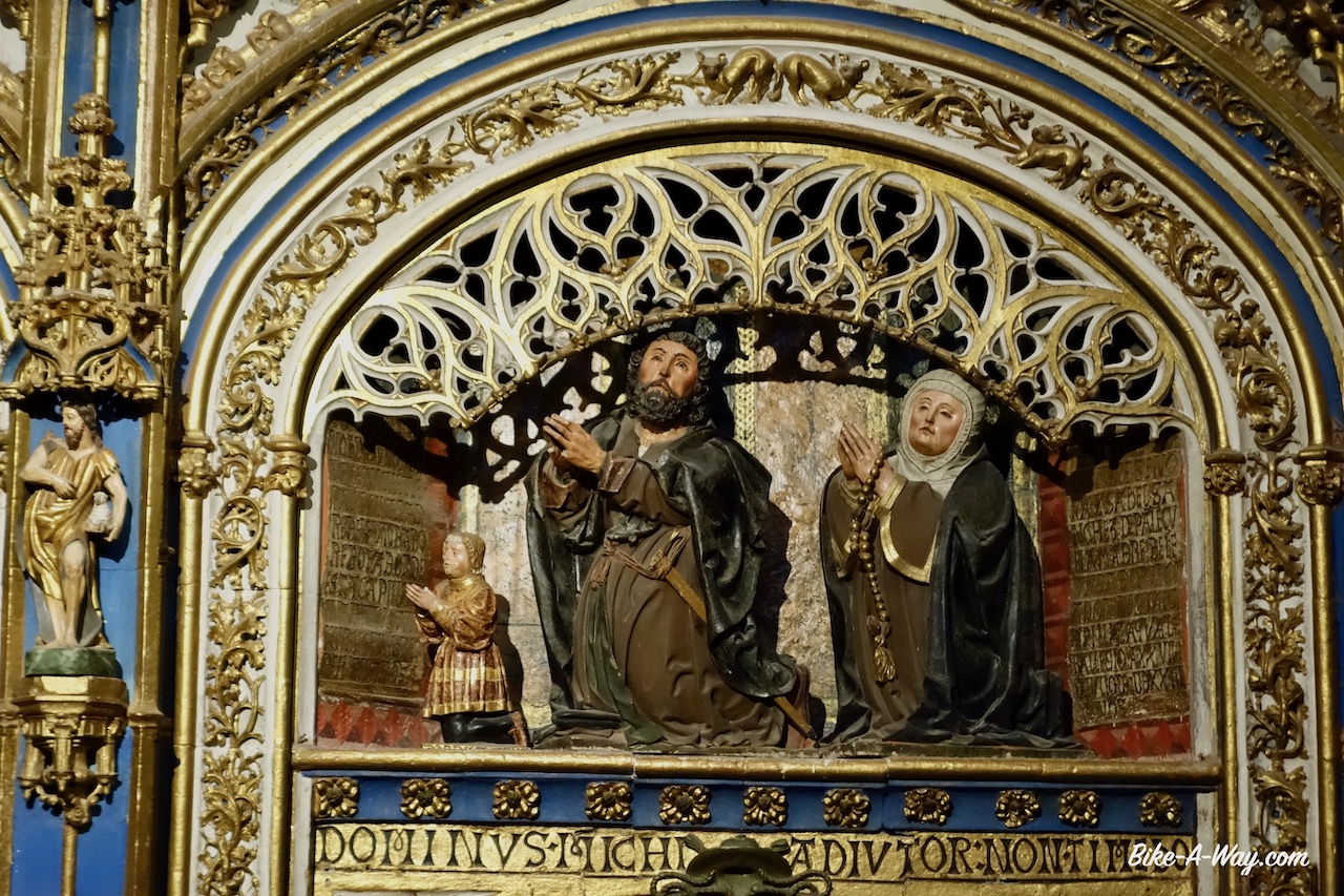
The ‘Capilla de Todos los Santos’ (all Saints), inside the cathedral.
Also in the ‘Capilla de Todos los Santos’.
Later in the afternoon, following the bike path along the Tormes River (which I crossed already a while ago on my way to Segovia), I rode to Decathlon.
A very bizar situation arose. They had one more Therm-A-Rest but refused to sell it to me first. After a whole discussion, they gave in. Bizar.
Bought new shoes, long pants to cycle and a soft shell to keep me warmer.
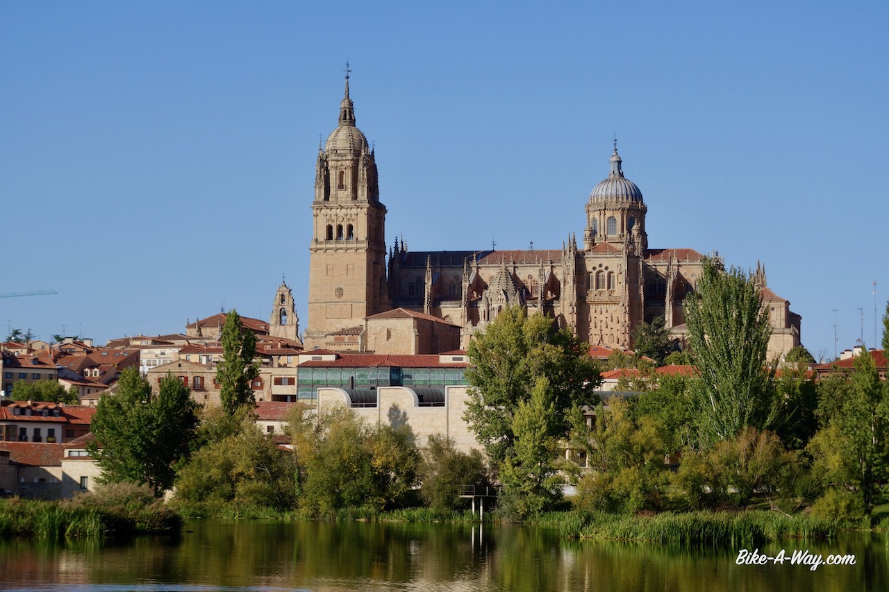
A view towards the cathedral in Salamanca from the bike path along the Tormes river.
Riding south of Salamanca, I take the off-road Via de la Plata. I still had my own waypoints of good wild camping spots so I knew exactly where I was going.
The famous, simple cross on the Via de la Plata, just south of Salamanca (you can see the city in the distance). I made the same picture with my mtb in 2017, in following post: https://bike-a-way.com/2017/04/30/via-de-la-plata/
At this place, just south of Salamanca, Wellington was leading a battle on 22July 1812 (the Battle of Arapiles). An Anglo-Portugese army defeated the French army during the ‘Peninsular War’. Spanish troops were present as well but didn’t take part in the battle. They were positioned in a way to prevent a French retreat. Two months later, Madrid would fall. But of course…. that track you see is also the Via de la Plata and my way south.
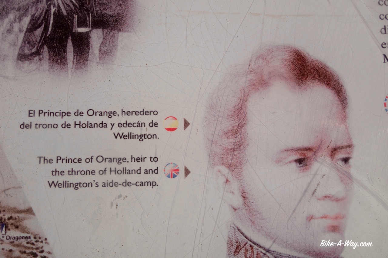
Wellington was also the guy who beat Napoleon in Waterloo, Belgium in 1815. It was a very tight battle, which Napoleon should always have won. Napoleon (and the French) ruled over (what’s now called) Belgium until then, after he got it from the Habsburgers when he defeated them in Italy. Napoleon was actually pretty good to Belgium, and it was he who gave the instructions to build the first docks and shipyards in the port of Antwerp. This sign here in Spain puts something indeed real clearly. ‘The prince of Orange, used as Wellingtons’ aide-de-camp’. The prince licked Wellington’s ass for years, and this is why Wellington pushed Belgium into the hands of the Netherlands (to create a larger buffer state with Prussia). Not the best period in Belgian history, and barely 15 years later, Belgium gained its independence in 1830. In theory, the country will celebrate its 200 years independence in 2030. I wonder whether we’re gonna make it. Often called ‘the battlefield of Europe’ with virtually all European powers and nations ruling and fighting there, from Romans, to Vikings, Spanish, Habsburgers, French and Germans, the country faces now a much severer enemy: incompetent, corrupt, nasty, selfish politicians, who may cause the country to split up before its 200th anniversary.
Cool trees south of San Pedro de Rozados.
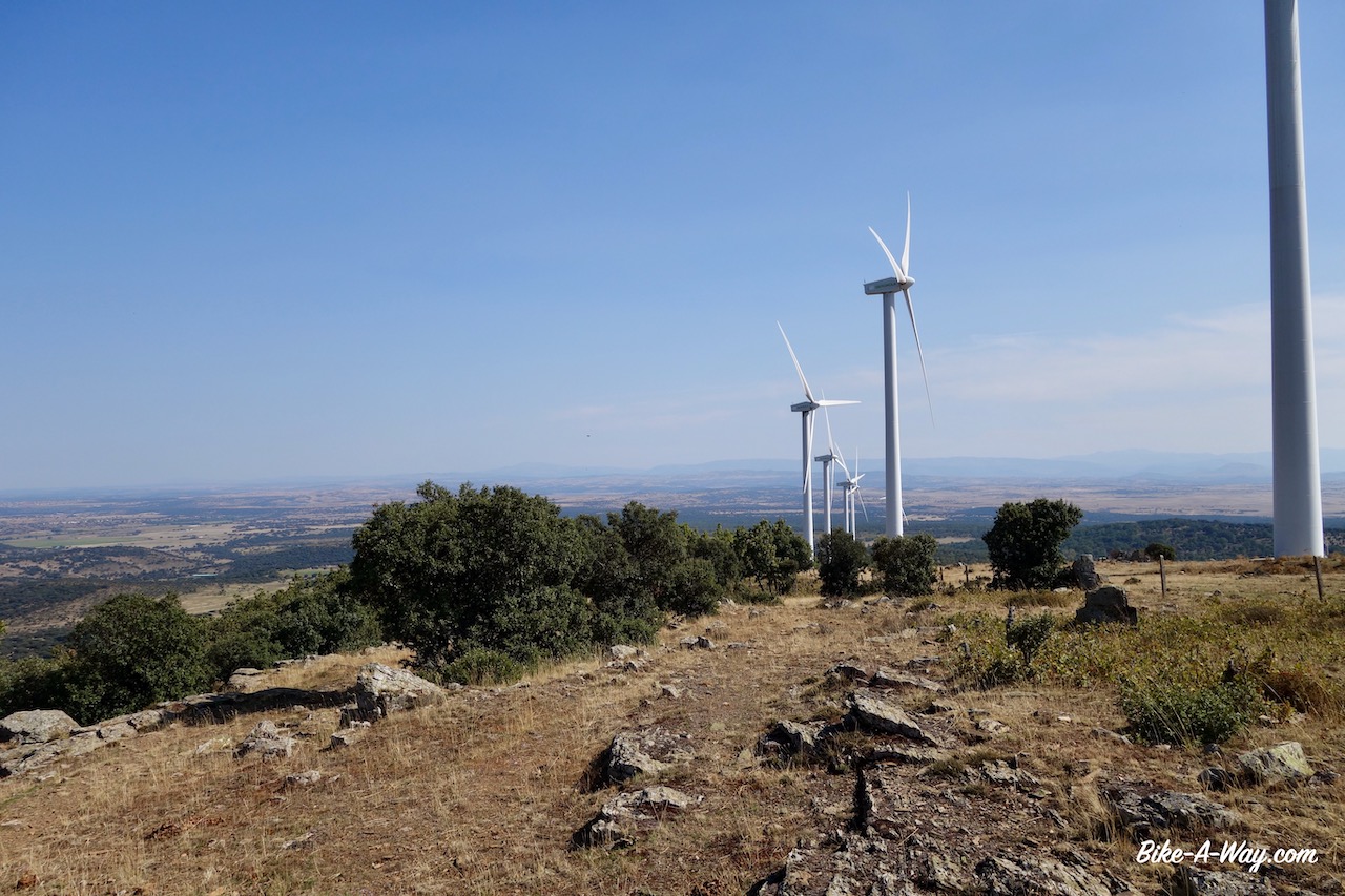
This is a real nice stretch of the Via de la Plata and I was looking forward to ride it again. About ten kilometer after San Pedro de Rozados follows a short, steep climb (pushing required) to a hill top full of wind mills. An English lady hiking towards Santiago told me this is the highest point on the Via de la Plata. No idea wheter this info is correct.
The highest point on the Via de la Plata ?
I knew from my visit in 2017 that after tackling this hill, I would enter some land with excellent wild camping possibilities.
After that good night, I rode the short distance to Valverde de Valdelacasa and settled down in the pilgrims albergue. Lots of wind and torrential rain was predicted for the coming night.
You can still see the slightly elevated Roman road, a few millennia old. Who knows Julius Caeser himself rode here when he was on holiday ? The milestones along the track are 2.70 meter high.
The ‘tungsten’ (wolfram) open pit mine of Los Santos. Tungsten has the highest melting point of all the elements discovered, melting at 3,422 °C. Its density is 19.25 times that of water, much higher (about 1.7 times) than that of lead. So many things you learn from a cycling blog…. 😉
Fetching water in Valverde de Valdelacasa…
… where I took water in 2017 as well 🙂
Waking up in my room in the albergue, a quick glance through the window showed all surrounding mountains covered in thick, ugly, grey clouds and the downpour had changed the street in a river a few centimeter deep. The cleaning lady showed up before 10 am and I had to evacuate my room. The four Spanish cyclists who slept in the dormitory had left already.
“Why on earth would somebody go out in this weather ?”, I wondered.
But I’ve seen (most) people doing that before. Or I am an incredible pancake, or those people’s holiday must be calculated down to the minute and they’ve got no time to lose.
Anyway, by 11 am it was just raining instead of the earlier downpour. “Don’t be a soft potato for once”, I told myself and went out.
The village Valverde de Valdelacasa from my window in the albergue. I normally won’t stay in albergues, but this one also had private rooms and was excellent value for money.
The Sierra de Bejar in the distance packed in dirty grey clouds.
It was Friday. I was 36 km from the post office in Hervas and although the tracking showed the package I was waiting for since more than a month was still stuck in Madrid, I wanted to go and check whether it might have arrived by some miracle.
Not a hundred meters, really, less than hundred meters I was on my bike, and they opened all gates in the sky. What a downpour Few hundred meters further, asphalt changed in sand…. mud. After 3,8 km I noticed the rear tyre was almost flat.
“Aaah, f*%k, not now !”.
Refusing to change the tyre on the muddy road, I gave it 72 pumps and continued riding.
Exactly two kilometer further… almost flat again.
A hundred pumps this time.
I had to pump a third time before reaching the next village, La Calzada de Béjar.
“I’ll never make it before 14:30 (closing time of the post office) like this.And what’s the point, racing to a post office to collect a package which is still hundreds of kilometer away in Madrid, according to the tracking ?
“Better shelter a bit here”, I told myself, because it’s not only raining, but a real strong ice-cold storm wind is blowing from the side as well.
On the other hand, I was wet already. And what if this tracking was wrong and my package was sitting in Hervas. They only hold it for two weeks before it is returned to sender. If I don’t check, it might be on its way back to Belgium before it ever officially arrived……
I jumped back on my bike, after giving the tyre one hundred pumps.
View to cloud covered, wind swept Sierra de Béjar.
At 14:10 I arrived at the post office with twenty minutes to spare. The last part from Béjar to Hervas is really easy over the via verde. In total, I stopped nine time to inflate the tyre.
Nonchalant, I asked the post employee for my package, as if I was sure it would be there.
Even more nonchalant, he handed it over to me.
“Break now my wooden shoe”, I thought. (But lesson learned. In future I’ll use DHL to send packages. Maybe 10 euro more expensive, but they come and collect the package at home, and they guarantee delivery almost anywhere in the world in two days. No more postal services for me).
Well, it makes life a lot easier. I rode back to the via verde verde where the former railway station has an awning under which I could replace the worn rear tyre with the new one from my package, and put another tube inside (the slime tube was way too slimy to patch). I’ve ridden about 5.000 km on the old tyre, which is not bad for a knobby tyre, on a loaded bike over rough terrain.
Time to start a new chapter of my trip in the Extremadura.
Route: Ciudad Rodrigo – La Alberca – Hervas – Avila – Segovia – Olmedo – Valladolid
The first part of the route through Castilla y Leon.
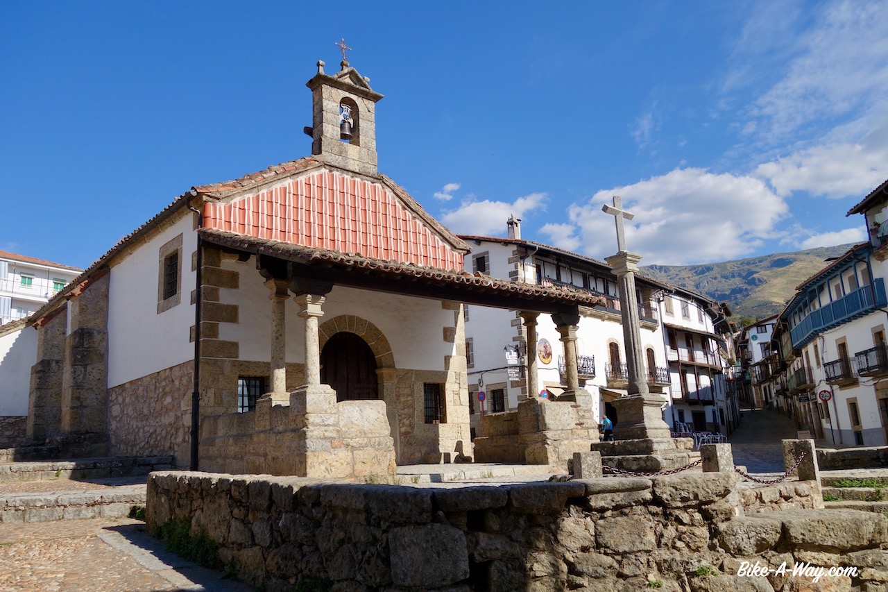
Just beyond the Portugese / Spanish border lies the tiny historical town of Ciudad Rodrigo.I had noticed it on my maps all those years, but it is in such an out of the way corner of Spain that I thought I’d probably never reach it.But here I am.
Nice little place.Old town up the hill.Impressive old city walls, a castle tower, an old cathedral, the house of the marquis which I liked a lot, …. yeah, it’s worth a visit.
The house of the Marquis
I check into a hotel for two nights.Lot’s of stuff to do, besides typing for this website.Laundry, bike cleaning, visit restaurants, downloading podcasts, recharging all the devices, etc, etc…
On my rest day in Ciudad Rodrigo I strolled back towards the old town to have another look at all the old buildings and have lunch.After lunch, I walked the loop over the old town walls.didn’t see another person.It’s siesta time, you’re not supposed to walk, I guess haha.
My legs needed a bit of a rest period as well, I was thinking.They felt rather tired after the constant climbing, day after day since I reached the Pyrenees.“Nothing better than some riding along canals to give the legs some rest”, I thought.We’re in mountainous Spain, and not in flat Belgium, but there happen to be canals a few hundred kilometer north from here, the ‘Canal de Castilla’.I started investigating whether I could include that into my ride somehow.
From one thing came another.The idea is to go eventually further south, to Extremadura, but the canals are north from here so I have to make a loop somehow in order to avoid riding the exact same thing twice.
I could ride via Avila, that’s supposed to be an interesting town.And then, I’m not far from Segovia, with it’s picturesque cathedral and….’.
Oh, and there’s another greenway I could include, and then go to the canals this way, return that way, a bit of Via de la Plata there, and ….
It’s proven again that too much thinking is good for nothing.In search of a way to give the legs some rest, I just added another thousand kilometer with a hilly passage through the Sierra the Francia and the Sierra de Bejar and yes, also some riding along the Castilla Canals.
It’s going to be fun ! 🙂 🙂
The ride from Ciudad Rodrigo to La Alberca over the main road is easy.La Alberca is at 1.050 m asl or so.Super touristic, even on a weekday.This typical old houses with wooden frames.A bit like in Troyes and Bergerac in France. Lots of shops selling the Jamón (ham) for which the region is famous, lots of typical tacky tourist shops with t-shirts, bags, magnets to put on your fridge, restaurants with menu del dia’s, pinchos (tapas), ….
La Alberca
The region is famous for its hams. Cycling the region, I saw a lot of the black pigs in the fields..
Plaza Mayor in La Alberca
This stuff is not for me anymore.I leave town after 45 minutes and find myself an ok place under the chestnut trees to camp.The night definitely is going to be quieter than last night in the hotel with it’s banging doors well into the night (despite the noise isolation which the hotel advertised but was totally non-existing).
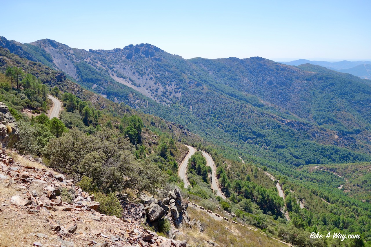
I had put a lot of time in preparing my little loop in Castilla y Leon, starting from Hervas, but not too much time in the route from Ciudad Rodrigo to Hervas.That night, I suddenly remembered that, months ago, I already looked into some nice roads in this area.Instead of riding straight to Hervas the next morning, I rode back up to La Alberca and from here took the road straight south into the Parque Natural Batuecas.From La Alberca, I first have to climb a little bit higher to the Puerto del Portillo Pass (1.247 m).From the pass, I have a brilliant view to all the lower hills in Extremadura region. On the downhill, a series of switchbacks until I reach the Rio Batuecas.I take a little side road to visit the Monasterio de las Batuecas, but it’s not open for visitors.
The eternal powerlines, but a good view to the endless row of mountains.
Switchbacks on the descent of the Puerto del Portillo.
Clearly on the switchbacks.
Never mind.I keep going down.Although I’m supposed to be on a tour of Castila y Leon region, I am entering Extremadura region for a while.I ride already a part of the northern section of the Cicloextremeña, a loop that follows the borders of Extremadura region. More about that in a few weeks, when I’ll ride the rest of it.
It’s one of the harder stretches of that loop that I’m doing now.
After Riomalo de Abajo, situated at the confluence of the Rio Ladrillar and the Rio Alagon, I climb steep on a stony dirt track.This is the start of a remote section, closed to motorized traffic and without any services for 60 kilometer.
Heaven.
Down below, I can see the wide body of water, the Rio Alagon.Also the Rio Hurdano joins and eventually, as always when there’s some water here, they’ve built a dam and created the large Embalse de Gabriel Y Galan.It’s a fantastic off-road ride through the forest.I take a right turn on the dead end road towards Granadilla, which is supposed to be an interesting place down at the lake.From far away I can see the fortress already.I arrive at 2.15 pm. The whole village is closed with the big iron gate from the middle ages.Entry to town is only in the morning and late afternoon / early evening.Basically the times shops are open in other places.Nothing to do but to ride back where I came from.It is paved roads from now towards Abadia, then Aldeanueva Del Camino, a place I passed through in 2017 as well when cycling the Via de la Plata.
The closed city gate in Granadilla
Approaching the Sierra de Bejar.
What’s changed now is there is a via verde from here, going to Hervas, a historical town further up the hill and all the way to Bejar, the town at the pass.In 2017 I still had to go through the busy valley.A good improvement !
Hervas is a nice place.A real town this time, not like the tourist Disneyland of La Alberca.I was hoping to pick-up a package send from home 10 days ago with a new solar panel, a new rear tyre and my old gps, as the current one is failing, but the package is still in Brussels. It seems that in this period of time, the Belgian Post can bring a package only from the north of the country to the centre of the country, a whopping distance of about 60 km in 10 days. I walk faster.
Very smooth riding and climbing on the via verde towards Hervas.
Well, we’ll see.Maybe they get it on a plane one day and hopefully it arrives when I return here at the end of my Castilla y Leon loop.
I visit the town church (from the outside, because it is closed) and the old Jewish quarter.
Jewish quarter in Hervas
Hervas
Growing out of a little seashell.
All the time since leaving the closed town of Granadilla, I was riding east and looking to a wall of mountains, the Sierra de Bejar.When I passed here in April 2017, I was riding south to north alongside them, and the tops were still covered in snow..Not so now of course.But this time, I had to get over the range.
It’s a very easy climb.The hardest thing were the persistent hundreds of little flies going around my head all the time, trying to enter my mouth, ears, eyes,…. I haven’t mentioned it yet, I think, but it is terrible this year.I’ve never had that amount of flies and mosquitos in Spain as this year.Climate change ?
Anyway, there are many, many, many more of this irritating bugs than normally and they make my life out in nature hard.Riding the bike they swarm around you when you’re climbing, slow and sweating.At night, they eat you at your camp site.
Once over the top (unnamed pass, 1.313 m), I am back in Castilla y Leon.On my left hand is yet another Embalse (Embalse de Navamuno).
Candelario, the first town is really beautiful again and worth a visit.
Ermita del Humilladero in Candelario (16th century).
The fortress in Puente Del Congosto at the Rio Tormes (Salamanca is further downstream at this river, where it’s much wider already).
In Puente Del Congosto I went back on dirt, following the ‘Cañada Real Soriana’.Fantastic riding again.The mountains of the Sierra de Gredos to my right, the high plains to my left.Some stretches are pretty desolate, but that’s what I like.
Fantastic dirt road riding on the Cañada Real Soriana.
Camping spots along the track are plentiful.
More or less every church tower in Spain has a stork nest. This tower had five (!) nests.
Enjoying some clean, fresh water after a long, dry stretch.
And I was not the only one appreciating the spring.
I toured around Avila a bit.The cathedral was closed right in front of my nose for siesta.No problem.Enough buildings to look at from the outside.Avila is most famous for its old city walls. Apparently you can walk them, but I never found a place where I could mount them.Avila is the birth place of the cyclist Julio Jimenez who won three times polka dot jersey in the Tour the France and was also three times King of the Mountains in the Vuelta.
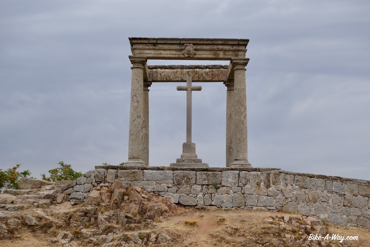
Los Cuatro Postes, just outside Avila’s city walls.
Avila with the famous city walls clearly visible.
One of the town entrances.
Avila cathedral.
East from Avila there’s a bike path of about 14 km.First night camping along it, a terrible thunderstorm passed by.Thousands and thousands of lightnings right above the tent.Of course, I am at the highest point 20 or 30 kilometer around. Also a lot of rain came down, but that’s good because the region is really dry and fires are still a concern when camping.
The bike path stops at the village of Urraca-Miguel and I have to take the paved road Av-500 further east.As the road is blocked for road works, and the busy N-110 is not an option, I pushed the bike up a steep path, 14 upto 16% inclination.It had a dead-end at the top.By the time I was down again, it was siesta time and I saw the road workers leaving.Time to hit right through the road works.
Fantastic country just outside Avila
Paved bike path that goes for 14 km outside Avila.
Still on the bike path, just before its end at Urraca-Miguel.
The steep hill on which I pushed the bike, fruitless
Descending, step by step.
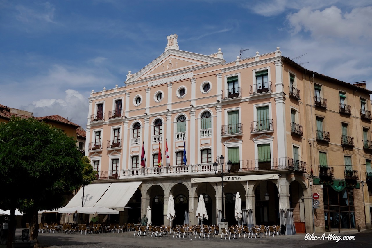
Arriving in the town of El Espinar, all shops are closed.It’s fiesta. Some obscure saint.Nobody knew exactly why.
Up to Segovia.Against the wind ever since entering Spain.Luckily I have the Sierra de Guadarrama on my right to admire.After Segovia, I make an 180 degreesturn and ride back west.I bet the wind, after blowing all these days will do exactly the same.
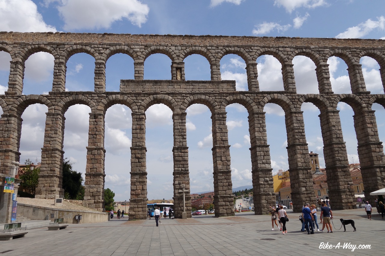
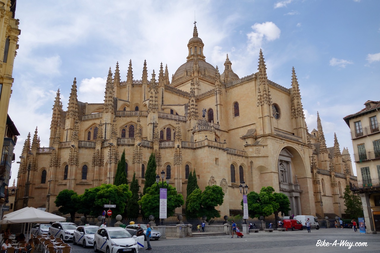
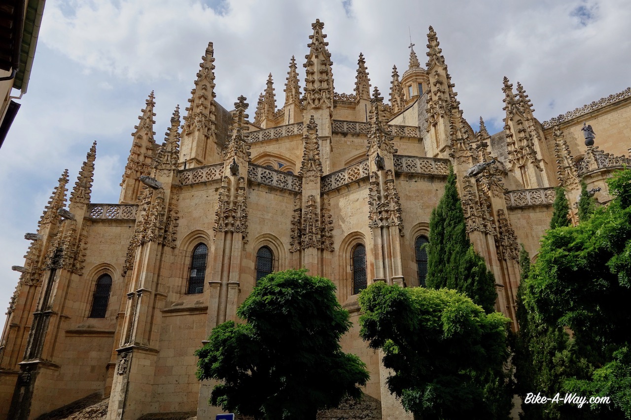
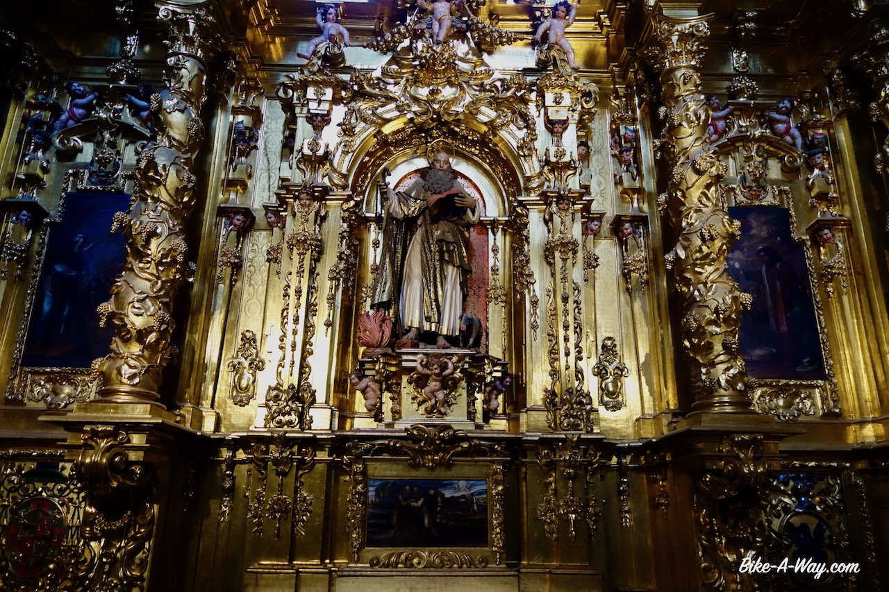
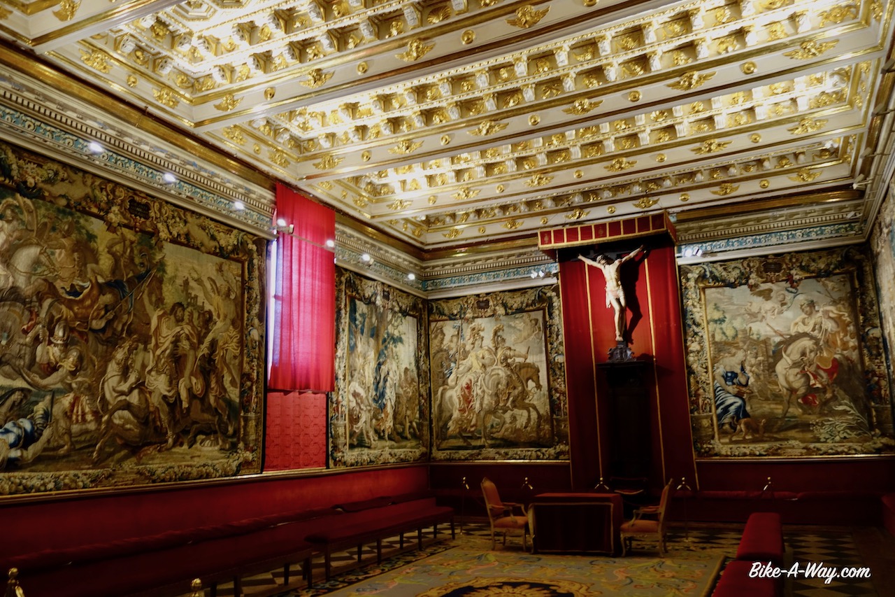
But first a visit to the city.The two main highlights are the enormous Roman Aqueduct and the cathedral.The entrance fee to the cathedral was 3 euro, I think, but it is worth it.In the basement is a museum with paintings in the style of the old Flemish masters like Rubens and Van Eyck, a sign says.
While the paintings were reproductions by Spanish painters, another museum with carpets showed carpets all from Brussels.Probably taken when the Spanish ruled in our region.
Segovia is also the birth place of cyclist Pedro Delgado.
The world famous aqueduct in Segovia.
The Gothic cathedral of Segovia.
Courtyard in the cathedral
The 500 year old Belgian carpets hanging in the museum of the Segovia cathedral.
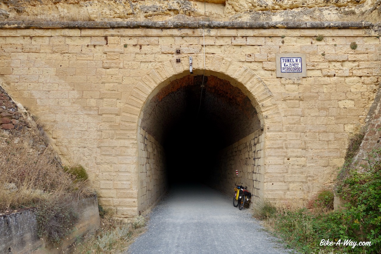
Segovia was the place where I turned west again, but more important, it is the place where some easier part follows.I have the Via Verde Del Eresma ahead of me.73 km of almost flat gravel riding.I loved the stretch, cycling along the Eresma river, through the pine forests, all traffic free, enjoying the scenery while listening to some podcasts.And I was completely wrong about that wind.It just kept blowing from the east and made my life very easy for once 🙂
There are two tunels along the via verde. This is the first one, just outside SegoviaL
Typical Castilla y Leon landscape. You can see the tower of the cathedral of Segovia.
Ermita de la Aparecida which you’ll pass riding the Via Verde Del Eresma.
A bit outside Segovia, the via verde passes the jail of the town. I think it’s a really good idea to built the jail there. The criminals can look out their small window, between the bars and get confronted every time with the ultimate symbol of freedom, a cyclist, standing on his pedals, freewheeling over the via verde. If they ever get free, hopefully they think twice before they do stupid things again and lose their freedom again 🙂
Olmedo is the terminus of the via verde.I follow a few kilometer of bitumen before going on sandy roads again, over yet another camino to Santiago, this time the one from Madrid, the Ruta Jacobea Madrilena.Valladolid is the capital of the autonomous region Castila y Leon.Quite a big town with over 300.000 people.Before entering the town, I again cross the Douro River, which I crossed a few weeks ago further downstream in Portugal already. The Douro river is Spains third longest river (895 km). I didn’t ride into the centre of town, as I was chased by rain and thunderstoms.The city lies at the Pisuerga River. I also crossed this river a few weeks ago when cycling in the Cordillera Cantabrica, in the town of Cervera de Pisuergo.
Church of Santa Maria del Castillo in Olmedo.
Ermita de Sieteiglesias near Valdestillas. Another beuatiful, but hermetically sealed religious building. Look at the clear sky after the rain.
Ermita Cristo del Amparo. The door was open, so I thought lets have a look, but when I wanted to enter I heard an old man mutter prayers without ending, so I left.
Here in Valladolid I will start my flat ride along the Castilla Canal, but that’s for the next post.
Route: Rio de Onor – Vimioso – Palaçoulo – Sendim -Freixo de Espada à Cinta – Vila Nova de Foz Coa – Almeida
My route through northeast Portugal.
After a small climb out of the valley of the Rio de Onor, I soon was on dirt tracks again.Excellent tracks, nobody else around and with endles views to the mountains around me.This region in north-east Portugal is called Tras-os-Montes, meaning ‘beyond the mountains’ and is the most isolated Portugese region.Once I crossed the provincial road En-308, thedirt track soon became rougher and there was a steep descent towards the Rio Maçãs, (or Rio Manzanas, depending whether you’re Portugese or Spanish).This tiny stream forms the border between the two countries.I actually cross the stream to pitch my tent, so technically speaking, I sleep in Spain again.More rough and often steep tracks close to the border bring me eventually to Quintanilha.
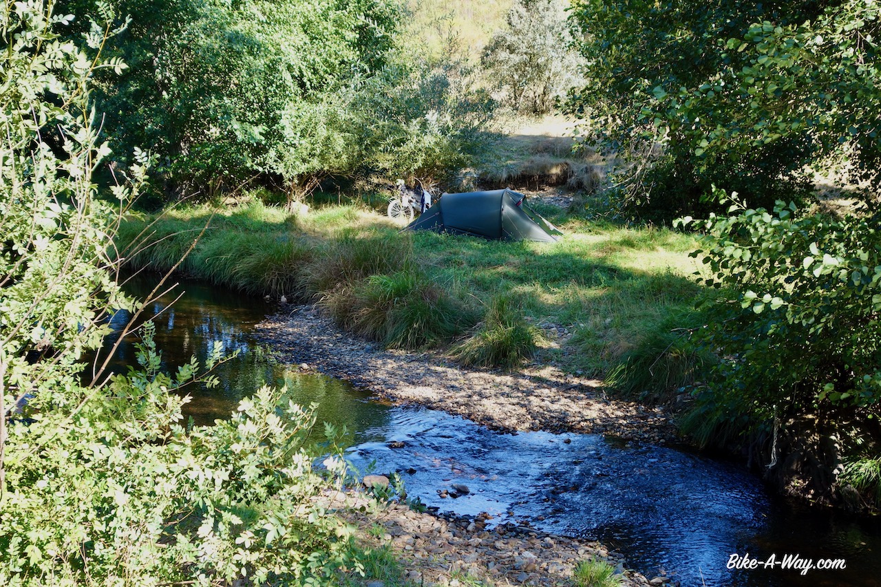
Picture taken from Portugese territory. The stream is the border. The tent is pitched in Spain.
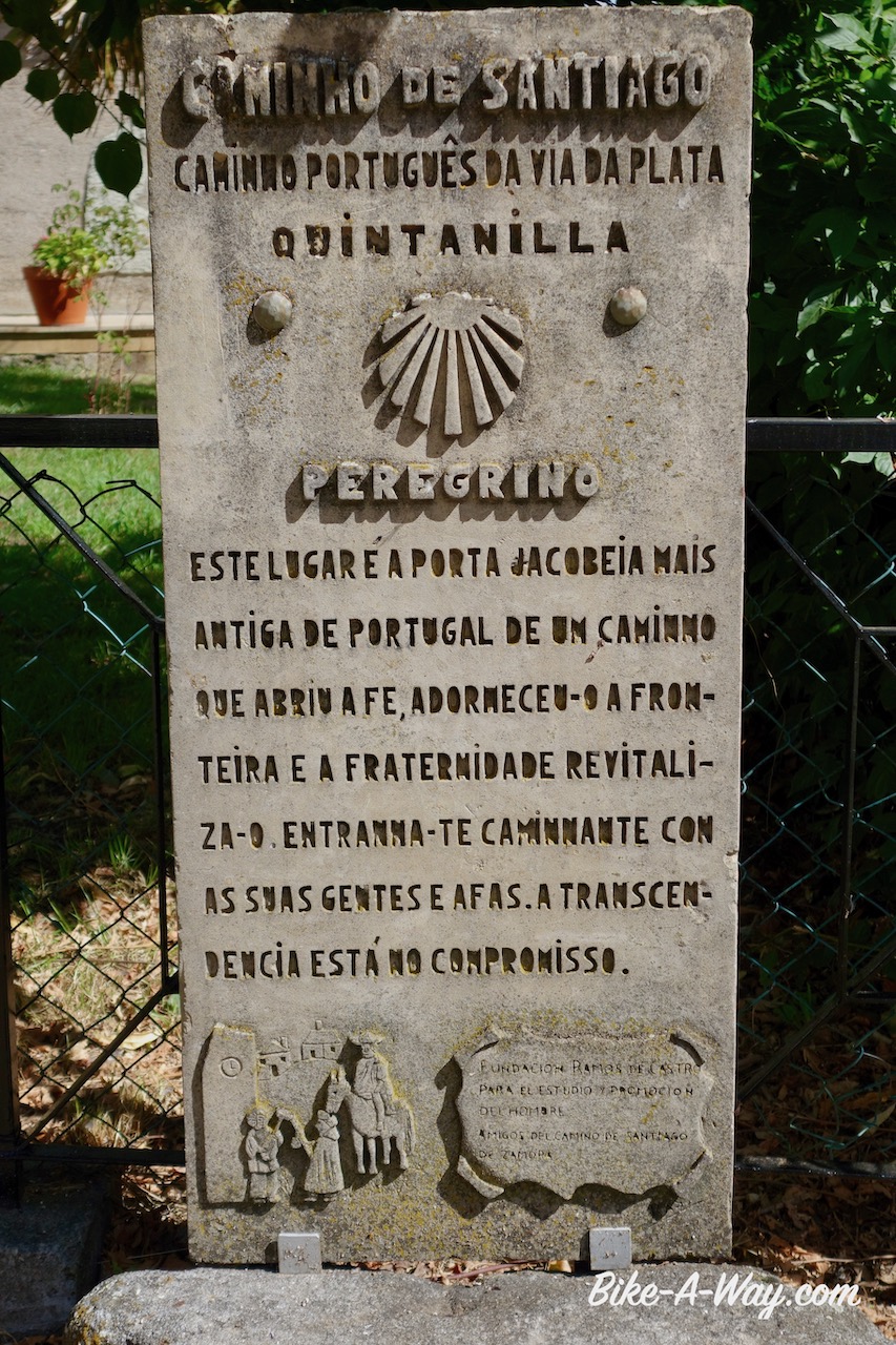
Also in Portugal, the significance of yet another pilgrims route is never far away.
I didn’t find a shop in Pinelo and in the next town, Vimioso, everything was closed.This would become a constant during my time in Portugal, difficulties to resupply.
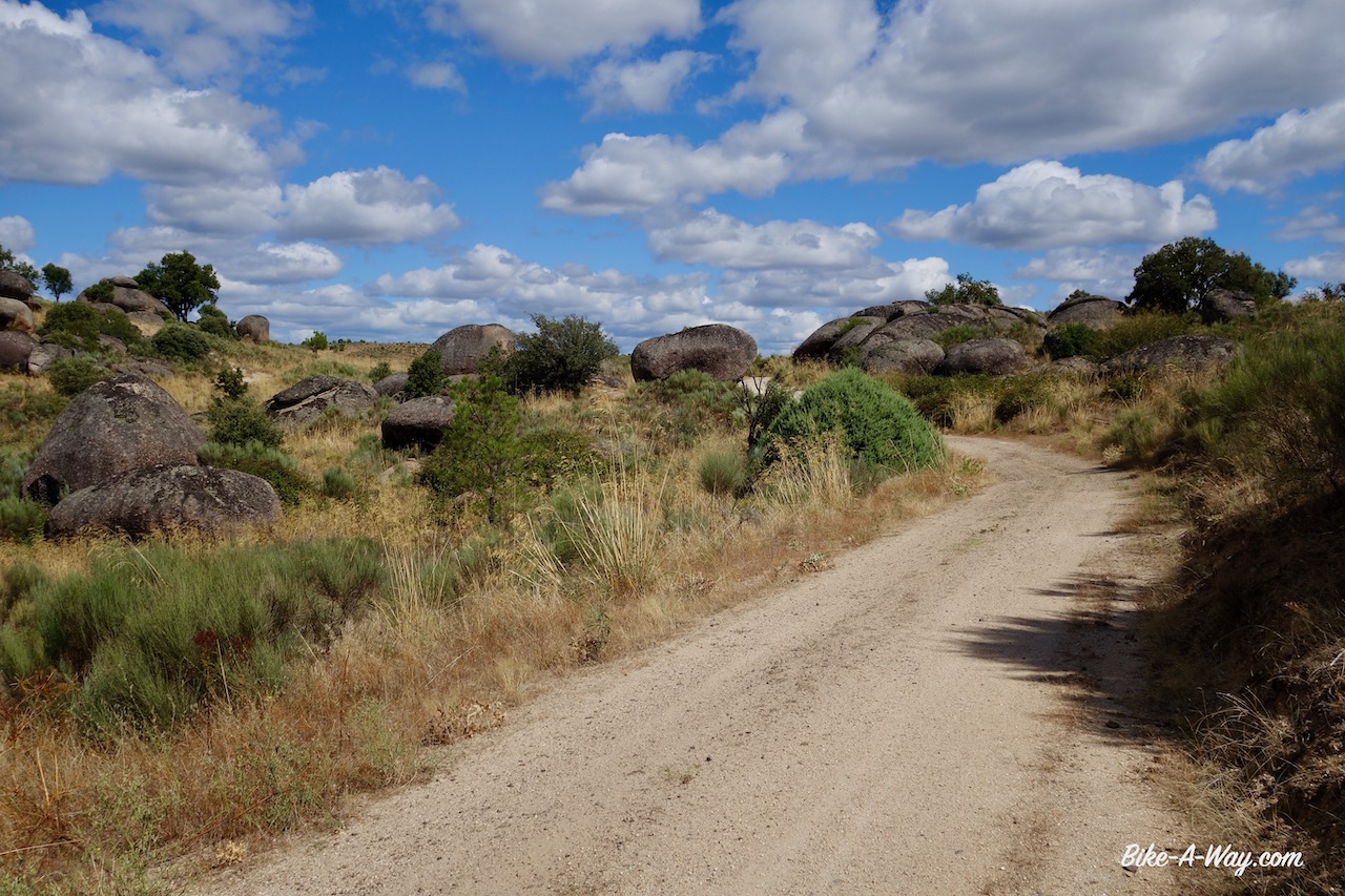
I rode into the Parque Natural Do Douro International.As so often, they call a region a ‘nature park’ but besides the explicit prohibition to camp, I don’t see any significant difference to other regions which are not in the nature park.
Sometimes the track was really old and overgrown, but there were no alternatives.
I discovered this very old bridge.
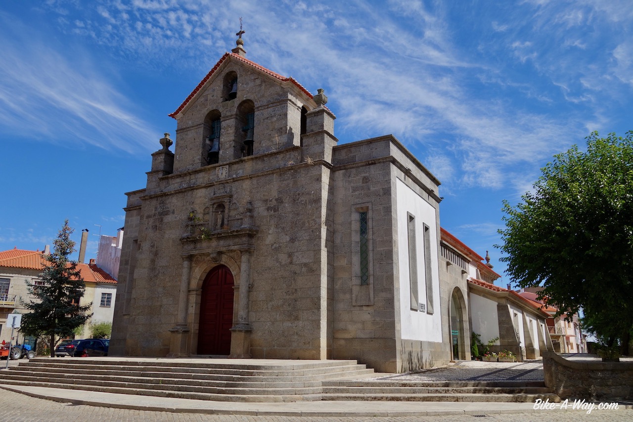
Igreja Matriz de Sendrim
I’m riding in the ‘Serra do Mogadouro’ range.No huge mountains, but constant steep climbs and descents.After a few days, they killed my legs.This is a really hard region to cycle.
The church in Ventoselo.
I rode a mixture of paved roads and this kind of dirt tracks, the GR 36.
First viewpoint to the Douro River
Riding into Freixo de Espada à Cinta over the GR 36
Outside the town of Freixo de Espada à Cinta there is viewpoint with brilliant views to the deep canyon of the Douro River, which forms the border between Spain and Portugal here.The whole region is also littered with electricity lines from the many dams in the river.
Statue of the explorer Jorge Álvares in Freixo de Espada à Cinta. He is considered to be he first European to have reached China by sea. For this reason, there’s also a statue of him in Macau.
Church in Freixo de Espada à Cinta
You can climb the tower of the castle. View towards the church and part of the town.
The graveyard as seen from the castle tower.
Canyon of the Douro River, seen from the Miradouro Do Penedo Durão. The opposite site is Castilla y Leon region, Spain. Going straight east for 100 km, you’ll end up in Salamanca.
After this viewpoint, I turned west, a bit further inland Portugal towards Ligares.A German retiree I met told me this is the hottest region of Portugal.Hot and dry, I must say.The three main crops I see along the road are olive trees, almond trees and grapes for the famous Port Wine.
Sometimes, the GR 36 became a bit rough. Here, the track goes steep down towards the Ribeira Do Mosteiro river. This is hike-a-bike country. No way you’re gonna ride a loaded bike here.
I left the bike at the ridge and hiked down to check for camping opportunities, which were better higher up.
No traffic noise, no barking dogs, no humans. Total peace and quiet.
Here you can see the GR 36 working it’s way down to the little bridge.
Almond trees. The almonds were ready to eat.
In the little town Urros there was no shop to be found and no water fountain so I asked an old lady to refill my water bottles.I got a bag of figs on top of it.
By the time I was inVila Nova de Foz Coa, my legs were so utterly tired from all the recent climbing that I, with regret, gave up on the idea of riding the off-road route through the valley of the Coa River.It was just going to be too hard at this moment to enjoy it.
Cycling along the Douro River with its many vineyards.
The church in Vila Nova de Foz Coa.
Vila Nova de Foz Coa
Well, I still rode part of the route to Castelo Melhor, but after that sticked to the national route nbr 332.Not a lot of traffic at all, but just as I noticed several years ago, the attitude of the Portugese drivers compared to the Spanish is astonishing.I can’t stop mentioning how good the Spaniards are behaving in traffic and how much space they give cyclists and how patient they can wait behind you if they are not sure whether they can pass you in a safe way.
Nothing of that is found in the Portugese driver.
A very steep downhill (-18%) towards the Coa River.
Rio Douro.
Vineyards, olive trees and almond trees.
Suddenly I saw this kilometer sign; km 222 along the N 222 seems to be a special one, looking at all the stickers….
…. the explanation followed a few kilometer later. There’s a motor club here, and apparently this stretch road is claimed as one of the nicest stretches of road in the world. It’s nice allright, but… don’t overrate it pls.
In Castelo Rodrigo, I ask the lady of the tourist info after which Rodrigo the place is named, and whether it is the same Rodrigo as in Ciudad Rodrigo, the bigger town a bit further in Spain.
She didn’t have a clue.Tourist info employees prefer you to ask for a city map and walk out, I guess.Good thing was, Castelo Rodrigo had the first decent supermarket since entering the country, a French Intermarché.
Castelo Rodrigo, renowned as one of the most beautiful historical towns in Portugal
You often see this statue with the arrows. No idea what it is all about. Let me know, if you know.
The cycling now was easy on a plateau, 600 – 700 m asl.
I visited the historical town Almeida with its star-shaped fortress of the 17th century, built to protect the country against Spanish invasions.
Entrance of fortress of Almeida.
Houses in Almeida.
Nice old Triumph Spitfire. Also the bell tower of Almeida is in the picture.
Near the village Vale Da Mula, I left Portugal and went back into Spain. More about that soon in a next post.


 In the little town Urros there was no shop to be found and no water fountain so I asked an old lady to refill my water bottles.


 In Castelo Rodrigo, I ask the lady of the tourist info after which Rodrigo the place is named, and whether it is the same Rodrigo as in Ciudad Rodrigo, the bigger town a bit further in Spain.