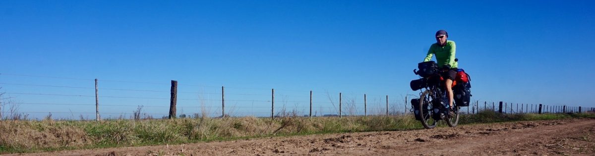
I’m finally ready for another biggish trip, starting from Couvin, in the south of Belgium and, all going well, ending in the north of Alicante province, Spain.
I’ve put a lot of energy in creating my route. So much that I ended up with five routes between these two destinations. Enough to look forward to in the future.
I’ll start with what I think will be the one but easiest route I have put together. Easy, cause I want my knees to make it to the end.
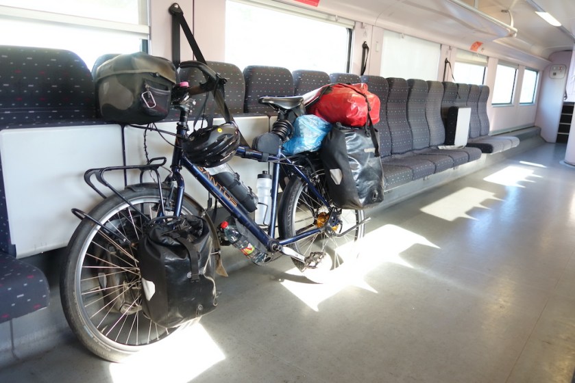
Starting from the train station in Couvin, I plan a very short first day and hope to find a decent camping spot early on. The good reason for this short day is a first interesting visit, In Brûly-de-Pesche, just south of Couvin. There is a bunker (Wolfsschlucht) in which Adolf Hitler and his high command resided from 6 till 28 June 1940 to prepare his battle against France and where the conditions for the French armistice were prepared.


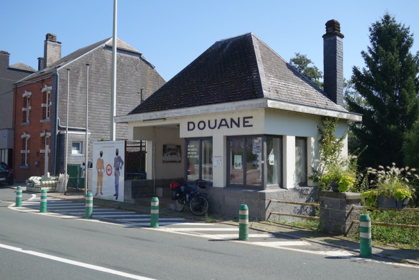
Next day, after one last portion of Belgian fries, I hop over the border into France.
Since 2016, there are only 13 regions in (the European part of) France. This trip, I’ll travel through four of them, namely, ‘Grand Est’, ‘Bourgogne – Franche-Comté’, ‘Centre – Val-de-Loire’ and ‘Nouvelle-Aquitaine’.
More details about the Spanish part of the trip will follow if I ever manage to make it to and over the Pyrenees.
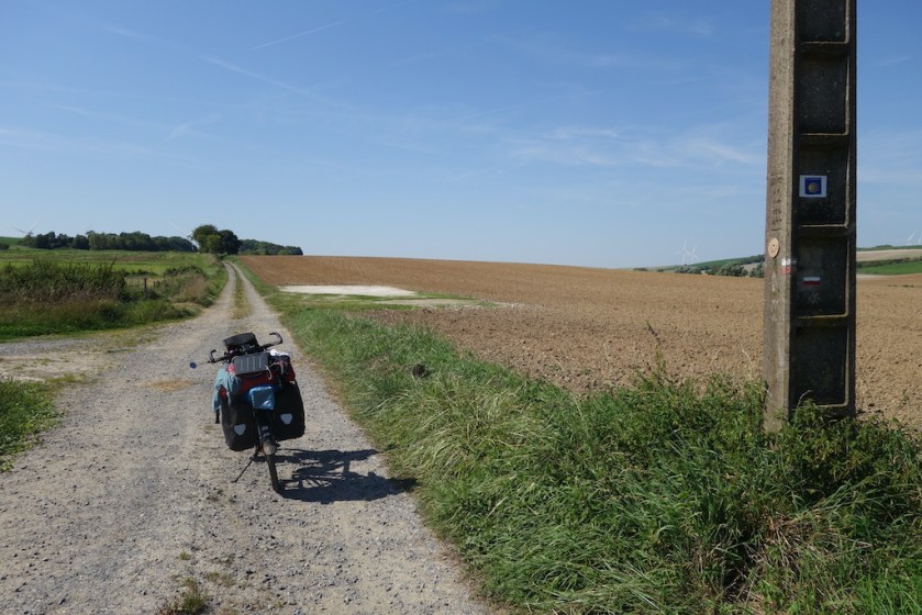
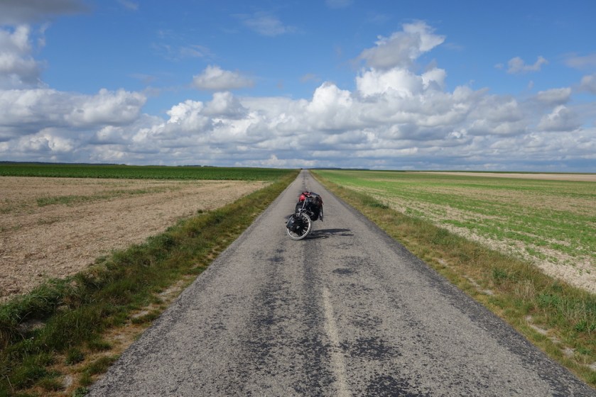
It’s typical countryside of north-eastern France which I know from previous trips. One small hill after the other to tackle, mostly very gentle, but sometimes with steeper parts upto 8%. My first days, I do not find even one bar, restaurant that’s open. If you see how much the catering industry is alive in Belgium and also in Spain, in France it is, apart from bigger towns and touristy places, dead. Nothing going on in the villages.


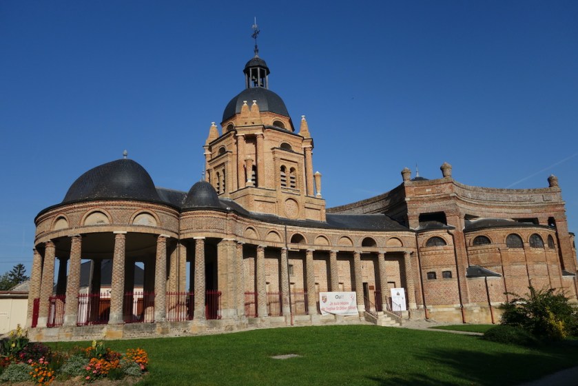
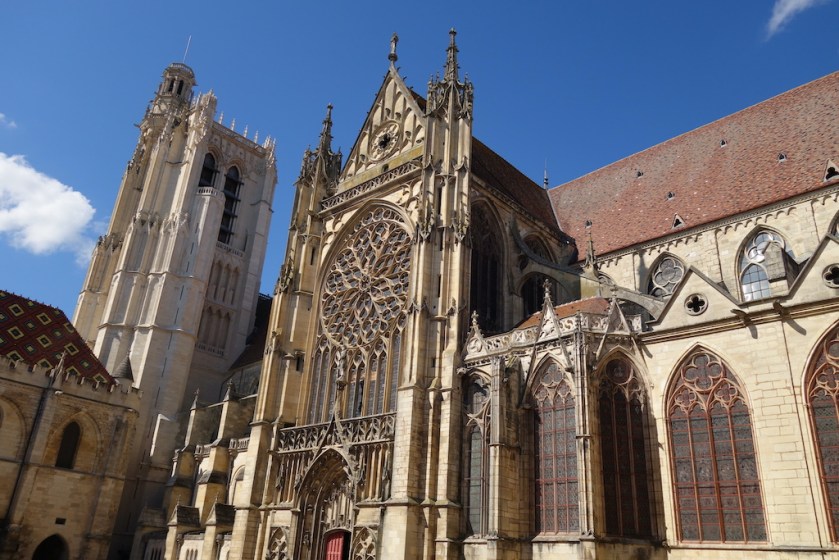
Although by now, I only covered a short distance in northern France, but it is astonishing to see the different building styles they used for the churches in such a small region (click to enlarge):


Earlier on, I wrote I am riding the one but easiest of the five routes I made between Belgium and Spain. The only problem is, once I have decided on a route, I look into it in further and further detail, trying to avoid every road that’s carries too much traffic. And by doing that, I always end up inserting more and more small, often dirt roads, which tend to get up the hills steeper and higher than your main road, and that’s what I get to feel in the Champagne region. Here, just north of the city of Reims, the hills get really steep and it’s here I had to choose between going through the city, which I did, and liked, back in 2020, or skipping it and continue straight south. Because the weather looked bad for the evening and the next day, I decided on the latter option, hoping to reach the campground at Epernay in time.

In Ludes, a small village just south of Reims, I was surprised to find at least twenty champagne houses in one street. After the village, the road went up 10 – 11% to get over the hill and through the Parc Naturel de la Montagne de Reims.
Let’s not talk about the campground. It was loud, like every campground.
The cycling along the Canal Latéral à La Marne was nice though.
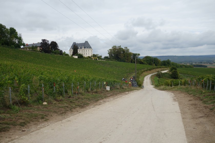
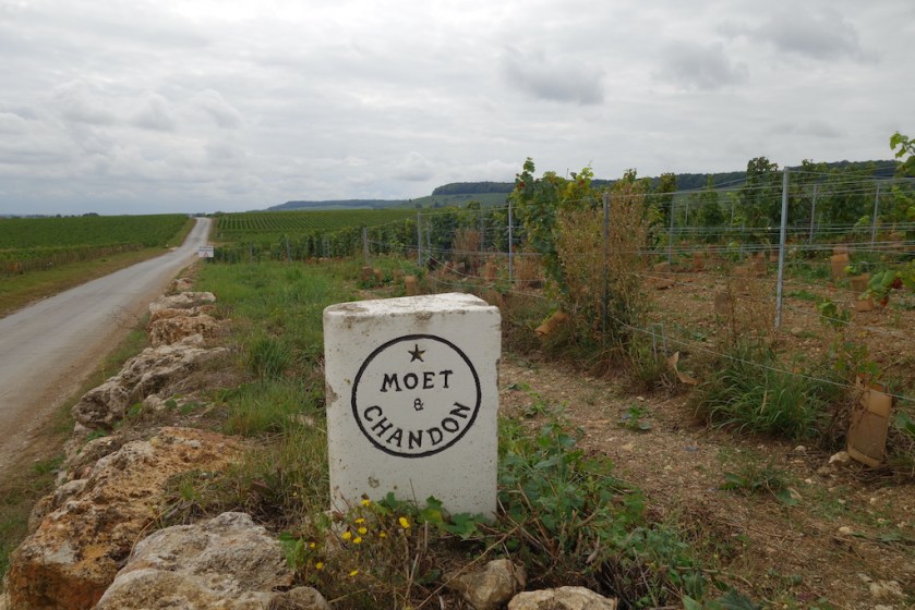
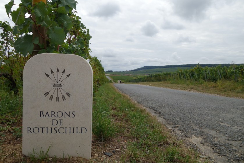
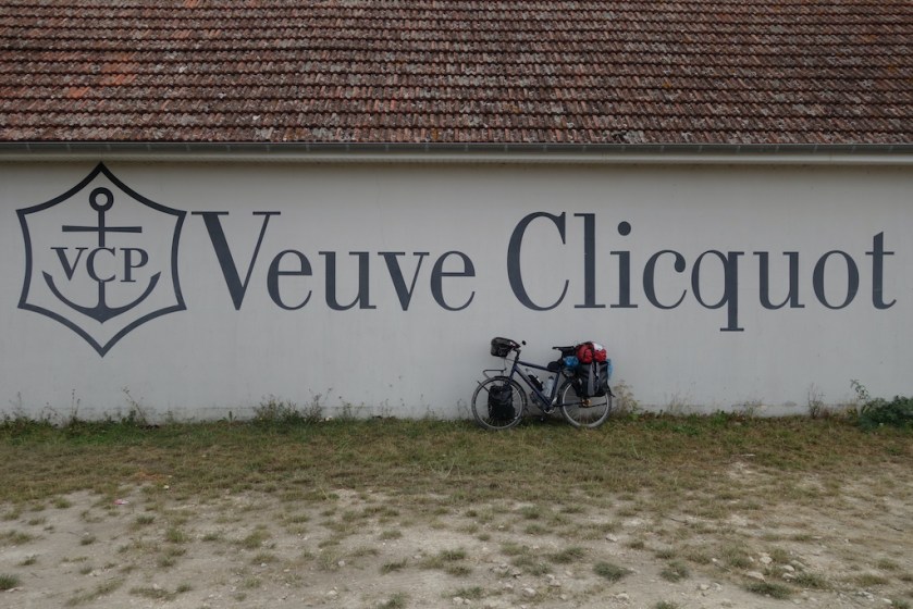
South of Epernay, I cycled through the vineyards of all the famous champagne houses, Moët et Chandon, Veuve Cliquot, Rothschild, etc…
When I stopped to have a chat with one of the guys in the vineyard, I was presented with two glasses of champagne. ‘Tradition has it that once you drink champagne in the champagne vineyards, you’ll get married before the end of the year’, he said.
‘I’m sorry but I’m gonna have to let down tradition’, I replied. No time for that.
He also explained that, unlike further south in the wine regions, the champagne grapes all had to be picked manually, and if I understood correctly, in an eight day time period.


Once south of the village Fère-Champenoise, with a military graveyard of the first world war, it’s already over with the champagne vineyards. It’s incredible that all the worlds’ champagne is harvested in such a small region.

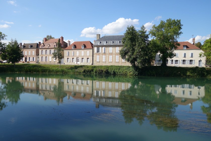
After crossing the Aube River (which, like many French rivers also gives its name to the department) I cycle for a while along the Seine and the Canal de la Haute Seine. Very nice.

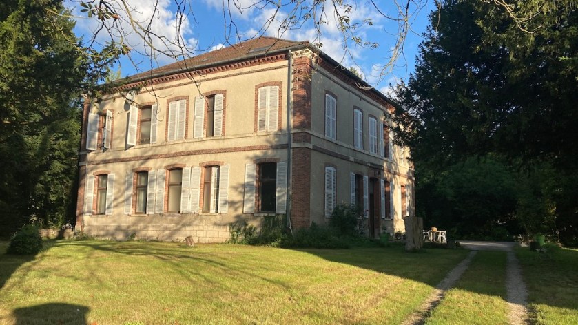
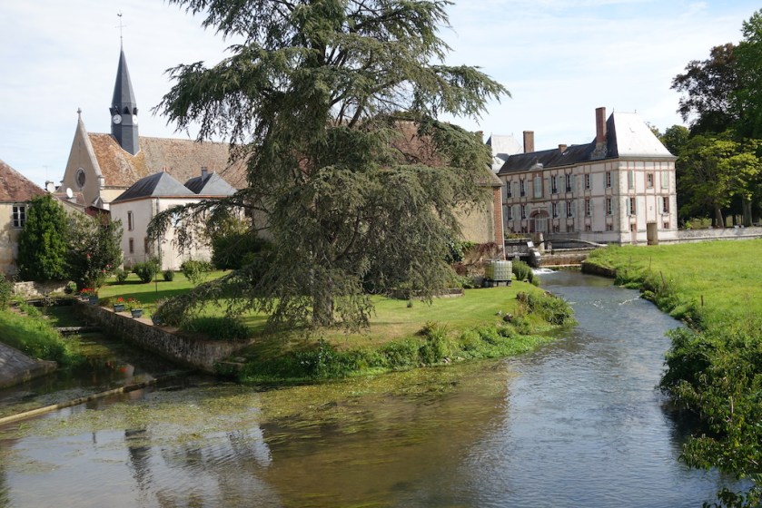
In Trancault, after I was searching the last 30 km for an open cafe or restaurant, I finally went to the mairie (town hall), to ask if I could use their toilet, which they kindly allowed. One thing let to another, and I was invited by a nice couple to spend the night at a local château, / farm.


At the next village, Saint-Maurice-Aux-Riches-Hommes, I crosses the border into the next French region, Bourgogne – Franche-Comté’ and in to the department Yonne.
L’Yonne is again the name of the main river in this department, and I cross it in the city of Sens, where there’s the confluence with the Vanne River.
Sens has got a nice church and all, but this small town is already too big for me. It just doesn’t work, me and all this traffic, people, noise, graffiti, rubbish, …..

On this route, I also included some of the larger forests still left in France, f.e. the Forêt de Montargis. Some of the tracks have signs that it’s only accessible for ‘Ayant droits’. I suppose this are those who cut the forrest, and hunters, so I neglect the signs. Me, not destroying flora nor fauna, ‘has the right as well’, in my opinion.
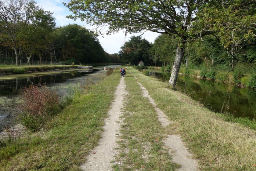
At Cepoy, I now already entered the third region on this trip, Centre – Val-de-Loire, I reach the Canal de Loing which, after the junction with the Canal de Briare, becomes the Canal d’ Orleans. It connects the Seine with the Loire river, has 28 locks to cover the elevation changes, and was a real joy to cycle along. Sometimes on asphalted tracks, but more on good, sandy single track. Splendid !


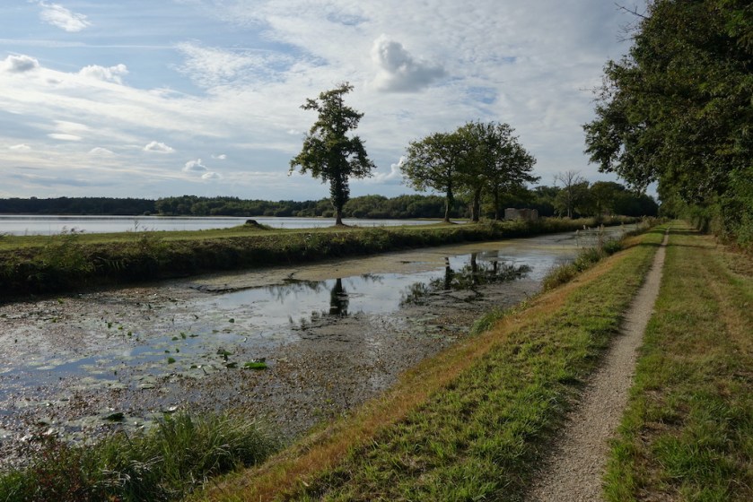

I left the canal to ride through, and camp in, the Forêt domaniale d’Orlénas (the forrest of Orléans). Lot’s of mosquitos and wild boar, but also peace and quiet at night (well, except for the wild boar I had to chase away twice).
Next up is the Loire river, but more about that in a later post…

Nice Koen. Herkenbaar ook, iets grotere dorpen en de onzin die begint. Je eigen regels vormen en toch dat bos in gaan, prima. Je vraagt je af of de natuur een gesloten instelling is of zo?! Je hebt mooie paden gekozen. Het maakt wel degelijk uit dat je zoveel werk steekt in voorbereidingen. Ik doe dat nooit… maar jij hebt echt prachtige paden bereden.
LikeLiked by 1 person
Yep, ik vind het ook gewoon als voorbereiding die allerkleinste wegen en paden te zoeken en later op het terrein vast te stellen “oh ja, dat was dit weggetje, etc”.
Buiten enkele verbodsborden die ik diende te negeren nergens een onaangename verrassing gehad.
LikeLiked by 1 person
Dat is leuk ja, de weg op de map in het echt te zien.
Had je nooit hekken die dicht waren of wegen die plots ophouden?
Misschien meer iets voor Hongarije?
LikeLike