Spain: Criss-crossing the Cordillera Cantábrica, Prt 2

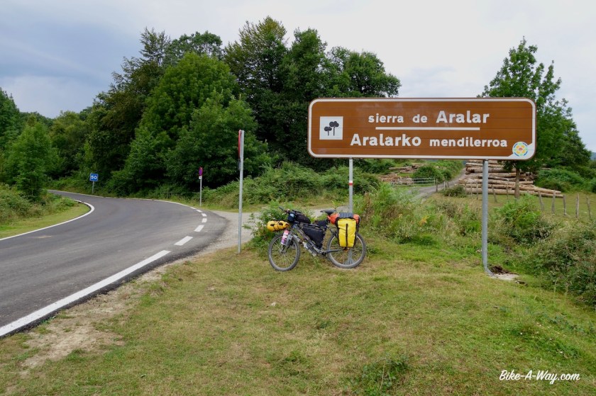
Route: Boñar – Pto. Vegarada – La Pola – Pto. de la Cubilla – Saliencia – Villablino – Vega de Espinareda – Ponferrada
Route Cordillera Cantabrica 2
Second part of my route through the Cordillera Cantabrica.

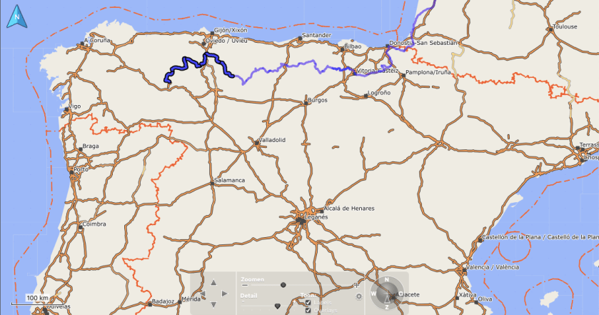
With food in my bags for three days, I now had to decide what route to take. The weather was still fine today, but the forecast for the next five / six days was pretty terrible. I pondered it over for a while on a bench near the town square in Bonar. The initial route would lead my all the way over the Cordillera Cantabrica, back to its northern slopes, than down, before remounting, to the southern side, quite a lot via unpaved tracks.

Or I could follow tiny roads LE-321, LE-3621 & LE-3505, going right through the mountains, but staying on the south side.

The latter option, I rode already in 2005.

After forty five minutes of thinking, I decided on the second option. There was more rain predicted on the northern side, colder temperatures, and all that on dirt and gravel tracks…. that’s good in the sun, but it could be miserable in the wrong conditions.

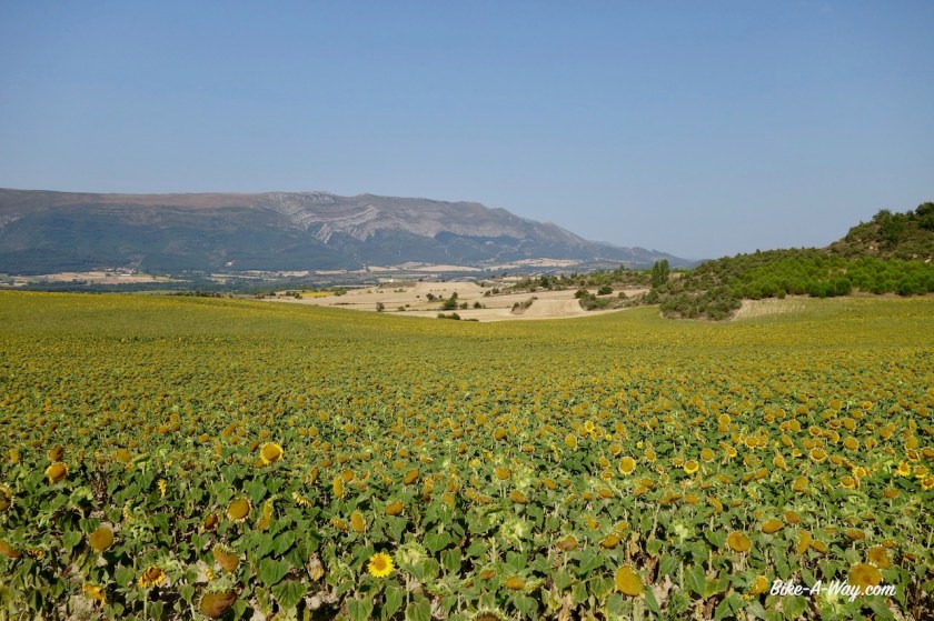
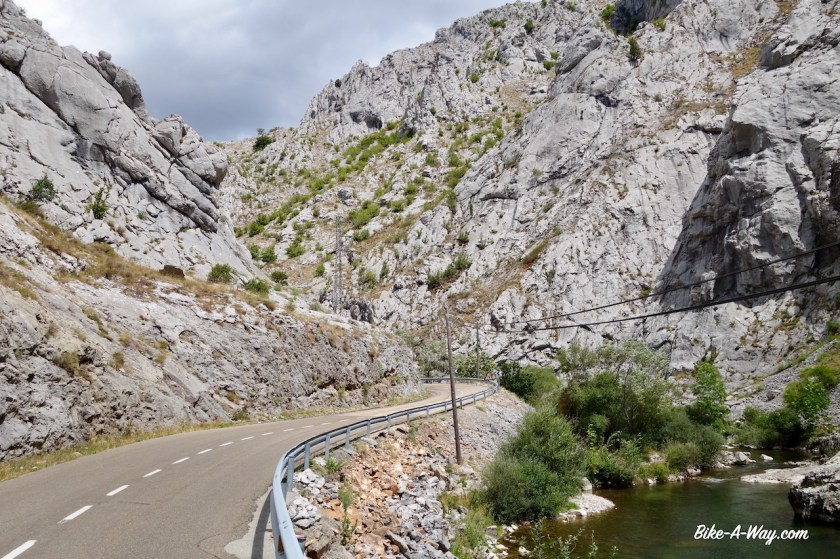
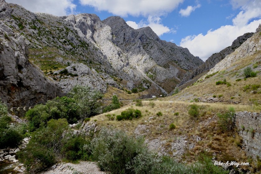
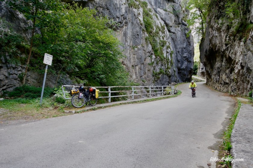
Having ridden this route already, I remembered it was “nice”, but I didn’t recall it specifically. And what a good choice I made. The ride through the canyon of the River Curueno is simply super, super impressive. Incredible how this tiny river has cut out such a deep canyon in the barren mountains.

DSC01764

DSC01774

DSC01781

DSC01788

DSC01790

At the left turn towards Valdeteja, I leave the Rio Curueno. The road starts climbing a little more. I was thinking “where does this road lead to, if I were to go straight ?”.

Of course ! It would lead me Valdelugueros, and then I would be back on the route I planned, going north. This means I made good progress already.

“Should I do it ?”

I kept riding the other direction, the paved option, thinking if I kept doubting long enough, the moment to turn around would have passed.

It’s a nice enough road I’m on. Wait, I just ride a little further up, to that bend in the road, and then I decide. Let’s take a picture… I seemed to have turned the bike around already, and back down I went towards the Rio Curueno and.. going north…

The road climbs only very slowly and once you’re in Tolibia de Abajo, you’re out of the canyon. (If people would ever ride that paved option, the most spectacular part is before the junction towards Valdeteja, so you’ve seen the best).

DSC01797

DSC01799

DSC01801

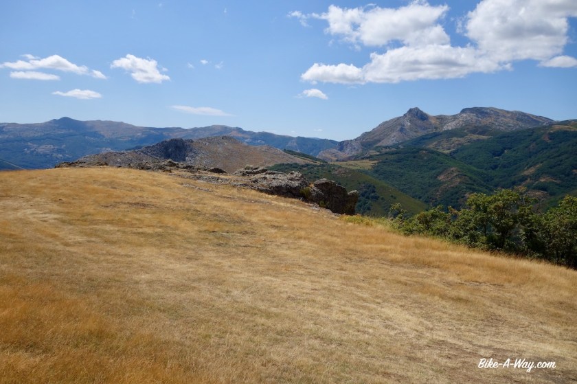
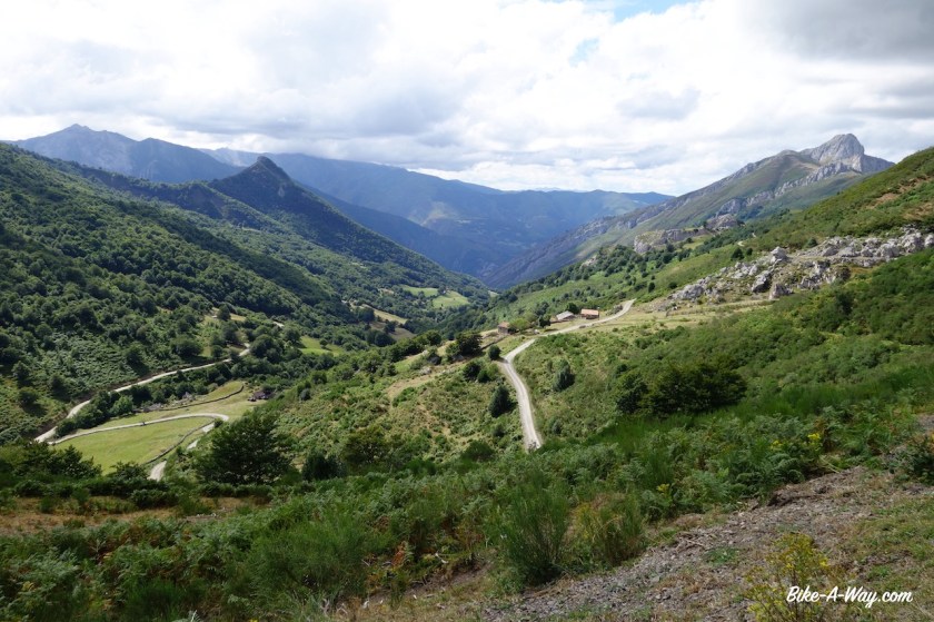
After Valdelugueros the road starts to climb a little more, but still nothing terrible. Left and right of me, all mountain tops above two thousand meter; Pico de Fuentes, Pico del Oso, Pico Nogales, ….

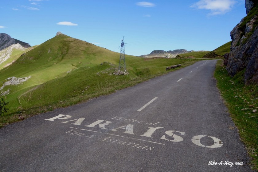
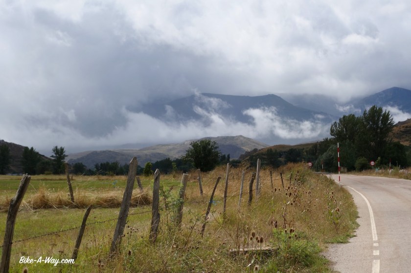
The top lays at 1.563 meter, the ‘Puerto Vegarada’. As so often, the top is also a border, this time between Castilla y Leon and Asturias.

DSC01802

DSC01808

DSC01810

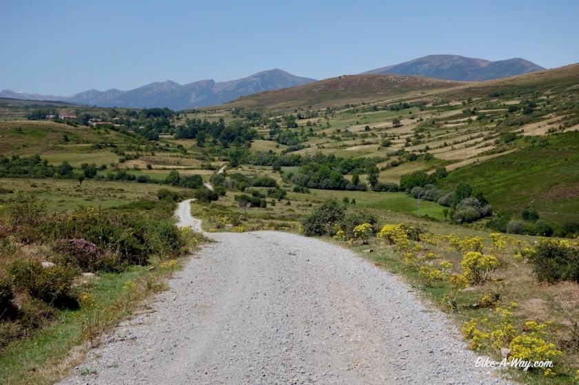
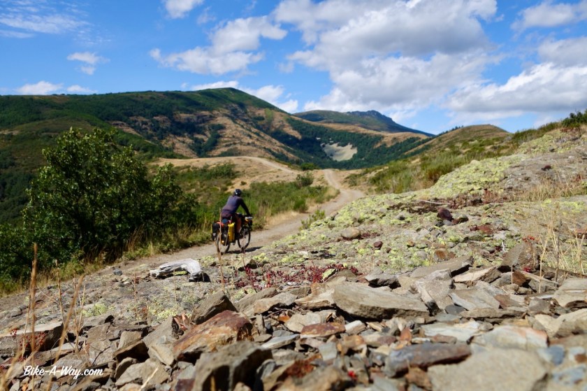
In front of me lays a nice gravel track and the good news is, I will go down from 1563 meter to 200 meter in one go.

The bad news is, I then have to climb back up to almost 1.700 meter, also in one go.

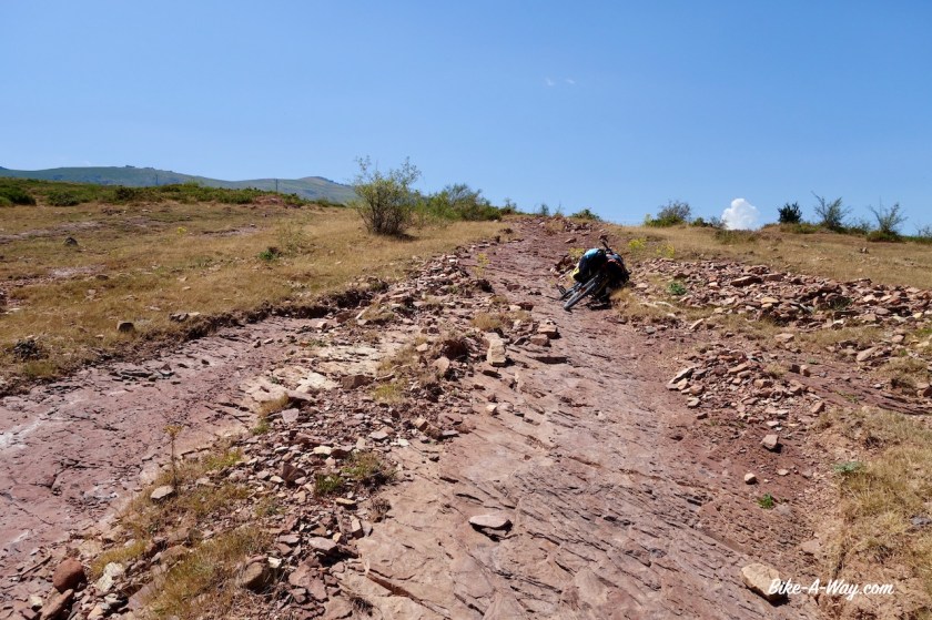
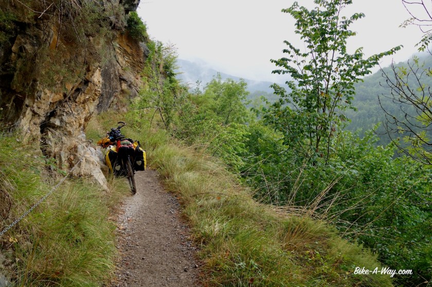
The downhill, smooth at first, soon goos steep, steep into the valley. 12%, 14%, 16%…. 20%. With three days worth of food and 5,5 liter of water (ready to camp if I see a spot), it surely is stretching the limits of my v-brakes on these track full of loose gravel.

I find a spot next to the Rio Aller in its early stages.

DSC01819

DSC01825

DSC01828

DSC01839
This guy refused to move even one millimeter, so I walked slowly by him.

The downhill remains steep until I hit the asphalt.

I surely hope that climb back over the Cordillera will be easier.

The Rio Aller soon becomes wider. It starts raining, and looking up at the sky, it won’t stop anytime soon. Time for a hotel for two nights and give the legs some rest.

DSC01857

DSC01859

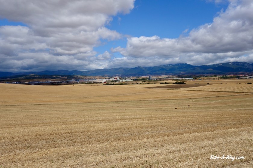
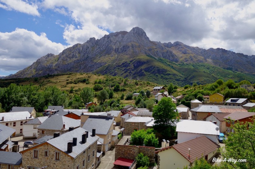
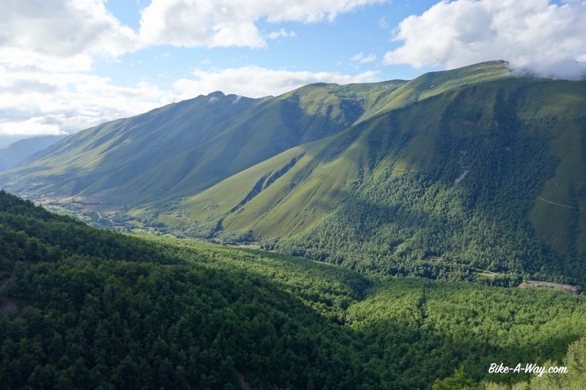
I now have left the valley of the Rio Aller, and riding upstream in the valley of the Rio Lena. A busy valley with a major highway, a provincial road, a railways and villages and towns all squeezed into that narrow space. Still, I found good options to go almost car free through it.

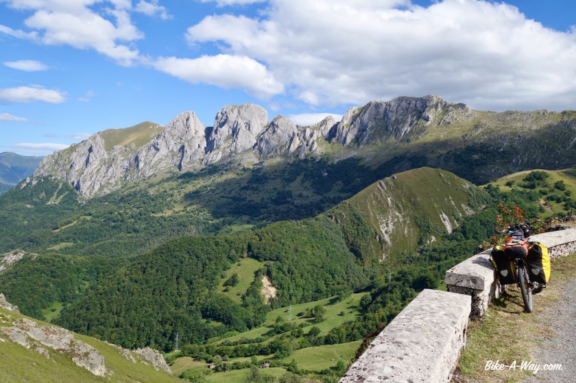
I am ready for the ‘grand finale’, back over the Cordillera Cantabrica, north to south, with some serious climbs ahead of me.

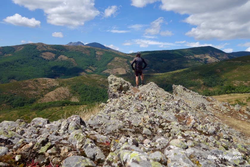
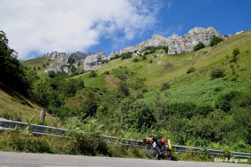
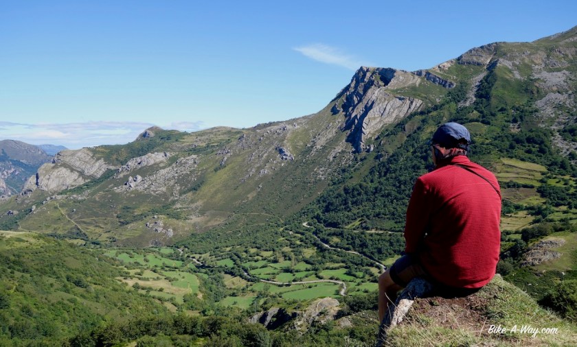
I start with a mountain, nicknamed ‘The Gallibier off Asturias’; Puerto de La Cubilla to Alto ‘L Palo (1.690 m) / The Vuelta a Espagne passed here in 2019 (stage 16). Jacob Fuglsang won the stage, and also two Belgians were in the top 10, Thomas De Gendt and Philippe Gilbert. Tadej Pogacar did the 17 km long climb at the fastest average speed, 25,3 km/hr ! You can see a resume of that stage here.

Today, my time was a little bit slower as Pogacar’s last year, but there was nobody in front of me when I came to the top !

DSC01869
‘Il Pistolero’ must have ridden here as well.
DSC01870
And the new generation.

DSC01873

As if the climb wasn’t long enough, I was fighting a very fierce headwind.But what a beautiful climb it is, and the gradients are much, much more doable as that downhill I had a couple of days ago.

The region Asturias is famous for producing milk. In all Spanish supermarkets you’ll find the Asturias milk. And I think all the cows producing it, are on this mountain. So, not good for camping, but I haven’t seen a flat piece of land anywhere anyway.

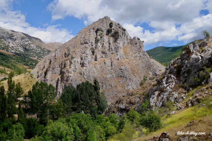
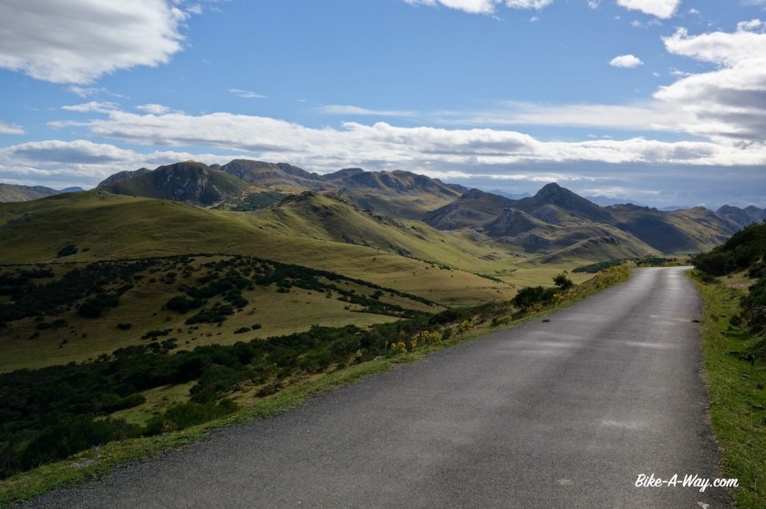
Working my way up, I keep some beautiful tops in view, Siega L’Aba (2.131 m), La Mesa (1915 m), Penon de Vachalampo (1800 m), Quentu Las Planas (1856 m), La Tesa (1900 m).

DSC01884

DSC01888

DSC01894

DSC01897

DSC01899

DSC01905

DSC01912

DSC01915

DSC01922

DSC01923

DSC01927

DSC01931

DSC01932

DSC01935

At the top, I’m leaving the Asturias region and enter Castilla y Leon again.

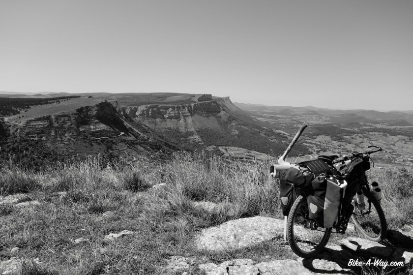
The wind at the top was very violent and almost knocked one over.

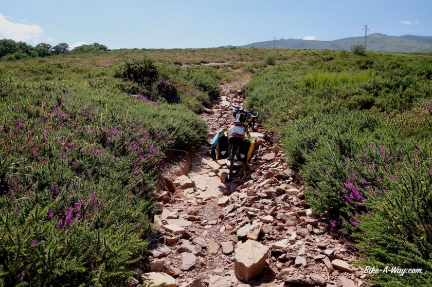
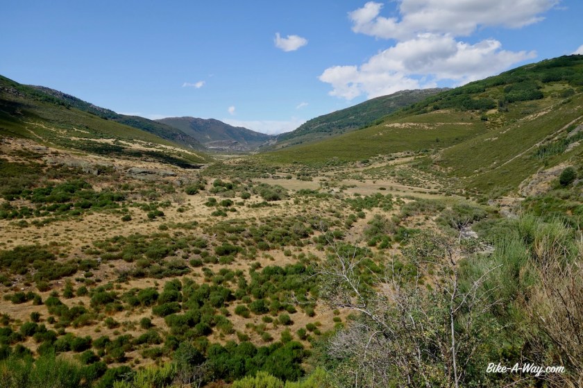
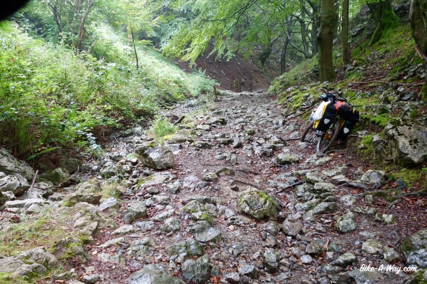
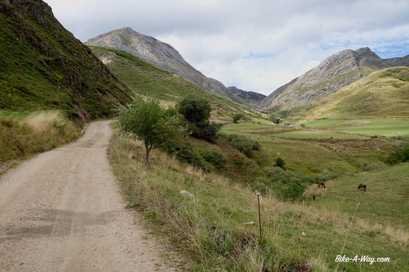
After Casa Miers (closed), I’m back on dirt for the downhill through the ‘Barranco de la Alcantarilla’ to the village San Emiliano.

DSC01941

DSC01944

DSC01946
This is where big rivers start.

DSC01951

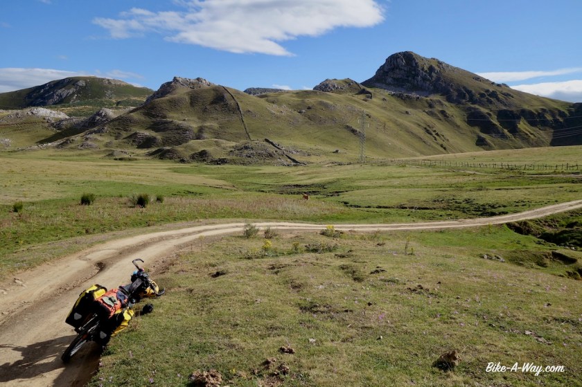
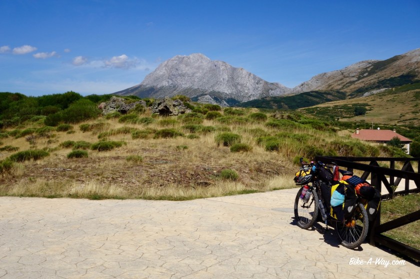
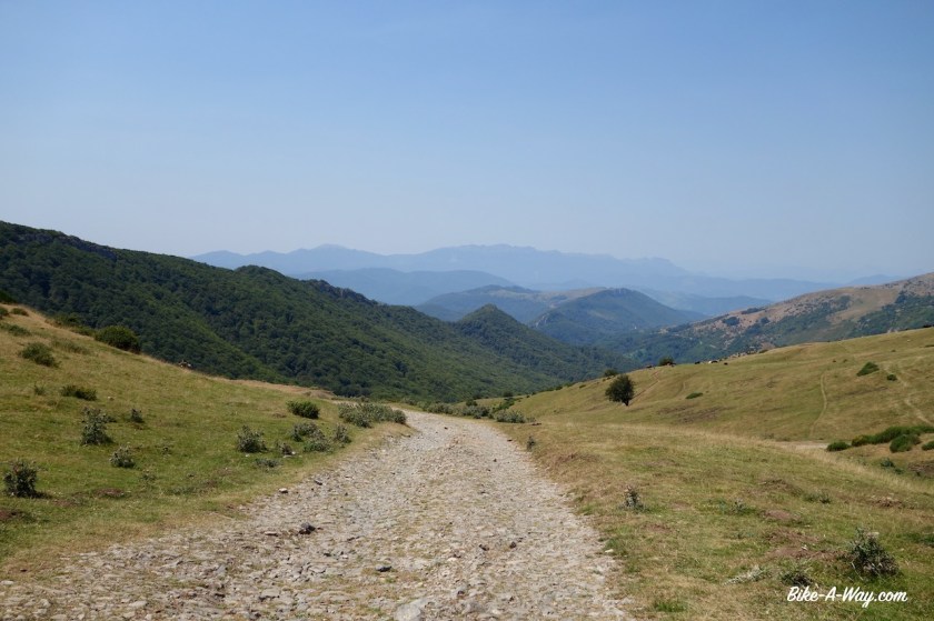
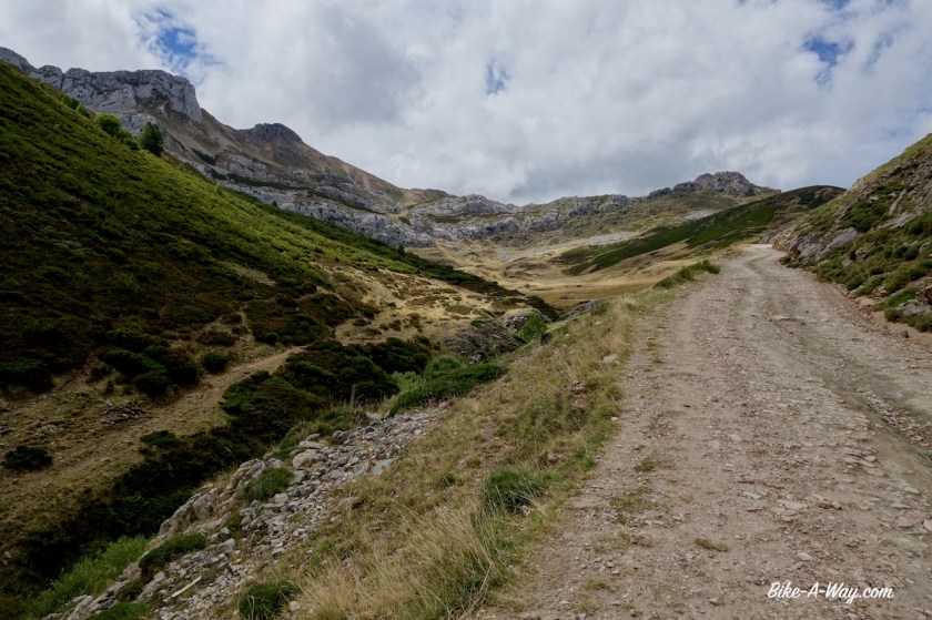
After this village, I have a smooth climb over a paved road. If I would keep following this road, I’d go to the Puerta Ventana, but I take the small side road towards Torrestio. After the village the road becomes a stony track, always steeper and steeper, until I’m up the Alto de Farrapona (1708 m).

DSC01967
Clouds are rolling in, but again, by climbing over another pass, I stayed clear of the clouds.

DSC01970

DSC01972

DSC01979

DSC01980

DSC01987
There were a few hikers in front of the track who tried to feed this donkey, but the donkey just went away from them all the time. I refilled my bottles at a small stream, while the donkey kept an eye on me. When I was ready, he/she came to me, not shy at all. I stayed with the animal for a while, but every time I mounted my bike and wanted to resume cycling, he bit in my panniers to prevent me from going. Maybe he/she saw similarities between us and thought I was a pack animal as well with that heavy bike ?

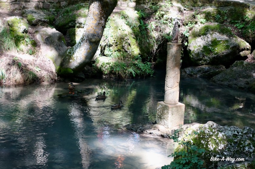
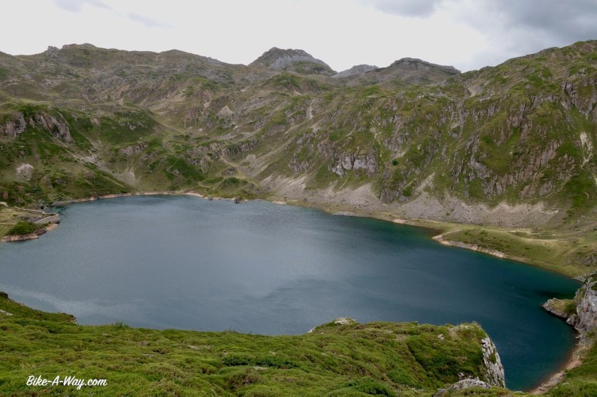
From the pass, a little, stony track goes left towards the ‘Lagos Saliencia’. I ride my bike towards the first lake, ‘Lago Cueva’. I intended to visit the first lake only, but it’s so beautiful that I lock my bike and start hiking up to Lago Cerveriz and on to Lagos Calabazosa o Negro. The dark lakes with the sharp mountain peaks all around it are spectacular and worth the effort. I see a small track I can follow to make the loop complete around the back of Lagos La Cueva.

DSC01998
Looking down into the valley of the Rio Saliencia.
DSC02008
Lago Cueva
DSC02023
Lago Cerveriz
DSC02031
Lagos Calabazosa o Negro
DSC02049
Another view to Lago Cueva, from the other side this time. The bicycle is somewhere on the right of the picture. I had to hike over the ridge to the left to visit the two other lakes, then looped around back to Lago Cueva here.

DSC02054

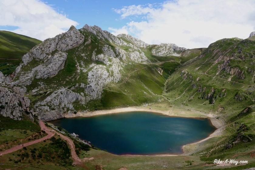
Camping is not allowed here so I ride down, into the nature park Somiedo, where camping isn’t allowed either.

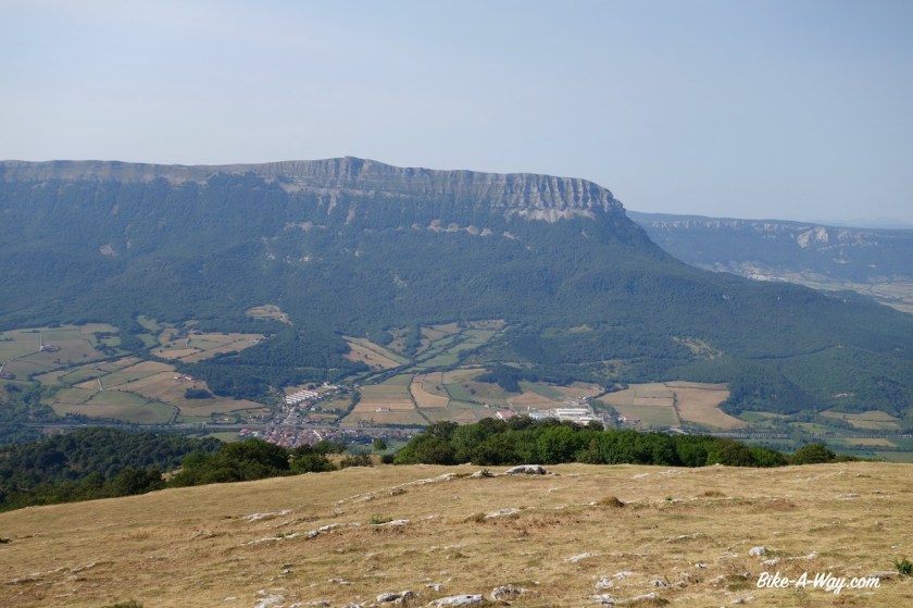
The park is famous for having a large population of wolves and free roaming bears and is said to be one of Spain’s roughest natural areas. The highest peak is Pico del Cornón (2194 m)

I went to the camp site in La Pola. It’s behind the hotel and belongs to them. Before going to the reception, I went to take a look. Instant unhappiness. I don’t want to be here. It’s horror. People, cars, caravans, campervans,… all packed on top of each other on the small field. Even if they pay me, I don’t want to be here.

I rolled back down towards a field I saw just before the confluence of the Rio Somiedo and Rio Saliencia. The tent is pitched next to the river. A lot of grass in the field. If I’m lucky, I might see a bear this evening or tomorrow morning.

But alles, no such luck. Cold it was. Terribly cold, although it’s one of the lowest places I slept recently. Must be ‘inversion’, I remember from school, when it’s warmer high up as down in the valley.

DSC02055
On the downhill from Alto de Farrapona.

DSC02061

DSC02066
In the field, much, much better than the loud, busy, expensive campground.

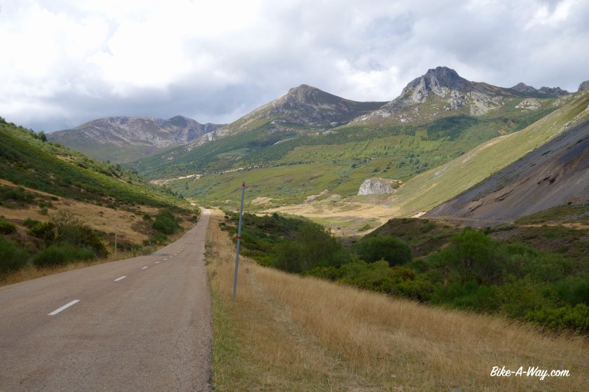
After Pola la Somiedo I have another three mountain passes in front of me. Before the first pass, I first take a side road to the viewpoint ‘Mirador Principe de Asturias’ It’s on a little steep climb into La Peral village, but do make the effort if you come here. It really is worth the view !

DSC02068
On the climb towards Puerto de Somiedo

DSC02072

DSC02087
View from Mirador Principe de Asturias.
DSC02090
View from the office.
DSC02100
La Peral village.
DSC02104
Sometimes you have to watch for cyclists, sometimes for deer, here.. for bears.

DSC02105

Than, over Puerto de Somiedo (1.485 m). Here I leave Asturias and enter Castilla y Leon again. The downhill is super smooth, low percentages.

DSC02118

I eventually end up again at the busy road CL-626.

Never, ever think it’s a good idea to have a bicycle holiday and follow this road along the Cordillera Cantabrica. It carries way too much traffic.

I think I could have left the busy road already in Villaseca de Laciana and go on the via verde, but I only saw its existence just before Villablino.

Also west of Vilablino is a via verde over an old railway line to the village Caboalles de Arriba. This used to be a mining area, that’s why they had the railway.

Back over the next pass, Puerto de Cerredo (1.359 m) via which I enter Asturias again.

Downhill to the ugly mining town Zarréu where I turn left on a so-called private mining road (built by or for them). it is a very wide road and doesn’t even have an official road number, but the people down in Zarréu assured me I could take it.

Climbing again. On the top, Puerto Valdeprado (+/- 1.350 m), I again enter Castilla y Leon.

DSC02125

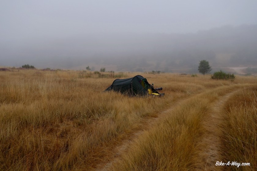
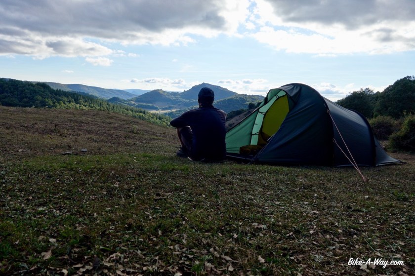
It’s hard to find a place to camp, which is annoying when you’ve climbed three passes and daylight is fading, but eventually I’m lucky to find a splendid place.

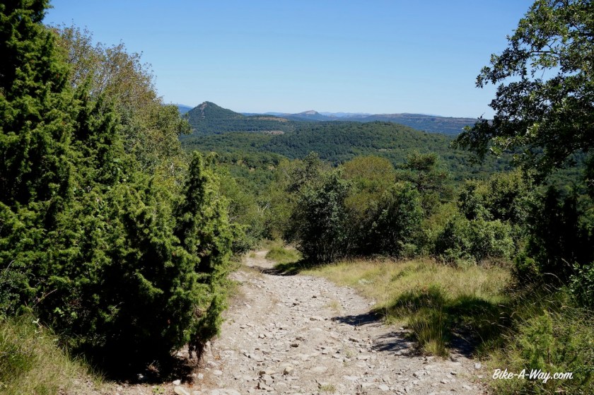
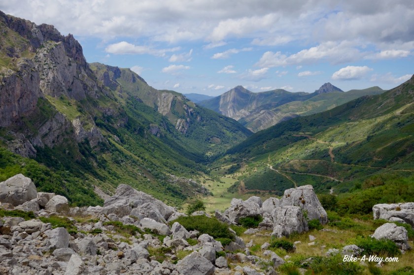
Resuming the decent next morning, also on this side of the mountain, there are regularly signs that it’s a private mining road, but I see a few other cars and nobody is bothering me cycling here. The power plant I pass a little later seems permanently closed, so I really think it’s ok to use this road. Slowly I’m leaving the Cordillera Cantabrica behind, riding down along the Rio Cua. Some steep parts back up again too, but mostly down for me. I’m in a bit of a hurry. It’s Sunday and I need a bakery before siesta time. I find it eventually in Fabero.

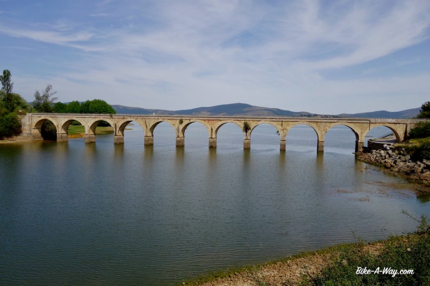
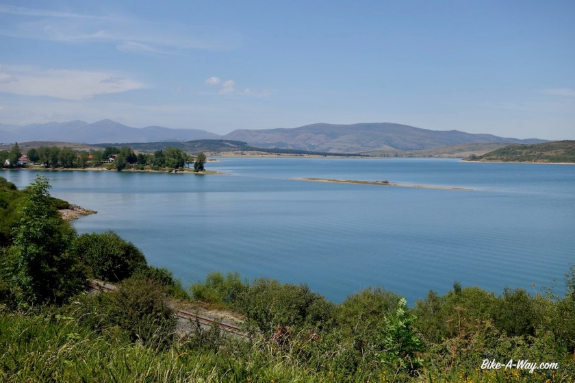
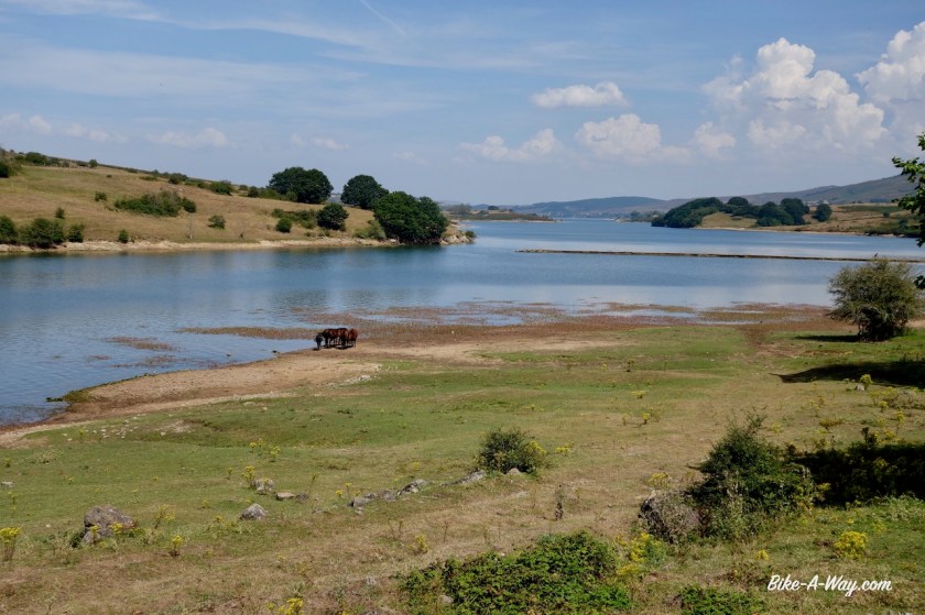
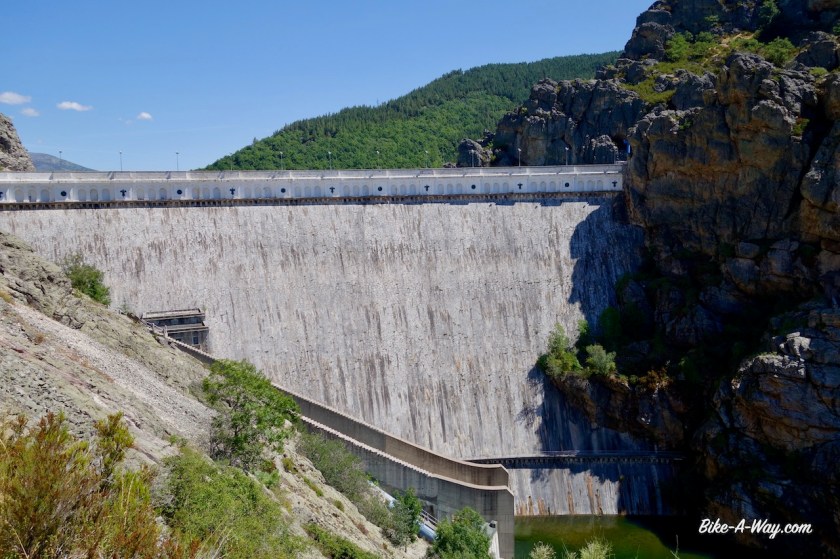
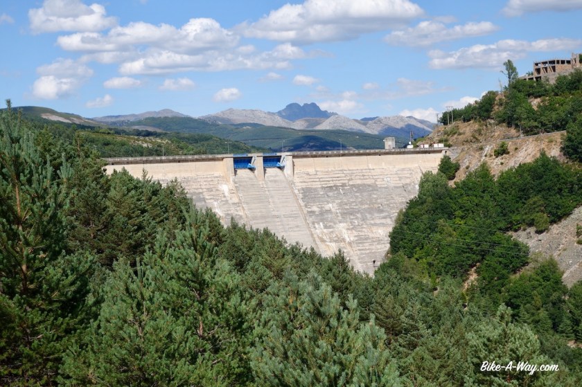
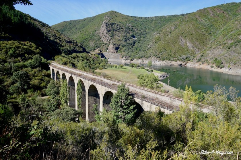
In the next town, Vega de Espinareda, I could go straight south towards Ponferrada, but that would be a major road, so I searched for a better alternative. I go east towards Berlanga Del Bierzo on a quieter road, on to Tombrio de Arriba and to Torina, where after a short stretch and the wider (but not busy) LE-463, I exit the road to take a small, unused road of which all the asphalt is crumbling, along the Embalse de Barcena, the big reservoir in the Rio Sil. Nobody else here and I have brilliant views to the lake and to the old railway line with its bridges and tunnels.

DSC02136

DSC02138

DSC02140
Embalse de Barcena, just outside Ponferrada.

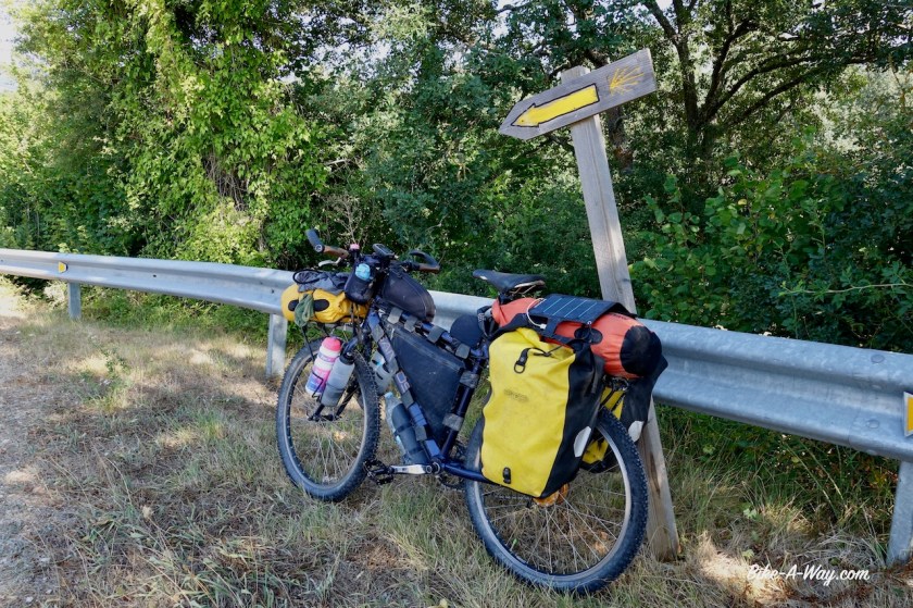
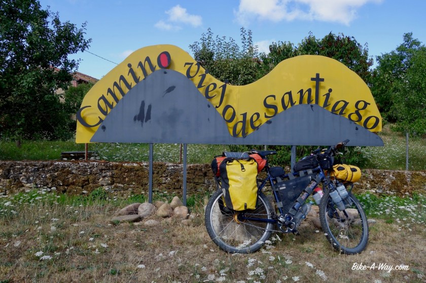
Just as I’m leaving the borders of the lake, I see yellow signs again, and it appears I’m back on the lesser used Santiago route ‘Camino Olvidado’ (remember, near the town of Bonar, I was already sharing this route for a while).

On my way into Ponferrada I pass a big windmill factory. They were just loading the wings on trucks. Unreal how large they are. From the ground, you could never see the edges of the wings are like a saw.

Next report, I’ll be leaving Ponferrada behind and head towards Portugal.

Spain: Criss-crossing the Cordillera Cantábrica, Prt 1

Route: San Martin de Losa – Hierro – Medina de Pomar – Espinosa de los Monteros – Reinosa – Cervera de Pisuerga – Guardo – Boñar

It was sweltering hot the day I left my campsite next to the potato field. Via San Martin de Losa I rode, all via super quiet country roads and tracks, to Quincoces de Yuso. There’s a bakery and a small fruteria where you can buy all the necessary, provided you are willing to wait long, very long. Service is super slow and, untypical, and in both shops, very unfriendly.

Next up was the ‘Ermita de San Pantaleon de Losa’, a small church built on a high rock. I left my bike at a house with some friendly locals and hiked to the top. The Ermita itself was closed, but the views definitely worth the climb.

Route Cordillera Cantabrica 1
First part of my route through the Cordillera Cantabrica.
DSC01419
The ermita is on top of this hill.
DSC01422
Ermita de San Pantaleon de Losa

DSC01427

DSC01424
View from the Ermita

Following provincial road BU-550 along the Rio Jerea, I come at a fork. Right will bring me directly to Medina de Pomar, but I drew my route to the left, via the small settlement of Hierro. Nothing to see there, only the fact that I think it is a nice stretch, with a climb over a completely deserted, small, worn asphalt road. Which option to chose ?

It is so hot, and the direct road to the right would be easier. The junction is a good point with river access if you’d like a swim in the river and think it over, but some local youth was already in there.

I went left, the harder, but probably much nicer option. Good choice. The scenery, with high rocks coming out of nowhere is really beautiful.

Just before the start of the climb, I take a left turn and ride in the hamlet of Quintana-Entrepenas. I need shelter from the heat and sun and it is provided here with a fountain with drinking water, and a deserted building giving shade. The faintest of internet signals even allows me to catch up on some news on the phone. Close to 7 pm, when the temperatures dropped a bit, I start the climb. It’s nothing huge, going from 590 meter to something like 850 meter, but there are steep parts of +10%.

DSC01434

I find a good camping spot just under the collection of houses which is ‘Hierro’. Shade, now in the evening and also in the morning, and a small breeze. Just too many flies and I have to wait till after the sunset before I can prepare diner (flies go to sleep).

Next morning, riding through Hierro, I see that probably only one of the ramshackle houses is still inhabited. The church has partly collapsed. The road turns to gravel. Again, I have splendid vistas to the surrounding valley and mountains. The top of the ‘pass’ is about hundred meters above Hierro. A splendid downhill on good gravel follows. Still vultures everywhere I look up in the sky. Also a young deer on the track. And a fox.

DSC01438

From Villavedeo I found a gravel track all the way to Medina de Pomar. Excellent, excellent riding.

DSC01447

DSC01453

Medina de Pomar is an ancient town, with some interesting historical buildings, an ‘alcazar, old church, etc…. good for a couple of hours. The guy who founded Ascuncion in Paraguy is from this town (but born in Espinosa de los Monteros). He was only a couple of years older then I am now, when he died. Damn, I’ve got a lot of work ahead of me if I still want to found a capital within a few years….

What have I done, after all, in my life ?

DSC01458
Alcazar de los Velasco at Medina de Pomar
DSC01460
Medina de Pomar
DSC01462
Medina de Pomar
DSC01466
Gate to the old town, Medina de Pomar
DSC01467
Statue of Juan de Salazar y Espinosa, founder of Asunción, capital of Paraguay

I leave the small town in the afternoon. It’s burning hot. Luckily, villages are at short distances from each other and I always find a bench somewhere in the shade. Often a water fountain to refresh myself as well.

But the inevitable happens after a couple of days off sweltering heat; a thunderstorm. I dive into a side track and find a good place in a field to pitch the tent. Temperatures drop immediately with ten degrees and I have a much better sleep as the night before.

DSC01478
Still seeing the yellow Camino de Santiago arrows from time to time.

DSC01480

Up to Espinosa de Los Monteros, a friendly little town. I lose an hour by queueing for the little supermarket and for the panaderia. Now I have a few kilometer on the provincial road BU—526 in front of me, but it’s mostly downhill.

Espinosa de Los Monteros

I arrived around 2pm in Cueva, the village just before ‘Ermita de San Bernabé’. It’s a famous thing, a church and some stuff in caves, but it is closed for siesta between 2 & 5 pm. I decide not to wait for it and resume cycling along small backroads until I rejoin the BU-526 in Entrambosrios to climb over the saddle. I’m now cruising down next to a spectacular rock face. It seems the top is just above me but little do I know the Sierra de Dulla is much higher than what I see now.

When I look back on my way out of Perosa de Valdeporres I can really appreciate how spectacular Mt. Dulla really is. It will remain in view for quite a while.

DSC01497
Sierra de Dulla (1.143 m asl)

DSC01518

The little tertiary road works it’s way up to Ahedo de las Pueblas. A very beautiful village. Must be a nice thing to live in these surroundings. I’m riding at the top of a hill. A barren place with a lot of semi-wild horses. It would be brilliant to camp here, but a very fierce wind starts to blow and I see dark grey clouds rolling in from the north.

Suddenly, I am already descending, the huge Embalse (reservoir) Del Ebro is in front of me a few hundred meters below. I find a very good spot to camp behind some trees, well sheltered for the violent winds. A big thunderstorm is rolling over.

DSC01520

I ride south along the Embalse Del Ebro. After the village Arija I leave Castilla y Leon region and ride into Cantabria.

It’s a Sunday, and quite a bit of Spaniards have found there way to the lake for a refreshing swim. I keep my eyes open for a small, private beach. Once I think I found it and descend with my bike to the little tiny beach. Nobody here.

Ooh…. one guy is sitting there. Cross-legged. Talking to himself. Totally naked.

I go.

I find another spot allright later on to enjoy a swim in the lake.

DSC01527
Railway bridge over one of the arms of the Embalse Del Ebro.

DSC01537

DSC01540
Embalse Del Ebro
DSC01543
Embalse Del Ebro
DSC01544
This time, a road bridge over the Embalse Del Ebro
DSC01551
Embalse Del Ebro
DSC01562
Mornings start to be misty from time to time, and chilly.
DSC01565
Small roads into Reinosa.

Reinosa, a bigger place at the western side of the lake is nothing special, but it has a big Mercadona supermarket on the outskirts and a Repsol gasstation where I can refill my fuel bottle for cooking. I use about one liter of fuel per month.

DSC01568

DSC01572

About six kilometer west of Reinosa is the spring of the Ebro, the second longest river in Spain. The river Tajo is about 100 km longer but the Ebro is the longest running its entire course in mainland Spain (The Tajo goes on to Portugal). Instead of running its waters north for about 50 kilometer to the Atlantic Ocean, the Ebro choses another path, downhill, all the way to the Mediterranean, more than 900 kilometer away. The spring is at about 900 meters asl, so on average it’s losing one meter per kilometer. Although it will be much less in the last half of its trajectory I’m sure.

There is a hiking trail all along the river and I follow the first six kilometer upstream on the bike, from the city to the spring.

DSC01573

DSC01574

DSC01579
The spring of Spains 2nd longest river, the Rio Ebro.
DSC01578
This duck is swimming in the earliest, cristal clear water of the Ebro.

After Reinosa, I had two options in mind to continue my trip. The northern option through the ‘Picos de Europa’ or a southern one via the Montana Palentina. The first option for sure would be the more spectacular, and also much harder.

Possibly too hard with too much bike pushing over rocky hiking trails.

Consulting the weather forecast, the decision was made easily. Rain for the next eight days if I were to go north, only for two days if I go south.

South it will be.

DSC01585

I make a small mistake pushing my bike up a dry, rocky, steep stream bed. I should have just followed the nice gravel track to Poblacion de Suso, and join the main road CA-280 there. Now I pushed my bike for 45 minutes over rocks, through thorny bushes. My legs are bleeding at a dozen places. If I don’t forget it, I’ll clean up my gps-track so if anybody downloads it, you go the better way.

DSC01587
This is the good way to go, towards Poblacion de Suso. I accidentally went this way, than turned back, because I had the illusion the shorter way would be better….
DSC01588
Better ?
DSC01589
Defintely not better !

Very beautiful mountain scenery again. I see dark clouds rolling in again from the north over Reinosa, but if I hurry up, over an unnamed pas, 1.352 meter asl, I’m pretty sure these clouds will get stuck behind the mountain.

The mountain range that forms the border between Cantabria and Palencia province (back in Castilla y Leon) is 1900 meter high. On the downhill I reach my highest speed so far on this trip, 74,86 km/hr, the cyclometer says. That was with laundry flapping from my front and rear rack. It’s been years since I managed to go over 80 km/hr. Maybe later.

DSC01591
You can see the clouds rolling in over the hills already. They never managed to get over the pass from where the picture was taken.

DSC01592

DSC01600
The town of Brañosera which I passed on the descent is considered to have the first town hall in Spain, granted in 824.

Today I also see the first storks of this trip.

After Barruelo de Santullan, I take the small PP-2125 road through the Montana Palentina. A signs tells me this is one of the few places in Europe where bears are still roaming around. Maybe I’m lucky to see one late evening or early morning when I’m camping ?

DSC01611

DSC01616

DSC01619

After San Cebrian de Muda, I’m back on gravel. Or stones sometimes, but always well rideable. Very enjoyable route, with plenty of camping options. As those two days of bad weather are coming up, I ride into Cervera de Pisuerga, a little town I visited already in 2005, to buy provisions, then ride back into the hills to the same place above Rabanal de los Caballeros where I camped the night before, to sit out the rainy weather, read, rest and eat.

DSC01620
@ Cervera de Pisuerga
DSC01621
inside the church in Cervera de Pisuerga. Nowadays, almost all churches in Spain are locked. The few that are open often ask entrance fees…

In the afternoon an older gent suddenly arrives in the field near my camp. He was very friendly and came to repair the beehives a bit. He tried to warn me for something, but I couldn’t understand the words. He mimicked an animal, with wings it seems, and a horn.

I didn’t get it. A flying dinasour ?

The devil himself maybe ??

Next morning, when I was back on the track down to Cervera de Pisuerga… i realized it, when I saw the bear poo. That’s what he was trying to warn me for haha.

The road out of town is a bit too busy for my liking but soon I can turn on a smaller road towards Resoba.From this village, a stony track climbs into the mountains of Parque Natural de Fuentes Carrionas Y Fuente Cobre – Montaña Palentina. Often steep, sometimes a bit gentler.

DSC01635

DSC01636

DSC01641
Steep down- and uphills.

DSC01645

DSC01649

DSC01652

DSC01655

DSC01659
The ‘Valle de Pineda’

A steep downhill to the valley of the Rio Carrion follows and I find a very nice spot to pitch the tent next to it. From here, I follow the ‘Ruta Valle de Pineda’ towards Vidrieros. A shame they allow 4WD’s to use the track. There are a lot of hikers and mtb-ers. If I were to drive a 4WD, I would very uncomfortable riding my big, loud machine among these people. Why not go out yourself ??

In Vidrieros, I see on a sign it was actually forbidden to camp where I did (natural park). Sorry, but there were no signs the route I entered the park. I am riding next to one of the region’s highest peaks, ‘Curavacas’ (2.526 m)., which means ‘heal the cow’ (or ‘cow healer’ ??).

DSC01671

DSC01674
Riding ‘Valle de Pineda’

DSC01675

DSC01677

DSC01678

DSC01692
Pico ‘Curavacas’ , the cow healer at 2.526 m the highest mountain of Palencia province.

At Triollo, I arrive at the big Embalse de Camporredondo. I cycled along this reservoir in 2005, but that is such a long time ago, I remember nothing. And I’m riding in the other direction anyhow now. This road is super, super spectacular. I follow a little side road for a while, to have views towards another giant of the region, Peña Prieta (2.539 m). But, the most spectacular of all, I have all the time in sight. It’s Peña Espigüete (2.451 m).

DSC01699
What a nice spot for a final resting place, isn’t it ? Eternally looking at the Embalse de Camporredondo.

DSC01700

DSC01701
To the right, you can see the road that’s going along the lake.
DSC01704
Peña Espigüete
DSC01714
Peña Espigüete

DSC01715

DSC01719

DSC01725
The Camporredono dam in the Rio Carrion.
DSC01729
Embalse de Compuerto
DSC01730
Compuerto dam.

After Camporredondo, they’ve built another dam for another reservoir in the Rio Carrion, called Embalse de Compuerto.

From here, I roll into the towns, Velilla del Rio Carrion and Guardo. both have the air of old easter European towns where the time have stood still. Nothing charming here.

I was heading from Guardo to Cistierna. Busy road CL-626 runs between this two places, so I decided to take a quieter option, going further south, more or less out of the mountains towards Calavares de Arriba and even a little detour further south to the town of Almanza, to visit the local bakery. Almanza claims to be on one of the Camino de Santiago routes, but the track I have from the Camino Olvidado runs further north. More small roads bring me into Cistierna. Here I am definitely sharing the track with the Santiago route again. A very pleasant road through Yugueros, and towards Barillos de las Arrimadas and eventually to Bonar a little town with again supermarket, etc..

DSC01735
Pitching the tent again in sunny, warm weather.
DSC01737
But waking up to cloudy mornings.
DSC01738
In the town of Almanza.

DSC01748

DSC01753
The Iglesia parroquial Sta. Marina in Barillos de las Arrimadas, 12th century. It was possibly serving as the headquarters of the Military Orders of Santiago and Templars.
DSC01751
But it was locked…

DSC01752

DSC01755

DSC01757
Approaching Boñar.

Part 2 of my meanderings through the Cordillere Cantabrica to follow soon.

Spain: Navarra & Basque Country / Euskadi

Route: Etxalar – San Sebastian – Lekunberri – Vitoria-Gasteiz – Berberana

Waking up in spain the next morning, me, and the hill tops around me are bathing in a sea of clouds. What a sight. It is if I were a couple of thousand meter above sea level, while I’m standing at barely 400 meters asl. I take it very easy in the morning. The last days have been hectic enough, and I intend to take a hotel for one are two nights in Lesaka.

Route Basque Country
The Route I rode in this blog post.
DSC01061
It’s good to be back in Spain, back in the country with the worlds best car drivers. Nowhere else on my travels I found the big majority of the drivers giving you so much space when they pass you, or just waiting patiently behind you when they can’t pass you safely. Often, I’m not even realizing a car is behind me because, contrary to other countries, they don’t speed into you, almost under your rear rack, braking at the last moment, revving the engine…. no, they come slowly, unnoticed. Spain is also one of the few places in Europe where you can spend winter comfortably AND it’s a country with an immense diversity of landscapes.  Downsides… yes, there are a few…. Spaniards are loud.  There are way too many dogs.  You seldom will have a night in your tent without hearing dogs barking, especially in the southern half of the country (but they are almost always behind a fence or on a chain, so not attacking you).  And Spanish kitchen is overrated. You can eat very good here, but the typical ‘menu del dia’ some people are so enthusiastic about is 99% of the times a disappointment. Meat, potatoes, no veggies.  
DSC01064
Back in Spain, where you will always notice this semi-wild horses in the mountains.

DSC01066

DSC01072

DSC01079
France is at the other side of the hills.
DSC01092
Unzipping my tent in the morning, heating water for a coffee. Not a bad view at all.

The downhill over a good track into Etxalar is very steep. This is were the difference between v-brakes and good disc brakes show. I’m torturing my rims. Etxalar is a very neat little town. A tv crew was just making some shots, even of me enterig the village. Who knows I will appear on TVE 🙂
There was a sign outside the tourist info, about Carmen, and an opera, and a girl from this village. I don’t know anything about the famous opera, and I wonder whether it is about that one and whether the story starts here ??

DSC01099

DSC01101

DSC01103

DSC01104

Lesaka, the next village is a bit bigger. but has a nice center also All the hotels are full. I should’ve stayed in Etxalar. Alas, no rest days for me. After my siesta I leave town and climb back in the hills. Back up to 400 meter. Down I go via the track under the power lines. 16 to 19% the cyclometer says. Ouch, my rims 😦
From the Presa (reservoir) San Anton, another climb follows. The sealed road NA4000 (‘NA standing for the region of Navarra) is very quiet, but nevertheless, I opt for the continuation of the climb for a goat track, again under the power lines. My progress is too slow for the cyclometer to measure any inclination, but it will be in the 16 – 19% range again (I’m pushing of course, not riding). Instantly my shirt is soaking wet again from the extreme effort. Shoulders, knees, everything hurts from pushing that heavy load up the steep track.
Pure joy 🙂

DSC01114
In the distance you can see the steep track I came down, than passed the Pressa San Anton, and the steep uphill track again.

DSC01121

Up at the Aritxulegi pass (500 meter), I am standing above the the tunnel of the NA4000. This is the border between Navarra and the Basque (Euskadi) regions. There is a side track where cars can come up to a picnic area. No good to camp here, so I go back down a bit to a place where I ‘m less likely to be disturbed, and better sheltered from the wind. The weather is changing.
At night, I hear fools, probably drunks, yelling and screaming at the picnic area, flashing strong lights and they are racing cars, braking through curves and the tunnel, wearing out their tires in one night. Good decision to come back to the place I am.

DSC01131
On the via verde into San Sebastian.

Under very grey skies, with some rain, I ride down the hill and briefly hit the coast in San Sebastian, also called the world most gastronomic place. Not any city on this planet has more Michelin Stars per square kilometer then San Sebastian.. The city was Europe’s cultural capital in 2016 and has 186.000 inhabitants. People, people, nothing but people and cars, so after a stop of 30 seconds, I say goodby to the coast and head back inland. Inland, that’s the ‘Montes Vascos’, the Basque Mountains. They form the eastern section of the Cantabrian Mountain Range which I hope to cross east to west. The Basque coastal range forms the water divide of the Mediterranean and Atlantic basins. The Bay of Biscay causes great weather changes in this region. This is the ‘green Spain’.

DSC01132
Beach in San Sebastian.

I could already ride the whole way into San Sebastian on bike paths, and leaving town, I prepared a route all along bike paths as well. Splendid.
In Urnieta, just out of town, I take my first hotel of the trip. It’s getting late, all mountains are covered in dreary, dark grey clouds, and I just feel liking having a good shower instead of keeping my eyes open for a camping spot.

Soon after leaving Urnieta, I can take the Plazaola-Leitzaran Greenway, starting in the Basque town of Andoain to Lekunberri in Navarra region. It’s 41 km long and there are no fewer than 32 tunnels to negotiate on the Basque part of the trail alone. Also multiple viaducts, some over a hundred meter in length. Slowly, slowly, like an old diesel engine, I climb from sea level to 660 meter asl at Uitzi, the highest point of the line.
The first half of the Greenway follows the Leitzaran River.

DSC01143

DSC01145

DSC01149

On my second day on the via verde, I meet a Belgian couple with their son, riding the Vuelta de Vasco, the route I picked up after San Sebastian as well. This via verde is the easiest part of it. Some good climbing, on and off-road, is awaiting.
But first, I have to wait in Lekunberri for the end of the siesta and the (small) supermarket to reopen at 5 pm.

DSC01156

DSC01168

DSC01169
This little cups on a string are still present along trails, to help hikers have a drink. I guess soon they will all disappear forever due to corona virus, and a permanent change in our habits (I never used them anyhow, but still, it was a friendly gesture).

Upon leaving Lekunberri, I meet another Belgian couple from Brussels, riding part of the trail on hired bikes. It’s amazing. Every other hiking or cycling tourist I meet along the way seems to be Belgian this year.
Out of Lekunberri, I have to climb to a hight of approx. 1.200 meter via a quiet paved road. But the weather is turning, and it is turning rapidly.
Violent head winds, darker and darker clouds. Soon I dive into a forest and prepare a spot to pitch the tent. The winds is still increasing and the trees are swaying violently, dropping branches, dead and living ones. A big one falls right next to my tent and I opt to break it down again and move asap. A broken tent means big troubles for me, and the tent is way too new to have it destroyed like that. And if it’s a big branch, maybe not only the tent will be destroyed…

DSC01177

DSC01178
The field where I woke up, after replacing the tent from the forest in last nights storm.

I move to a field a bit further on. At night, I hear the relaxing sound of the tawny owl (bosuil). I think that must be the most successful owl in Europe, because I hear him often at night in various countries.

Next morning the sun is out again, and I am on my way before 9 am. Partly because of the heat (the sun was on the tent), but mostly because I was being attacked by hordes of aggressive horseflies.
First up the paved road to the Santuario de San Miguel de Aralar. Today, after about 1750 km, I climb for the first time on this trip above a height of 1.000 m.
The Santuario stands at about 1.220 m asl. There is a cafeteria where I eat and drink something. I also buy a big chunk of typical basque cheese from a vendor at the top.

DSC01186
Monte Beriain (1.494 meter), seen from Santuario de San Miguel de Aralar.
DSC01190
Santuario de San Miguel de Aralar, built at this spot to thank Saint Michael the Archangel.

DSC01191

DSC01197

Then back down again to rejoin the Vuelta de Vasco for an off-road trip through Aralar Nature Park. It definitely is the highlight of my trip so far. An ‘adventurous’ gravel road, spectacular mountains, blue sky, temperature around 34 degrees C. Just perfect. I’m crossing the Basque/Navarra border a couple of times.

I make it a short day. From here the road descents into the valley of the Arakil River, and from the top of the Santuario earlier today, I could see that’s not a place I want to be stuck for the night. A highway passes thru, one village after the other. No, better quiet up the hill.
Well, quiet it never is over here. All the animals, cows, horses, sheep, goat have heavy bells around their neck, and they are all over the place. But that’s still better than traffic noise.

DSC01203

DSC01217

DSC01227

DSC01228

DSC01235

DSC01239

DSC01247

DSC01248

The weather will turn around completely the next days. Temperatures will drop by more than 10 degrees and there will be rain. Main thing is to get down to the village before 1 pm to buy provisions before siesta starts. After that, quite some climbing and no more chances to buy anything before the capital of the Basque region, Vitoria-Gasteiz.

But….. nothing worked out like that.
Opening the zipper of my tent in the morning, I saw a flat rear tire.
After breakfast, I took off the rear wheel. Going with my hand through the tire, I found two thorns inside. I mended the two holes in the tube. But then found another one.
And another one.
After using almost half my repair patches and half the tube of glue, I was good to go.
220 times pumping to bring the tire on pressure, loading all the luggage, including a soaking wet tent only to notice…. I had a flat tire in the back again….
Aaaghrrr !!
Off-loaded everything again.
Started to rain harder.
More wind.
I now put the spare tube I have inside, but that’s a tube with a small leak I can’t find.
220 times pumping to bring the tire on pressure.
It is completely hopeless I will make it in time to the shop before siesta.
The descent is much harder as expected. It’s basically through a dry river bed with big rocks. Unrideable.
I have to pump the rear tire a couple of times before I’m down in the valley.
It’s 2:05 pm.
The shop in Arbizu closed at 2 pm.

DSC01259
Too stony for riding.

DSC01260

I ride eleven km to Alsasua where I find a supermarket that’s open.
The bike shop is closed though.
Till Monday 10 am.
There’s a Chinese shop. They tend to sell everything, so… who knows, they have a tube ?
They do. 28 inch tubes, 27,5 inch tubes, oh…. and one more 26 inch tube.
I grab it, happy I am saved.
Outside, while cutting the package open, I’m thinking … “o-oh, I didn’t check whether the valve is presta and not schraeder”… Schraeder of course.
Aaaaaghr… won’t fit in my rims.

In the drizzle, I rode up the hill in search for a place to camp, with food for two days and nine liter of water. Found nothing suitable so it is back down and I ride to a small pine forest squeezed in between the busy highway and the provincial road I’m on.
Not the nicest place, but it will have to do for two nights until the bicycle shop is open.

Monday morning, 10:20 am I am standing at the bicycle shop. The paper with opening hours which was there on Saturday, is now replaced by another paper. It says the shop is closed until next Monday.
Can you believe that ??
Forty hours I am waiting in my tent, meters away from a busy highway, and now this ??

DSC01270

This means I cannot ride through the Sierra Andia and miss out on the Parque Natural Ubasa y Andia. That’s a real pity. Luckily, I find a reasonably interesting, and quiet route all the way to Vitoria-Gasteiz (250.000 people), the capital of the Basque Country. The last stretch into town, I rejoin the ‘Vuelta de Vasco’. It’s a via verde (greenway) all the way into town.

DSC01272

It is said Vitoria-Gasteiz has the second highest standard of living in Spain. Between 1950 & 2020, the population exploded with a factor five ! They’ve got a club playing in the Primera Division; Deportivo Alavés. The well know cyclist Mikel Landa was born here.

I check into a hotel and spend the afternoon strolling through town, buying two new tubes, a slime tube and a regular one, and have diner.

DSC01275

Leaving town, still on the off-road ‘Vuelta de Vasco’, The route is initially nice. You pass a big shopping area a few kilometer out of town with a big Decathlon, a Carrefour supermarket and a Chinese shop for all your needs.
Now starts a really hard stretch, which I had to push the bike almost all the way. You reach three hill tops, and the last one is so steep I could hardly hold the bike and push it up. But your reward is expansive views over the country side, no people and multiple excellent wild camping options. Up on the ridge, or a bit down towards Jugo. I camped a few kilometer before Jugo, with only 2.2 liter of water in my bottles. I just wanted to stay here and enjoy the views to Olazar mountain from my tent.

DSC01279

DSC01290

DSC01315

DSC01301

With empty bottles (but still enough water for two big cups of coffee in the morning), I rolled down to Jugo, filled up, and continued to Murgia, where you will find a small supermarket and bakery. I now left the ‘Vuelta de Vasco’. Initially I wanted to go all the way to Bilbao. It’s supposed to be a nice town, but in corona times, I prefer to skip towns if possible.

DSC01325

DSC01342

The alternative I created was probably better than a visit to Bilbao.
Ok still some bike pushing on some stretches because it was so steep, but mostly excellent riding. The two big rewards of the day were ‘Salto del Nervion’, three hundred meter deep cliffs, and ‘Mirador Esquina Rubén’, both in the ‘Monumento Natural de Monte Santiago’. Lots and lots of Griffon Vultures (Vale Gier).

DSC01345

DSC01350
Salto del Nervion
DSC01352
Salto del Nervion

DSC01392

DSC01396
View from Mirador Esquina Rubén.

Via quiet villages like Berberana and Villalbla de Losa, without any shops, but with water points, I finish the day next to a potato field, not picturesque but nicely sheltered from the sun.

DSC01412

Next episode, I will continue my ride further west through the Cordillera Cantábrica.