
Route: San Martin de Losa – Hierro – Medina de Pomar – Espinosa de los Monteros – Reinosa – Cervera de Pisuerga – Guardo – Boñar
It was sweltering hot the day I left my campsite next to the potato field. Via San Martin de Losa I rode, all via super quiet country roads and tracks, to Quincoces de Yuso. There’s a bakery and a small fruteria where you can buy all the necessary, provided you are willing to wait long, very long. Service is super slow and, untypical, and in both shops, very unfriendly.
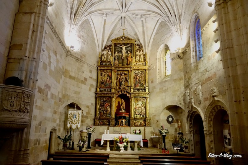
Next up was the ‘Ermita de San Pantaleon de Losa’, a small church built on a high rock. I left my bike at a house with some friendly locals and hiked to the top. The Ermita itself was closed, but the views definitely worth the climb.


Following provincial road BU-550 along the Rio Jerea, I come at a fork. Right will bring me directly to Medina de Pomar, but I drew my route to the left, via the small settlement of Hierro. Nothing to see there, only the fact that I think it is a nice stretch, with a climb over a completely deserted, small, worn asphalt road. Which option to chose ?
It is so hot, and the direct road to the right would be easier. The junction is a good point with river access if you’d like a swim in the river and think it over, but some local youth was already in there.
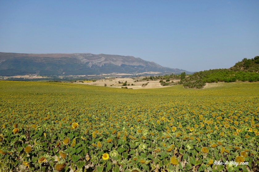
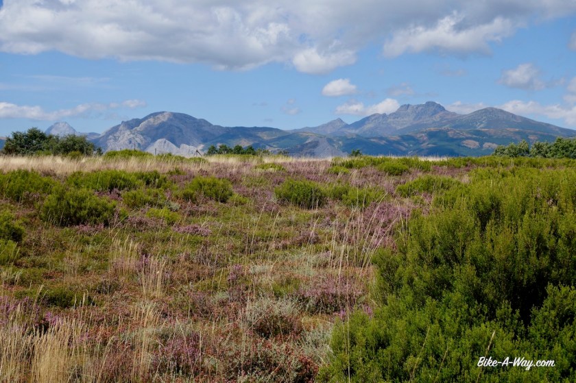
I went left, the harder, but probably much nicer option. Good choice. The scenery, with high rocks coming out of nowhere is really beautiful.
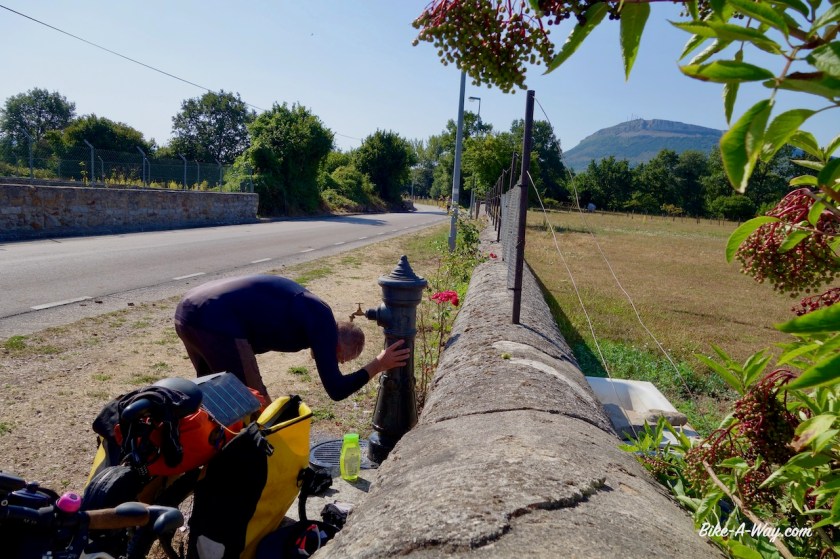
Just before the start of the climb, I take a left turn and ride in the hamlet of Quintana-Entrepenas. I need shelter from the heat and sun and it is provided here with a fountain with drinking water, and a deserted building giving shade. The faintest of internet signals even allows me to catch up on some news on the phone. Close to 7 pm, when the temperatures dropped a bit, I start the climb. It’s nothing huge, going from 590 meter to something like 850 meter, but there are steep parts of +10%.

I find a good camping spot just under the collection of houses which is ‘Hierro’. Shade, now in the evening and also in the morning, and a small breeze. Just too many flies and I have to wait till after the sunset before I can prepare diner (flies go to sleep).
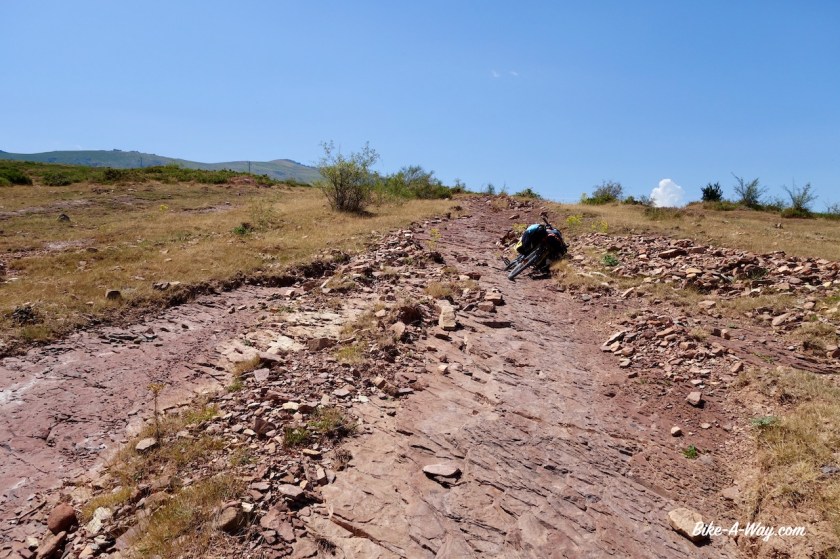
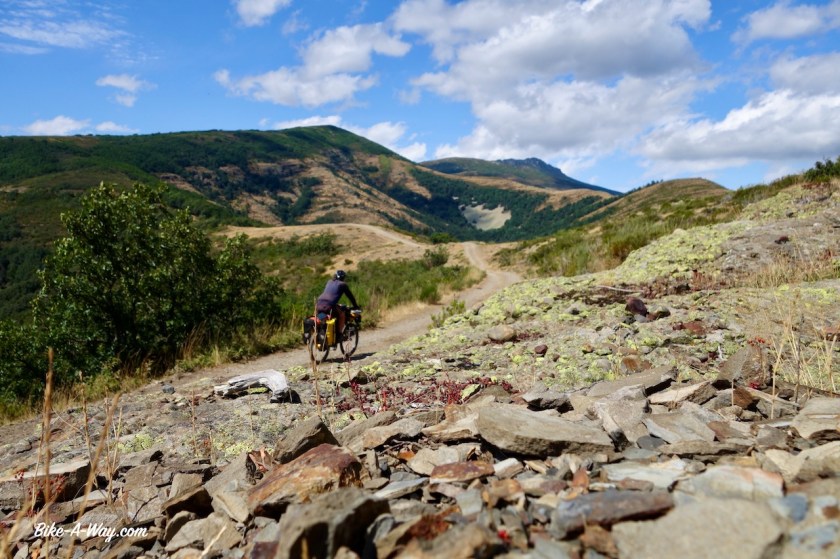
Next morning, riding through Hierro, I see that probably only one of the ramshackle houses is still inhabited. The church has partly collapsed. The road turns to gravel. Again, I have splendid vistas to the surrounding valley and mountains. The top of the ‘pass’ is about hundred meters above Hierro. A splendid downhill on good gravel follows. Still vultures everywhere I look up in the sky. Also a young deer on the track. And a fox.

From Villavedeo I found a gravel track all the way to Medina de Pomar. Excellent, excellent riding.

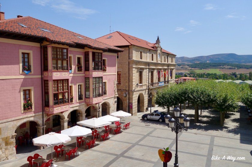
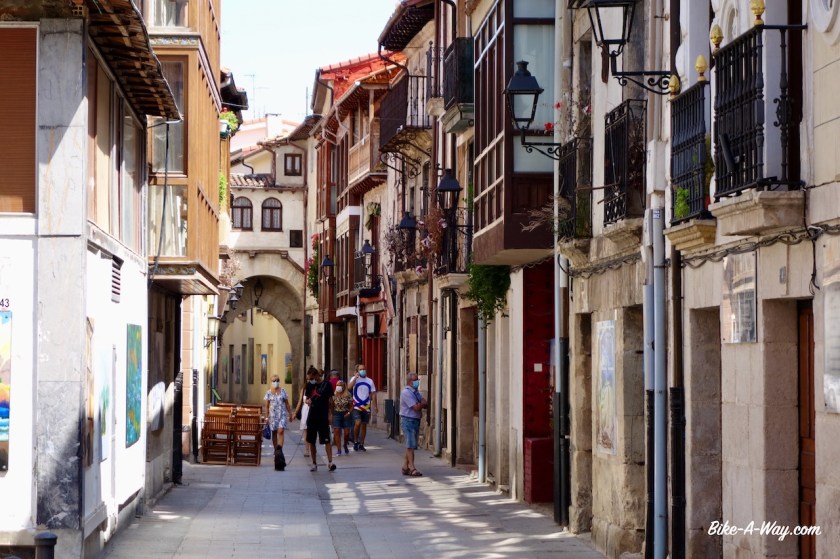
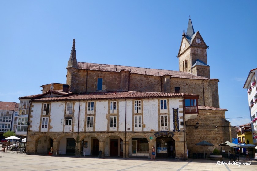
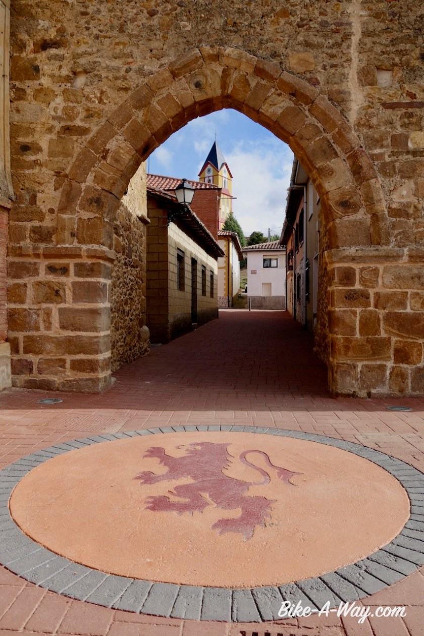
Medina de Pomar is an ancient town, with some interesting historical buildings, an ‘alcazar, old church, etc…. good for a couple of hours. The guy who founded Ascuncion in Paraguy is from this town (but born in Espinosa de los Monteros). He was only a couple of years older then I am now, when he died. Damn, I’ve got a lot of work ahead of me if I still want to found a capital within a few years….
What have I done, after all, in my life ?


I leave the small town in the afternoon. It’s burning hot. Luckily, villages are at short distances from each other and I always find a bench somewhere in the shade. Often a water fountain to refresh myself as well.
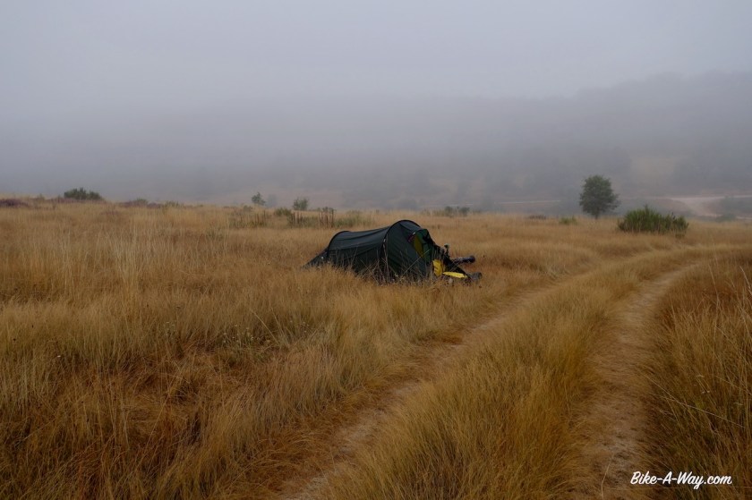
But the inevitable happens after a couple of days off sweltering heat; a thunderstorm. I dive into a side track and find a good place in a field to pitch the tent. Temperatures drop immediately with ten degrees and I have a much better sleep as the night before.
Up to Espinosa de Los Monteros, a friendly little town. I lose an hour by queueing for the little supermarket and for the panaderia. Now I have a few kilometer on the provincial road BU—526 in front of me, but it’s mostly downhill.
I arrived around 2pm in Cueva, the village just before ‘Ermita de San Bernabé’. It’s a famous thing, a church and some stuff in caves, but it is closed for siesta between 2 & 5 pm. I decide not to wait for it and resume cycling along small backroads until I rejoin the BU-526 in Entrambosrios to climb over the saddle. I’m now cruising down next to a spectacular rock face. It seems the top is just above me but little do I know the Sierra de Dulla is much higher than what I see now.
When I look back on my way out of Perosa de Valdeporres I can really appreciate how spectacular Mt. Dulla really is. It will remain in view for quite a while.


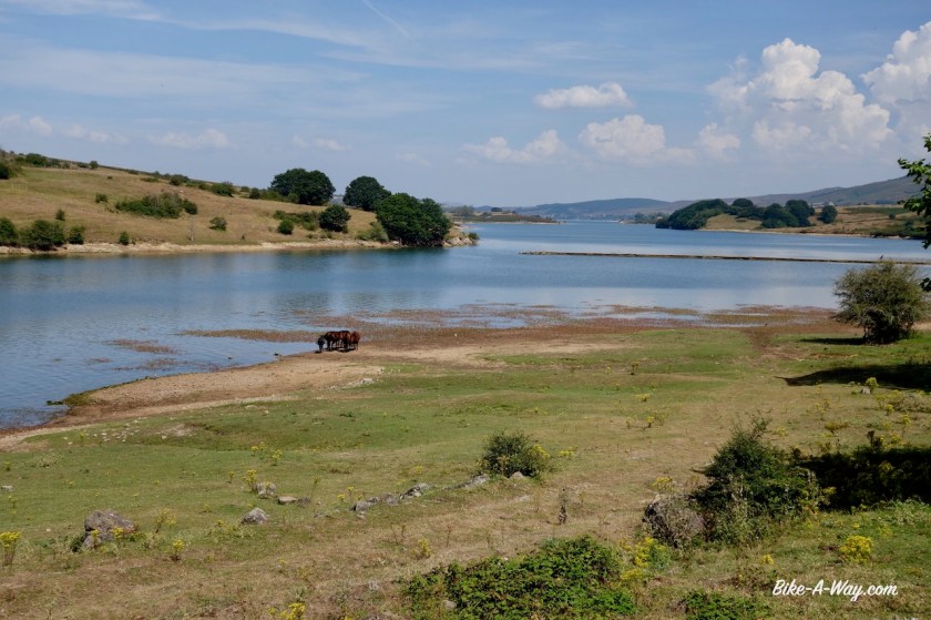
The little tertiary road works it’s way up to Ahedo de las Pueblas. A very beautiful village. Must be a nice thing to live in these surroundings. I’m riding at the top of a hill. A barren place with a lot of semi-wild horses. It would be brilliant to camp here, but a very fierce wind starts to blow and I see dark grey clouds rolling in from the north.
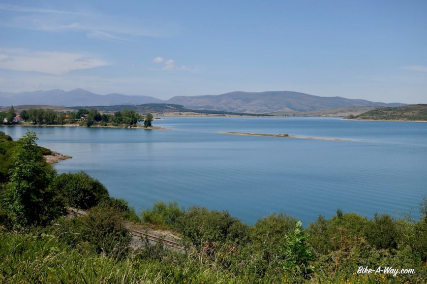
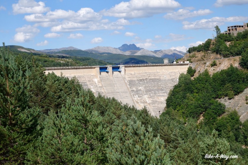
Suddenly, I am already descending, the huge Embalse (reservoir) Del Ebro is in front of me a few hundred meters below. I find a very good spot to camp behind some trees, well sheltered for the violent winds. A big thunderstorm is rolling over.
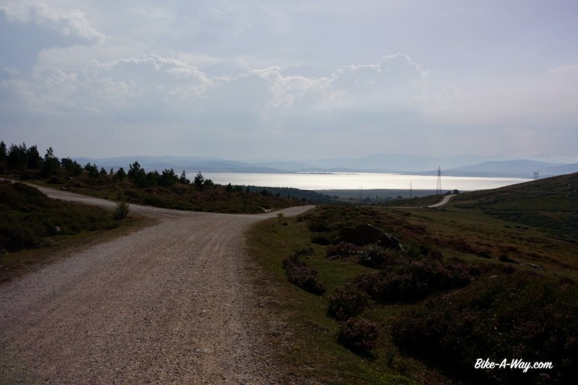
I ride south along the Embalse Del Ebro. After the village Arija I leave Castilla y Leon region and ride into Cantabria.
It’s a Sunday, and quite a bit of Spaniards have found there way to the lake for a refreshing swim. I keep my eyes open for a small, private beach. Once I think I found it and descend with my bike to the little tiny beach. Nobody here.
Ooh…. one guy is sitting there. Cross-legged. Talking to himself. Totally naked.
I go.
I find another spot allright later on to enjoy a swim in the lake.


Reinosa, a bigger place at the western side of the lake is nothing special, but it has a big Mercadona supermarket on the outskirts and a Repsol gasstation where I can refill my fuel bottle for cooking. I use about one liter of fuel per month.
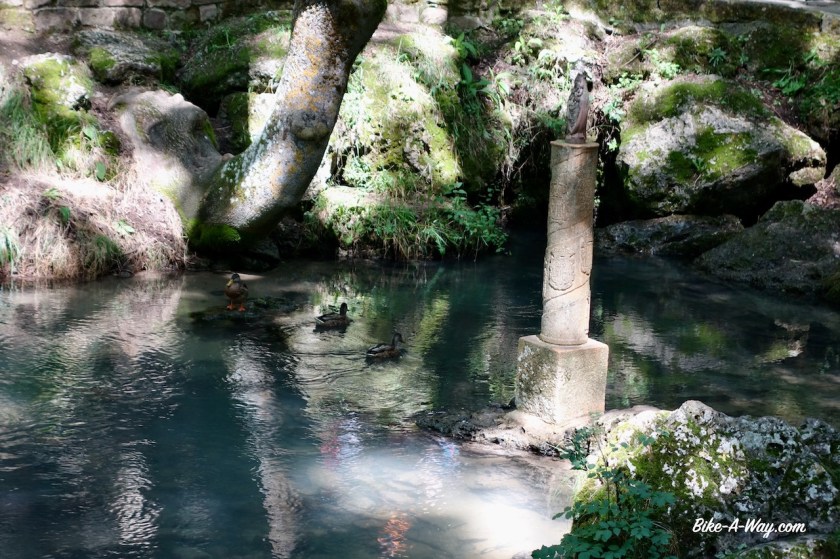
About six kilometer west of Reinosa is the spring of the Ebro, the second longest river in Spain. The river Tajo is about 100 km longer but the Ebro is the longest running its entire course in mainland Spain (The Tajo goes on to Portugal). Instead of running its waters north for about 50 kilometer to the Atlantic Ocean, the Ebro choses another path, downhill, all the way to the Mediterranean, more than 900 kilometer away. The spring is at about 900 meters asl, so on average it’s losing one meter per kilometer. Although it will be much less in the last half of its trajectory I’m sure.
There is a hiking trail all along the river and I follow the first six kilometer upstream on the bike, from the city to the spring.


After Reinosa, I had two options in mind to continue my trip. The northern option through the ‘Picos de Europa’ or a southern one via the Montana Palentina. The first option for sure would be the more spectacular, and also much harder.
Possibly too hard with too much bike pushing over rocky hiking trails.
Consulting the weather forecast, the decision was made easily. Rain for the next eight days if I were to go north, only for two days if I go south.
South it will be.

I make a small mistake pushing my bike up a dry, rocky, steep stream bed. I should have just followed the nice gravel track to Poblacion de Suso, and join the main road CA-280 there. Now I pushed my bike for 45 minutes over rocks, through thorny bushes. My legs are bleeding at a dozen places. If I don’t forget it, I’ll clean up my gps-track so if anybody downloads it, you go the better way.
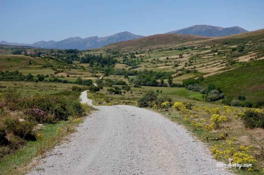
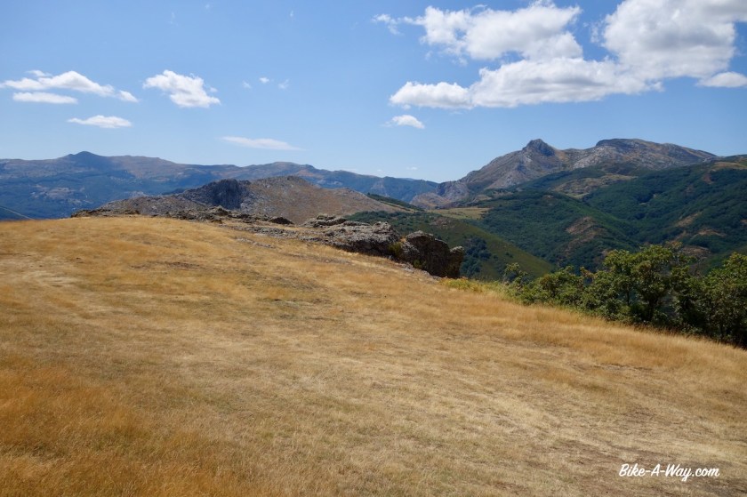
Very beautiful mountain scenery again. I see dark clouds rolling in again from the north over Reinosa, but if I hurry up, over an unnamed pas, 1.352 meter asl, I’m pretty sure these clouds will get stuck behind the mountain.
The mountain range that forms the border between Cantabria and Palencia province (back in Castilla y Leon) is 1900 meter high. On the downhill I reach my highest speed so far on this trip, 74,86 km/hr, the cyclometer says. That was with laundry flapping from my front and rear rack. It’s been years since I managed to go over 80 km/hr. Maybe later.


Today I also see the first storks of this trip.
After Barruelo de Santullan, I take the small PP-2125 road through the Montana Palentina. A signs tells me this is one of the few places in Europe where bears are still roaming around. Maybe I’m lucky to see one late evening or early morning when I’m camping ?


After San Cebrian de Muda, I’m back on gravel. Or stones sometimes, but always well rideable. Very enjoyable route, with plenty of camping options. As those two days of bad weather are coming up, I ride into Cervera de Pisuerga, a little town I visited already in 2005, to buy provisions, then ride back into the hills to the same place above Rabanal de los Caballeros where I camped the night before, to sit out the rainy weather, read, rest and eat.

In the afternoon an older gent suddenly arrives in the field near my camp. He was very friendly and came to repair the beehives a bit. He tried to warn me for something, but I couldn’t understand the words. He mimicked an animal, with wings it seems, and a horn.
I didn’t get it. A flying dinasour ?
The devil himself maybe ??
Next morning, when I was back on the track down to Cervera de Pisuerga… i realized it, when I saw the bear poo. That’s what he was trying to warn me for haha.
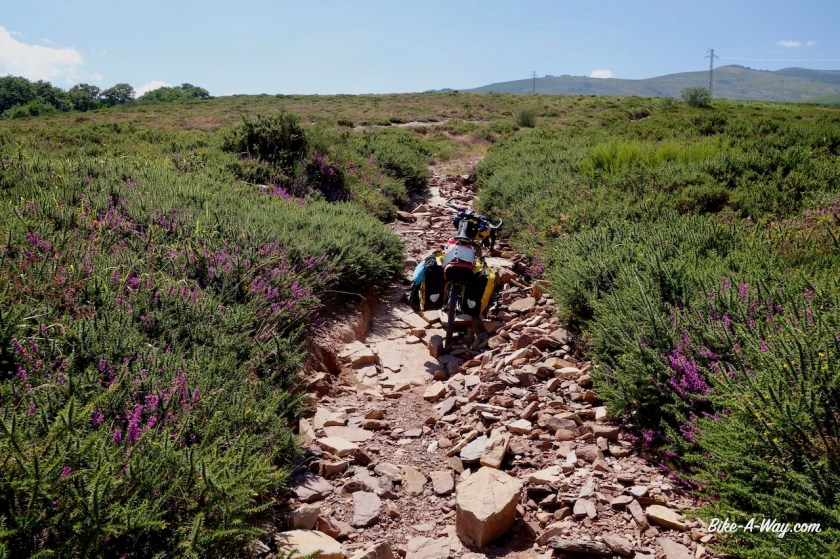
The road out of town is a bit too busy for my liking but soon I can turn on a smaller road towards Resoba.From this village, a stony track climbs into the mountains of Parque Natural de Fuentes Carrionas Y Fuente Cobre – Montaña Palentina. Often steep, sometimes a bit gentler.


A steep downhill to the valley of the Rio Carrion follows and I find a very nice spot to pitch the tent next to it. From here, I follow the ‘Ruta Valle de Pineda’ towards Vidrieros. A shame they allow 4WD’s to use the track. There are a lot of hikers and mtb-ers. If I were to drive a 4WD, I would very uncomfortable riding my big, loud machine among these people. Why not go out yourself ??
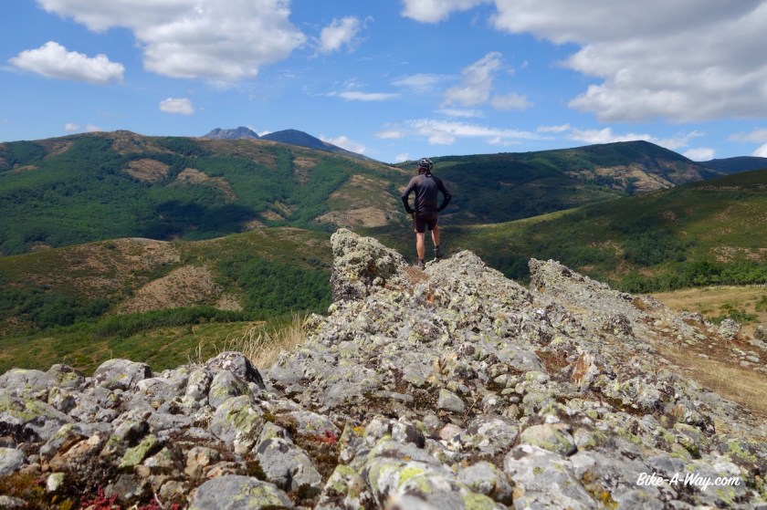
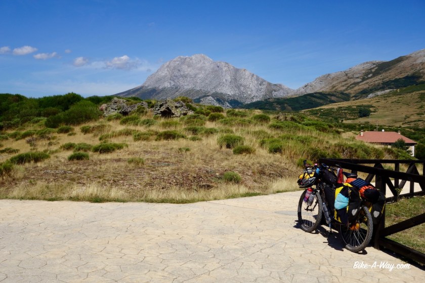
In Vidrieros, I see on a sign it was actually forbidden to camp where I did (natural park). Sorry, but there were no signs the route I entered the park. I am riding next to one of the region’s highest peaks, ‘Curavacas’ (2.526 m)., which means ‘heal the cow’ (or ‘cow healer’ ??).


At Triollo, I arrive at the big Embalse de Camporredondo. I cycled along this reservoir in 2005, but that is such a long time ago, I remember nothing. And I’m riding in the other direction anyhow now. This road is super, super spectacular. I follow a little side road for a while, to have views towards another giant of the region, Peña Prieta (2.539 m). But, the most spectacular of all, I have all the time in sight. It’s Peña Espigüete (2.451 m).


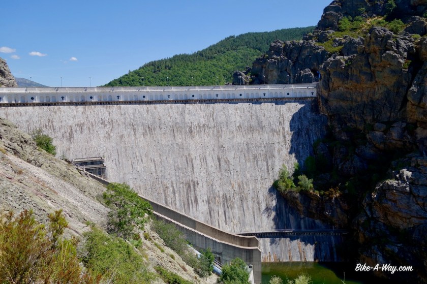

After Camporredondo, they’ve built another dam for another reservoir in the Rio Carrion, called Embalse de Compuerto.
From here, I roll into the towns, Velilla del Rio Carrion and Guardo. both have the air of old easter European towns where the time have stood still. Nothing charming here.
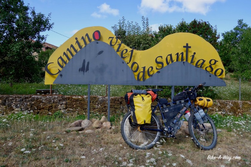
I was heading from Guardo to Cistierna. Busy road CL-626 runs between this two places, so I decided to take a quieter option, going further south, more or less out of the mountains towards Calavares de Arriba and even a little detour further south to the town of Almanza, to visit the local bakery. Almanza claims to be on one of the Camino de Santiago routes, but the track I have from the Camino Olvidado runs further north. More small roads bring me into Cistierna. Here I am definitely sharing the track with the Santiago route again. A very pleasant road through Yugueros, and towards Barillos de las Arrimadas and eventually to Bonar a little town with again supermarket, etc..


Part 2 of my meanderings through the Cordillere Cantabrica to follow soon.

Hoi Koen,
Leuk te lezen dat je het zo naar je zin hebt in een erg mooie omgeving – wat merk je daar van Covid? Voor mij is het erg surrealistisch om je verslagen te lezen i.v.m. de best wel grote lockdown hier.
Klinkt wel als een best wel zware route die je voor jezelf hebt uitgestippeld. Welke app gebruik jij om je routes uit te zetten?
Zag dat je je zonnepaneel bij je hebt – houdt die je devices goed opgeladen of heb je toch nog wel regelmatig 220v nodig?
Ben benieuwd naar je volgende verslag met mooie foto’s.
Veel fietsplezier,
Inge
LikeLike
Hoi Inge,
Covid impact is zoals bij ons, hoewel ik de indruk heb dat de Spanjaarden veel beter de mondmasker voorschriften volgen.
Ik steek veel tijd in routes uitzetten. De basis blijft altijd een papieren Michelin kaart waar je van het kaartbeeld al kan afleiden in welke regio je wilt fietsen. Daarna volgt een combinatie van vanalles. Voor Cantabrië bijvoorbeeld is een deel van de route de off-road `transcantabrië route, die ik dan minutieus bekijk in Basecamp en dan alternatieven zoek voor de extreemste passages. Mijn route door Frankrijk was gebaseerd op de wandelroutes Campaniensis en Lemoviciensis. Ook daar de ‘onmogelijke’ passages uitgefilterd.
Een goeie routeplanner vind ik http://brouter.de/brouter-web/#map=10/52.4702/7.4947/standard waar je kan aangeven wat voor soort fietsroute je wil volgen en waar dan naast een originele route ook nog een aantal alternatieven worden opgegeven.
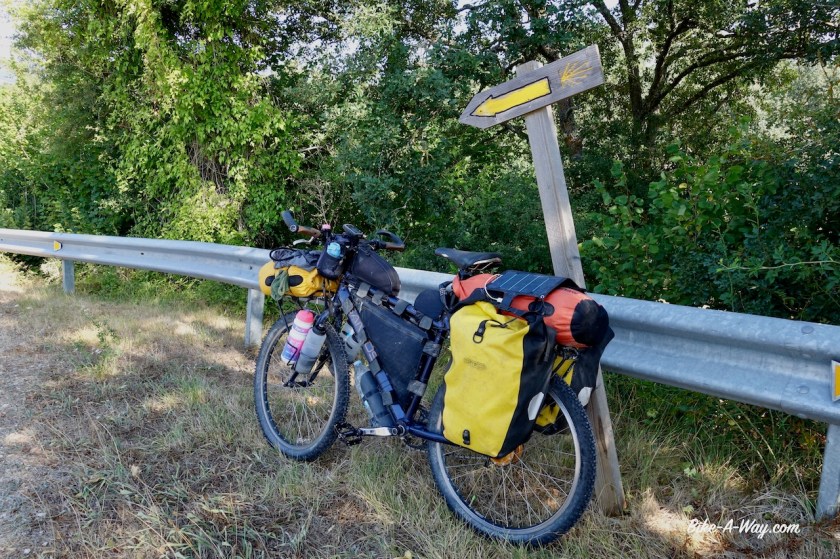
Zonnepaneel is van de nieuwste generatie, amper 200 gram en (ik denk) 11W.
Werkt uitstekend. Ik heb 2 powerbanks die ik eventueel in hotel volledig bijlaadt, maar normaal trek ik het heel lang enkel met het zonnepaneel. Laptop en scheerapparaat hebben nog gewoon 220v nodig, maar beiden gaan makkelijk 2,5 week mee op batterij.
LikeLike