Chile: Carretera Austral, the northern part

Route: Coyhaique – Puyuhuapi – Puerto Raul Marin Balmaceda – Chaiten – Puerto Montt

05/01/2018
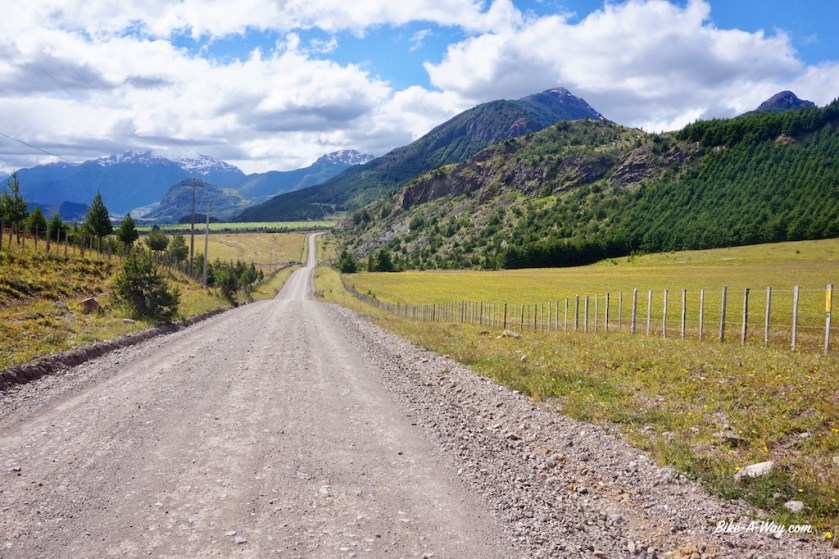
Leaving the town of Coyhaiqe, I have to climb another 10 kilometer or so out of the town on the paved road with a constant stream of traffic before I can turn off to the old section of the Carretere Austral on gravel. It’s a steep climb up a 750 meter high hill. Same complaints as the previous days: all land is fenced off and it’s hard to find a place to pitch the tent.
At night, it rains continuously, just like it has the past week or so, but the days are dry, warm and sunny. I can surely live with that.

DSC02284

DSC02286
Coyhaique from a distance.

DSC02296

DSC02298

DSC02302

06 – 11/01/2018
About twelve kilometer before (south) Manihuales I rejoin the paved section of the Carretera Austral. which continues to be paved for a while now. But, there’s a possibility to take a gravel road about nine kilometer north of Manihuales, which I prefer over the asphalted road. I find a cosy place to pitch the tent, right next to the river. It’s close to the road but I don’t have to climb fences today. For the first time in months, I make a nice camp fire.

DSC02315

DSC02317

DSC02347

This gravel option lasts for 21 kilometer and provides more nice wild camping spots further on. A small part of the road even has no fences either side of the track. This must be like the Carretera of the old days. The rest of the day I follow the smooth pavement and have an early stop a few kilometer before Villa Amengual, so I can do my shopping in the morning.

DSC02353

DSC02369

DSC02393

DSC02397

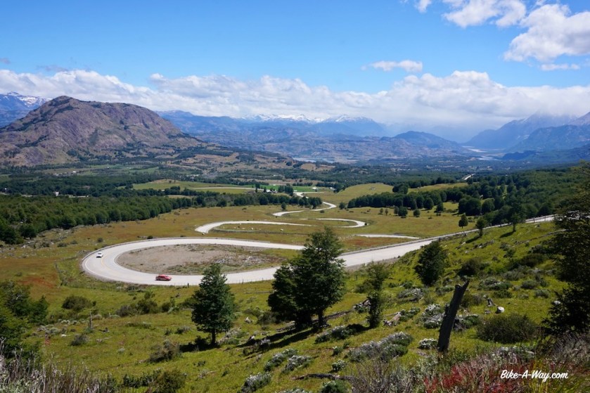
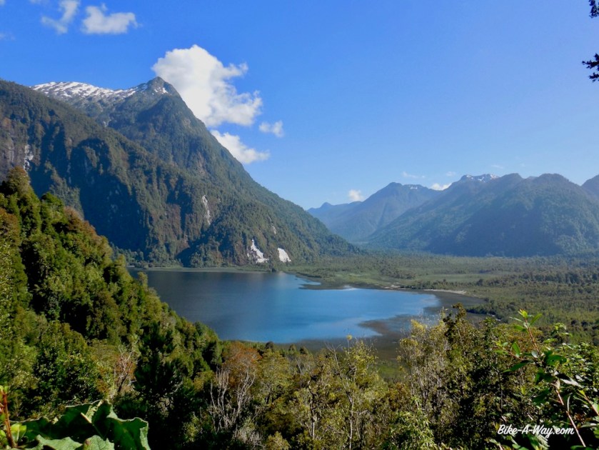
From Villa Amengual, the road climbs over a small saddle before going steep down into the valley of the Rio Cisnes. After the junction to Puerto Cisnes, the Carretera becomes gravel again and climbs towards the ‘Portezuelo Quelat’ before going down to the next river valley and eventually some kind of sea arm. After a few days with rain, today was a nice and sunny day again.

DSC02412

DSC02415
@ Villa Amengual

DSC02423

DSC02446
From the ‘Mirador El Lobo’.
DSC02464
Swiss cycling couple riding down from Alaska.

DSC02476

DSC02480
If you can cycle all day between the fences, you can sure camp between them as well (check the height of some of these fences !)

The nights continue to be wet and it takes some time for the tent to dry. By the time I arrive at the entrance of Parque Naional Queulat, the sun is out again.
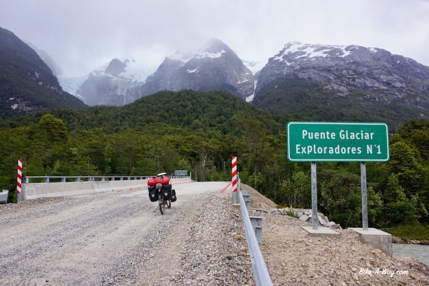
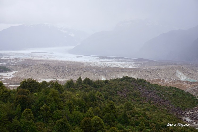
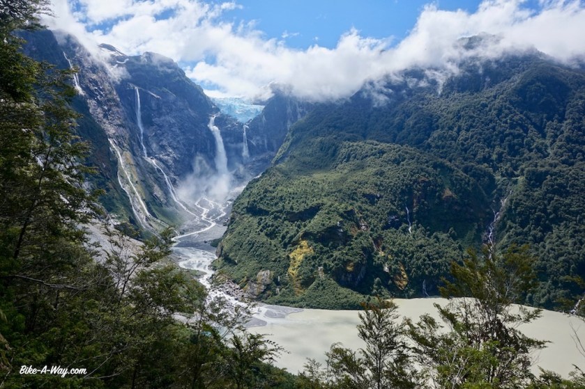
The main attraction here is the ‘Ventisquero Colgante’, a ‘hanging’ glacier. A 3.3 km trail leads up to a viewpoint. It’s a spectacular thing, but seeing where the glacier is now, compared to where it used to be in 1940 and 1970 as you can see in the N.P. building… I don’t think there ‘ll be much glacier left to hang here in a couple of years.

DSC02482

DSC02483

DSC02490

‘Ventisquero Colgante’
Now, if this isn’t a spectacular view point !

DSC02514

DSC02536

DSC02539

Puyuhapi is a nice little town, but not nice enough to convince me to stay for the night.
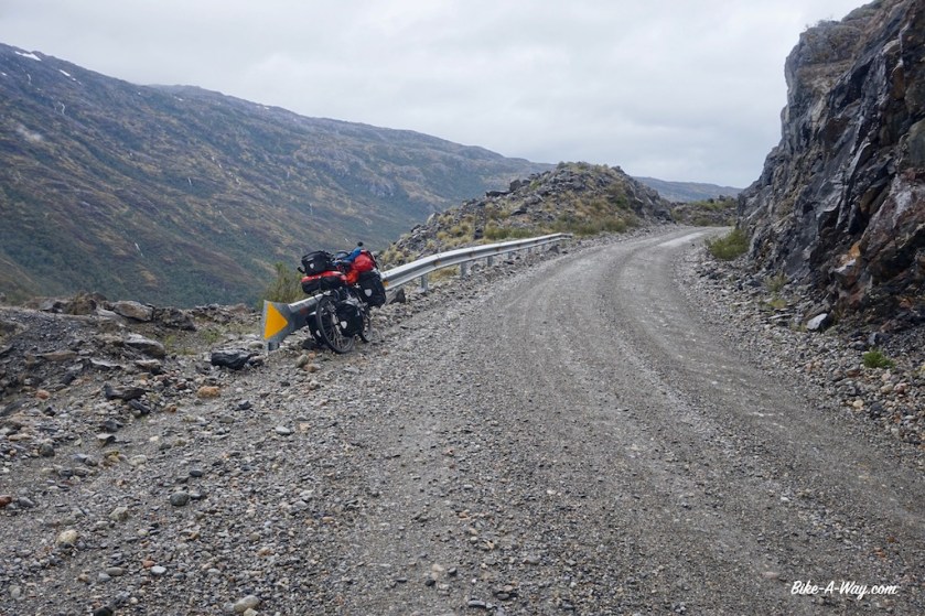
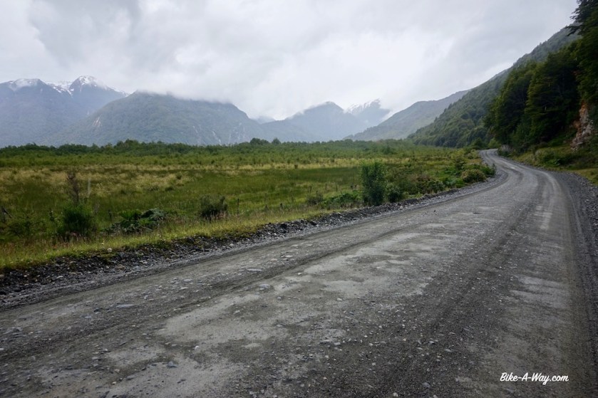
A bad stretch of ripio, with stones as big as fists follows for the first 15 kilometer or so. It’s late evening when I pitch the tent at a camping twenty kilometer south of La Junta. I’m the only camper (yesss, it’s gonna be quiet 🙂 ) and the owner has to fire up the wood stove for his only guest in order to have some hot water for the shower.

DSC02547

DSC02552
The question is: “Who is …..” 🙂
DSC02553
Met these nice Belgians along the road.
DSC02567
I think a King Fisher ?

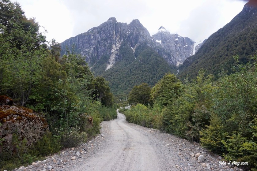
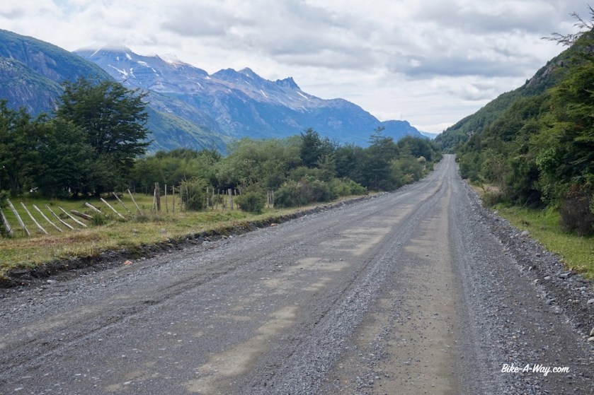
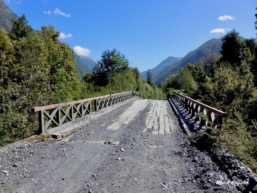
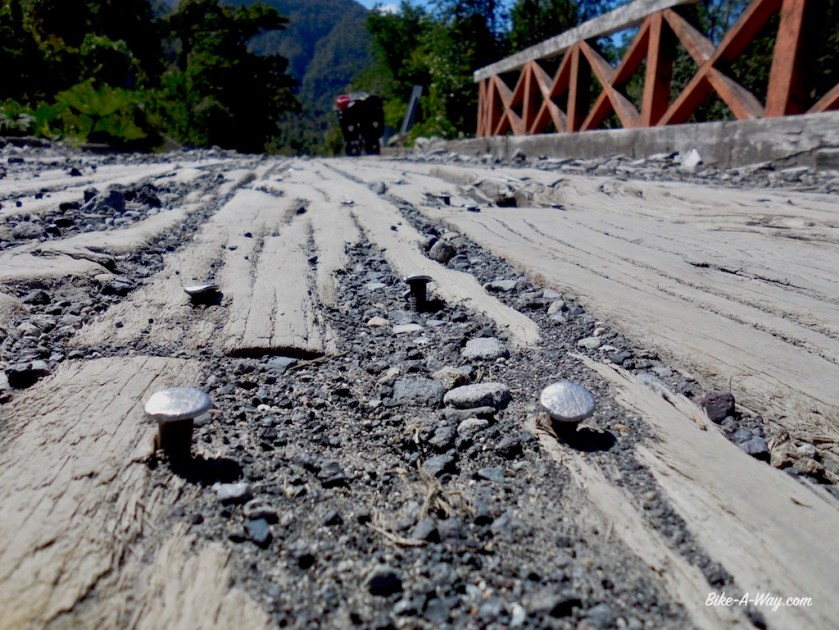
La Junta is another little town with a few small village stores. Normally I’d be continuing on the asphalt going north, but the landslide in Villa Santa Lucia still hasn’t been cleared (and apparently won’t be before April), so I take a left turn, cycling west towards Puerto Raul Marin Balmaceda. A few very nice camping options at the beginning of the road, but it’s still too early in the day for me. The gravel goes from good to bad, to very bad, to a bit better again.
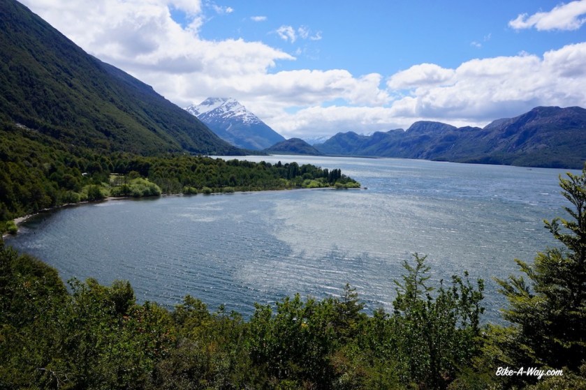
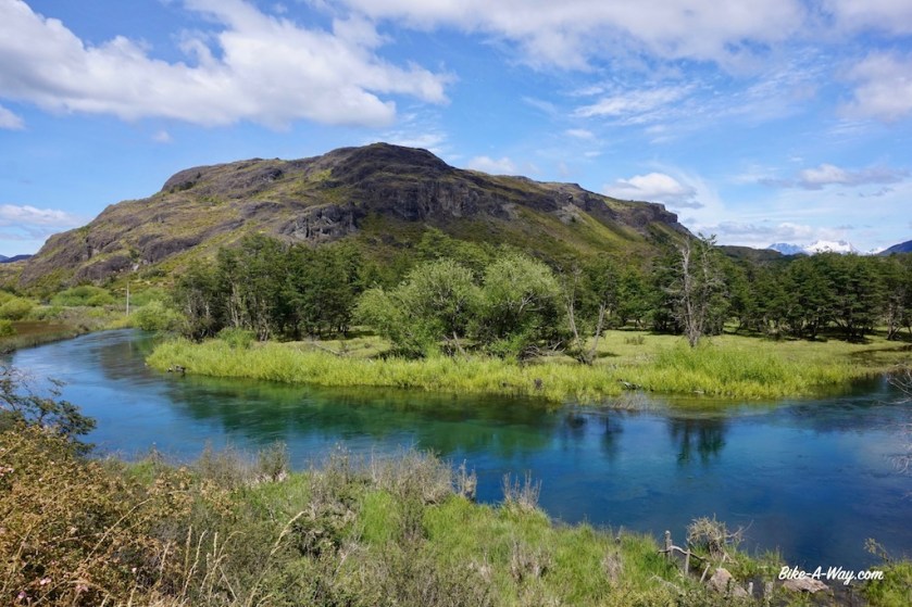
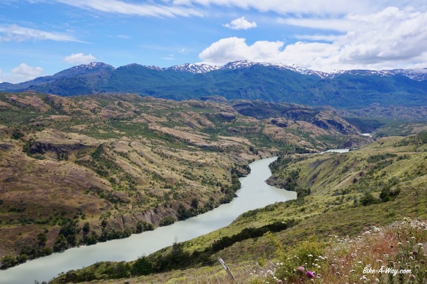
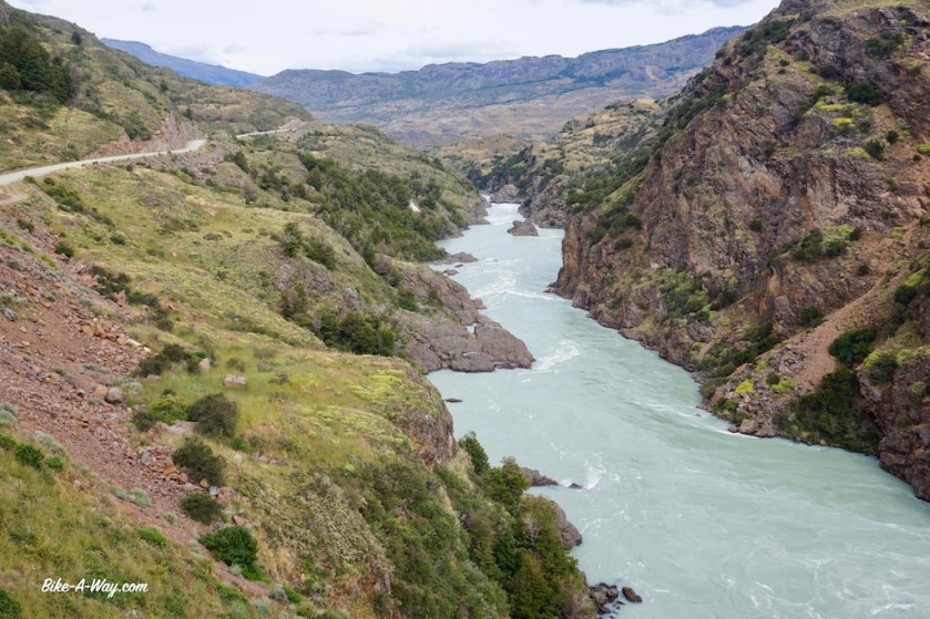
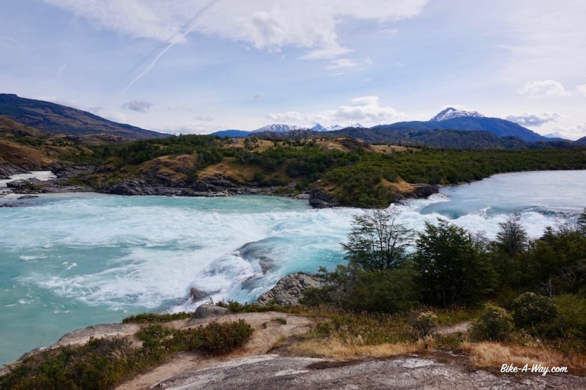
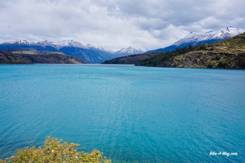
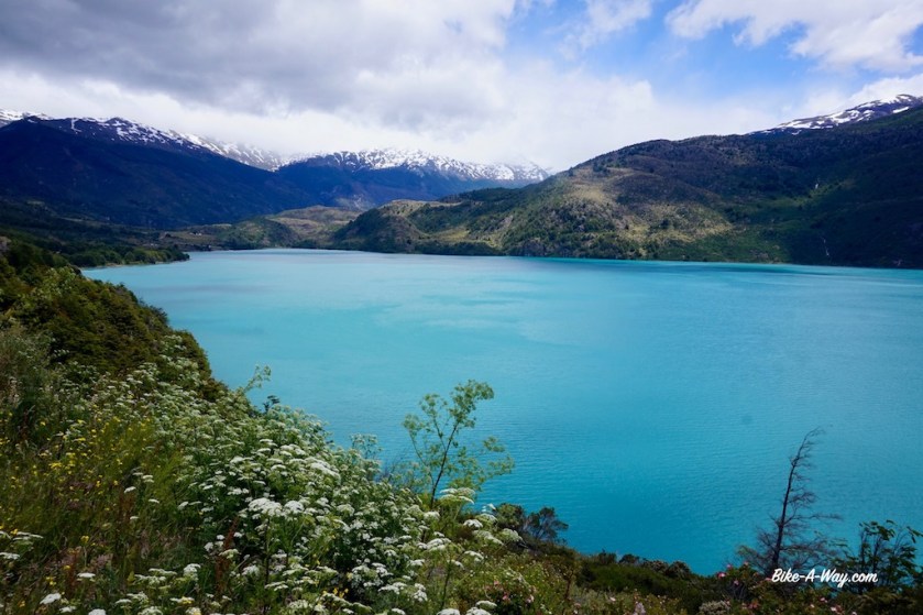
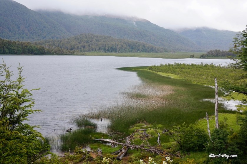
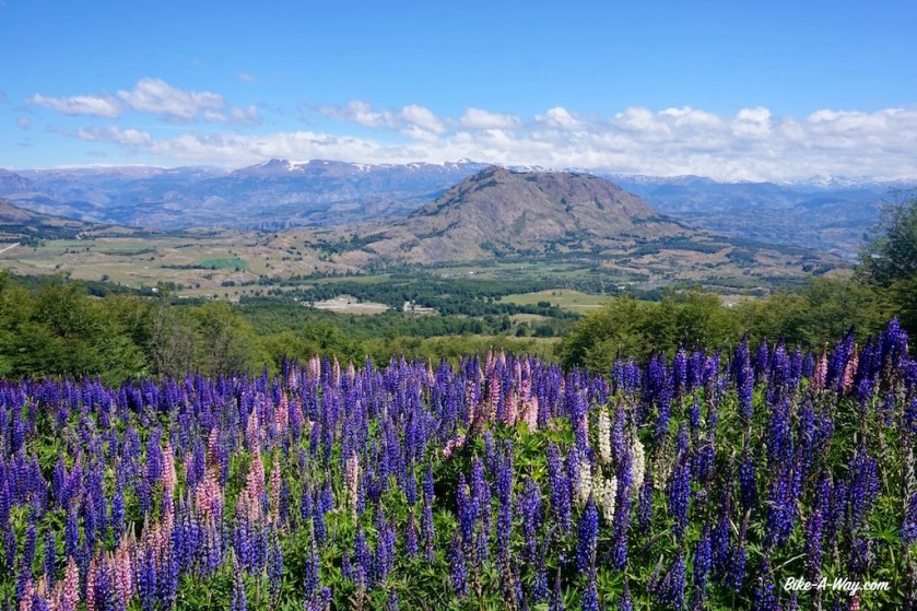
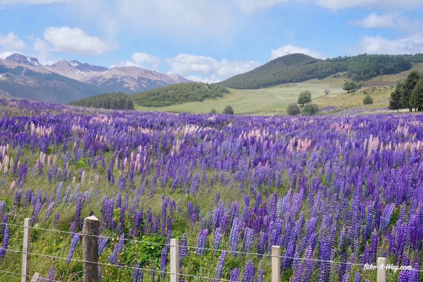
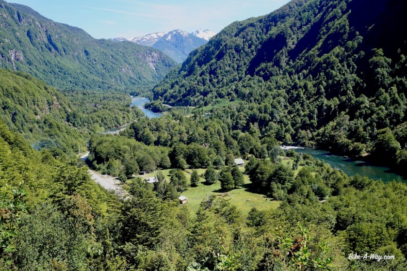
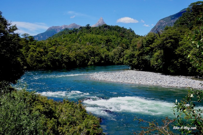
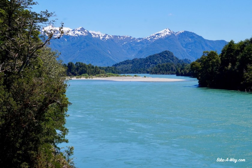
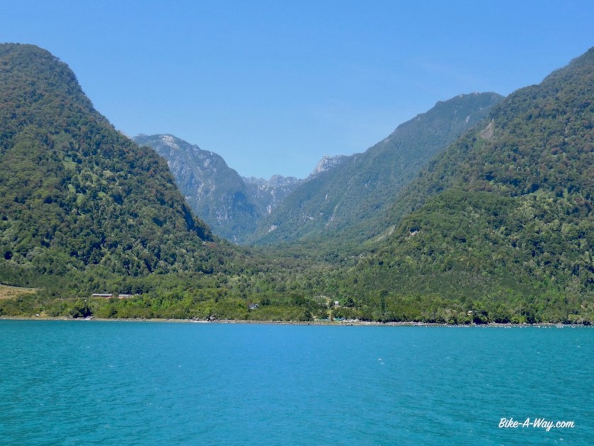
I’m riding in the valley of the Rio Palena and the scenery is excellent.
Big shame is the amount of traffic traveling this route, in their usual style, speeding at centimeters beside your legs, leaving huge clouds of dust behind.
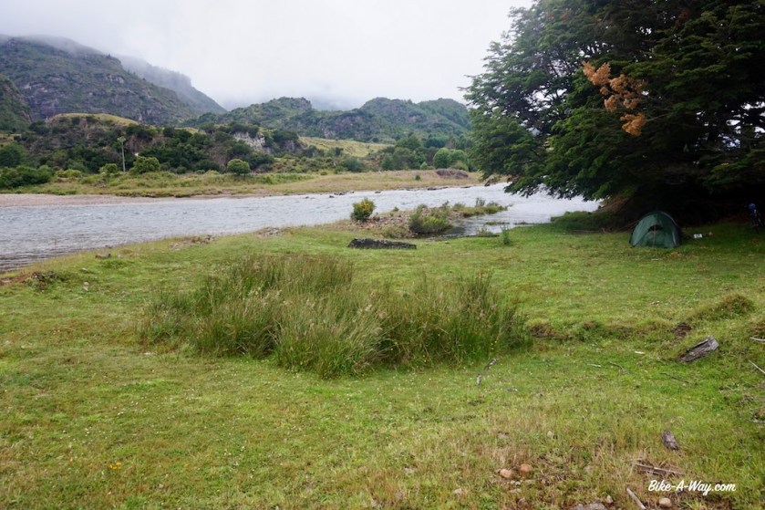
In October last year, I rode further upstream along this river in colder and wetter conditions. About ten kilometer before the end of the road, there’s a ferry to cross the river, but that’s only running until 6 pm. I won’t make that and have again difficulties finding a place for the night. Not because of fences, but due to the jungle here. Eventually I pitch the tent near a waterfall in front of which some heave bulldozers destroyed the vegetation recently.

DSC02580
Rio Palena

DSC02582

DSC02587

DSC02604

DSC02601
The last picture before the camera fell down and broke 😦

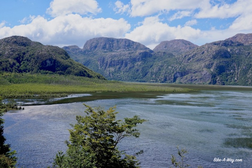
Next day, after crossing the river, I notice there are several nice options to camp between that side of the river and Puerto R.M. Balmaceda.
The compulsory registration process for the ferry was some of the most inefficient things I have ever seen in my life. There was one lady sitting inside the office when I arrived. It took the lady and the man with the tattoo of a skull on his hand 35 minutes to make the booking (no idea why they “work” as a duo, instead of each taking a customer ??). Then there was a group of six kayakers ahead of me. It took just under an hour to arrange the registration and booking for them. The lady had to enter their passport numbers four times before she succeeded. Then it was me. They reached succes in my booking in 24 minutes. Lucky I arrived in town three hours before the ferry left.

DSCN2237

DSCN2242

DSCN2257

DSCN2260

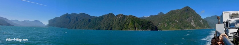
The ferry ride through the Gulf of Corcovado is scenic, with good views of the snow capped volcano Nevada.

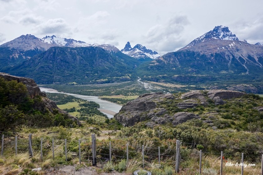
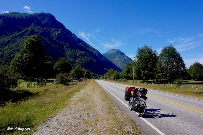
North of Chaiten, the road is paved again. Here I enter the Parque Nacional Pumalin which, just like Parque Nacional Patagonia further south, is a park established by Douglas Tompkins and his wife, he the owner of ‘The North Face’, she of the clothing line ‘Patagonia’ and ‘Esprit’.  They donated it to the Chilean state in March 2017.
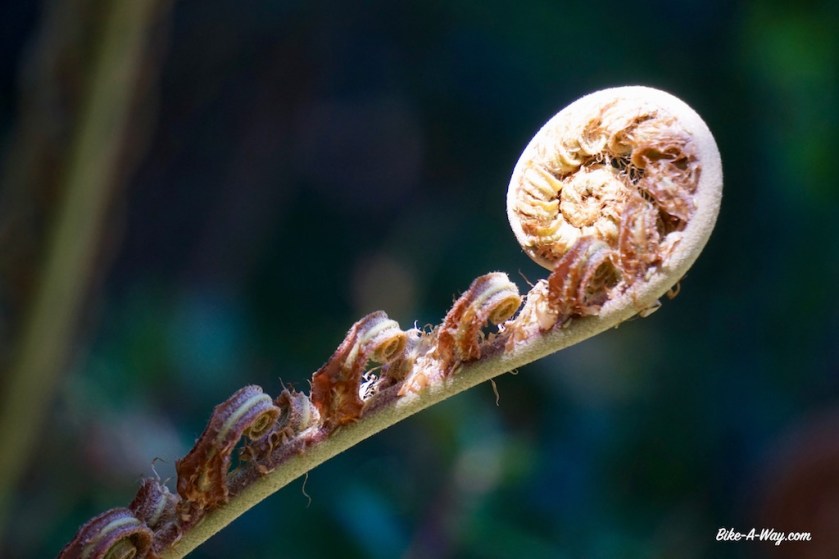
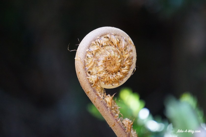
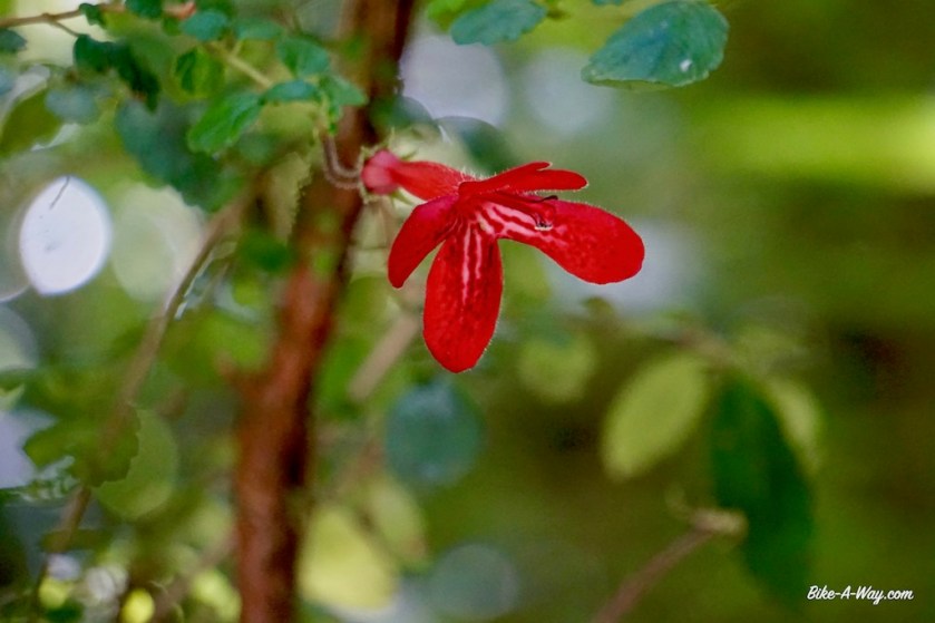
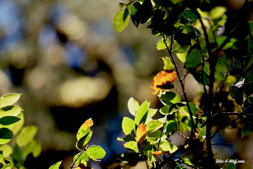
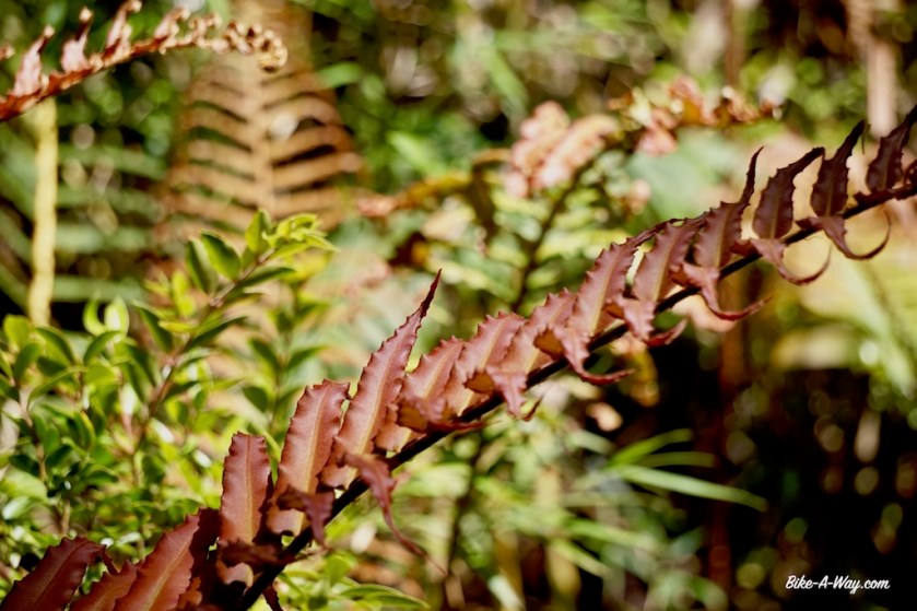
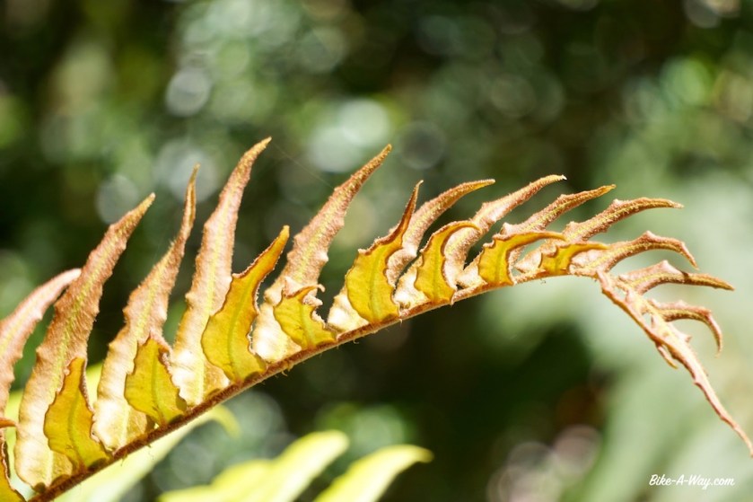
The temperatures are tropical and so is the environment. All dense jungle with big ferns and other rain forest plants. Wild camping would be very hard here. I climb the volcano Chaiten, which erupted in 2008 and made a devastation in the town further down. It’s a hard hike up the steep hill, but the views are spectacular. I can see the Pacific Ocean, the ‘Lago Blanco’ where I would camp later that day and the crater two lakes, a brownish one and a green one and also a new mountain arose after the eruption.

DSCN2309

DSCN2329
On top of the Volcano Chaiten.
DSCN2331
Lago Blanco, seen from the Chaiten Volcano.
DSCN2337
I camped along the Lago Blanco in National Park Pumalin. There are only 6 pitches or so, all having their own little shelter.
DSCN2342
Sunset at Lago Blanco

DSCN2348

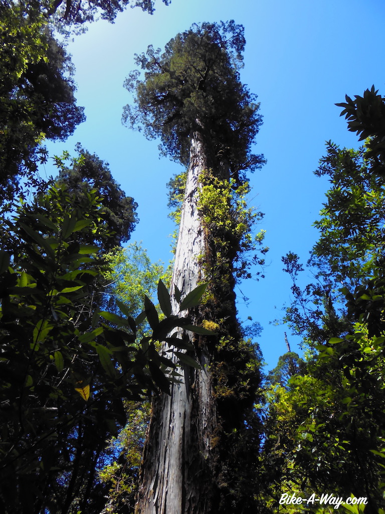
Next day make another hike in the park to some waterfalls of which the higher one is very spectacular. I also make a hike into a part of the park where there are still some Alerce trees, these big and old guys which were also in the ‘P.N. Los alerces’ in Argentina which I visited a few months ago.

DSCN2363
Lago Negro, National Park Pumalin

DSCN2373

DSCN2475

DSC02644

FSCN2413b

DSC02702

DSC02668

DSC02676

DSC02681

DSC02683

DSC02687

DSC02694

DSC02696

DSC02699

DSC02700

Alerce Tree
Alerce Tree

After the five hour ferry ride from Caleta Gonzalo to Hornopiren (with the snowy cone of the Hornopiren volcano just behind the turquoise sea) there isn’t all too much time left for biking. I’m leaving Hornopiren nevertheless. It’s a small village where all traffic seems to stuck up, waiting for one of the two daily ferry’s. Pretty soon, the Carretera Austral turns into ripio again, the version with the big loose stones, and a climb between 10 & 14%. Quite a bit of traffic, so I’m riding in a constant cloud of dust.
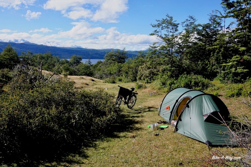
On my map, I’ve seen an alternative smaller route along the coast of this little peninsula. It’s longer, but I hope it has less traffic. It appeared even to be paved for a while. It’s been a while, but today I find a nice place to camp at the tip of a bay.

DSC02705

DSC02707

DSCN2494

DSCN2518

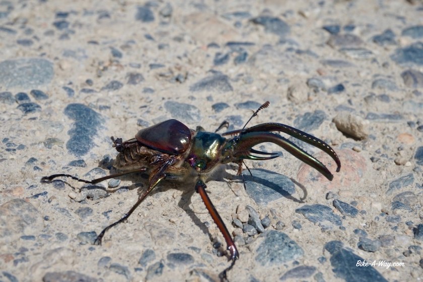
Soon, the alternative road turns to gravel as well. Gravel with washboard, but no big climbs. I’m having a full day of riding along the Pacific Coast. Major problem here, just like the previous days, are these big black and orange insects, almost as big as the tip of your thumb. I don’t know if they are horse flies as well. They look much meaner. They always come in pairs, or in two pairs, circle at high speed around you for a couple of times and then come to hang right in front of your face (so they must be able to fly backwards, as I’m cycling at that moment). It’s intimidating.
The tricks is not to try and hit them while they fly around you. They’re too fast. You must wait until they’re staring you in the face. But while you hit one, there are still three left.
It must be quite a sight, riding a heavily loaded touring bike on gravel, with stones as big as eggs, trying to stay upright while you’re swaying arms and legs to get rit of these flies, face covered with bandanas to protect yourself against dust and flies. A few of them land on your sweaty back and sting you there.

DSCN2543

DSC02714

DSCN2570
Riding my bike along the Pacific Coast 😀

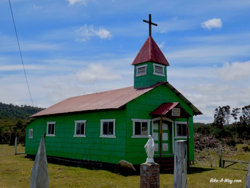
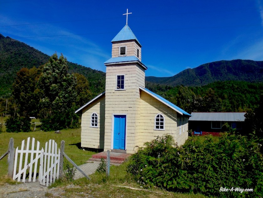
A lot of nice, old wooden churches along this route. Near the tip of the peninsula, I find a side road of this side road. I have to cross a shallow river, but get rewarded with more spectacular views. The sea water is surprisingly warm so far south.

DSCN2545

DSCN2555

DSCN2573

DSCN2576

DSCN2578

DSCN2588

It was not my idea to ride into the town of Puerto Montt, but my camera fell down from a pole a couple of days ago, and the lens broke. I still have a small point-and-shoot camera for back up, but don’t want to rely on that one the whole trip.

About 30 kilometer before Puerto Montt, I pitch the tent in a field above the road, whit good views of the Pacific below me. No wind protection, so hope the weather will be quiet tonight.
It’s been a very hot day and it’s impossible to go inside the tent while the sun is at it. After the flies lunched of my back during the day, it’s now the mosquito’s eating diner at my back.
Lot’s of scratching tonight…

In the whole of Puerto Montt, there’s no wide angle lens.
None.
I check every shop and asked every shop whether they knew a place…, I checked tourist information. They all said I might be lucky in Santiago. But checking the Chilean Sony store online… they even don’t have it in stock. Seems like I’ll have to continue shooting pics with my old Nikon point-and shoot cam for the remainder of the trip 😦 .

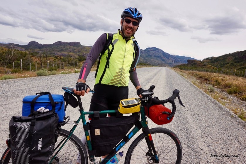
Riding the Carretera Austral is maybe not the easiest thing, but it can be done by anybody who is in reasonable shape and has a bit of stamina and a decent bike and gear.
It’s not the distance what makes the route hard. There are other factors:
The (often bad) ripio, the head-winds, the rain, the steep climbs, the horse flies, the traffic at times, the longer stretches without any service,…

What about the Carretera Austral as a biking route ?
Is the scenery nice ?
Yup, it definitely is and I enjoyed it.
BUT, I think it is seriously over-hyped.
Often, the Carretera is described as one of the world’s best cycling routes.
This depends on perception of course, and while I find the route to have way too much (unkind & speeding) traffic, again, somebody else could think differently.

Often the route is described as wild camping heaven as well.
That’s a flagrant lie.

After a couple off days on the route, I started asking cyclist coming from the opposite direction about their opinion of this so-called wild camping heaven. All, without exception, said they “couldn’t see that”.
No question of perception here.
For the most part along the Carretera it was hard, if not impossible to find a wild camping spot for the night. Often I kept riding for another 20 kilometer after I started searching for a spot and still ended up in a bad place or at a camp site.
Mostly because all land is fenced off, or unsuitable for camping (steep hills or dense jungle).

Overall, I’m still happy I cycled it, but I think there are routes in various parts of the world that are very spectacular as well, with better camping options, less traffic and more considerate drivers (Sweden, Norway, Spain, Switzerland, Iceland, Canada, Usa, ….)

Chile: Carretera Austral, the southern part

Route: Villa O’Higgins – Cochrane – Coyhaique

18/12/2017
It’s close to noon time before I leave the hostal in Villa O’Higgins. My departure was delayed due to bad weather on Sunday. A bit further north on the Carretera, there was a landslide which killed unfortunately a bunch of people, and more still more missing. Forces of nature are a thing to be reckoned with in this part of the world with it’s frequent earthquakes, volcanic eruptions and mud slides, all having caused huge amounts of deaths in the past.

The road didn’t arrive in Villa O’Higgins until 1999. It’s construction was ordered by Pinochet. Still, it’s all a washboarded dirt road for the next hundreds of kilometer. Cyclists I’ve met in Villa O’Higgins and on the road all told me horror stories about the local horse flies, a bit further north, attacking them in swarms.

At first, the cycling goes rather smoothly, until I arrive at the border of Lago Cisnes. The wind is in a rage, knocking me almost of my bike again. Several parts, I have to push the bike as riding it is impossible.

DSC01386

DSC01390

DSC01394

A bit over 30 kilometer into my ride, there’s a guy sitting along the road. I recognize him immediately from pictures I saw in Villa O’Higgins. It’s Jorge, a local farmer who built a nice wooden shelter next to the road, especially for cyclists. While I have a chat with him, the fortieth vehicle of the day passes me. This being the quietest part of the whole Carretera, as it’s a death-end, it still has it’s traffic. Don’t believe the stories like “Ooh, you’ll see maybe a hand full of cars”.

As the weather was sunny, I decided not to stay in Jorge’s cabin and ride on a bit longer. I prefer my tent anyways.

DSC01398

DSC01399

Next day I rode down to Rio Bravo. It was a day full of rain. Waterfalls are coming down the mountains both sides of the road, some of them really spectacular.
I cross twelve other cyclists on their way south: a French man, a Swedish guy, a Chilean couple, two Brazilian men and two guys who didn’t bother stopping for a chat.
I spend the night in the waiting room for the ferry, together with an Australian and an English cycling couple. All these cyclists were riding in the opposite direction.

DSC01422

DSC01425
Steep, steeper, steepest…. climbing hills in Chile.
DSC01428
Typical steep descent, followed by another steep climb. Your legs will get a work-out here 🙂 (and your rims will suffer).

DSC01436

DSC01448
I saw many of these little frogs on the southern part of the Carretera Austral.

DSC01450

DSC01458

At 11 o’clock, I hop on the ferry to cross this deep sea inlet towards Puerto Yungay at the other side. I shared the ferry with a group of construction workers who are building the new pier in Villa O’Higgins and are on their way home much further north in Chile. After the bus ride from O’Higgins to the ferry, they have to take a bus to Coyhaique, another bus to Puerto Montt from where they catch a plane and another bus to arrive home for a ten day visit before returning to the pier on this southern end of the road.
Apart from a small shed selling hot drinks (but not the empanadas everybody says it’s famous for), there’s nothing Puerto Yungay.
The climb away from the river is steep. So steep they even paved it for a bit. My odo-meter shows 20%. My already sore pulses, arms and shoulders hurt pushing the bike up. It’s a day of continuous rain, mostly pretty heavy. I don’t feeling like turning left, taking the dead-end road towards Tortel, a village famous for it’s wooden walkways i.o. roads. It’s cold, wet and the wind is blowing right out of that valley. I continue another 20 kilometer and pitch the tent on a small, soggy piece of grass along the Rio Baker. It continues raining all through the night.
Met no other cyclists today.

21/12/2017
The official start of summer in the southern hemisphere.
It rains all day and it’s cold.
I stay in the tent, finishing Michael Jacobs book ‘Andes’ and Tilman Waldthalers’s book ‘Querdurch Australia’. I like to read two books at the same time.
I start in a new book: Sapiens from Yuval Noah Harari.
It’s a four day ride from Villa O’Higgins to the next town with Provisions Cochrane. Lucky me I take at least seven days worth of food on rides like this 🙂

DSC01463

22/12/2017
Still some rain in the morning, but around 09:00 hrs the sun comes out for a bit.
After breakfast, I can pack a more or less dry tent.
The weather stays dodgy all day. When I end up riding in hail, I see a blue sky behind me and wait a bit. At other times I have to hurry to stay in front of the next rain shower.
Riding like this, I manage not to get too wet today. A shame most of the views are taken away from me by the clouds. The mountain range to the west, ‘Cordon Los Nadis’ seems to create it’s own (bad) weather.
I find a nice spot for the tent in the hills about 30 kilometer south of Cochrane, overlooking Lago Chacabuco below me and with the snowy peaks of the ‘Campo De Hielo Norte’, the Northern Ice field behind it. A much, much better end of the day then the two previous days.
I met eight other cyclists today, all riding the opposite direction, two Dutch, three English, two French and one Italian.

DSC01521

DSC01537

23/12/2017
I wake up to a blue sky and have fantastic views to the snowy peaks of the Ice Field.
It’s a short ride into Cochrane today. The Carretera Austral is very rough and bumpy with washboard on this stretch. The landscape again is impressive. I cross fast flowing rivers, ride along Lago Esmeralda and beautiful rock formations. At the outskirts of Cochrane there’s a two day long rodeo going on. I pitch my tent at ‘Camping Cochrane’. Campings here often are not like what we think of in Europe. It’s just in the backyard of someone’s home. But the friendly lady here has built a nice shed where one can cook and sit and a clean sanitary building. Also a laundry service is on order, which I gladly use.
No other cyclists today.

DSC01578

DSC01589 (1)

DSC01584
Picking cherrys directly from the trees at the camp ground in Cochrane.

24/12/2017
Another nice and sunny day, which I use to relax and clean my bicycle.

25/12/2017
Rainy day.
Christmas diner at the campground. The friendly owner has arranged a lamb which is roasted next to a fire by a 84 year old man.

DSC01597 (1)

DSC01602 (1)

26/12/2017
Time to move on. I’m getting into the more spectacular parts of the Carretera Austral, all along the Rio Baker, Chile’s largest volume river. The road meanders up and down in it’s valley. From above, I can see the the confluence of the blue waters of the Rio Baker with the brown waters of the Rio Chacabuco. I meet a skunk along the road today. A living one this time (before I only saw them regularly as flat as a pancake).
The road eventually drops down steeply towards the Rio Chacabuco, and climbs equally steep back out of it. Next remarkable stop is the ‘Confluencia Rio Baker & Rio Neff). Just like with the Rio Chacabuko, the brown waters of the Neff river join the glacier blue waters of the mighty Baker river. There’s a track going down to this point, only a few minutes walk from the road. Do it !
Today I meet nine other cyclists, a Californian couple, two Australian guys, a Dutch couple, an Israeli guy and two Italians.
I camp just before Puerto Bertrand right next to the Rio Baker, together with a Dutch couple traveling in a van for 10 weeks in the region.

DSC01612 (1)

DSC01614 (1)

DSC01633 (1)

DSC01639 (1)

DSC01647 (1)

DSC01656 (1)
Victor, the Israëli cyclist.

DSC01662 (1)

DSC01673 (1)

DSC01695 (1)

DSC01729
Cyclists’ horror: horse fly

28/12/2017
I rode all the way from Puerto Bertrand to Puerto Rio Tranquillo.
That’s not what I intended, but the last 20 kilometers there were no camping spots. Fences everywhere. Very frustrating. I think I’ll buy some pliers here and start cutting these fences. Then I become ‘The De-Fencer’.
The ride itself was brilliant again. A steep climb out of Puerto Bertrand, 13 – 14%.
Then down to Lago Bertrand, up again and down to Lago Negro and finally Lago General Carrera. As so many lakes in the region, this lake lies both in Chili and Argentina, where they call it Lago Buenos Aires. It’s the second biggest lake in South-America, after Titicaca Lake, which lies in two countries as well, Peru and Bolivia.
Anyway, spectacular scenery, blue sky with white and sometimes grey clouds, strong head wind as well as a strong tail wind. At the top of the hill before Puerto Rio Tranquillo is a field where you could wild camp, but the wind was blowing from all directions and I opted to cycle down to the village and pitch the tent at a camp ground.
Met eight other cyclists today, two German couples, an English girl, a Japanese man (cycling from Alaska to Ushuaia, and after that taking on Europe) and two American girls.

DSC01737

DSC01736

DSC01750

DSC01789

29 + 30/12/2017
As I missed Perito Moreno and O’Higgins Glaciers, the first voluntarily, the second by an act of God, I did not want to miss out on the chance to visit another glacier. This one at the northern edge of the northern icefield. To visit the ‘Exploradores Glacier’, I had to ride into the ‘Valley de los Exploradores’, a death-end road going west from Puerto Rio Tranquilo, down towards the Pacific Ocean.
The day started well. I hadn’t even ridden ten kilometer and I was already sitting in an abandoned shed of which half the floor was rotten away and the other half full of animal shit. I was not sitting there because I like to sit on rotten floors in animal shit.
No, it was raining. And raining hard.
When I have to chose between riding my bicycle in the rain, against the wind, or sitting on a little, fragile wooden bench on a rotten floor full of shit in a building of which the windows are gone, surrounded by old rubber boots, rotten clothes, a rotten mattress and a bunch of mosquitos … I seem to choose the latter.

Luckily, after half an hour it cleared out a bit (strong winds do have their advantages) and I was happily riding again. Well, not so happy, because the road climbed immediately by 13 / 14% again. But as so often, the views make it all worth-while. A stunning blue lake, Lago Tranquilo, to my right hand side.

I keep riding into the valley, with the mountains of the ‘Cordon Los Parvas’ to the north and the 4.058 meter high ‘Monte San Clemente o San Valentin’ to the south. This is the highest mountain of the southern Andes. Behind the Cordon Los Parvas’ lies the Volcano Hudson, which erupted in 1991 and devastated thousands of square kilometers.
These high mountains tend to make their own weather, and when they do that, this means bad weather. I got to see neither of the two famous peaks and eventually got a lot of rain.
It was already 6 pm when I arrived at the ‘mirador’ (viewpoint) of the glacier. A viewpoint with an entrance fee…
I guess glaciers are like humans or cars or animals, you’ve got pretty ones and ugly ones.
I’ve seen glaciers before in my life, in Norway, Switzerland, Iceland, Canada, the Usa, New-Zealand. This must be the ugliest of them all. Nobody is to blame.
The end of the glacier looks like a dump of building debris. All the stones it carries down the mountain, after the ice has melted. The rain doesn’t cheer up things either of course.

I ride back twelve kilometer to a place I spotted before to pitch the tent and ride back towards Puerto Rio Tranquilo the next day. I didn’t meet any other cyclist in the Valle Exploradores. It’s a quieter route as the Carretera Austral, but in much worse condition (washboard). The route itself is definitely worth it if you’ve got time, with beautiful scenery and many impressive waterfalls, but the glacier is not.

DSC01820

DSC01827

DSC01830

DSC01837

DSC01896

DSC01907

DSC01919

DSC01920

DSC01936
The Exploradores Glacier in less then ideal circumstances, but even by blue skies, not the most beautiful glacier.

DSC01941

31/12/2017
To celebrate a wonderful year, I treated myself today with a trip on the Lago General Carrera to the ‘marble caves’. The pictures say enough.
Do it when you’re here.

DSC02026
Labrador

DSC02047

DSC02091

DSC02094

DSC02127

DSC02105

Then there was only one thing left to do this year. Leave town and make sure I had a quiet night. I didn’t feel like listening to drunk people, driving cars like idiots around the few streets of the village, bad fireworks mixed in all this. So I left the place early afternoon and rode a bit over 30 kilometer to pitch my tent at a sheltered place and made the usual pasta dish.
Despite the short ride, I crossed about twenty other cyclists. Two French couples, a Japanese guy who cycled Australia and North- and South America, a Scottish couple, a Brazilian guy and a bunch of others. I’m gonna stop counting them and talk to everyone, because I lose too much time. But it’s nice to talk to like-minded people a bit for now.

So, another year has come to an end. A year where I cycled 13.652 kilometer and climbed 154.602 meter. I must improve on that a bit in 2018.

DSC02146

DSC02148

DSC02154
Lago General Carrera.

DSC02160

01/01/2018
I take it very easy on this first day of the new year and am leaving my spot early in the afternoon only, after the tent finally dried from the rainy night.
Many people claim the part between Puerto Rio Tranquilo and Cerro Castillo might be the most beautiful part of the Carretera Austral. I don’t see too much of it because of the clouds. It does give it a special atmosphere but the regular rain showers I get all day are not pleasant.
It’s difficult to find a place to camp in the evening as again, all land is fenced off.
I do find a place between trees. Well sheltered, but it’s not a beautiful spot.

DSC02168

DSC02172

DSC02175

DSC02187

DSC02190

02/01/2018
It rained hard all night, but I do manage to pack a more or less dry tent by late morning. Sometimes I even get sunny spells and from a distance I see already the impressive Cerro Castillo mountain. I have regular chats with other cyclists today again. Most started from Balmaceda, a little airport a days’ ride north from here.
I stay the night at a camp site in the village Cerro Castillo, as there were no options for wild camping before the village, and I want to hike up the mountain tomorrow.

DSC02199

DSC02209

DSC02210

DSC02220

03/01/2018
Another night and also morning where it didn’t stop raining. It was too late to start the hike up Cerro Castillo. I didn’t feel like waiting at the campground all day and maybe have rain again tomorrow morning, so I packed my stuff and left.
Normally, I would be in a bad mood, because Cerro Castillo is where the gravel road stops and the Carretera turns for the first time in an asphalted section. The Chileans were clever though, and they made the last 8 kilometer of ripio in such a bad state, that even I am happy it turns to asphalt for a while.
North of Cerro Castillo, lies the first + 1.000 meter hill of the Carretera Austral. In a few beautiful switch backs, I work my way up. Near the top are two other cyclists admiring the view. Turned out to be a Belgian couple who started from Cuzco, Peru. In the descent I stop for a chat with a German couple who are on a long trip, starting from La Paz, Bolivia and who will go to cycle Australia later this year. A bit further on the descent I meet an English couple who are on a four month bicycle trip in South-America.
On top of the second hill of today, again around 1.000 m asl, is a campground of Conaf, the Chilean National Park organization. It’s 5 pm, but I want to continue a bit further now it’s finally dry.
The tail wind I had out of Cerro Castillo turns into a fierce headwind now.
All land is still fenced of. Every time I’m almost out of sight and barking distance of one little farm, the next one shows up already. Again, it seems very hard to find a wild camping spot along the Carretera Austral.

DSC02232
Turning old busses in sandwich bars is a thing here.
DSC02251
Nice climb on a paved road out of Cerro Castillo.

DSC02252

DSC02259

DSC02268

04/01/2018
There’s a possibility to get off the asphalted road into the first bigger town so far south, Coyhaiqye, but the wind was so fierce and it didn’t stop raining, so I chose to stay in the pavement.
Bad decision.
This road connects Coyhaique, the regional hub, with the airport at Balmaceda and it’s a real highway with constant & fast traffic.
I stay at a bad campground in town, but more importantly I finally get a haircut, find white gas for my stove which burns so much cleaner then the normal car fuel and can do some shopping.

** Part 2, Coyhaique – Puerto Montt to follow soon. **