I took a couple of rest days In Lagos at the Portugese south coast which I used to visit the dentist, get a haircut and a new bike chain.
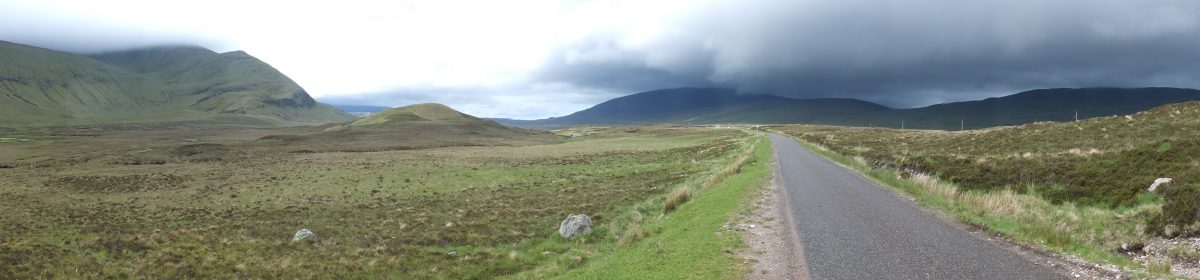
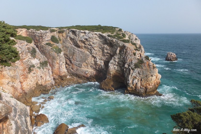
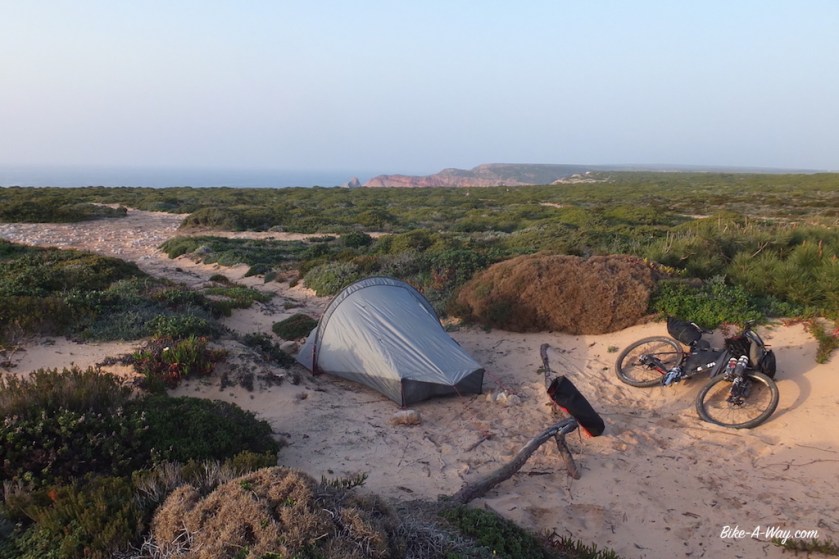
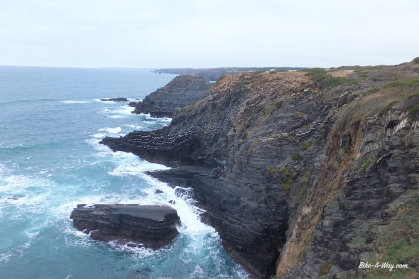
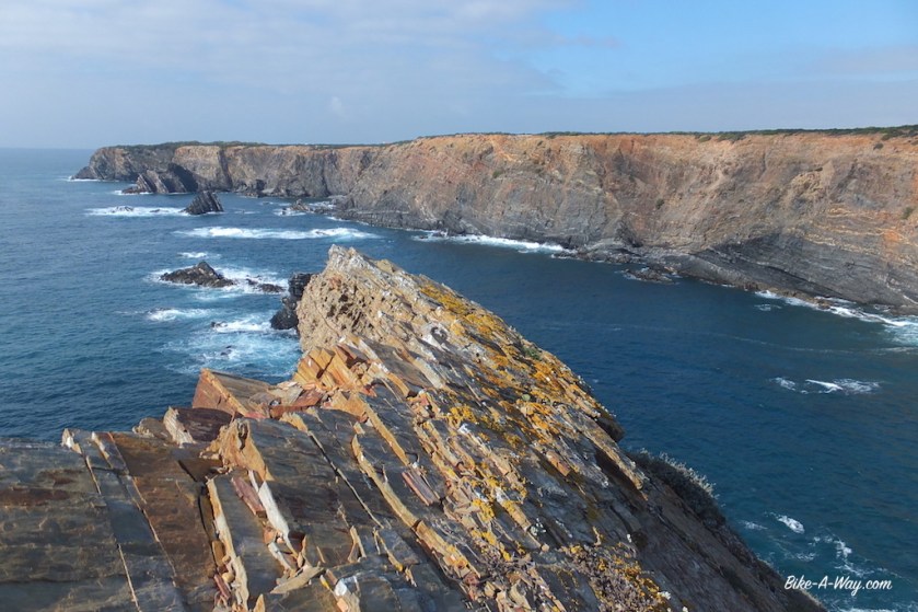
Leaving Lagos, I’m following mostly small paths (Via Algarviana) along the coast. Constant climbing and descending, but with fantastic views to the coast. When I see a beautiful camping spot on one off the cliffs, I throw the plan to cycle beyond Cabo Sao Vicente today over board and stop early to enjoy the place. Just below my spot the wild sea water has carved an arch in the rocks. I have a very good night rest with the sound of the braking waves and I don’t close the tent, so I can watch the stars.


Down at the next beach the following morning, ‘Praia do Barranco’, it’s full of hippies, making loud music, making a mess with empty bottles of alcohol, these would-be type of Jezus guys with only a loincloth, … ![]()
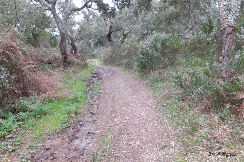
I start the next hike-a-bike section, a steep climb to the next cliffs.
Then the new chain brakes. I wasn’t even pushing really hard.
39 km, that’s what you do on a Sram chain. First and last time I bought this brand.
I had Shimano chains braking in the past, but that was after many thousands of kilometer. Not after 39 km.
Luckily, I’ve learned to carry my old chain for a couple of days, to see if the new one sits right, so no problem. But when I install the old Shimano chain back, the little pin on my chain braker, brakes.
NOW I have a problem.
Luckily I’m not too far from Laos yet, so my father can buy a new chain braker and bring it.


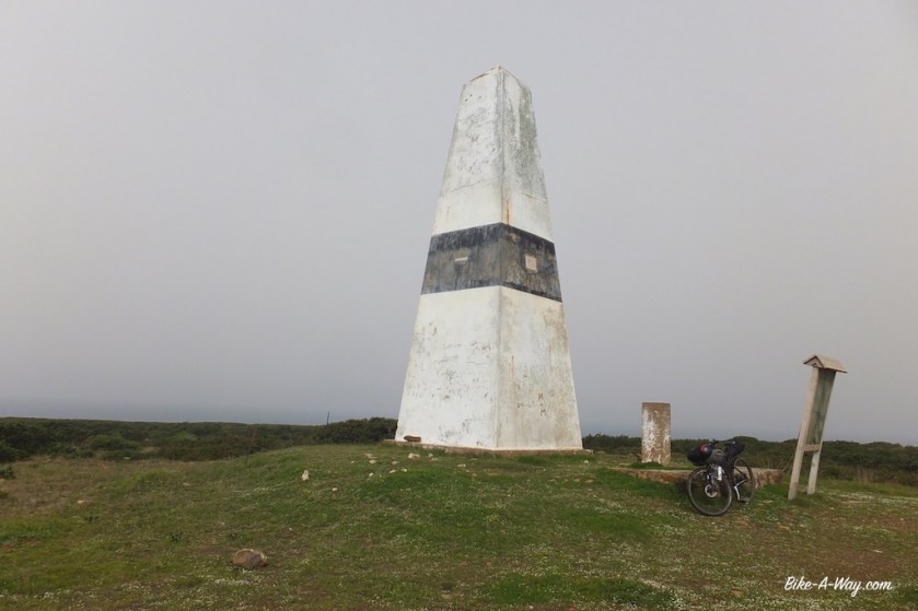
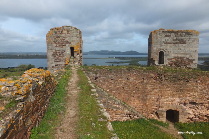
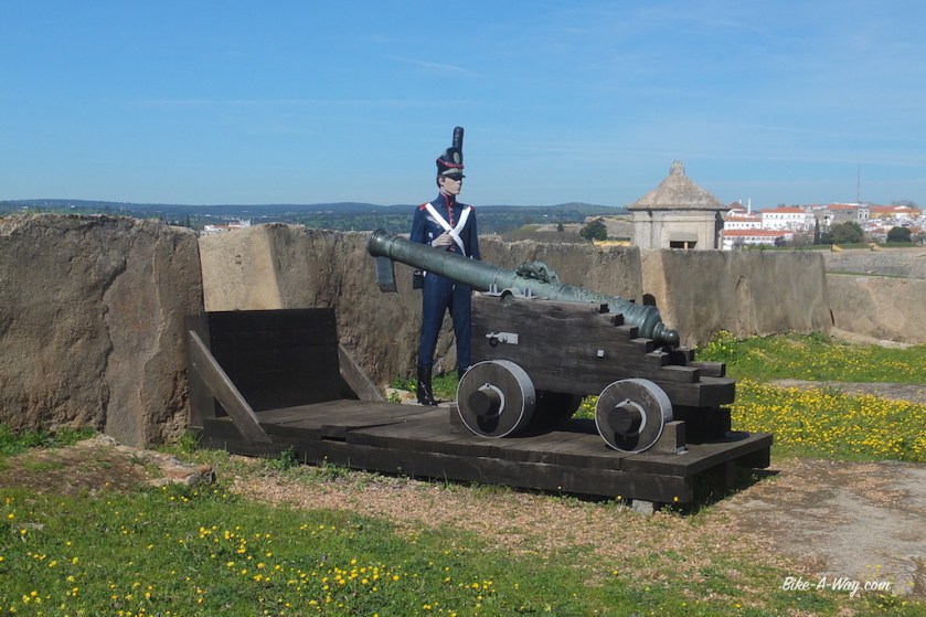
In Sagres, I visit the fort and the light house. You can take your bike inside the fort and cycle around (it’s a huge place).
Recommended.
There’s a whole history about Henry the Navigator over here.
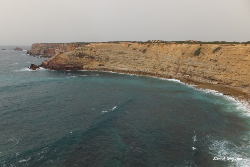
From the Sagres fort and light house, you can see the next place of interest, the Cabo Sa Vicente light house already.
It’s only a 6 km ride between the two light houses. In between, you can stop at the ‘Forte de Beliche’ to have a look.
Cabo Sao Vicente is the South Western most part of Portugal and the European continent (mainland).
In a way, you could say from here, I’m turning north, heading home again.
The little museum at the lighthouse is interesting if you like maps and old ships.
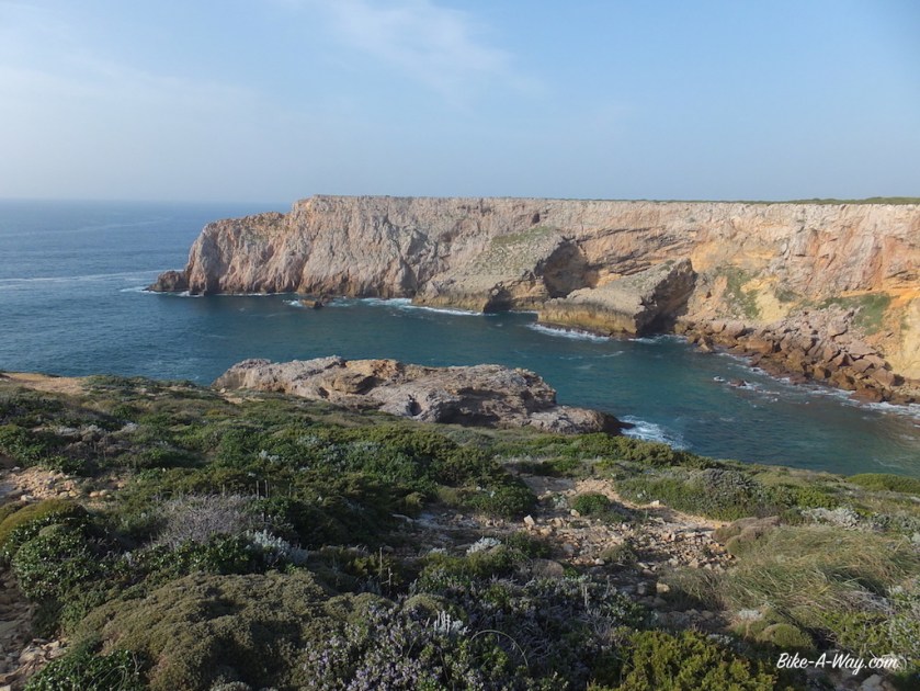
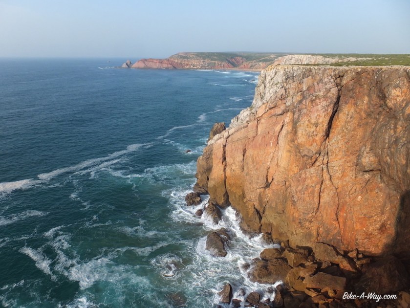
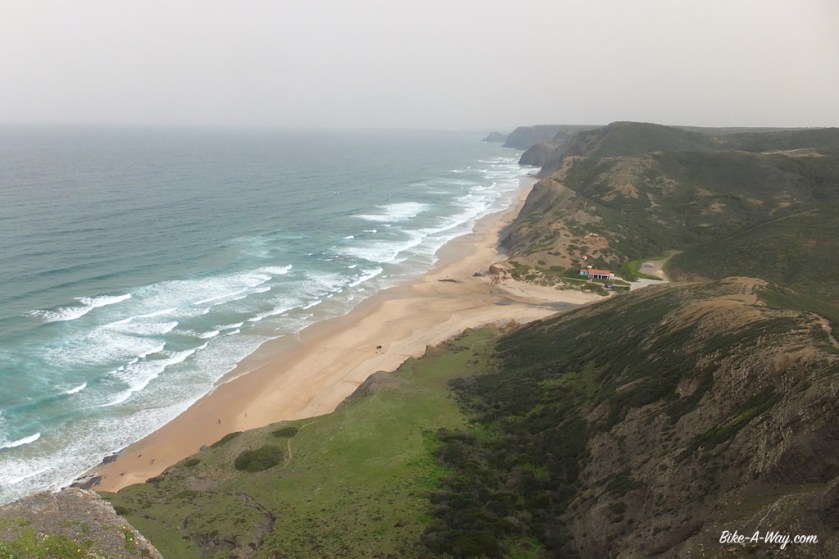
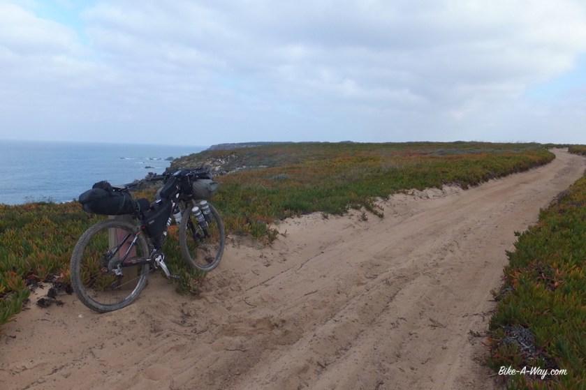
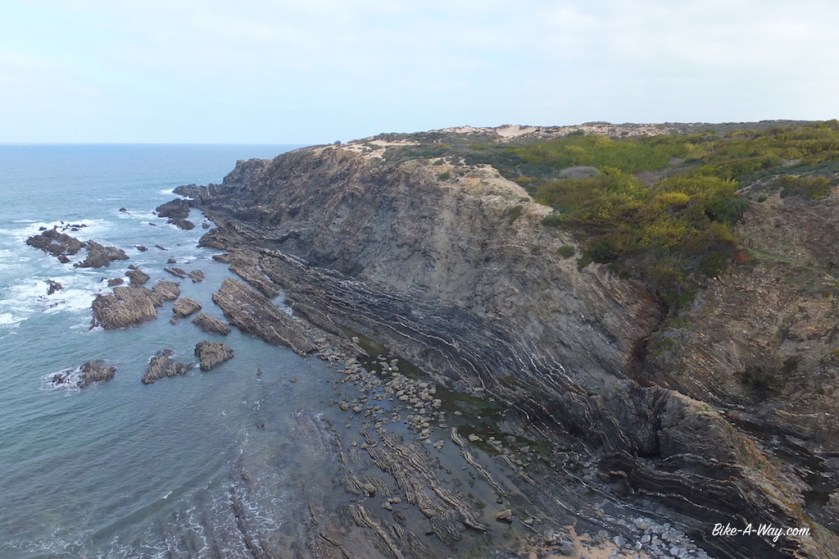
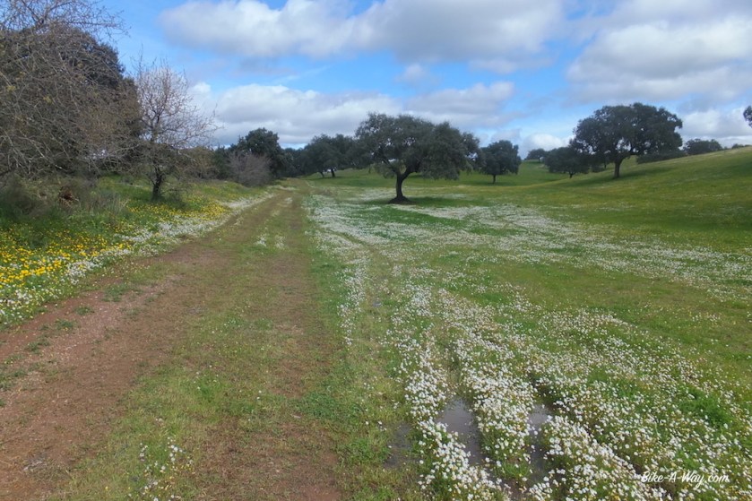
From Cabo Sao Vicente I follow the Rota Vicentina north along the Atlantic coast. This whole coast line is declared national park, Parqua Natural do Sudoeste Alentejano e Costa Vicentina (Vicentine Coast Natural Park). They claim it’s the best conserved coastal stretch in Europe. I guess they might have another opinion in Norway, but it sure is a magnificent piece of coastline.
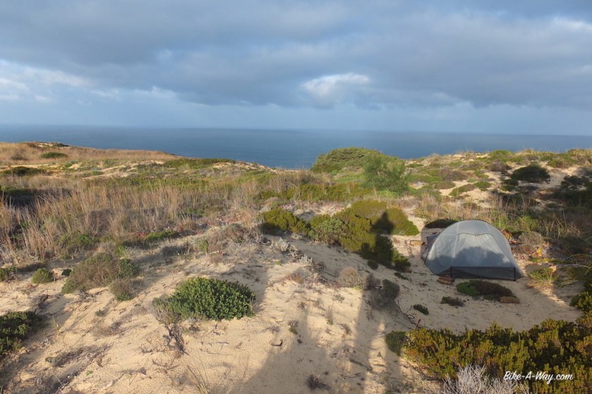
I pitch the tent 2 km north of the light house, near really spectacular cliffs, with the light of the light house in view all night.
This is a very spectacular part of Europe, and the Rota Vicentina a sometimes hard (steep), but rewarding way of seeing it. I’m not making big progress these days, but that’s not the intention either.
I have to climb constantly to about 150 meter, and go back to sea level. Not high, but it’s steep.
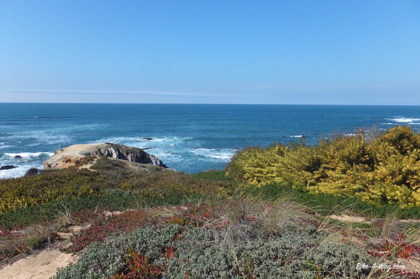
The view from ‘Miradou da Cordoama’ is yet another highlight. The next climb, from ‘Praia da Cordoama’, on a single track on a small ridge is heavy, but again, nothing compared to a climb a bit further on.


Near Carrapateira it get’s a bit more touristy, with wooden walk ways to the view points. The sights remain spectacular.
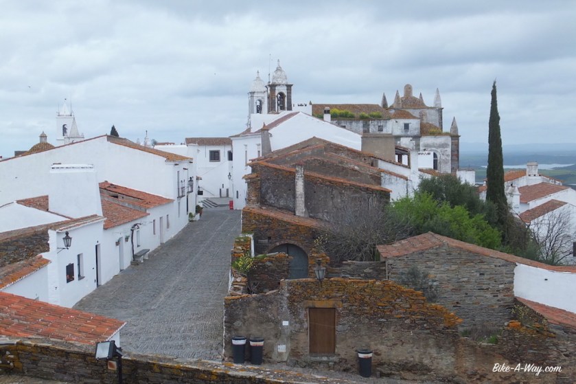
Aljezur is a good place to have a lunch, and a big supermarket, and a castle above the town. Inside the castle isn’t much to see. The view from below to the old castle walls up the hill is actually more spectacular.


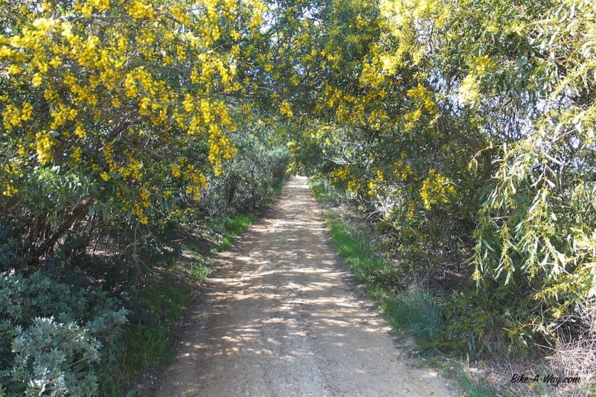
Beyond Aljezur, the Rota Vicentina follows an irrigation canal for a while, so the cycling is easy.
Near ‘Praia de Odeceixe’, I take a left turn, a bit south again on the fishermen’s trail to find another nice camping spot in the dunes on top of the cliffs.
In Odeceixe I cross the Seixe river, which forms the border between the Algarva and Alentejo regions.
I keep meandering to and from the coast the next days, making little progress, but enjoying all the more. Zambujeira do Mar, Cabo Sardão, Almograve and up to Porto Covo, passing one beautiful beach after the other, separated by cliffs that are competing to be the most spectacular one.
This coastal stretch is definitely a highlight of the tour so far.


In Porto Covo I pitch my tent on the campground. It’s my first campground since the Netherlands in September last year 🙂
Here I’m leaving the coast and follow the Rota Vicentina inland towards the Morgavel Reservoir.
When I was making my route, I couldn’t choose whether to cycle along the Portugese south coast or cycle the ‘Transportugal’ route, so I ‘m trying to take the best of both and cycle a bit southeast again, to pick up the Transportugal route now near ‘Ourique’, from where it’s back in a northerly direction.


Pretty soon though, what I feared became true.
The Transportugal race is ridden every year, but I could only find a gps track of more then 10 years old.
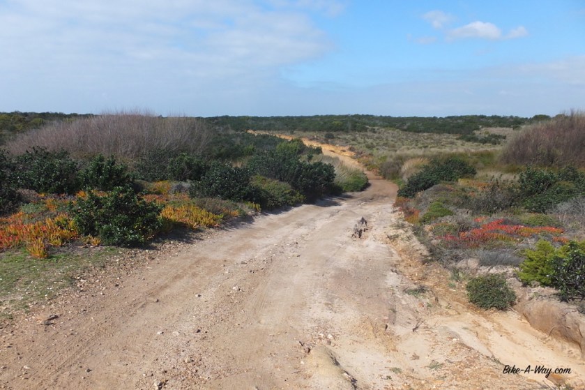
Many dirt roads were fenced off and I had to go to the paved roads from time to time.
That’s where you’ll meet the Portugese drivers. The difference between Portugese and Spanish drivers is like day and night.
Unbelievable how the mentality can be so different in neighboring countries.
Almost all Spanish drivers will patiently sit behind you until it’s safe to overtake you, and when they do, they will give you lots and lots of space.
In Portugal, it’s completely the other way around. They are passing you just before curves, giving as little space as possible, pushing you off the road if needed, and driving fast. And that’s not the exception, it’s the vast majority and unfortunately they are among the most incompetent drivers of the continent.


Luckily, I’m still a lot on the dirt tracks, with beautiful scenery.
Like in Spain, dogs are a nuisance in Portugal. Unlike Spain, many of them run free in Portugal. At one of these dirt tracks, I suddenly had 5 of these huge monsters attacking me. 4 of them came to my left, one of them went around, to my right side.
I thought it would be wise to deal with the one on my right first, so he wouldn’t get any funny ideas. Throwing a few stones didn’t make him run away, but he was thinking twice at least. Same thing to the aggressive monsters on my left.


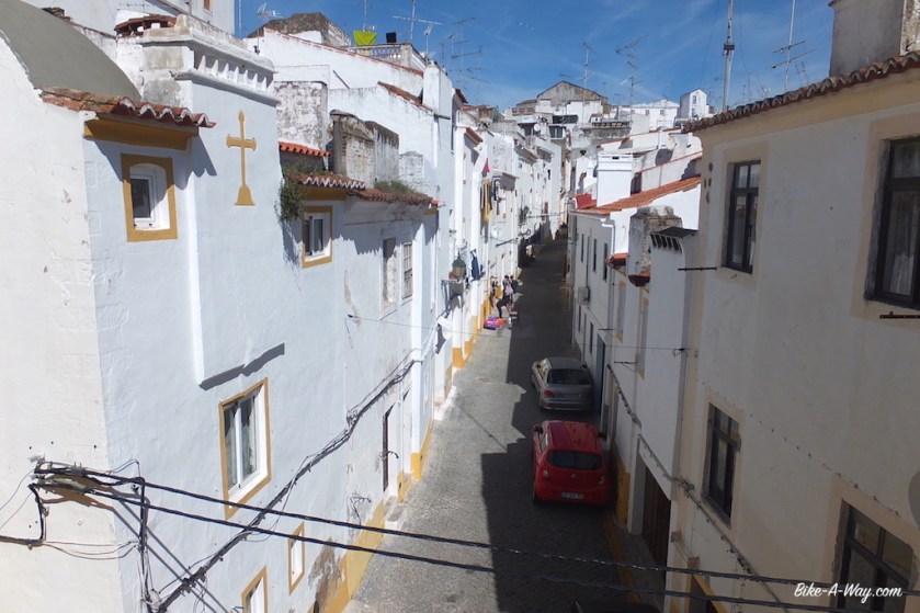
A bit west of Serpa I cross the Guadiana river again. The wind is so strong it almost blows you off the bridge. The weather has deteriorated and I take a room in the ‘Residencial Serpinia’ in Serpa.
Good room, great breakfast, very friendly reception. The town is worth the small detour.


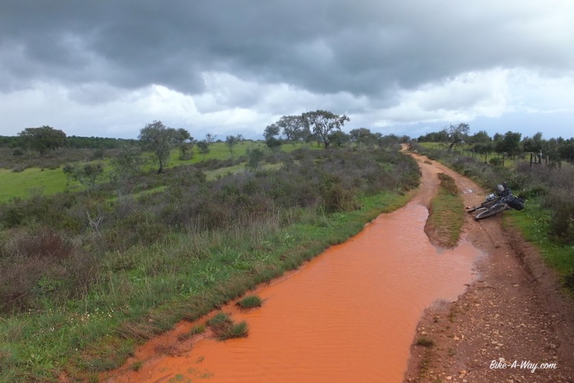
After Moura, my route goes to the river Ardila. Near the village Santo Amador, I’m supposed to wade through the river. This might be possible at certain times of the year, but definitely not today. It’s a deep river with a strong current. I find a nice place to camp near the river. The detour towards the next bridge is for tomorrow.


The Portugese made one of the largest dams of Western Europe in the Guadiana river creating an artificial lake of 250 square kilometers. Wikipedia learns you the dam was completed in 2002 and its reservoir reached the full level, for the first time, in 2010 only.

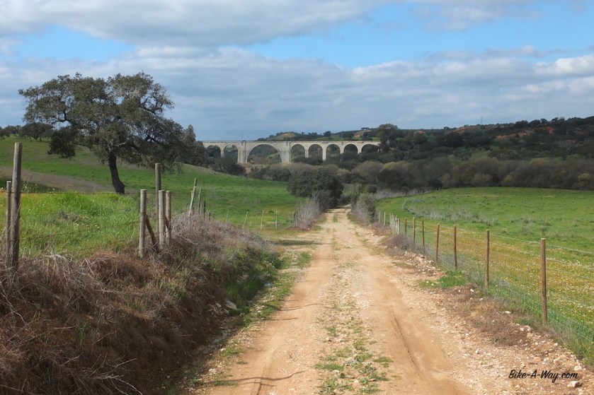
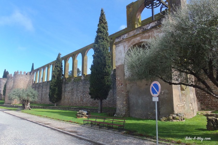
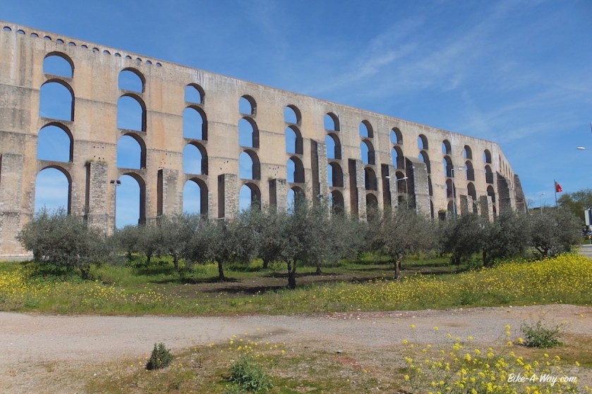
Other interesting places I visited on my way north were Monsaraz (steep climb to get there !), Juromenha (nice castle) and especially Elvas (gigantic aquaduct).
From Elvas, I drove back into Spain for a loop of Extremadura region.


South-Portugal:
Distance: 693 km
Average km per cycling day: 43,31 km (I went slooow along the coast 🙂 )
Altimeter: 9241 m
Nights slept inside: 1
Nights slept outside: 15 (of which 14 wild camping)
Flat tires: 1
Broken chain: 1
My gps track can be downloaded from Wikiloc
.
