Australia Prt 4, Tasmania: Hobart to Llandaf

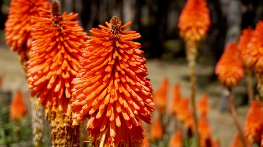
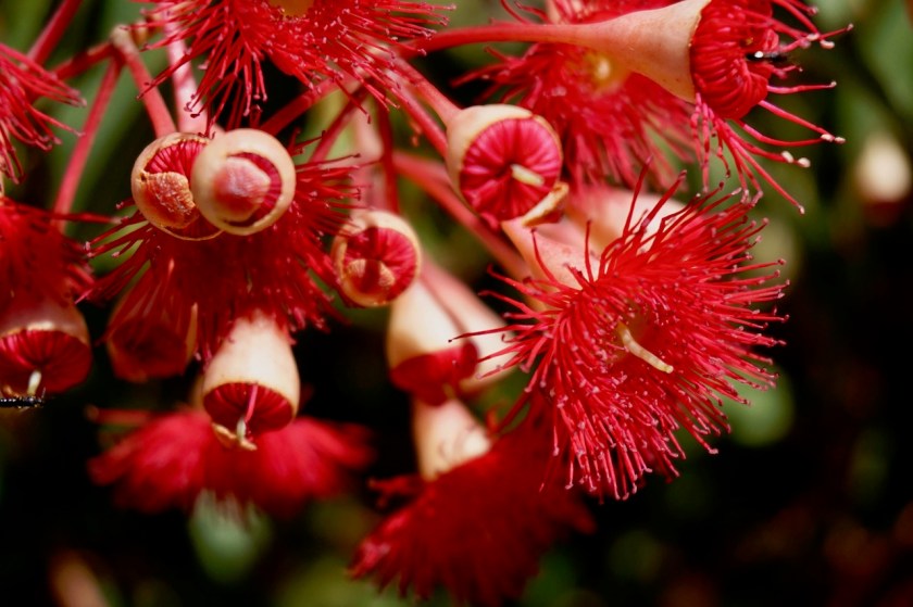
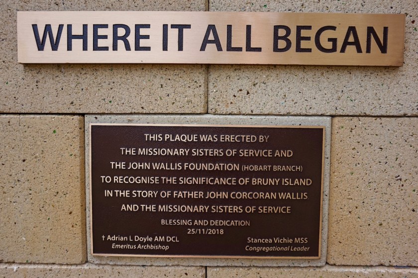
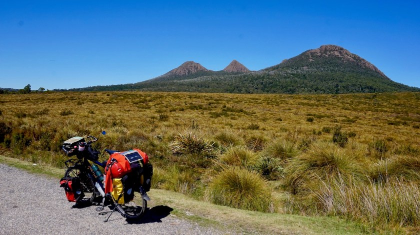
Route: Hobart – Bellerive – Sorell – Nugent – Maria Island – Buckland – Stonehenge – Honey Suckle Road – Llandaff

Day 28: 7 March 2019
From Kettering to Hobart
45,19 km (Total so far: 1034,22 km) – Altitude climbed: 782 m
Weather: Sunny, medium head wind

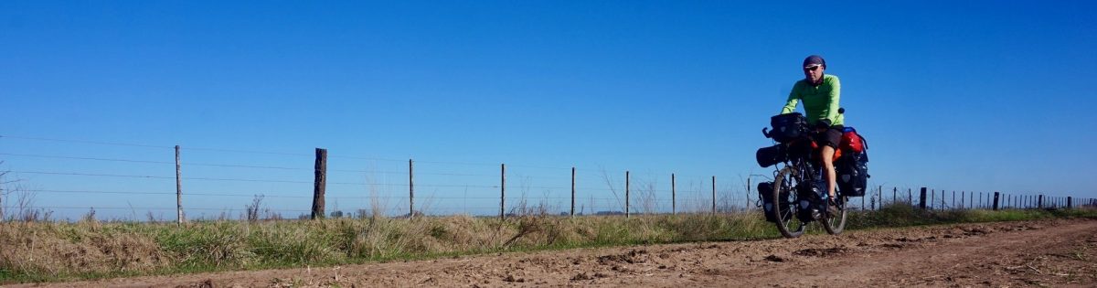
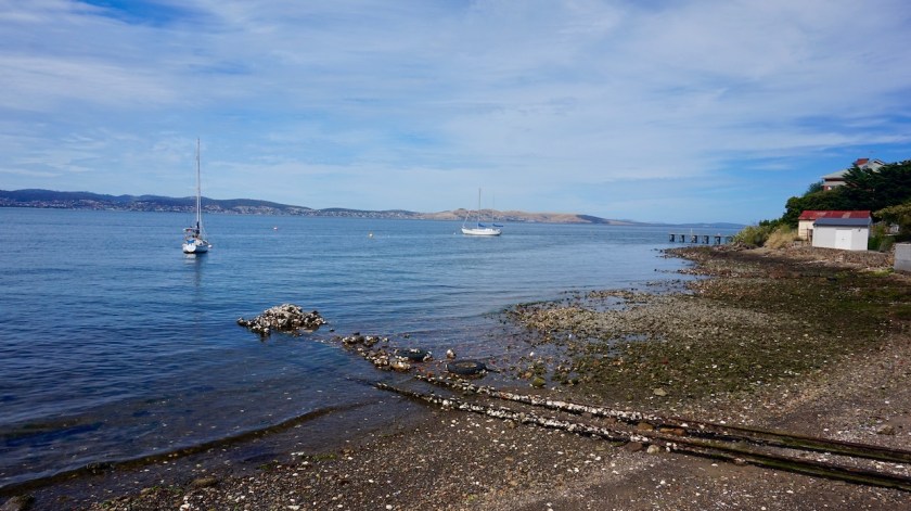
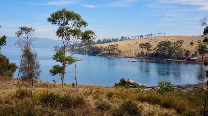
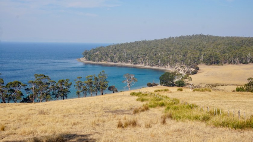
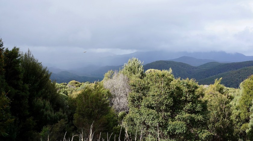
Today was mainly riding back to Hobart the same way as I rode towards Bruny Island a week ago. To avoid a bit more busy roads, I made the detour over the hill towards mConingham. Beautiful and on a good gravel road. Excellent views towards Bruny Island a few times.
I stopped at the Bunnings store in Kingston to buy a new bottle of Shellite (white gas) for my stove.

DSC05139

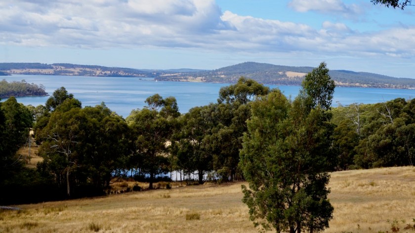
In Hobart I visited the well stocked and friendly map shop on Elizabeth Street and went to have a look in a few of the outdoor stores. In the evening I was hosted by Nico And Mykal who live on the edge of Hobart, already on the slopes towards Mount Wellington with excellent views towards that mountain.
We had a nice chat and a tasty dinner and a night rest indoors.

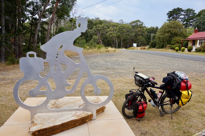
Day 29: 8 March 2019
From Hobart to Wattle Hill
58,54 km (Total so far: 1092,76 km) – Altitude climbed: 632 m
Weather: Sunny, cloudy, medium tail & side wind

My initial route for leaving Hobart was via the Bowen Bridge towards Richmond, avoiding the busy A3 Tasman Highway. After discussing this with Mykal yesterday, I changed my mind. He pointed out that my preferred option would still be a rather busy road, no shoulder and winding through the hills.

Instead, I crossed the Derwent River via the Tasman Highway Bridge. This bridge has a very narrow side track, separated from the traffic for pedestrians and cyclists. The high winds, and the climb up the bridge didn’t make it easier. Why can’t they make this lane 50 centimeter wider ?
Would the bridge then become unaffordable ?

DSC05153
What were they thinking ??

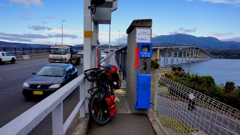
Once on the other side, it all becomes good though.
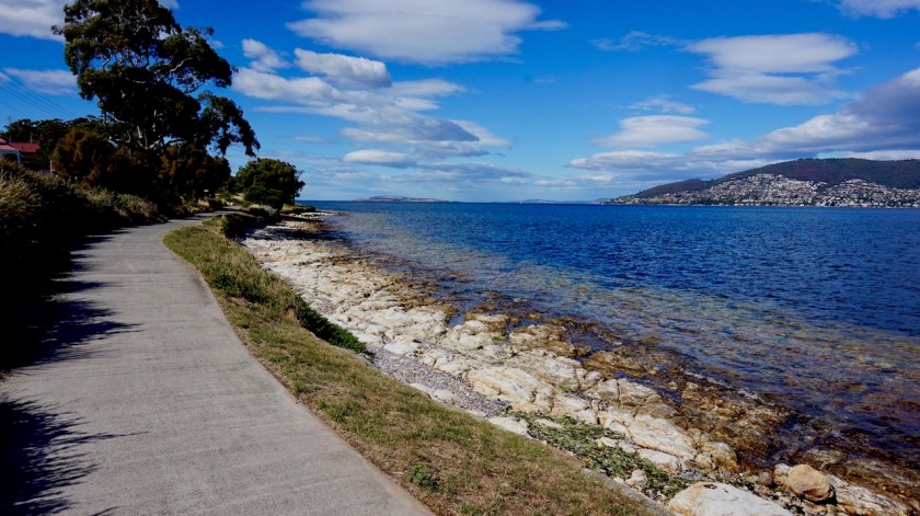
A bike path skirting the seaside. Brilliant views back to Hobart, the northern tip of Bruny Island where I was cycling a couple of days ago and to the peninsula south of Lauderdale.
Via Garmin Basecamp I created a track yesterday evening that turned out to be excellent.
In Bellerive I learned from a sign the big Tasman bridge collapsed in 1975. Several people died. A local who was walking his dog told me a ship crashed into the bridge.
I got to talk to another Tasmanian in front of the big Eastlands Shopping Centre and have an invitation for a stopover in case I would pass his house further on the East Coast.
I explained to him I was planning to take the C301 road towards Avoca.”That’s a very rough dirt road”, he said. He looked me deep in the eyes, “you surely don’t want to ride that kind of road on your bike, do you ?”
“That’s exactly what I want”, I thought, but obediently, I lowered my eyes and answered “No Sir.”

DSC05156
The Tasman Bridge over the Derwent River, Mount Wellington in the background.

From a sign along the bike path, I learn Charles Darwin was here as well, I think it was 1835.
Leaving Bellerive and Kangaroo Bay the bike path meanders along the coast.
In the grass next to the bike path I spot a couple of Galahs. This Grey and red cockatoos with a small white cap on their head are one of the most widespread Australian birds.

DSC05163

DSC05171

From Howrah I cut through the small park towards the bike path along the B33 Rokeby Road. Less scenic, traffic noise, but an excellent, separate bike path. After Rokeby follows the only bad stretch, a few kilometer on the busy B33 and later the C330 Acton Road. After about three kilometer on this C330 I spot a sandy hiking / mtb trail going left towards Acton Park. I take this one. It makes a few steeper inclines, but I’m alone, in the nature, no cars, so all is perfect.
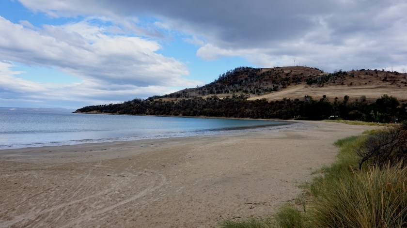
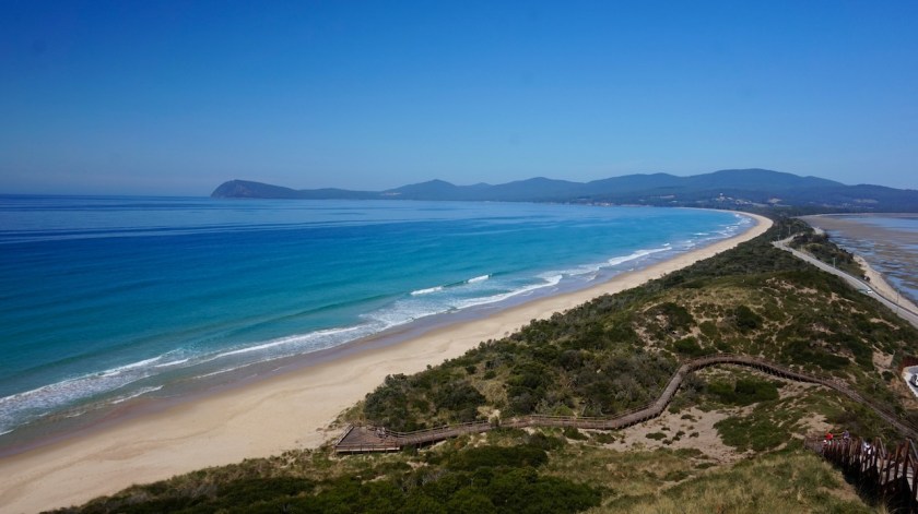
Some more sandy bike paths and I arrive at Seven Mile Beach which is almost deserted. It’s a beautiful stretch of beach where I take a small rest and eat a snack.

DSC05173
The corner of Seven Mile Beach

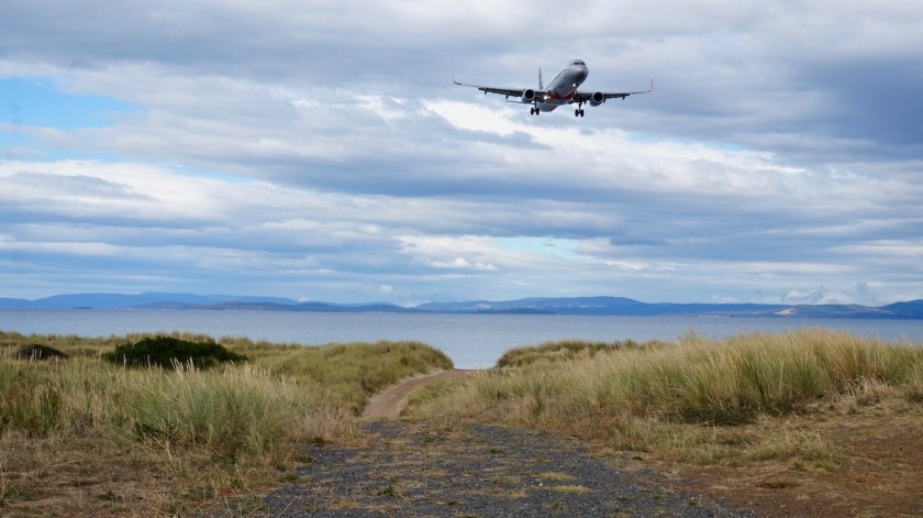
My route continues via the back side of the airport on a road that’s blocked for cars. Airport on one side, the dunes and the beach on the other side.

DSC05177

Eventually I have to go back towards the Tasman Highway. Exact one kilometer on a good shoulder, then there is again a separate bike path to cross the Pitt Water. After Midway Point, the bike path is at the other side of the bridge.

Sorell is a busy town at the junction of the A3 and A9 highways. Tony, a cyclist from Lauderdale stops me to have a chat. The sky is getting more and more grey and after a Big Mac Meal in the Mac Donalds (sorry), I hurry into the hills.
I had two options after Sorrel: one along the coast via Dodges Ferry, but that option required a longer stretch along the super busy A9, and I didn’t know how much of that traffic would choose the coastal option. So one kilometer after Sorell, I took the option into the hills towards Nugent.
All land seemed to be fenced for sheep farming.
At Wattle Hill I saw an open fence, a hill, some trees and more open land. Perfect place for the night.

Day 30: 9 March 2019
Wattle Hill
Rest Day
Weather: Cloudy, light rain

A cloudy day, drizzle, rain, some dry periods.
Didn’t feel like riding in that so stayed in the tent, reading and sleeping.
Made a pasta with mushrooms, onions, peppers and tomatoes.

Day 31: 10 March 2019
From Wattle Hill to Spring Beach
47,08 km (Total so far: 1139,84 km) – Altitude climbed: 1079 m
Weather: Sunny, cloudy, medium head wind

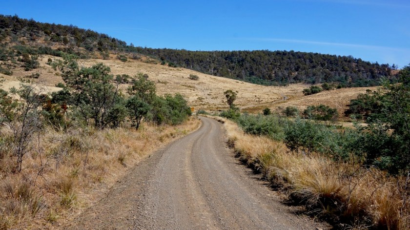
Almost immediately the paved road turns into gravel and would stay like that for most of the day. Some steeper inclines are sealed for a few hundred meters.
The first hill goes to an altitude of 375 meters, sometimes up to 11 or 12%. In Nugent I have the choice to take the C335 towards Kellervie, or the Mill Road.
I’m not sure whether the latter will cut through all the way towards the Wielangta Road. The Garmin map shows a thin red line, which is often over private land.

DSC05184

DSC05185

I stop a car in Nugent and the lady tells me there’s a boom gate, but I should be able to cross through the forest.
A sign at the beginning of Mill Road claims it’s a ‘no through road’, but I trust the lady’s advise and continue.
There’s a steep descent into the next valley, so I hope I don’t have to retrace my steps later on.
At the border of the Wielangta Forest is indeed a (closed) beam, which I can pass easily.
Behind the beam a soft tracks, sometimes on the muddy side from yesterdays rain.
No recent tracks.
Good.
Time for a Podcast.
Episode 37, ‘Tango d’Amore’ from the brilliant ‘Mij Gedacht’ Podcast.
A three hour episode.
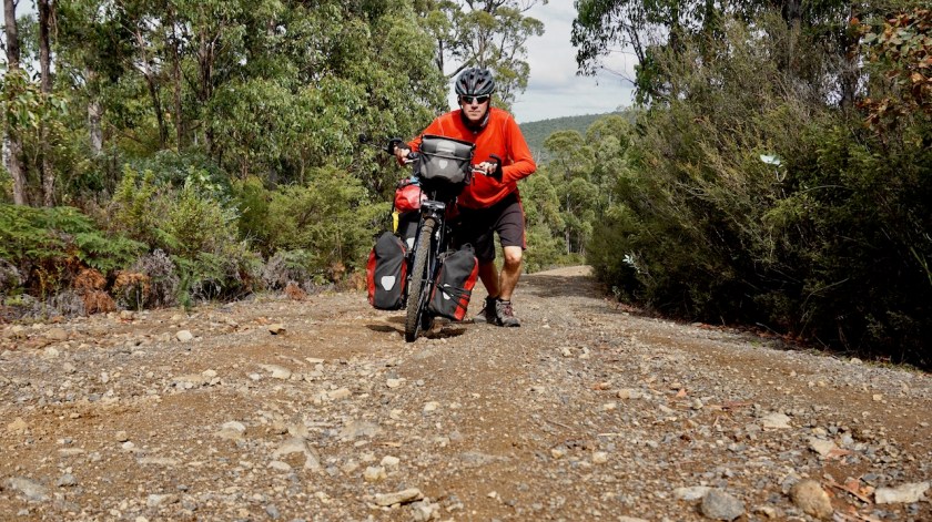
The track becomes stony at times, steep, up to 14%.
Pushing the bike.
No worries, I’m on a deserted track, laughing out loud regularly with the podcast and although progress is slow, I’m having a blast.

DSC05192

DSC05194

At the Wielangta Road there’s some traffic but not much.
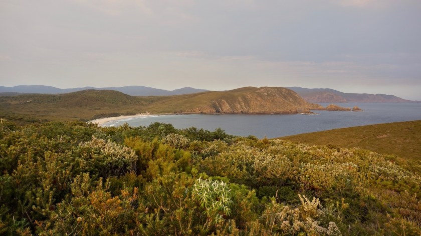
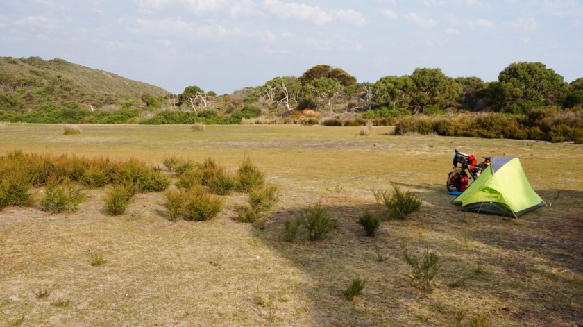
I turn right towards Rheban with its beautiful beach. About ten people here during this long weekend.
I consider pitching the tent at the far end of the beach but decide against it. I want to be on an early boat towards Maria Island tomorrow.
I end up pitching the tent at some land that’s for sale with some roughly cleared tracks. Mosquito infested.
Just after finishing my curry-couscous with broccoli, peppers, carrots and onions, it starts raining.
Good, I love the sound of light rain on the tent to fall asleep.

DSC05204

DSC05206

DSC05213
The cliffs near Spring Beach

Day 32: 11 March 2019
From Spring Beach to Encampment Cove, Maria Island
29,56 km (Total so far: 1169,40 km) – Altitude climbed: 325 m
Weather: Sunny, medium head & tail wind

DSC05217

I first stopped at the sanitary buildings in Spring Beach to wash out yesterdays cycling clothes.
No shops in Spring Beach but Orford, a bit further on had an Iga supermarket.
From Orford I had to cycle seven kilometer on the Tasman Highway. It’s beyond my comprehension some people cycle this way all around the east coast. Way too much traffic to be any fun.
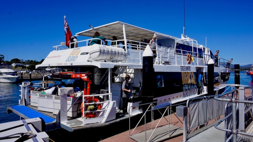
Triabunna is the village from where the ferry to Maria Island leaves.
Maria Island used to be a convict center back in the 19th century.
The whole island is national park now. I have the national park pass, but there’s still a hefty fee to get to the island. 75 Dollar in my case (45 for me, 10 for the bike and 20 for the luggage).
For that amount, you can travel 12,5 times to Bruny Island.
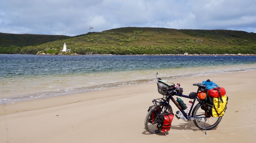
It’s just a half our passage with the fast boat crossing the Mercury Passage to Darlington, the old convict centre on Maria Island.

DSC05219
The fast ferry to Maria Island.
DSC05226
Australia’s maritime flag is red i.o. blue.

DSC05229

It was busy with people (last day of the long weekend), so I’ll visit this convict probation station from 1825 on my way back.
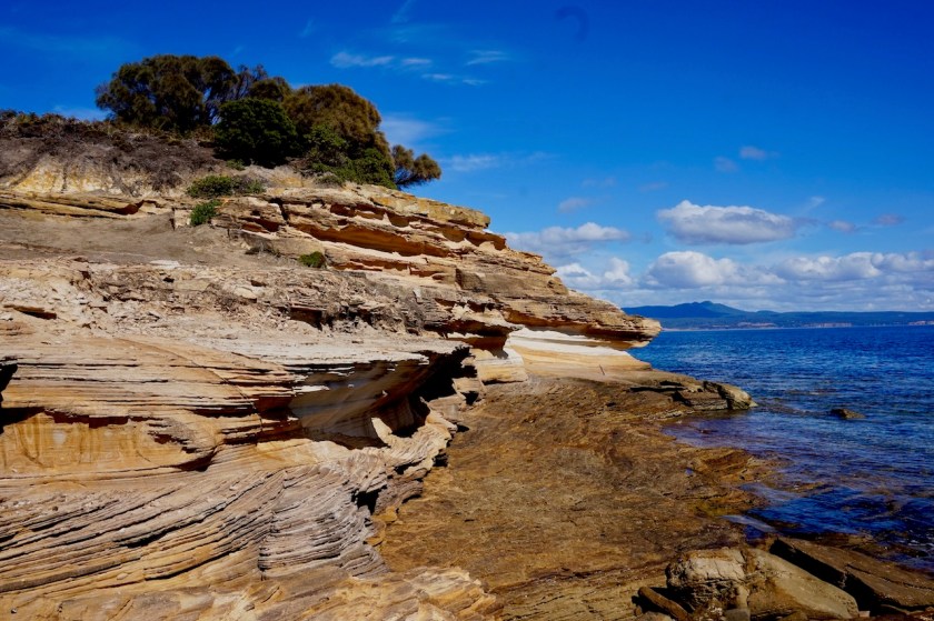
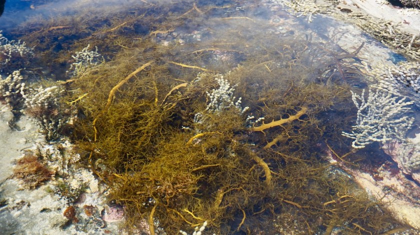
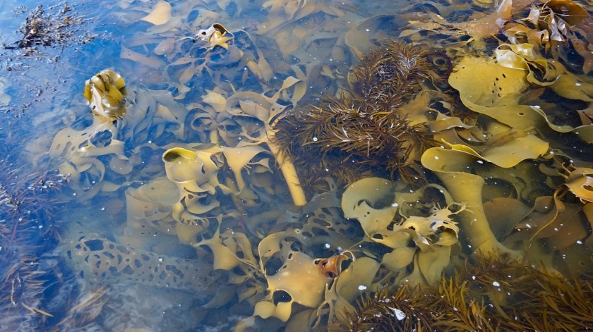
From the crystal blue waters of Darlington bay, I cycled over the small hill, passing the Ruby Hunts Cottage towards Hopeground Beach, again with this bright azur blue waters.
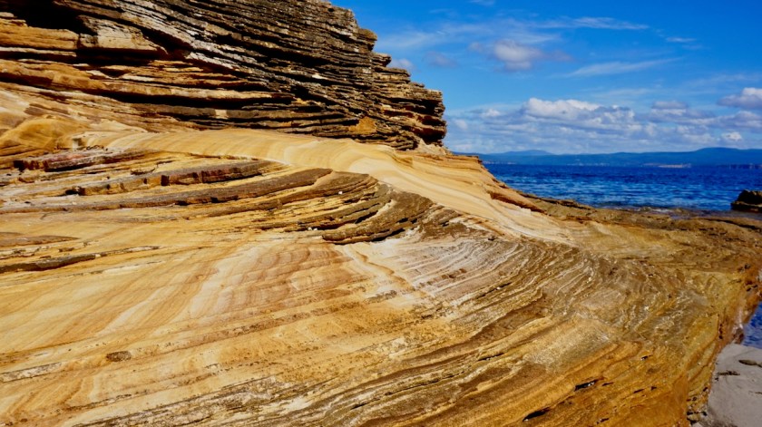
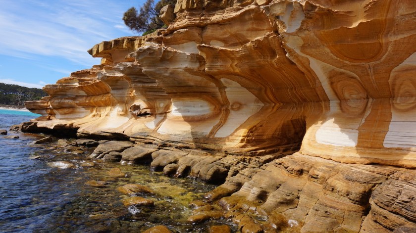
Due to the high tide, there wasn’t much to see of the painted cliffs.

DSC05237

DSC05242

DSC05250

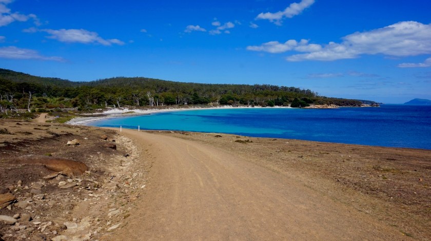
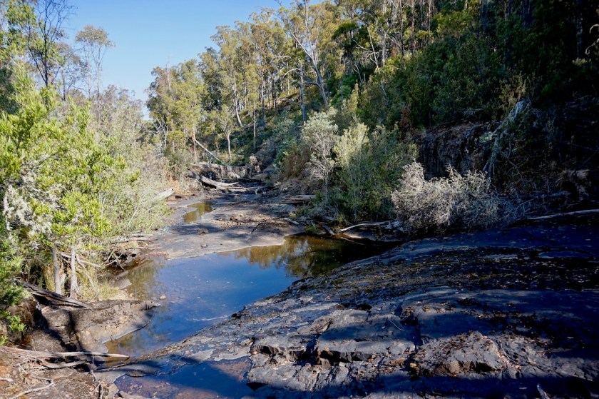
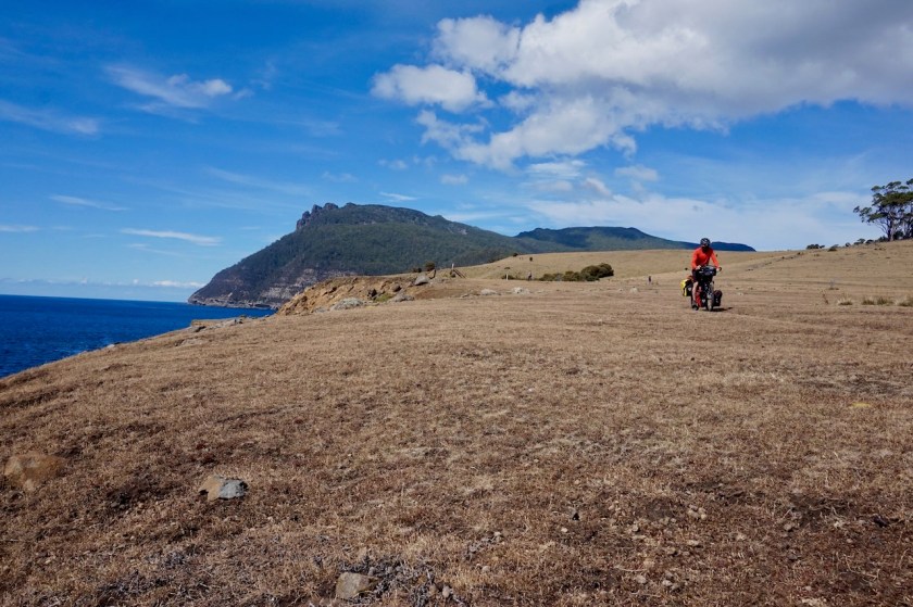
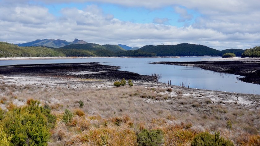
Maria Island is an almost car free island. Just a few cars from the park rangers ride around. The dirt track stays close to the coast with spectacular views towards the Mercury Passage and Tasmania’s mainland behind.

A sandy track leads to Return Point, definitely worth the visit and, again, a nice beach (no people) and clear waters.
I pitch the tent at encampment Cove.
The place is teaming with wombats, a few kangaroos and at night way too many possums that try to eat through my panniers (those without food inside). So I take everything in the tent but it becomes an almost sleeples night as they keep hanging around the tent.
I also hear a few Tasmanian Devils in the bushes behind my tent.

DSC05270

DSC05291
Wombat. Those on Maria Island have longer hair and are a bit lighter in color as their family on the main land.
DSC05294
Mount Maria in the background.

Day 33: 12 March 2019
From Encampment Cove to French’s Farm (Maria Island)
20,64 km (Total so far: 1190,04 km) – Altitude climbed: 189 m
Weather: Sunny, in the evening heavy storm with rain and hail

The day started a bit rainy but by 10 o’clock the sun came out. I first made the loop towards Point Lesueur and the convict houses. Very tiny, windowless structures at a stunning location.

DSC05319
Bennett Wallaby
DSC05329
Tasmania’s main land in the background

Like Bruny Island, Maria Island has its isthmus, the McRaies Isthmus, with on one side Shoal Bay and the other side Riedle Bay.
Unlike Bruny Island, there’s no sealed road on the isthmus.
I read it is forbidden to push or ride your bike over the beach, but a girl and a couple said the park ranger recommended them to take the beach, because the sand was hard packed.
I followed them.
Wrong decision.
The beach is several kilometer long and it was very hard work to push the heavy bike over it.

DSC05348
Pushing the bike along the McRaies Isthmus

At the end I had to choose, going to Robeys Farm, or to Haunted Bay.
I choose Robeys Farm (the easier of the two).
It’s nothing special and I recommend just visiting the beaches of the isthmus, or maybe go to Haunted Bay (where you can maybe see seals ??).
On the way back, I took the sandy track over the isthmus, which is still unrideable in many places, but much easier than the beach.

Isthmus
I didn’t climb Mount Maria to have a view of the isthmus, so this is a picture I took from the internet from the discover Tasmania website, just to give you an idea.

After the misery with the possums last night, I pitched my tent at the old French’s Farm tonight. Right behind the old farm house, so I was protected for the wind which was predicted to be at a force 9 again tonight.
That turned out to be only for half an hour, but with very hard rain and a lot of hail.
All without damage to the tent.

IMG_20190312_181047861_HDR

With all the pushing over the beach and the sandy track, I can proudly say my average speed of today was 6,58 km/hr.

Day 34: 13 March 2019
From Frenchman’s Camp, Maria Island to Triabunna
22,00 km (Total so far: 1212,04 km) – Altitude climbed: 373 m
Weather: Sunny

From the isthmus back to Darlington, one can choose between the ‘inland route’ and the ‘coastal route’. I took the coastal route again. Hardly any people this time around near the painted cliffs. They are magnificent, but would be even better when the sun would be at it, so I would return later in the day.

DSC05371

Thus, rode further on to Darlington where I took a right turn and the short ride through Brickfields Valley towards Fossil Bay. The views to the cliffs and ‘Bishop and Clerk’, the islands’ second highest mountain are very beautiful.
From the Fossil Cliffs, it’s down towards the ‘Fossil Quarry’, a place where they used to dig to make cement.
Over here, you don’t have to search for fossils between the rocks, but literally you have to search for rock between the fossils. Millions of years old, all on top of each other.

DSC05434
Bishop and Clerk Hill.
DSC05456
Lunch break with a view to Schouten Island (not in the picture)

DSC05461

I completed the loop back towards Darlington and rode back to the painted cliffs in full sunshine now.

DSC05380

DSC05391

DSC05414

DSC05425

DSC05485

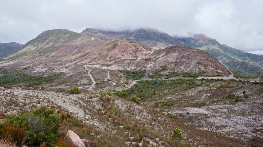
I had a chat with one of the park rangers, who discouraged me of riding via the small roads to Ross in the next days. “It’s all gravel roads and nothing to see there. And dangerous because there are no signposts on these roads and you could get lost and….”
He also had interesting things to tell me, about the Tasmanian Devil program. They brought 15 or 16 healthy devils to the island and they seem to do well. They eat possums.
Good.
This population can save the species of extinction on Tasmania, where most of the animals suffer from the facial tumors, and if not they get killed by cars.
I asked whether there are snakes on Maria Island, and apparently they have three kinds. The most common being the Tiger Snake, which I have seen several times in Tasmania and also on Bruny Island.

A quick further investigation of the buildings of Darlington, and than the 5 o’clock boat back to Triabunna, where one can camp behind the hotel, provided you donate a gold coin which is used to support the local firefighters or another cause, and have a beer in the bar.
I had two beers, but stayed one night only nevertheless. Alarms going off three times at night, loud people, slamming doors and trunks, squeezed between camper vans and having to pitch the tent on a field of brown grass (urine, urine, urine)…. it all doesn’t make me too happy.
Back to ‘the wild’ tomorrow.
Whilst in the pub, I booked my return journey from Devonport to Melbourne. On 28 March I will sail with the night boat. That means I have to hurry up a bit, because there’s still quite a long way to ride and I want to fit in Freycinet National Park

Day 35: 14 March 2019
From Triabunna to Murderers Tier
70,81 km (Total so far: 1282,85 km) – Altitude climbed: 1000 m
Weather: Sunny, Medium head wind

Although I don’t like to stay in these kind of places where I camped last night, my neighbors were too kind to me.
From a Dutch family I got a big cone bag (puntzak) of fries and some mayonnaise they brought from home (is that allowed ??).
This morning, my German neighbors invited me for a coffee and a nice chat.
That, combined with re-arranging my bags, packing, shopping, charging my telephone in the tourist info, resulted in a late start.
And I have this intention to ride bigger distances to make it in time to Devonport.
The lady in the tourist information advised against taking my planned route for three reasons:
– I may get lost ‘in there’.
– It could be dangerous
– There’s nothing to see out there

But I stubbornly do what I want 😉

DSC05514
Maria Island in the background

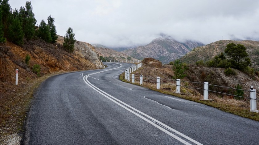
I have to ride 25 kilometer back towards Buckland over the Tasman Highway.
It is terrible.
Four times I have cars or camper vans coming really close to me.
Another time a car passes me while a small truck was coming from the other side (the famous three seconds they don’t have to spare to slow down). The truck has to go so far to the side he touches the metal barriers next to the Ross River, he starts swaying left to ride.. all ends well (except for his damage).
Twenty five nerve wrecking kilometer later, I’m in Buckland.
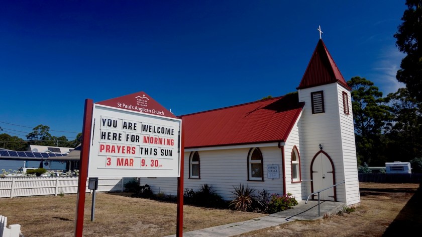
A ‘historical’ church (not historical for European standards), a roadhouse and a park where I wash a shirt and have lunch. I’m joined by another cyclist who called it a day already and pitched his tent behind the pub.
It’s been five years he’s cycling Tasmania already, every time for five months, but he doesn’t seem to leave the highways too much it seems.

DSC05520

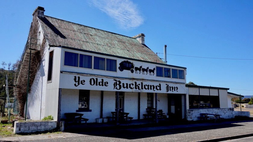
My good times begin in Buckland again.
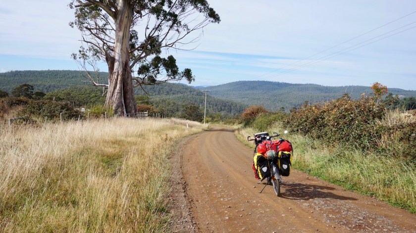
The road is still sealed for the first fifteen kilometer or so.
Maybe five cars pass me, instead of the 250 cars per hour on the highway. The road climbs steadily into the Driscolls Hills. Sometimes a bit steeper, but mostly gently.
After the road turns into gravel, all traffic disappears and I would see less than a handfull of cars in the next hours.
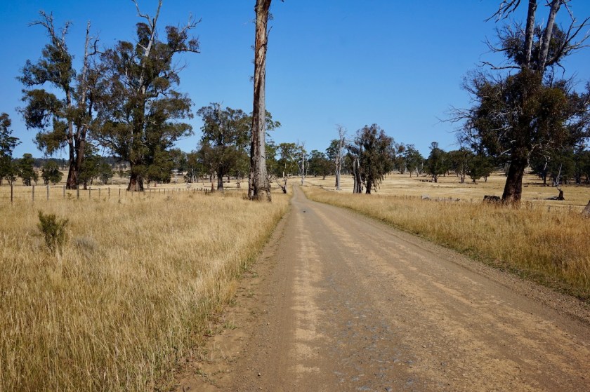
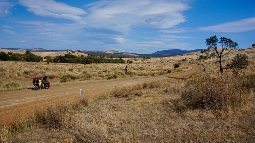
I planned to follow the C318 towards Whitefoord, but the Tin Pot Marsh Road, which is cutting about fifteen kilometer from the route, is good enough, so I follow that one along the Sawpit Tier hills towards Stonehenge.

DSC05527
Some people call this ‘nothing’. Me; I like nothing 😀

I sometimes ride through forest, but most of the times it’s fields with sheep. All land is fanatically fenced of end I end up pitching my tent in front of the gate of one of the fields.
No cars pass anymore today.
It does cool down, to 4 degrees over night.
Good temperature to sleep 🙂

DSC05536

Day 36: 15 March 2019
From near Murderers Tiers to 20 km into Honey Suckle Road
65,22 km (Total so far: 1348,07 km) – Altitude climbed: 1202 m
Weather: Sunny, moderate wind from all directions

Apartheid rules in Tasmania !
Today, I saw fields with strict separation.
Fields with exclusively brown cows, other fields with exclusively black cows.
And there’s not only separation based on colors, also on the sexes.
On different occasions, I saw fields with only rams.

My cycling day was fan-tas-tic !
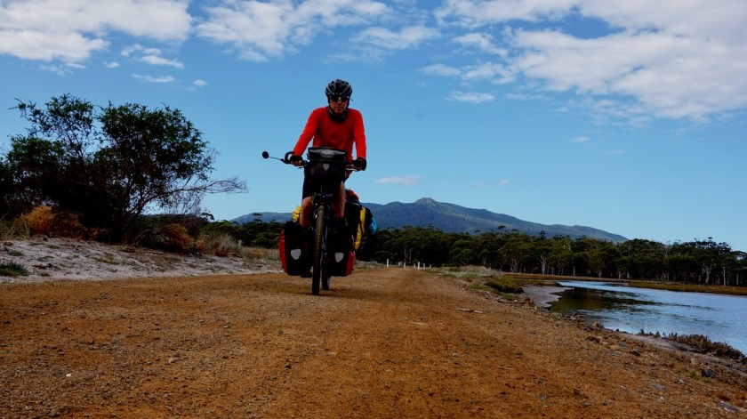
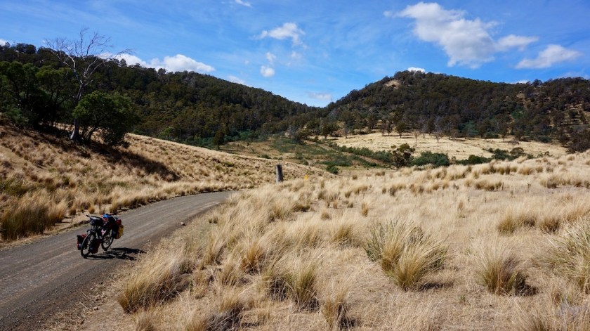
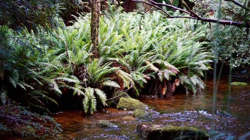
Riding along the good Lemon gravels road towards Stonehouse Road. No traffic, fields with brownish grass, large death trees, forrest, steep hills, moderate hills.

DSC05542

DSC05546

DSC05551

But I’m a bit restless.
Still suffering from the trauma of entering Hobart on that busy road, I have visions that the whole of Launceston, Tasmania’s second biggest town, will travel tomorrow Saturday via the B34 road towards the coast.
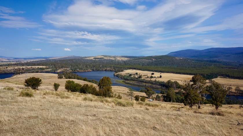
I first stop at the junction towards Tooms Lake.
My paper map shows a connection all the way through the Eastern Tiers Forest Reserve towards Lake Leake, where I would join the B34 but from where it would be almost all downhill to the coast.
But after inspecting my ‘Open MTB Map’ on the Garmin and the map Garmin supplies with the inReach app ‘Earthmate’, they both show no connection after the lake.
I sit down and wait half an hour for a car to come by, so I can ask.
Nobody comes 🙂
I decide to be wise and continue on my intended route towards Ross.

Soon though, a van approaches from the other side and he stops. The guy has a house close to the lake and says in theory there is a track, but very, very rough with big stones, etc..
He can recommend the other track, some sixteen kilometer down the road I saw on my map.
It would be a longer stretch, but bring me eventually to Lake Leak as well, and avoiding the busy roads.

In good spirits I continue.
Soon after the Tooms Lake junction, the fences along the road disappear and I arrive in wild camping heaven. The scenery is top. The red dirt track, brown fields, green forests, grey death trees, blue sky.

DSC05555

DSC05557

DSC05568

Just before the bridge over the Macquarie River, I stop at a farm to have the route confirmed and take some extra water.
At the bridge, I wash my socks, bandanas and my hair in the river.

At the junction of the Tooms Lake Road and the Honey Suckle Road is a sign stating it’s a ‘no through road’, but I ignore it.
Another farmer on his quad stops and also confirms I can reach Lake Leak by this way, but it will be hard.
He also says there are quite a lot of ‘mad guys with guns’ further on, hunting for deer.
I hate hunters.
“So I have to choose between the mad guys on the road and the mad guys in the bush ?”, I ask him.
“Take this track”, he says, “that will be better”.
He understood me.

From here, Life starts te be hard.
Very hard.
The inclinations are steep, 12, 13% on the gravel.
Steep down and up.
And down.

DSC05570

More good wilde camping to be had.
I push on until 6 pm.
Just when I start to search for a spot, another pick up truck approaches me.
He stops as well.
I guess they don’t see too many people on pushbikes here if they all stop haha.
He just wanted to make sure I was fine and also confirms I will eventually end up at Lake Leak.
Twenty kilometer into Honey Suckle Road, I pith the tent on hill a bit off the road.
It seems to be all dense forest from here, so camping might become harder if I push on further.

DSC05576
The further you proceed on the Honey Suckle Road, the rougher it gets.

32 km left, with the hardest part still to come before I reach the main road again.
Best song of the day on the music player: Ryan Paris: Dolce Vita

Day 37: 16 March 2019
From 20 km along Honey Suckle Road to just passed Apsley River
77,51 km (Total so far: ) – Altitude climbed: 1.097 m
Weather: Sunny, strong head winds

Within the first kilometers of my ride today, the signs started to appear.
‘Keep out !’, ‘No Entry !’, signs they were hunting and shooting.
I heard them shooting.
A lot.

I rang my bell and continued cycling, hoping the signs were meant for the land next to the road, and not for the road itself.
By ringing the bell, I could make clear to the hunters I was a cyclist and not a dear in a red shirt.
Although I doubt my bell makes enough noise to reach that far.
To be on the safe side, I stopped listening to my podcast with Sven De Ridder and have all attention on what happened around me.
Nothing happened.

DSC05580

DSC05579
I haven’t said anything about this nasty little creatures. These small ants are everywhere. STINKY ANTS !! I read about them before and could never believe how ants could smell so bad. Surely, it was exaggerated. Until you meet them. From the moment you touch them, brush them off you, or kill them, they release this terrible stench.

There were also the ‘good guys’, with signs along the property to ‘Keep Out !’ and ‘No Hunting’ and ‘No shooting’.
It seems to me the guys on the left side of the road were the crazy guys, those on the right side the good guys.

A large tree blocked the road.
That first guy who told me yesterday this route was good and he had ridden it a few weeks ago seemed to tell me bullshit. This tree was laying here since a long time.
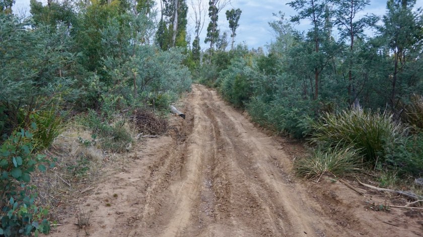
I pushed the bike around and continued on an obviously unused track since long time.

Big stones, wires and a pile of sand blocked the track further on.
This is where the collapsed bridge over the Macquarie River is.
I first went down on foot to check the situation and see what could be done. Having to go back all the way would be disaster.
But all was fine. I must be really close to the spring of the river as there was hardly any water.
But if you see how high that bridge used to be over the river and still it’s washed out, that means it must be torrential at times.

DSC05582

DSC05588

DSC05593
‘Inside’ the Macquarie River. you can see the remnants of the old bridge.

A steep push over loose gravel and rocks to get out over the river bed.
A bit further on, I reach the McKai Road, a much better track.

Those who want to avoid the highway, but want an easier option then the Honey Suckle Road:
Follow my route until after the Stonehouse (on Stonehouse Road C306).
About two kilometer before the junction to Tooms Lake, another track veers off to the right. No signpost there, but that is the same track as the one I ended up after crossing to Macquarie River.
It will be much shorter and much easier, but you will miss the fantastic scenery from the Tooms Lake junction to the bridge over the Macquarie River, and the first section of the Honey Suckle Road.

I continued on, reaching a high point at 697 meter near the junction with the Lake Leake Road (B34).
Back on asphalt I quickly coasted down to the coast.
Against strong head wind.
Just when I took the 90 degree left turn onto the Tasman Highway, I met a British couple on bicycles, making a loop around the island over the highway.
Despite my 90 degree turn, the wind blew still straight in the face.
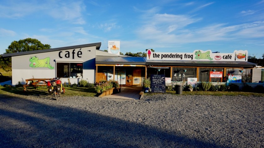
Just before the turn off towards Freycinet National Park, I stopped for a small bite and a coke at ‘The Pondering Frog Café’.
Very friendly people, excellent vegetable curry pie and I filled the water bottles.
I found a good place to camp a bit further on along the Coles Bay Road.
Lot’s of mosquito’s.

DSC05595
View of Moulting Lagoon and the hills of Freycinet National Park behind it.

DSC05596

Next post, all about Freycinet National Park !

Australia Prt 3, Tasmania: Cycling Bruny Island

Route: Hobart – Taroona – Kingston – Kettering – Bruny Island

Day 21: 28 Feb. 2019
From Hobart to Bruny Island, Simmonds Bay
61,19 km (Total so far: 792,00 km) – Altitude climbed: 826 m
Weather: Sunny

A busy day.
The camping kitchen closed at 8 pm yesterday, before all my devices were fully charged, so I sat there again this morning for 1,5 hour to finish that.

Via the bike path I rode into town. Part of the way I cycled with some other cyclists who were also hikers and went out every morning on their bike to drink a coffee in town near the marina.
In the town center, I first went to the ‘Find Your Feet’ shop to collect the Garmin inReach Mini I ordered with them. We arranged the subscription with Garmin as well.
From now on, when something serious happens, I just have to push a button and the Flying Doctors, helicopters, ambulances, rescue teams, …. everybody will come to me as quick as they can.
So they say.

Treated myself to a lunch in an Asian restaurant as well.
Hobart, and I think the whole of Australia, has a lot of Asian immigrants.
East- and Southeast Asians.
Good !
I like to be among these friendly, hard working people and they are a guarantee you can have some very good food, whether it is Thai, Vietnamese, Taiwanese, Chinese, Korean, … always delicious.

IMG_20190228_123858589_HDR

The ride from Hobart to Bruny Island along the coast is just something you have to go through.
Riding out of town towards Sandy Bay is pleasant.
Towards Taroona and Kingston, there are a few hills and most of the road has some form of shoulder. It is not good, but you will survive (although I noticed the other side of the road, on the way back, will be worse).

DSC04705
Sandy Bay, just outside Hobart

DSC04708

Kingston is a big place, with a big Coles supermarket, so provisions could still be bought here.
From here the roads gets busier.
Again, often this ‘shoulder’ which we call at home a ‘suicide lane’ for cyclists, but it’s ok. Better then the way into Hobart via the A10.
Between Margate and Snug there’s a new good bike path.
Then one more hill towards Kettering and the ferry to Bruny Island.

DSC04713

I was warned water is not easy to find on Bruny, so I took a lot at the sanitary building in Kettering.
It was the 18:30 hrs ferry I got. The passage takes just 30 minutes. This means I had another hour to find a place for the night before sunset.
Everything along the main road is fenced off (a lot of sheep farming, I saw), so I descended via Missionary Road towards Simmonds Bay where I found a beautiful spot for the night.

Day 22: 1 March 2019
From Bruny Island, Simmonds Bay to Adventure Bay
40,86 km (Total so far: 832,86 km) – Altitude climbed: 368 m
Weather: Sunny, light tail wind

DSC04733
Morning dew on the tent

From Simmonds Bay I rode back to the main road and on to Great Bay.
There, I found a really fantastic spot where I hope to camp in a few days, on the way back.
North and south Bruny are separated by an isthmus called ‘The Neck’. There’s a good view point from the top of a dune. Kilometers and kilometers of beach.
Fantastic view.

DSC04757
Great Bay
DSC04777
The long beach along ‘The Neck’ and Fluted Cape in the background
DSC04782
The Neck

Further on, already on the southern part of the island, don’t forget to stop at ‘Coal Point’ if you are here.
More views, beautiful rocks, sea weed, ..

DSC04796

DSC04799
Fascinating under water life.

DSC04805

The water at Adventure Bay was colored red on the western side. Maybe due to algae ?
There is a general store here which a good selection of products, but at steep prices.
Near the end of the bay are several monuments referring to the history of the place where famous European Explores landed.
The first was Abel Tasman in 1642, Then James Cook in 1773, Tobias Furneaux a couple of times, and Bruni D’Entrecasteaux (1792) (after whom the island, and the channel between Bruny and Tasmania) is named.
D’Entrecasteaux is a name that will show up more later in the naming of Australian national parks,..
Also William Bligh and Jacques De Labillardiere visited this place.

DSC04820

DSC04822

DSC04865
Adventure Bay Church

DSC04866

Me, lacking the funds to have a boat, I arrived on the pushbike and I took a swim in these waters of the Southern Ocean.
And life was good. Very, very good.

Day 23: 2 March 2019
From Adventure Bay to Mable Bay
43,48 km (Total so far: 876,34 lm) – Altitude climbed: 1210 m
Weather: Sunny, hot !

First thing today, I rode back to the far corner of Adventure Bay to hike the Fluted Cape Walk.

DSC04893
Severe Hazards !   Ridiculous, over the top warnings.

Starting off by hiking to the far corner of the beach, then an easy hike along the rocky coast to Grass Point. The water between Bruny Island and Penguin Island is so shallow you could walk to the other island.
From Grass Point at sea level, the trail starts climbing to the top of the cliffs, almost 300 meter higher.
Fan-tas-tic views of these cliffs.
It’s a sometimes steep climb, but totally worth it.
2,5 hours later, I was back at the starting point and went to eat lunch on the bench near the Captain Cook Statue.

DSC04908
Impressive 300 meter high cliffs along the Fluted Cape Walk

The walk was already a bit demanding, but I knew the hardest part still had to come; cycling over the hills towards the other side of the island via the rough Lockleys Road.
It starts oh so gentle but then, after the junction with Resolution Road…. 11%, 12% climb on a stony track.
I have pushed most of the way to the top.
It was burning hot and the sun was in such an angle that most of the time there was no shade to be found on the road.

DSC04931

DSC04934

The downhill is just as demanding and I had to stop each time after about 80 meters descending to cool down the rims. So steep !
There are some good views of Cloudy Bay Lagoon and the hills around on the descent.

DSC04942

DSC04944
View towards Cloudy Bay and Cape Bruny

In Lunawanna I took some extra water from the toilet building.
If you think like me you’re quickly gonna cycle this 19 km to the lighthouse and come back most of the route,… think again.
Again, it starts gentle but the road becomes hillier as you’re nearing the lighouse.

IMG20190302154243279

I arrive at Cape Bruny and the lighouse two hours before sunset. The gates were closed at 5 pm, but you are still allowed to walk in. I pushed the bike through the gate and parked it a bit further beyond the house of the lighthouse keeper;
Immediately a park ranger came up to me and I thought “o-oh, the bike shouldn’t be here”…
But she came out especially to check whether I was fine and if I didn’t need any water.
Now, isn’t that super-friendly !
I gladly took the offer. They were a couple of volunteers to look after the place for a week.
The man told me they also manage the weather station.
Today, when entering the data at 9 am and 3 pm, ‘the system’ asked whether the data was correct, as they were figures never recorded before.
I forgot to ask whether it were records for this day, a 2nd March, or all time records, but I suppose it’s a 2 March record.

26°C at 9 am and 38°C at 3 pm.
That’s in the shade.
The man who does the tours of the lighthouse told them he reckoned it was over 50 degrees in the sun this afternoon.
I told them I had 46,4 degrees on my cyclometer, and I was in the sun all day, so that could be.

DSC04966
Cape Bruny  Lighthouse

From the lighthouse, one can see two little white islands in clear wheather. White because of all the bird droppings. But this late in the day, and with these temperatures, it wasn’t clear enough. These two islands are the southern most point of the Australian continent.

DSC04972
View from the lighthouse towards Lighthouse Bay.

I saw a Swift Parrot near the lighthouse.  These endangered species can fly 100 km/hr and are the fastest parrots on the planet.

As the camping at Jetty Beach was crowded, and loud last night till after 2 am, I headed back towards the national park entrance and found myself a quite spot.

Before pitching the tent, I hiked down to the beach at Mabel Bay. Fantastic wild waters, high rocks on both side of the beach and one old schooner on anchor.

The tent was erected just before sunset and a all that’s left to do is prepare a big pot of pasta with a lot of vegetables.

DSC04981
Nature making it’s own art

DSC04973

Day 24: 3 March 2019
From Mable Bay to Little Lagoon
41,58 km (Total so far: 917,92 km) – Altitude climbed: 495 m
Weather: Cloudy, sun in the evening

The day started cloudy, but the predicted rain never came.
After yesterday’s hard day, I slept in a bit. I am glad I pushed this few kilometer yesterday evening and have this quite spot for the night instead of the listening to the drinkers and shouters at Jetty Bay.
I heard the crashing of the waves sixty meter below me.

After breakfast, I changed the front break pads and tightened the chain.
The first 14 kilometer of the day were the same as yesterday afternoon, back along Great Taylors Bay, over the hills to Little Taylors Bay and Lunawanna where I washed my clothes and my hair.
To my surprise, the road between Lunawanna and Alonnah is still unpaved. On a Sunday afternoon, there was a bit of traffic, people returning to Hobart, I guess.
In Alonnah I met cyclists again, Aldrik & Amélie, a young French couple who arrived just a few days ago in Hobart and will stay for a year on a working holiday visa.
Allonah has a general store, but smaller than the one in Adventure Bay.
I ate a big hamburger for lunch, needing the calories.

IMG20190303124424670HDR

DSC04987

DSC04992
The Statue for ‘Father John’ who arrived in Tasmania in February 1933. He travelled from Dennes Point in North Brunny via bush tracks by push-bike to Alonnah on South Bruny where he did a lot for the local community.
DSC04995
Father John, on his push-bike, and my push-bike, 86 years later.

After Allonah, the road leads back to the Isthmus. I stop and climb the 233 steps again to the lookout platform.
Just after the small landing strip, a track leads to Cape Queen Elizabeth. It’s a hiking trail, but wide and flat enough to cycle a large part of the way. ‘Big Lagoon’ on my right hand is completely dry, and so is ‘Little Lagoon’ a bit further on.
The difference between the big and the small one, is that the small one had nice, very short grass inside (eaten by the rabbits and kangaroos, I guess).

DSC05036
Big Lagoon

I hiked down to Moorina Bay which is the far end of Neck Beach before returning to a brilliant camping spot I found earlier, a few kilometer from the main road, with the sound of the waves at the other side of the dunes, it will be really peaceful tonight.
A lot of snakes around, but they tend to go away when they see me.
Oh, and the sun came out after 6 pm.
Lovely evening, watched thousands of stats and the Milky Way.

DSC05026

Day 25: 4 March 2019
From Little Lagoon to Great Bay
50,18 km (Total so far: 968,10 km) – Altitude climbed: 785 m
Weather: Sunny, moderate head wind in afternoon

A sweet quite night made me wake up just after sunrise. I could see the sky changing it’s colors before the sun came over the hill.
On the program today: visit the northern part of Bruny Island.

DSC05038
Ford Bay

The first part of the way I rode already last week, all the way back to my first nights’ camp from where I continued along Simmonds Bay to Barnes Bay.
On Killora road, there’s a moderate climb over the hill and the junction to the Old Quarantine Station which I visit (open Thu. to Mon.).
Really interesting. The volunteer park ranger tells you passionately about the history of the place which served as a quarantine place both for plants and for humans on different occasions.
Two people died here during the quarantine period of the Spanish Influenza after WW I.
The park ranger also told me that hottest day ton 2 March really was the hottest day ever on Bruny, with at one point of the island a record of 39.2 °C.
I hiked to the graves of the two men who died here, visited the old buildings, etc…
Two hours were gone quickly.

DSC05053
View to Shelter Cove from the Old Quarantine Station
DSC05054
The graves of the two people who died in the Quarantine Station.
DSC05057
Long house in the Quarantine Station.

After the Quarantine Station follows another climb with excellent views towards Tasmania and the D’Entrecasteaux Channel in between.
Nebraska Beach, towards the northern end of the island is a disappointment. Still beautiful, but compared to the other beaches on the island not so good. Many sheds for boats on the beach, houses, ….

DSC05071
Road at North-Bruny along the D’Entrecasteaux Channel.

At Dennes Point, the far north one can take water again at the sanitary facilities.
There is nothing else on the northern part of the island. no shops and, as far as I could see, no restaurants.
From Dennes Point the road climbs steep to Dennes hill (120 m asl).
There is a house right at the top. they have views to both sides of the island the the D’Entrecasteaux Channel on one side and Bull Bay on the other side.

DSC05077
Bull Bay

Bull Bay, which one views from the top of the hill looks marvelous as well.
I returned to a camping spot I discovered earlier on right next to Great Bay.
Nice sunset, brilliant night sky, … a good day again.

DSC05079
My spot at Great Bay

DSC05088

DSC05104

Day 26: 5 March 2019
Great Bay
Weather: Sunny

A rest day during which I occupy myself with the usual things, reading on the Kindle, play with the computer as long as battery life permitted me to do so, walked on the beach, slept and oh, I went to the Beer, Cheese and Bread shop two kilometer from my camping spot to buy a bread and a piece of cheese. I finished the shellite in my stove, so can’t cook anymore.

IMG_20190305_151509932_HDR
One bread and a piece of approx. 150 gram cheese will set you back 28 AUD (18 Euro) on Bruny.  But it tastes good 😛
DSC05108
Great Bay

Day 27: 6 March 2019
From Bruny Island, Great Bay to Kettering
20,93 km (Total so far: 989,03 lm) – Altitude climbed: 341 m
Weather: Cloudy, rain, some sun

Last night there was a terrible storm. Looking at the ‘YR’ website, it stated wind force 9 in my area. I was camped just along the D’Entrecasteaux Channel and the wind just blew in from the southwest right into my tent, so it could even have been a bit stronger there.
Windforce 9 means between 75 & 88 km/hr and ‘children are blown away’ according to the Beaufort table.
Windforce 10, adults are blown down. Well, I was laying down in the tent anyway.
I was hoping that tree right behind my tent, of which half came down in a previous storm, would hold up one more time.
It rained, it hailed and sprankels came through the flysheet.
That’s where a good water column comes in handy (dreaming about a Hilleberg Unna again).
When it stopped raining for a moment I went out to fasten the pegs better again.
It calmed down overnight and I could pack a dry tent in the morning.
Squeezed out another hot drink with the last drops of fuel and went to the ferry terminal. Half way a good downpour of course.

DSC05137

This time I got the large ferry to go back to Kettering.
I contacted a Warm Shower host to spend the night. I enjoyed a warm welcome, that shower and even a great diner with Stan and his wife.
Tomorrow, back to the big town, and hopefully a bit further.

Bruny Island was a fantastic experience. I stayed six days and cycled more than 200 kilometer on the island.

Schermafbeelding 2019-03-13 om 20.21.51

Australia Prt 2, Tasmania: Strahan to Hobart

Route: Strahan – Queenstown – Derwent Bridge – Ouse – Hobart

Day 12 & 13: 19 & 20 Febr. 2019
5 km before Macquarie Heads
Weather: Cloudy, sun, rain showers

Two rest days. My chosen spot is remarkably quiet. Only one 4WD each day passes. Maybe a ranger doing his tour ?  I can’t be seen anyway. The days aren’t actually that bad with regular periods of sun.  Although that’s only here, right at the coast. A bit further, in the hills, it will be much wetter.

Day 14: 21 Febr. 2019
From 5 km before Macquarie Heads to 12 km before Queenstown
51,86 km (Total so far: 416,95 km) – Altitude climbed: 864 m
Weather: Cloudy, rain showers, light tail wind

The weather wasn’t too inviting to go out and I had food and water enough to stay another day but despite the excellent Therm-A-Rest NeoAir mattress, my favorite piece of equipment, I started to feel my back from being horizontal so long.
First down to the Macquarie Heads. The peninsula ends at a beach where there’s a very narrow channel of water between the Southern Ocean and the inlet. Few people with their 4WD on the beach.
Why ?
Why you have to drive with your 4WD on the beach ?
Can’t they walk these last few meters ?
Can’t they forbid this ?
So many things are forbidden in this country.
But they won’t do that, because the majority likes to ride their 4WD on the beach and that’s democracy.

DSC04321
Macquarie Heads, the Kelly Channel / Hells Gates

Back in Strahan I go find that bakery they told me about back in Zeehan. He still has a few pieces of ok bread. Much better anyway than the cardboard bread you find in the supermarket.

The road towards Queenstown climbs back into the hills, but never really steep, and is quieter as expected. I think I’m riding ride behind the heaviest rain showers because the road is constantly very wet, but I keep it dry.
At the highest point there’s a look-out for the tourists. All I see is dark grey clouds and rain everywhere around me.
Starting to look for a place for the tent, I find that it really must have been raining a lot here the last days. It’s all mud and on the patches of moss I find, I sink five centimeter into the water.

DSC04327

Eventually I find a stony place under the electricity lines.
And, as so often, when I start pitching the tent, a serious rain shower starts.
Never can keep it fully dry for a day in western Tasmania 😉

Day 15: 22 Febr. 2019
From 12 km before Queenstown to +/- 4 km after Victoria Pass
54,01 km (Total so far: 470,96 km ) – Altitude climbed: 906 m
Weather: Cloudy, rain, sunshine, moderate tail wind

There is a Thai restaurant in Queenstown !
That’s the most important news of the day.
For the rest, Queenstown is a sad place. You see the ugly mining operations from far away. Most houses in town are of the corrugated iron variety. No, it’s nothing like the ‘posh’ Queenstown in New-Zealand.

DSC04330
The ugly results of mining operations

DSC04332

After shopping and lunch I start the long ride east. I say long because I’m dreading this part of my route. It’s again the highway A10 and I fear it will be too busy to be enjoyable. There are no alternatives.
During the steep climb out of Queenstown, traffic is indeed a bit too dense to be enjoyable, but less than expected. At the first little pass I park the bike and walk the boardwalk path along the Horsetail Waterfall. It’s an easy twenty minute return.
Nonetheless I see only one couple going to the end as well. Most give up half way and return to the safety of their vehicles.
At the other side of the road is another highlight, only 900 meters away and a little climb, the ‘Iron Blow’ look-out with an impressive view in the pit and the surrounding destroyed landscapes.

DSC04334

DSC04346
To the right the Horsetail Waterfall and to the left you can clearly see the boardwalk track they made to a viewing platform. Impressive.

DSC04352

DSC04359
Iron Blow

Here in Queenstown, they mine for copper, back in Zeehan it was silver, in Corinna gold and in Waratah it was zinc. A lot of different minerals in such a small area.
Bad for the environment, but good for (someone’s) economy.

After all these diversions, I loose all the altitude again on the downhill towards Burbury Lake.
The road is quieter and becomes even pleasant to ride.

DSC04366
Burbury Lake

Climbing away from the lake, I ride through an area that must have burned down a couple of years ago.
Nelson Falls is the real highlight of the day.
I forgot to go and have a look to the Montezuma Falls when I was in Zeehan (too busy staying ahead of the rain). But this Nelson Fall really makes up for it.

DSC04374

DSC04377

DSC04379

DSC04384

DSC04395
Nelson Falls

The road climbs steady but not too steep. After almost two weeks on the island, I pass today only the second motorbike rider who says hi to me. In Europe and America, almost all motorbike riders greet cyclists.
A little bit after this guy, his wife follows on another bike. She is just being overtaken by a small white car in a blind bend off the road. In my rearview mirror I see how the guy stops and make the car stop as well. I hear him shout to the driver.
He is 100 % right to do so and I wonder whether I should turn around and give him some moral support, but he seems man enough to handle it himself.
You would be surprised what kind of impatient idiots overtake you in a day.
It’s much better here as in South-America of course, but they aren’t super-good here either. I would say just a bit above Belgium.
I would give the drivers here 60%.
So far, Sweden and Spain (away from the costa’s) are the only two countries I cycled with a top rating for car drivers.
Just one step lower follow Norway, Denmark, Germany and Switzerland.

I climbed and climbed towards the highest point of the day, Victoria Pass.
I just finished taking the obligatory picture when I met the first other cyclist on the road here in Tasmania, Pavel from Poland (there was Olivier from Belgium, but I met him on the boat, not on the road). Pavel arrived after a journey of three days and four flights into Hobart and will cycle for three weeks on the island. He is going the other way around, so I might meet him again.

This morning, I packed a soaking wet tent but finally after it was promised, and delayed, for days on end, the sun came out in the afternoon.
I stop in time so my tent can dry a bit, I make a pasta with fresh vegetables from Queenstown and yes… I had a brilliant day today.
Only those damn mosquito’s in the evening.

Day 16: 23 Febr. 2019
From +/- 4 km after Victoria Pass to passed Lake St. Claire
65,60 km (Total so far: 536,56 km) – Altitude climbed: 1000 m
Weather: Sunny, no wind

Everything is perception.
Yesterday I started cycling in a temperature of 13 degrees and it was cloudy, a drizzle, miserable.
Today too I started cycling in a temperature of 13 degrees but under a blue sky. What a difference and what a joy.
A passing motor biker even turned his head and gave me the thumbs up.

DSC04405
A misty morning, but soon the weather would become glorious.  Passing the Great Divide, it did exactly what it promised.

Someone had sprayed ‘Meat Head’ in white letters on the road and I wondered whether this referred to the English version of the Flemish movie ‘Rundskop’.

After an hour of cycling I reach Donaghys Hill where I stop to hike to the lookout. It’s good to stretch the legs a bit in the morning. From the lookout you have a good view to the peak of Frenchmans Cap, I think the highest peak in the Franklin-Gordon Wild Rivers National Park through which I’m riding now.

DSC04408

DSC04409

DSC04414
Frenchmans Cap to the right

DSC04421

Another stop a bit further brings me to the narrow suspension bridge over the Franklin River where I have a chat with three guys who go out to climb Frenchmans Cap from different sides in the coming week.

DSC04428

The road is climbing to a highest point of 839 meter. They call it ‘The Great Divide’ here as well. I’m now officially entering the drier eastern side of Tasmania. To my right is the King William Range with the impressive Mount Rufus.

DSC04453
King William Range, Mount Rufus.

The ride remains very pleasant and soon I’m in Derwent Bridge where’s the junction to Lake St. Clair, five kilometer further. It’s a nice lake. I walk around a bit but the sun is in no good position to make really good pictures. The campground is apparantely 30 dollar for a tent, which I find too much, so I head out again and find myself a place in the forest a few kilometer passed the lake.

DSC04480

When I start preparing diner, I see a leech, and another one, and another one.
I kill five and am now worried about both the mosquito’s attacking me and these leeches. I had one once in my foot in Thailand, years ago, and it’s no fun.

Day 17: 24 Feb. 2019
From passed Lake St. Clair to passed Victoria Falls
60,52 km (Total so far: 597,08 km) – Altitude climbed: 621 m
Weather: Sunny, light head wind

Searching on the internet this morning, I find the Florentine Valley Road is still closed due to the forest fires they had. This means my route south, which I planned to stay west of the A10, so via Wayatinah and Maydena is impossible.
No problem, then we take the back-up plan, i.e. following the Tasmanian Trail.
I skip the junction with the ‘Fourteen Mile’ gravel road, which looked nice enough to cycle, and continued on the A10, which seems busier on a Sunday as yesterday.

DSC04488
Mount Olympus

A downhill to the Nive River, which created an 80 meter deep valley, then steep up to the junction with the Marlborough Road.
I don’t go to Bronte Park, where there’s supposed to be a store as it’s an 8 km return trip on that road which carries a lot of much traffic.

At Bronte Lake, I see a sign that tells me I’m almost exactly in the geographical centre of Tasmania.
Now I can finally leave the paved Lyell Highway (A10) behind me and join the dirt roads of the Tasmanian Trail. Still lots of roadkill shows some still drive like madmen here.

DSC04495

The gravel road goes up but all goes smoothly. For the first time here in Australia, I’m on a road where I feel comfortable enough to take my music player out and listen to a few podcasts of ‘The Outdoor Station’. Soon I’m riding along Dee Lagoon. The country here reminds me a lot of Sweden and Finland. Only a different kind of trees.

DSC04504
Even on the gravel roads, roadkill
DSC04511
The official Tasmanian Trail signs.

I change the podcasts for some music.
The shuffle function decides The Tide is High from Blondie is the first song I hear in Australia. It’s nice to ride with music sometimes. All those years I’ve never changed the music on my player but there are thousands of songs, so I’m good till I die.
DSC04519That bothers me, while I’m riding here, that I don’t know when to use the word ‘dead’ or ‘death’.
I’m thinking about it but can’t figure it out. English is only my third language, so it won’t be perfect or sophisticated.

Anyway, the sun on my head, gravel roads, hearing the hits one after the other… Simple Minds with Belfast Child, Michael Jackson’s Leave Me Alone, Taco with Puttin’ on the Ritz, the Eurythmics with 1984 (song almost as good as the book), life is very good again.

I make a stop at the Victoria Falls.
Being away from the tourist highway, the path is completely overgrown, but I want to go and have a look anyway. It safes me a visit to Zimbabwe.

DSC04522

DSC04523

DSC04525
Bees at work. Lots of local honey is sold along Tasmania’s Roads.

DSC04528

DSC04533
Typical gravel road along the middle section of the Tasmanian Trail.

DSC04540

DSC04539
The impressive Victoria Falls !

After the falls, I’m on a much lesser used gravel road, going through a forest.
At 4 o’clock, I see I’m about to leave the forest and go back into open grass land. It’s hot, the land is probably for cattle and fenced off so I stop early and enjoy the terrific view I have and the great weather.

No leeches, but plenty of horseflies out here.
Just because perfection isn’t necessary 🙂

DSC04546

DSC04557
Wild camping on the hill with great views to the dry land ahead of me.

Day 18: 25 Febr. 2019
From the forest passed Victoria Falls to
35,99 km (Total so far: 633,07 km) – Altitude climbed: 763 m
Weather: Sunny, moderate and hard head wind

Some bike maintenance before I left today. Cleaning the bike is the best way to spot any potential problems. I checked if all the screws of the pannier racks were still tight, cleaned the chain and chainrings and lubed the chain.

It was a very, very beautiful ride into Ouse. On a dirt road, rolling hills with beige, dry grass, cattle in the fields.
Terrific.
Riding in the opposite direction, it would be hard as there was a 13% downhill.

DSC04563

DSC04567

DSC04574

DSC04576

Did some shopping and laundry in Ouse. The temperatures went up to 35 °C in the shade so it all dried in an hour. As it was so hot, I took my time to relax at a picnic table under a roof in the small park. Got to chat way too long with a couple from New-Zealand, and later on with two ladies, one from New South Wales the other from America, so it was 3:30 pm by the time I was on my way again.

From Ouse to the Repulse Dam, the ride was again very beautiful. Some steep inclines, but never too bad.
After the dam, it got too hard.
Very steep climbs and the a connection between two existing dirt roads via a logging road. Steep down to the Broad River. No bridge there, so cross it through the water.
The uphill was less steep as the downhill (16 %), but nevertheless mostly unrideable with this bike set-up. This is real bikepacking country.

DSC04587

DSC04588
The Derwent River, which I crossed already at Derwent Bridge a couple of days ago.
DSC04595
The track becoming a real logging track, with steep climbs and descents.

DSC04599

Short, hard, beautiful day.
But rethinking whether I should keep following the Tasmanian trail further south, as I know it will be more of the unrideable stuff with my heavy bike towards Judbury. It also remains unclear which tracks exactly are open and which are closed (from the recent forest fires) near Judbury.

Day 19: 26 Febr. 2019
From 15 km before Ellendale to Along A10 Highway
79,47 km (Total so far: 712,54 km) – Altitude climbed: 864 m
Weather: Sunny, medium head wind

A day with a bit of everything.
I left my quiet camp site in the middle of nowhere and soon was on the paved road towards Ellendale. The local post office is also a very basic general store (sweets, a coffee) and I had a nice chat with Charlie who operated it.

DSC04604
So far, riding in Tasmania has been very satisfying. Only negative things are too much road kill and unexpectedly, too much empty cans and bottles along the roads, even in the national parks. Sometimes, you find roadkill and garbage united.
DSC04606
With his or her eyes wide open on the asphalt, as if to say…
DSC04608
The Ellendale Post Office with Charlie.

I skipped the off-road detour the Tasmanian Trail made here, because I heard it is pretty difficult stuff. So I continued through Westerway, the junction to Mount Field National Park. It’s Tasmania’s most popular national park, and I saw a lot of traffic going there, so I skipped it.

After Westerway I joined the Tasmania Trail again for some brilliant off-road sections. I passed a big field where the fire fighters were breaking down their tents. Helicopters were still flying on and off. The lady who lived in the house next to the field told me they’ve been here a long time but were moving today to a place closer to the fires.
It has been very loud for her lately, she sad, with all the helicopters.

My route continues on the hill, above the main road. Good views.

DSC04611

DSC04613

At Bushy Park, it’s back to the asphalt, which I follow towards busy New Norfolk.
Dilemma here.
The Tasmania Trail goes west into the mountains from what I was told via very steep tracks.
The other options are the highway A10 towards Hobart, or the B10 at the other side of the Derwent River.
I saw a local police officer at the Woolworths supermarket. He claimed the A10 would be the safer option as, according to him, more trucks were using the B10.
I sat down for half an hour thinking what to do.
Honestly, with around 700 altimeters in my legs, and the hard day yesterday, I didn’t feel ready for the hard ride over the mountain via the TT.
On the other hand, I am never ready for busy roads either.
Still, I took the latter option.
Because it’s easier, because then I could pick up my Garmin inreach plb before going to Bruny Island and see whether it works (and if not, I was passing through Hobart anyway again on my way back), and I could visit the Mona.

It is a horrible ride along the A10.
My advise, don’t be a wimp like me and take the Tasmania Trail.
The C615 (Molesworth Road) was closed until March, but I took that turn anyway, hoping to find a spot to camp.
All private land.
I took the Glen Dhu Road, but same situation.
So back to the A10.

Kilometers further I found something in a dead end road near a tomato grower.
Nothing fancy, lot of traffic noise, but close to the big town.

Day 20: 27 Feb. 2019
From Along A10 highway to Hobart
18,27 km (Total so far: 730,81 km) – Altitude climbed: 131 meter
Weather: Sunny

Continued the drag along the A10.
You know, they have a railway, all the way from Hobart to Mount Field National Park.
A railway that is not used at all.
With a small budget, a little work and a bit of good will, they could turn this easily in a rail trail that could benefit the people of Hobart, the people of New Norfolk, which could be a boost for local tourism, in an eco friendly way, which could also be used by local cyclists…. but they choose to leave it unused.
A pity.

Closer to town, there is a bicycle way leading through town, and passing the Mona (Museum of Old & New Art).
World famous, so I decided to go and have a look.
It’s a nice thing. I was inside for almost 5 hours.
Mostly new art.
I still think the Te Papa museum in Wellington, New-Zealand was even more impressive, although it’s been 14 years since I was there, so maybe hard to compare.

DSC04679

DSC04632

DSC04633

DSC04636

DSC04651
Modern Art from Belgian Wim Delvoye

DSC04652

DSC04657
This Porsche 911 symbols the way everything, including people are getting fatter and fatter.
DSC04663
There’s also a bike in the Mona ! 🙂
DSC04682
MONA
DSC04681
From WimDelvoy, who has a crane in Westende as well.
DSC04683
Wim Delvoye
DSC04684
Painted windows inside the Wim Delvoye Chapel.

Anyway, very glad I visited the Mona.
Ended the day at the campsite in Hobart, which is terrible, and loud and not my thing, but necessary for a night.

DSC04689
Hobart campsite
DSC04691
Trying to charge as many devices as possible from one plug.