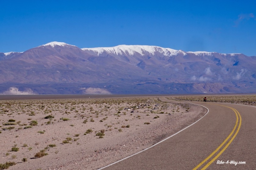
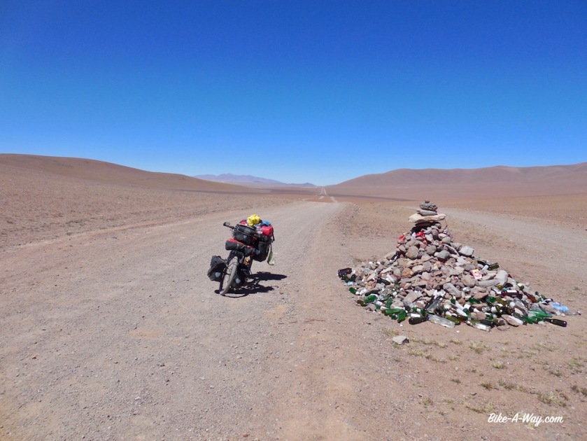
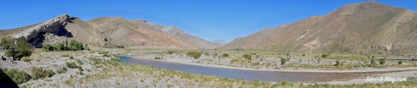
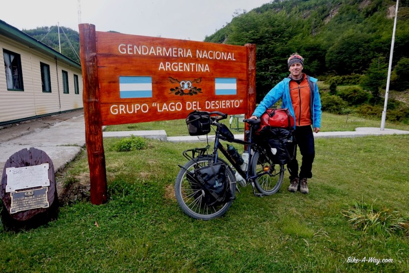
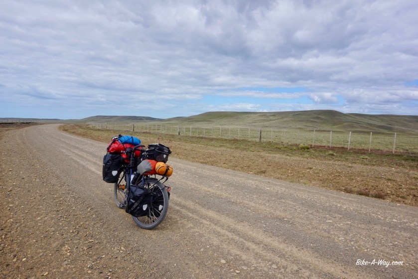
Route: Belén – El Eje – Antofagasta de la Sierra – Salar de Pocitos – Paso de Sico
Since days I’m in doubt whether to continue my route north via ruta 40, which goes along some spectacular ravines and over the Abra del Acay, Argentina’s highest mountain pass (4.972 meter), or via Antofagasta de la Sierra through the ‘Puna de Atacama’, a very desolate high plateau.
The website from the ‘Vialidad’, that must be the Argentinian organization responsible for the roads, says since a while the road over Abra del Acay is closed due to flooding.
Not very promising.
On the other hand, two cyclist I met further south who came via Antofagasta de la Sierra said it would be horrible to cycle that road in a northerly direction.
Tough choices to make, as both options seem to throw their difficulties at me.
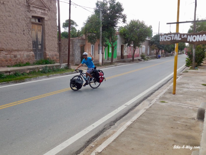
In Belén, I ride into Frederic again, a French cyclist I briefly met further south in Villa Union.
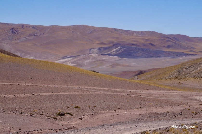
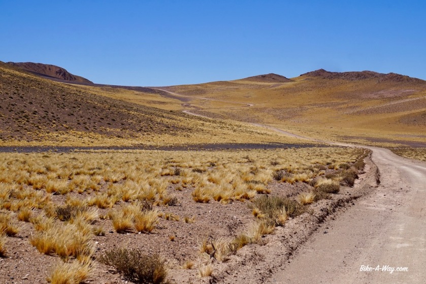
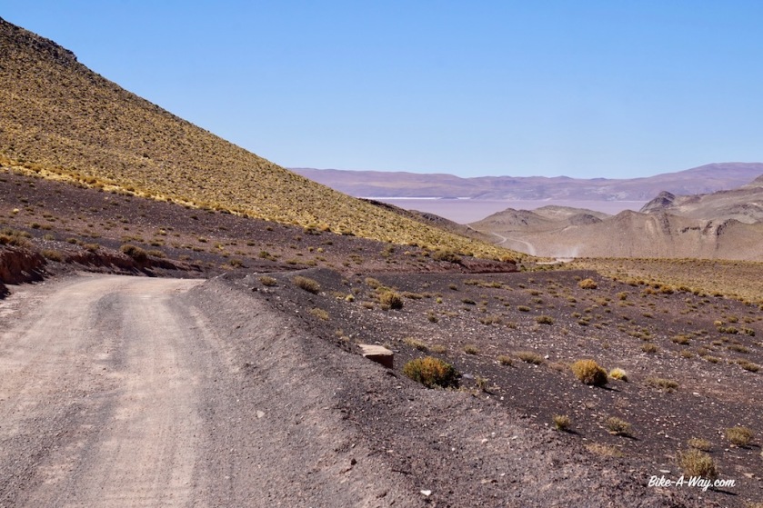
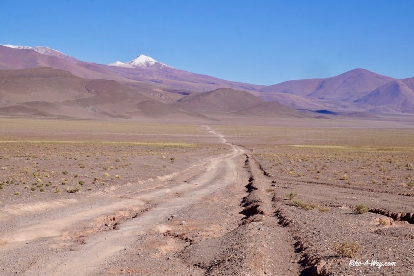
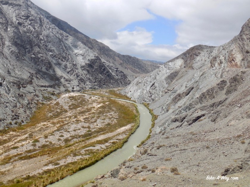
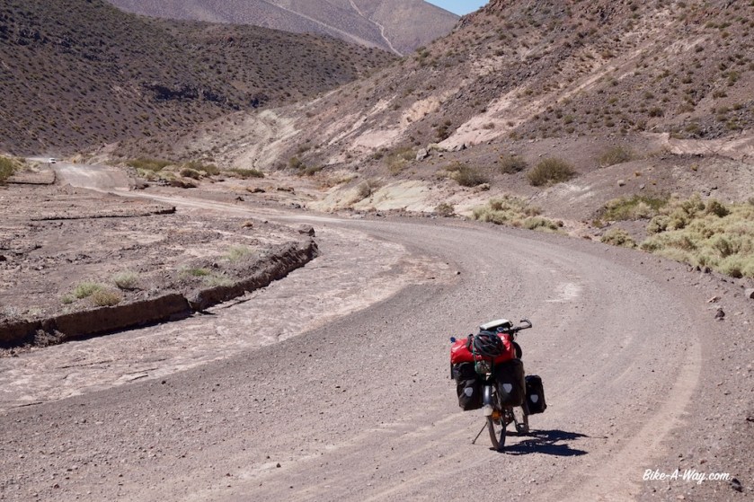
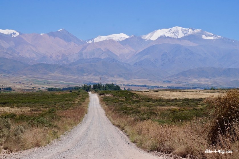
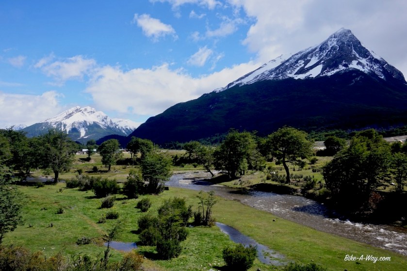
Together with him I ride that same day towards EL Ejen and decide to ride the route via the Puna, towards Antofagsta de la Sierra.
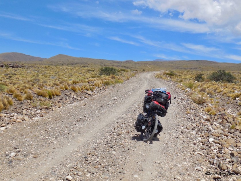
Starting from Londres at 1.200 meter, El Eje at 1.775 meter, we cycle up towards a height of 3.992 meter at Portezuelo de Pasto Ventura.
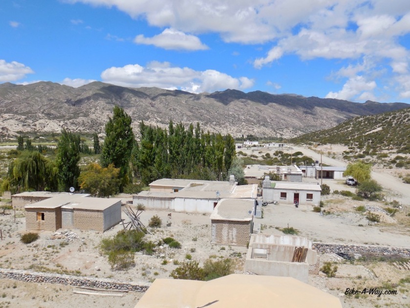
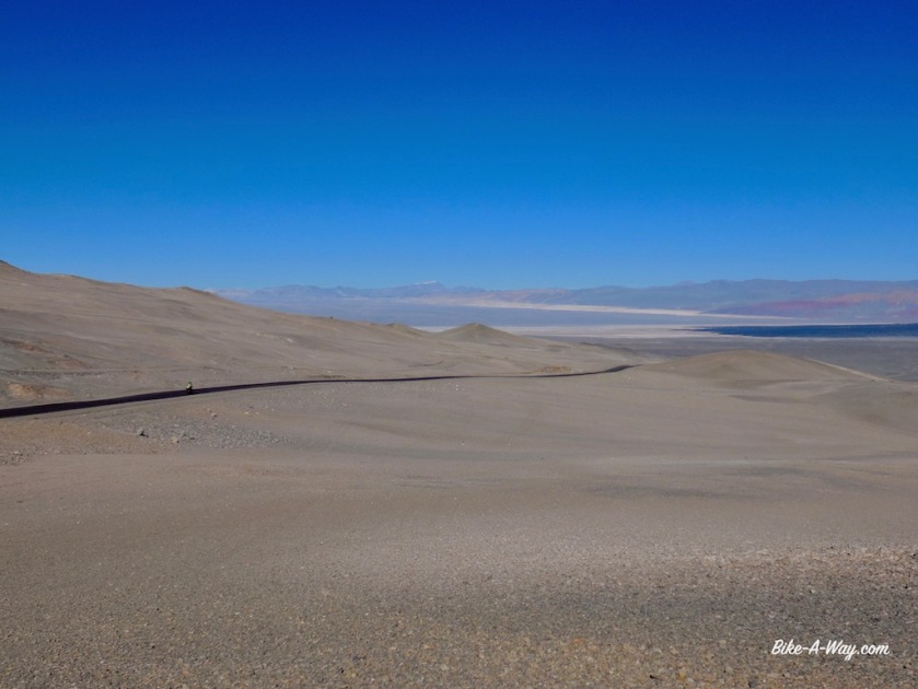
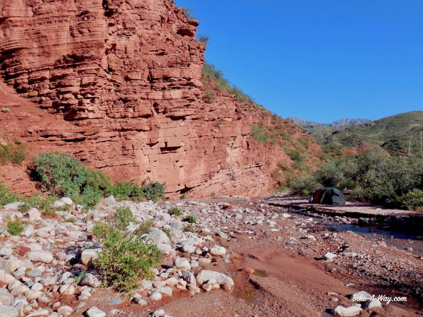
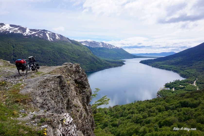
Hamlet along the road to Antofagsta DLS.
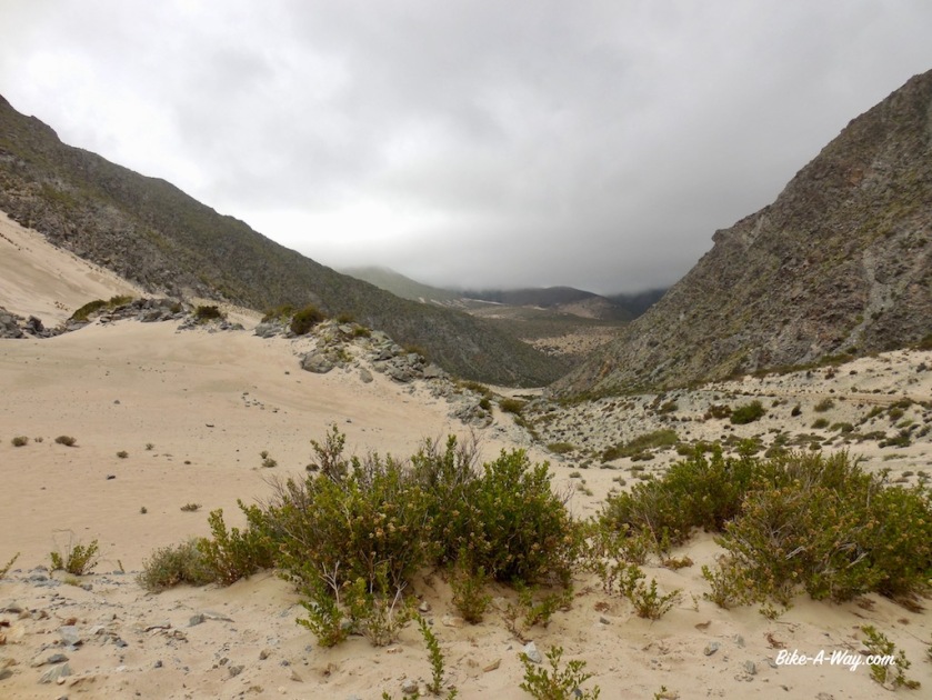
The first day of our climb onto the Puna (altiplano), the weather was still cloudy, until we climbed out of this valley.
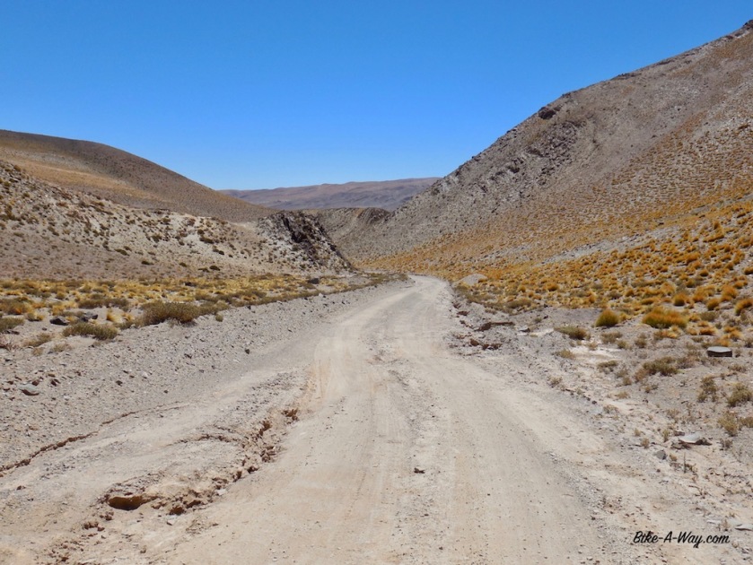
The straight road of 20 kilometer into the hamlet ‘El Peno,’, at 3.350 meter seemed to take forever against the strong Puna winds.
It seems the elevation doesn’t affect me too much so far, but both Frederic and I have diarrhea, probably from water we took from a pipe at El Bolson. And diarrhea sucks a lot of energy out of your body.
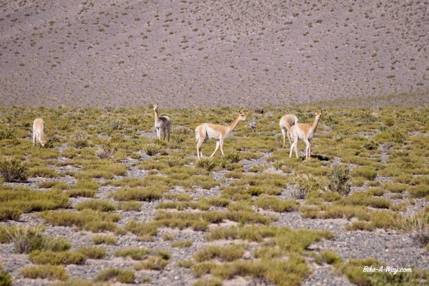
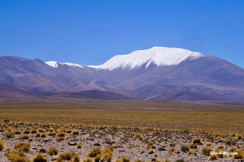
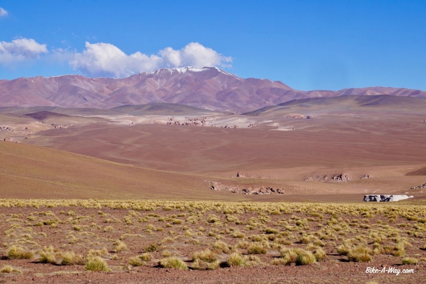
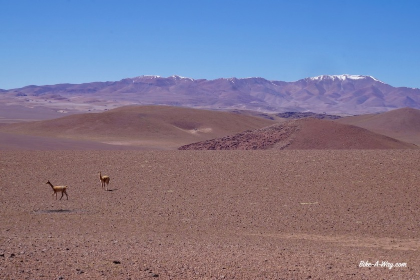
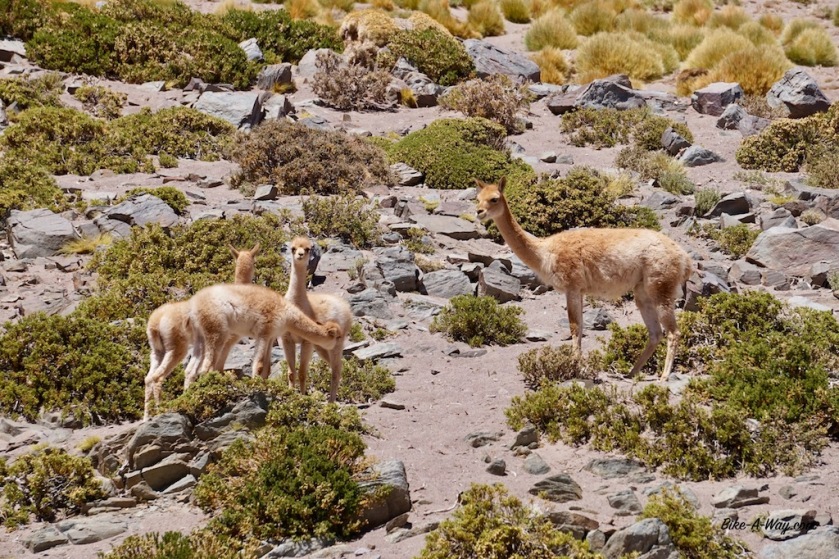
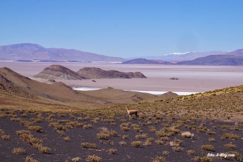
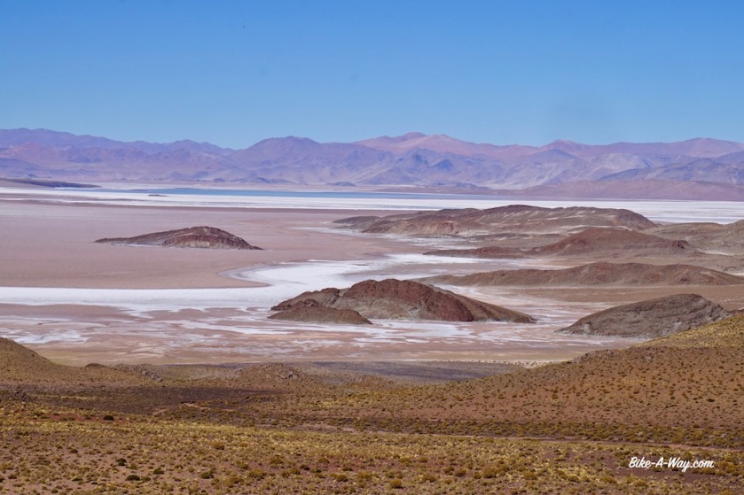
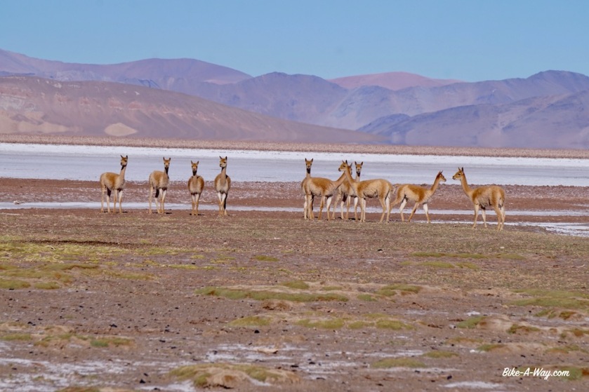
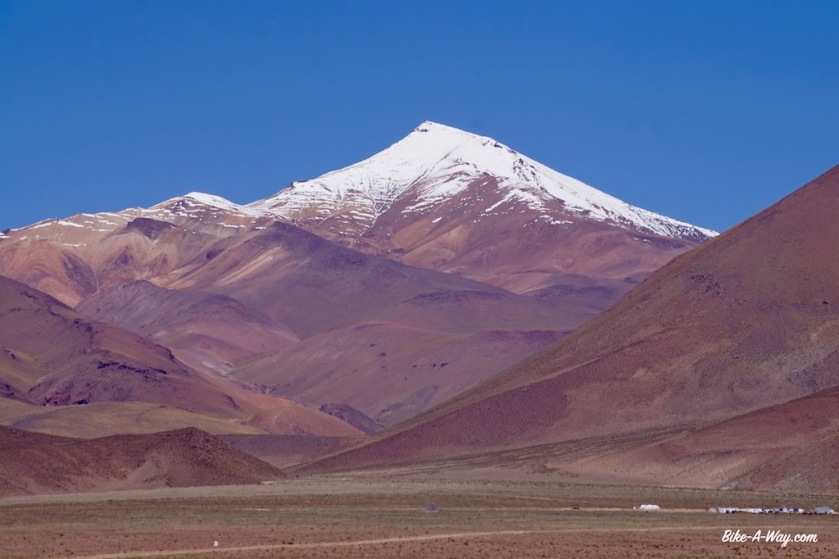
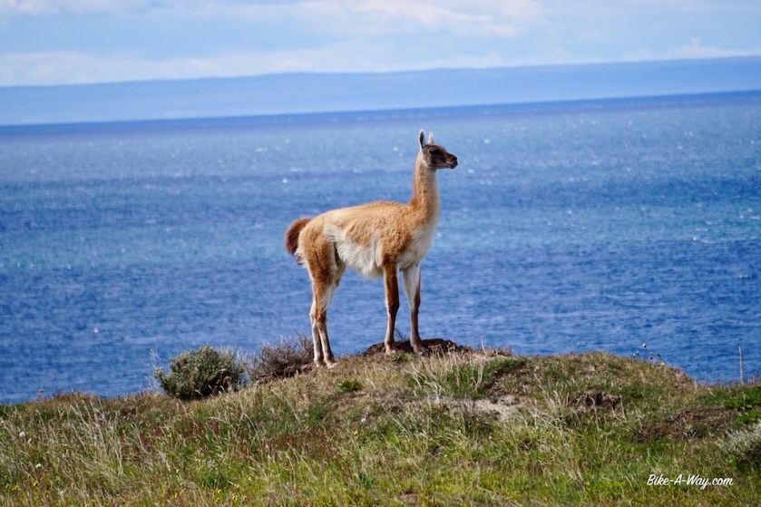
Cerro Laguna Blanca, just above or just under 6.000 m, depending on which source you use.Vicunas, not as rare anymore as a couple of years ago.
Again, Cerro Laguna Blanca
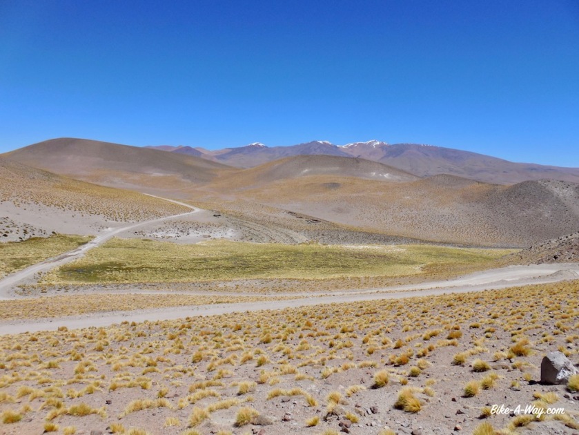
Find the car to appreciate the grandeur of this landscape.
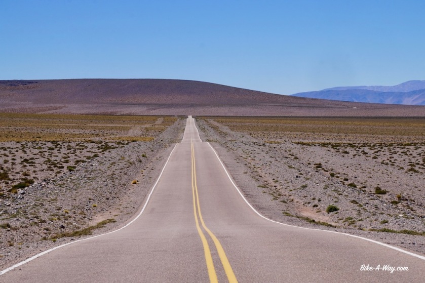
Sixty three kilometers separate El Penon from Antofagasta de la Sierra with only 400 climbing meters. Luckily the wind was quiet. If you have it in the face here, it’ll be a terrible day.
Frederic continues his route towards Antofalla and I stop and check in the hostel in Antofagasta de la Sierra to have a half day rest and a good meal tonight.
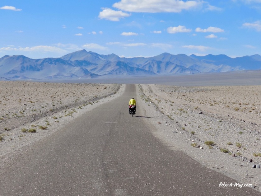
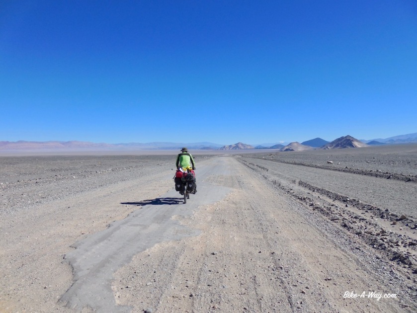
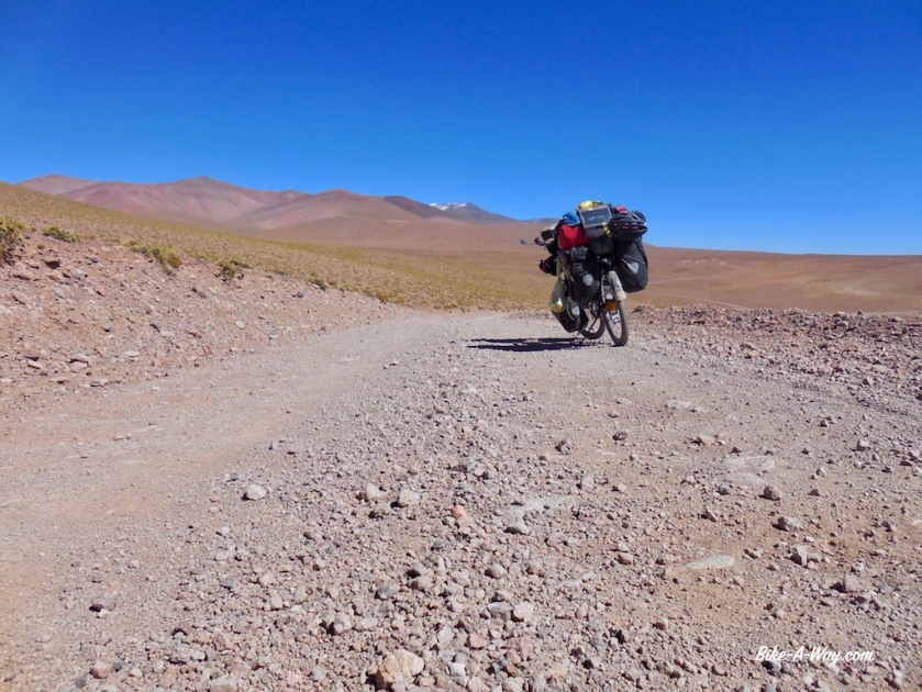
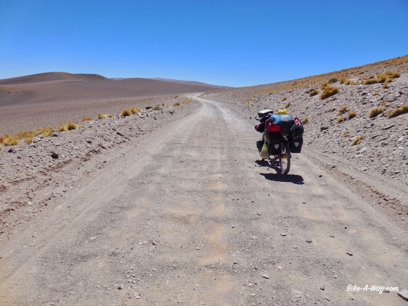
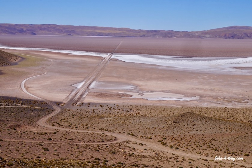
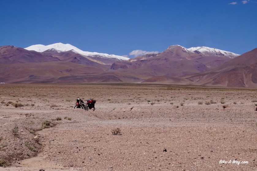
You can see me cycling in the distance 🙂
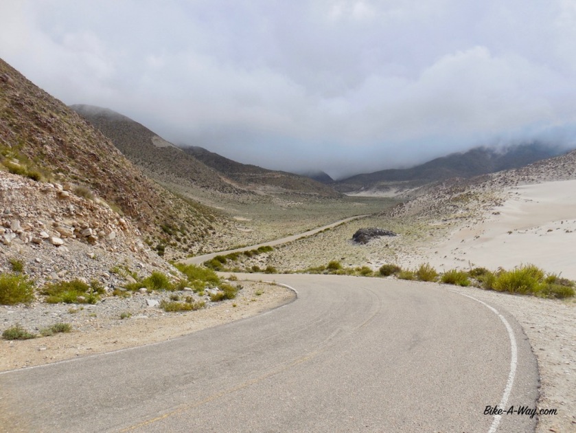
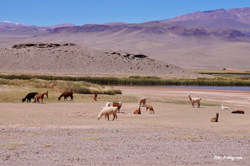
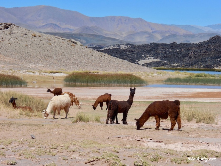
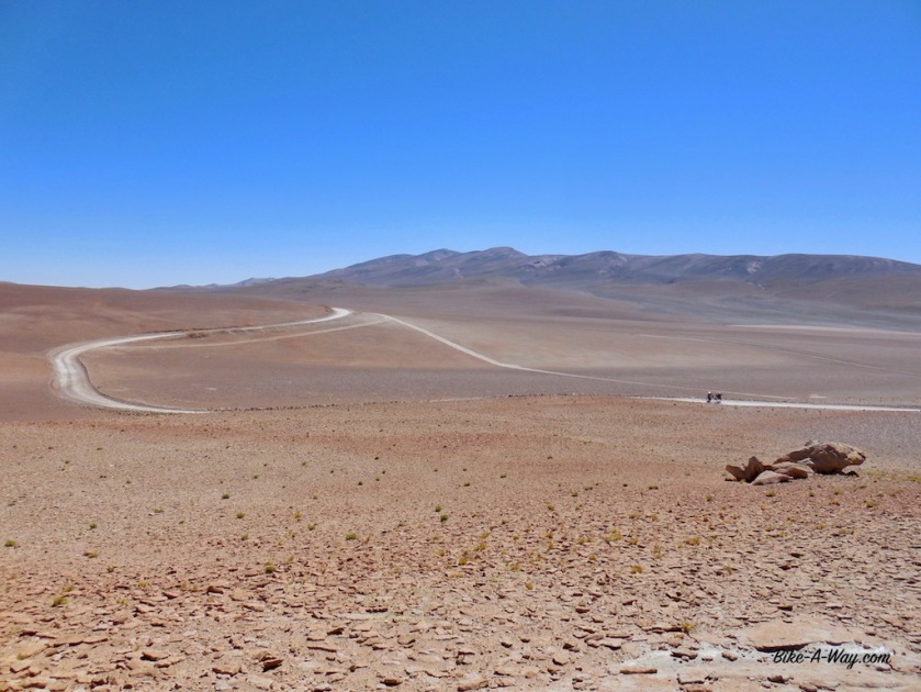
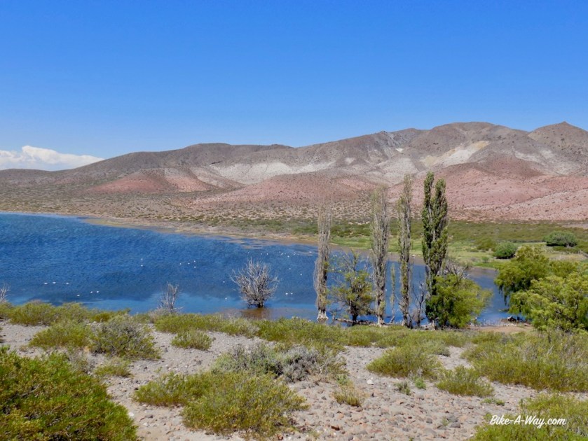
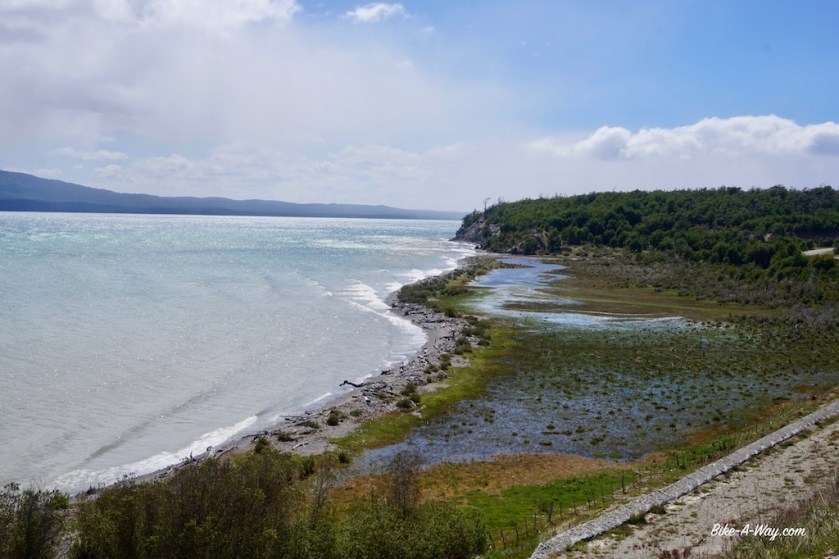
A new asphalt road is being built between El Penon and Antofagasta de la Sierra, but so far, traffic still has to take the sandy roads right & left of it. We cycled the asphalt.Llamas at a lake just outside Antofagasta DLS.
And flamingo’s, which I saw all the way from the cold lowlands of Tierra del Fuego, all the way through Patagonia and also here high up in the Puna.
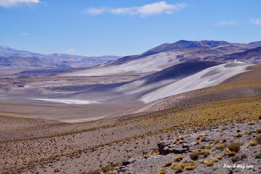
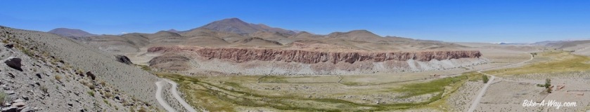
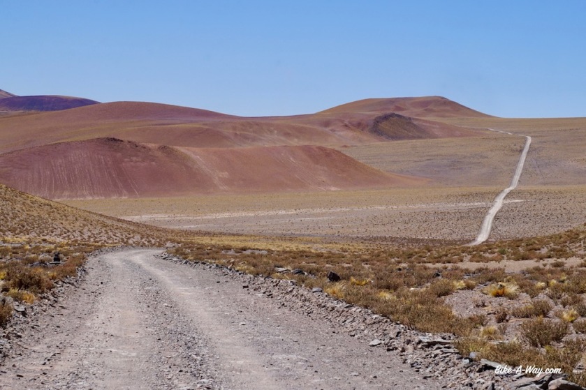
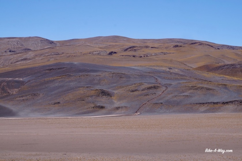
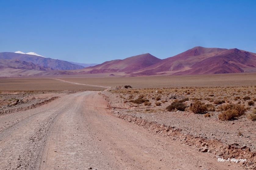
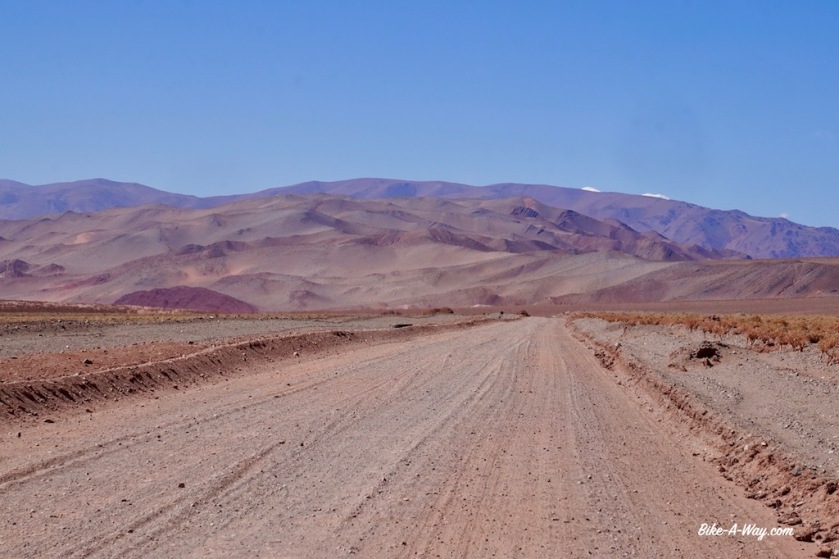
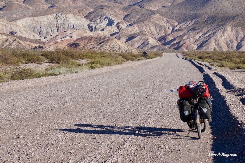
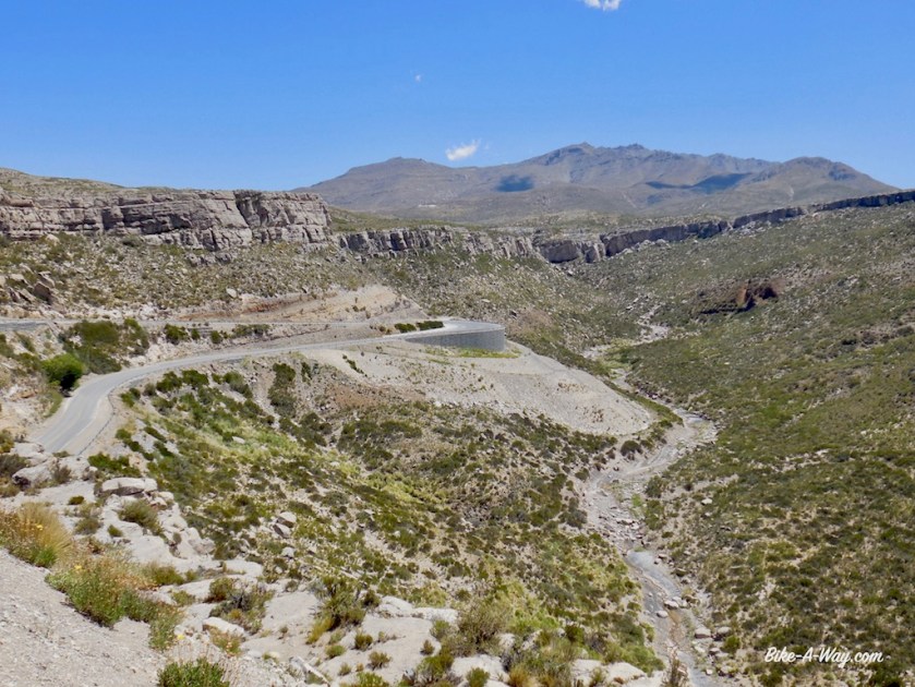
The big test comes after Antofagasta DLS, the climb from 3.300 meter to the ‘Abra Falda Cienaga’, a pass at 4.442 meter.
Riding stretches like this, it is not only elevation what makes it difficult. The road promises to be a mess, there’s the wind at this altitudes, the total absence of water, no villages for provisions and the sun which is burning immensely now in summer. The days are hot, but after the sun sets, it cools down very rapidly.
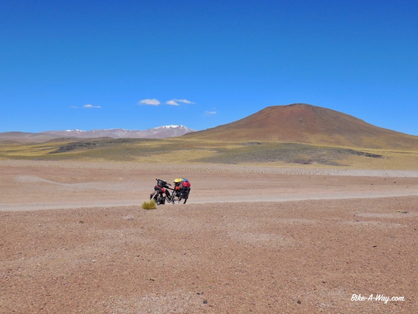
I leave town with four days worth of food, i.e. 1,2 kg of bread, two large packages of chocolate, six tins of paté, a pot of ‘dulcé de leche’ (which I find awful, but is easy to carry), two cans of tuna, two tins sardines, 500 grams oats meal, 500 grams rice, 500 grams spaghetti, three tomato’s, two peppers, three onions, garlic, parmesan cheese, a lot of cookies, an apple, a banana, dried fruit, nuts, tomato sauce, curry powder, milk powder, chocolate milk powder, tea, instant coffee and …. sixteen liters of water.
I hope to ride to Salar de Pocito’s, the next hamlet 220 kilometer away in three days.
So I’ll have 5 liters of water a day to drink and for cooking, dishes and 0,33 liter/day to brush my teeth.
Three Imodium tablets should keep the intestines at bay.
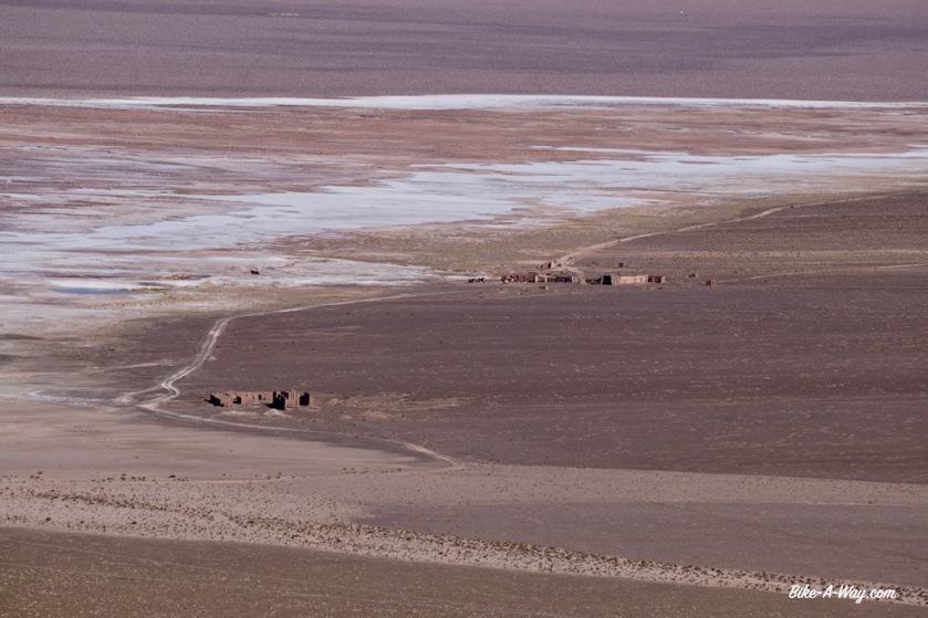
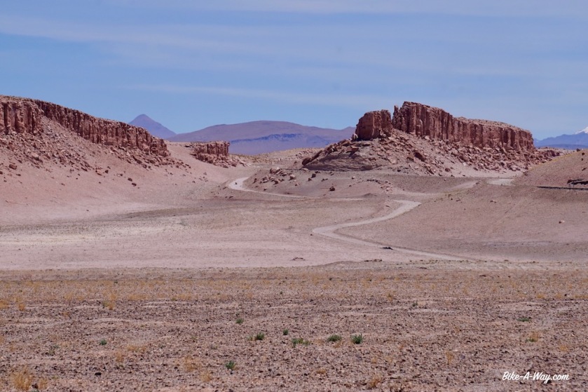
Antofagasta de la Sierra, the ‘loneliest’ town in Argentina.
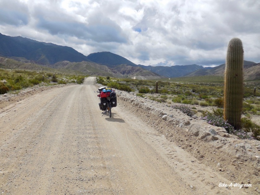
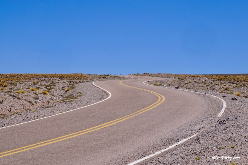
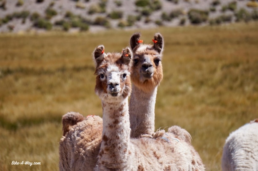
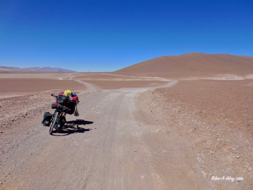
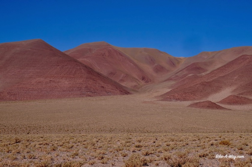
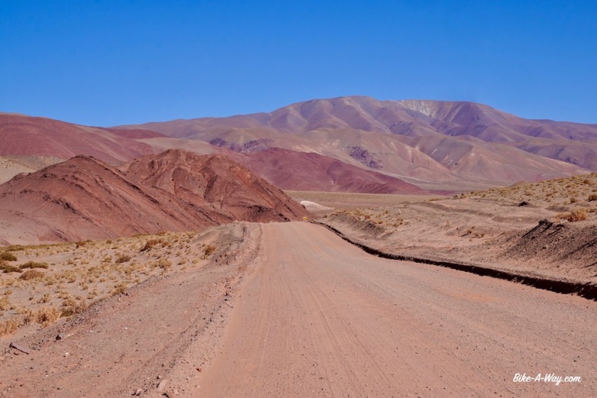
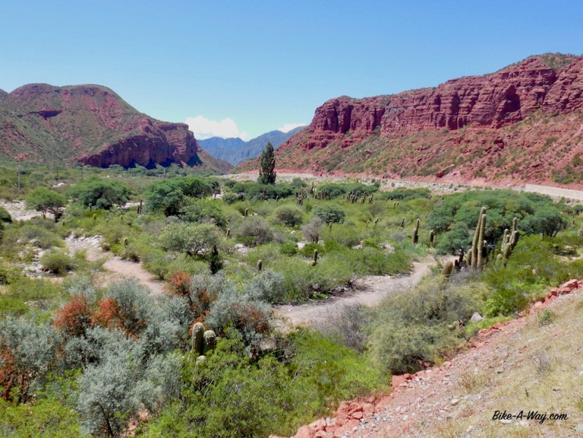
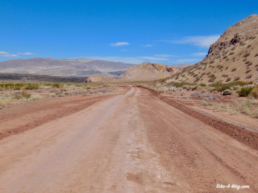
The road starts to climb seriously at Paycuqui, a hamlet of three or four houses. I thought the Puna would be a colorless, desolate high plateau, but it is much, much more beautiful as expected. Mountains in grey, yellow, green and red, many Vicunas and …. a little tail wind to help me up !
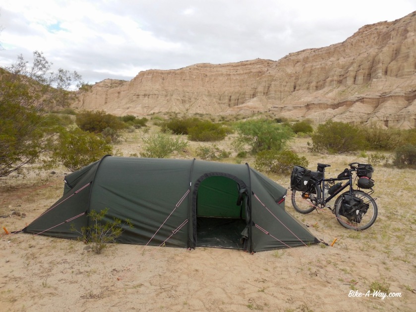
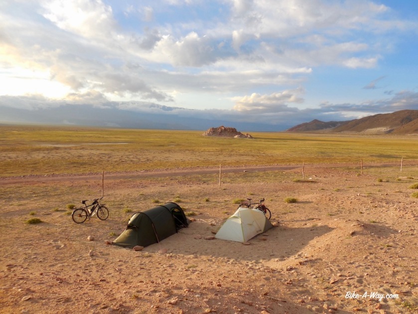
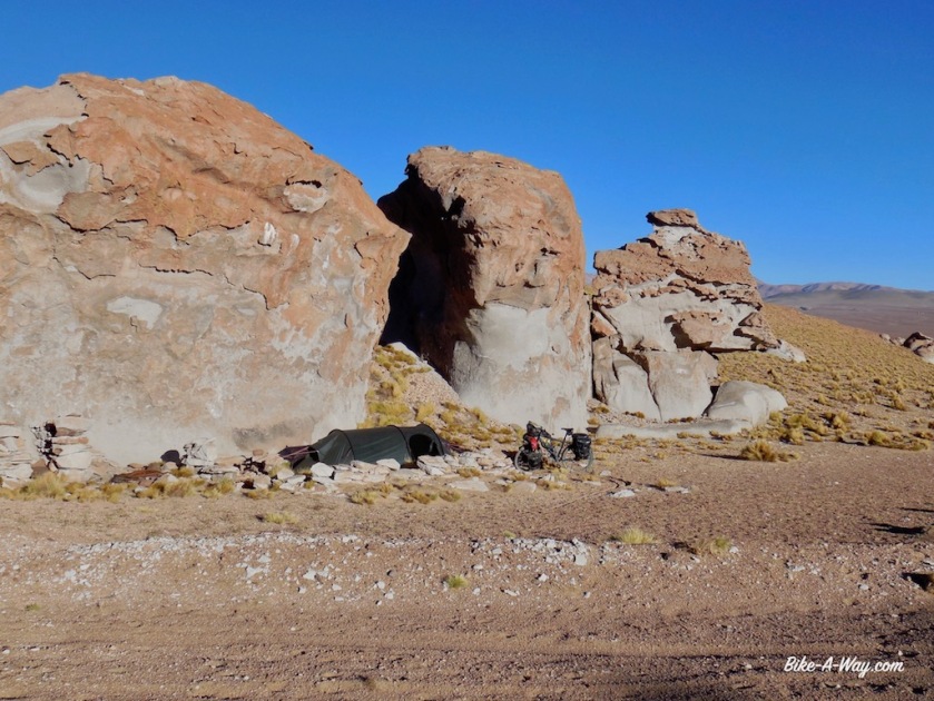
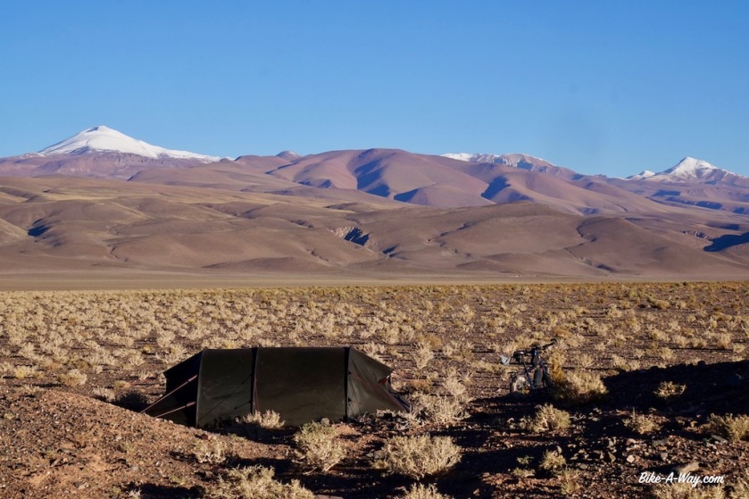
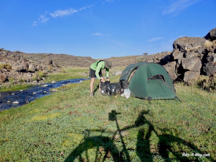
I camp just under the pass at an elevation of 4.358 meter, my highest camping spot ever. Some large rocks protect me well from the wind.
Many cyclists I meet seem to get by on a diet of just pasta with tomato sauce or even only olive oil, but that doesn’t work for me.
So as the sun sets at 19:45, I’m cutting peppers, onions and garlic to make a nice rice & curry dish, with some tuna at this altitude
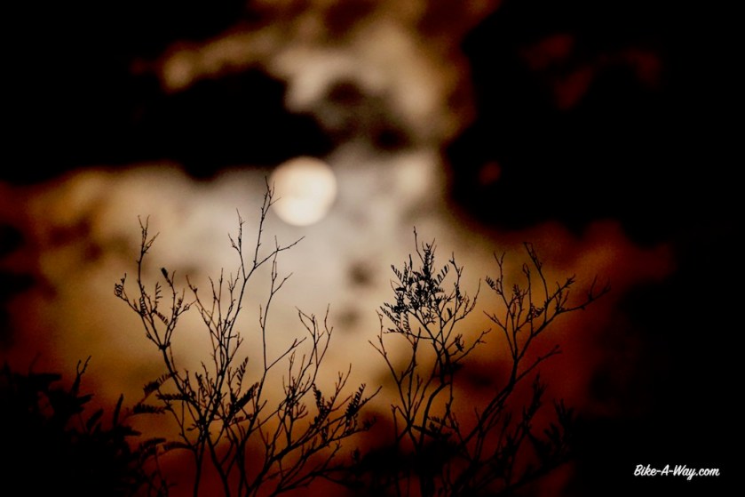
At 22:00, I shortly leave the tent again. The last brightness from the sun in the west is gone. The moon rises after midnight today. No light pollution for hundreds of kilometer, and at this elevation, the night sky is simply unreal. A shame I don’t have a camera anymore with which I could catch it, but I’ll always remember it.
My highest camp so far at 4.358 meter, well protected from the winds.
From my camp spot the next day, the road undulates for a while and it seems to take forever to reach the pass. A while ago I downloaded a bunch of episodes from ‘The Date on Friday’ from 2016 and 2017 (De Afspraak op vrijdag), a program from Belgian television discussing the political events of the last week. So I’m getting a little bit up-to-date again.
After 20 kilometer or so, I’m finally at the top. 4.432 meter according to my gps readings. I also passed the 30.000 kilometer since I started this trip in April 2016.
Wobble, wobble, wobble…Some vicuna’s, surviving one way or the other above 4.000 m.
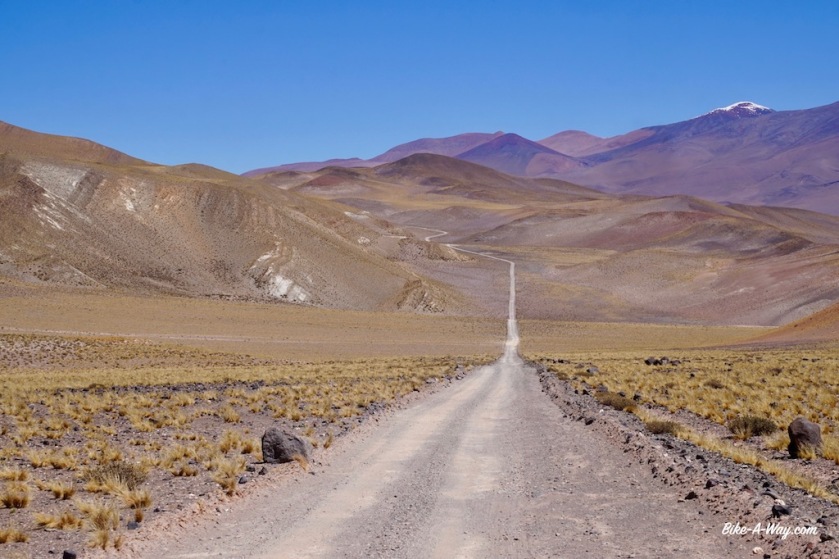
It keeps going up and down for a while before I finally reach the highest point, but what a spectacular environment.This guy lives at + 4.400 meter.‘Abra Falda Cienaga’, the highest point on this Argentinean Puna route at 4.432 meter.
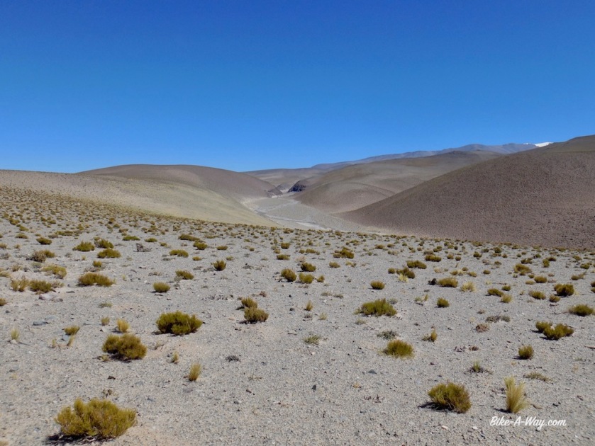
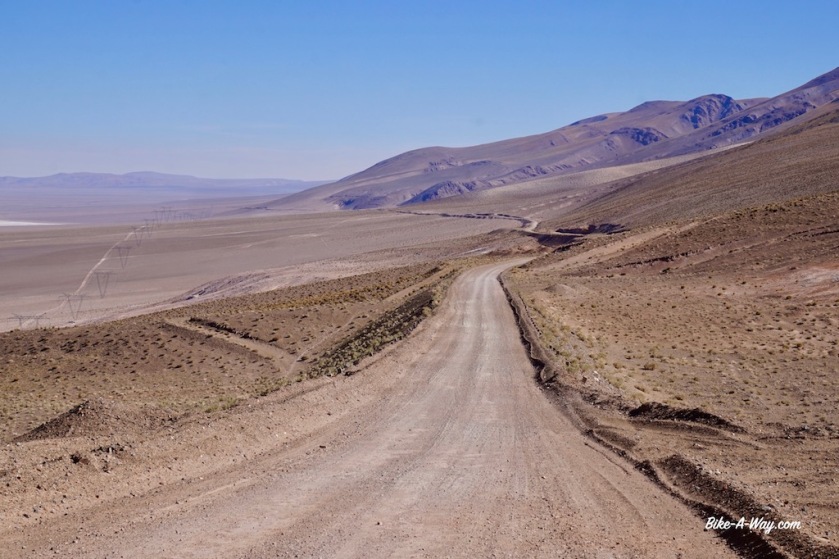
After yesterdays short day of 47 kilometer, I was hoping to make some better progress today but the road keeps descending and climbing. I cycle slow but even then I still stop to just look around. It’s like I’m cycling on Mars.
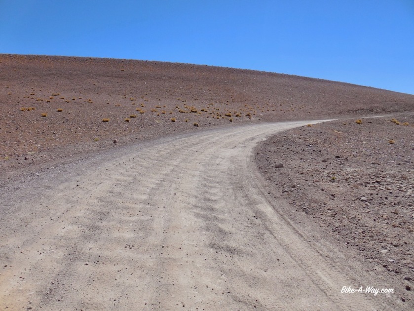
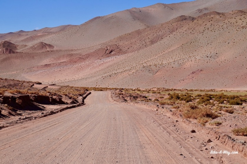
The road is dramatically bad. It’s washboard all the time, with often deep sand thrown in to it. Many times I need to push the bike, which sinks into the sand with all that weight. I breathe heavily at this altitude.
Good, rideable sections are short.
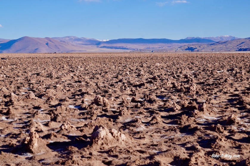
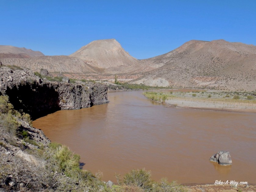
Especially the downhill towards the ‘Salar del Hombre Muerto’ (salt plain of the death man) is awful, as are some parts of the track around it.
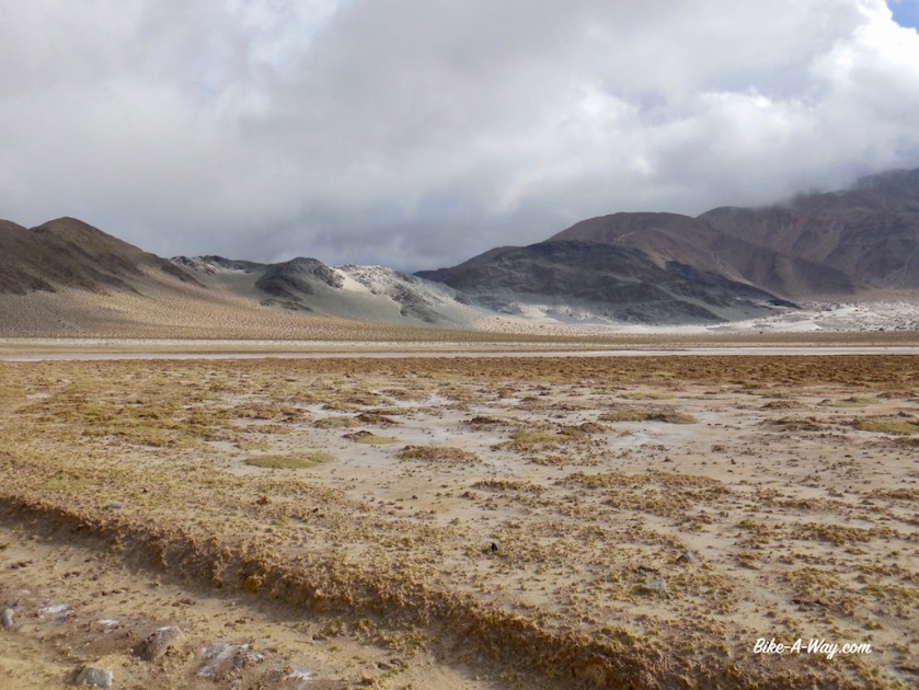
After cycling all day above 4.000 meter, the salar is at an elevation of 3.980 meter.
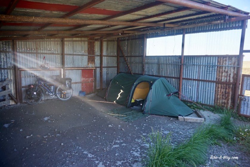
After sixty kilometer I arrive at the unmanned police post north of the salar. It’s basically just two containers which are unfortunately locked. They have a water tank behind them, which I opened from the top. The water was lukewarm from the sun all day, so I had a nice shower in this dry high altitude desert.
I pitch the tent behind one of the containers. Less scenic then the day before, but again properly sheltered from the wind.
Now I’m already 32 kilometer ‘behind schedule’, so it’s good I took again too much food.
I filtered water from the tank, which I use for cooking, do the dishes and brushing teeth. Even with a day extra, I should be fine with the water to reach Salar de Pocitos.
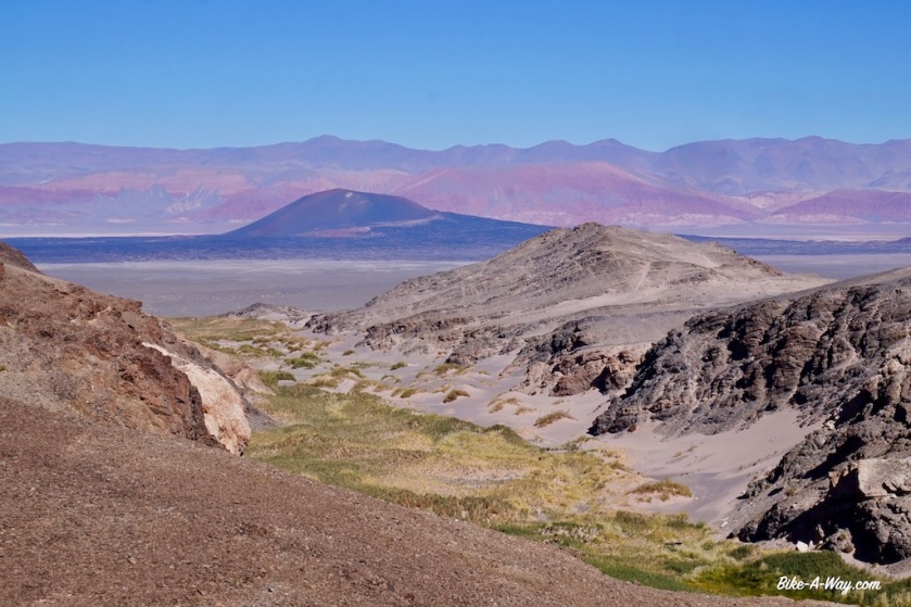
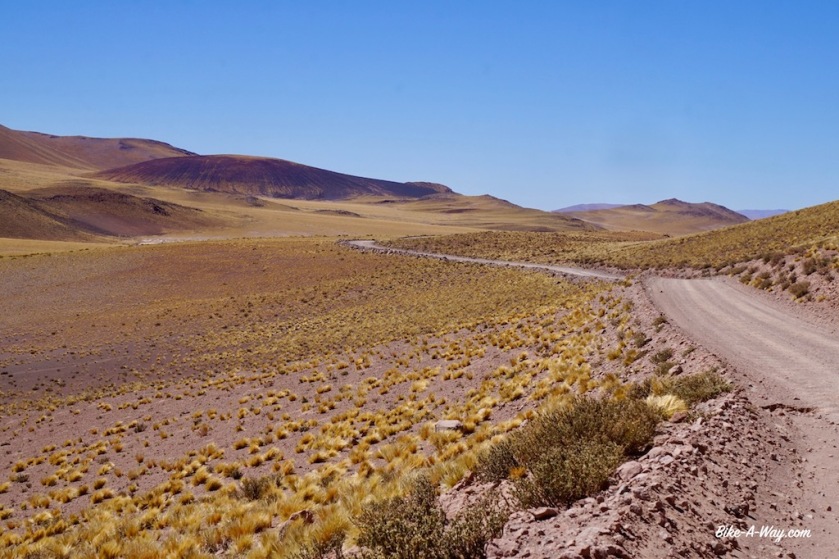
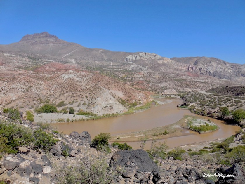
The stretch between‘Abra Falda Cienaga’ and Salar del Hombre Muerto was definitely the most spectacular (and no traffic apart from three jeeps in the morning with ‘adventure tourists’ visiting the salar.
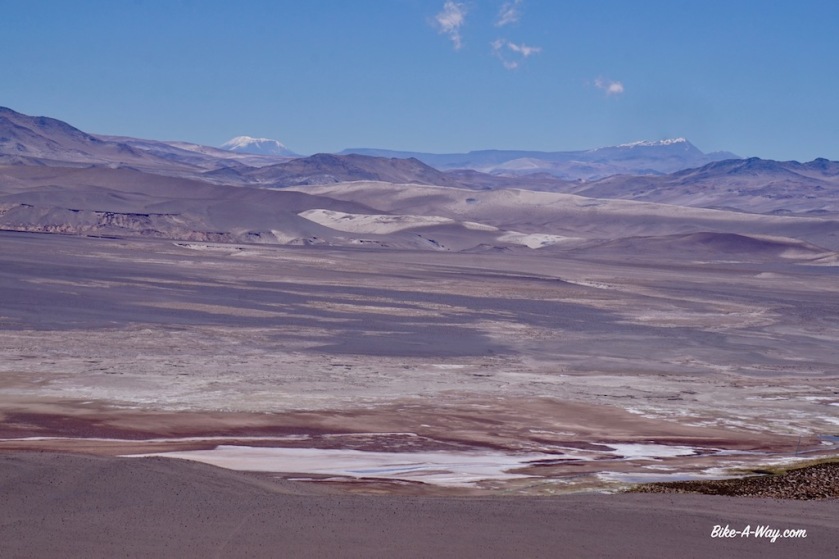
Another little, unnamed salt plain.Every 0,7 seconds your back, pulses, shoulders get smashed on these roads. It’ll make you stronger.
A vicuna on his lonesome admiring the Salar del Hombre Muerto.
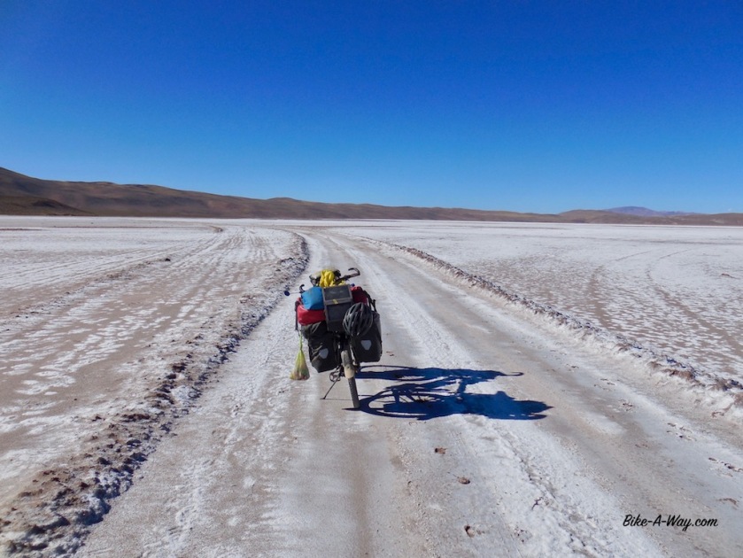
Salar del Hombre Muerto, 3.980 meter above sea level.There are two roads to the other side. The straight one in the middle seemed too muddy so I took the long way around to the left, adding +/- 15 kilometer to the trip.
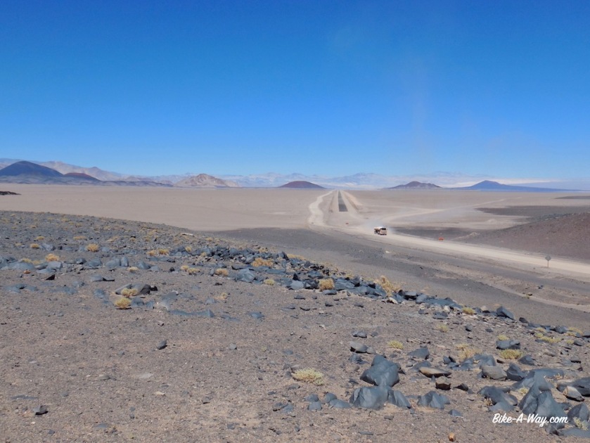
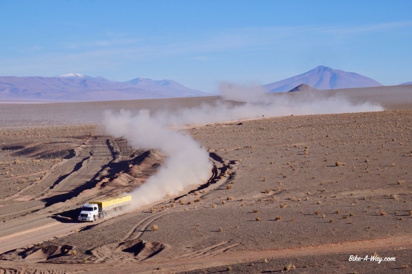
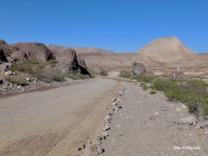
North of the Salar del Hombre Muerto, I have to climb another unnamed pass of 4.195 meter. The road is better for a while but becomes again really sandy and bumpy as the day carries on. As I was virtually on my own between Antofagasta de la Sierra and the salar, now north of this salt plain there is again some traffic of pick-up trucks and big trucks.
None of them symphatic enough to slow down the slightest and leaving me in a cloud of dust every time.
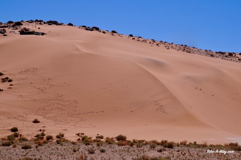
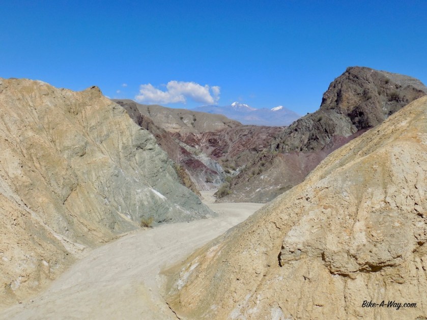
The landscape offers an incredible variety of colors again, with even some sand dunes.
As if red, green, brown and yellow rocks and salt flats aren’t enough to keep you busy, nature throws in some sand dunes for you to admire as well.
You might think, “what is he always moaning about this traffic..”, well watch this truck coming …..This is where he passes you, never slowing down the least bit. See how you’re in that dust cloud for minutes, all sticking to your body covered in sun cream.
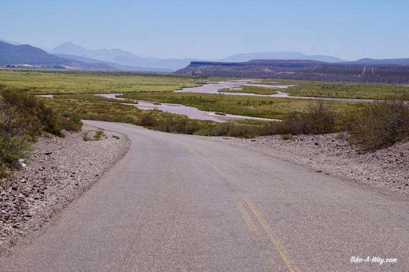
Next day, riding along the salar in a combination of white and red colors, the Volcan Galantop (6.740 m) behind it, I stop for lunch in Salar de Pocitos. Still on ripio road, I climb again to a hill top over 4.000 meter and set up camp for the day looking at Volcan Queva (6.130 m) from the porch of my tent and Cerro del Rincon (5.606 m) on the other side of the tent.
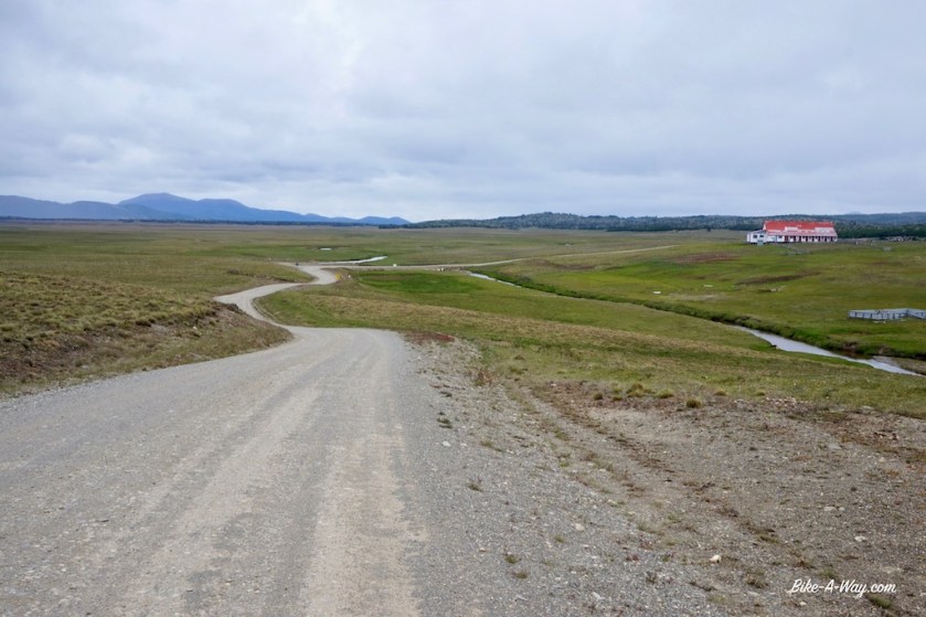
The red house on the left is the restaurant and the village shop. They can give you a place to sleep as well. Service was friendly and the food was simple but okay.
I took this short cut from the ruta 27, out of Solar de Pocito’s towards ruta 51.Nice place to spend the night, again above 4.000 meter, admiring Volcano Queva (6.130 m)
My last kilometers in Argentina are, yet again, along a difficult to ride stretch of ripio and loose sand road along the Salar del Rincon. I met an Argentinean guy on my way up who was invited to stay the night at the immigration post. Also the Japanese cyclist I met in Londres could stay there.
As I had still a lot of vegetables which the Chilean customs would confiscate, I cooked a warm meal at the border post. No shops after the border to stock up on new vitamins.
To my surprise, Frederic arrives as well. I thought he would be a day ahead of me by now.
For whatever reason, we were not allowed to spend the night at the immigration. They send us out at 16:30 hrs, a few hrs before sunset, and with a big climb still ahead of us, the wind blowing like hell from the west. Three kilometer after the immigration, we found some rocky boulders which gave minimal shelter from the hard wind and called it a day.
Tomorrow up and over the Paso de Sico for a final, short stretch in Chile.
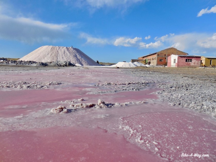
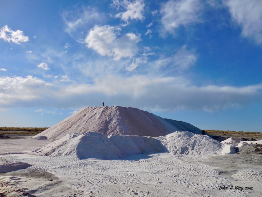
Salar del Rincon on the left.Salar del Rincon
Passo Icalma – Paso Sico
Distance: 2.568 km (of which 238 km by bus)
Average km per cycling day: 58,25 km
Altimeter: 23.707 meter
Nights slept inside: 11 (8 in hostel, 2 in the refugio Volcan ‘El Tromen’ and 1 at Salar del diamante)
Nights slept outside: 35 (of which 34 wild camping and on in hell-Camping El Festival in Tunuyan)
Flat tires: 3
Route: Uspallata – Calingasta – Iglesia – Rodeo – San José de Jachal – Villa Union – Chilecito – Alpasinche – Belén
Route nbr 40 between the provincial capitals Mendoza and San Juan will probably not be a big joy to ride, so I chose a smaller option closer to the Andes range, Ruta 149 from Uspallata towards Calingasta, Rodeo and San José de Jachal.
My map suggested the road from Uspallata to Calingasta would be paved all the way. A false claim.
Pretty soon I’m back on gravel.
The map also showed on various points ‘Qhapaq Nan’. I had no clue what it was. Along the road, I learned this means ‘Inca Road’, and I’m now on the southern most section of this historic trail (the Incas’ southern progress was stopped here by the Mapuches).
To my west, I have views of the Cordillera del Tigre with again a bunch of 5.000 + m high mountains.
Unfortunately, Parque Nacional El Leoncito was closed, due to serious damages in the park after the heavy rains.
Proceeding north, the Sierra del Tigre now the east of me, I visit the stunning Cerro El Alcazar.
It being rainy season, I encountered regular rain showers and electrical storms.View from Cerro el Alcazar
You can see the bike down in the valley.
While having lunch at the ‘plaza’ in Calingasta, I learn from a teacher who’s waiting for the bus to Villa Nueva there wouldn’t be any possibilities to buy provisions there. But she promises to refill my water bottles in the school tomorrow.
On the way in the next day, I meet some German guys who drove a big chunk of the South-American continent with their Paris-Dakar style moto’s the last three months.
They warn me for the upcoming stretch of ripio, saying it was some of the hardest they encountered. They even had to dismount their motor bikes in the loose sand.
I don’t see the teacher back in Villa Nueva, but she told her colleagues I would show up.
Talking way too long with them, and the German guys, it’s already afternoon, and very hot, when I leave Villa Nueva.
I enquired with the teachers whether there wasn’t a small kiosko or anything to buy some bread, but they said there wasn’t. You could only buy alcohol here.
But, on my way out, of ‘town’, there was a small wooden sign outside a shed that claimed they sold food and beverages.
Entering the building, a fragile centenarian was just having his lunch.
He had some basic stuff, like cans of tuna, pasta, olives, …
No bread.
I bought some extra pasta, tuna, onions and dry, tasteless cookies. Then I saw his fridge.
Aaah, “a cold coke please”, I asked.
But indeed, he only had beer in that fridge.
What a shame. I told him he should put some coke in there for passing cyclist.
I would have bought one, and who knows another cyclist will show up on his doorstep later today ?
In the end, he gave me also what was left of his bread, so I was good to go.
Eighty kilometer of very bad road was coming up, he said.
It wasn’t all that bad at first. Lot’s of washboard. Up and down. Some sandy stretches.
But no traffic.
Nothing.
What a good road !
At the beginning of a particularly bad stretch, I was just trying to push my last meters before dismounting, I saw a cyclist coming from the other side.
On a Santos bike ! 🙂
It was John, a Dutchman cycling from Brazil to Santiago de Chile, then flying out to New-Zealand.
We chatted for quite some time. He warned me a stretch of 8 kilometer was coming up. Like a dried out river, full of loose sand and stones. Eight kilometer of pushing.
This was my fourth longer conversation in 24 hours.
Good, but that’s enough socializing for this month 😉
I pitched the tent a bit further on, leaving the hard part for tomorrow.
John, the Dutch cyclist going the opposite way.
Having that part behind, I reached the pass (2.655 m) at a place cold Tocota.
Only thing here is a police check point. Reluctantly, they gave me some water. They claimed they didn’t have much themselves.
The 8 km section of loose sand.
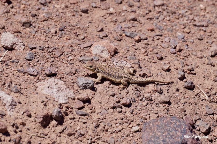
This little chap was hiding low after he saw me. When walking, they have legs a few cm high.
At the town of ‘Iglesia’, I’m back on asphalt, and there are some shops.
Both my guide book and map claimed I should visit ‘Capilla de Achango’, an old chapel, some three kilometer from the main road, along a bad gravel path.
I went down.
‘If the chapel is closed, you can get the key from the house next door’, the guidebook said.
Not when nobody’s home of course.
In Rodeo, I went to the park headquarters of the Parque Nacional San Guillermo.
It was closed.
Just after Rodeo, at the ‘Dique Cuesta del Viento’, they’ve built a dam in the Rio Jachal, thus creating one of the top windsurfing spots in the world, just at the foot of the Andes mountains. Apparently, in summer wind is blowing almost every day here at speeds upto 120 km/hr. It wasn’t blowing that hard the morning I passed, but the wind sure made me work hard until half way down the road to San José de Jachal. In this town, one should visit the ‘Iglesia Sande Jachal’ with it’s black Madonna.
It was closed.
The lake at Cuesta del VientoRio JachalAnother road victim.
Since halfway between Rodeo and San José de Jachal, I felt this strange ‘wobble’ in my back wheel. I trust my rims, since they are Belgian made Rigida touring rims, so it had to be the tyre. And sure enough, it was torn for about 20 cm right where it fits in the rim (this is not the tyre I repaired back in Chile, that one is still holding out).
I limped into town. A Maxxis mountainbike tyre was the bast I could get
San José de Jachal is also the place where I have to decide whether I ‘ll make the detour via Parque Natural Provincial Ischigualasto, better known as ‘Valle de la Luna’ and Parque Nacional Talampaya. Both are renowned to be among the most beautiful in Argentina.
BUT, both can be visited under guidance of a ‘guardaparque’ only.
Now, it is claimed you can get a guardaparque on a bike in ‘Valle de la Luna’, but I can see from here they probably don’t have a bike, or it’s broken, or ….
Furthermore, I heard (part of ?) the park is flooded by the heavy rains and can’t be visited.
Nothing of all these question can be confirmed or denied in San José de Jachal, so I decide not to take my chances and ride directly north through the Cuesta de Huaco towards Guandacol and Villa Union, again on Ruta 40.
It’s still rainy season here (till end of March) and almost every evening and night there’s a thunderstorm with a spectacular light show. That’s nice enough as long as there’s not a real storm coming with it, or hail, which I don’t like on the tent.
Some nights, I’m out in the open pampa and my tent with it’s three aluminium poles the highest thing around for kilometers, which makes me worry not to get hit by the lightning.
After the horse flies further south, there are now smaller flies, only a few millimeter long which annoy me. They do bite as well.
And ants.
Zillions of ants. Everywhere. Just before Guandacol, every spot I inspected was even infested with red ants.
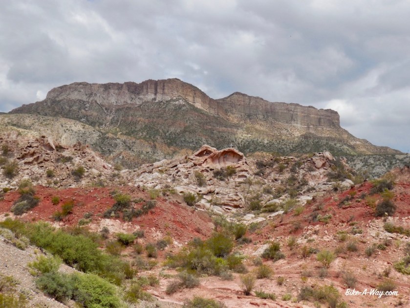
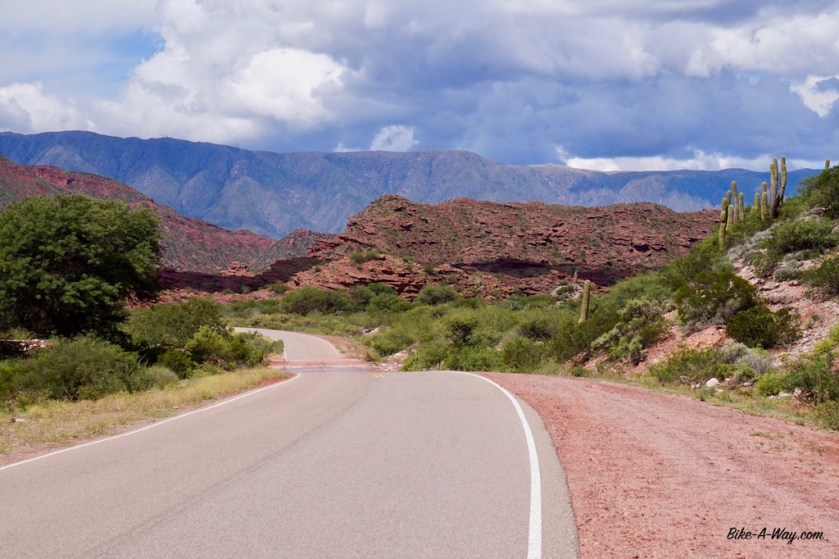
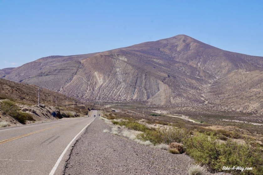
I’ve been cycling between beautiful red rocks for a couple of days now, but 40 kilometer after Villa Union, when one starts climbing towards the Cuesta de Miranda, suddenly I spot the first big cacti along the road. It’s like a wild west country here.
Terrific wild camping spot just under the top of the Cuesta de MirandaNear the top of Cuesta del Miranda, red & green scenery here.
Continuing traveling along Ruta 40, I pass Chilecito, Pituil, and cycle into Londres, one of the oldest little towns of the province Catamarca. For the first time since quiet a while it’s raining heavily and when I see a loaded touring bike at the hostel in Londres, I call it a day as well. The bike was from a Japanese cyclist, heading south.
We go for diner together later that night. He’s a university student at the Kyoto university.
Between Nonogasta and Chilecito is one of the very few cycling lanes in Argentina. Lot’s of wild camping options next to it.Ah, choices, choices…Not one of the most beautiful spots, but it gave me perfect shelter from the winds.The Japanese cyclist I met in Londres, one of the oldest towns in Argentina.
Route: Lago Aluminé – Las Lajas – Chos Malal – Bardas Blancas – Malargüe – San Rafaël – Tunuyan – Tupungato – Potrerillos – Uspallata
27/01/2018
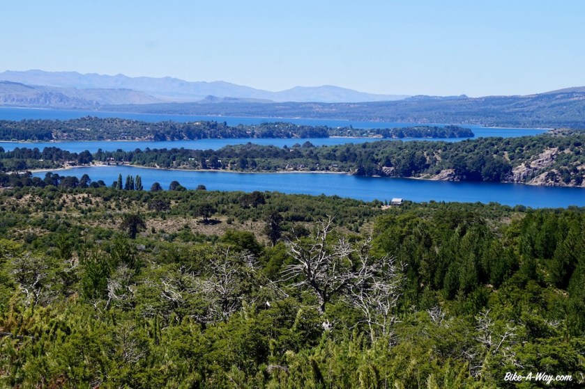
After having spend the night in the no men’s land between the Chilean and Argentinean immigration posts, I descend towards Lago Alumine. Coming from the Icalma Pass (1.335 m), I get a beautiful birds eye view of the lakes. Being back in Argentina, I can enjoy their bakery culture again, with a bigger variety as their Chilean neighbors.
I slowly ride along the northern shores of the big Aluminé lake, stopping sometimes to check out the beach and the water.
Route 23, again a gravel route of the worst kind, with rough wasboard, loose sand (yes, that combination is possible) or just a bunch of stones slows me down on the flat parts to 6 or 7 km/hr.
Luckily, the gradient is much, much gentler as what I had in Chili. Slowly my road climbs up the valley of the Rio Litran. I spot a few possible camping spots along the river, but the fire pits, broken bottles, rubbish and car tracks suggest I might get company in the evening, so I press on, finding a nice spot under an araucania tree in the bed of a dried up stream, a few hundred meters from the road.
Next day there are only a few, bumpy kilometer left to the highest point of the road at 1.621 meter. The ‘road’ stays high up for a while before descending towards the paved road 242 on which I have an easy way down towards the town of Las Lajas.
To ensure a quiet night, I chose to wild camp next to the Las Lajitas River, a few km before town.
After Las lajas, I suddenly seem to enter another world again. After having spend the last months in a wet and green environment, I’m suddenly back in the dry and hot desert. I was a bit careless about that upon leaving Las Lajas, and should have taken more water.
Luckily, there’s some sort community building for Mapuche’s at Coihueco where I can refill my bottles.
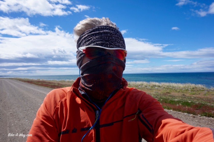
Due to the strong winds, I need to put my helmet on top of my sombrero to keep it on.
After a rest day in Chos Malal, I had to choose between the paved Ruta 40, or a small white road on the map, going through the ‘Reserva Nacional Tromen’, via the ‘El Tromen’ Volcano.
The latter, off-road route is way more interesting of course.
I fill up all the water bottles and the water bladder before taking off. As soon as I leave the Ruta 40, I’m on ripio again. Still some traffic. Nineteen cars until the junction to Tricao Malal.
After that, I would encounter one more car until the end of the day at Laguna Tromen.
As there aren’t any sheltered places to pitch the tent, I opt to sleep in the refugio near the Guardaparques. The climb isn’t too steep, but the temperatures went up to 47,5 degrees in the sun. As there’s no shade here, that’s the only temperature that counts.
To the west of me is the ‘Cordillera del Viento’, which luckily doesn’t create to much of a wind this time around. But from what I’ve heard, it can get pretty bad here.
After an extra rest day in the refugio, it’s only a short climb to the top off the pass at 2.277 meter.
Volcan ‘El Tromen’
The huge lava field below El Tromen.
Highway 37
Between the little town of Barrancas and Bardas Blancas, I encounter a much longer, and also much worse ripio stretch as I expected. I camp somewhere in the middle along the Rio Grande (one of so many Rio Grande’s). It’s a brownish fast flowing river, suitable to get a quick wash of the body, but useless to drink.
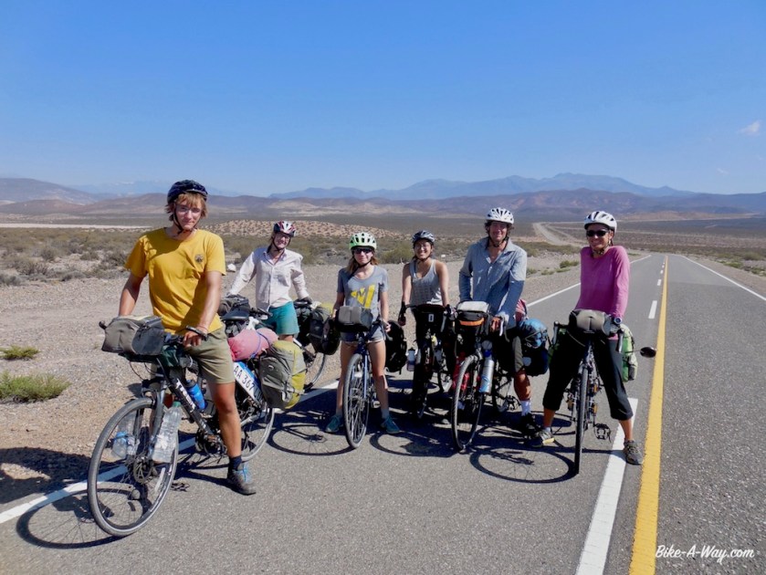
A Canadian family + 1 friend, cycling from Ecuador to the Southern tip of South-America.
The area to my east is the Reserva Provincial El Payén, a huge area with more or less the highest volcano density in the world. To the west of me, there’s the Sierra de Cochico, and the the Andes of course.
Thirty kilometer south of Malarguë, the misery starts again: brain death drivers speeding at centimeters passed your legs. I thoroughly enjoyed the ride all the way from where I entered Argentina again near the Lago Aluminé, but it couldn’t last.
I really wonder how this works. Do these people have a perimeter of about 30 kilometer from their town which they never leave, or do they change their attitude if they do so ?
The only thing I do in Malarguë, besides buying provisions, is having lunch in the YPF gas station and use their pretty good wifi connection.
A Swiss guy comes ver for a chat. He came down to South-America a couple of months ago for a big cycling trip but has given up since. Reason: The way people behave on the road. He bought a car in Chile and is now traveling in that.
I’m facing a little problem. Ruta 40 has an unpaved section a bit further north of here. It’s 163 kilometer long, and apparently in a very bad state, pushing required in some sections.
Not a problem normally.
On the contrary, I would look forward to it, but I’ve had so much ripio lately in Chile, then had the hard ripio climb via El Tromen, after that the bad ripio sections between Barrancas and Bardas Blancas.
It has come to a point where my hands, pulses and especially my shoulders really hurt. So now I plan to follow the paved (longer) route via San Rafael, which most cyclists seem to take.
I worry a bit I will end up in San Rafael in the weekend of 11 & 12 February. The internet tells me that’s when carnaval is celebrated.
I am not looking forward to share my time with drunk, excited, loud carnaval party goers.
When I enquire with the lady at the gas station if she knows if they have carnaval celebrations in San Rafael, she doesn’t know. But tonight there s some kind of “fiesta” here in Malarguë, she says cheerfully, as if i’m the luckiest guy in the world to arrive just at this day.
I pretend to be excited by this news, but can’t hurry enough to leave town. At the far end of town is a tourist information, where I again try to find out about possible carnaval celebrations in San Rafael. Both guys working there don’t have a clue, but, we have a fiesta tonight in Malarguë.
Thanks guys…
I cycled of into the wind and found an excellent place to pitch the tent. There was an open gate, leading to a row of trees. Behind the trees some of these big rolls off grass behind with I pitched the tent. Perfect shelter. The wind blew super strong from the mountains, making lot’s of noise in the trees, but the tent hardly moved.
Nice, wind sheltered place.
In the morning, the gate was closed, of course.
Back on the road, I had to cover another 40 kilometer towards El Sosneado.
Strong side wind blowing from the Andes, but I didn’t worry. In El Sosneado, I would turn east and have this wind in my back. It would blow my fast and easy towards San Rafael (in two days).
And yes, after refilling my water bottles at the police station, I left switched ruta 40 for ruta 144.
I hardly had to peddle to get the speed above 30 km/hr.
Wow, this is insane, I have to be careful, or I will arrive in San Rafael tonight already.
Five kilometer it lasted.
Five kilometer, then one big wind gust in my face.
My speed went down to 20 km/hr.
The wind turned immediately.
It never blows from the north east.
Excepted when karma has it’s roll to play.
Now I moved like a turtle at 8 km/hr. Even that I ‘ve learned to accept by now. But not on roads like this, with that much traffic. Eyes locked on the rear view mirror.
Losing your concentration for four or five seconds is immediately rewarded with a near death experience from the next passing cars.
I hate them.
I truly hate these Argentinean and Chilean drivers.
They won’t slow down, ever.
I tried everything, claiming 1/3 of the lane, so here’s no actual space to pass me when another car or truck is coming from the other side.
They don’t care.
They go a little, little bit closer to the centre of the road, hoping the car from the other side goes a bit to the side, but if he doesn’t, your done.
I tried claiming half of my lane.
Sure no place now for them to come in between me and the car from the other side.
They are not impressed.
None of them.
They keep coming at full speed.
As a cyclist you have two options. Dive in the ditch, or end up in a wheel chair (if you’re lucky).
I can’t count the times I feared for my life today.
I cycled 115 kilometer and ended up sleeping at the ‘Salar del Diamante’. Not one suitable place to pitch your tent on this windy pampa.
The commercial operations on the Salar seem to be something of the beginning of the previous century, with very, very old trucks, machinery still showing names of English manufacturers. It must have been a state of the art, modern thing back then, but it seems not much has been invested or maintained since those days.
From San Rafael I will take the bus. The road going north connects with Mendoza. this are the two biggest cities of the province, so I know already what that will be like.
I’ve completely had it with the sick attitude of these drivers. And that’s 99% of what’s out on the road here.
Salar del Diamante
My home for the night at the Salar del Diamante
I gave up on cycling the potential death road between Malarguë and San Rafael. An employee of the salar gave me a lift into town. There I went straight to the bus station and bought a ticket out of town, to Tunuyan, a place south of Mendoza. It appeared a small place on the map, but is much bigger as expected.
The campground, ‘El Festival’, where I write this at 1 am in the morning.
It hasn’t stolen it’s name. It seems like a festival here. Tents are pitched at 50 centimeters interval. I placed mine in the only corner with still a bit place left, but at 23:00 hrs, four guys arrived in an old Ford Sierra. Before they pitched their tent, they built their ‘sound system’, with huge loud speakers.
Now, at 1 am, people are still arriving and building their tent at less then 50 centimeter of mine.
Three couples with small kids and toddlers.
At 1 am !
Am I strange if I find all this abnormal ?
Either way, I’m getting sick of the fact it is never quiet in South-America.
Argentina and Chile not very populated ?
Don’t make me laugh.
They are everywhere, they are loud and if there’s one thing nobody seems to do here, it’s thinking about other people.
Why on earth are peoples with kids & toddlers still building tents at 1:30 am (they have troubles erecting it).
There’s a buggy almost standing inside my tent.
I truly wonder how much I can have before I….
The tent next door, kids start to cry.
I’m pretty close to crying myself as well.
At 2:45, they finally had their tents up. They struggled a bit with the last one.
Well, they struggled with that one over an hour. No wonder when you’re trying to pitch it inside out !
“Now it’s time to start the bbq”, I wanted to joke, but no need for that, because that’s exactly what they did.
Kids, all under five years old, still running around.
At 3:45, a couple of the babies are brought inside the tent, not all of them.
The other kids have to go in the tent at 4:15.
Babies start to cry.
Now the parents start the car stereo.
Some of the adults go to sleep.
Drunk snoring mixes with the ‘music’.
Camping ‘El Festival’ at Tunuyan, the worst campground ever.
So it went on and on all till morning.
I went inside my tent, exhausted at 4:45 am.
Woke up two hours later. Two of the guys were still siting outside, obviously drunk and under influence of other drugs. Only way to manage the sleep deprivation, I guess. They’ll probably hit the road later on in their cars.
I start to make some noice with pots and pans to have my little revenge on those sleeping.
By 9 am, freshly showered but overly tired, I leave the campground.
The Carrefour in town is the first ever around the world not selling any fruits, vegetables and bread.
The yellow roads on the map, indicating minor paved roads west of Tunuyan are still traffic infested.
Probably more then a few of them on drugs and alcohol. I anticipated that and made a route on gravel roads towards Tupungato with the help of the great online routeplanner ‘BRouter’.
This routeplanner seems to be able to come up with great options the world all over.
I got it thanks to a tip of one of my idols, Frank Deboosere. He’s got a great webpage, including a blog section about his cycling trips.
Apart from Ben Crabbé, Frank Deboosere and his colleague Sabine Hagedooren are the only decent people left on the BRT.
Anyways, that BRouter is a great tool.
An old Vailant car 🙂
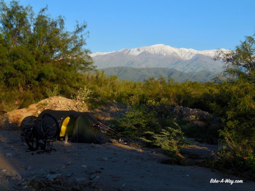
I pitch my tent a bit off the road a few kilometer past the village San José, at the start of the climb towards Uspallata.
It isn’t the very best of places, but I’ve got a tiny irrigation channel passing by, which means I don’t have to use any of my drinking water to do the dishes (and it makes a calming sound like a little pont with a bubbling stone), andI’ve got a line of trees protecting me from the wind if needed.
The only nuisance a fair amount of traffic passing by till after sunset.
The tent is pitched by 6 pm. I start reading a bit inside the tent but fall asleep within minutes.
One way or the other, I find energy to make diner around sunset.
Apart from the occasional barking dog, the night was quiet and I decide to take a rest day here. I badly need that after the horrible day in traffic on route 144 to San Rafael, the bus ride to Tupuyan and the worst night of my life on the worst camp ground I ever encountered in that same place.
All is good again.
Well the ground under my tent is a bit bumpy. No problem at night as the excellent Therm-A-Rest NeoAir filters all that out, but it’s not very comfortable during the day.
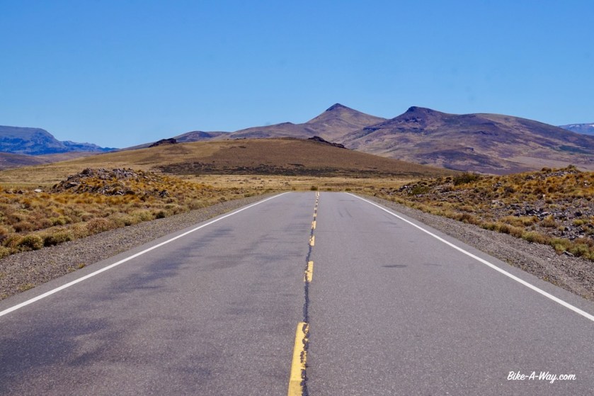
The road soon turned to ripio again after my wild camping spot. I’m entering a part of the Andes with some of it’s highest mountains. The very highest, Aconcagua (6.960 m) is not visible from here, but I have terrific views of it’s smaller brothers, Volcan San Jose (5.856 m), Cerro Tupungato (6.570 m) and Cerro Juncal (6.072 m). The views from the unnamed pass I’m taking today, 2.292 meter high, are splendid.
The traffic on Route 7, the main highway between Buenos Aires, Mendoza and Santiago de Chile is of course busy, but somehow not as bad as expected. The scenery again is amazing.
I leave the bike in a hostel in Uspallata and take the bus up and down to Santiago de Chile for a day.
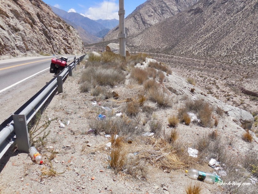
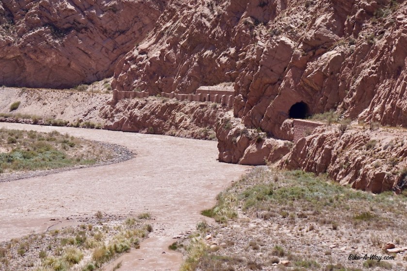
Old railway infrastructure built by the English.Typical roadside garbage. For one reason or another, diapers are everywhere, often bags full. Why can’t they throw that away at home instead of throwing full bags of that along the road ? Another favorite is bottles with yellos liquid. and it ain’t Fanta.The old railway tunnels which could be easily converted into the most spectacular cycling track.
There is a huge, huge, huge potential here in creating the worlds most spectacular bike path.
An old railway line, build by the English, is climbing from Mendoza, via Uspallata towards the Cristo Redentor (= Paso Los Libertadores) Pass (3,200 m). The line runs at the other side of the Mendoza River for most of the way and most of the tunnels and bridges are still intact.
On the Chilean side, another railway line, completely out of use is going down.
If both governments would invest in a bit of asphalt, or even just take the railway away and level the ground, not any other bike path in the wold could match this.
Thousands of cyclist would come to ride this, hostels and restaurants on the way up would get good business, it would be one of these ‘little adventures’ one must do.
But they prefer to just let it crumble to pieces, just like the rest of the lines in the southern half of South-America.
What a pity.
Passo Cristo Redentor on the Chilean side. Spectacular downhill (I did this by bus, going up & down into Santiago de Chili from Argentina for a day).Taken from the back window of the bus. Spectacular road, but I don’t want to be here on my bike with that traffic.
07/12/2017
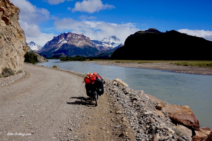
After a night in a hotel in Puerto Natales, I took the bus onward to El Calafate, back in Argentina and from there straight onto another bus to El Chaltén. In hindsight, I’m happy with my decisions not to cycle this stretch through the pampa, against the relentless winds again. Only the stretch between El Calafate and El Chaltén on the routa 40 is much nicer as I anticipated, and there I regretted it not to be on my bike.
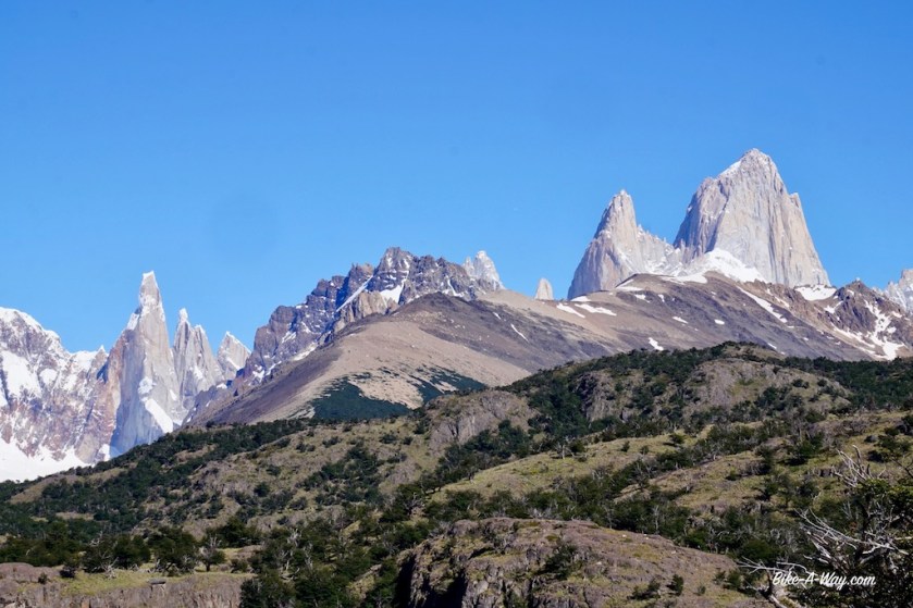
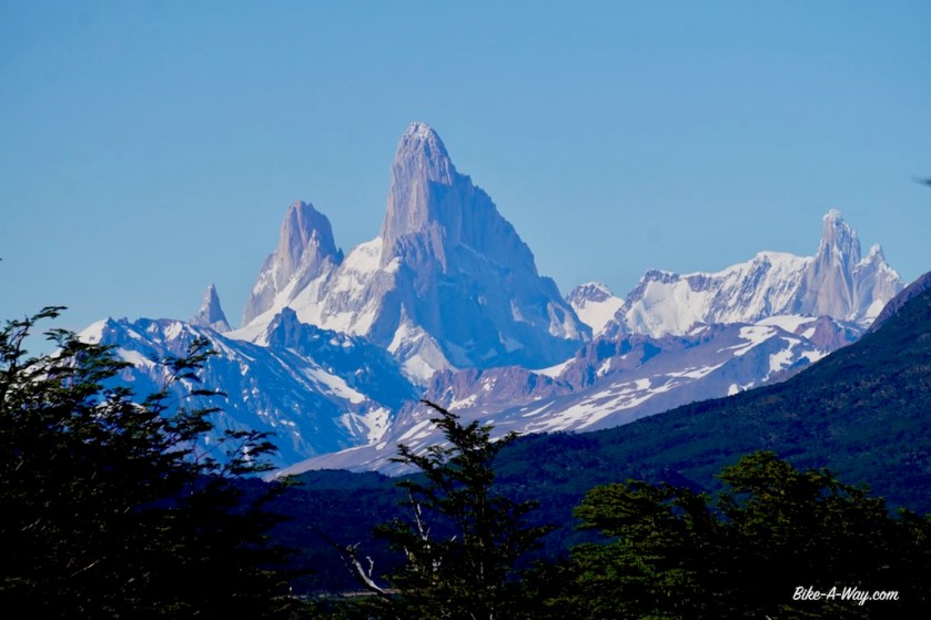
Approaching El Chaltén, I had my first views of the magnificent and iconic Mount Fitz Roy, named after the Beagle’s Captain Robert Fitzroy.
While I was completely battered from the bus ride and wanted to take a rest day the day, the weather was brilliant again. That’s an opportunity one can not let by here, so at 07:30 hrs I was walking out of town already into the norther section of Parque Nacional Los Glaciares towards the ‘Lago de los 3’ trail. This is a trail of about 10 kilometer (one way) leading you up to a lake at the foot of Mount Fitz Roy. To my surprise, I was almost alone on the trail. The last kilometer is steep and a bit harder, but the rewards is awesome and the pictures speak for themselves.
I do get it on my nerves of all this people who nowadays have to pose with outstretched armes in front of every natural attraction, as if they discovered or created them.
El ChalténThe valley I would cycle through a few days later towards Lago del Desierto.The last bit up to the ‘Lago de los 3’ lookout.And what a reward, standing so close to one of worlds famous mountains. Mount Fitz Roy (3.375 meter)
On my way down, I crossed busloads of people climbing, struggling up. It was a good decision to leave that early. I’m surprised to see so many people, twenty years my junior who are sitting along the trail, panting, totally exhausted. People are even more out of shape as I thought.
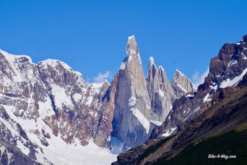
Luckily, about two kilometers on the way back, I can take a right turn to a trail which connects the hiking trail to Mount Fitz Roy to another trail, the day hike towards Cerro Torre.
It was still pretty early, so I decided to do both trails in a day. On the connecting trail of 8 kilometer, I only met one couple and one single hiker. It’s an easy trail along few lakes. Very beautiful and inside the forest, so you’re pretty sheltered from the high winds.
On the trail towards Cerro Torre, there’s no protection for the wind anymore, which blows with enormous forces right in your face. I headed on but really quickly the white clouds which covered the famous peak became darker and darker, the already storm like wind fiercer and fiercer.
I decided to turn back, as this would lead to nothing. I couldn’t see anything of the peak, and wasn’t eager to continue in the rain or snow.
Amazingly, I still saw people totally unprepared going on towards the Cerro Torre, carrying no rain gear, without decent shoes. And then they are surprised they have to be rescued.
Around 4 pm, I was back in El Chaltén, having hiked 30 km and 1.800 altimeter.
The valley towards El Torre, covered in clouds, but stil spectacular.
Saturday was a rainy and windy day which I used to do an oil change in the Rohloff hub and book my ferries on the Lago del Desierto and Lago O’Higgins. I skipped the famous and touristy Perito Moreno Glacier, but only because I had a boat trip to the O’Higgins Glacier in mind.
Sunday was a real warm and sunny day again, so I retraced my steps towards the look-out point of Cerro Torre. How lucky I am. Some people sit in El Chaltén for a week and never get to see a thing, and here I am sitting in a t-shirt looking at these spiky Andean peaks against a blue sky, drinking pure water from the streams floating down of them.
Cerro Torre at the right left, Fitz Roy on the right.Cerro Torre (3.102 meter high)
Late Sunday, I got the message I urgently had to go to the people from ‘Exploradores’, where I booked my ferries. It seemed the ferry on Lago O’Higgins had a serious problem and would surely not run again until Christmas. A big bummer. There’s a second, smaller boat doing the trip, but their website still shows sailing schedules of last year, and it’s not clear whether and when they would go to the O’Higgins Glacier. I booked my transfer online. The people of ‘Exploradores’ office did a really great job in tracking me down, calling all the hotels, hostels and guesthouses in town until they found me, in order to advise me the ferry broke down and give me my money back.
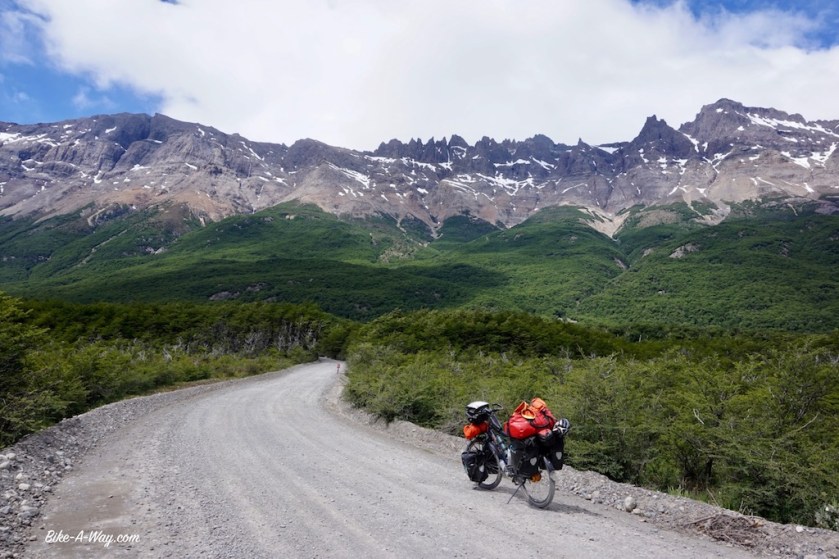
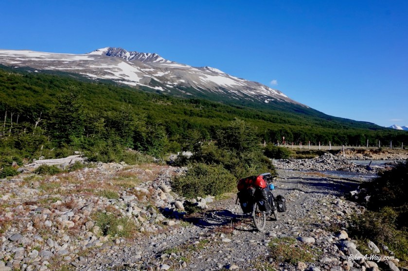
On Monday I cycled the 40 km from El Chaltén towards Lago del Desierto. A beautiful gravel road, many times in bad condition. But the scenery makes up for it. I stop at a beautiful waterfall, cycle between snowy mountains, cross rivers, along lakes, ….
On the way down, I got interviewed by a friendly Italian lawyer who writes in his spare time for a cycling magazine. Again I posed for a few pictures 🙂
On all my previous trips before South-America, I only got interviewed once for the local tv of Nong Kai in Thailand but now it’s one after the other.
The Italian cyclist.
At 16:30 my ferry leaves for the one hour crossing towards the Northern edges of Lago del Desierto.
My original plan was to camp near the Argentinian border post, where I’d have spectacular views of the back side of Mount Fitz Roy. It was too cloudy to see anything now, and as I understood the little ferry I booked to cross Lago O’Higgins would go on Tuesday ‘somewhere in the morning’. There wouldn’t be any more crossings later this week, due to the upcoming bad weather. I could not do otherwise than start the famous and hard crossing towards the Chilean side in the evening. The Argentinian border guards were surprised I was still taking that stretch on so late in the day.
This must be one of the most peculiar border crossings in the world. The Argentinian immigration sitting down at the Lago Del Desierto, the Chileans at the Lago O’Higgins. From the Argentinian side, there’s only a mule trail going steep up towards the pass, separating both posts. The path is often a gully, one meter deep and just as wide only. The first part I have to unload most of my backs, go up and down a few hundred meter to carry the first load, come back down to pick up the second load, bring that up, come back down to collect the bike and push that up again, so doing the stretch five times. Luckily, it’s mostly dry, but at some parts I got some drizzle.
I push and push, carrying my stuff over rocks, through another gully, through several larger and smaller streams, through a muddy swamp, until at 22:00 hrs, half an hour after sunset I pitch my tent on a flat part in the middle the trail. I guess there’s no chance at all anybody will come through here at night.
Lago del DesiertoThe one and only road between the Argentinean and Chilean border.The swamp you’ll have to cross. Luckily, there are a few river crossing before and after this, so your feet are wet already, and you’ll get a chance to wash of the mud off later on.
Camping on the ‘road’ between the Argentinian and Chilean immigration.
I wake up at 6 am. I’m about one kilometer from the pass and the official border. Just before this border, there would be better camping opportunities on a nice grassy field.
Crossing this border also means my seventh Argentinian / Chilean border crossing this trip, and also my third crossing of the Andes range.
The Chileans luckily made a ripio track up to the border, which makes the going a lot easier. It’s again a glorious day today and looking back, I still have some sights of the back side of Mount Fitz Roy in the distance.
Despite the many photo stops I take, I still arrive with the Chilean border guys down at the lake around 9:30. It seems I’m just in time, as a small boat approaches the jetty at Candelario Mancilla, as this place is called.
The Chileans have constructed a nice ripio road at their part of the border.They even construcred bridges, so no more wet feet.
Eventually, I still got a nice view of the back side of Mount Fitz Roy, seen here from the Chilean side.First views to Lago O’Higgins.
I’m the only person present, but soon seven other cyclists and a bunch of hikers descent from the campground which lays a bit above the jetty.
The Captain told me today he doesn’t do any glacier trips, as he has to bring some solar panels to a farm further down the lake.
He’ll be back around 2 pm to bring us to the other side of the lake.
Apparently, the boat is allowed to take 16 passengers only. We are eighteen people. Everybody seems to have their own reason to justify why they could board the ship instead of others. Even those (most of them) who had a booking for the other company which doesn’t run. They were stuck here since five days already. The weather was too bad on this side of the Andes to run the boat.
A group of five French cyclists seems to be really arrogant about their ‘right’ to take this boat. The female part of an Austrian cycling couple starts crying a bit, and suddenly they earned their right to be on board as well. Emancipation, equality and feminism only go that far apparently…
As the boat doesn’t make a trip towards the glacier today, and the captain promised to do another run tonight around 7 pm, I decided I did not want to be part of this unsympathetic bunch for a few hours on a small ship and instead enjoy the local scenery a bit longer on this side. A French hiker kindly gave up his place on board as well, to make space for the crying Austrian girl. The male part of this Austrian couple asked me ‘What currency do you pay in Belgium ? ….’
I thought I heard it all in my life, but apparently ….
The little boat that takes you in a bit more than two hours to the other side. The crossing at the middle of the lake was very, very rough, this little boat rolling and pitching to all sides.
Needing a few ‘real’ rest days, I pitched my tent a few kilometer outside Villa O’Higgins. Luckily, the weather was bad, So all the more reasons to stay in the tent to read and rest, without having the feeling I should be on my bike 🙂
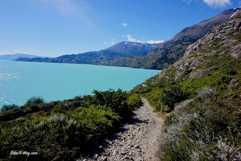
O’Higgins Lake is called San Martin Lake on the Argentinian side of the border (Both O’Higgins in Chili and San Martin in Argentina were important independence heroes for their country, living and fighting at the same time as the famous Bolivar ).
The lake has a very irregular shape, with eight arms, four in each country. With a maximum depth of 836 meter, it’s the deepest lake in the Americas. The lake’s surface is at an elevation of abt. 250 meters, which means the bottom at some parts is at almost 600 meter below sea level !
The lake is fed by multiple glaciers of the huge ‘Campo `de Hielo Sur’, the Southern ice Field.
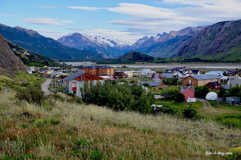
Villa O’HigginsThe Christmas stal at Villa O’Higgins.
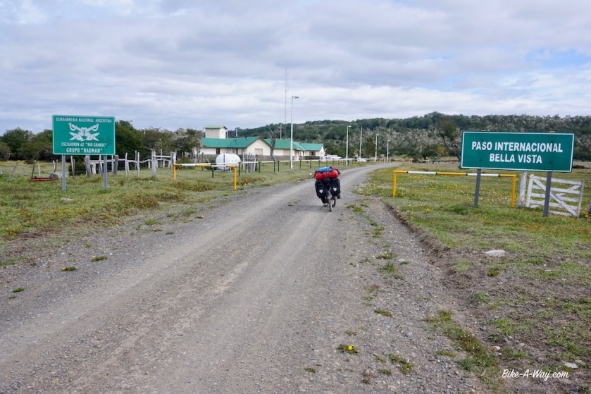
Route: Ushuaia – Tolhuin – Rio Grande – Radman – Cameron – Porvenir
Being at ‘The End of the World’, I now turn my wheels 180 degrees and cycle back towards the equator and turn my back to Antartctica. A good feeling.
I slowly made my way out of Parque National Tierra del Fuego back towards Tolhuin, stopping briefly in Ushuaia to buy provisions. A couple had a chat with me in front of the super market and I was asked for an autograph for the first time in my life. I camped a night before the Passo Garibaldo at an ‘designated free camping area’. As was to be expected at a place like this, it’s littered with empty plastic and glass bottles , plastic bags, toilet paper, tins, food residues and the corps of a dead dog.
Humans…..
Parque Nacional Tierra Del FuegoCerro Guanaco. The trail up the mountain was closed due to snow.Isla Redonda in the Beagle Channel
Bahia Lapataia, where the road really, really ends.
The Beagle ChannelHousing at the outskirts of UshuaiaAnd of course, the obligatory picture 🙂
Before reaching Tolhuin, one can take a small ripio road that leads through a forest along the banks of Lago Fagnano, Tierra del Fuego’s biggest lake. There are several nice spots to pitch a tent. Better to avoid the weekend, as it’s also a place where local people come to bbq, which must come along with drinking, throwing empty bottles around and car stereo’s at maximum level, arriving and leaving cars with removed sound reducers.
Today, I got sunshine, two snow storms and lots of wind.
Santos Travelmaster, mastering the art of travel @ Lago Escondido – Tierra Del Fuegolago FagnanoLago Fagnano – the bad weather fast approachingUntil onmy minuts later I was in a snow storm.
I stayed a second night at the Casa de Ciclistas in Tolhuin. On my way down to Ushuaia, this was the place where I met the first other cyclist since Trevelin. Bad night of sleep this time. I shared the room with an Argentinian young cyclist who was one of these guys who prided himself on “spending no money at all” (which basically means living on everybody else’s back). He stayed everywhere as long as he could ‘for free’. He was already three nights in the Casa de Ciclistas. I think he stays everywhere until they kick him out. He doesn’t buy anything in the bakery, but goes asking old stuff for free. His main diet is eating the leaves of the Dandelium. Even cows don’t eat these leaves.
He also rings at farm houses along the road and asks if he can ‘buy’ some food, counting on the fact they’ ll give it for free, etc, etc, etc…
Then Gerard arrived. A 70 year old French guy on a recumbent bike. He looked very fit and has a great tour coming up. But …… Gerard snored louder as all the Mirages jets from the French army combined.
After a sleepless night, I retraced my steps into the interior of Tierra del Fuego. First I had to do 20 more horrible km on the busy RN 3 with it’s speeding madmen, brainless drivers.
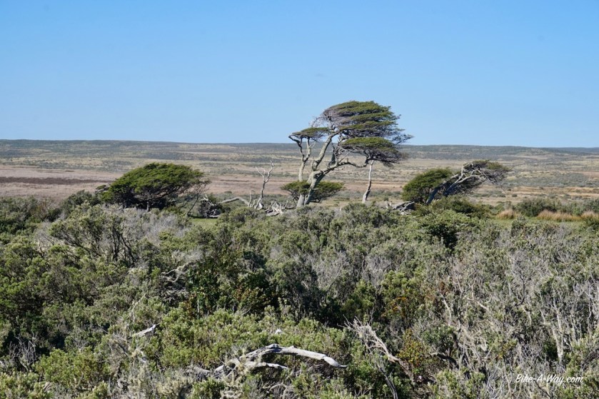
Once I was on the ripio road RP 18, it was quiet. Except for the wind. Again, I was into riding single digit speeds all day. I was freezing to death when I was speaking to a friendly German couple in their Mercedes Unimog who travelled the length of the American continent the last four years, I was sweating, battling in my rain gear against the wind, I am producing two liter of snot a day in these conditions, which is damn annoying to get rid of, wearing thick gloves, but …. I was having a hell of a great time, as I was where I wanted to be and I could look around to these small trees with there special forms, overgrown by liches, listening to the wind, or to some music sometimes.
All that in stark contrast to riding the national roads in this country, where one has to watch his little rear view mirror 75% of the time in order to avoid being killed.
Gerard, 70 year old French guy still going very strong.
28/11/2017
The sun came out yesterday evening and the wind got down completely all night.
The days are getting long this far south as summer is approaching. Sunrise is around 5 am and it sets a bit before 22:00 hrs.
By the time I got on the bike again this morning , the wind was out in full force again. I stopped at Estancia Los Cerros to replenish some water. After the estancia, the road makes a 90 degrees bend, and so does the wind. It’s again a very, very hard day in the saddle. The short cut I was hoping to make near estancia Ruby, north to the road that leads to the Radman / Bella Vista border was fenced of, which was a disappointment because now I had to make the whole detour via RN 3 again. I pitched the tent about 10 km before RN 3 near the edge of the forest.
Sleeping another night under the Belcanto trees.
29/11/2017
Can you believe it !?
After battling the last 100 km against the wind from Tolhuin to come down here, I’m starting today with a tailwind. This is terrible news, because after only 9 km, I’m turning on RN 3 to do some shopping on the outskirts of Rio Grande, before make a more or less u-turn on the ripio road west towards Porvenir. Turning west, so again against the wind.
There will be no possibilities to buy any provisions for the next 350 kilometer.
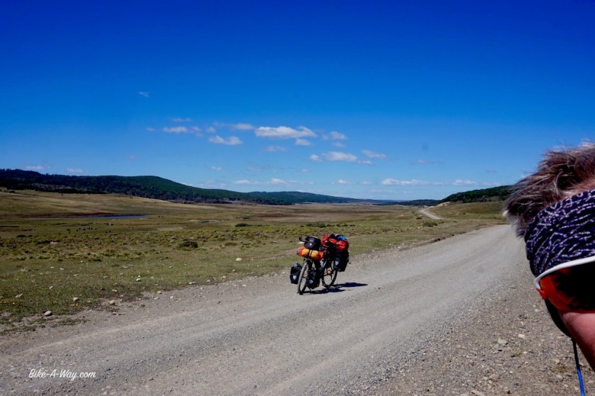
I filled up my water bottles at the police post at the corner of RN 3 & RP B. The dirt track goes up and down all the time between 20 & 95 m asl. Nothing too bad but there’s this one constant, that brutal, violent head wind. Just like the two previous days, I manage to cycle the 60 km I planned to do but I am completely, and I mean completely exhausted by the end of the day.
The dirt tracks RP 9 & RP 18, just south of where I’m now are going through forests, but now I’m in completely barren land again. Not one single tree. Grasland with not a single bush growing higher than 30 cm. No shelter, not to take a break for lunch, nor for camping.
I first tried to pitch my tent today after 57 km in a gravel pit. The first spot I saw today that could give the tiniest bit of wind break.
After inserting the second pole in the fly sheet, I just couldn’t hold it anymore. The tent was like a parachute. No way it would hold out a full night. I stuffed it back in it’s stuff sack and continued cycling again.
It was passed 7 pm already.
On my gps, I saw there was a river a bit further on, but I had zero hopes there would be some trees along it over here. But again, I was so lucky this time. I saw it from the hill top already. Just before the river a small shed. I could only hope that one way or another, I could enter it.
It appeared to be a solid corrugated iron structure, three walls, open on the lee side. I think it’s used to shave the sheep. Perfect flat concrete floor, and 100% sheltered from the wind. It felt like the Hilton to me.
Outside were some wooden beams I used to pitch the tunnel tent on the concrete floor. The storm was banging the walls of the structure violently. Made a nice vegetable curry with a heap of rice. Fell asleep by 9:30 pm. I’m back to nights of 11 hrs of sleep.
30/11/2017
It required all my courage to leave my perfect shelter this morning. It was a great day though, blue sky and reasonably warm. From the first meter, I battle against the storm again. It’s like constantly climbing a high col. For the last 200 km, and the col will go on for another 300 km.
At km 44 and 52, there are small ‘forest’ where it would be good to camp.
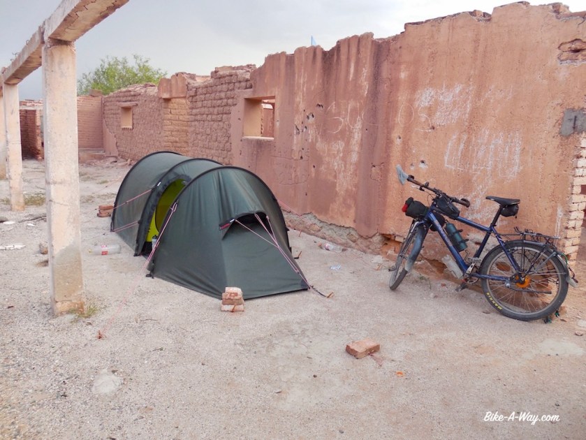
At km 56, there’s an abandoned house where you could probably sleep. I spend the night in a small chapel, about 5 kilometer before the border. I still had a lot of vegetables and sausages the Chilean customs would take from me, so decided to spend the night before the border.
A nice German couple traveling in a Jeep decided likewise and showed up in front of my chapel just as I was reading a bit in the sun.
I covered 37,73 km today. That took me 4 hours and 24 minutes of riding time, which is at an average speed of 8,57 km/h. Says enough, I’m afraid
But ! It gives me a lot of time to look at the landscape. Only two cars passed me today.
Oh, I saw my first two condors today. Biiiiiiig !!!!!
One of the condors that suddenly flew over me. Look at the tree in the corner to appreciate the wind force.
The little chapel where I spent the night.
01/12/2017
The formalities at both the Argentinian and Chilean side went without problems. I wasn’t even searched this time by the Chilean customs. They wouldn’t have found anything. I carry no fruit, vegetables, honey, meat, dairy products, nada. All that’s left to eat the coming days is in powder form or in tins.
If needed, it would be possible to sleep inside at the Argentinian border post. They’ve got some sort of ‘recreation center’ there. You can take water as well.
There’s something strange going on at the Argentinian side of Tierra del Fuego.
All the cattle in the field are bulls. Everywhere bulls. no cows.
Normally it’s the other way around and you only rarely see a bull.
Outside the Chilean border control, I opened my passport to check what stamp they gave me. I forget the Chileans always put a little paper inside which you’ve got to present at the next border post. A wind gust blew the paper away, to the other side of the road. By the time my bike was on it’s kick stand, the paper was behind the fence I had to climb now in front of the immigration. I ran through the field behind my paper until I was almost back in Argentina.
The winds are crazy.
When you want to eat a cookie, by the time your hand reaches your mouth, the cookie is blown away and you end up with just a few crumbs between your fingers. The coffee you’re trying to drink is blown out of your mug.
My clothes are literally being blown apart.
Today was a tough day again. I didn’t make the 60 km I should have done.
Made 56,20 km far today, and I rode a little way back when I was on top of a hill and saw the trees stopped for a while. It took me some time to clear a space in the forest, which was full of fallen trees, branches and thorny bushes I had to remove. The little saw on my Swiss Army knife comes in very handy here. I’m pretty good sheltered from the hard wind, which makes a lot of noise in the trees just above me but doesn’t really impact the tent.
I always liked forests a lot, but since Patagonia, I love them.
I fail to understand why so many people find it boring to ride for days on in the forest, like f.e. in Scandinavia or Canada. I really like doing that. The trees give you shelter from the wind if it blows hard, from the sun if it burns, the forest smells good after it rained, but it smells good as well when it’s really hot, it makes it easy to hide away for wild camping, there are a lot of animals you can spot. It’s also much cooler in the forest on really warm days.
Anyway, I think there’s not enough forest in Patagonia and Tierra del Fuego.
A hard days work, and I managed an average speed of exactly 10 km/h today. Better then yesterday, but I’m here in my tent, totally wasted.
02/12/2017
What a super day I had today.
Normally, the wind quiets down for a while overnight, but last night it just continued on and on. But the tent was perfectly sheltered. I woke up again to a blue sky, took my time in the morning, as usually and hit the road by 11 am.
Near Russfin, I washed my clothes in the river. The weather was good enough to have them dry by the evening. The stretch between Russfin and Cameron is the most beautiful part so far, coming from RN 3 (from RN 3 to Tolhuin is equally beautiful). I ride through long valleys, going up and down. Good camping opportunities between km 81 and 79.
I entered the village of Cameron to replenish water. Although it’s a village of moren then 200 people, there ‘s no kiosko, no panaderia, nothing. The village is at a beautiful bay, sheltered between some hills, but they managed to make it an ugly place, and are continuing to make it uglier with the new houses they’re building. I don’t understand, if they’re building something new, why they can’t make it a bit nicer.
NOW you’ll understand Patagonian winds.
I reached the ‘Bahia Inutil’, the huge bay in the Strait of Magellan. The English wanted to make a port here, but because the water is so shallow, they called it ‘Useless Bay’. Nowadays, they would send in some dredgers and make it useful.
From Cameron …. I had a tailwind !!!
The gravel road meanders along the bay, up and down over the hills. So beautiful. the sun shines, temperatures of 16 degrees. The only thing missing to make the day really perfect, is some good, spicy Thai food and a beer.
About 20 kilometer before I reach the penguin station, I start to look for a place to camp, but it seems I missed my chance. Nothing there that would give sufficient shelter in case the weather turns bad overnight. The wind blows straight from the Cordillera Darwin and picks up over the bay here, so can get pretty violent.
Just before the penguin station, there’s a sheltered place in the downhill on the right side near Estancia 3 Hermanos. There’s also an emergency shelter on the left side, in which I retreated.
Should’ve pitched the tent instead. The bed in the shelter is terrible.
03/12/2017
Went to the penguins first thing in the morning. The penguins here at the tip of Baja Inutil are the King Penguins. With their average height of 90 centimeter, they are the second largest penguins after the ‘Emerald Penguins’, which are only found on Antarctica. The King Penguin lives here, in the Sub-Antarctic. With 126 units and a few new borns, this is one of the smallest colonies on earth. There are about 1,5 million King Penguins on earth. Much larger groups live on the Falkland Islands, Sandwich Islands, some Islands south of Tasmania and New-Zealand and the biggest group, about a million, lives on South Georgia, a bit to the east of the Falklands.
It are very funny creatures to observe.
The brown hairy ones are the new chicks.The chicks seem to be suffering from “the heat” 🙂
Morning and first half of the afternoon, the weather was brilliant again, even really warm. I had a head wind again, but it wasn’t hard. Just outside the ‘Pinguïneria’ I had a nice long talk with three Germans traveling in a mini-van. I also had a talk with an Italian motor traveler, a group of an American & three Italians and a Dutch-Italian couple. A very social day today 🙂
Traffic really picked up from the Pinguïneria, which resulted in a much more destroyed ripio road with a lot of washboard and loose gravel.
As always, you can imagine which direction I was cycling…
4/12/2017
Man, man, man, how did I suffer today.
Where I had yesterday an easy day with only a very light headwind, and the day before even half of the ride a tail wind, today it was full head on again. Many times I couldn’t go faster then 5 km/h on the flat and I had to push many an uphill. I averaged 9,14 km/h on a 41 kilometer day.
The wind blows strait from the Andes, over the Strait of Magellan into my face.
The views were good, but nothing too spectacular. Much less traffic, probably because the ferry between Porvenir and Punta Arena doesn’t run on Mondays.
Pitched the tent in a field. I’m not very happy with the shelter I have, so fingers crossed for a quiet night…
Guanaco at the edge of the Bahía Inútil
5/12/2017
Once I left the little canyon where I pitched the tent, I realized it was much better sheltered as I anticipated. The wind was torturing me all the final twenty kilometer into Porvenir. The road seemed to go up and down endlessly.
Arriving in Porvenir, 450 out of the last 470 km have been on ripio.
Here, I take the ferry to Punta Arenas, leaving Tierra del Fuego island after 25 days.
From Punta Arenas, I’ll find a way to get to El Chaltén or directly to the Carreterra Austral at Puerto Yungay.
I’ve been riding over 5.000 km in South-America now, of which a couple of thousand against relentless head winds over the pampa, without shelter for me or my tent.
While places like Torres del Paine, Perito Moreno Glacier and Mount Fitz Roy should be highlights, in the course of the last weeks, I was dreading more and more the prospect of going there.
The roads between these place are busy with trucks heading to and from Punta Arenas and with the brain death car- and especially minibus drivers for the tourists between these places.
Driving into Torres Del Paine would undoubtedly be a magical thing, if I wouldn’t have to be concentrated 150% all the time on the road, watching my rear view mirror every other second to check on upcoming traffic. Concentrated on the road, i.o. on the landscape. I spoke with several people in Ushuaia and also the last days near the Pinguinerïa. Tourists who told me they were in Torres del Paine last week. They tried to make reservations for the campsites four weeks in advance. All but one were full already.
So that was over 5 weeks ago. I don’t stand a chance of finding something, and when I heard there stories of congested ‘hiking trails’ with actual traffic jams …. no, that’s not my thing.
I would hate every single second of it. I don’t make reservations months in advance to pitch my tent somewhere and I definitely not going to stand in line to see a mountain like I’m in Disneyland. And it seems that what’s this region has become: the Disneyland of the Andes.
That may be highlights for people who are transported down here by plane or in buses, but I’ll find my own highlights on quieter, more genuine places.
The bizar entrance to Porvenir
14:00 hrs. The ferry leaves Porvenir with only a few minutes delay.
Once we leave the sheltered harbour and enter the Strait of Magellan, you feel the forces of the wind and the waves on the ship’s hull. We can’t be more then a kilometer or so on the Strait when the Captain announces the port of Punta Arenas is closed due to the strong winds and we have to return to Porvenir.
I felt that gale all morning and find it strange the ship left at all. I guess they contacted Punta Arenas only after we departed.
I saw another freighter taking our place at the only ramp in the little harbour, so I’m curious whether we’ll go on anchorage, or that ship will have to leave again.
Swinging the vessel in the Strait of Magellan felt like a dangerous operation. We had to turn 180 degrees and took full wind now, and getting in the current. The ship was rolling heavily left to right. Fantastic !
I was keeping an eye on where to swim to in case we would capsize and wondered whether I would be able to swim back to the shore in this ice cold water. I doubt it. I’m already freezing in an outdoor swimming pool in summer in Europe.
But I needn’t swim; we entered the port again all right.
The little freighter was send back to anchorage and we could come alongside.
Most passengers left the ferry and drove the long detour to Punta Delgada, where I crossed last month on Tierra Del Fuego. Hopefully for them, this much shorter crossing will be operational.
An hour after we were back in the port, the Captain announced a new departure was scheduled for 19:00 hrs. Many passengers were gone already. Two rather fat and older ladies in their late forties came to sit next to me. Like many of these people that are gifted with the talent to sleep anywhere at anytime, they soon dozed off. One of them snored like a pig, with her mouth wide open. I stared at my Swiss knife…
At 18:00 hrs, it was announced the weather was still to rough, and earliest departure was foreseen for 07:00 hrs the next day. We were send ashore, not allowed to spend the night on board. The little harbour is five kilometer outside Porvenir, and I didn’t feel anything to cycle back there, get up the next morning at 4:30 am in order to leave the hotel by 05:15, to arrive back in the port by 06:00 hrs (when you apparently needed to get your ticket stamped with a new date). The little terminal ashore remained open, which I shared with a fat Chilean guy who missed a couple of front teeth. He snored like a mammoth.
Tierra Del Fuegoan Iron Maiden fan.
Around 22:00 hrs I saw how our ferry went adrift. The ropes couldn’t hold it anymore. They tried to lower the anchor, but to no avail. The vessel took full wind from the side and was blown to the opposite shore rapidly. They managed to get control just in time and bring the ship back to the quay.
The departure next morning was again delayed from 07:00 to 08:30 hrs, but then finally, off we went. This is an old Greek ferry, built for the Mediterranean. I wonder whether it is suitable for crossings on the rough Strait of Magellan, more than 35 kilometer wide between Porvenir and Punta Arenas. Crossing the Strait took about two hours.
I spent only a couple of hours in Punta Arenas, which actually seemed to be a rather nice town. The bus company didn’t make any objections on me carrying my bike on the bus. Riding that road between Punta Arenas and Puerto Natales, I was glad I wasn’t cycling it. Too much traffic.