Australia Prt 7, Nsw & Vic: Swan Hill to Renmark

Route: Swan Hill – Balranald – Mungo NP – Mildura – Wentworth – Lake Victoria – Renmark

Day 61: 9 April 2019
From 12 km before Swan Hill to 12 km before Balranald
97,93 km (Total so far: 2487,54 km) – Altitude climbed: 182 m
Weather: Sunny, strong head and tail wind

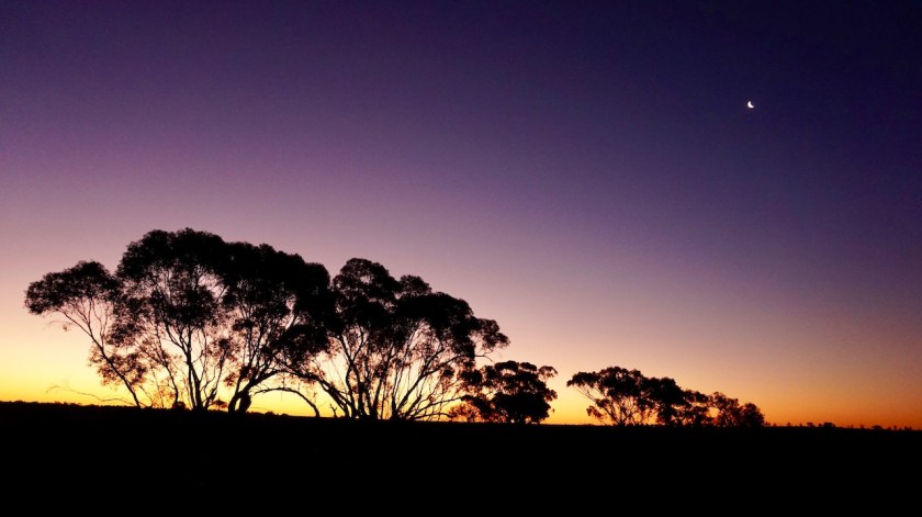
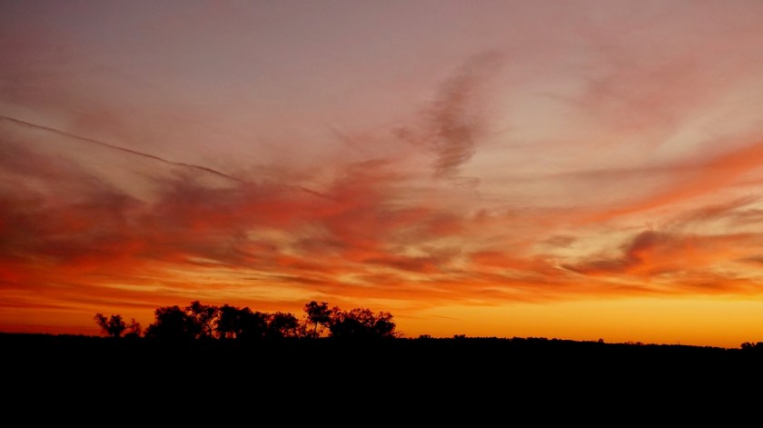
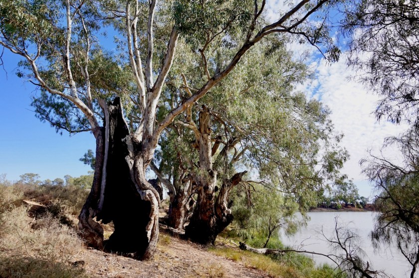
It was a very windy night. A cold wind. I had pitched only the inner tent so it blew right through. Except for my nose, I was warm enough, but it all made a bit too much noise. I was camped in a bend of the little Murray River, so it came in right from the water.

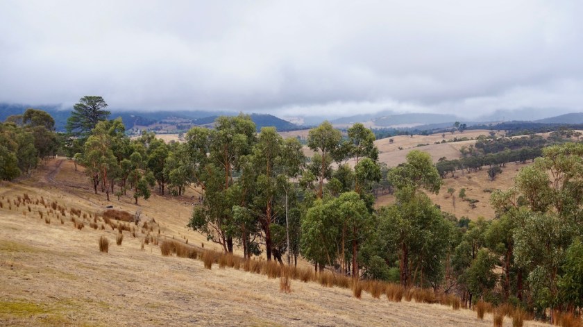
After little under an hour cycling, I reached Swan Hill, on the 10th day after leaving Melbourne. It is here the expedition of Burke & Wills reached the Murray River, 18 days after leaving Melbourne. That actually puts my performance to shame, beating them with only 8 days. Some may think I’m heavily loaded, but I carry, food and water included maybe 50 kg.
The Burke & Wills expedition was carrying 20 tons !
But they didn’t have bikes to transport it. They did it with wagons, horses and camels.
Thus, once again, it is proven the bicycle is a superior mode of transport.

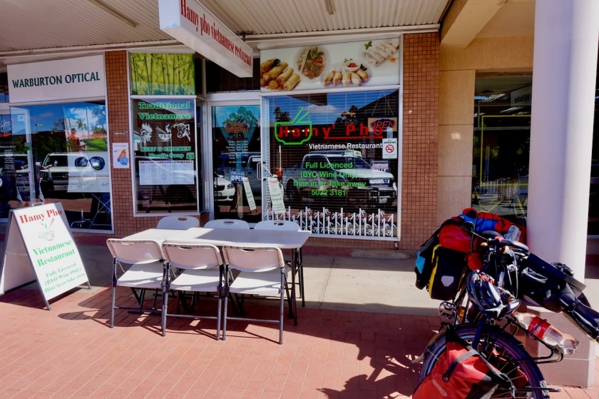
The Murray River floats through Swan Hill at an elevation of still 70 meter asl, 30 meter lost since Echuca. I buy provisions, new cycling gloves and go for lunch in a Vietnamese restaurant in town.

DSC06228

Before the historical bridge over the Murray is a small memorial for Charley Gray, an important member of the Burke & Wills expedition. Oh, maybe I haven’t explained that yet, for the non-Aussies, this expedition was all about trying to be the first to cross Australia south to north and happened in 1860.
Burke & Wills were on their way for the state of Victoria, whilst John McDouall Stuart, a much more experienced explorer, was aiming the same for the state of South Australia.

DSC06230

DSC06231

While I was having my lunch in the Vietnamese restaurant, the wind must have shifted a
bit, and I also changed direction a bit, going north west towards Balranald and Mungo National Park.
A strong wind was blowing in my back now, and at times I was pushed forward at 30 km/hr.
That’s too much fun to continue for too long.
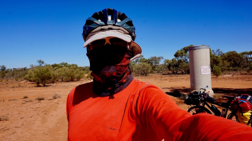
Another flat tyre.
In the back, of course.
Probably a thorn I picked up when the sandy bike lane ended a few kilometer outside off Swan Hill.
I decide to pump it, and see how much longer I can go.
Twenty kilometer, that was.
Good enough. I stop at the junction with a sandy path to pump it again, when suddenly a guy appears out of nowhere.
“Hi, don’t be scared. I brought nothing with me not to scare you”, he says.
“I wasn’t scared”, I think and say “hello”, while pumping my tyre.
“I’m a bushman” he says, “I lived here all my life, from when I was this little (holding his hands low to the ground) until now”.
I was a bit disappointed at this.

My first bushman, and he looks like one of these beggars in front of the supermarket or the bottle shop, a completely worn jeans, double the size he needed, hair that hasn’t been washed yet in 2019, filthy hands,….
I was hoping for something more Crocodile Dundee style.
At least, he could make sure he had a hat like Mick Dundee, don’t you think ?

Mick DundeeHe went on to tell I had to be careful, for other guys in the bush who where using amphetamines and other drugs.
Did I want him to bring me to Balranald, he asked.
I declined, explaining him I wanted to cycle.
Now, and I swear I don’t make this up, he started to tell me about a Japanese cyclist he once met, and that guy didn’t carry anything, “not a drop of oil and hardly any water. They had to rescue him and …..”

Many people know about the famous G.J. Coop who published two diaries about his cycling adventures in Australia, ‘Heading West’ and ‘zzOz (zig zag across Australia)’. His trips must be more than ten years ago now, and people were always warning him, because ‘there was this Japanese cyclist and ….’.
I thought I was gonna piss my pants when this guy started to tell me the exact same story.

DSC06234
Not a hill in sight 🙂

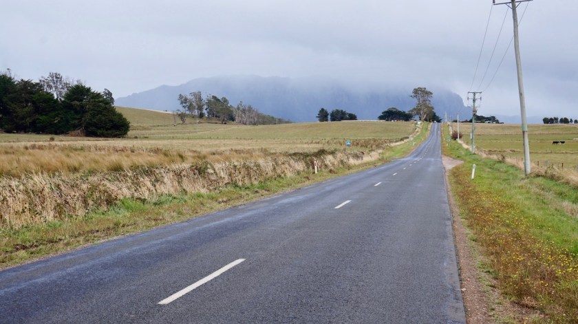
Joining the Yanga Highway, I’m on a busier road.
There would be an opportunity to leave it again after crossing the Wakool river and ride via Weimby Kyalite and the Windomal Roads towards Balranald but I chose to stay on the highway for once.
The road I came off was gradually turning more and more towards the west and at the end I was almost battling against the wind again. After turning 90 degrees on this highway, that strong wind is blowing right in my back again, so I want to make the most of that.

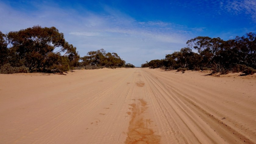
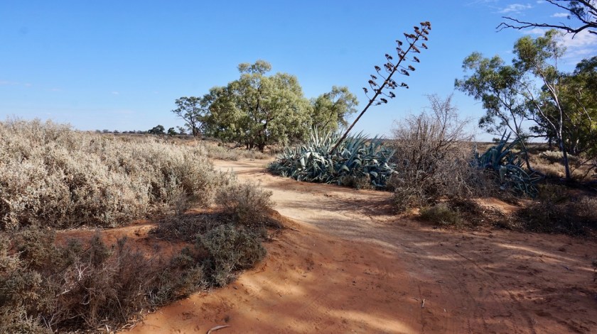
I’m now riding through ‘Mallee country’, harsh scrub, low growing mallee eucalyptus.

Despite my long break in Swan Hill, I still have the longest distance since arriving in Australia, 97,93 km. I didn’t go over the 100 km mark, just because I saw an ok place to camp, 12 km before Balranald.

I could identify two birds again today: the Black-Faced Cuckoo-Shrike and the Crested Pigeon, two very common birds.
And more emu’s as well.

DSC06239

Day 62: 10 April 2019
From 12 km before Balranald to along Marma Box Creek Road
85,37 km (Total so far: 2572,91 km) – Altitude climbed: 109 m
Weather: Sunny, moderate tail and side wind

The Yanga Highway seemed bussier then yesterday. Or maybe my progress was just slower due to a much reduced tail wind.
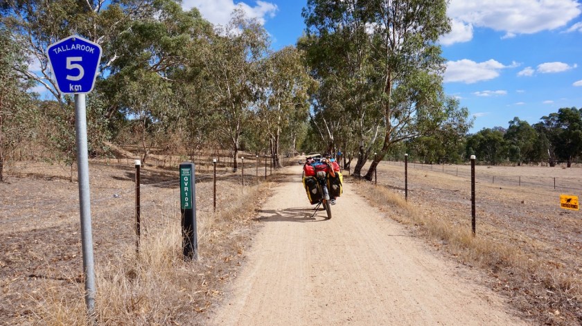
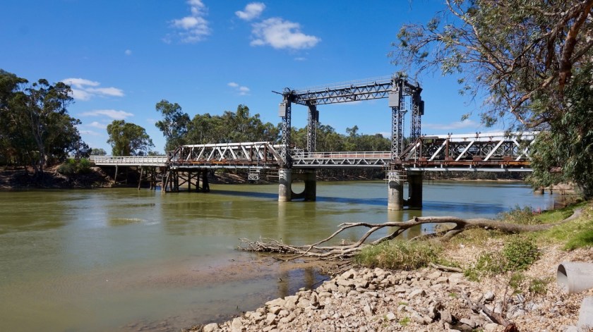
For five kilometer I rode on the Sturt Highway, then crossing the Murrumbidgee River and entering Balranald, another stop on the Burke & Wills expedition as well.
There are two supermarkets (Iga & Foodworks), a bakery and a pizza thing for all your needs.
As I won’t see any shops until I arrive in Mildura, 320 kilometers further on, I buy food for six days and load the bicycle with about 16 liters of water (which I hope to replenish at Mungo National Park).

DSC06240

DSC06241

DSC06245
On this scale, a ‘high’ fire danger still seems pretty good.
DSC06247
I am in…

I continued cycling north over the Ivanhoe Road and had three nice encounters.  First a ute stopped. He had a bike rack with a shiny black bike, the Australian brand which name I forgot now. This guy hopes to ride the Birdsville track five weeks from now.
Then a ute coming from the other direction stopped for a chatting, curious where I was going to.
At the junction with the Ivanhoe Road and the Marma Box Creek Road (the road towards Mungo), another car stopped. An Estonian couple, already 1,5 year here, working on vinyards and factories, said ‘You really don’t want to go that way’.
Well, that’s exactly the way I plan to go.
A lot of corrugation is awaiting me and even in the car they went very slow, they said.
And the part between Mildura and the park is even worse.
We chat a bit longer before we go our own ways.
At least I know what’s coming up.
I stop a bit earlier as planned. Suddenly both sides of the dirt track were fenced off.
And as fences can go for 30 kilometer or more here, I call it a day.

Oh, btw, at the junction of Ivanhoe & Marma Box Creek Road, there’s a small concrete tank with a tap from which you can take water.
It looked good to me. I used it for cooking.

DSC06248

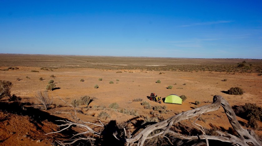
The camping is fantastic here. Far away from any town, there is no light pollution. The stars, the Milky Way….. at nighttime, there is often no wind …. complete and perfect silence.
You hear nothing at all.
Perfect.

DSC06257

Day 63: 11 April 2019
From along Marma Box Creek Road to alongside Lake Mungo
73,85 km (Total so far: 2646,76 km) – Altitude climbed: 247 m
Weather: Sunny, light tail wind

The fence for which I made an earlier as planned stop yesterday only lasted for a little while, so nothing to worry there.
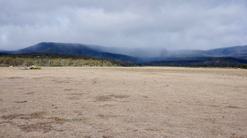
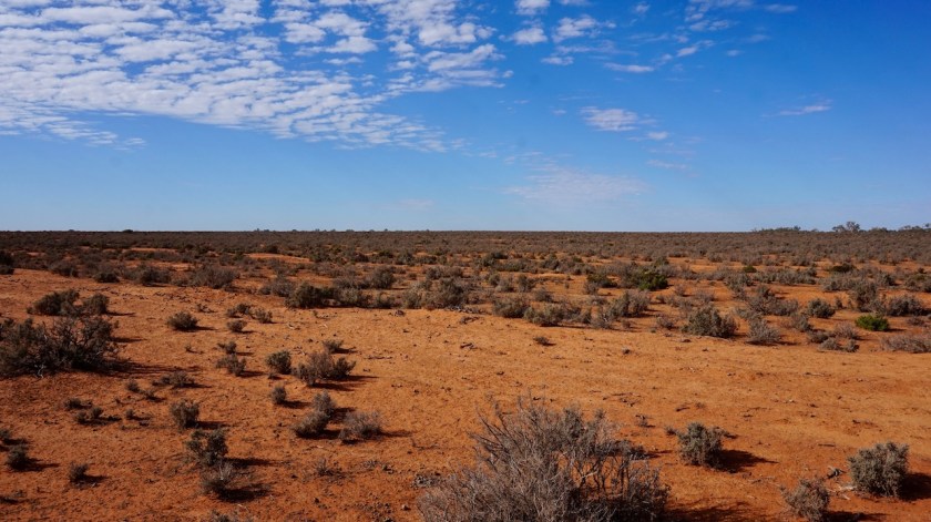
I ride through a landscape that really starts to feal as ‘The Outback’, although those really remote areas still have to come, where I am many, many hundreds of kilometers away from a village or town, instead of the 150 km I go out now.
But the sand is red, sometimes plains with just scrub, sometimes these low Eucalyptus Trees that grow a maximum of about 7 meters high only. I think these are the Mallee, but I still need to get to know the exact names of the flora here.
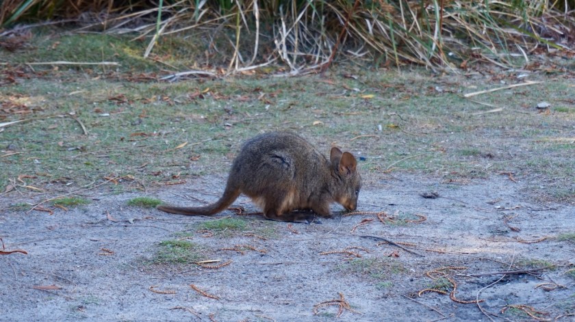
Everything is so different from ‘home’. The differences between kangaroos, wallaby’s, pademelons, every colored bird we would name a parrot, could be a cockatoo or a parakeet as well.
All these trees we don’t have, gum trees, box trees, coolabah trees, eucalyptus trees….
But all in all, the landscape reminds me at times to Southern Patagonia, bare the color of the sand.

DSC06260

DSC06264

At the junction of Marma Box Creek Road and Balranald Road (not sure of this name), there is another concrete water tank where I refresh myself a bit. I still carry enough water, so don’t refill here.
Not a lot of traffic, I think I saw seven cars today.
Three assholes who pass at full speed throwing stones from under their wheels and a big cloud of dust, the other four slowing down, two of them stop for a little chat.

DSC06268

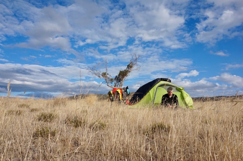
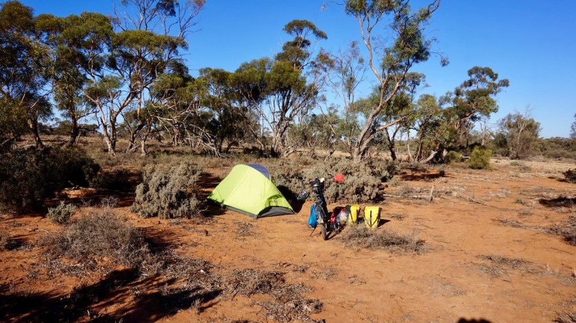
Again, I stop early, a few kilometer before the official Lake Mungo campground from the national park. I prefer a quiet night on my own, and that’s exactly what I get.
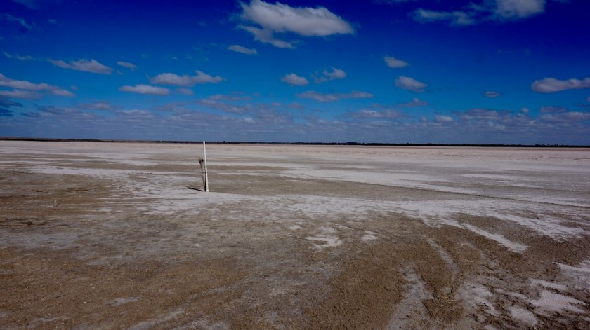
I take a small side track towards the dry Lake Mungo. Careful not to push the bike over thorns towards a nice spot I enjoy the late afternoon with a view over this flat desert land.

DSC06270

DSC06275

DSC06287
How good do your campsites have to become ?  Looking out at the dry Mungo Lake, the Walls of China in the far distance.

DSC06311

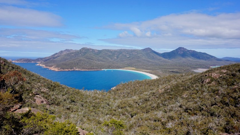
Day 64: 12 April 2019
From Alongside Lake Mungo to near Mungo Lookout
72,55 km (Total so far: 2719,31 km) – Altitude climbed: 200 m
Weather: Sunny, light head, side and tail wind

DSC06321A full day in Mungo National Park. The loop road through the park has to be ridden anti-clockwise, it’s a one way track.
First to the most famous part of the park, the ‘Walls of China’, a long dune, consisting of clay on this side, white sand on the other side. Erosion has made nice shape in the hard packed clay.
But, you are not allowed to go on the dune without a guide and a guided tour is 50 AUD (1282 Belgian Francs or 32 Euro) which I find too much to walk around a dune a bit.
And honestly, I have seen much higher and more impressive things like this in Argentina.

Anyways, this Mungo area was inhabited by Aboriginals 40.000 years ago and makes it the oldest place in Australia where they have found traces of their culture.

DSC06319

DSC06347

DSC06395

Red Top Lookout offers a more close-up view of the erosion.
Until here, one could retrace his steps, if you continue, it’s the one way loop all the way back to the park head quarters (60 km).

DSC06363
Honk, honk, honk….honk, honk….
DSC06373
“What on earth is that ?  Is that a red Kangaroo, sitting at that table ?  Oh no, it’s one of these crazy people riding a pushbike through these sandy, hot lands…”
DSC06377
“Let’s be a bit charming, maybe he is naive enough to give me some food ?”
DSC06379
“No food, but at least he helped me get to some water. Everything is so dry here.”
DSC06383
“Thank you, crazy man.”

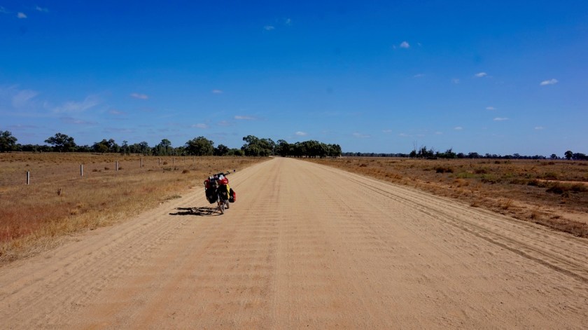
The track deteriorates a lot. Very corrugated and large stretches with loose sand where I have to push the bike.
By the end of the day I’m really tired of all the pushing and the washboard corrugations hurt my shoulders.
Luckily, there are hot showers at the visitor centre.

DSC06401

DSC06410

DSC06426

DSC06427

DSC06435
The dry Lake Leaghur.

DSC06441

Day 65: 13 April 2019
From near Mungo Lookout to 50 km before Mildura
58,67 kmkm (Total so far: 2777,98 km) – Altitude climbed: 123 m
Weather: Sunny, moderate head wind

Three flat tyres !
Yes, three.
And only after 250 meter into my trip today. That must be a personal record.
Must have happened while pushing the bike out of my camping spot, although I was very careful not to ride over any potential thorn or sharp thing.
Both the front and the rear tyre were losing air, and I still had the punctured tube with me from when I had that puncture between Swan Hill and Balranald. Couldn’t find the hole back then.

The Mungo Lookout has a water tap, so I filled that red bag on the back of my bike with water and started to work.
The three tubes patched, rear and front tyre exchanged (the wear on the back was already clearly visible after less then 3.000 km on rough roads) and the chain tightened, I could finally start, with 1,5 hour delay.

And the road from the park towards Mildura is bad.
Heavily corrugated and a lot of deep loose sand where I have to push the bike.
Throw some moderate head wind in and the going was tough and slow. Hard on the bike and the rider. Pulses, arms, shoulders and my back taking a beating.
Real Outback travel, that’s what I’m here for 🙂
The landscape is flat, light undulations with the lowest point at 55 meter asl and the highest 120 meter asl.

DSC06446

DSC06447

Still 2,5 hours before sunset I was spent.
Off-loaded the bike and brought the bags one by one into the bush a bit off the road, then carried the bike to that place.
Not taking my chances anymore to have flats tomorrow morning.

DSC06450

Day 66: 14 April 2019
From 50 km before Mildura to passed Mildura
79,69 km (Total so far: 2857,67 km) – Altitude climbed: 224 m
Weather: Sunny, light head wind

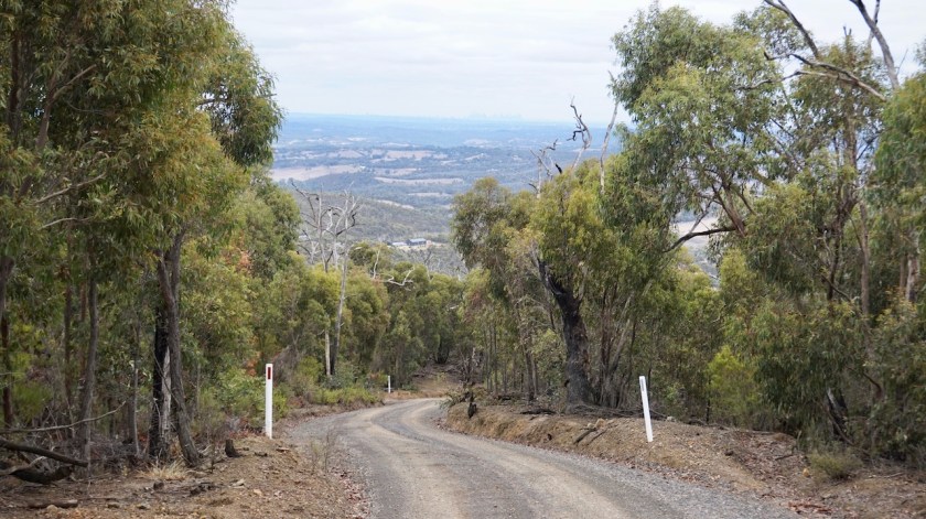
After a bit over twenty kilometer I was back on asphalt. But these first twenty kilometer were stil quite hard with a lot of loose sand and pushing the bike.
But these ordeals are the only way to make me appreciate asphalt.

DSC06460

I didn’t like Mildura. I cycled around a bit in the place and there’s truly nothing to like about the place. Big city, + 50.000 inhabitants, a lot of noisy traffic a few bike lanes to which exactly one car driver paid attention. All the others come from the side streets, over the bike lane to the edge of the road without looking for a cyclist. For them, you are like a kangaroo, better dead than alive.

Even on a Sunday, supermarkets are open from 6 am till midnight.
Why ?
Do people really need to be able to buy a broccoli, a wooden spoon or a bag of tea at 11 pm on a Sunday ?
Can’t people think ahead anymore ?
Plan ahead ?
Just a few hours ?
Ridiculous.
The Bunnings warehouse lies five kilometer out of town. On the wrong side of course, but I need to go for a new bottle of shellite for the stove.
At least, Mildura’s library is a nice place to sit for an hour to do some necessary things online and recharge batteries.
The sun is setting by the time I reach the Murray, west of the town for a place to camp.
The river floats here at 35 meter asl, and still has a long way to go to the ocean.
Many people here and I retread a bit away from the river to find a quiet place and not pitch my tent between the river and the dusty dirt road where people ride up and down till midnight, of course without any regards to other people and the dust they are creating.
Time to go to a less populated place along the big river tomorrow, if that is possible during these Easter holidays.

Day 67: 15 April 2019
From passed Mildura to 10 km passed Wentworth
44,46 km (Total so far: 2902,13 km) – Altitude climbed: 85 m
Weather: Sunny, moderate head wind

As I was close to the city yesterday, I had good phone reception and managed to watch Paris-Roubaix on the laptop. On SBS with Robbie McEwen.
Excellent race.

I left my camping spot late morning and kept riding along the south side of the Murray River via the Redgum Track. Ample possibilities for people with caravans and campervans to come camping, which means the whole area is littered. Empty beer bottles and cans, cardboard, empty jerry cans, broken camping furniture, etc, etc….

DSC06470
The Red Gum Track
DSC06475
A lone fisherman on the Murray.

DSC06478

DSC06479

A few kilometer east of Wentworth, I crossed the Murray again and rode for the third time from Victoria state into New South Wales.
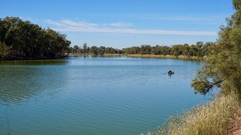
Wentworth is the confluence of Australia’s two biggest rivers, the Murray and the Darling River, bringing waters from Queensland and northern New South Wales all the way down to the bottom of Australia.
The Murray-Darling basin covers 1.06 million sq km, the size of France and Spain, and covers 14 percent of Australia’s landmass.

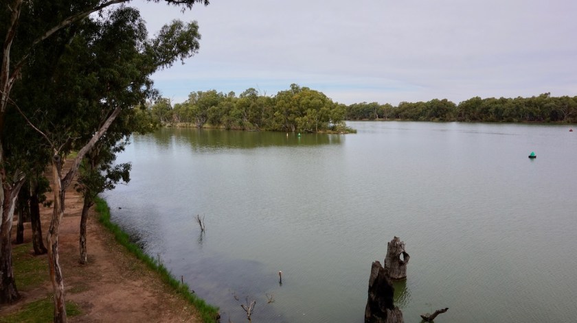
They’ve built a small watch tower to have a better overview. On clear days, you’re supposed to see the different (green and brown) colors of both rivers, but is was a bit cloudy when I was there.

DSC06503
Confluence of Murray and Darling Rivers.  Not the most spectacular under a grey sky.

A few kilometer west of town, I visited the Perry Sand hills, dating back from a previous ice ago some 40.000 years ago.
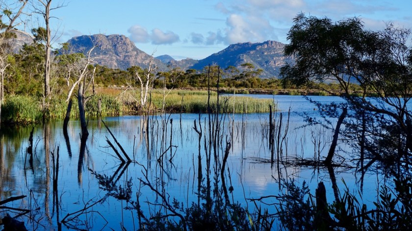
Pitched the tent a few kilometer further near a dry creek bed. The only place with a bit of trees and bushes in this otherwise wide open, flat landscape

Today, I saw a small Willy Wagtail attacking (or destracting) a much bigger Australian Magpie.  Good on you, I’m with you eh, Willy Wagtail.

DSC06518

DSC06522
Hurray ! Hurray !

Day 68: 16 April 2019
From 10 km passed Wentworth to Lake Victoria / Rufus River
60,15 km (Total so far: 2962,28 km) – Altitude climbed: 59 m
Weather: Sunny, moderate head wind

About six kilometer from last nights camping spot, I arrive at the ten mile bridge, crossing the Great Anabranch of the Darling River. This 480 km natural watercourse is actually the original course of the Darling River, which has cut a new course further to the east about 10.000 years ago.
The Anabranch leaves the Darling River further north from here and enters in the Murray a bit south from here, after it’s confluence with the Darling River.

DSC06527
My landscape for the time being. No complaints.
DSC06538
Red Gum Trees

DSC06548

The wind blows from the north west. That’s straight from the desert. And does it get hot today.
35 degrees in the shade. That’s well above 40°C in the sun. We’re going towards winter now, so I can imagine what it can be like here in summer.

I leave the Renmark Road for the gravel Rufus Road.
Not much traffic around here, but when a car or truck does go by, I move to the wrong (right) side of the road, just to stay out of the dust with this north westerly.
A truck driver stops for a little chat and to enquire where I’m heading.

DSC06551
Blue-Tongue Lizard

Just as I felt I was getting cooked under the sun, there was a junction to my left and some trees giving shade. And there was more.
Water !
A creek, Frenchman’s Creek.
I pushed to bike to a place in the shade and went for a swim, ignoring the signs saying that it was dangerous and blah blah blah.
Returning to the bike, I saw the rear tyre was flat.
Just being careless for 25 meter pushing aside the track, and you’re punished.
No warning signs for that 😉

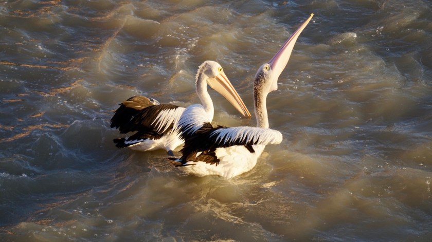
Moving on, the road is paved when I came nearer Lake Victoria.
Lots and lots of Pelicans feeding from the inlet. What a sight !
I rode back a few hundred meters to camp under the small eucalyptus trees.
There’s a tap with water at the toilet building and also at the information sign near the inlet.

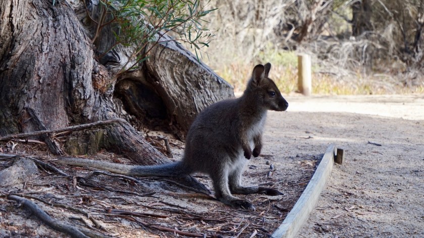
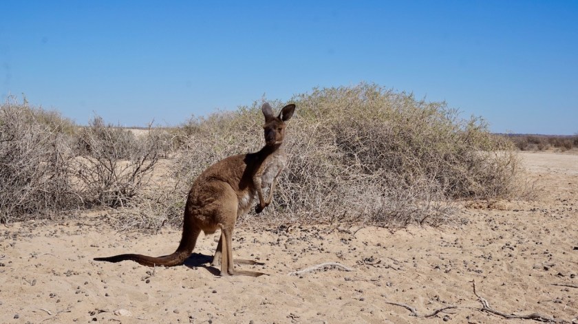
In the morning, dozens of kangaroos jumping around my tent, all being wary, but also very curious. Brilliant

DSC06614
Their eyes are so unreal. Like they are from plastic and glued on them.
DSC06605
Too close for comfort.
DSC06612
This one just caught a fish.

Day 69: 17 April 2019
From Lake Victoria / Rufus River to Coombool Swamp
72,96 km (Total so far: 3035,24 km) – Altitude climbed: 229 m
Weather: Sunny, strong head wind

A very frustrating day.
When I wake up, I see the rear tyre is flat, despite me bringing all the luggage into camp by hand, then carrying the bike over.
The road is worse than yesterday.
Very bumpy, endless corrugations, a lot of deep, loose sand where I’m required to push the bike, slight uphills, a strong head wind and 35 degrees in the shade.
And there’s always that heavy bike.
And the flies !
Not dozens anymore but hundreds flying and zooming around my head, on my shoulders, my back, my hands, …

DSC06643
This is nothing compared to my back, which is black of the flies.

Then, there was the Old Wentworth Road I planned to take.
A sign saying ‘Road Closed’ was shoved to the side and car tracks were going in.
I followed my planned route, also because this road was smaller than the wide Rufus Road, which is never charming to ride, and it seemed harder packed sand.
That didn’t last long.
After 2,5 km I arrived at a gate with a sign ‘Shut Gate Please’.
As far as I understand, you’re welcome to enter it in that case.
A bit further there was a sign to ‘Keep Out’ (Talkeetna Station).
Bat that was at the unfenced side of the road.
What’s the interpretation here ?
‘Shut the Gate’, means you can come in.
There are also official road signs along the track like for a grid and these official white poles.
Probably they don’t want you to enter the private land beside the road.
Nobody will put official road signs on his private land, right ?
And the government will not put official road signs on private roads, right ?

I check my large scale map, and even on that one, this track is marked.

Five kilometers further on, another cattle grid. This time leaving no space for interpretation. I had to keep out. But, there was a phone number on the sign to enquire for permission.
Hard, in a region where there’s no phone reception.
I turned back, a 15 km slow, bumpy, windy, sweaty rond trip for nothing.

How are you supposed to plan a trip like that, if tracks on official maps, with all the road signs, end up being private ??
Back on the Rufus Road, I saw I just had finished my 3.000th kilometer for this trip.

DSC06634

The track became even bumpier and sandier.

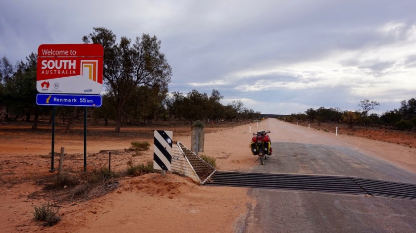
Today, I also entered my fourth Australian state, and I keep ticking them off in a nice order, because this one is the fourth smallest, South-Australia.
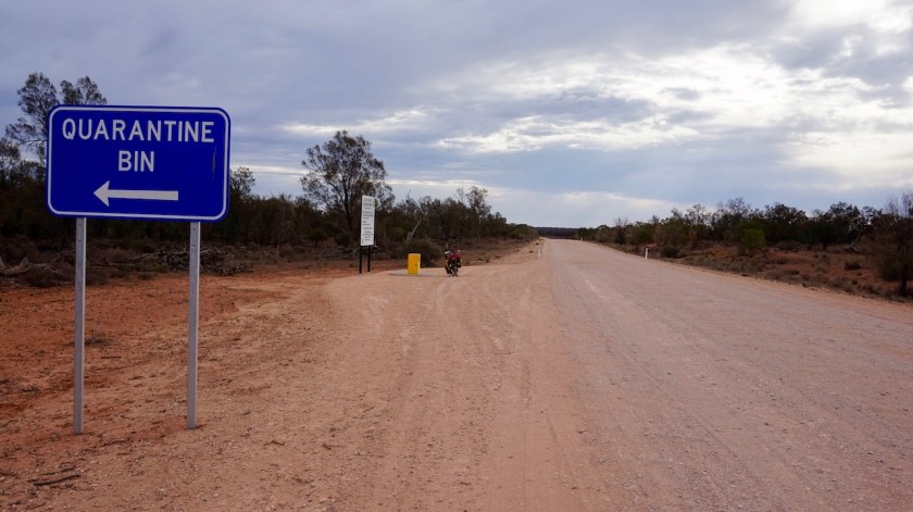
Quarantine rules require you to dump your fruit and vegetables in a bin at the border. No worries, I had just 1/2 broccoli and half a pepper left.

DSC06638

DSC06640

All in all, not a good day, not at all.
But that happens on long trips.
Better tomorrow.

Day 70: 18 April 2019
From Coombool Swamp to Renmark
54,15 km (Total so far: 3089,39 km) – Altitude climbed: 154 m
Weather: Sunny, moderate head and side wind

Literally five drops of rain yesterday evening. And a pretty hard wind, which was welcome to cool things down a bit. The road was not as catastrophic as yesterday, but stil quite bumpy. And, as I was turning my wheels south for the day, the wind had shifted from northwest to southwest, so I was still fighting against it. Good thing was, due to this southerly direction, the temperatures dropped by 10 degrees compared to yesterday.
Went to the Toyworld in Renmark for a new tube. Presta is not so common, so that had to be brought in. I had to wait for an hour, which I used to visit the Chinese restaurant for a take away lunch which I ate in the beautiful park between the library and the Murray River.

DSC06654

DSC06657

I will stay tonight with Ian, Keryn and Shannon. We had a superb diner and a couple of beers in The Club, next to the river and I could sleep in a real bed.
All is good again.
Looking forward to riding my bike in South-Australia, but more about that in the next post.

Australia Prt 6, Vic & Nsw: Melbourne to Swan Hill

Route: Melbourne – Diamond Creek – Seymour – Rusworth – Echuca – Barham – Murrabit – Swan Hill

Day 50 & 51: 29 & 30 March 2019
Melbourne

On arrival in Melbourne, I saw another bicycle on board the Spirit Of Tasmania.
Bianca, living literally a stone’s throw away from the ferry landing, had just cycled a tour around Tasmania as well.
We went for a very delicious breakfast together before I went off, getting supplies in the Coles supermarket.

On my ride into the city centre, I was stopped by an older Asian man on an old bike. He introduced himself as ‘Master Tai’, A 76 year old Chinese Man. He had plenty of houses in Melbourne, told me about how he had had a flourishing business in China, but gave everything to his ex-wife.
He came back to Australia, starting from scratch, and in no time had millions of dollars again.
“I like what you do, I can give you millions”
“I can even turn that stone into gold’, he told me.
“Turn my bike into gold”, I said to him, but he couldn’t live up to his claims.
“Next time I see you, I turn you into a millionaire”, he said again.
I thanked him for his kindness and rode on into town, where I wanted to visit some of the outdoor stores before noon time, when I had to be down at the Princess Bridge to meet up with Paul,a cyclist originally from Adelaide, who makes regularly long trips in Europe and has his own website, https://www.ebiketraveller.site.
The plan was to stay one day only, but bad weather on Saturday decided otherwise.

DSC05985
Yesss, they’ve got one here as well 🙂

On Saturday, a French couple, Philippe and Marie arrived. They had stayed with Paul before, on their arrival in Australia.

It’s a fine neighborhood here, with some trendy café’s and best of all, a big Asian community, mainly Vietnamese it seems, but also Thai and Chinese, with their own shops and restaurants. Yup, a neighborhood I could live.

Day 52: 31 March 2019
From Melbourne to Wild Dog Creek
63,68 km km (Total so far: 1935,84 km) – Altitude climbed: 827 m
Weather: Cloudy, rain

Also today the weather was still cloudy and some rain was predicted in the afternoon. I was so anxious to start my long trip, crossing the Australian continent south to north, that I couldn’t wait another day.
Paul joined me for the first kilometers.
I had made my route along the Yarra River Trail. Not the shortest route to leave town, but it’s car free and mostly along the green river banks so you’re not even realizing you are leaving such a big town.
All locals along the trail were very outgoing and every time I stopped they approached me enquiring where I was going, etc…
After the Yarra Trail, I took the Diamond Creek Trail. From here, the road starts to climb. Not too serious, but you’ll have to work a bit already.

The Great Dividing Range was covered in clouds and it started raining, so that has to wait another day. Barely 17 degrees today.

DSC05991
Paul (on the right) and the French cyclists.
DSC05994
Fairfield Pipe Bridge, Yarra Trail, Melbourne
DSC06005 (1)
Red Crimson Rosella, shaking the water from his head
DSC06006
Great Dividing Range covered in clouds

Day 53: 1 April 2019
From Wild Dog Creek to King Parrot Creek
49,56 km (Total so far: 1985,40 km) – Altitude climbed: 780 m
Weather: Cloudy, sunny, light tail wind

Steep.
Steep !!
I managed again to chose the steepest way over the range, I think.
That dirt road through the King Lake National Park. I could cycle it, with great efforts, when the gradients were 14 or 15%. Most of the time however, it was steeper and I had to push. Sometimes 18%, after that, I pushed too slow to register the inclination.

Interestingly, I passed some memorials for the big forest fires that raged through this region on 7 February 2009 and killed 14 people in St. Andrews alone, as much as 173 in the whole state of Victoria. The event is now known as Black Saturday.
That day, temperatures were 45,7 °C and winds of 150 km/hr started new fires in instants 20 kilometer away from the previous spot.
The Black Saturday Fires destroyed areas extending some 100 km from west to east.

Today, temperatures were as low as 14 degrees only.

DSC06019
Very steep climbs into Kinglake National Park
DSC06020
View back to Melbourne from the Great Dividing Range

At the junction with the paved Whittlesea-Kinglake Road C724, I reached the highest point at 648 meter.
Not impressive, you would think.
Well, try and do it. It was very hard. Luckily, once at the top, finally the sun came out.
Melbourne under a thick layer of clouds at one side, the hinterland bathing in the sun.

There is some sort of unmaintained bike path along the road which keeps me nicely separated from the traffic.
The downhill was very smooth, except from one steeper part, so should be easier coming from the other side.

Today I cycled from ‘Wild Dog Creek’ to ‘King Parrot Creek’.
Sounds nice he 🙂
By the way, yesterday I saw King Parrots. What exceptional beautiful birds.
I also saw many Red Crimson Rosella’s and Eastern Rosella’s.
The Sulphur-crested Cockatoo’s are everywhere in flocks of 20 or 30 birds making lots of noise.
Fantastic.
Lost my tripod today 😦

DSC06039

Day 54: 2 April 2019
From King Parrot Creek to Northwood Hill
66,62 km (Total so far: 2052,02 km) – Altitude climbed: 441 m
Weather: Sunny, moderate & strong tail & side wind

Along the King Parrot Creek Road, I cycled towards the Great Victorian Rail Trail, which I left again a bit before its end (or beginning) to cycle via the School House Lane towards Seymour.
There is a huge Vietnam War Memorial at this place. Or American War Memorial, as it would be called by the Vietnamese people.

Cycled out of town, then took Northwood Road. All land is fenced off, found a reasonable place in a bend in the road where the fences were a bit further off.
did I see a Whistling Kite today ?
Not sure, so not ticking it off.

DSC06052
Great Victorian Rail Trail

DSC06056

DSC06071
Vietnam (American) War Memorial, Seymour

Day 55: 3 April 2019
From Northwood Hill to 5 km bf Rushworth
59,87 km (Total so far: 2111,89 km) – Altitude climbed: 396 m
Weather: Sunny, light head and side wind

Thanks to careful planning in the months before I left to Australia, I ended up riding a few interesting gravel roads like the Weir Road and the tracks through Whroo Nature Consevation Reserve. I ended up in Rushworth, a little town established in 1853 during the gold rush.
One of the nicest little towns I came through so far.
Well maintained old buildings, all friendly people. I cycled out of town with Damian, a fellow local cyclist.

DSC06078

DSC06101
Rusworth
DSC06103
Rusworth

Day 56: 4 April 2019
From 5 km bf Rushworth to Yambuna
60,81 km (Total so far: 2172,70 km) – Altitude climbed: 90 m
Weather: Cloudy, sunny, moderate head wind

Flies !!
I was warned about them, and read about them in several blogs from other cyclists and today, as I crossed the C345 (Bendigo – Murchison Road) , going north from Rushworth, they were suddenly there. Not a few. Hundreds !
They sit on your back, on your bags, on your wet laundry, circle around you, try to get into your ears, your nose.
The legionair cap I bought in Melbourne, combined with a bandana and good sunglasses that sit close on your face help a lot, but it is super annoying when you stop, or when you want to eat.
They are persistent.
They don’t bite.

I continued riding straight north.
Flat lands here, irrigation channels, cattle, all land fenced off, just like the previous days.
Uninspiring country, but a nice change after all the climbing on Tasmania.
I pitch the tent about six kilometer north of the Murray Valley Highway in the Allan Corry Roadside Reserve.

Day 57: 5 April 2019
From Yambuna to after Moama
42,92 km (Total so far: 2215,62 km) – Altitude climbed: 77 m
Weather: Sunny, strong head wind

On the fifth day of April, around noon time, I reach the borders of the Murray River …

A strong head wind all day, no matter in which direction I turn the handle bars. You have those days.
But it’s a good day.
I should have ridden a few kilometers longer yesterday, because I see some really good camping spots along the Goulburn River, just before its confluence with the Murray River.
I leave the bumpy Glanville Road for the Bangerang Road, staying as close to the river as possible.

In Echuca I find a new Gorilla Pod in the local camera shop. It’s even cheaper as in Europe.
Echuca is a nice place, some older buildings, a McDonalds I visit and a long visit to the library to recharge all the devices.

From Echuca, I cross the Murray River and enter my third Australian state, New South Wales.
I visited the two smallest ones, Tasmania and Victoria already. New South Wales is the most populous, but also the third smallest of the seven. I know this statement is not entirely correct, because you have states, and territories, and there’s also the Australian Capital Territory and the Jervis Bay Territory, but these are so small, and to keep things simple, I reckon with seven states, because that’s how it looks at the map.

DSC06133

DSC06136
The single trail tracks along the Murray River, outside Moama.

The Murray River is hundred meter asl here, still more than a thousand kilometer from its mouth.
That will be some slow moving stream. The Murray is also Australia’s longest river and will be my companion for the coming weeks.

Ten kilometer west of Moama is a forest with mtb trails along the Murray and plenty of goods places to pitch a tent.

Day 58: 6 April 2019
From 10 km passed Moama to Koondrook State Forest
60n18 km (Total so far: 2275,80 km) – Altitude climbed: 60 m
Weather: Sunny, moderate head wind / no wind in the forest

What a brilliant ride today.
I left my pitch along the Murray quite late, too occupied with Thai Airways giving me a hard time returning money of my cancelled tickets, and also trying to decide which tent I should order.

DSC06139
Camping right between the track and the river, and not a soul in sight.

The first ten kilometer of the day along the asphalted Perricoota Road are nothing special, but once I take a left turn into the Perricoota Forest Road, the fun begins.
Asphalt disappears, washboard for a little while, but then a good hard packed sand road through open farm land.
Once I enter Perricoota State Forest, all fences disappear and it’s a very beautiful ride through the forest. The Murray River is very winding here and always appears and disappears.
Camping is possible everywhere.

DSC06144

I stop along one of the bends in the river to wash out some clothes and have a swim.
The Perricoota Forest becomes the Koondrook State Forest where, after 2270 km into my ride here, I have my first flat tyre.
I pump it a few times until I find a good spot for the night, and patch the tube after pitching the tent.

DSC06145
Wobble, wobble, wobble.

Saw two groups of four Emu’s today, running alongside me, crossing my path, joinced by kangaroos. It feels like cycling through Jurrasic Park.
Great day.

Day 59: 7 April 2019
From Koondrook State Forest to Campbells Island State Forest
51,18 km (Total so far: 2326,98 km) – Altitude climbed: 28 m
Weather: Sun, moderate head wind

The joy of cycling along the Murray continues, here on the New South Wales Side.
Before reaching the asphalt and riding into the small town of Barham, I saw one car.
When you see more kangaroos than cars, life is good.

DSC06159

Two supermarkets in Barham, a ‘Foodworks’ and an ‘Iga’.
I chose the Foodworks, because I’ve never entered one. There’s also a Thai restaurant in town (Happy Elephant Thai – it was closed on a Sunday afternoon) and in the small park I found an electrical outlet to charge the phone and laptop. Two poles of my tent are starting to break. I repaired them but that’s not gonna last, and I don’t want to end up in the desert with a collapsed tent, so I ordered a new one.
I was at the point of ordering a Hilleberg Rogen. The tents are so good and so beautiful, but of course you also pay for what you get.
So I changed my mind, and ordered a cheaper Marmot tent, hoping that will last for the remainder of the Australia trip, and save a new Hilleberg for later, when it can be used in the conditions it was built for.
The Marmot has a full free standing mesh inner tent, which will be cool in the desert, and allow me to watch the stars (or be blinded by the moon when I try to sleep).

Leaving Barham, I stay on the NSW side of the river and after two kilometer or so, I am back on the gravel, entering the Campbells Island state Forest.
Until tomorrow morning, when I write this, I saw zero cars.
A new spot right beside the Little Murray River (the river splits in two for a while, a bit after Barham.)
After Barham I entered the Fruit Exclusion Zone, or Pest Free Zone, I don’t know exactly, but I didn’t see any checkpoint for this.

Day 60: 8 april 2019
From Campbells Island State Forest to 12 km before Swan Hill
62,63 km (Total so far: 2389,61 km) – Altitude climbed: 54 m
Weather: Sun, strong head wind

A battle against the wind, that’s what it was today. All was fine as long as I was on the bumpy gravel road at the New South Wales side of the river but after hitting the asphalt and crossing the Murray it was a full on strong wind in the face.
I filled up the water bottles and bladder in Murrabit, a neat little community on the Victoria side which has made a real effort in putting panels everywhere explaining the historic relevance of the place and its railway.
From Murrabit, I was mostly on asphalt, but still my speed often wasn’t above 10 or 11 km/hr because of this wind.

DSC06183

But hardly any traffic. I was grateful for the good preparation I’ve put in this whole route.
Part of this reparation, I’ve put waypoints in my gps with possible interesting spots to have a look at.
One of these was Lake Tutchewop. I had imagined to see a lake, but what I got was a South-American style dry salt lake. Very surprised and very happy I battled this extra kilometer against the wind to have a look at it.
Highlight of the day.

DSC06190
On the edge of the salt lake, Lake Tutchewop

DSC06197

DSC06202

DSC06205
Or was that this huge Australian Pelican that took off ride beside me when I cycled along an irrigation channel.
This bird was huge and it took him so much effort, flying in big circles, to gain altitude as if it were a large Boeing taking off.
What a magnificent animal.
It has the longest bill of any living bird and has a wing span of 2,3 to 2,6 meter. The record bill size is 50 centimeter.
At least as impressive to see as the Andean Condor.

I camped on Pental Island, a piece of land between the Murray and the Little Murray Rivers, about ten kilometer before Swan Hill, not wanting to enter the ‘big town’ tonight.

More about that, enter re-entering New South Wales where I visit Mungo National Park in the next post.

Australia Prt 5, Tasmania: Freycinet NP to Devonport

Route: Freycinet National Park – Avoca – Evandale – Deloraine – Mount Roland – Devonport

Day 38: 17 March 2019
From Passed Apsley River to few km before Coles Bay
45,87 km (Total so far: 1471,45 km) – Altitude climbed: 745 m
Weather: Sunny, strong head / side / tail wind

Again, what a day !
The highlights keep following up.
I was lucky with the weather again. A bit a cloudy morning but the afternoon and evening were brilliant.
The 25 kilometer from my camp spot to Coles Bay were not the most pleasant due to the busy road and too many impatient drivers.
It’s Sunday, no time to waste, I guess.

DSC05613

First I headed to the Wineglass Bay Lookout.
After the national park visitor centre, the road has a few short steep inclinations.

It’s about 1,5 hour return walk to the lookout where one has to gain an elevation of about two hundred meter. As always, most of my fellow hikers were not in the best of shape and what keeps surprising me, bad equipped in the shoe department. People hike up in flip flops or the most fragile sandals.
A very high percentage of tourists in Australia is Chinese.
And the Chinese must worry.
They are in a much, much worse shape than the already sad state of my fellow western people.
They struggle and I heard some making noises I haven’t heard from humans before.
Smoke some more cigarettes, guys.

The view towards Wineglass Bay is world famous and rightfully so.
It was worth make the detour only for this.

DSC05618
Richardsons Bay
DSC05645
Wineglass Bay

But, there’s more.
After hiking down, I went to Honeymoon Bay. Stunning scenery again, the crystal clear waters and the mountain peaks of ‘The Hazards’ behind that.
The four peaks, Mount Amos, Mount Dove, Mount Baudin and Mount Parsons can be climbed, but it is late afternoon and the weather will turn tomorrow.

DSC05653
Honeymoon Bay

Returning to my bike from the bay, a Pademelon is sniffing my front panniers.He/she is not shy at all.
That means too many tourists.
I take the Cape Tourville Road towards Sleepy Bay, on the other side of the peninsula.
All worthwhile, all very impressive.
I don’t continue to the Cape Tourville lighthouse, as I really need to go shopping before closing time.
I always carry too much food, but that’s all eaten the last days. The initial plan was to ride via Ross and Campbell town, which I skipped, so I was still surviving on food bought in Triabunna.

DSC05677
pademelon
DSC05694
Sleepy Bay

For a moment I hesitated to camp in the national park, along Richardsons Bay. It’s a very beautiful location. On my way back I rode along the side and more then half of them were taken, so that will be too loud.
I returned to no-mans-land a few kilometer outside Coles Bay and baked some burgers in front of my tent.
All good.

Day 39: 18 March 2019
From few km before Coles Bay to near Friendly Beaches
29,31 km (Total so far: 1500,76 km) – Altitude climbed: 213 m
Weather: Cloudy, light head wind

A lame day.
After breakfast I did some long overdue back-up’s of my pictures, then cycled back to Coles Bay to buy groceries for the next days.
In Swanwick, I found a public electricity connection and I had decent enough phone reception to make an update for the website whilst charging all my devices.
The plan to cycle all the way back out to the Tasman Highway and then back to Cranbrook where I will take a dirt road is out of the window for today; too late for that. Unless I could find a small boat that could bring me to the other side (Point Bagot) from where a track leads over the peninsula towards Swansea.
I cycled to the pier but there were no boats whatsoever, not even a small dinghy.
No worries, I’ve got food and water enough for an extra night out.

DSC05709

Friendly beaches looked pretty wild from the lookout at the top of the dunes. And pretty impressive. Untouched beaches, hopefully they will stay that way.
The national park has basic camping facilities down there (which they will upgrade), and I could see too many campervans for my liking, so I turned back, took another side track and found my own private place, with better wind protection for the night.

Day 40: 19 March 2019
From near Friendly Beaches to 7 km into Old Coach Road C301
35,38 km (Total so far: 1536,14 km) – Altitude climbed: 336 m
Weather: Cloudy, rain

The weather forecast for today was bad. On every website I consulted.
A few overnight showers, but dry when I woke up.
Packed the wet tent and I started cycling. If I would lose another day, I would have to ride to Bicheno for provisions, an additional 24 kilometer return trip on the Tasman highway.
The ride back to that Tasman Highway was no fun. Too many people in too much of a hurry giving too little space to cyclists, despite the frequent signs along the road to give minimum 1,5 meter.
Just after the junction, I went back into the ‘Pondering Frog Café’ for a coffee and a vegetable curry pie before taking on the fifteen kilometer on the Tasman Highway, which I dreaded.
Back over Cherry Tree Hill (185 meter), then coasting down towards the Old Coach Road where the joy could start again.

Miraculously, I saw rain showers all around me, but I kept it dry. The hills in front of me send a clear message. I saw the rain pouring down there, so pitched the tent at not the grandest of wild camping places after a short day in the saddle.

DSC05765

Good, because a couple of days ago, I purchased Peter Fitzsimons’ book ‘Burke & Wills’ on the Kindle. The cover shows an old picture of Australia’s most famous explorers. It’s a recent book (2018). 736 pages and after 75 pages I must say I love it.
And what a coincidence that, very roughly, the first part of my route on Australia’s mainland is not so different as what these men took. With the same aim, reaching the Gulf of Carpentaria, starting from Melbourne.

I still have to read 1/3 of Herman Brusselmans’ book ‘Hij Schreef te Weinig Boeken’ (639 pages) and am also reading Thomas Stevens’ ‘Around the World on a Bicycle – Volume I, From San Francisco to Teheran’, a 998 pages two volumes book about Thomas Stevens bike ride around the world started in …. 1884 !

That’s alternating between three different colossal works, but I love it.

Day 41: 20 March 2019
From 7 km into Old Coach Road to 1 km into Milford road
64,64 km (Total so far: 1600,78 km) – Altitude climbed: 667 m
Weather: Cloudy, sunny, strong tail wind

It hasn’t rained hard, but it did continuously until deep in the night which has made the Old Coach Road into sometimes a muddy affair. When I’m around 350 meter asl, I climb into the clouds.
descending from the Coggle Hills towards the settlement of Royal George, the sun reappears above the valley. While riding in the sun with a good tail wind through the St. Paul’s Plains, the Dickies Ridges to my right and the hills of Snow Hill Forest Reserve to my left, remain covered in clouds, a beautiful sight.
Near Royal George, the pavement started again. This is cycling at its best.

In Avoca I face a dilemma. I planned to go straight ahead here via the Storys Creek Road and a loop around Ben Lomond National Park.
But here too, nothing but thick, grey clouds and rain showers.
Or…. I could turn left, follow the Esk Highway in a westerly direction and continue riding in the sun.
I think it over while drinking a coke in the gas station and decide that riding those hills in that kind of weather would not bring me any fun.
So the highway it is.
Out of Avoca, a reasonable shoulder appears, traffic is light, the wind from the side now, it’s a good ride.
After Llewelyn, a one house settlement, I turn right into the Milford Road.
It says again ‘no through road’, but we’ll see tomorrow about that.
The land is unfenced, and although the wind blows still strong, I pitch the tent on the barren hill enjoying a wonderful, sunny evening. Even Ben Lomond shows its face later in the evening.
On the one side of my tent, I have the red sky of the sunset, while on the opposite side, a bright, gigantic full moon is rising from behind Ben Lomond.
Life indeed is very good again.

DSC05774

Day 42: 21 March 2019
From1 km into Milford Road to 1,5 km into road C521, Woolmers Road
71,61 km (Total so far: 1672,39 km) – Altitude climbed: 437 m
Weather: Sunny, light head wind, heavy rain in the night

Well, this is indeed a ‘no through road’.
Despite my map and my gps suggesting there’s a bridge here over the South Esk River, the track ended up at a private property. The owner said there was no bridge, which I think we can believe as the river is quite wide here and it seemed unlikely to me there would be a private bridge. Maybe google earth can tell more.

Anyways, I had to turn back, continued on the Esk Highway until the junction with the oh so busy Midland Highway, which I crossed, taking the small backroad towards Conara, thus avoiding the Highway. After Conara remains an 800 meter stretch on the highway before I can turn right on the Glen Esk Road (with a bridge over the South Esk River).
So, after cycling 30 kilometer, I was back at exactly 8 kilometer from where I started this morning.
No worries, the weather is fine, and so is the route.
The Nile Road which I’m following now is still partly gravel.
The amount of rotting road kill here is stunning. A death wallaby, possum, kangaroo always within sight, and definitely within smelling distance. Kilometer after kilometer this disgusting smell of rotting, death meat.
Every day, day after day, thousands and thousands of these animals must be killed on Australian roads and… nobody seems to give a f***.
Very bizar.
Very sad.

DSC05815
Slalom between the roadkill 😦

Evandale is a ‘historical town’.
A few buildings from the late 19th century, two churches, the St. Andrews Uniting Church and the St. Andrews Anglican Church.
More importantly, Evendale is every year the scene of the national Penny Farthing Cycling Championships, the last weekend of February.

DSC05819

Leaving town, one could pitch his tent in the park along the South Esk River, but I think it might be the scene of drinking and / or fishing men in the evening, so I pushed on finding a spot in a field, about 1,5 kilometer from the Midland Highway.

Dark grey clouds, terrible rain showers in the distance over Ben Lomond and over Evandale.
It eventually came my way and it rained until deep in the night.
Glad I’m not anywhere near en Lomond where it must have been much more serious. Good decision to skip it.

DSC05837

Day 43: 22 March 2019
From 1,5 km into road C521 to Along the Tasmanian Trail, off Mole Creek Road
81,22 km (Total so far: 1753,61 km) – Altitude climbed: 739 m
Weather: Sunny, cloudy, moderate head & side wind

To my surprise, and contrary to the weather predictions, I wake up to a blue sky. Still uncomfortable about the trespassing into this field, I pack my stuff and decide to have breakfast later on.
First I cross the Macquarie river again, which I still know from further upstream.
To my left, I have beautiful views to the Great Western Tiers and the Cluan Tiers, half covered in clouds.
In Longford, I stop in the beautiful park to eat something, and lay out the tent to dry completely.
Beautiful Church they have here.
The quiet backroads via Bracknell towards Deloraine are a joy to cycle and almost completely deserted of traffic.  Richie Porte, Tasmania’s most famous cyclist, is from this region, I heard, so he must have been roaming this little roads as well.
Late afternoon, upon leaving Deloraine, the impressive Quamby Bluff (1226 m) shows its face.

DSC05858 (1)
Quamby Bluff

I push on, out of town because a bit further I will rejoin the off-road Tasmanian Trail.
Instantly, I have to dismount and push the bike on an impossible incline, some 30% or more on rough stones.
I loaded the bike up with three days worth of food and eleven liter of water, because I want a rest day. Push with all my power, two steps up, brake to hold the bike, puf puf, regain my composure, two steps up, puf puf puf, brake…..
It’s an insane job, but better than the highway.
Soon, I find a place for the tent.

Day 44: 23 March 2019
From Along the Tasmanian Trail to TT, into the Gog Range, along Lobster Rivulet
5,52 km (Total so far: 1759,13) – Altitude climbed: 105 m
Weather: Cloudy, rain

Again a beautiful moonrise yesterday evening and an all dry night, so I could leave the tent fly unzipped and watch the stars. As the weather looked promising, I decided to ride a bit today and make the best of it, instead of taking a rest day.
Pushing ridiculously steep up again for a short stretch, then almost as steep down.
Just when I was crossing the Lobster Rivulet (no bridge), lightning and instantly a very loud thunder and it started raining.

A perfect place to pitch the tent a few meter above the river, so no hesitation. I pitched the tent and that was it for today, 5,52 km.
We’ll see tomorrow.

Day 45: 25 March 2019
From Along Lobster Rivulet to foot of Mount Roland
35,85 km (Total so far: 1794,98 km) – Altitude climbed: 942 m
Weather: Cloudy, rain, strong head wind

Easy going paths brought me to the borders of the Mersey River. It’s a wide stream here, no bridge. Impossible to bring the fully loaded bike over in one go. I offloaded everything and had to bring it all over in four times. So with going and coming back, I crossed the river seven times. Along the banks, the river was thigh high, but the water not too cold.
At the other side is a large flat piece of grass which would be ideal for camping.
However, this could be reached with 4WD, and seeing the remnants of big fires that have been built here, despite the many signs you shouldn’t do so, I don’t know whether this is always such a quiet place as today.

A steepish climb from the Mersey River back up, up to 12% but on good gravel roads, so all can be cycled.
All day, it looks like it could start raining, as the clouds pack together agains the Gog Mountain. The paths here are really heaven to ride and I don’t see another soul.
Further on, I see this whole track system is closed from this side.
Ideal 🙂

DSC05901
Mount Roland, hidden in the clouds

Back on the pavement follows a very steep climb on the Paradise Road. Normally, I would have views towards Mount Roland, but it’s all covered in clouds.
I decide to go to the start of one of the two tracks nevertheless and hope for better weather tomorrow to climb it.

Day 46: 25 March 2019
From foot of Mount Roland to along Sheffield to Railton Rail Trail
15,63 km (Total so far: 1810,61 km) – Altitude climbed: 674 m
Weather: Heavy rain, very strong tail & side wind

It has rained a lot all night again. After midnight, the wind picked up and became quite heavy, but I was well sheltered in the forest.
Between the showers, I could pack a half dry tent and pushed to bike to the beginning of the trail to Mount Roland. The wind was still very strong, making lots of noise in the trees.

The path climbs up pretty steep, and often you have to clamber over big rocks.
Upon approaching the tree line, it started to rain heavy. I took shelter under a death tree, but even with my rain jacket and a plastic poncho, you cool down quickly when not moving.
I checked the thermometer. 5.0 degrees C.
Waited some more, but the driving rain didn’t stop. Once out of the forest, in combination with the rain and the slippery rocks, this would only be a dangerous situation and I don’t want to jeopardize the rest of my trip by going to this top by all means.

I descended again, and even that proved to be a rather difficult task over the slippery boulders, needing my hands for support often.
Back half way down, the sun came out again.
I stopped. Should I continue going back, or give it another try. The sun was out now, and I won’t be back here all too soon.
Yes, I went back up.
And soon, the clouds were back, the wind picked up.
Ah, forget it, I go back down.
At the bike, the temperature was up to 8.1 degrees C.

On my way between Mount Roland and Sheffield (about 8 km), I had to get of the road and seek shelter once because the winds became so violent it blew me from the middle of the road back into to the side, the driving rain blinded me, then to mountain was covered in clouds again, back blue sky, back covered in clouds.
I’ve been to many places that claim to have four seasons in one day: Scotland, Iceland, Tierra del Fuego, …. but here, they have four seasons in fifteen minutes.
It was clear the mountain didn’t wan anybody up there today, so you better listen then.

DSC05914
Mount Roland, 20 minutes after I left it when it was covered in clouds and rain.
DSC05918
Again Mount Roland, 10 minutes after the previous picture.

I had lunch in Sheffield. Chinese, cashew nut chicken and curry beef with fried rice.
The sun was out when I mounted my bike, but 1,5 kilometer further, I was cycling back in the rain.

Pitched the tent along the rail trail to Railton, with some good wind shelter from the trees.
But it was cold, God…. so cold.
Temperatures dropped a lot today.
For the first time since arriving in Australia, I use the sleeping bag as a bag and not merely as a blanket. And in my bag, it was comfortably warm.

DSC05921

Day 47: 26 March 2019
From Along Sheffield to Railton Rail Trail to Devonport
30,85 km (Total so far: 1841,46 km) – Altitude climbed: 211 m
Weather: Cloudy, strong head and side wind

Continuing along the rail trail, I was surprised, and disappointed to see so much illegal dumping of garbage.
In Railton, I stopped at the place were Norman Sykes used to live.

DSC05933

DSC05943

The road from Railton to Latrobe is terrible with more than a few idiots on the road.
From Latrobe to Devonport, I took the River Road along the Mersey River, which was good.
I was again warmly welcomed in Hans and Claudia’s house in Devonport, where I stayed for two nights, having some interesting discussions about future plans with Hans.

Day 48: 27 March 2019
Devonport
Weather: Sunny

Today we drove with the car to Narawntapu National Park where we made a beautiful walk. There’s a lake with a wide variety of birds. The park is dubbed the Serengeti of Tasmania, I read later. And indeed, it feels as if you are watching a typical African safari landscape, although you are here, along the Bass Strait in the roaring 40’s.

DSC05962

We returned to the car via an almost deserted Baker Beach.
In Europe, there would be 50.000 people on this beach.

DSC05979

Day 49: 28 March 2019
Ferry from Devonport to Melbourne
Weather: Sunny

After spending another lovely, relaxing day, a haircut and a very good meal, I cycled to the ferry terminal to catch the Spirit of Tasmania. Again the nbr 1 (they’ve got 2).

Some figures about the Australia trip so far:
Total distance cycled on Tasmania: 1846,36 km
Average km per cycling day: 43,96 km
Total altimeter: 25.798 meter

Shortest cycling day: 5,52 km (Gog Range)
Longest cycling day: 81,22 km (northeast Tasmania)
Highest maximum speed: 69,75 km/hr (on Cradle Mountain Development Road)

Most altimeter in one day: 1167 m (towards Cradle Mountain)
Highest point: 959 m (on Cradle Mountain Development Road)
Longest day in the saddle: 6 hrs 23 minutes (Eastern Tears Forest Reserve, Tasmania)
Total time in the saddle: 142 hours 57 minutes

Nights slept inside: 4
Nights slept outside: 43 (of which 38 wild camping & 5 on campgrounds)

Flat tires: 0 (thank you Schwalbe for the Marathon Mondials !)
Other gear issues: punctured Therm-A-rest NeoAir
Number of road kill: estimated 20.000 (that’s if there would be on average only 1 dead animal every 100 meter)

Below, the map from my route on Tasmania, cycled anti-clockwise.
The gpx track can be downloaded from Wikiloc.