
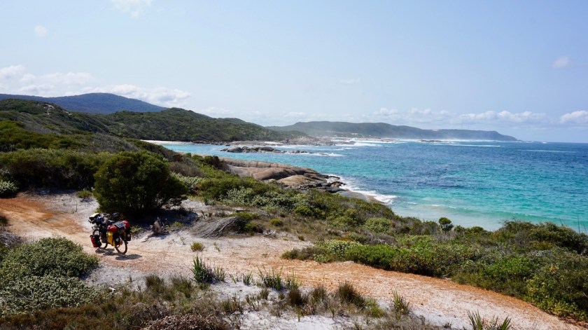
Route: Albany – Denmark – Walpole – Pemberton – Manjimup – Augusta / Cape Leeuwin
Day 230: 25 September 2019
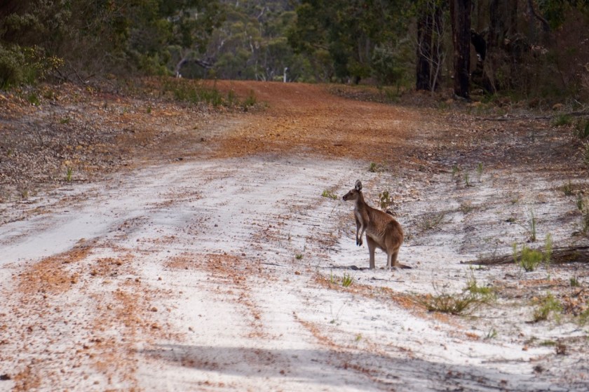
Albany
Weather: Sunny, cloudy
I destroyed my camping stove by accident in Esperance, and survived on bread three times a day the last month. Finally, I find a new stove in Albany.
I also went to the official starting point of the Munda Biddi Trail, a 1.000 km mountainbike route route between Perth and Albany. I will extend it a bit towards +/- 1.500 km with rides towards Cape Leeuwin and in the Margaret River Area.

Day 231: 26 September 2019
From Albany to along Francis Road
41,96 km (Total so far: 10.595,99 km) – Altitude climbed: 282 m
Weather: Cloudy, rain, light tail wind
Denis rode me first into town by car for some shopping. Then I waited till noon time till the rain eased off a bit. I still had a bit of drizzle later in the day, but it was fine.
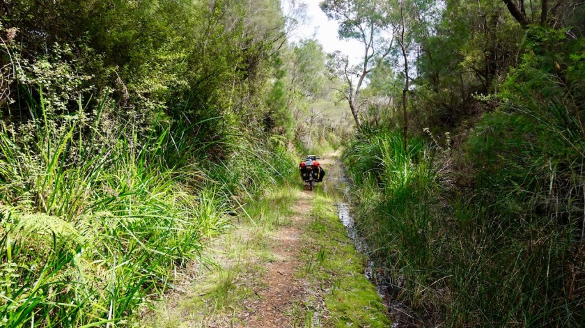
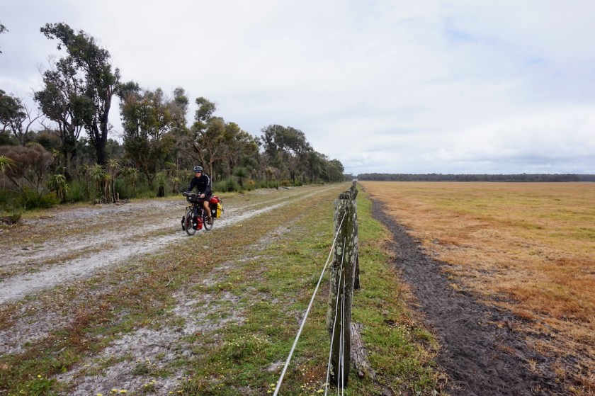
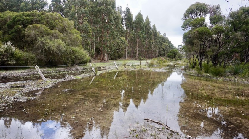
My first kilometers on the Munda Biddi are ok although it would be nice if they could find an alternative, or some single track, along the Old Elleker Road. But mostly it was pretty nice already. Camping spots were not so easy to find, as most of the trail still goes through farmland here.

Day 232: 27 September 2019
From along Francis Road to along Denmark-Nornalup Rail Trail
50,04 km (Total so far: 10.646,03 km) – Altitude climbed: 292 m
Weather: Sunny, light tail wind
It is obvious I am riding one of the more famous Australian cycling routes. The big majority will ride the Munda Biddi Trail in a north to south direction, so riding it the opposite way, I will meet many of them. Today I chatted with two couples riding the last day of their trip. Both of them were riding it leisurely, taking more than three weeks to finish it. Some people try to ride it in the least possible time, riding till midnight and starting again when it is still dark. That is also the reason why I won’t stay in the huts and shelters along the route too often.
After a day in the saddle, sound asleep at 9 pm, I don’t want to be woken up by people arriving and leaving again during my night rest.
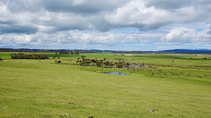
Good wild camping would be possible on the stretch along Hay River, outside of holiday season (in the season, I assume fishermen and families will park their caravans here). More good wild camping along the rail trail, about 8 kilometer before Denmark.
Denmark has a ‘Super Iga’, which is really well stocked. There’s also a Mitre 10 and a shop selling camping gear.
From Denmark, the Munda Biddi goes south to the coast, but there is also the continuation of the rail trail towards Nornalup. Both suppose to be beautiful rides and I couldn’t make my mind up which way to ride so, I took the easiest option and decided to ride both of them. First down the rail trail, then come back to Denmark via the Munda Biddi, shop again for provisions and ride out again via the rail trail to where it intersects with the Munda Biddi.
Good plan.


Leaving Denmark, there is a sign at the rail trail saying it is only open to hikers.
Ignore it.
There is an old bridge which more or less collapsed. You have to walk down three meter and take the new iron bridge and go back up three meter. I suppose this is such a life threatening action the town of Denmark decided not to take responsibility for that and therefore put the sign in place.
So just go, no worries.
To my surprise there are not many good spots along the track for camping, but you’ll find something eventually.
Day 233: 28 September 2019
From along Denmark-Nornalup Rail Trail to along Denmark-Nornalup Rail Trail
31,29 km (Total so far: 10.677,32 km) – Altitude climbed: 144 m
Weather: Sunny, no winds
Continued riding the Heritage Trail almost till I was back at the South Coast Highway. I didn’t ride the last few kilometer as they were flooded.
I saw a blue wren today. Almost riding over snakes also has become a daily occurrence.
Rode back to a suitable spot I saw before, along a field with views to the surrounding hills. Short day, so I can catch up a bit with the daily reports after having fixed my laptop.


Day 234: 29 September2019
From along Denmark-Nornalup Rail Trail to along Denmark-Nornalup Rail Trail
39,09 km (Total so far: 10.716,41 km) – Altitude climbed: 405 m
Weather: Sunny, light head wind
After a couple of kilometer on the same track I rode yesterday, I rejoin the Munda Biddi. First some single track in the bush just next to the South Coast Highway before joining William Bay Road. It is Sunday, a long weekend and school holidays.
So it’s busy.
The Carpark at the end of the road is already full at 10:00 am. Cars turning, looking for a place off the road. Crying children, screaming and yelling parents, all of them arriving at the little look-out, seeing this is not the way down to the water, turning their heels to the other track, without even looking out and admiring the view. The yelling from the people, down below at the rocks is louder then the crashing of the waves on these rocks.
Elephant rocks…. beautiful place, but not on a day like this.
Go, go.
There is a dirt road through the dunes to Madfish Bay and Waterfall Beach. A couple of brain deaths races passed me at 80 km/hr. Another idiot thinks it is necessary to fly his drone at a meter from my head. I find him. Ride up to him. Stop next to him. Say nothing.
He feels uncomfortable.
Good. He shouldn’t be doing that.

Then the nice part starts, a single track through the dunes.
And a mistake. My gps track went from Lights Beach over asphalt back to Denmark. Suddenly, no more Munda Biddi markers along the road. I realize I heard people talking about a track along the wind mills. Later I see the gps track must be wrong and I could have continued longer along the beach.

I went to the Iga to buy new provisions. Lots of people in town. The main drag, Strickland Street, was closed and full of old timers. That’s gonna be a hell of a drinking and bbq party at the campground all night.
Not me, I’m off to a wild camp, back along the rail trail. Good enough phone reception to watch the world championship cycling tonight.
Day 235: 30 September 2019
From along Denmark-Nornalup Rail Trail to alongside Kent River
66,99 km (Total so far: 10.783,40 km) – Altitude climbed: 856 m
Weather: Sunny, moderate wind all directions, rain afternoon and night
So, the first part of todays ride is the same as what I rode a couple of days ago.
Nothing boring though. In the first kilometer, a big tiger snake is laying rolled up on the track, warming itself in the sun.
Kilometer two; again I get four swooping attacks from that same vigorous magpie. I stared in his eyes when he came down to me. He looked so determined and so aggressive.
Kilometer four, a fox is staring patiently into a small hole, probably hoping his breakfast will come out at some point.

Turning onto Limbourne Road I leave the rail trail and am again on unknown terrain.
A steep climb on Point Hillier Vista, but with magnificent views back to the coast. Then, descending on dirt roads, losing views of the coast. I first hear, then find and see a White Tailed Black-Cockatoo.
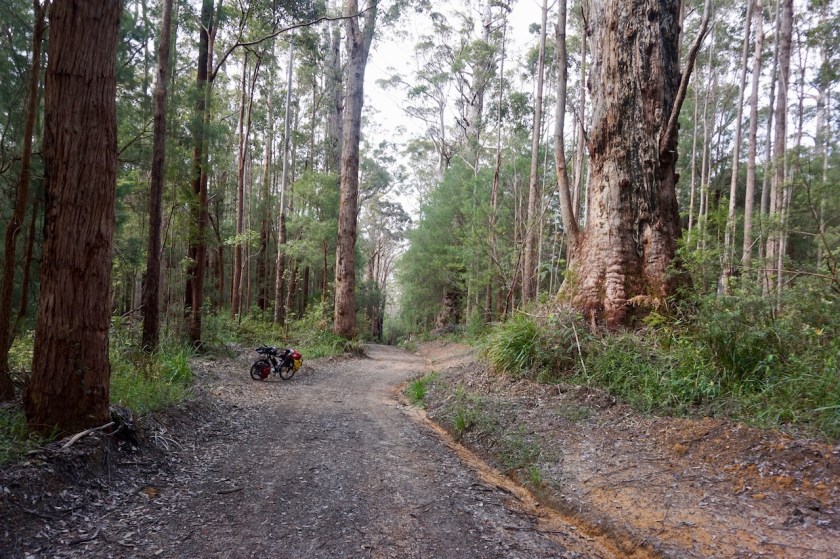
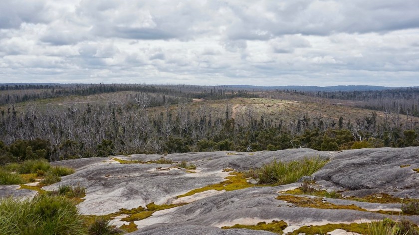
On a small single track through the forest, full with wild flowers, I reach my first Munda Biddi Trail Hut, the Jinung Beigabup. Much larger as expected. It is noon time only, so I just stay for lunch.


Mount Lindesay is the main feature of the day, seeing it sometimes to my left, sometimes in front, then to my right as the pad meanders its way through the fields and forests.
The sky at the western horizon is getting greyer and greyer. Don’t like that.
Inevitably rain starts to fall just as I cross the narrow suspension bridge over the Kent River. A handy clearing in the forrest just off the track is all I needed. I pitched the tent in a hurry and tucked in.


Day 236: 1 October 2019
From alongside Kent River to alongside Frankland River
52,98 km (Total so far: 10.836,38 km) – Altitude climbed: 873 m
Weather: Cloudy, no wind
Another Munda Biddi Trail rider passed my camp this morning while I was breaking down. I assume he must have ridden 35 km already from the previous hut. He didn’t stop.
When I reach the Booner Mundak hut, the second one on the trail, I see he wrote his name in the guest book and was planning to do the whole ride in seven days.
No time to stop then, of course.
A cyclist I spoke in Albany warned me already there is a ‘killer climb’ this side of Walpole. Also some entries in the visitor book at the hut showed some people really suffered. Well, we’ll see, it’s about 55 kilometer to Walpole and I still have food till tomorrow lunch time.
Some parts of the Middle Road, north and south of the hut, are very sandy and require some pushing. Not too bad now, after the rains, but I guess in dryer periods it might be an issue.
I meet three riders riding north to south and have a chat with two of them.
They don’t seem to be too knocked up from the climb they must have had earlier in the day.
Turning on Thompson Road (this are all dirt tracks), a steep part begins. 17% says the little cyclometer.
I push.
I remember fifteen years ago, in the spring time of my life, I cycled up 18% hills in Thailand.
Don’t even try anymore.
Just take my time and push and look at the giant trees in the forest.
After all I heard and read from this hill, in my imagination it had risen to Mount Ventoux-ian proportions.
It is not a long climb, just a few minutes pushing, no worries.
Near the top I have a chat with a friendly couple hiking the Bibbulman Track ‘the posh way’’, as they say, staying in lodges and hotels.
Steep down, 18%
I ride that, this is great fun.
There is a turn off, 600 meter to the Valley of the Giants.
The hikers told me they just went there and it was horrible. Full of kids, lots of noise. Right on the turn-off, there is ‘carpark 2’.
I guess that means there is a carpark 1 as well, and who knows a nbr 3 and 4 also.
Why would I go and pay an entrance fee to see the same trees I have now all around me, with chirping birds i.o. over exited, yelling humans ? Worrying about leaving the bike behind with all my stuff on it.
I’ll probably miss out on the hot dog, but they are terrible here anyway. They put the sausage between a loaf of this horrible white, spongy toast bread.
Not the good stuff.
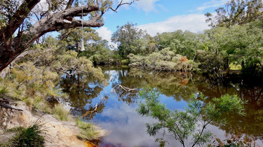
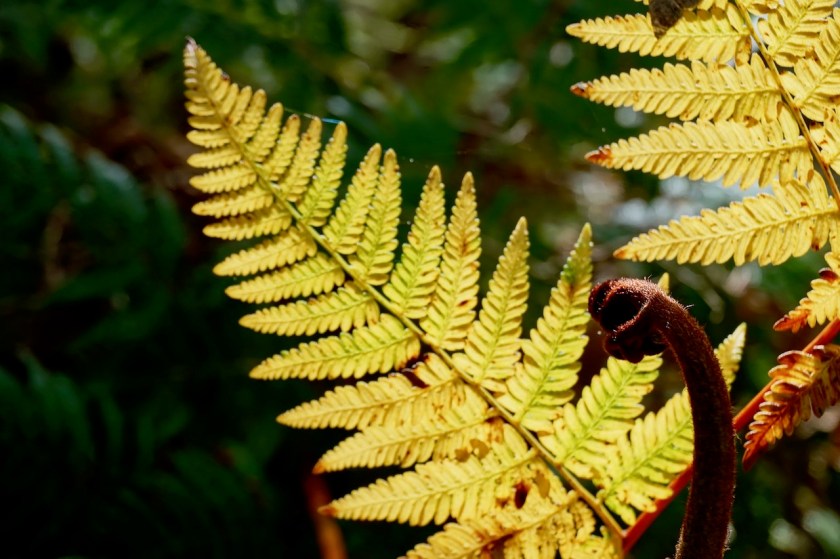
I roll down deeper into the forrest of the Walpole-Nornalup National Park. More huge trees, small streams, plants, bushes and birds everywhere. No cars, no people.
No phone reception 🙂
At the bridge crossing the Frankland River I find a nice spot to pitch the tent for the night.

Day 237: 2 October 2019
From alongside Frankland River to Kwokralup Beela Hut
52,08 km (Total so far: 10.888,46 km) – Altitude climbed: 900 m
Weather: Sunny, wind a bit from everywhere
It is a very beautiful ride alongside the Frankland River into Walpole. Some short steep sections, both up and down, but pleasant. No need to go for that treetop walk if you’re riding the Munda Biddi. Here, you cycle in the tree tops as the path is at points so high above the narrow valley.
I stay a couple of hours in Walpole to recharge all devices and do the necessary shopping for provisions. The plan was to cycle half way to the next Munda Biddi Hut, 30 kilometer from here and do the remainder of the ride tomorrow morning. As from the afternoon, heavy rain is predict until Sunday. I’m loaded up with food for five days, so I can sit out the bad weather, and ride the two days to the next village, Northcliffe.
The weather was so pleasant, and there was enough time left that I cycled all the way to the hut already, arriving at 5:30 pm with an hour of daylight to spare.
I pitched the tent at one of the designated spots as there was already another couple in the shelter.
Day 238 & 239: 3 & 4 October 2019
Kwokralup Beela Hut
Weather: Cloudy, very strong winds and heavy rain
The bad weather was predicted as from noon time on Thursday (3rd). It didn’t look that bad in the morning. Clouds, but from time to time a blue spot in the sky. Still, I decided to move from my tent to the hut. I had brought that food for a reason and it doesn’t pay off to ride two hours in the dry to become soaked later in the day.
But it remained dry all day.
Bummer, I could have gone outside.


The next day, it was still dry in the morning.
What to do ?
The forecast is for very heavy rain showers.
At times like this, one goes outside, looking at the sky and almost wishing for rain. Otherwise you stay idle without a reason. Finally, by 11:15 it starts. At that time a few guys ride in. Too much excitement, too much noise and testosteron, too many “whooo’s” and “whaaaa’s” from far away in the forrest. As always in a group of guys under thirty years old, there is the tough guy who has to limp a bit. He is so tough, despite his limp he still goes out on the bike. but off the bike…. limping.
This is the soccer player of the group.
They only stay for lunch, and then they go, in the rain.
I read a bit, drink a coffee, eat a cake, fall asleep, clean my bike, laundry was done yesterday already.

Day 240: 5 October 2019
From Kwokralup Beela Hut to 3 km before Yirra Kartta Hut
43,16 km (Total so far: 10.931,62 km) – Altitude climbed: 773
Weather: Cloudy a bit of sun, light head wind
Hmm, cloudy.
Just as cloudy as yesterday. Taking it slow and easy, I leave the hut around 11 am. It’s a bit of a climb up the hill again. Some rain drops from time to time. Not very attractive weather.
There is the junction towards Mount Frankland (410 m), from where you suppose to have nice views.
Not with these clouds.
More rain is coming. As everywhere, even these low hills make their own weather.
I wanted to go to the top, but again let it pass. There is no use in doing so now.
And so, the mountain is a metaphor for your professional life. If the circumstances of going to the top are unfavorable and make you unhappy, move away from it and soon the sun will come out again 🙂 .

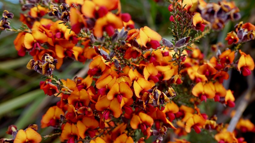
And so it did today. Riding away from the hill, the first rays of sun appeared. The ride towards Fernhook Falls is all on single track, very nice.
Fernhook Falls itself is a nice stop, but not overly impressive. So is the ride after the falls. You stay in the forest, which I like a lot. It is not super impressive, but just very good riding, almost all on single tracks.
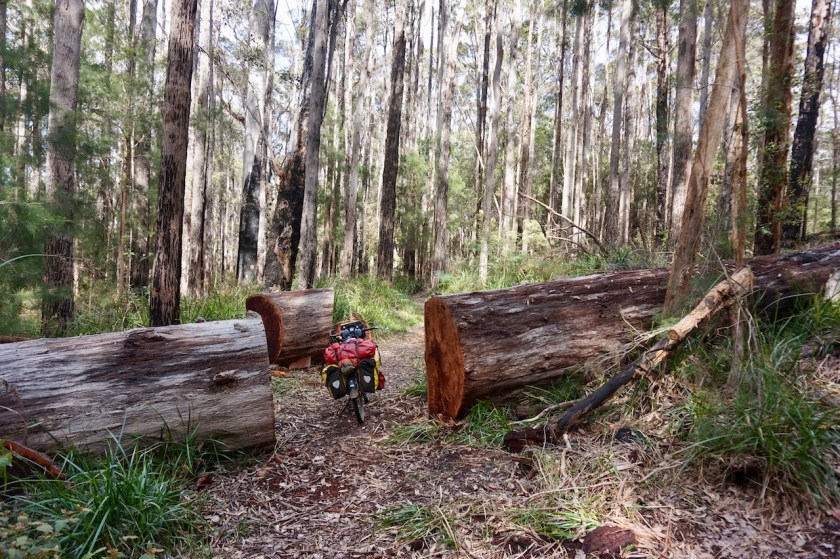
After crossing the South Western Highway, I have to clear the track from some large branches that probably came down during yesterdays strong winds.
I decide to pitch the tent a few kilometer before the next Munda Biddi hut, Yirra Kartta. It is Saturday and school holidays. Don’t want to push my chances too far. Just want to have a quiet evening.
A very good day on the bike again.

Day 241: 6 October 2019
From 3 km before Yirra Kartta Hut to 3 km after Northcliff
58,38 km (Total so far: 10.990,00 km) – Altitude climbed: 866 m
Weather: Cloudy, moderate head wind, rain in the evening
I am really starting to miss the blue skies and the warm weather of the interior.
(Not the flies though !)
Today was another grey, cold day. Night time temperatures are between 10 & 12 degrees, which is good, but daytime is between 16 & 18 degrees, which is ten degrees too cold.
Luckily, the track was super pleasant riding again.
First I rode into Yirra Kartta Hut where Stephen, a cyclist from Hong Kong was still busy packing up. He rides a Surly Wednesday fat bike, pretty well loaded up. Heavier than mine, I think. But he has the right travel spirit and is in no hurries. The other guys with whom he shared the hut left at first daylight and were already in Northcliff by 9 am, I heard later from other cyclists coming the opposite way. Rather they then me.
As I said, the riding is all day in the forest on tracks completely free of any traffic. Towards Northcliff the land opens up a bit, some farming. Nice for a change. One sees the hills, but with human habitation also come the swooping magpies, which were very aggressive again.
Mind the head !

Day 242: 7 October 2019
From 3 km after Northcliff to Warren River
23,31 km (Total so far: 11.013,31 km) – Altitude climbed: 281 m
Weather: Sunny, no winds
A Bibbulmun hiker passed my tent and stopped for a chat this morning while I was still having breakfast. Generally taking it easy till the tent was dry.
After Northcliffe, there is an asphalt section of about 2,5 km where I had the most aggressive magpie attack so far. It started of with a couple at the beginning of the section, but that only lasted a couple of hundred meters as always. Then, near the end of that asphalt section I was attacked by four magpies at once. Every two seconds another one dived at me. It went on and on for at least 500 meter. That’s a long time ! Super aggressive they were.
Back in the forest, I was safe again but the track passed some more fields and farms, and that’s where the magpies are.
Here are some video’s from Youtube, really worth watching:
Probably the best clip here:
Another nice one here
Even the tough guys on moto’s get swooped:
The weather was finally sunny again. Down at the Warren River there’s an old wooden bridge. The setting was just too beautiful to pass by. I stopped for the day and camped.


Day 243: 8 October 2019
From Warren River to 12 km passed Pemberton
31,33 km (Total so far: 11.044,64 km) – Altitude climbed: 540 m
Weather: Sunny, no wind
I woke up to the most incredible bird sound orchestra ever. Kookaburra’s and dozens and dozens and dozens of other bird songs. (example here)
The sun was out.
A few kilometer into my ride some heavy Caterpillar (the company specialized in making equipment to destroy the planet) machinery was at work clearing forestry roads. Soon, these magnificent trees I am cycling along now, will be cut. It is un-be-lie-va-ble this is still going on. I heard that Australia is, after Brazil, the second largest forest clearing country in the world.
Good on you, Australia !
It makes me mad. I was outraged on my bike, thinking they were going to clear this whole area soon. Should I attack the Caterpillar driver ? It would probably delay things only with an hour and have me labeled as a foreign trouble maker, kicked out of the country.
There is zero hope for this planet if people in so called civilized countries still continue these practices.

In my rage, I rode over a snake on a downhill. He was just laying next to a branch. I stopped to check him out. A tiger snake, not fully grown yet. Luckily he was ok. I think the branch caught most of the impact. Don’t want to end up creating road kill myself.
A bit further on, one of this small birds that always hop along with you, from branch to branch landed at a meter and a half from me. Sitting on that branch he/she started to sing a song, showing off that beautiful tail they have.
Fantastic !
But the loggers will soon destroy your habitat my friend.
No worries, it is called ‘managing the forrest’.
There is a nice switchback climb, not steep from East Brook towards the Gloucester Tree area.
Close to the top, I had a flat tyre in the back.
Pemberton has a good supermarket and friendly visitor centre. I talked with some grey nomads from Victoria and Queensland whilst having lunch.
Riding out of Pemberton and hitting the dirt again, the tyre in the back was flat again. I know by now how to fix a tube. To patch was ok, no sharp things stuck in the tyre, the tube even held the air when I blew it again. Changed it for another tube and will fix this one later. I’d like to keept it, as it is one of this really heavy Chinese, more or less puncture resistant.

Day 244: 9 October 2019
From 12 km passed Pemberton to along Parsons Road
38,82 km (Total so far: 11.083,46 km) – Altitude climbed: 705 m
Weather: Cloudy, no noticeable winds
A grey and cloudy day.
Temperatures in the low 20’s, so okay for cycling.
A few kilometers into my ride, just as I turn into Ivan Road, a big emu runs out of the bush and crosses the road maybe ten meters in front of me. I can feel the wind it makes. So impressive how it accelerates and runs away with these strong legs and flat feet.
But you don’t want to collide with them, I think.
For a second time I cross the Warren River, the road goes up, a bit down again and I am making the most of the ‘momentum’ for the next hill.
Pea gravel, a bend to the right in the road, 45 km/hr.
(Pea gravel is something typical for this area, but imagine you are riding over ball bearings, strewn a few centimeter thick over the road).
The bike starts to swing all over the place. For a moment it seems I get it under control again, but the edge of the gravel track comes nearer and nearer and I crash hard. On my left knee, the one I had troubles with a while ago, the left shoulder and elbow.
What a shame I don’t have a Gopro and filmed it. I get up and check the bike. It seems ok.
Then I make a few steps. I seem to be ok as well. Big bang on the knee and some blood and some road rash on the left shoulder and elbow. Luckily I was wearing gloves to protect the hands.
It all seems ok, but as the great José De Cauwer always claims when a cyclist falls on tv, the night will be a sleepless one and the real pain will come tomorrow.
We’ll see.
The knee glows a lot, but it functions well up the next hill.
And that’s where José goes wrong. The pain doesn’t come tomorrow, it came after 6 kilometer.
Also the left elbow and the palm of my right hand hurt. Can’t even remember I used my right hand in the crash.

I take it easy the rest of the day. Still had a close encounter with a Western Brown snake, the small bush flies are out now, after the good weather yesterday and some aggressive magpies swooped me a bit in Quinninup.
There is a very steep hill out of Quinninup, 15% up, 12% back down.
I meet another cyclist from Hobart with quite a bit of experience in South-America, Mongolia, China, Taiwan, …

I pitch the tent just beyond a stretch of forest that has been completely cleared by loggers.
Apart from the crash, good cycling tracks today.
Day 245: 10 October 2019
From along Parsons Road to Karta Burna Hut
60,65 km (Total so far: 11.144,11 km) – Altitude climbed: 786 m
Weather: Sunny, moderate head wind
A perfect sunny day, temperatures mid twenties.
Beautiful tracks towards Manjimup, the biggest place since Denmark, I think (the two big supermarkets Coles and Woolworths are here). I went for lunch in ‘The Two Black Birds’ (Burmese Curry Chicken Samosa) while I was recharging my devices.
As rain is predicted for tomorrow, I push on the the next Munda Biddi Hut, so I can wait it out in the hut. But I pitch my tent a bit away from the hut so I can have a sound sleep.
Two other cyclists are in the hut, Marcus and Daniel, whom I met just outside Manjimup already.
Good cycling day, apart from the puncture in the front 1,5 km before reaching the hut. The tyres, having 11.500 km now over often very rough terrain are really getting at the end of their life span.

Day 246: 11 October 2019
Karta Burna Hut
Weather: Rain
Stayed in the hut, repairing the tyre, changing brake pads, reading, sleeping, …
Day 247: 12 October 2019
From Karta Burna Hut to near power line service track
61,64 km (Total so far: 11.205,95 km) – Altitude climbed: 472 m
Weather: Cloudy, sunny, light and moderate head wind
This hut being at one of the higher points along the Munda Biddi, the day starts with a downhill along a switchback single track. Lots of switchbacks, so easy both going down or up.
At the bridge over the Donnelly river, I leave the Munda Biddi Trail for a while to visit the Margaret River area. Soon I can leave the asphalt road again, taking a left turn on Coronation Road.
When I’m on Four Acres Road, I am a bit disappointed, it being a wide, straight dirt road, not too exciting. But, there is a small track branching off to the right, into an unnamed national park. No hesitation, and I steer the wheels in that direction. It is sometimes a bit sandy, there are some muddy pools from the recent rains, but the scenery is nice and the sense of adventure is there.
Trying to stay on the smallest tracks, I eventually end up on the service track under the power line. This one goes straight up and over every hill and is sandy quite often.
I find a nice protected spot for the night, on grounds that would drain the rain very well. Bad weather predicted for the night.


Day 248: 13 October 2019
From near power line service track to forest along Courtney Road
40,74 km (Total so far: 11.246,69 km) – Altitude climbed: 121 m
Weather: Rain, moderate head and side wind
A miserable day.
They morning rain stopped around 10 am, and it looked like it could be an ok day. I packed a dry tent away and got going by 11 am. The track under the power lines was much better as yesterday and soon I reached the asphalt Milyeannup Road.
I should have followed this one south towards Governor Broome Road, but no … I saw a smaller, lesser travelled option.
Often I am rewarded that way, but today this became a bit of an ordeal. The tracks were very sandy, or, more often, flooded. Sometimes even temporary rivers, one of them 90 centimeter deep. I made very slow progress, traversed some planted commercial forest (with ‘keep out !’ signs), I build some temporary bridges with branches to cross flooded areas, …
In short, the going was slow, and in the end, the feet got wet anyway.
Around 2 pm it started raining and I had travelled only about 18 kilometer so far. Drizzle alternated with rain, it was grey, windy, depressing weather. Actually, since leaving Hopetoun, the weather has not been really fantastic.
Just like on the Mawson Trail, where they recommend to ride it in April, they recommend to ride the Munda Biddi in September or October.
All wrong !!
I understand you don’t like cycling by 40 degrees, but also 16/17 degrees, or less the last week, is not pleasant.
I think November and March are ideal for this trails. A bit warmer.
I Pitched the tent at the edge of a tree plantation

Day 249: 14 October 2019
From forest along Courtney Road to Skippy Rock Road
51,09 km (Total so far: 11.297,78 km) – Altitude climbed: 484 m
Weather: Cloudy, cold, moderate head wind
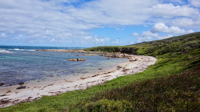
I made a little loop to avoid as much as possible riding on the Brockman Highway, but a stretch of about five kilometer can’t be avoided, as the highway has the only bridge over the Blackwood River. Taking the Glenarty Road, I pass the first vineyards of the Margaret River area.
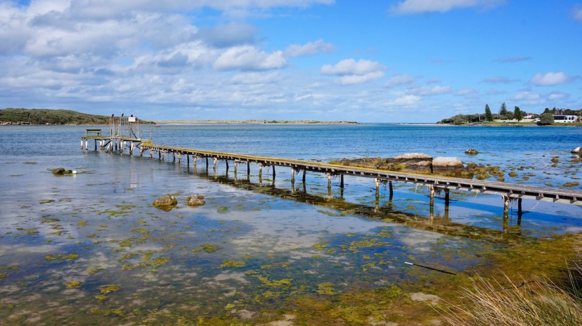
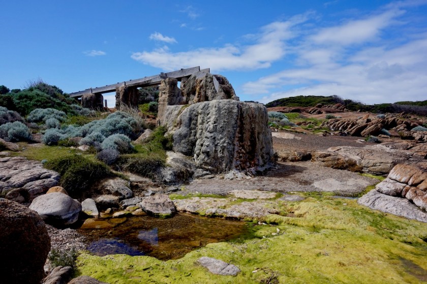
Augusta, the little town sitting here at the edge of the Australian landmass is touristy. They’ve made a nice path of a few kilometer right at the edge of the Blackwood river. Some old wooden piers still standing.
I save my visit to the light house for tomorrow but ride already in that direction, camping along Skippy Rock Road. It is a very windy night, but I am perfectly protected by the bushes.


Day 250 – 252: 15 – 17 October 2019
Augusta
37,14 km (Total so far: 11.334,92 km) – Altitude climbed: 311 m
Weather: Cloudy, sun, rain
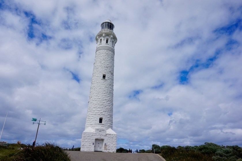
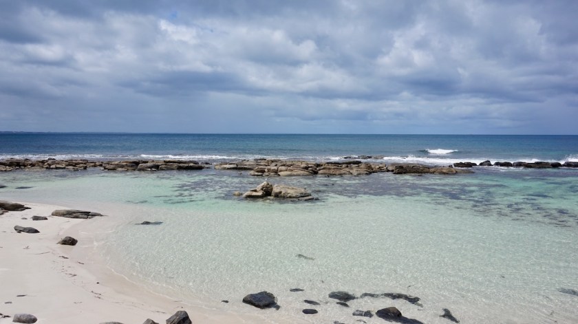
Just around the corner from where I pitched my tent, I have a spectacular view towards the Cape Leeuwin Lighthouse below me. This lighthouse, at the southwestern extremity of Australia is the tallest lighthouse of mainland Australia. It is not as old as some of the lighthouses we have in Europe, but then again, nothing is here.
I am lucky the sun is out in the morning, although there are still too many white and grey clouds in the distance to prevent making nice pictures.
It costs six pounds to visit the grounds of the lighthouse, twenty for a guided visit. Zero to view the lighthouse from a distance.
I opt for the 6 Aud option.


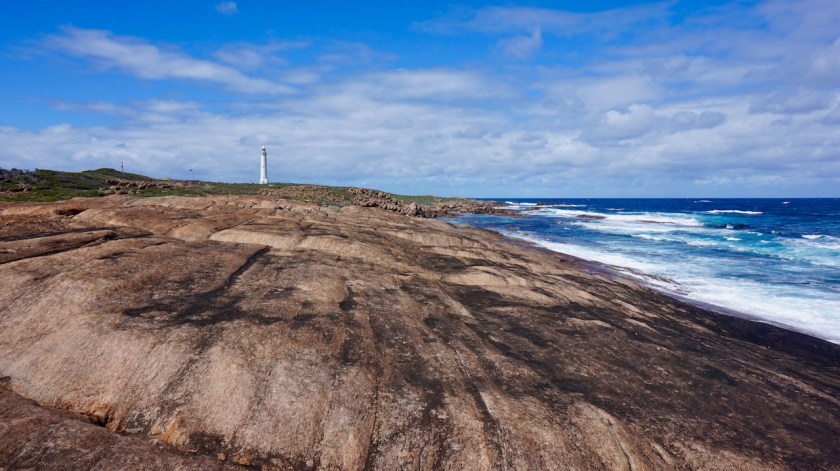

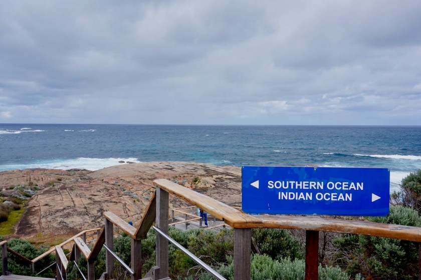
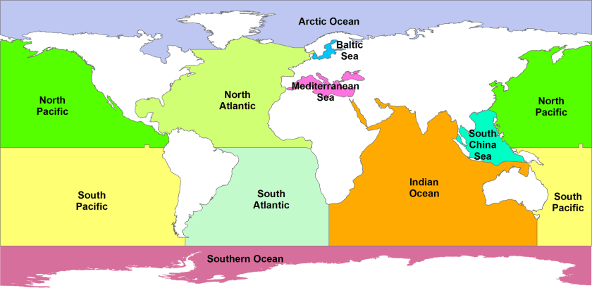
That’s because I want to go behind the lighthouse. This is not only the southwestern most point of Australia, it is also the place where two oceans meet, the Southern Ocean and the Indian Ocean. You can see the waves rolling into each other from two angles.
You could say that this way, I am seeing the third ocean since I’m in Australia, The Indian and Southern Ocean here, and the Pacific Ocean also in Tasmania.
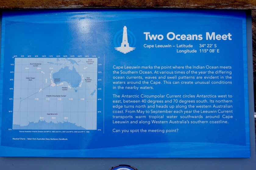
But I don’t know whether that statement is entirely correct. It depends which source you use.
The IHO (International Hydrographic Organization – considered the authority for such conventions) draws maps where the border of the Southern Ocean comes nowhere near the Australian landmass.
I found this on Wikipedia:
“Australian standpoint:
A map of Australia’s official interpretation of the names and limits of oceans and seas around Australia
In Australia, cartographical authorities define the Southern Ocean as including the entire body of water between Antarctica and the south coasts of Australia and New Zealand, and up to 60°S elsewhere.[35] Coastal maps of Tasmania and South Australia label the sea areas as Southern Ocean[36] and Cape Leeuwin in Western Australia is described as the point where the Indian and Southern Oceans meet.”


hi, Koen, you make us travel graeat!, thanks a lot,that s so nice, Cap Leuwin looks like Brittany,doesn’it? Enjoy.Hope see you soon
Sylvie and Arthur
LikeLike
Hi Sylvie, hi Arthur,
I hope you are doing great.
Yes, actually it does look a bit like Brittany. Only much, much warmer. Probably I’ll be cycling in Europe again in 2020, but nothing is sure yet 🙂
LikeLike