Route: Lago Aluminé – Las Lajas – Chos Malal – Bardas Blancas – Malargüe – San Rafaël – Tunuyan – Tupungato – Potrerillos – Uspallata
27/01/2018
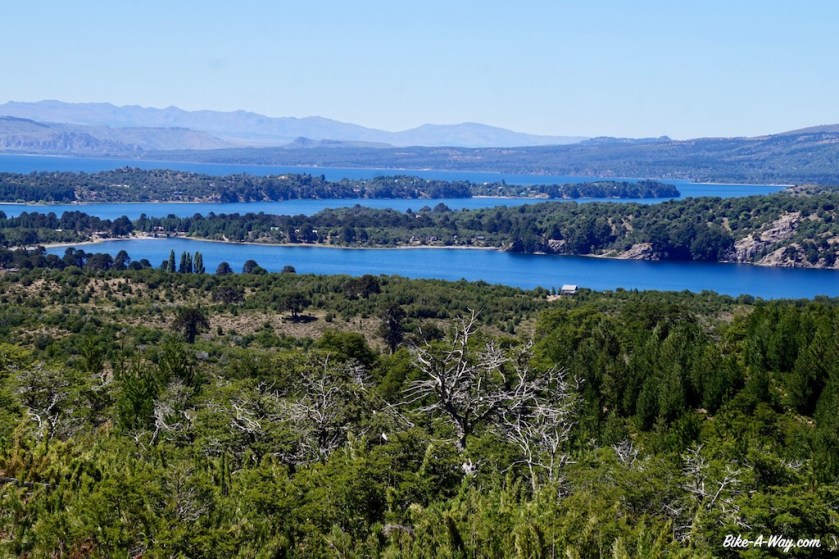
After having spend the night in the no men’s land between the Chilean and Argentinean immigration posts, I descend towards Lago Alumine. Coming from the Icalma Pass (1.335 m), I get a beautiful birds eye view of the lakes. Being back in Argentina, I can enjoy their bakery culture again, with a bigger variety as their Chilean neighbors.
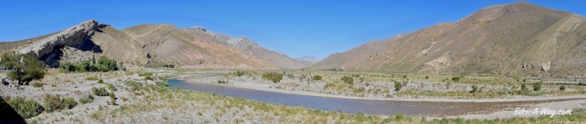
I slowly ride along the northern shores of the big Aluminé lake, stopping sometimes to check out the beach and the water.
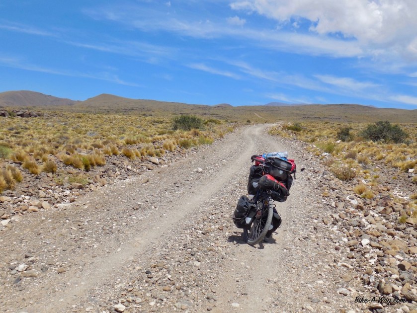
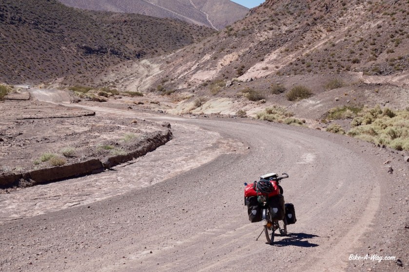
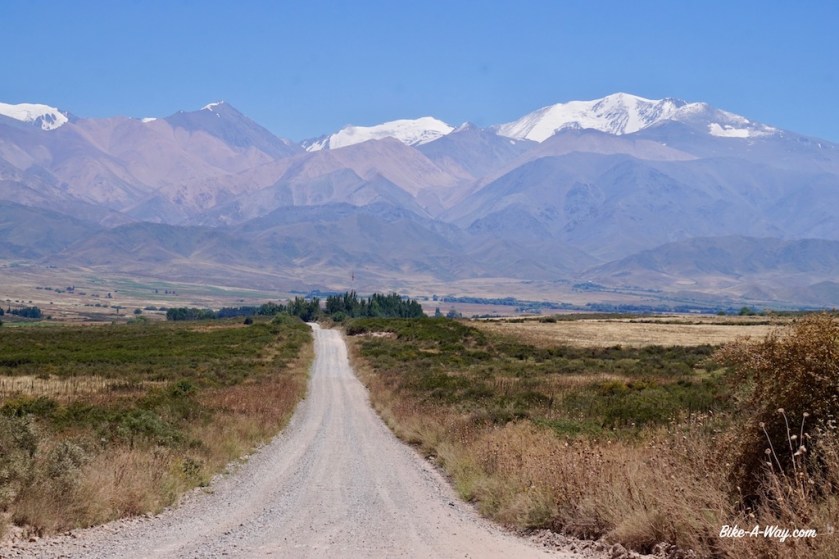
Route 23, again a gravel route of the worst kind, with rough wasboard, loose sand (yes, that combination is possible) or just a bunch of stones slows me down on the flat parts to 6 or 7 km/hr.
Luckily, the gradient is much, much gentler as what I had in Chili. Slowly my road climbs up the valley of the Rio Litran. I spot a few possible camping spots along the river, but the fire pits, broken bottles, rubbish and car tracks suggest I might get company in the evening, so I press on, finding a nice spot under an araucania tree in the bed of a dried up stream, a few hundred meters from the road.

Next day there are only a few, bumpy kilometer left to the highest point of the road at 1.621 meter. The ‘road’ stays high up for a while before descending towards the paved road 242 on which I have an easy way down towards the town of Las Lajas.
To ensure a quiet night, I chose to wild camp next to the Las Lajitas River, a few km before town.


After Las lajas, I suddenly seem to enter another world again. After having spend the last months in a wet and green environment, I’m suddenly back in the dry and hot desert. I was a bit careless about that upon leaving Las Lajas, and should have taken more water.
Luckily, there’s some sort community building for Mapuche’s at Coihueco where I can refill my bottles.


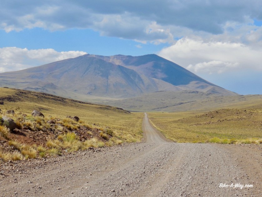
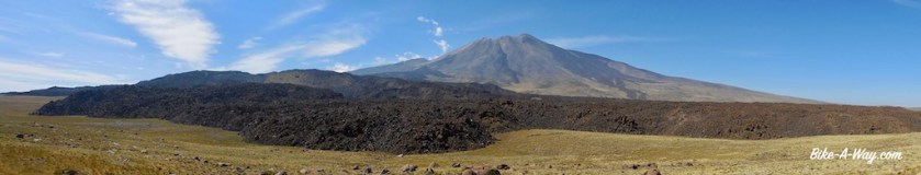
After a rest day in Chos Malal, I had to choose between the paved Ruta 40, or a small white road on the map, going through the ‘Reserva Nacional Tromen’, via the ‘El Tromen’ Volcano.
The latter, off-road route is way more interesting of course.
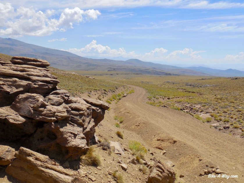
I fill up all the water bottles and the water bladder before taking off. As soon as I leave the Ruta 40, I’m on ripio again. Still some traffic. Nineteen cars until the junction to Tricao Malal.
After that, I would encounter one more car until the end of the day at Laguna Tromen.
As there aren’t any sheltered places to pitch the tent, I opt to sleep in the refugio near the Guardaparques. The climb isn’t too steep, but the temperatures went up to 47,5 degrees in the sun. As there’s no shade here, that’s the only temperature that counts.
To the west of me is the ‘Cordillera del Viento’, which luckily doesn’t create to much of a wind this time around. But from what I’ve heard, it can get pretty bad here.
After an extra rest day in the refugio, it’s only a short climb to the top off the pass at 2.277 meter.


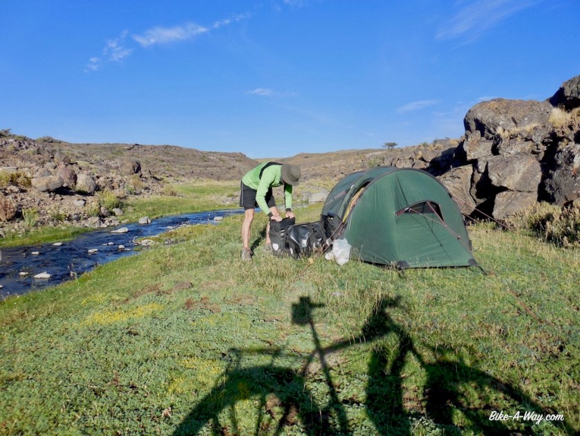


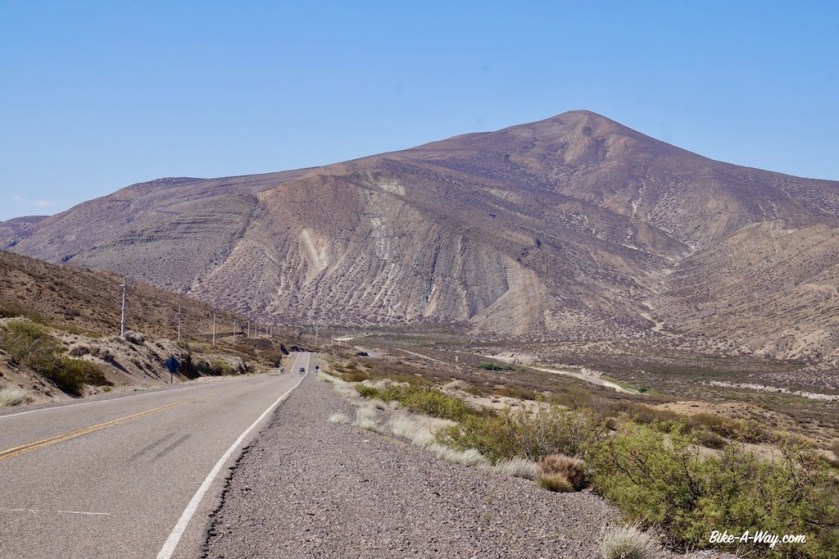
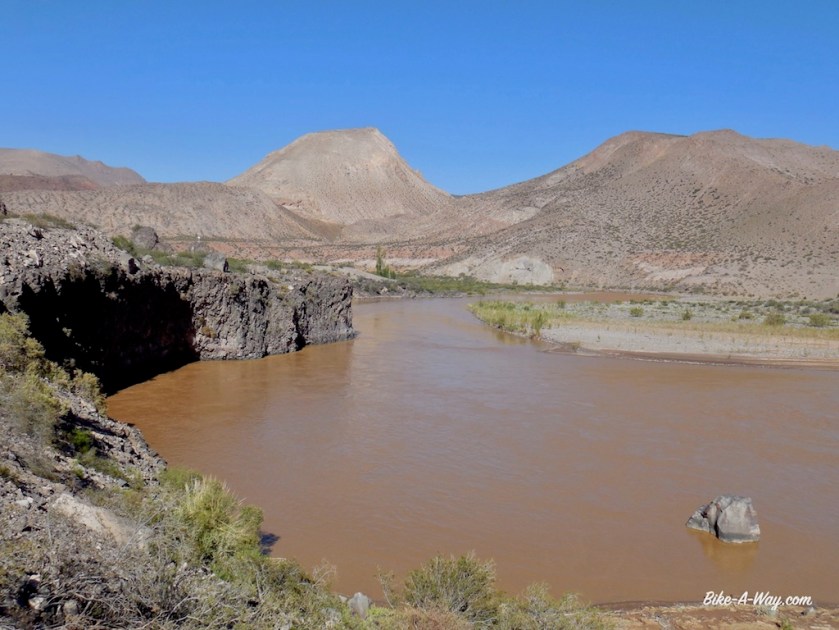
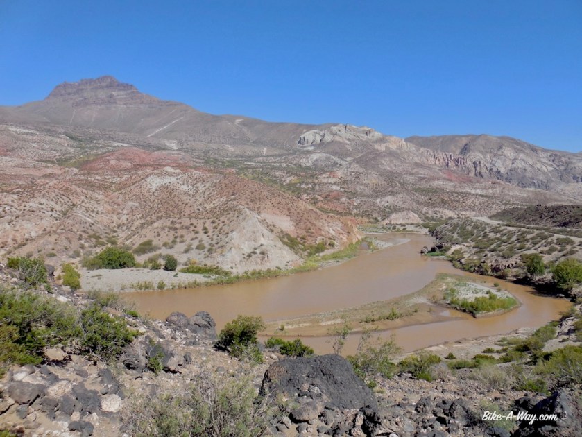
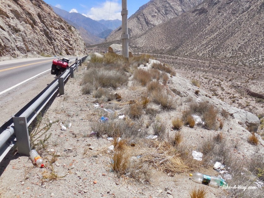
Between the little town of Barrancas and Bardas Blancas, I encounter a much longer, and also much worse ripio stretch as I expected. I camp somewhere in the middle along the Rio Grande (one of so many Rio Grande’s). It’s a brownish fast flowing river, suitable to get a quick wash of the body, but useless to drink.

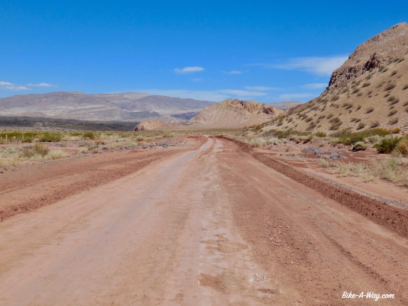


The area to my east is the Reserva Provincial El Payén, a huge area with more or less the highest volcano density in the world. To the west of me, there’s the Sierra de Cochico, and the the Andes of course.


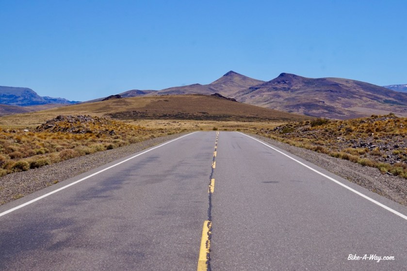
Thirty kilometer south of Malarguë, the misery starts again: brain death drivers speeding at centimeters passed your legs. I thoroughly enjoyed the ride all the way from where I entered Argentina again near the Lago Aluminé, but it couldn’t last.
I really wonder how this works. Do these people have a perimeter of about 30 kilometer from their town which they never leave, or do they change their attitude if they do so ?

The only thing I do in Malarguë, besides buying provisions, is having lunch in the YPF gas station and use their pretty good wifi connection.
A Swiss guy comes ver for a chat. He came down to South-America a couple of months ago for a big cycling trip but has given up since. Reason: The way people behave on the road. He bought a car in Chile and is now traveling in that.
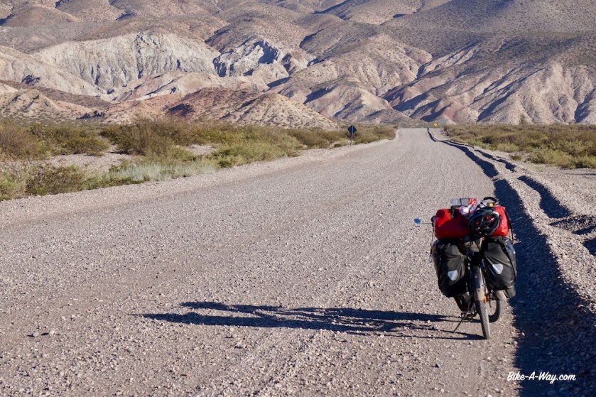
I’m facing a little problem. Ruta 40 has an unpaved section a bit further north of here. It’s 163 kilometer long, and apparently in a very bad state, pushing required in some sections.
Not a problem normally.
On the contrary, I would look forward to it, but I’ve had so much ripio lately in Chile, then had the hard ripio climb via El Tromen, after that the bad ripio sections between Barrancas and Bardas Blancas.
It has come to a point where my hands, pulses and especially my shoulders really hurt. So now I plan to follow the paved (longer) route via San Rafael, which most cyclists seem to take.
I worry a bit I will end up in San Rafael in the weekend of 11 & 12 February. The internet tells me that’s when carnaval is celebrated.
I am not looking forward to share my time with drunk, excited, loud carnaval party goers.
When I enquire with the lady at the gas station if she knows if they have carnaval celebrations in San Rafael, she doesn’t know. But tonight there s some kind of “fiesta” here in Malarguë, she says cheerfully, as if i’m the luckiest guy in the world to arrive just at this day.
I pretend to be excited by this news, but can’t hurry enough to leave town. At the far end of town is a tourist information, where I again try to find out about possible carnaval celebrations in San Rafael. Both guys working there don’t have a clue, but, we have a fiesta tonight in Malarguë.
Thanks guys…
I cycled of into the wind and found an excellent place to pitch the tent. There was an open gate, leading to a row of trees. Behind the trees some of these big rolls off grass behind with I pitched the tent. Perfect shelter. The wind blew super strong from the mountains, making lot’s of noise in the trees, but the tent hardly moved.

In the morning, the gate was closed, of course.
Back on the road, I had to cover another 40 kilometer towards El Sosneado.
Strong side wind blowing from the Andes, but I didn’t worry. In El Sosneado, I would turn east and have this wind in my back. It would blow my fast and easy towards San Rafael (in two days).
And yes, after refilling my water bottles at the police station, I left switched ruta 40 for ruta 144.
I hardly had to peddle to get the speed above 30 km/hr.
Wow, this is insane, I have to be careful, or I will arrive in San Rafael tonight already.
Five kilometer it lasted.
Five kilometer, then one big wind gust in my face.
My speed went down to 20 km/hr.
The wind turned immediately.
It never blows from the north east.
Excepted when karma has it’s roll to play.
Now I moved like a turtle at 8 km/hr. Even that I ‘ve learned to accept by now. But not on roads like this, with that much traffic. Eyes locked on the rear view mirror.
Losing your concentration for four or five seconds is immediately rewarded with a near death experience from the next passing cars.
I hate them.
I truly hate these Argentinean and Chilean drivers.
They won’t slow down, ever.
I tried everything, claiming 1/3 of the lane, so here’s no actual space to pass me when another car or truck is coming from the other side.
They don’t care.
They go a little, little bit closer to the centre of the road, hoping the car from the other side goes a bit to the side, but if he doesn’t, your done.
I tried claiming half of my lane.
Sure no place now for them to come in between me and the car from the other side.
They are not impressed.
None of them.
They keep coming at full speed.
As a cyclist you have two options. Dive in the ditch, or end up in a wheel chair (if you’re lucky).
I can’t count the times I feared for my life today.
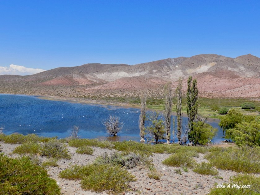
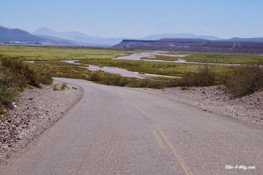
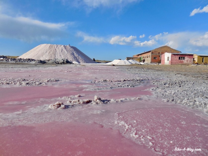
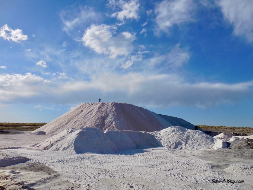
I cycled 115 kilometer and ended up sleeping at the ‘Salar del Diamante’. Not one suitable place to pitch your tent on this windy pampa.
The commercial operations on the Salar seem to be something of the beginning of the previous century, with very, very old trucks, machinery still showing names of English manufacturers. It must have been a state of the art, modern thing back then, but it seems not much has been invested or maintained since those days.
From San Rafael I will take the bus. The road going north connects with Mendoza. this are the two biggest cities of the province, so I know already what that will be like.
I’ve completely had it with the sick attitude of these drivers. And that’s 99% of what’s out on the road here.


I gave up on cycling the potential death road between Malarguë and San Rafael. An employee of the salar gave me a lift into town. There I went straight to the bus station and bought a ticket out of town, to Tunuyan, a place south of Mendoza. It appeared a small place on the map, but is much bigger as expected.
The campground, ‘El Festival’, where I write this at 1 am in the morning.
It hasn’t stolen it’s name. It seems like a festival here. Tents are pitched at 50 centimeters interval. I placed mine in the only corner with still a bit place left, but at 23:00 hrs, four guys arrived in an old Ford Sierra. Before they pitched their tent, they built their ‘sound system’, with huge loud speakers.
Now, at 1 am, people are still arriving and building their tent at less then 50 centimeter of mine.
Three couples with small kids and toddlers.
At 1 am !
Am I strange if I find all this abnormal ?
Either way, I’m getting sick of the fact it is never quiet in South-America.
Argentina and Chile not very populated ?
Don’t make me laugh.
They are everywhere, they are loud and if there’s one thing nobody seems to do here, it’s thinking about other people.
Why on earth are peoples with kids & toddlers still building tents at 1:30 am (they have troubles erecting it).
There’s a buggy almost standing inside my tent.
I truly wonder how much I can have before I….
The tent next door, kids start to cry.
I’m pretty close to crying myself as well.
At 2:45, they finally had their tents up. They struggled a bit with the last one.
Well, they struggled with that one over an hour. No wonder when you’re trying to pitch it inside out !
“Now it’s time to start the bbq”, I wanted to joke, but no need for that, because that’s exactly what they did.
Kids, all under five years old, still running around.
At 3:45, a couple of the babies are brought inside the tent, not all of them.
The other kids have to go in the tent at 4:15.
Babies start to cry.
Now the parents start the car stereo.
Some of the adults go to sleep.
Drunk snoring mixes with the ‘music’.

So it went on and on all till morning.
I went inside my tent, exhausted at 4:45 am.
Woke up two hours later. Two of the guys were still siting outside, obviously drunk and under influence of other drugs. Only way to manage the sleep deprivation, I guess. They’ll probably hit the road later on in their cars.
I start to make some noice with pots and pans to have my little revenge on those sleeping.
By 9 am, freshly showered but overly tired, I leave the campground.
The Carrefour in town is the first ever around the world not selling any fruits, vegetables and bread.
The yellow roads on the map, indicating minor paved roads west of Tunuyan are still traffic infested.
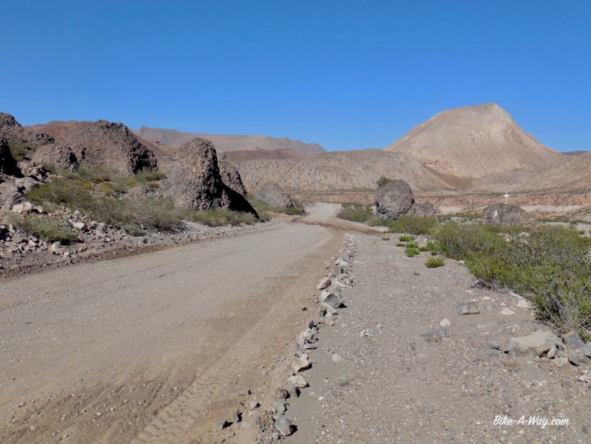
Probably more then a few of them on drugs and alcohol. I anticipated that and made a route on gravel roads towards Tupungato with the help of the great online routeplanner ‘BRouter’.
This routeplanner seems to be able to come up with great options the world all over.
I got it thanks to a tip of one of my idols, Frank Deboosere. He’s got a great webpage, including a blog section about his cycling trips.
Apart from Ben Crabbé, Frank Deboosere and his colleague Sabine Hagedooren are the only decent people left on the BRT.
Anyways, that BRouter is a great tool.

I pitch my tent a bit off the road a few kilometer past the village San José, at the start of the climb towards Uspallata.
It isn’t the very best of places, but I’ve got a tiny irrigation channel passing by, which means I don’t have to use any of my drinking water to do the dishes (and it makes a calming sound like a little pont with a bubbling stone), andI’ve got a line of trees protecting me from the wind if needed.
The only nuisance a fair amount of traffic passing by till after sunset.
The tent is pitched by 6 pm. I start reading a bit inside the tent but fall asleep within minutes.
One way or the other, I find energy to make diner around sunset.
Apart from the occasional barking dog, the night was quiet and I decide to take a rest day here. I badly need that after the horrible day in traffic on route 144 to San Rafael, the bus ride to Tupuyan and the worst night of my life on the worst camp ground I ever encountered in that same place.
All is good again.
Well the ground under my tent is a bit bumpy. No problem at night as the excellent Therm-A-Rest NeoAir filters all that out, but it’s not very comfortable during the day.
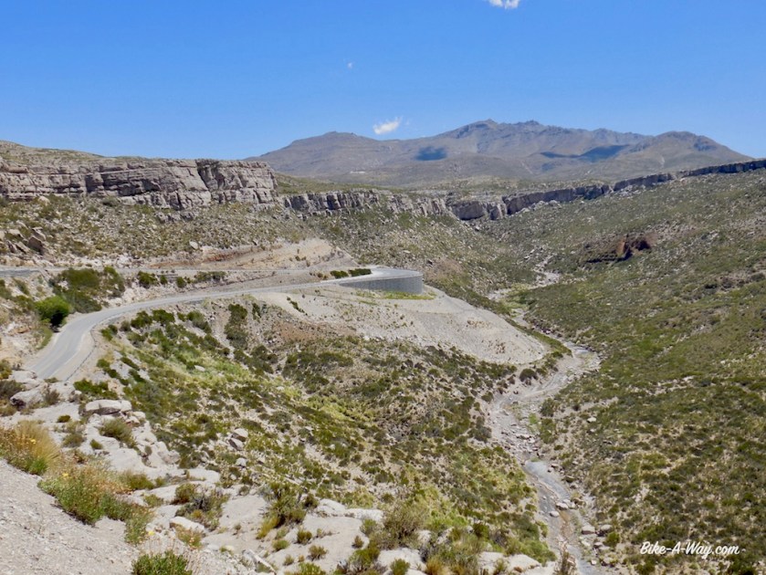
The road soon turned to ripio again after my wild camping spot. I’m entering a part of the Andes with some of it’s highest mountains. The very highest, Aconcagua (6.960 m) is not visible from here, but I have terrific views of it’s smaller brothers, Volcan San Jose (5.856 m), Cerro Tupungato (6.570 m) and Cerro Juncal (6.072 m). The views from the unnamed pass I’m taking today, 2.292 meter high, are splendid.


The traffic on Route 7, the main highway between Buenos Aires, Mendoza and Santiago de Chile is of course busy, but somehow not as bad as expected. The scenery again is amazing.
I leave the bike in a hostel in Uspallata and take the bus up and down to Santiago de Chile for a day.


There is a huge, huge, huge potential here in creating the worlds most spectacular bike path.
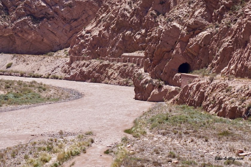
An old railway line, build by the English, is climbing from Mendoza, via Uspallata towards the Cristo Redentor (= Paso Los Libertadores) Pass (3,200 m). The line runs at the other side of the Mendoza River for most of the way and most of the tunnels and bridges are still intact.
On the Chilean side, another railway line, completely out of use is going down.
If both governments would invest in a bit of asphalt, or even just take the railway away and level the ground, not any other bike path in the wold could match this.
Thousands of cyclist would come to ride this, hostels and restaurants on the way up would get good business, it would be one of these ‘little adventures’ one must do.
But they prefer to just let it crumble to pieces, just like the rest of the lines in the southern half of South-America.
What a pity.


Very interesting my friend…Your task of bicycling along Argentina and Chile is a tough one for what I realize from your narration. The Geography in both countries is fantastically beautiful but their behavior and values is a different story.
However, you seem to be doing all the right things and being triumphant with your efforts. Good for you my friend! Continue your trip and I hope that things will be in the up and up! 🙂
LikeLike