Route: Gobernador Gregores – Comandante Luis Piedra Buena – Rio Gallegos – Monte Aymond – Punta Delgada
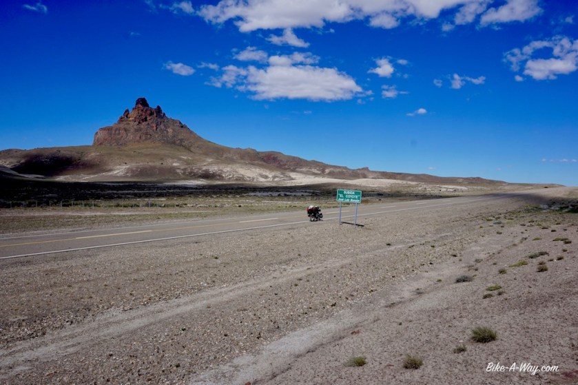
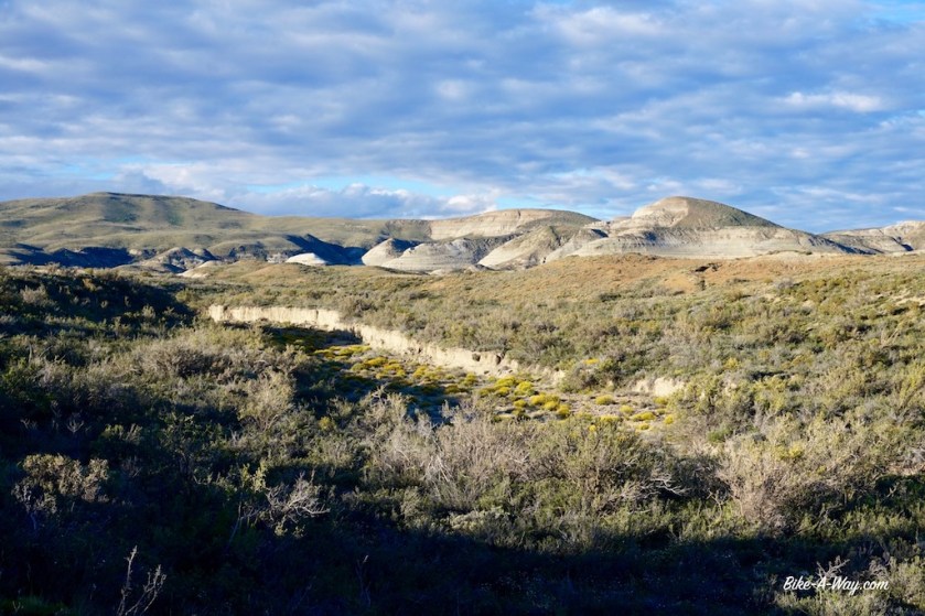
I decided to leave the Ruta 40 and take road nbr 27 towards the Atlantic coast to visit another national park. The first 60 km are really beautiful in the valley of the Rio Chico with some spectacular shaped hills. On my left side is the ‘Gran Altiplancie Central’ which I’m descending now. That Altiplancie isn’t that ‘alti’ by the way. On my right (southern) side is again a steppe like landscape. I can imagine the winds going like hell here, but today it’s quiet and sunny. About 6 km before the junction of ruta 27 and 71 the road goes a bit down into a valley. I unload the bike to lift everything over the fences and push the bike a whole way into the valley to find a fantastic spot for the night. Heaven after yesterdays hell at the campground in Gobernador Gregores. The full moon is out, I’ve got a few birds singing, some geese and a few horses in the distance. Don’t know if I’ve got puma’s as well. People keep warning me about them. But people are afraid of everything nowadays.


Two days later, after another night camping in a gravel pit, the entrance into the little town ‘Comandante Luis Piedra Buena’ must be the dirtiest entrance to a town ever. They’ve got an open garbage dump in the valley just outside of town. With the Patagonian winds, everything blows around kilometers wide, all the way onto the hills, garbage everywhere.
Disgusting.
I only stop in town to buy provisions and head down south on highway 3.


After 27 kilometer, I arrive at the park headquarters of Monte Leon. The park rangers were gone already but there’s a notice at the door. It claims the park is closed because part of the road into the park is washed out.
Excellent news !
It being a Saturday, I was afraid there might be groups of people, bbq-ing late into the night, screaming and shouting as they like to do here.
Now I would have the park all for myself and very quiet.
They’ve printed two pictures under the notice. Yes, it’s clear, you can’t pass by car.
But I saw no problems for a bike.
The actual road into the park was a few kilometers further down RN 3.
As they closed the fence, I again had to unload the bike and lift everything over it, like I have to do almost every night in order to pitch the tent somewhere.
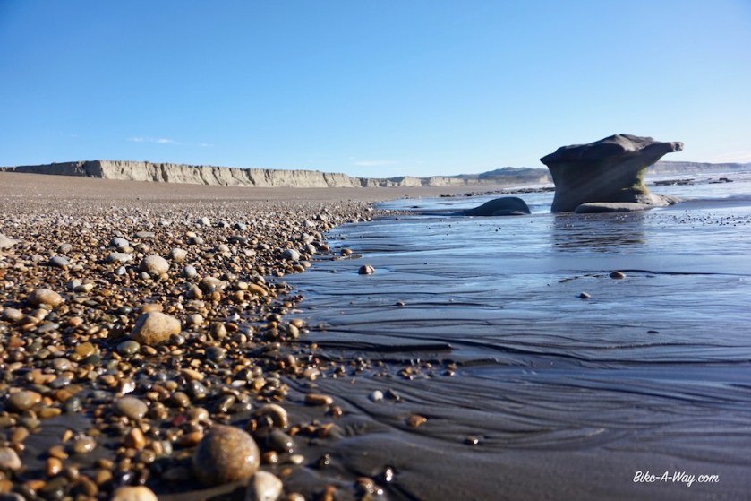
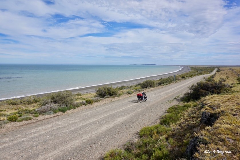
From the main road, it’s a 20 kilometer ride down to the coast.
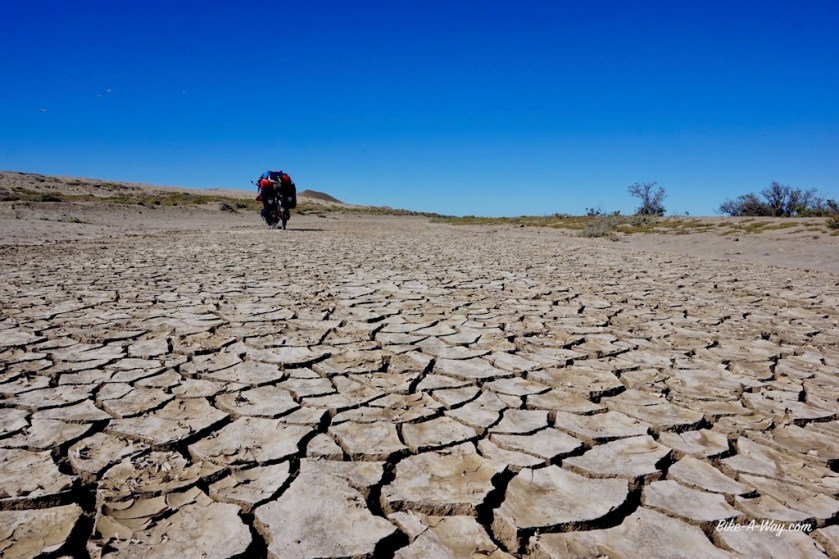
The little wash outs could be repaired in a day I think, but apparently they don’t do it.
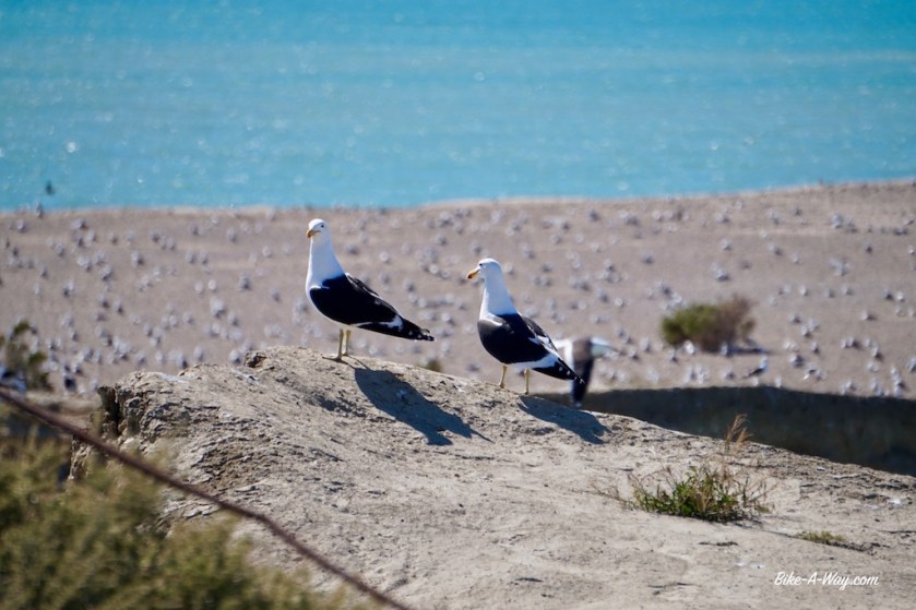
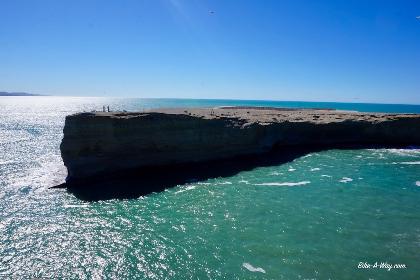
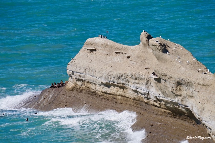
After a very, very windy night, I first go and have a look at Monte Leon Island, with thousands of seagulls and cormorants. Then I cycle to the point where you can see the sea lions.
I just mounted the bike again when a motorbike approaches me and stops aggressively. A guy in a green uniform, obviously a ‘guardaparque’ shows his dissatisfaction of me being here. I play dumb a bit, but nothing to do about it, I have to leave the park. A whole explanation of ‘seguridad’ and that blablabla that’s always used nowadays to restrict people of doing anything.
He literally follows me on his motorbike, but I calmed him down a bit, explaing I came from the other side of the world, especially to see this beautiful park.


It’s a slow ride, as I have to climb onto the plateau again. After a few kilometers, we arrive at the track that’s going down to the penguins, the reason why I’m here, so I give it a shot and ask the guardaparque whether he doesn’t feel like visiting the penguins ?
A big ‘NO !’ haha.
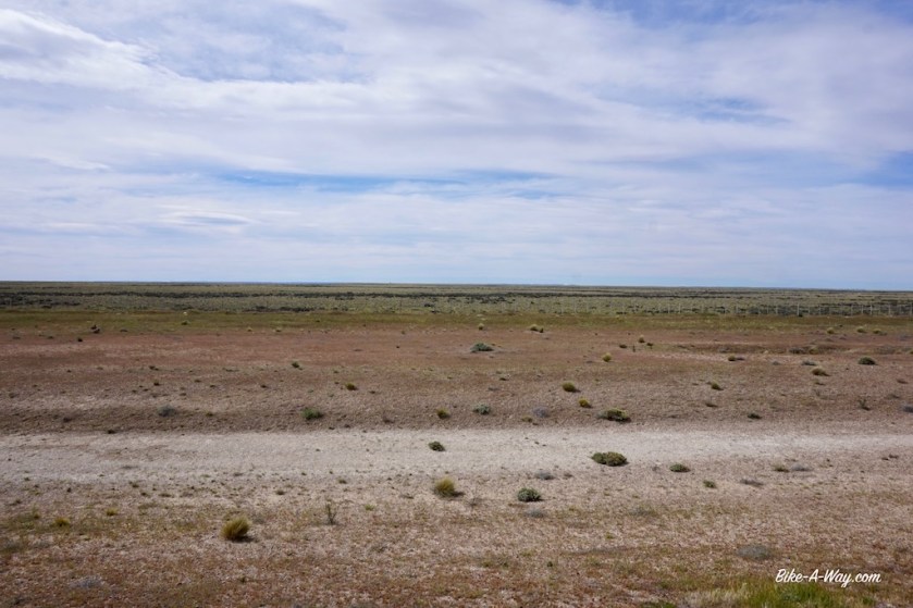
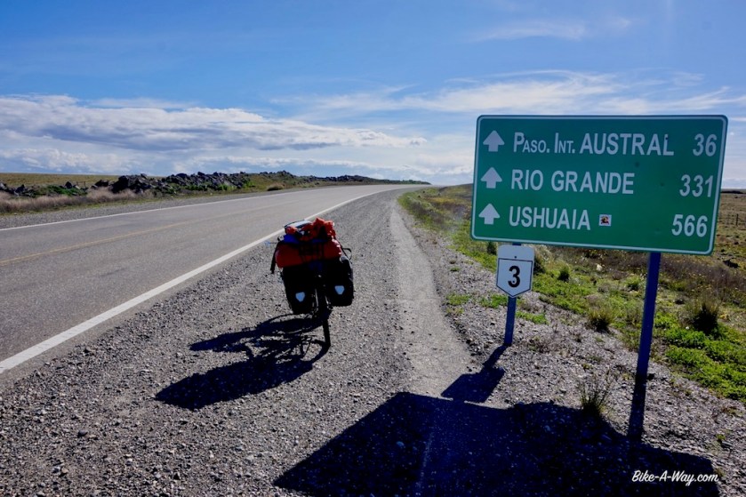
Back on RN 3, There’s a strong north wind which blows me quickly down the road. Unfortunately, it becomes a side wind later, but pitching my tent that evening along the borders of the Rio Coig, I had 142 kilometers in the legs. Not much protection from the wind here. I found some bushes that were a bit higher then the average 30 cm scrub growing here, but it sure was a beautiful place to spend the night.


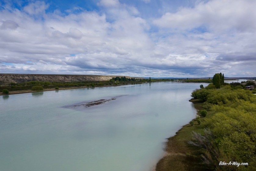
In order to avoid a night in Rio Gallegos, the capital of Santa Cruz province, I stopped at the campground 25 kilometer west of town at the bridge over the river, in Guer Aike. It’s a reasonably quiet place, so good for a rest day. Last days, I had excellent weather, temperatures mid twenties and mostly a tail wind.


Rio Gallegos is bigger, louder and uglier as expected. After buying provisions and a few near death experiences because of the total idiots driving around, I leave town. Luckily, a few kilometer south of town, the road becomes quiet again. I pushed on towards Laguna Azul, a crater lake about 9 kilometer north of the border with Chile. I pitched the tent down in the crater, next to the lake. That’s a descent of 55 meter into that crater. It’s so steep I have to unload the bike and go three times down and back up again to gather all my stuff. And get up a fourth time after pitching the tent to make pictures of course.


A brilliant spot to spend the night, but I estimated I’d need at least two hours to get my bike and stuf back to the rim the next morning. Again I had to travel four times up and down, but every time you make a step 30 centimeters up, your feed sinks down 20 centimeter in the loose gravel, so in fact you climb it each time three times.
Allas, after an hour I was up. In the nine kilometer to the border, I ate an apple and three carrots, as you’re not allowed to bring those into Chile. This border region is pretty beautiful, with extinct volcanos on both side of the road.
For one or the other bizar reason, I didn’t get an exit stamp from Argentina, but the Chileans made no problem stamping me in.
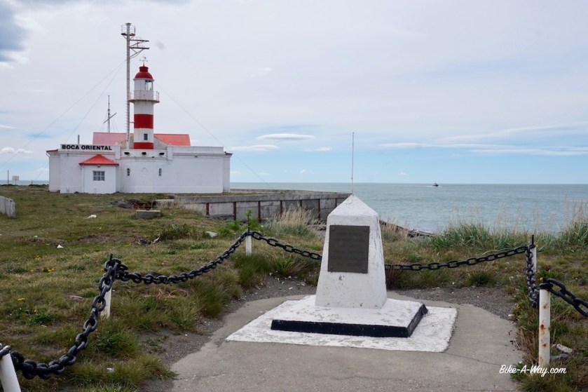
After the border control, I soon see the Strait Of Magellan. There’s a tiny grey line on my map, right next to the Strait, and I decide to leave the main road for this one. Now, I’m riding a few meters away from the Strait of Magellan, what I find a magical experience. This strait with all it’s history, but also the knowledge that I’m riding my bike right on the southern edge of ‘The America’s”. Sure, there’s still Tierra del Fuego further south, but that’s an island. This is the far end of the American mainland.
After sleeping in a crater yesterday, I’m pitching my tent tonight pretty close to the shores of the Strait.

It was a Belgian, Roeland van Brugge, who was the first person of the Magellan expedition to see the Pacific Ocean. Together with a few other guys, Roeland van Brugge was send ahead in a dinghy to check whether the Strait was a dead end or not. They checked several bays and in the end, Roeland climbed a mountain and could see with his own eyes that the Strait ended in the Pacific. That mountain is known to this day as ’Monte Campana de Roldán’.


The weather Gods punished my early stop yesterday with a strong head wind today. But never mind, that early stop was needed, because my desire to sleep one night next to the Strait of Magellan was too big. And I needed to make bread.
I took the ferry across the Strait at Punta Delgada and left the American mainland behind, towards Tierra del Fuego.
Fire Land ! Magic ! 🙂


felicitaciones amigo, un abrazo y fuerza
LikeLike
Muchas gracias Walter 🙂
LikeLike