Spain: Castilla y León, Prt 1

Route: Ciudad Rodrigo – La Alberca – Hervas – Avila – Segovia – Olmedo – Valladolid
Route Castilla y Leon 1
The first part of the route through Castilla y Leon.

Just beyond the Portugese / Spanish border lies the tiny historical town of Ciudad Rodrigo.  I had noticed it on my maps all those years, but it is in such an out of the way corner of Spain that I thought I’d probably never reach it.  But here I am.  

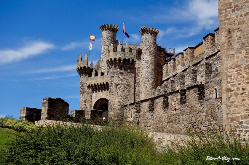
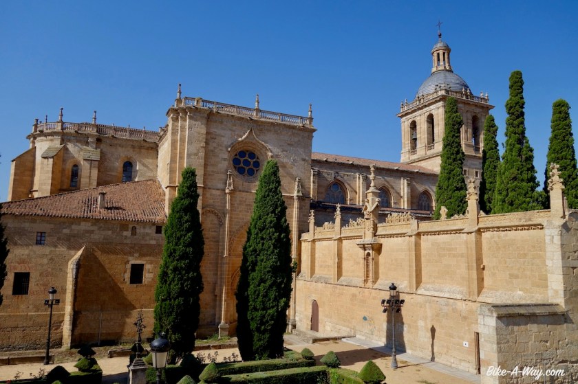
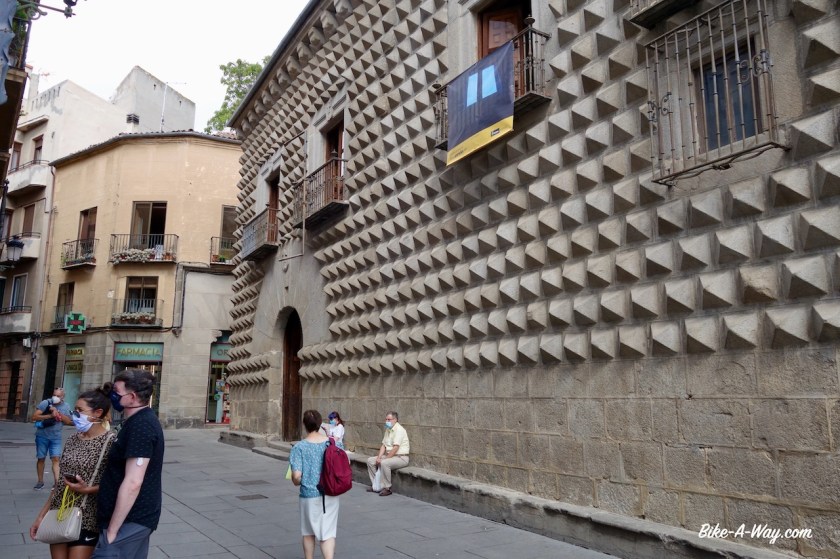
Nice little place.  Old town up the hill.  Impressive old city walls, a castle tower, an old cathedral, the house of the marquis which I liked a lot, …. yeah, it’s worth a visit.

DSC02554
The house of the Marquis

DSC02558

I check into a hotel for two nights.  Lot’s of stuff to do, besides typing for this website.  Laundry, bike cleaning, visit restaurants, downloading podcasts, recharging all the devices, etc, etc…

On my rest day in Ciudad Rodrigo I strolled back towards the old town to have another look at all the old buildings and have lunch.  After lunch, I walked the loop over the old town walls.  didn’t see another person.  It’s siesta time, you’re not supposed to walk, I guess haha.

DSC02565

My legs needed a bit of a rest period as well, I was thinking.  They felt rather tired after the constant climbing, day after day since I reached the Pyrenees.  “Nothing better than some riding along canals to give the legs some rest”, I thought.  We’re in mountainous Spain, and not in flat Belgium, but there happen to be canals a few hundred kilometer north from here, the ‘Canal de Castilla’.  I started investigating whether I could include that into my ride somehow.

From one thing came another.  The idea is to go eventually further south, to Extremadura, but the canals are north from here so I have to make a loop somehow in order to avoid riding the exact same thing twice.  

I could ride via Avila, that’s supposed to be an interesting town.  And then, I’m not far from Segovia, with it’s picturesque cathedral and….’.

Oh, and there’s another greenway I could include, and then go to the canals this way, return that way, a bit of Via de la Plata there, and …. 

It’s proven again that too much thinking is good for nothing.  In search of a way to give the legs some rest, I just added another thousand kilometer with a hilly passage through the Sierra the Francia and the Sierra de Bejar and yes, also some riding along the Castilla Canals.

It’s going to be fun ! 🙂 🙂 

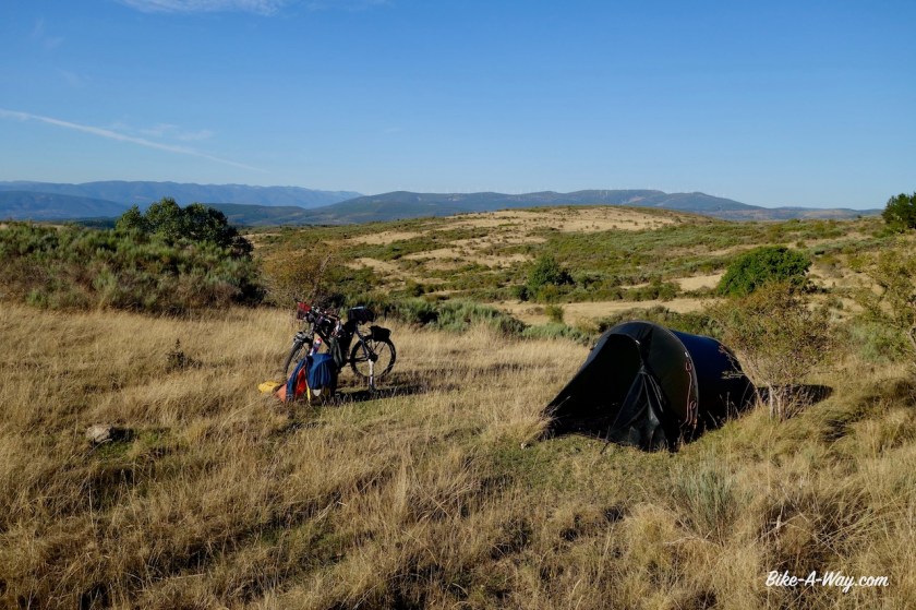
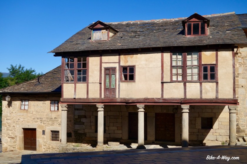
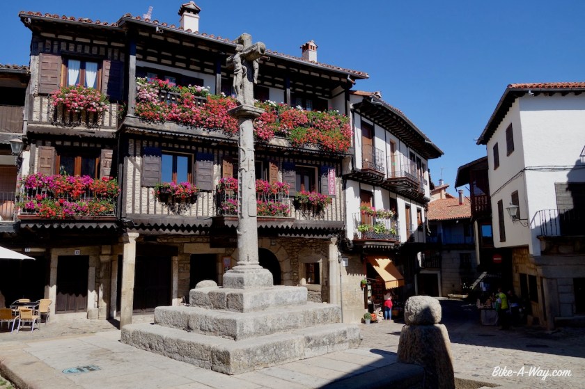
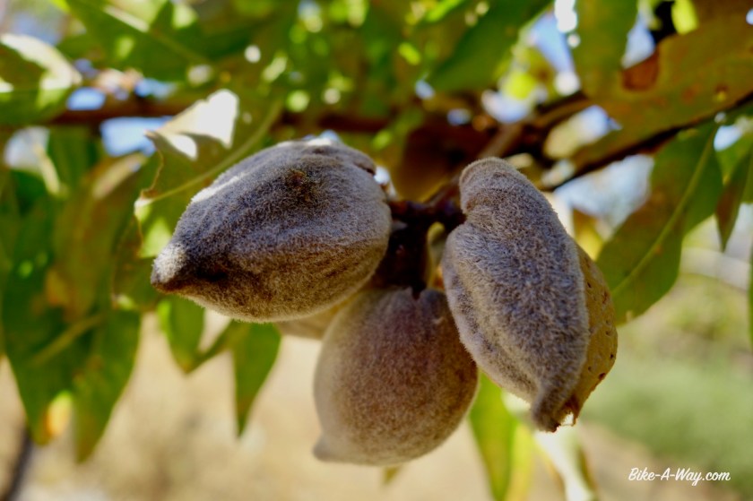
The ride from Ciudad Rodrigo to La Alberca over the main road is easy.  La Alberca is at 1.050 m asl or so.  Super touristic, even on a weekday.  This typical old houses with wooden frames.  A bit like in Troyes and Bergerac in France.   Lots of shops selling the Jamón (ham) for which the region is famous, lots of typical tacky tourist shops with t-shirts, bags, magnets to put on your fridge, restaurants with menu del dia’s, pinchos (tapas), ….

DSC02616
La Alberca
DSC02619
The region is famous for its hams.  Cycling the region, I saw a lot of the black pigs in the fields..
DSC02621
Plaza Mayor in La Alberca

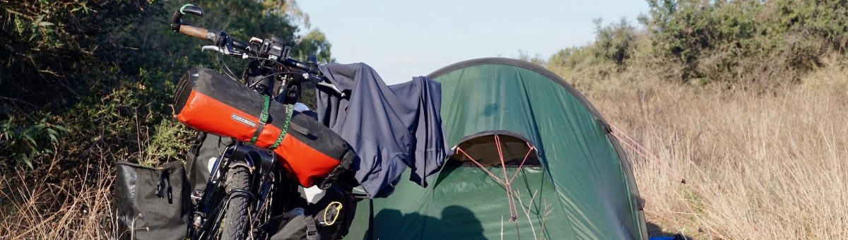
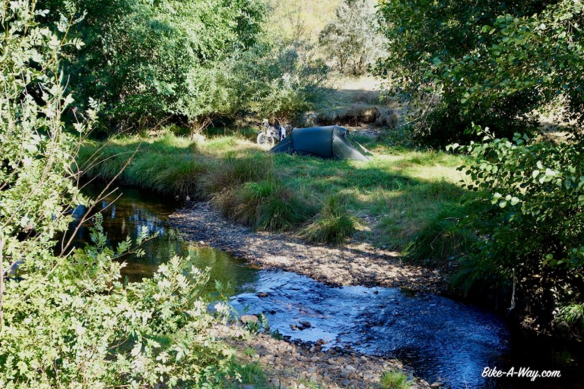
This stuff is not for me anymore.  I leave town after 45 minutes and find myself an ok place under the chestnut trees to camp.  The night definitely is going to be quieter than last night in the hotel with it’s banging doors well into the night (despite the noise isolation which the hotel advertised but was totally non-existing).

DSC02642

DSC02636

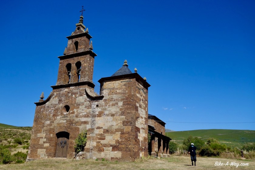
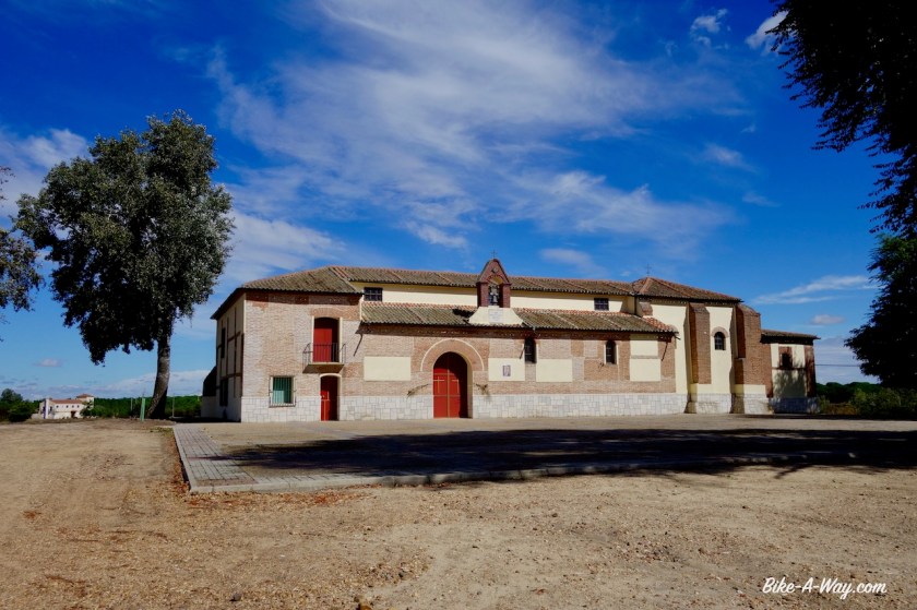
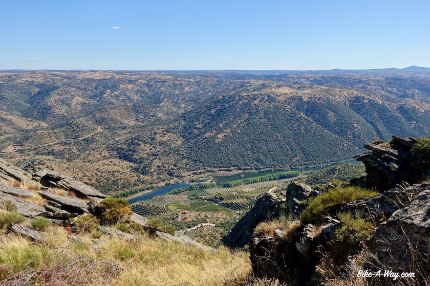
I had put a lot of time in preparing my little loop in Castilla y Leon, starting from Hervas, but not too much time in the route from Ciudad Rodrigo to Hervas.  That night, I suddenly remembered that, months ago, I already looked into some nice roads in this area.  Instead of riding straight to Hervas the next morning, I rode back up to La Alberca and from here took the road straight south into the Parque Natural Batuecas.  From La Alberca, I first have to climb a little bit higher to the Puerto del Portillo Pass (1.247 m).  From the pass, I have a brilliant view to all the lower hills in Extremadura region.   On the downhill, a series of switchbacks until I reach the Rio Batuecas.  I take a little side road to visit the Monasterio de las Batuecas, but it’s not open for visitors.

DSC02645
The eternal powerlines, but a good view to the endless row of mountains.
DSC02655
Switchbacks on the descent of the Puerto del Portillo.

DSC02668

DSC02671

DSC02673
Clearly on the switchbacks.

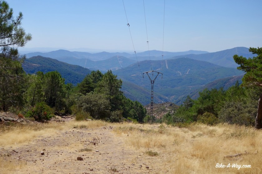
Never mind.  I keep going down.  Although I’m supposed to be on a tour of Castila y Leon region, I am entering Extremadura region for a while.  I ride already a part of the northern section of the Cicloextremeña, a loop that follows the borders of Extremadura region.   More about that in a few weeks, when I’ll ride the rest of it.

It’s  one of the harder stretches of that loop that I’m doing now.  

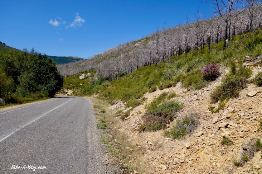
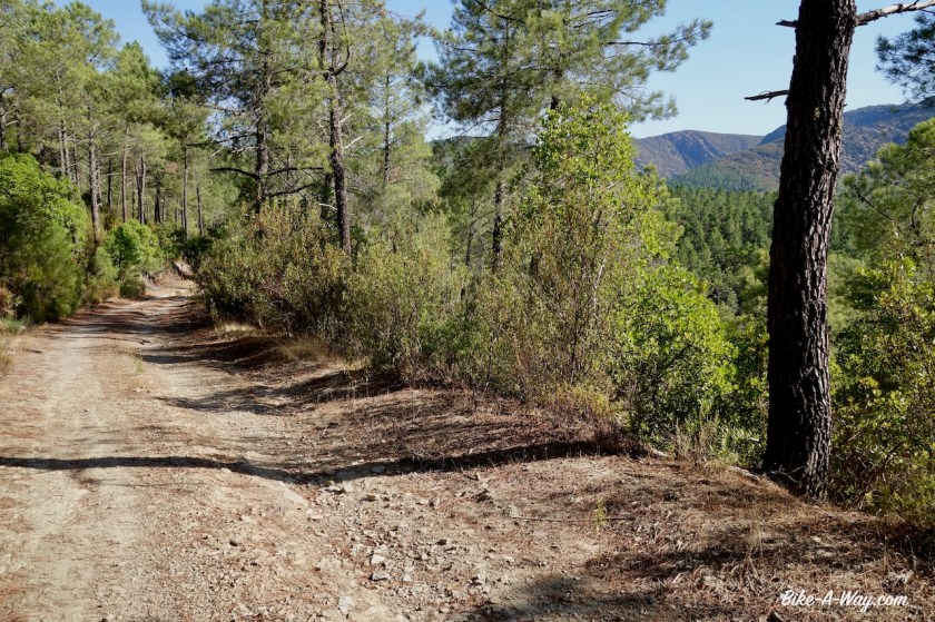
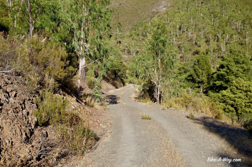
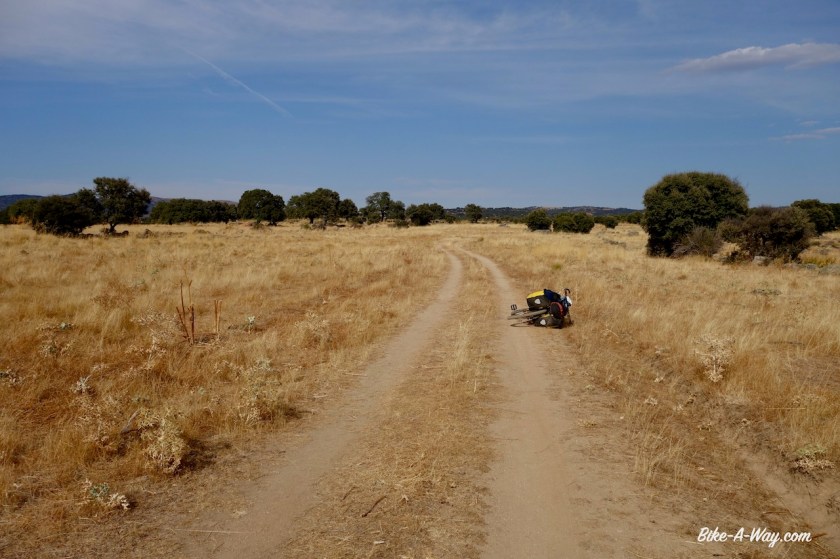
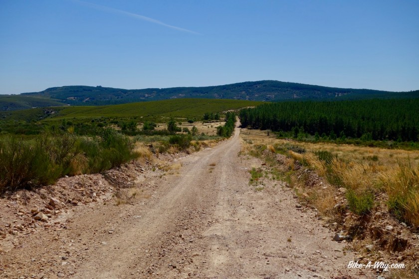
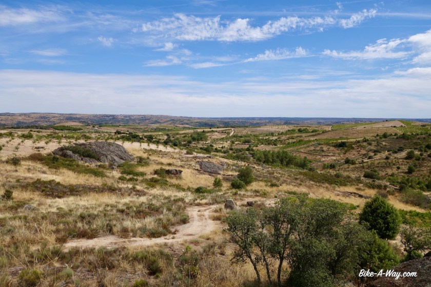
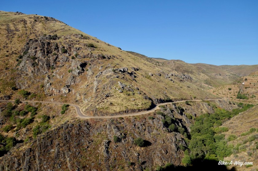
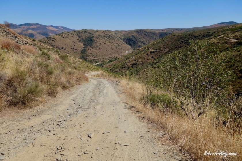
After Riomalo de Abajo, situated at the confluence of the Rio Ladrillar and the Rio Alagon, I climb steep on a stony dirt track.  This is the start of a remote section, closed to motorized traffic and without any services for 60 kilometer.  
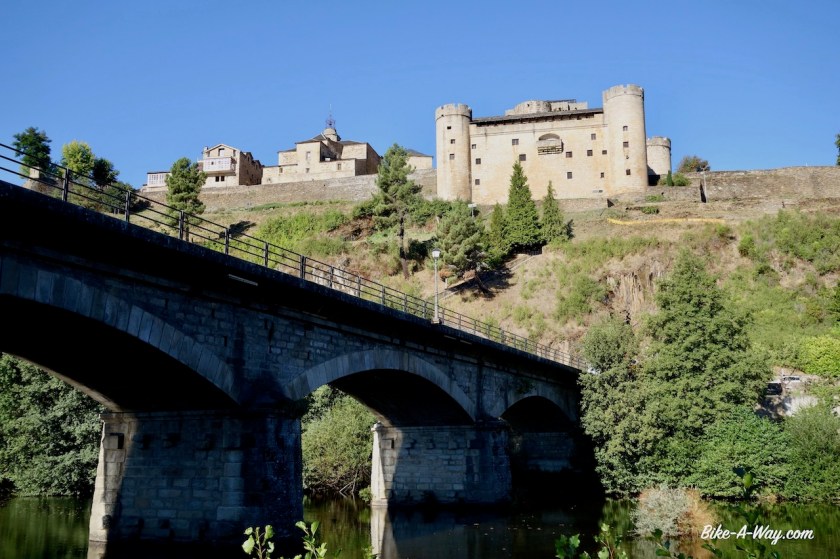
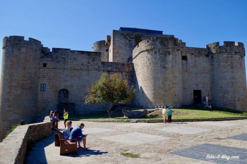
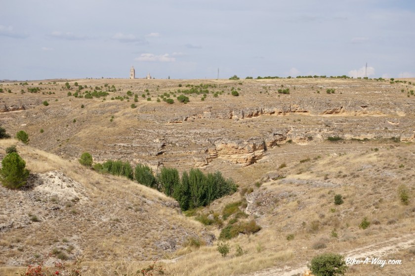
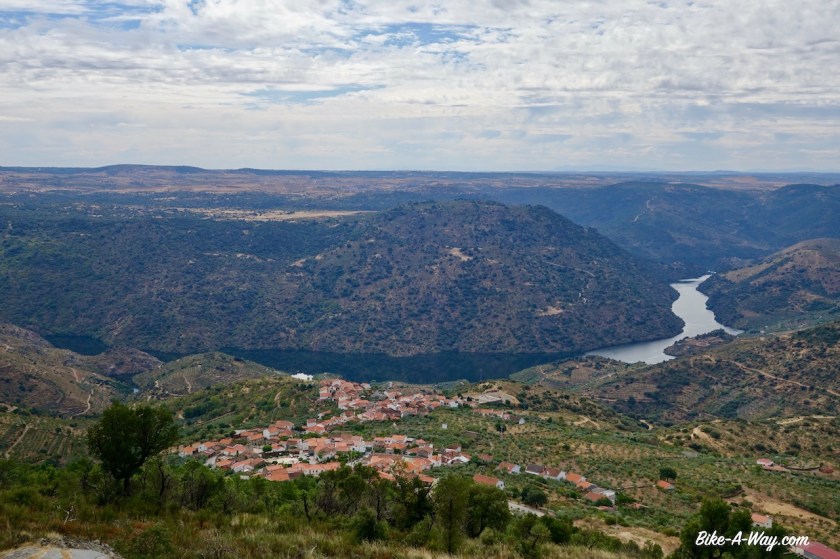
Heaven.  

DSC02693

DSC02697

DSC02699

DSC02702

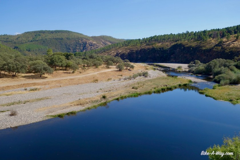
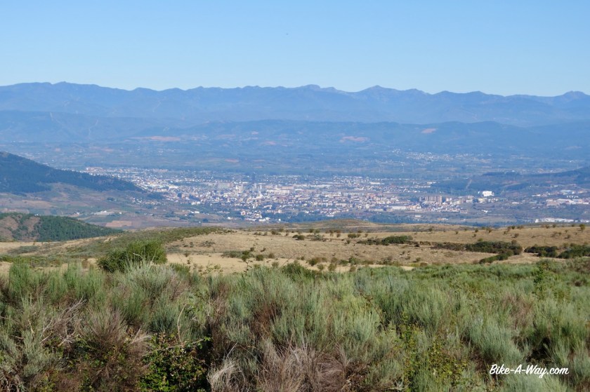
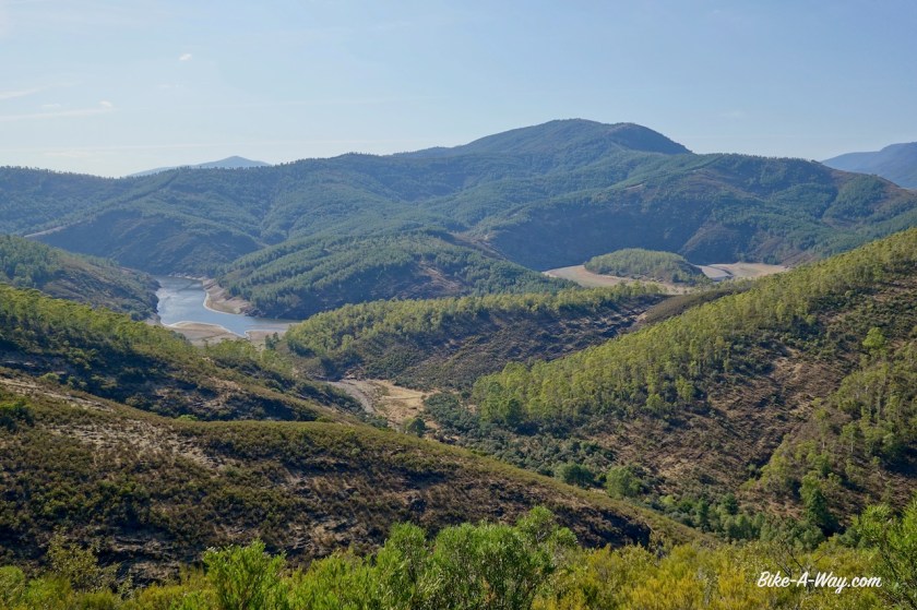
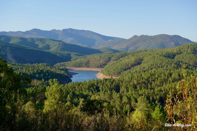
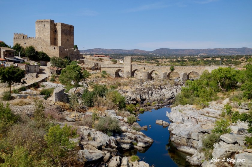
Down below, I can see the wide body of water, the Rio Alagon.  Also the Rio Hurdano joins and eventually, as always when there’s some water here, they’ve built a dam and created the large Embalse de Gabriel Y Galan.  It’s a fantastic off-road ride through the forest.  I take a right turn on the dead end road towards Granadilla, which is supposed to be an interesting place down at the lake.  From far away I can see the fortress already.  I arrive at 2.15 pm. The whole village is closed with the big iron gate from the middle ages.  Entry to town is only in the morning and late afternoon / early evening.  Basically the times shops are open in other places.  Nothing to do but to ride back where I came from.  It is paved roads from now towards Abadia, then Aldeanueva Del Camino, a place I passed through in 2017 as well when cycling the Via de la Plata.

DSC02705

DSC02710

DSC02715

DSC02727
The closed city gate in Granadilla
DSC02734
Approaching the Sierra de Bejar.

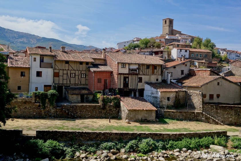
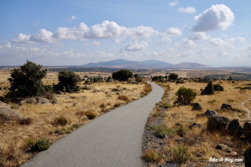
What’s changed now is there is a via verde from here, going to Hervas, a historical town further up the hill and all the way to Bejar, the town at the pass.  In 2017 I still had to go through the busy valley.  A good improvement !

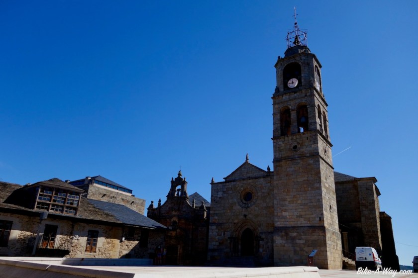
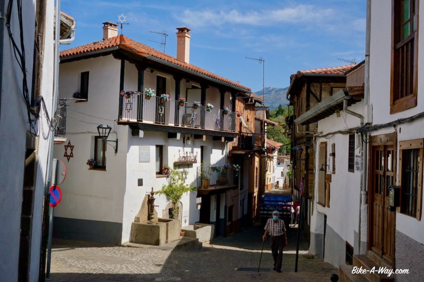
Hervas is a nice place.  A real town this time, not like the tourist Disneyland of La Alberca.  I was hoping to pick-up a package send from home 10 days ago with a new solar panel, a new rear tyre and my old gps, as the current one is failing, but the package is still in Brussels.   It seems that in this period of time, the Belgian Post can bring a package only from the north of the country to the centre of the country, a whopping distance of about 60 km in 10 days.  I walk faster.

DSC02736
Very smooth riding and climbing on the via verde towards Hervas.

Well, we’ll see.  Maybe they get it on a plane one day and hopefully it arrives when I return here at the end of my Castilla y Leon loop.

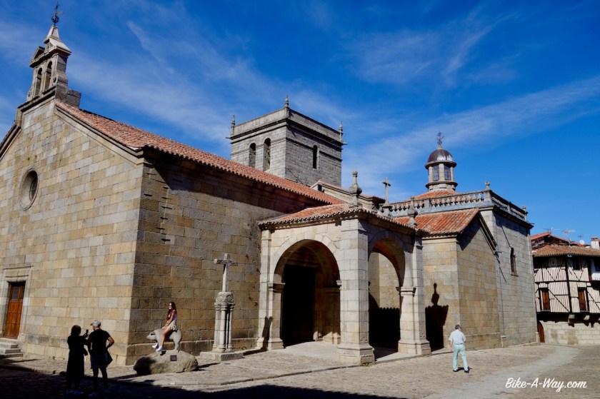
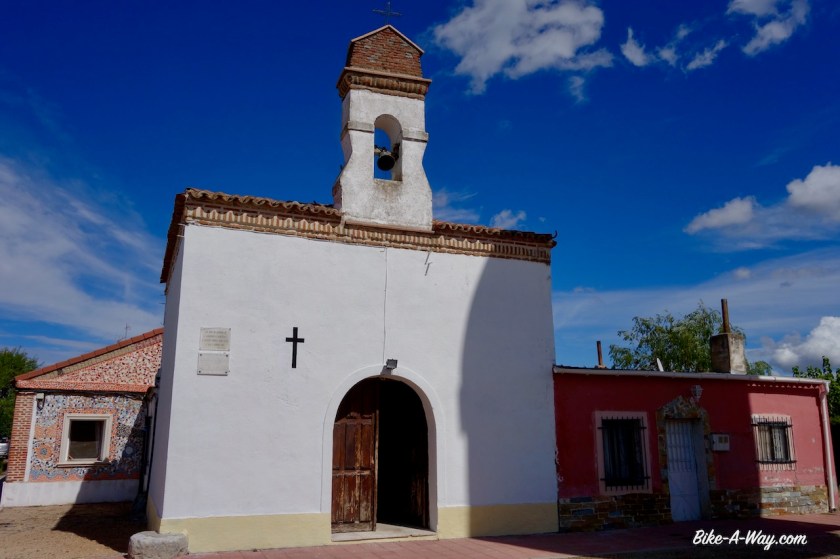
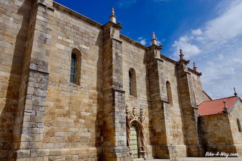
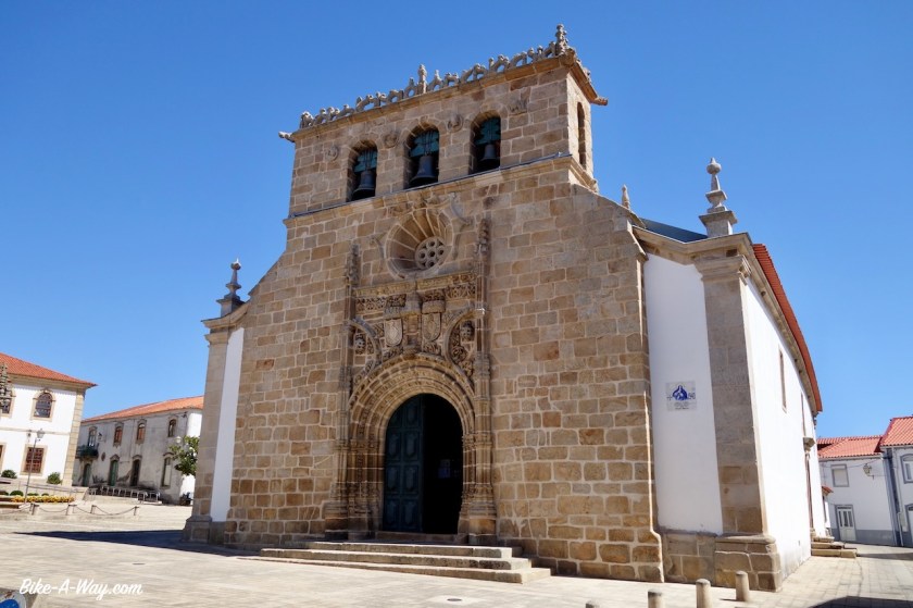
I visit the town church (from the outside, because it is closed) and the old Jewish quarter.

DSC02750
Jewish quarter in Hervas
DSC02752
Hervas

DSC02753

DSC02755

DSC02756

DSC02760

DSC02764
Growing out of a little seashell.

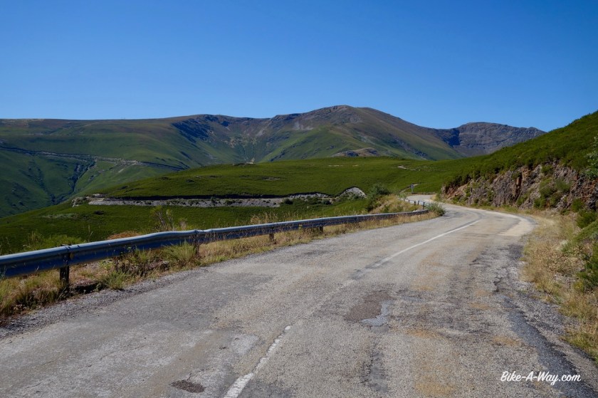
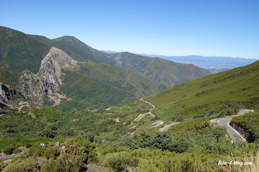
All the time since leaving the closed town of Granadilla, I was riding east and looking to a wall of mountains, the Sierra de Bejar.  When I passed here in April 2017, I was riding south to north alongside them, and the tops were still covered in snow..  Not so now of course.  But this time, I had to get over the range. 

It’s a very easy climb.  The hardest thing were the persistent hundreds of little flies going around my head all the time, trying to enter my mouth, ears, eyes,…. I haven’t mentioned it yet, I think, but it is terrible this year.  I’ve never had that amount of flies and mosquitos in Spain as this year.  Climate change ?

Anyway, there are many, many, many more of this irritating bugs than normally and they make my life out in nature hard.  Riding the bike they swarm around you when you’re climbing, slow and sweating.  At night, they eat you at your camp site.

DSC02770

Once over the top (unnamed pass, 1.313 m), I am back in Castilla y Leon.  On my left hand is yet another Embalse (Embalse de Navamuno).

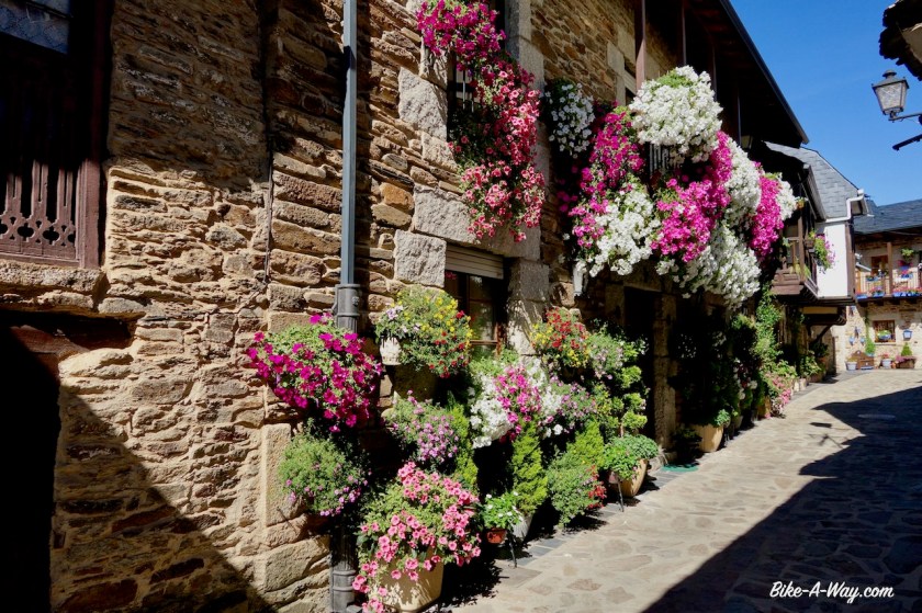
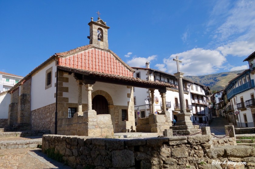
Candelario, the first town is really beautiful again and worth a visit.

DSC02781
Ermita del Humilladero in Candelario (16th century).

DSC02819

DSC02825
The fortress in Puente Del Congosto at the Rio Tormes (Salamanca is further downstream at this river, where it’s much wider already).

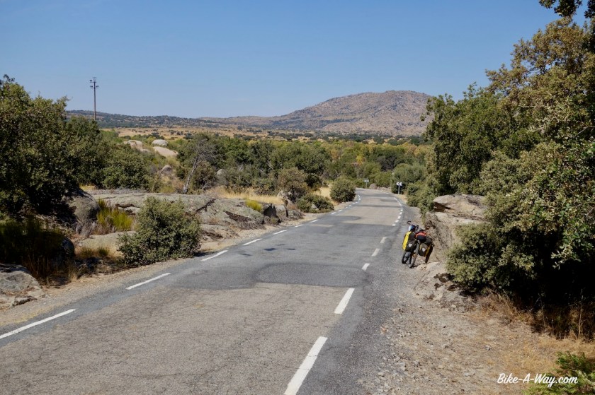
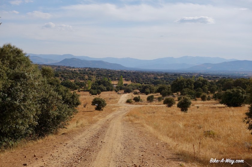
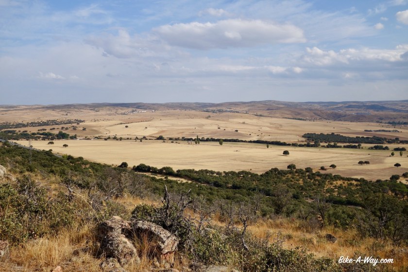
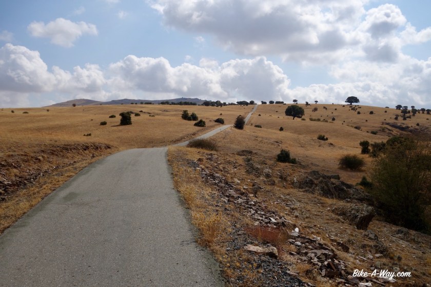
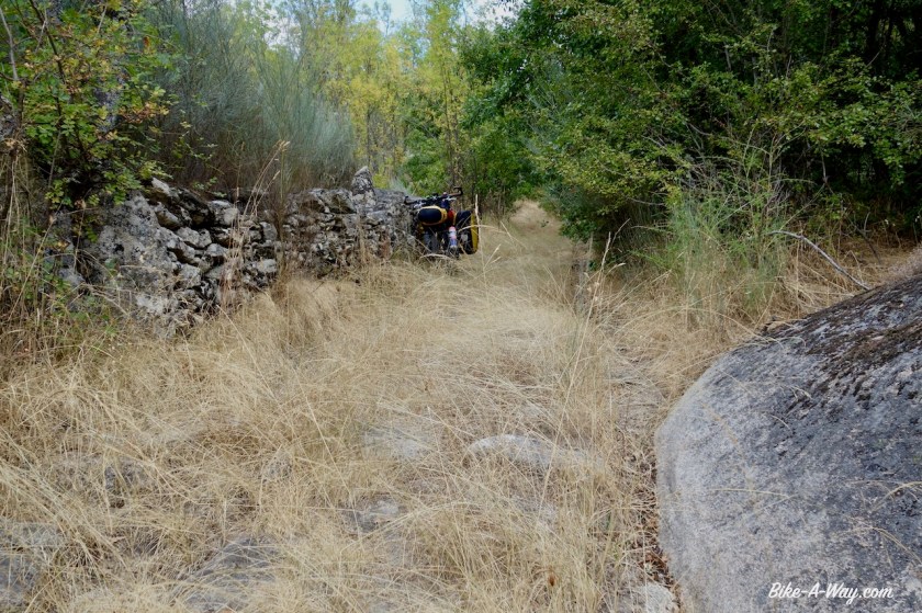
In Puente Del Congosto I went back on dirt, following the ‘Cañada Real Soriana’.  Fantastic riding again.  The mountains of the Sierra de Gredos to my right, the high plains to my left.  Some stretches are pretty desolate, but that’s what I like.

DSC02834
Fantastic dirt road riding on the Cañada Real Soriana.

DSC02835

DSC02840

DSC02845

DSC02847
Camping spots along the track are plentiful.
DSC02848
More or less every church tower in Spain has a stork nest. This tower had five (!) nests.

DSC02850

DSC02863
Enjoying some clean, fresh water after a long, dry stretch.
DSC02864
And I was not the only one appreciating the spring.

DSC02867

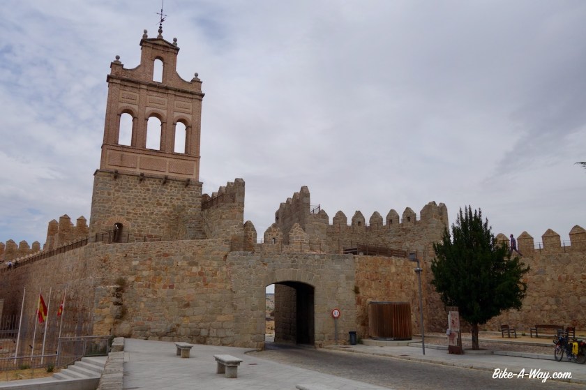
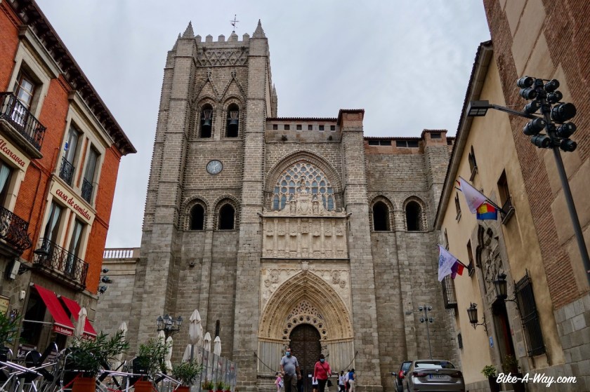
I toured around Avila a bit.  The cathedral was closed right in front of my nose for siesta.  No problem.  Enough buildings to look at from the outside.  Avila is most famous for its old city walls.  Apparently you can walk them, but I never found a place where I could mount them.  Avila is the birth place of the cyclist Julio Jimenez who won three times polka dot jersey in the Tour the France and was also three times King of the Mountains in the Vuelta.

DSC02877
Los Cuatro Postes, just outside Avila’s city walls.
DSC02881
Avila with the famous city walls clearly visible.
DSC02884
One of the town entrances.
DSC02887
Avila cathedral.

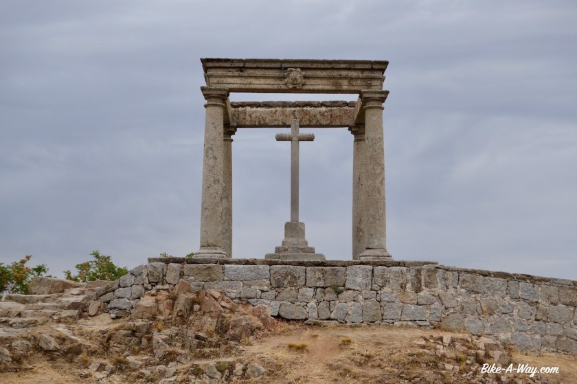
East from Avila there’s a bike path of about 14 km.  First night camping along it, a terrible thunderstorm passed by.  Thousands and thousands of lightnings right above the tent.  Of course, I am at the highest point 20 or 30 kilometer around.  Also a lot of rain came down, but that’s good because the region is really dry and fires are still a concern when camping.

The bike path stops at the village of Urraca-Miguel and I have to take the paved road Av-500 further east.  As the road is blocked for road works, and the busy N-110 is not an option, I pushed the bike up a steep path, 14 upto 16% inclination.  It had a dead-end at the top.  By the time I was down again, it was siesta time and I saw the road workers leaving.  Time to hit right through the road works.  

DSC02892
Fantastic country just outside Avila
DSC02897
Paved bike path that goes for 14 km outside Avila.

DSC02898

DSC02901
Still on the bike path, just before its end at Urraca-Miguel.
DSC02903
The steep hill on which I pushed the bike, fruitless
DSC02910
Descending, step by step.

Arriving in the town of El Espinar, all shops are closed.  It’s fiesta. Some obscure saint.  Nobody knew exactly why.

Up to Segovia.  Against the wind ever since entering Spain.  Luckily I have the Sierra de Guadarrama on my right to admire.  After Segovia, I make an 180 degrees  turn and ride back west.  I bet the wind, after blowing all these days will do exactly the same.

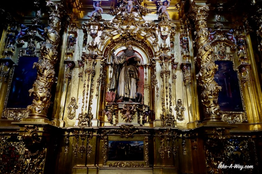
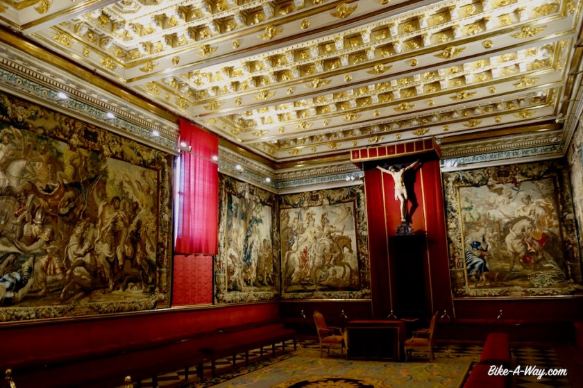
But first a visit to the city.  The two main highlights are the enormous Roman Aqueduct and the cathedral.  The entrance fee to the cathedral was 3 euro, I think, but it is worth it.  In the basement is a museum with paintings in the style of the old Flemish masters like Rubens and Van Eyck, a sign says.

While the paintings were reproductions by Spanish painters, another museum with carpets showed carpets all from Brussels.  Probably taken when the Spanish ruled in our region.

Segovia is also the birth place of cyclist Pedro Delgado.

DSC02928
The world famous aqueduct in Segovia.

DSC02932

DSC02948
The Gothic cathedral of Segovia.

DSC02951

DSC02972
Courtyard in the cathedral

DSC02983

DSC02980
The 500 year old Belgian carpets hanging in the museum of the Segovia cathedral.

DSC02985

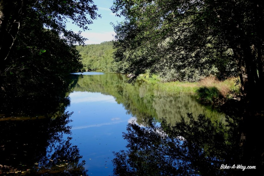
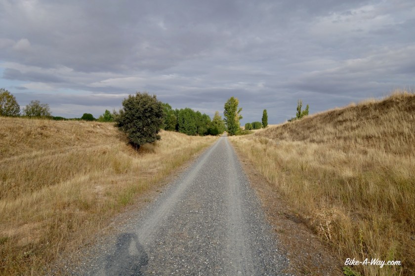
Segovia was the place where I turned west again, but more important, it is the place where some easier part follows.  I have the Via Verde Del Eresma ahead of me.  73 km of almost flat gravel riding.  I loved the stretch, cycling along the Eresma river, through the pine forests, all traffic free, enjoying the scenery while listening to some podcasts.  And I was completely wrong about that wind.  It just kept blowing from the east and made my life very easy for once 🙂

DSC03001
There are two tunels along the via verde. This is the first one, just outside SegoviaL
DSC03006
Typical Castilla y Leon landscape. You can see the tower of the cathedral of Segovia.
DSC03010
Ermita de la Aparecida which you’ll pass riding the Via Verde Del Eresma.

DSC03014

DSC03016

DSC03029

DSC03030
A bit outside Segovia, the via verde passes the jail of the town. I think it’s a really good idea to built the jail there. The criminals can look out their small window, between the bars and get confronted every time with the ultimate symbol of freedom, a cyclist, standing on his pedals, freewheeling over the via verde.  If they ever get free, hopefully they think twice before they do stupid things again and lose their freedom again 🙂 

DSC03036

DSC03041

DSC03052

Olmedo is the terminus of the via verde.  I follow a few kilometer of bitumen before going on sandy roads again, over yet another camino to Santiago, this time the one from Madrid, the Ruta Jacobea Madrilena.  Valladolid is the capital of the autonomous region Castila y Leon.  Quite a big town with over 300.000 people.  Before entering the town, I again cross the Douro River, which I crossed a few weeks ago further downstream in Portugal already.  The Douro river is Spains third longest river (895 km).
I didn’t ride into the centre of town, as I was chased by rain and thunderstoms.  The city lies at the Pisuerga River. I also crossed this river a few weeks ago when cycling in the Cordillera Cantabrica, in the town of Cervera de Pisuergo.  

DSC03056
Church of Santa Maria del Castillo in Olmedo.
DSC03068
Ermita de Sieteiglesias near Valdestillas. Another beuatiful, but hermetically sealed religious building.  Look at the clear sky after the rain.
DSC03079
Ermita Cristo del Amparo. The door was open, so I thought lets have a look, but when I wanted to enter I heard an old man mutter prayers without ending, so I left.

Here in Valladolid I will start my flat ride along the Castilla Canal, but that’s for the next post.

Portugal: Trás-os-Montes and Beira Alta

Route: Rio de Onor – Vimioso – Palaçoulo – Sendim -Freixo de Espada à Cinta – Vila Nova de Foz Coa – Almeida
Route NE Portugal
My route through northeast Portugal.

After a small climb out of the valley of the Rio de Onor, I soon was on dirt tracks again.  Excellent tracks, nobody else around and with endles views to the mountains around me.  This region in north-east Portugal is called Tras-os-Montes, meaning ‘beyond the mountains’ and is the most isolated Portugese region.  Once I crossed the provincial road En-308, the  dirt track soon became rougher and there was a steep descent towards the Rio Maçãs, (or Rio Manzanas, depending whether you’re Portugese or Spanish).  This tiny stream forms the border between the two countries.  I actually cross the stream to pitch my tent, so technically speaking, I sleep in Spain again.  More rough and often steep tracks close to the border bring me eventually to Quintanilha.

DSC02307

DSC02315
Picture taken from Portugese territory. The stream is the border. The tent is pitched in Spain.
DSC02321
Also in Portugal, the significance of yet another pilgrims route is never far away.

I didn’t find a shop in Pinelo and in the next town, Vimioso, everything was closed.  This would become a constant during my time in Portugal, difficulties to resupply.  

I rode into the Parque Natural Do Douro International.  As so often, they call a region a ‘nature park’ but besides the explicit prohibition to camp, I don’t see any significant difference to other regions which are not in the nature park.

DSC02327

DSC02338
Sometimes the track was really old and overgrown, but there were no alternatives.
DSC02340
I discovered this very old bridge.

DSC02344

DSC02357
Igreja Matriz de Sendrim

I’m riding in the ‘Serra do Mogadouro’ range.  No huge mountains, but constant steep climbs and descents.  After a few days, they killed my legs.  This is a really hard region to cycle.  

DSC02359

DSC02360
The church in Ventoselo.
DSC02363
I rode a mixture of paved roads and this kind of dirt tracks, the GR 36.
DSC02367
First viewpoint to the Douro River
DSC02371
Riding into Freixo de Espada à Cinta over the GR 36

Outside the town of Freixo de Espada à Cinta there is viewpoint with brilliant views to the deep canyon of the Douro River, which forms the border between Spain and Portugal here.  The whole region is also littered with electricity lines from the many dams in the river.

DSC02372
Statue of the explorer Jorge Álvares in Freixo de Espada à Cinta. He is considered to be he first European to have reached China by sea. For this reason, there’s also a statue of him in Macau.
DSC02374
Church in Freixo de Espada à Cinta
DSC02379
You can climb the tower of the castle. View towards the church and part of the town.
DSC02381
The graveyard as seen from the castle tower.

DSC02384

DSC02394
Canyon of the Douro River, seen from the Miradouro Do Penedo Durão. The opposite site is Castilla y Leon region, Spain. Going straight east for 100 km, you’ll end up in Salamanca.

DSC02395

After this viewpoint, I turned west, a bit further inland Portugal towards Ligares.  A German retiree I met told me this is the hottest region of Portugal.  Hot and dry, I must say.  The three main crops I see along the road are olive trees, almond trees and grapes for the famous Port Wine.

DSC02406

DSC02414
Sometimes, the GR 36 became a bit rough. Here, the track goes steep down towards the Ribeira Do Mosteiro river. This is hike-a-bike country. No way you’re gonna ride a loaded bike here.
DSC02416
I left the bike at the ridge and hiked down to check for camping opportunities, which were better higher up.
DSC02418
No traffic noise, no barking dogs, no humans. Total peace and quiet.

DSC02427

DSC02451
Here you can see the GR 36 working it’s way down to the little bridge.
DSC02455
Almond trees. The almonds were ready to eat.

DSC02457In the little town Urros there was no shop to be found and no water fountain so I asked an old lady to refill my water bottles.  I got a bag of figs on top of it.

By the time I was in  Vila Nova de Foz Coa, my legs were so utterly tired from all the recent climbing that I, with regret, gave up on the idea of riding the off-road route through the valley of the Coa River.  It was just going to be too hard at this moment to enjoy it.  

DSC02464

DSC02472

DSC02476
Cycling along the Douro River with its many vineyards.

DSC02482

DSC02486
The church in Vila Nova de Foz Coa.

DSC02488

DSC02487
Vila Nova de Foz Coa

Well, I still rode part of the route to Castelo Melhor, but after that sticked to the national route nbr 332.  Not a lot of traffic at all, but just as I noticed several years ago, the attitude of the Portugese drivers compared to the Spanish is astonishing.  I can’t stop mentioning how good the Spaniards are behaving in traffic and how much space they give cyclists and how patient they can wait behind you if they are not sure whether they can pass you in a safe way.

Nothing of that is found in the Portugese driver.

DSC02492
A very steep downhill (-18%) towards the Coa River.
DSC02496
Rio Douro.
DSC02499
Vineyards, olive trees and almond trees.

DSC02502

DSC02503
Suddenly I saw this kilometer sign; km 222 along the N 222 seems to be a special one, looking at all the stickers….
DSC02505
…. the explanation followed a few kilometer later. There’s a motor club here, and apparently this stretch road is claimed as one of the nicest stretches of road in the world. It’s nice allright, but… don’t overrate it pls.

DSC02504
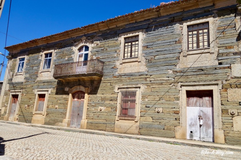
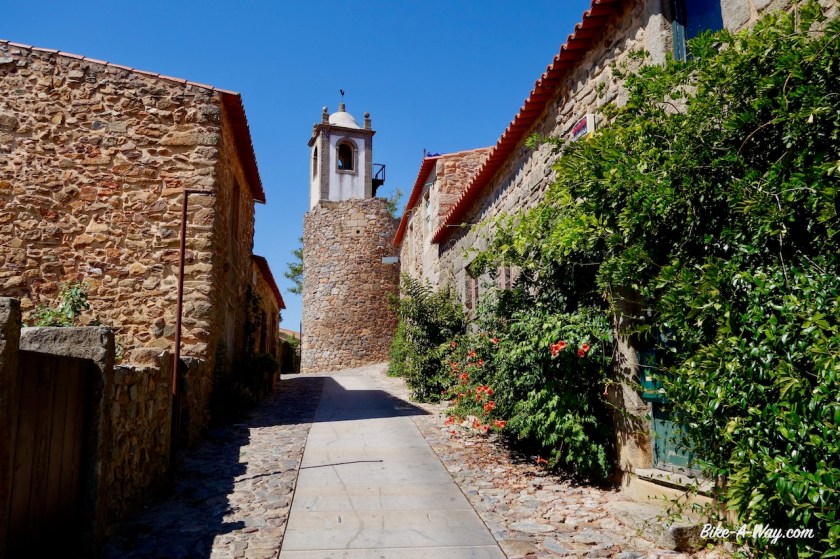
In Castelo Rodrigo, I ask the lady of the tourist info after which Rodrigo the place is named, and whether it is the same Rodrigo as in Ciudad Rodrigo, the bigger town a bit further in Spain.

She didn’t have a clue.  Tourist info employees prefer you to ask for a city map and walk out, I guess.  Good thing was, Castelo Rodrigo had the first decent supermarket since entering the country, a French Intermarché.

DSC02509
Castelo Rodrigo, renowned as one of the most beautiful historical towns in Portugal

DSC02520

DSC02514

DSC02518

DSC02515
You often see this statue with the arrows. No idea what it is all about. Let me know, if you know.

The cycling now was easy on a plateau, 600 – 700 m asl.

I visited the historical town Almeida with its star-shaped fortress of the 17th century, built to protect the country against Spanish invasions.

DSC02523
Entrance of fortress of Almeida.

DSC02524

DSC02530
Houses in Almeida.
DSC02534
Nice old Triumph Spitfire. Also the bell tower of Almeida is in the picture.

Near the village Vale Da Mula, I left Portugal and went back into Spain.  More about that soon in a next post.

Spain: Montes de León & Sierra de la Cabrera

Route: Ponferrada – Truchas – Puabla de Sanabria – Rio de Onor
Route Montes Leon
Route over the Montes de León & Sierra de la Cabrera.

From El Rasadero, the last village before Ponferrade, and a bit higher up, you have a good view point to the city. I’ve been here a couple of times before, it is a nice town.  The world championship cycling was held here in 2014 and as everybody remembers, Michal Kwiatkowski became champion here.

In Spain nowadays, all churches are closed. And if they are not, you have to pay an entrance fee. That’s a big difference with the Bhuddist temples in Southeast Asia which I can always visit.

Ponferrada Basilca is the first church since I entered Spain, about a thousand kilometer ago that’s open and free to enter. I wonder the reason for closing the churches.

Stealing ?

Vandalism ?

Something else ?

DSC02153
Ponferrada
DSC02157
Basílica Nuestra Señora de la Encina
DSC02156
Inside the basilica.
DSC02162
Castillo de los Templarios (Castle of the Templars)

The Decathlon in Ponferrada is the worst stocked Decathlon shop I’ve ever seen. They had almost nothing. Also not a new solar panel (I’ve lost mine outside La Pola).

Ponferrada is also on the major camino de Santiago route (the Camino Frances) but this time, I only saw two ‘pilgrims’ hiking into town. What difference to other years. 2020 is probably the best year to do your Santiago trip if you ever wished to do it.

Well, I’m not heading west to Santiago de Compostella. I’m going south, up and over the Montes de Leon. Since many years I had seen this one road going through the mountains and always wanted to take it once.

But mon dieu, what a steep climb it is.

From Villar de los Barrios, the road goes almost continuously steep up between 10 and 13% until you are well beyond San Cristobal de Valdueza, one of the most perfect villages I have ever seen. All buildings are in a perfect state.

DSC02165
Ermito del Santo Cristo at the entrance of Villar de los Barrios, the headquarters of the brotherhood of the Vera Cruz, one of the oldest in Spain, constituted before 1522. This building was rebuilt in 1627.
DSC02172
Excellent camping spot on my (steeeeep) way out of Ponferrada.
DSC02177
Views from my campsite back to Ponferrada and towards the mountains i’m coming from..
DSC02173
Nice sunset.

Up, up, up it goes. Less steep towards the first pass, Alto del Morredero (1.750 m).

A bit further, I pass Alto de los Portillinas (officially 1.905 m, but I had a bit less on the gps). From here you ride a while along the ridge on an almost flat road towards a final push at 1.955 meter, an unnamed highest point on the climb. This climb surely belongs in the row of Mont Ventoux or Tourmalet, that’s how long and hard it is.

DSC02182

DSC02189

DSC02201

DSC02205

DSC02213

DSC02214

DSC02215

DSC02219

DSC02230
At the top of the Montes de Leon, looking towards the next range I have to tackle, the Sierra de la Cabrera.

The downhill is less steep, around 8%

Just before the village of Truchas, I find a nice spot between the trees and next to the Eria River to pitch the tent. I could take the main road from here via Castrocontrigo and drive around the Sierra de la Cabrera but my map shows one small road over this range that reaches a high point at the Alto del Penon (1.840 m asl). Seems much more exciting than that main road.

DSC02232
Old church with old lady.

DSC02236

Well, exciting it was. And hard ! I really suffered. Then I made a mistake to ride too long and couldn’t find a real good camping spot anymore before Puebla de Sanabria. I was hoping to find something on the off-road stretch between El Puente de Sanabria and Puebla de Sanabria, but nothing there.

DSC02244
Climbing up the Sierra de la Cabrera.
DSC02246
Some parts suffered from a fire.
DSC02262
On the downhill from the Sierra de la Cabrera.
DSC02270
Rio Tera before Puebla de Sanabria.

Puebla de Sanabria….here my route crosses with my route of 2017, when I rode from the south towards Santiago the Compostella. It is a very touristic village.

DSC02274
Puebla de Sanabria

DSC02282

DSC02283

DSC02286

DSC02288

DSC02287

DSC02290

DSC02293

DSC02295
House of the Abbot.
DSC02299
Lots of work, watering the plants every day 🙂

If you thought that after the Montes the Leon and after the Sierra de la Cabrera, all was clear to reach the Portugese border, you’re wrong. The Sierra de la Culebra still awaits me. Luckily, it’s just rolling hills, compared to the ranges I have behind me. Apparently it’s the best place in Europe to see wolves in the wild. I didn’t see any….

I crossed the border to Portugal in the small village of Rio de Onor.