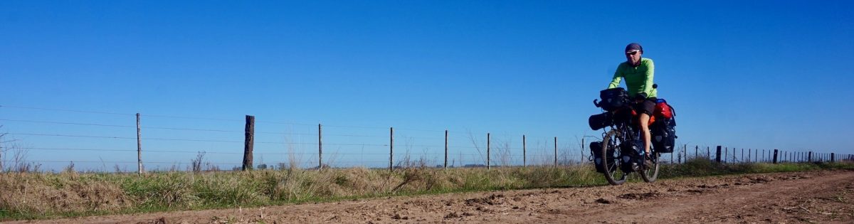
Route: Strahan – Queenstown – Derwent Bridge – Ouse – Hobart
Day 12 & 13: 19 & 20 Febr. 2019
5 km before Macquarie Heads
Weather: Cloudy, sun, rain showers
Two rest days. My chosen spot is remarkably quiet. Only one 4WD each day passes. Maybe a ranger doing his tour ? I can’t be seen anyway. The days aren’t actually that bad with regular periods of sun. Although that’s only here, right at the coast. A bit further, in the hills, it will be much wetter.
Day 14: 21 Febr. 2019
From 5 km before Macquarie Heads to 12 km before Queenstown
51,86 km (Total so far: 416,95 km) – Altitude climbed: 864 m
Weather: Cloudy, rain showers, light tail wind
The weather wasn’t too inviting to go out and I had food and water enough to stay another day but despite the excellent Therm-A-Rest NeoAir mattress, my favorite piece of equipment, I started to feel my back from being horizontal so long.
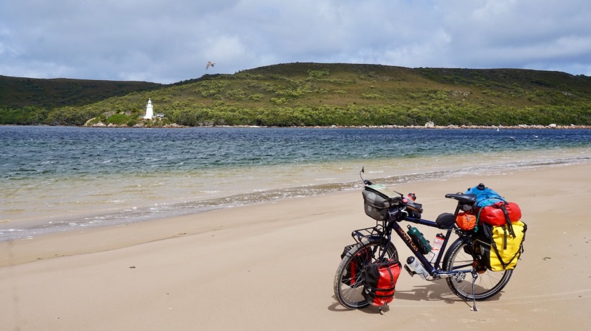
First down to the Macquarie Heads. The peninsula ends at a beach where there’s a very narrow channel of water between the Southern Ocean and the inlet. Few people with their 4WD on the beach.
Why ?
Why you have to drive with your 4WD on the beach ?
Can’t they walk these last few meters ?
Can’t they forbid this ?
So many things are forbidden in this country.
But they won’t do that, because the majority likes to ride their 4WD on the beach and that’s democracy.
Back in Strahan I go find that bakery they told me about back in Zeehan. He still has a few pieces of ok bread. Much better anyway than the cardboard bread you find in the supermarket.
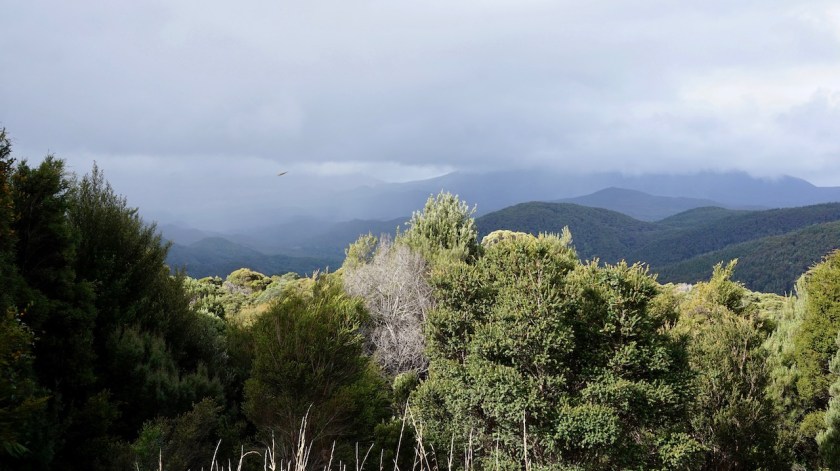
The road towards Queenstown climbs back into the hills, but never really steep, and is quieter as expected. I think I’m riding ride behind the heaviest rain showers because the road is constantly very wet, but I keep it dry.
At the highest point there’s a look-out for the tourists. All I see is dark grey clouds and rain everywhere around me.
Starting to look for a place for the tent, I find that it really must have been raining a lot here the last days. It’s all mud and on the patches of moss I find, I sink five centimeter into the water.
Eventually I find a stony place under the electricity lines.
And, as so often, when I start pitching the tent, a serious rain shower starts.
Never can keep it fully dry for a day in western Tasmania 😉
Day 15: 22 Febr. 2019
From 12 km before Queenstown to +/- 4 km after Victoria Pass
54,01 km (Total so far: 470,96 km ) – Altitude climbed: 906 m
Weather: Cloudy, rain, sunshine, moderate tail wind
There is a Thai restaurant in Queenstown !
That’s the most important news of the day.
For the rest, Queenstown is a sad place. You see the ugly mining operations from far away. Most houses in town are of the corrugated iron variety. No, it’s nothing like the ‘posh’ Queenstown in New-Zealand.


After shopping and lunch I start the long ride east. I say long because I’m dreading this part of my route. It’s again the highway A10 and I fear it will be too busy to be enjoyable. There are no alternatives.
During the steep climb out of Queenstown, traffic is indeed a bit too dense to be enjoyable, but less than expected. At the first little pass I park the bike and walk the boardwalk path along the Horsetail Waterfall. It’s an easy twenty minute return.
Nonetheless I see only one couple going to the end as well. Most give up half way and return to the safety of their vehicles.
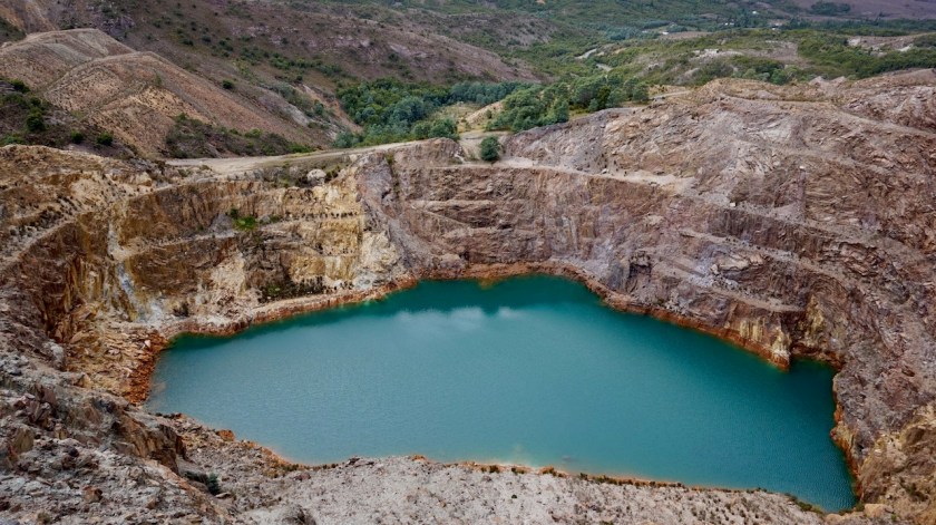
At the other side of the road is another highlight, only 900 meters away and a little climb, the ‘Iron Blow’ look-out with an impressive view in the pit and the surrounding destroyed landscapes.

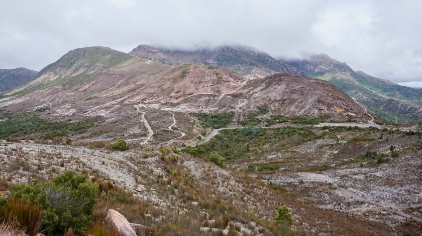
Here in Queenstown, they mine for copper, back in Zeehan it was silver, in Corinna gold and in Waratah it was zinc. A lot of different minerals in such a small area.
Bad for the environment, but good for (someone’s) economy.
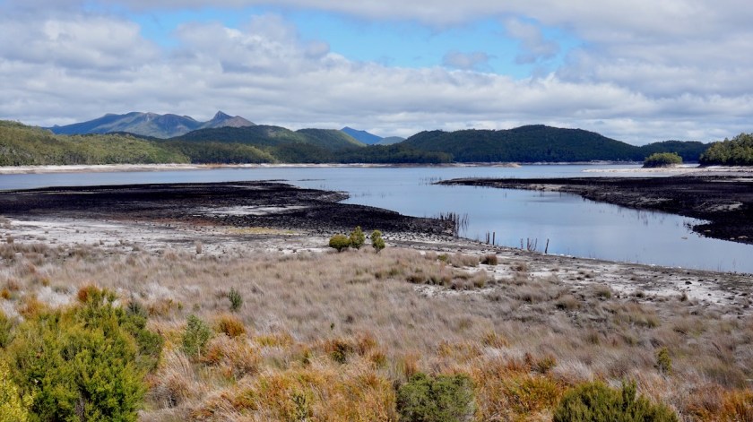
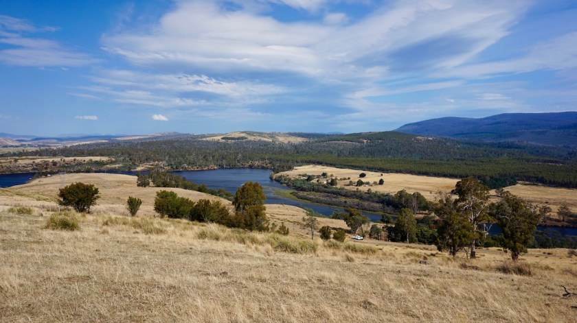
After all these diversions, I loose all the altitude again on the downhill towards Burbury Lake.
The road is quieter and becomes even pleasant to ride.
Climbing away from the lake, I ride through an area that must have burned down a couple of years ago.
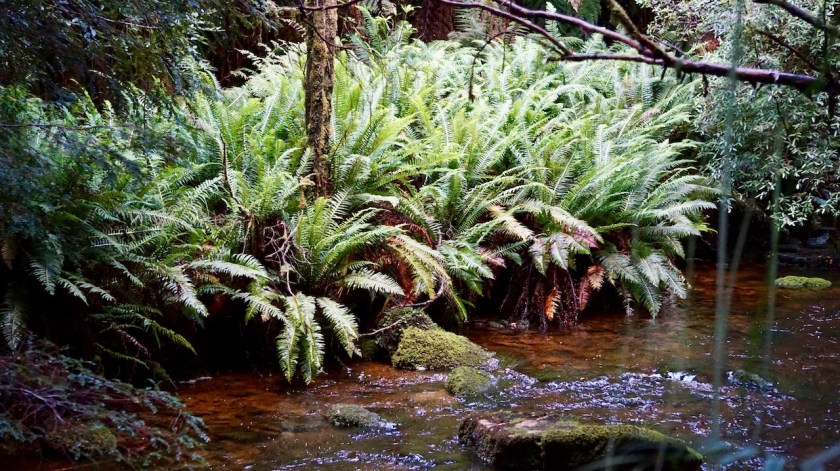
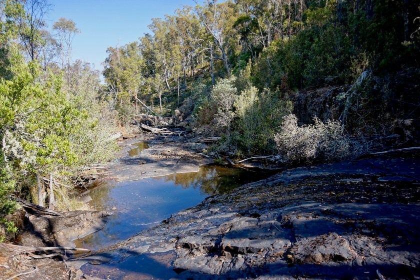
Nelson Falls is the real highlight of the day.
I forgot to go and have a look to the Montezuma Falls when I was in Zeehan (too busy staying ahead of the rain). But this Nelson Fall really makes up for it.


The road climbs steady but not too steep. After almost two weeks on the island, I pass today only the second motorbike rider who says hi to me. In Europe and America, almost all motorbike riders greet cyclists.
A little bit after this guy, his wife follows on another bike. She is just being overtaken by a small white car in a blind bend off the road. In my rearview mirror I see how the guy stops and make the car stop as well. I hear him shout to the driver.
He is 100 % right to do so and I wonder whether I should turn around and give him some moral support, but he seems man enough to handle it himself.
You would be surprised what kind of impatient idiots overtake you in a day.
It’s much better here as in South-America of course, but they aren’t super-good here either. I would say just a bit above Belgium.
I would give the drivers here 60%.
So far, Sweden and Spain (away from the costa’s) are the only two countries I cycled with a top rating for car drivers.
Just one step lower follow Norway, Denmark, Germany and Switzerland.
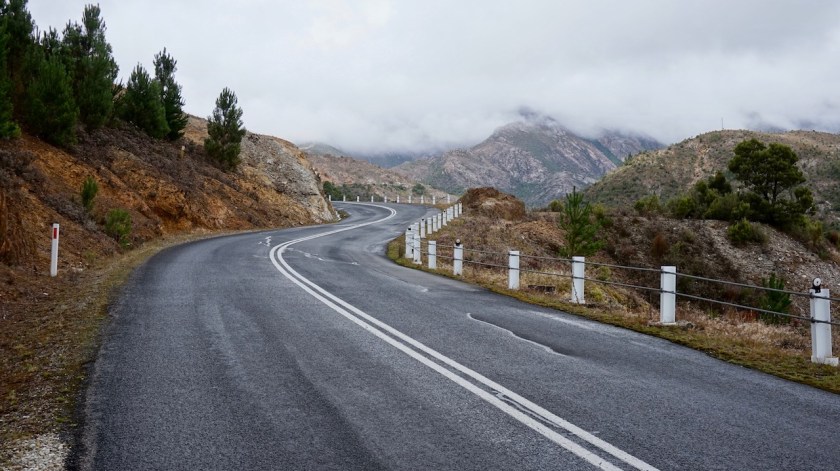
I climbed and climbed towards the highest point of the day, Victoria Pass.
I just finished taking the obligatory picture when I met the first other cyclist on the road here in Tasmania, Pavel from Poland (there was Olivier from Belgium, but I met him on the boat, not on the road). Pavel arrived after a journey of three days and four flights into Hobart and will cycle for three weeks on the island. He is going the other way around, so I might meet him again.
This morning, I packed a soaking wet tent but finally after it was promised, and delayed, for days on end, the sun came out in the afternoon.
I stop in time so my tent can dry a bit, I make a pasta with fresh vegetables from Queenstown and yes… I had a brilliant day today.
Only those damn mosquito’s in the evening.
Day 16: 23 Febr. 2019
From +/- 4 km after Victoria Pass to passed Lake St. Claire
65,60 km (Total so far: 536,56 km) – Altitude climbed: 1000 m
Weather: Sunny, no wind
Everything is perception.
Yesterday I started cycling in a temperature of 13 degrees and it was cloudy, a drizzle, miserable.
Today too I started cycling in a temperature of 13 degrees but under a blue sky. What a difference and what a joy.
A passing motor biker even turned his head and gave me the thumbs up.

Someone had sprayed ‘Meat Head’ in white letters on the road and I wondered whether this referred to the English version of the Flemish movie ‘Rundskop’.
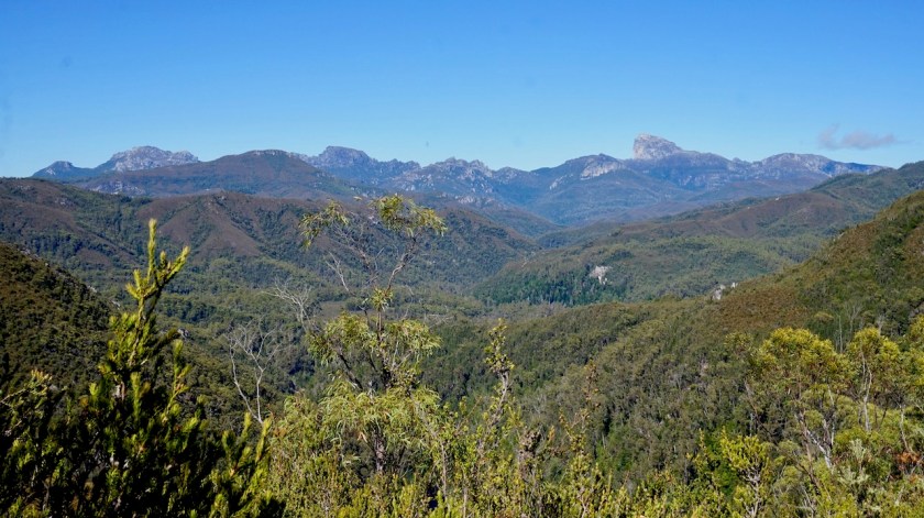
After an hour of cycling I reach Donaghys Hill where I stop to hike to the lookout. It’s good to stretch the legs a bit in the morning. From the lookout you have a good view to the peak of Frenchmans Cap, I think the highest peak in the Franklin-Gordon Wild Rivers National Park through which I’m riding now.

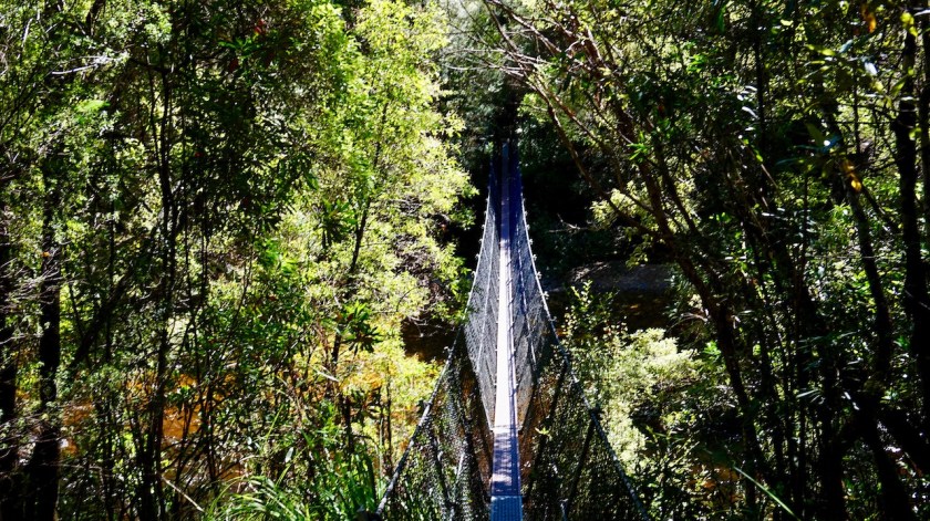
Another stop a bit further brings me to the narrow suspension bridge over the Franklin River where I have a chat with three guys who go out to climb Frenchmans Cap from different sides in the coming week.
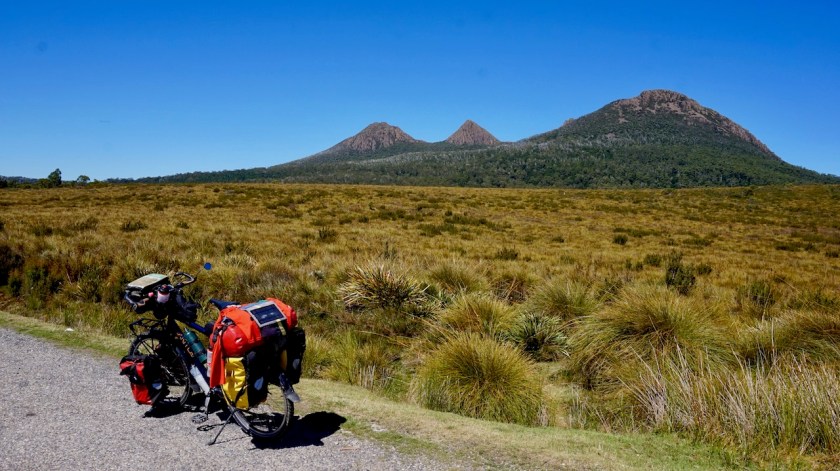
The road is climbing to a highest point of 839 meter. They call it ‘The Great Divide’ here as well. I’m now officially entering the drier eastern side of Tasmania. To my right is the King William Range with the impressive Mount Rufus.
The ride remains very pleasant and soon I’m in Derwent Bridge where’s the junction to Lake St. Clair, five kilometer further. It’s a nice lake. I walk around a bit but the sun is in no good position to make really good pictures. The campground is apparantely 30 dollar for a tent, which I find too much, so I head out again and find myself a place in the forest a few kilometer passed the lake.

When I start preparing diner, I see a leech, and another one, and another one.
I kill five and am now worried about both the mosquito’s attacking me and these leeches. I had one once in my foot in Thailand, years ago, and it’s no fun.
Day 17: 24 Feb. 2019
From passed Lake St. Clair to passed Victoria Falls
60,52 km (Total so far: 597,08 km) – Altitude climbed: 621 m
Weather: Sunny, light head wind
Searching on the internet this morning, I find the Florentine Valley Road is still closed due to the forest fires they had. This means my route south, which I planned to stay west of the A10, so via Wayatinah and Maydena is impossible.
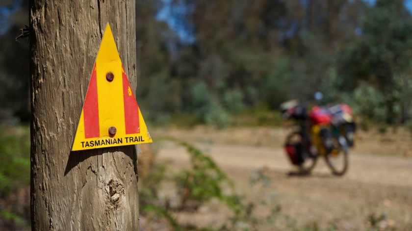
No problem, then we take the back-up plan, i.e. following the Tasmanian Trail.
I skip the junction with the ‘Fourteen Mile’ gravel road, which looked nice enough to cycle, and continued on the A10, which seems busier on a Sunday as yesterday.

A downhill to the Nive River, which created an 80 meter deep valley, then steep up to the junction with the Marlborough Road.
I don’t go to Bronte Park, where there’s supposed to be a store as it’s an 8 km return trip on that road which carries a lot of much traffic.
At Bronte Lake, I see a sign that tells me I’m almost exactly in the geographical centre of Tasmania.
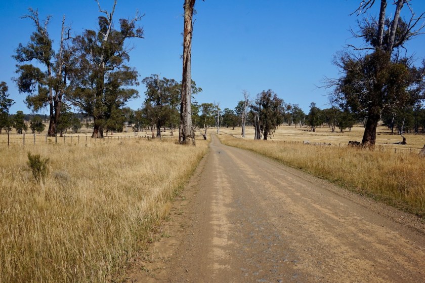
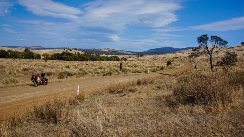
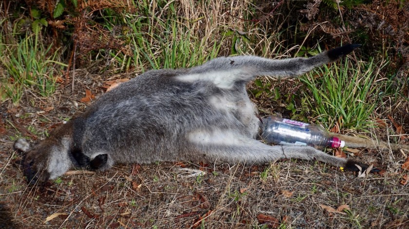
Now I can finally leave the paved Lyell Highway (A10) behind me and join the dirt roads of the Tasmanian Trail. Still lots of roadkill shows some still drive like madmen here.

The gravel road goes up but all goes smoothly. For the first time here in Australia, I’m on a road where I feel comfortable enough to take my music player out and listen to a few podcasts of ‘The Outdoor Station’. Soon I’m riding along Dee Lagoon. The country here reminds me a lot of Sweden and Finland. Only a different kind of trees.

I change the podcasts for some music.
The shuffle function decides The Tide is High from Blondie is the first song I hear in Australia. It’s nice to ride with music sometimes. All those years I’ve never changed the music on my player but there are thousands of songs, so I’m good till I die.
 That bothers me, while I’m riding here, that I don’t know when to use the word ‘dead’ or ‘death’.
I’m thinking about it but can’t figure it out. English is only my third language, so it won’t be perfect or sophisticated.
Anyway, the sun on my head, gravel roads, hearing the hits one after the other… Simple Minds with Belfast Child, Michael Jackson’s Leave Me Alone, Taco with Puttin’ on the Ritz, the Eurythmics with 1984 (song almost as good as the book), life is very good again.
I make a stop at the Victoria Falls.
Being away from the tourist highway, the path is completely overgrown, but I want to go and have a look anyway. It safes me a visit to Zimbabwe.


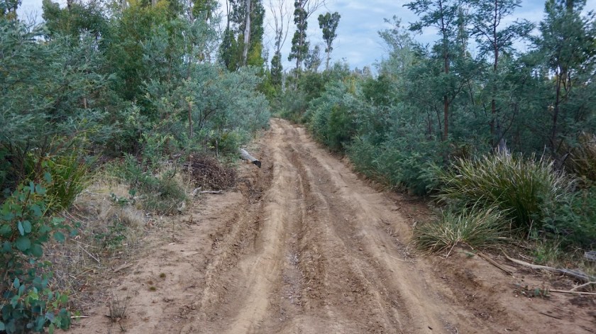
After the falls, I’m on a much lesser used gravel road, going through a forest.
At 4 o’clock, I see I’m about to leave the forest and go back into open grass land. It’s hot, the land is probably for cattle and fenced off so I stop early and enjoy the terrific view I have and the great weather.
No leeches, but plenty of horseflies out here.
Just because perfection isn’t necessary 🙂


Day 18: 25 Febr. 2019
From the forest passed Victoria Falls to
35,99 km (Total so far: 633,07 km) – Altitude climbed: 763 m
Weather: Sunny, moderate and hard head wind
Some bike maintenance before I left today. Cleaning the bike is the best way to spot any potential problems. I checked if all the screws of the pannier racks were still tight, cleaned the chain and chainrings and lubed the chain.
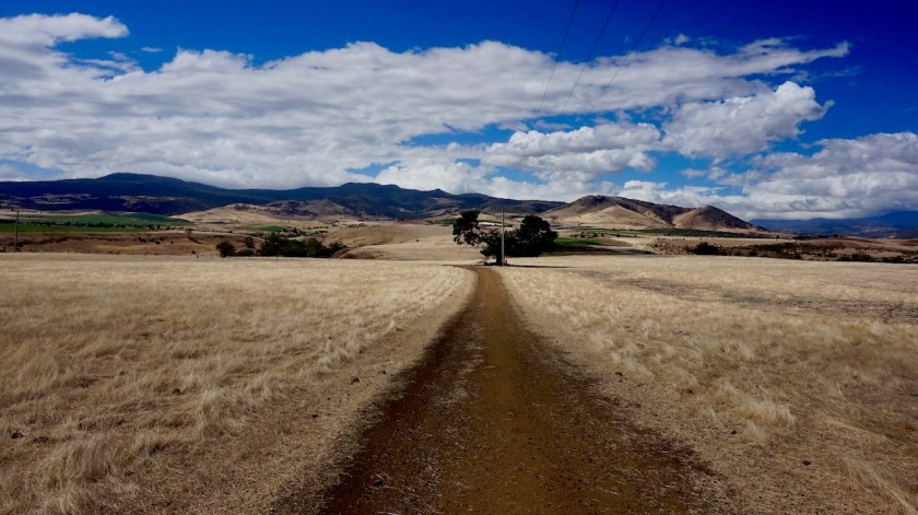
It was a very, very beautiful ride into Ouse. On a dirt road, rolling hills with beige, dry grass, cattle in the fields.
Terrific.
Riding in the opposite direction, it would be hard as there was a 13% downhill.


Did some shopping and laundry in Ouse. The temperatures went up to 35 °C in the shade so it all dried in an hour. As it was so hot, I took my time to relax at a picnic table under a roof in the small park. Got to chat way too long with a couple from New-Zealand, and later on with two ladies, one from New South Wales the other from America, so it was 3:30 pm by the time I was on my way again.
From Ouse to the Repulse Dam, the ride was again very beautiful. Some steep inclines, but never too bad.
After the dam, it got too hard.
Very steep climbs and the a connection between two existing dirt roads via a logging road. Steep down to the Broad River. No bridge there, so cross it through the water.
The uphill was less steep as the downhill (16 %), but nevertheless mostly unrideable with this bike set-up. This is real bikepacking country.

Short, hard, beautiful day.
But rethinking whether I should keep following the Tasmanian trail further south, as I know it will be more of the unrideable stuff with my heavy bike towards Judbury. It also remains unclear which tracks exactly are open and which are closed (from the recent forest fires) near Judbury.
Day 19: 26 Febr. 2019
From 15 km before Ellendale to Along A10 Highway
79,47 km (Total so far: 712,54 km) – Altitude climbed: 864 m
Weather: Sunny, medium head wind
A day with a bit of everything.
I left my quiet camp site in the middle of nowhere and soon was on the paved road towards Ellendale. The local post office is also a very basic general store (sweets, a coffee) and I had a nice chat with Charlie who operated it.


I skipped the off-road detour the Tasmanian Trail made here, because I heard it is pretty difficult stuff. So I continued through Westerway, the junction to Mount Field National Park. It’s Tasmania’s most popular national park, and I saw a lot of traffic going there, so I skipped it.
After Westerway I joined the Tasmania Trail again for some brilliant off-road sections. I passed a big field where the fire fighters were breaking down their tents. Helicopters were still flying on and off. The lady who lived in the house next to the field told me they’ve been here a long time but were moving today to a place closer to the fires.
It has been very loud for her lately, she sad, with all the helicopters.
My route continues on the hill, above the main road. Good views.

At Bushy Park, it’s back to the asphalt, which I follow towards busy New Norfolk.
Dilemma here.
The Tasmania Trail goes west into the mountains from what I was told via very steep tracks.
The other options are the highway A10 towards Hobart, or the B10 at the other side of the Derwent River.
I saw a local police officer at the Woolworths supermarket. He claimed the A10 would be the safer option as, according to him, more trucks were using the B10.
I sat down for half an hour thinking what to do.
Honestly, with around 700 altimeters in my legs, and the hard day yesterday, I didn’t feel ready for the hard ride over the mountain via the TT.
On the other hand, I am never ready for busy roads either.
Still, I took the latter option.
Because it’s easier, because then I could pick up my Garmin inreach plb before going to Bruny Island and see whether it works (and if not, I was passing through Hobart anyway again on my way back), and I could visit the Mona.
It is a horrible ride along the A10.
My advise, don’t be a wimp like me and take the Tasmania Trail.
The C615 (Molesworth Road) was closed until March, but I took that turn anyway, hoping to find a spot to camp.
All private land.
I took the Glen Dhu Road, but same situation.
So back to the A10.
Kilometers further I found something in a dead end road near a tomato grower.
Nothing fancy, lot of traffic noise, but close to the big town.
Day 20: 27 Feb. 2019
From Along A10 highway to Hobart
18,27 km (Total so far: 730,81 km) – Altitude climbed: 131 meter
Weather: Sunny
Continued the drag along the A10.
You know, they have a railway, all the way from Hobart to Mount Field National Park.
A railway that is not used at all.
With a small budget, a little work and a bit of good will, they could turn this easily in a rail trail that could benefit the people of Hobart, the people of New Norfolk, which could be a boost for local tourism, in an eco friendly way, which could also be used by local cyclists…. but they choose to leave it unused.
A pity.
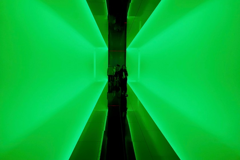
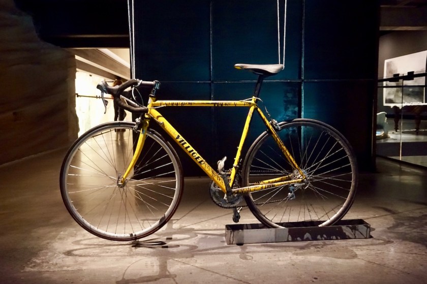
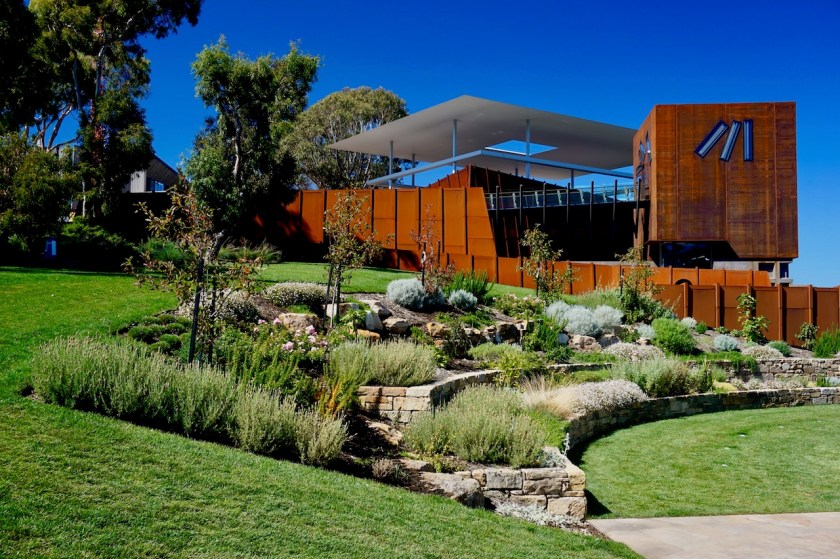
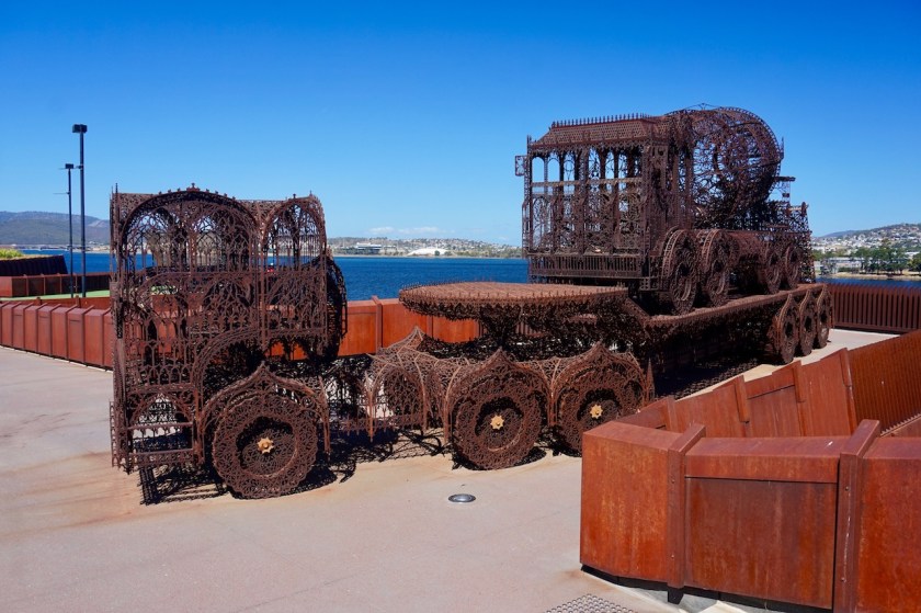
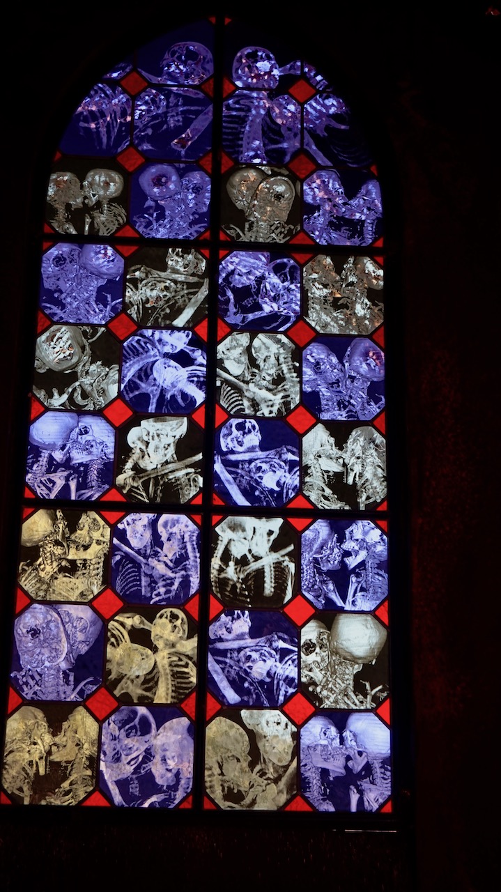
Closer to town, there is a bicycle way leading through town, and passing the Mona (Museum of Old & New Art).
World famous, so I decided to go and have a look.
It’s a nice thing. I was inside for almost 5 hours.
Mostly new art.
I still think the Te Papa museum in Wellington, New-Zealand was even more impressive, although it’s been 14 years since I was there, so maybe hard to compare.


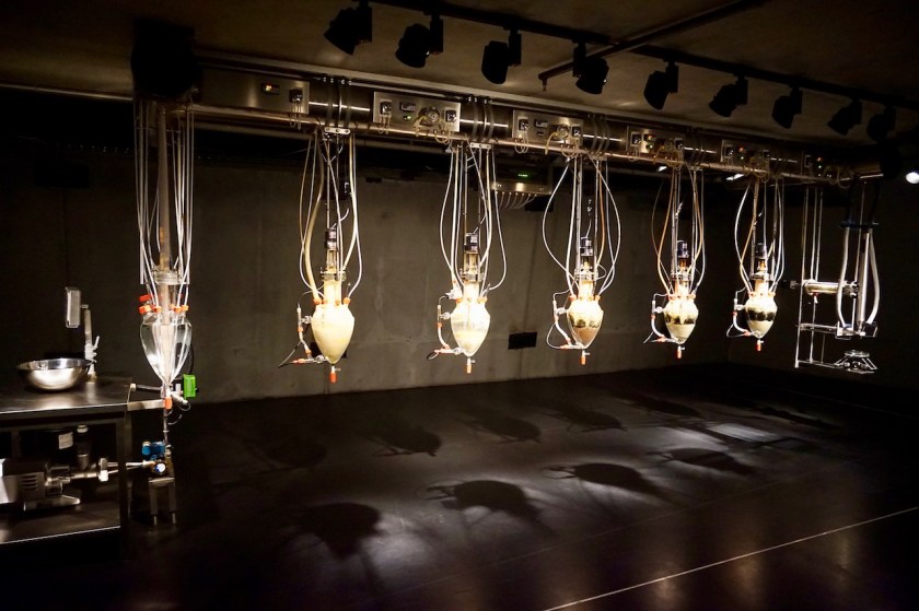


Anyway, very glad I visited the Mona.
Ended the day at the campsite in Hobart, which is terrible, and loud and not my thing, but necessary for a night.


