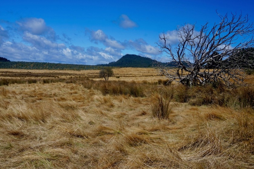
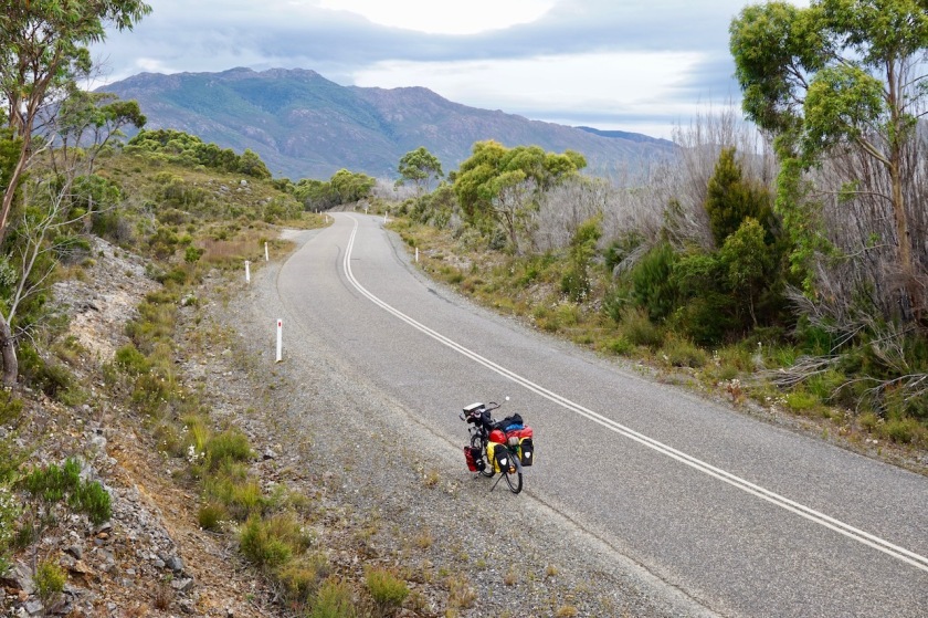
Route: Devonport – Wilmot – Cradle Mountain – Corinna – Strahan
After an eleven hour flight from Brussels to Bangkok (with a 24 hrs delay), a nine hour flight from Bangkok to Melbourne and an eleven hour ferry trip from Melbourne to Devonport, I am, finally, ready to start my trip Down Under. A trip which will hopefully show me some of the natural wonders in Tasmania and after that a whole lot of dry desert scenery, fantastic wild camping spots and solitude on the Australian main land.
I start off with a day by day story of my trip, but might change that format whenever I like to do so 😉
Here we go !
Day 1: 08 Febr. 2019
Melbourne
Arrived at 13:00 hrs in Melbourne from Bangkok. The immigration went really smooth. No more stamps in your passport when you enter Australia (what a shame). It’s all electronically. As I have visa for one year, I’m good until 8 February 2020.
The luggage nor the bike were checked (but where clean anyway).
I bought a Telstra sim-card at the airport and headed straight for the taxi stand to bring
me to my hotel where I assembled the bike and the stove. No time left to enjoy the swimming pool.
All good to go tomorrow.
Day 2: 09 Febr. 2019
Melbourne
35,40 km (Total so far: 35,40 km ) – Altitude climbed: 336 m
Weather: Cloudy
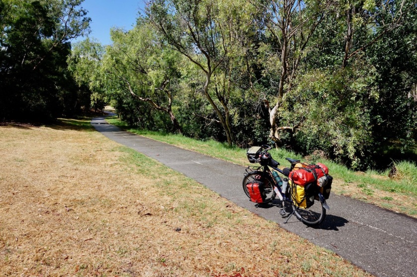
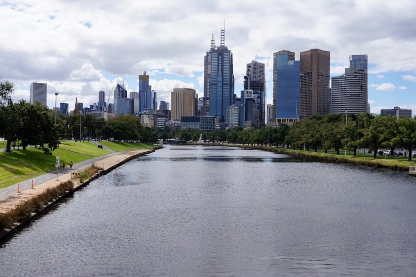
I managed to drive all the way to the center of Melbourne via bike paths through parks or separated from main roads. A route I prepared at home.
Tried to find a Garmin inReach plb in the CBD, but not successful.
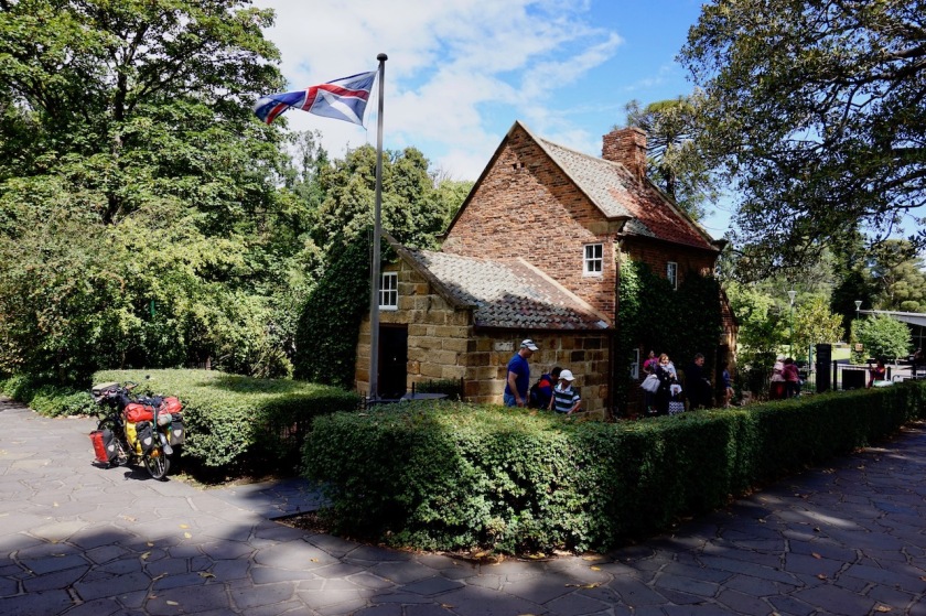
I rode a bit around the modern town, visited the tourist information and then headed towards the Fitzroy Gardens where one can find a bungalow where the parents of Captain Cook used to live. It has been shipped from England to Melbourne.
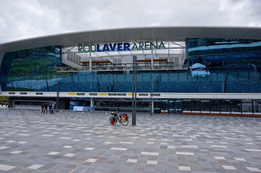
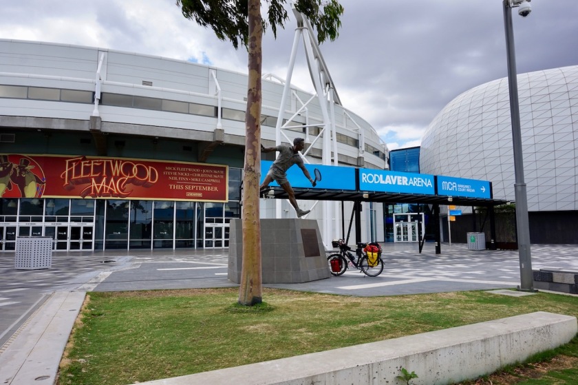
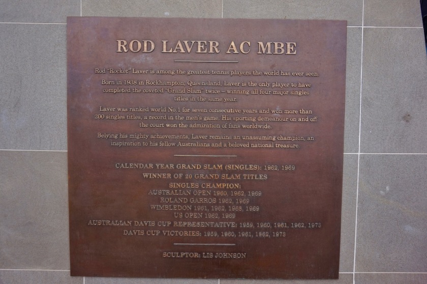
From the gardens I cycled to Yarra Park with the big Melbourne Cricket Ground, the Melbourne Arena and the only thing I really wanted to see in town, the Rod Laver Arena where the Australian Open are played.

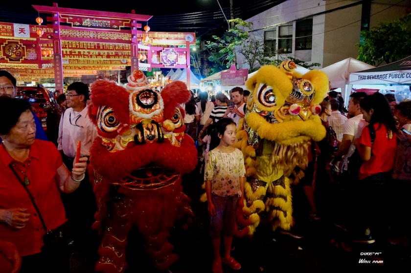
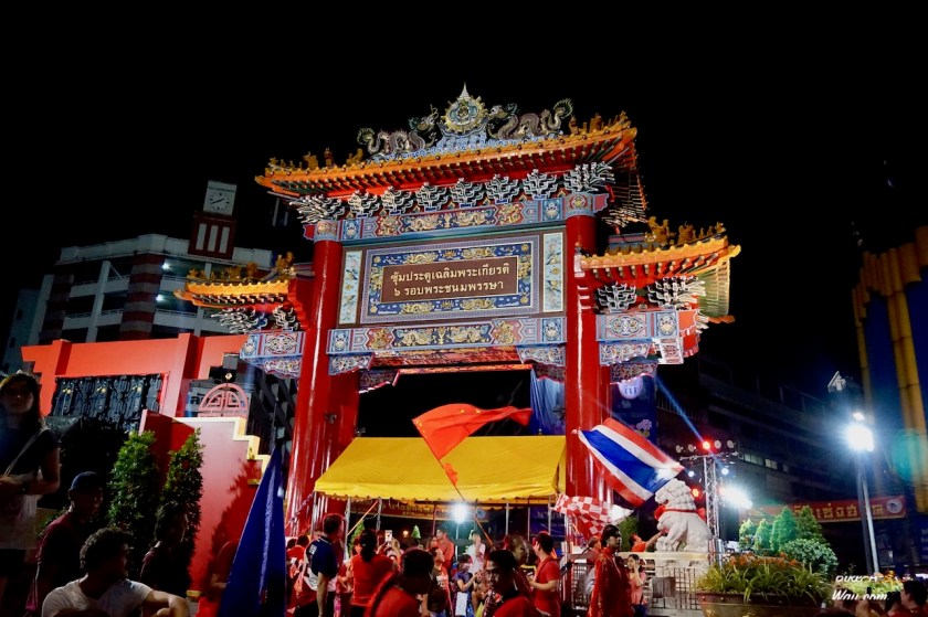
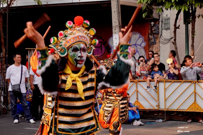
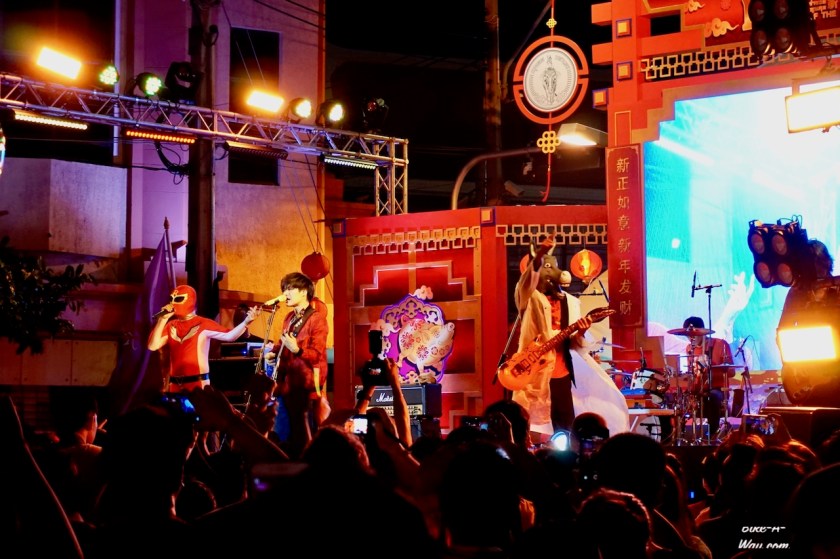
There’s a bike path all along the Yarra river to the port where I would catch the ferry tonight. Due to Chinese New Year, it was packed with people and Chinese food stalls.
In one of the Bunnings Warehouses I found Shellite (Australian version of White Gas) for the stove.
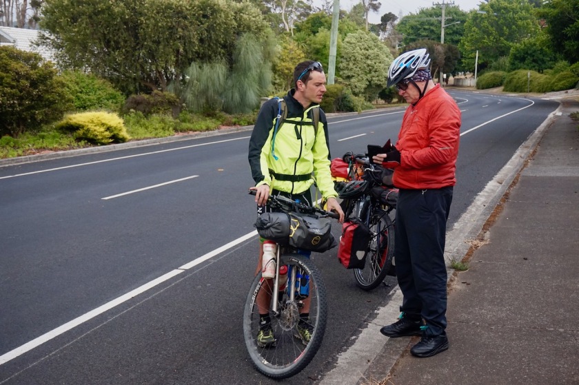
At 19:00 hrs I was at the pier, ready to board the ‘Spirit Of Tasmania I’. One other cyclist showed up, another Belgian Olivier.
On board the ship, I buy immediately an eight week visitor pass for Tasmania’s national parks.
Due to high winds, the passage was rough once we left Port Phillip Bay and entered the Bass Strait. Spend late into the night chatting with Olivier before we retreated for the night.
Day 3: 10 Febr. 2019
Devonport
4,7 km (Total so far: 40,10 km) – Altitude climbed: 100 m
Weather: Cloudy, some rain
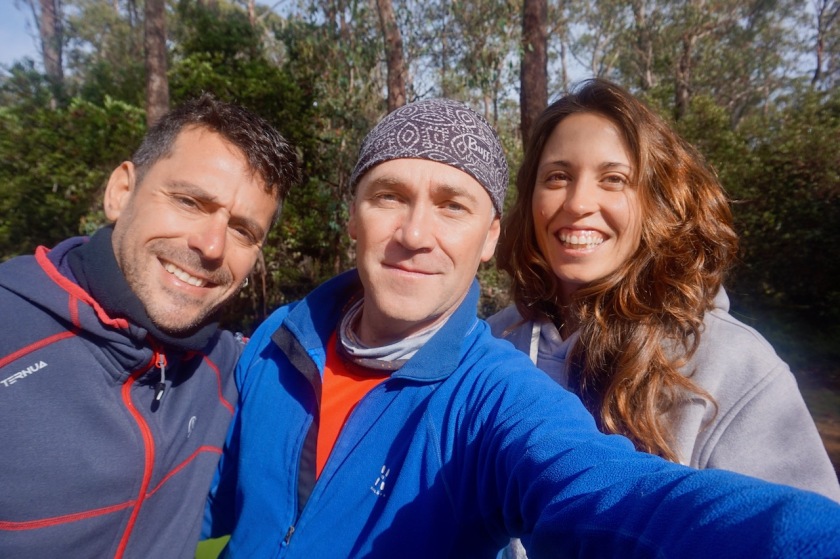
Hans, an online contact who invited me to stay the first night with him on Tasmania was waiting at the terminal when we arrived a bit after 7 am. Olivier was invited as well for a superb breakfast, prepared by Claudia, Hanses wife and Ava, who was staying as well for a couple of nights with her husband.
Spend the rest of the day sleeping and relaxing.
Day 4: 11 Febr. 2019
Devonport – near Lower Wilmot
29,76 km (Total so far: 69,86 km) – Altitude climbed: 664 m
Weather: Cloudy, rain – light head wind
I rolled the steep (almost 20%) hill down from Hans’ house back into Devonport to do some shopping.
Even before leaving town, I had to shelter for my first Tasmanian downpour. Instead of riding the suggested route to Cradle Mountain via Sheffield, I was stubborn and followed my own, hillier but quieter option via Melrose and Paloona.
Boy, did I suffer on these climbs. It’s been 4,5 months since I rode a loaded touring bike and 12 to 15% climbs seem to be the rule here.
Crossing Forth River, I had to tackle ‘Gentle Annie Hill’.
Half way up, less than 30 kilometer in my ride, I felt it was time to call it a day.
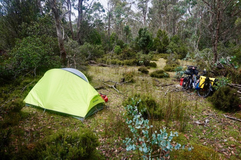
Pushed the bike 30 meter higher up a deserted forest track and pitched the tent.
Day 5: 12 Febr. 2019
Near Lower Wilmot
Weather: Rain
Rain all day.
Stayed in the tent, sleeping and reading.
Day 6: 13 Febr. 2019
Lower Wilmot to 20 km before Cradle Mountain
44,31 km (Total so far: 114,17 km ) – Altitude climbed: 1167 m
Weather: Cloudy, sunny, rain – light head wind
From my camping spot, I continued crawling up ‘Gentle Annie Hill’.
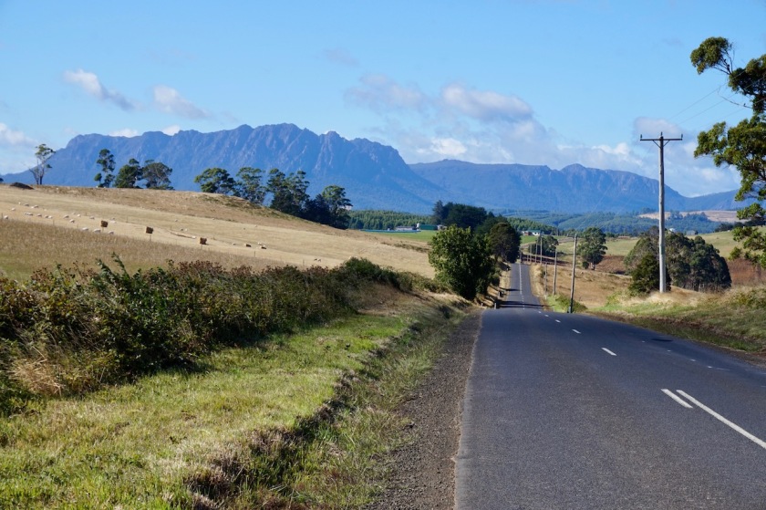
Now, Annie might have been gentle perhaps, the hill surely wasn’t. The weather is ever changing from clouds, to a bit of blue sky and sun, to downpours. After approx. 20 km I reached the small village of Wilmot, with a post office annex village store. They have a picknick spot with shelter in town as well.
After Wilmot the road goes STEEP (+ 15%) up. I even had to push the last part. You don’t go unpunished for almost five months without cycling. It will take many weeks again before I will be in some sort of shape. And these first weeks will be the hardest of the coming year if you look at the terrain. Hard parts will follow on the mainland as well when I’m in the dry desert with sometimes loose sand. But most of the climbing will be here in Tasmania.
After Moina, where the road from Sheffield joins, the traffic becomes uncomfortably busy at times.
I find a nice sheltered spot for the tent around 4 pm. Finished the book ‘From Ocean to Ocean’ from Jerome J. Murif which I started months ago. Excellent book from a guy who cycled in 1897 (!) from Adelaide at Australia’s south coast to Darwin in the north.
Day 7: 14 Febr. 2019
20 km before Cradle mountain to Cradle Mountain
14,33 km (Total so far: 128,50 km ) – Altitude climbed: 269 m
Weather: Rain – moderate & strong head wind
I woke up to slight a drizzle and took my time for breakfast. A short dry period allowed me to pack the soaking wet tent. By the time I was on the road, it rained again, and only ever harder and harder. Combine that with a strong head wind and a bit too much traffic and there’s nothing to get really happy about.
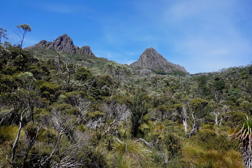
At the turn of to Cradle Mountain I doubted for a moment whether it would be worth going there in these conditions. You see nothing but grey cloud at the moment.
I went down anyway. At least I could warm up a bit in the visitor information centre.
They have shuttle buses driving all the way up to Dove Lake and back, dropping passengers off at various points along the road.
I decided not to go today.
It just kept raining, and raining and raining.
I installed myself at the camp ground. 25 dollar for a non-powered spot for a small tent and one person.
Something with ‘lumpsum’ prices etc.. where did I hear that before.…
Fortunately there’s a nice shelter where I can work a bit on my laptop and recharge some batteries. The weather should be better tomorrow for a visit to Tasmania’s most famous mountain.
It took me enough efforts to get up here, I want to see it at least 🙂
I spend the afternoon and evening in the chalet at the campground where they have fires, chatting with David and Paula from Blanes in Catalunya, Spain and surfing the internet.
Day 8: 15 Febr. 2019
Cradle Mountain to few km before Waratah
55,31 km (Total so far: 183,81 km) – Altitude climbed: 614 m
Weather: Sun, no wind
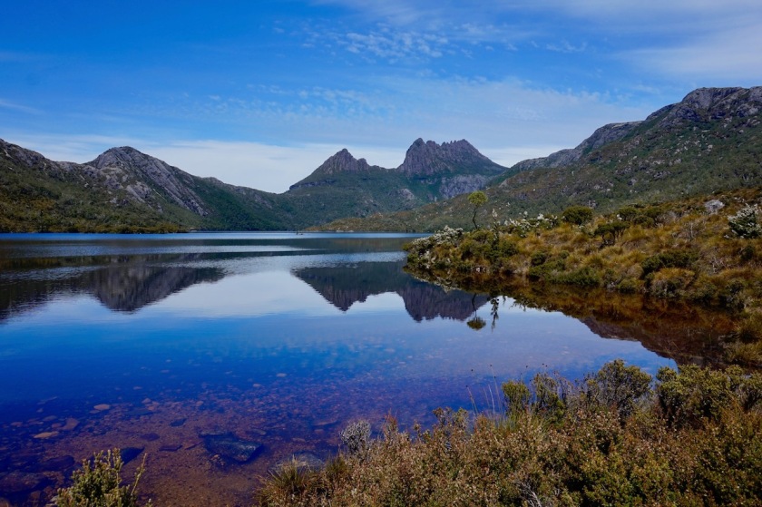
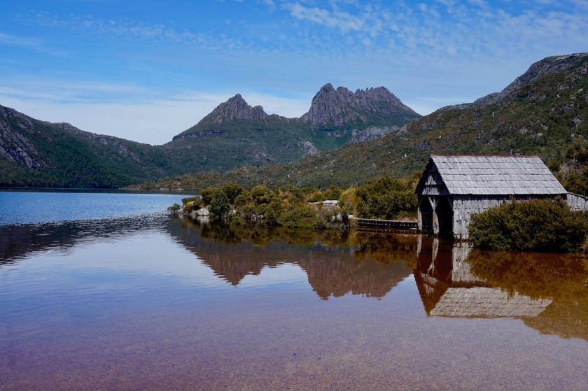
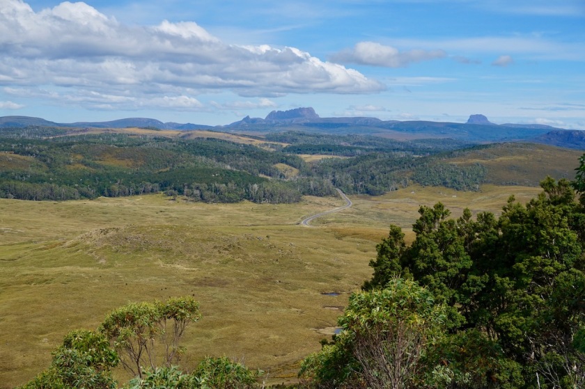
Well, it was worth the wait. A sunny, warm day, excellent to explore the national park a bit. After breaking down the tent (again check-out is latest at 10:00 am. Australia doesn’t allow its guests to sleep in a bit, it seems), I hurry down to the visitor centre and hop on the bus towards Dove Lake. The two hour circuit around the lake is the parks most popular hike and probably rightfully so as you have continuous marvelous views towards Cradle Mountain. It’s an easy hike, with too many people on the path. Nonetheless I’m happy to have the good fortune to have these views towards the mountain. According to the shuttle bus driver, only about 65 days a year the weather is as clear as today.
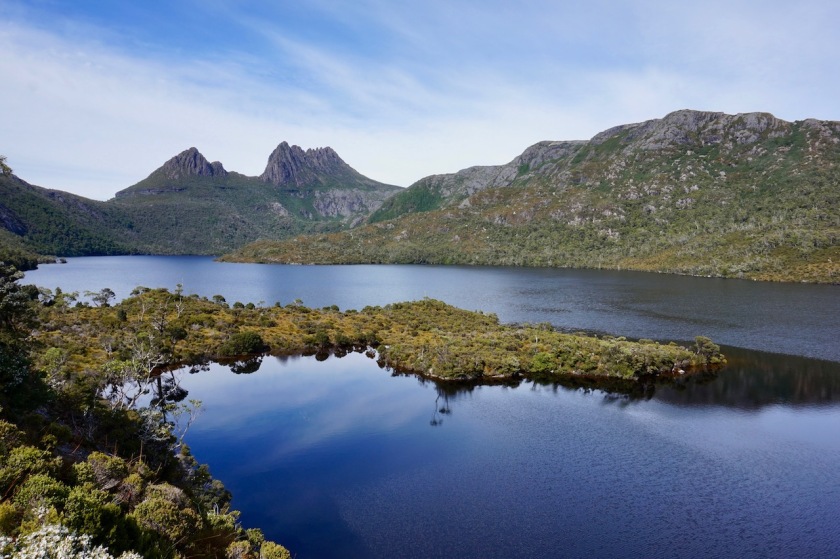


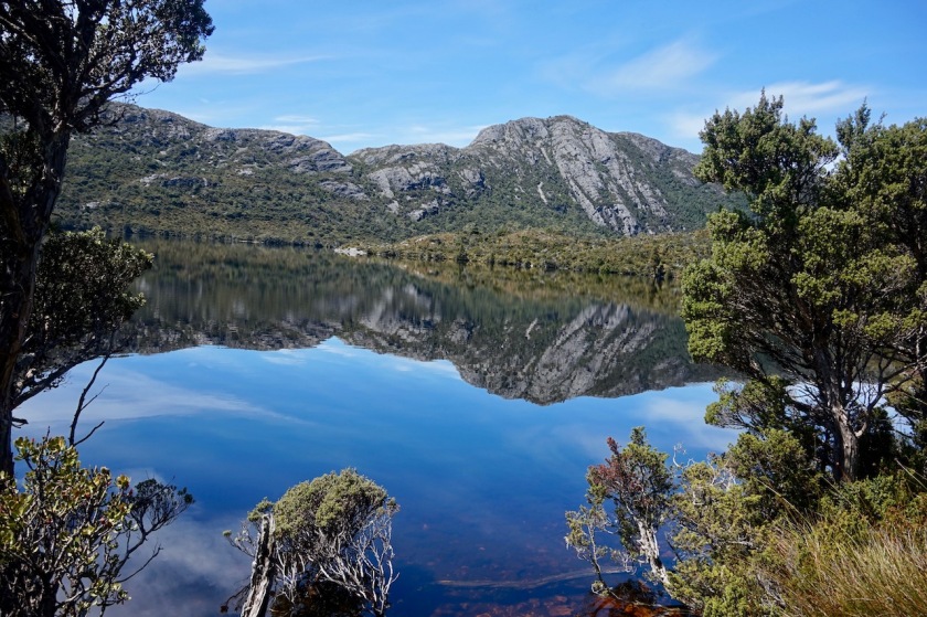
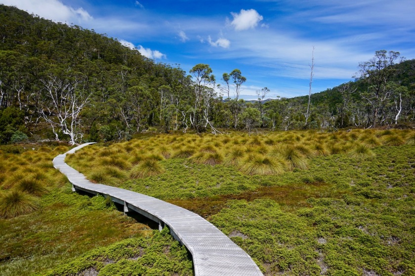
After the Dove Lake circuit, I take the shuttle bus towards Ronny Creek to hike the ‘Cradle Valley Boardwalk’. As the name suggests, the walk is all on wooden boardwalks (as is much around Dove Lake as well). It must have been an enormous job to make this thing.
Unlike Dove Lake, I see no other hikers here and I enjoy this walk tremendously.
Recommended !

Back in the visitor centre I jump on the bike so I can also enjoy my first meters of cycling in the sun on Tasmania.
I’m now on the Belvoir Road riding through the nature park with the same name.
Stil some steep climbing to be done, but at the summit there’s a nice, final lookout over the Cradle Valley and towards Cradle Mountain, now in the far distance.
Cradle Mountain is also where the famous ‘Overland Track’ starts. Probably a fantastic hike (about 10 days), but you’re only a few decades too late if you want to hike it.
Too popular, too crowded.
But, there is also something like the ‘Penguin Cradle Trail’, and I believe that could be really worth the effort, and not crowed at all.
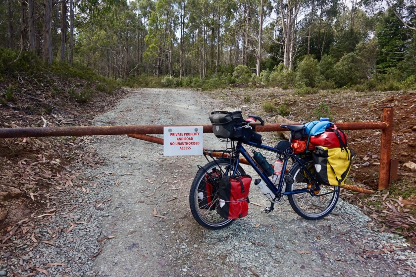
At home, I had spend some time to search for possible roads to avoid the main roads as much as possible. My first dirt road option, about 16 km from Cradle Mountain was already a fiasco.
The road was closed, claiming it was private land. There was a phone number on that sign, so I thought I’d ring them and ask permission.
No phone reception here.
So I carried on on the main road, knowing there was a second possibility a few kilometer further on. This second road (Murrays Plain Road) was open.
What a joy, being off the asphalt road.
But only for a kilometer.
Road closed again.
If that’s how it is over here with all this small roads I wanted to take, I can’t risk going all the way back to the north west point at Smithton via these small roads. After consulting the map, there seem to be three options:
– Riding to Waratah and then to Corinna
– Riding to Rosebery and then take the small road (if open) via the Montezuma Falls to Zeehan
– Riding directly to Queenstown.
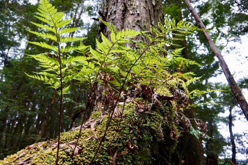
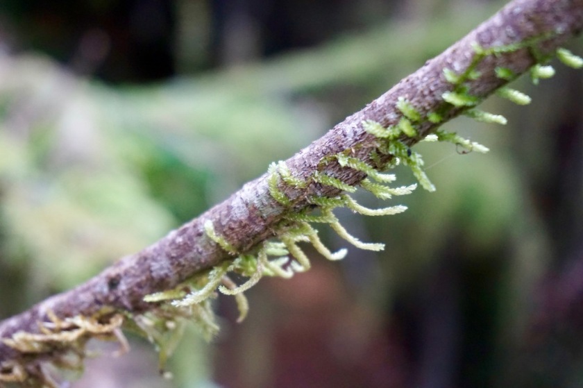
I chose the first option, because it still gives me the most kilometers on the island, and I will still ride through the Tarkine forest.
It is also the shortest stretch on the A 10, Murchison Highway (not a highway as we know it in Europe).
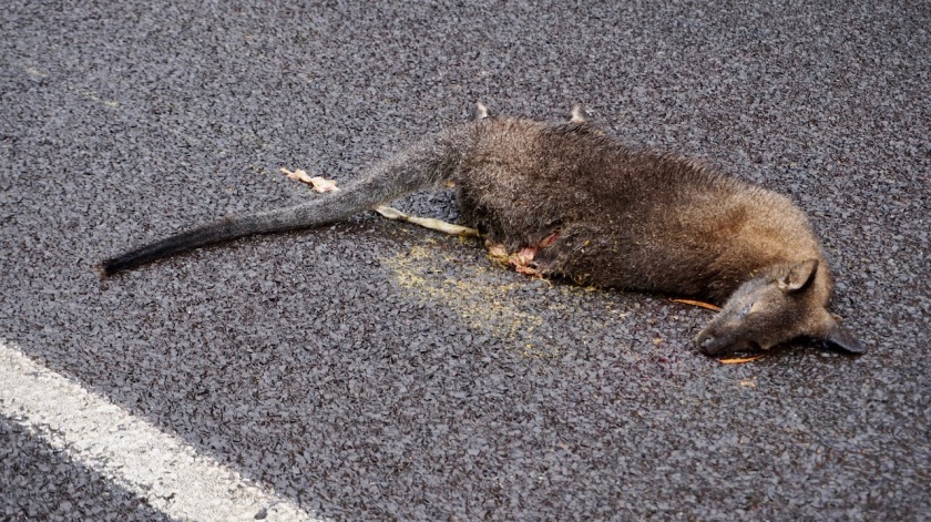
On a Friday evening, the highway is very quiet. But still, after only 150 kilometer on Tasmania, I have already the second beer can thrown at me from a passing car. I was warned these things happen here. What a shame these rutters never have the balls to stop their car and face me when I invite them to.
Day 9: 16 Febr. 2019
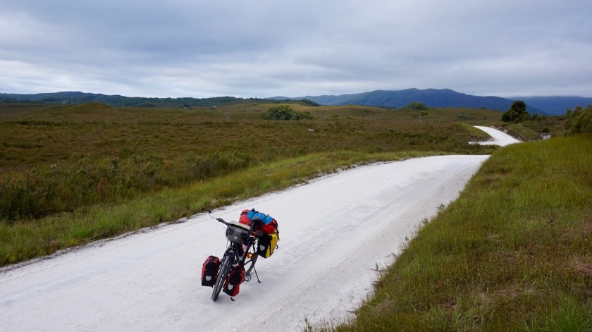
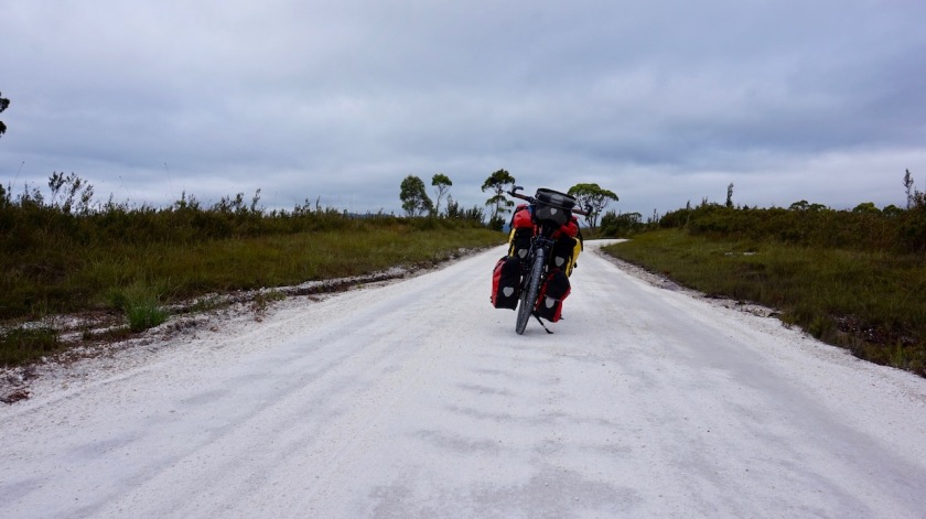
From few km before Waratah to 10 km before Corinna
58,77 km (Total so far: 242,58 km) – Altitude climbed: 942 m
Weather: Cloudy, sunny, light tail wind
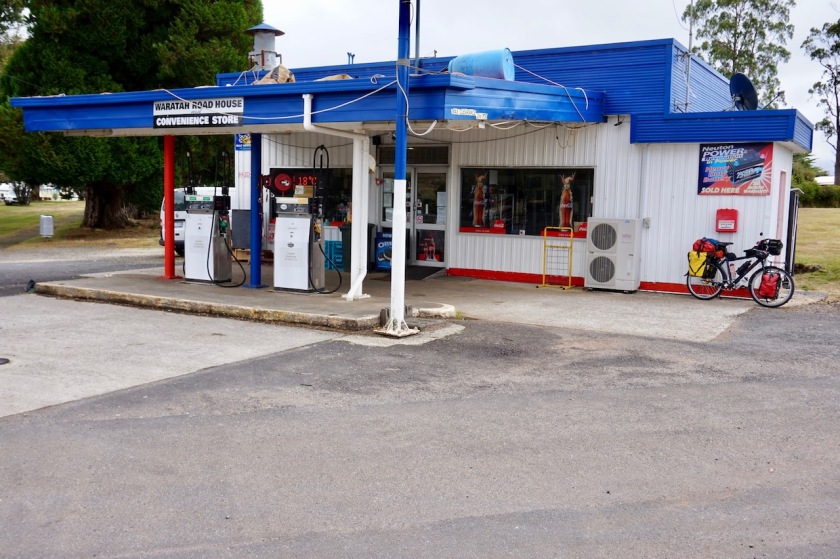
Waratah is a neat little town. No real shop, but the road house has a decent selection.
On a Saturday the road from Waratah to Savage River is very quiet, say about three cars an hour. No idea whether there would be mining or logging trucks during the week.
The road goes up and down, some steeper sections but never too bad.
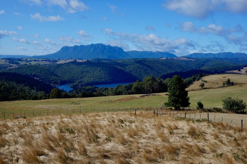
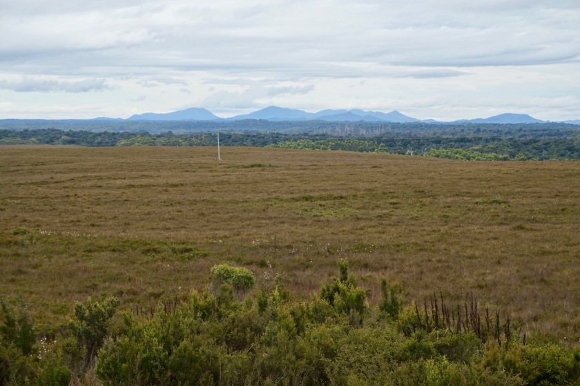
The lookout from Whyte Hill over the Tarkine wilderness is impressive. A friendly couple from Melbourne who arrive at the lookout fill up my water bottle and share a few cookies.
Apart from beer can throwers, I meet a lot of nice people, who always take their time for a chat.
From the lookout, it’s steep down towards Whyte River and, it can’t be avoided, a steep climb back up. If you don’t cycle for 4,5 months, you get punished. Your shape does not come back in a few days.
But, I take it easy and try to make days where I don’t have to climb more than a thousand meter.

I’m lucky by the way I’m here today. Tomorrow the road between Waratah and Savage River will be closed for a car rally.
It must be a strange rally, because it only goes till Savage River.
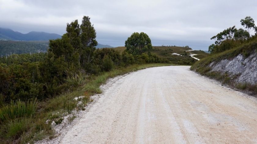
Savage River, an ugly mining places polluting the whole area, is where the asphalt stops and the dirt road starts. And I always thought rally’s were meant to be ridden away from asphalt.

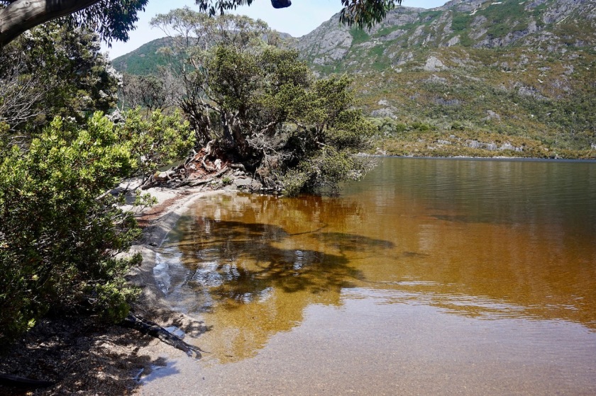
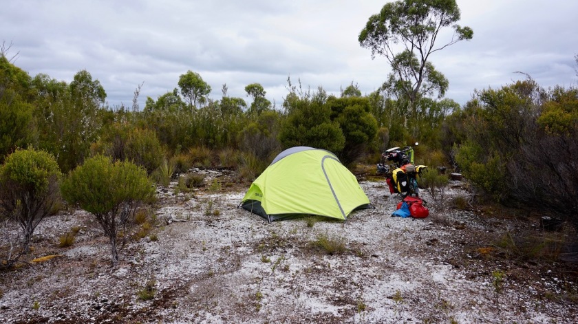
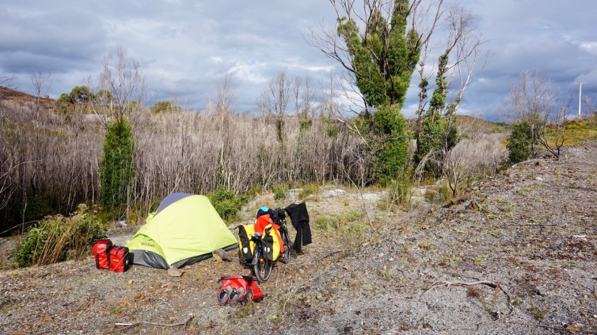
Ten kilometer before Corinna, I see a small track going away from my dirt road. I check it out as a camping option and bingo !
Excellent place, nice flat area and views towards what I believe must be Mount Meredith.
There’s a big ant hill eight meters away from my tent, but even they don’t disturb my paradise for the night.
I make a nice pasta dish and read Herman Brusselmans book ‘Hij schreef te weinig boeken’.
639 pages, should keep me occupied for a little while.
Day 10: 17 Febr. 2019
From 10 km before Corinna to 5 km before Zeehan
57,23 km (Total so far: 299,81 km) – Altitude climbed: 906 m
Weather: Cloudy, light tail wind
I was sleeping at 8 pm and woke up at 7 am.
Good. I’m in my rhythm again.
After years of sleep deprivation due to my job, there’s nothing more valuable than a good night’s rest.
Eleven hours is perfect.
On the road by 9:15 am. That’s early for me.

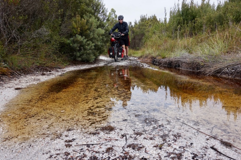
Just before reaching Corinna, an idiot in a red Subaru with such a huge Thule roof coffin came racing in from the opposite direction and coming around the corner, almost lost control of his old car, missing me at a meter or so.
Dirt roads are not necessarally safer.
At Corinna, you can rent huts, or camp, but at 40 dollars, I find the rate a bit on the high side.
I do go in for a coffee and a brownie though. They have a small ‘shop’ in the café, but it’s basically just cookies and shampoo they sell. There’s a water tank with rain water to fill your water bottles.
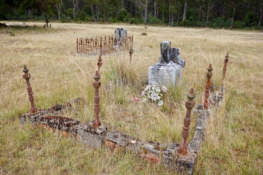
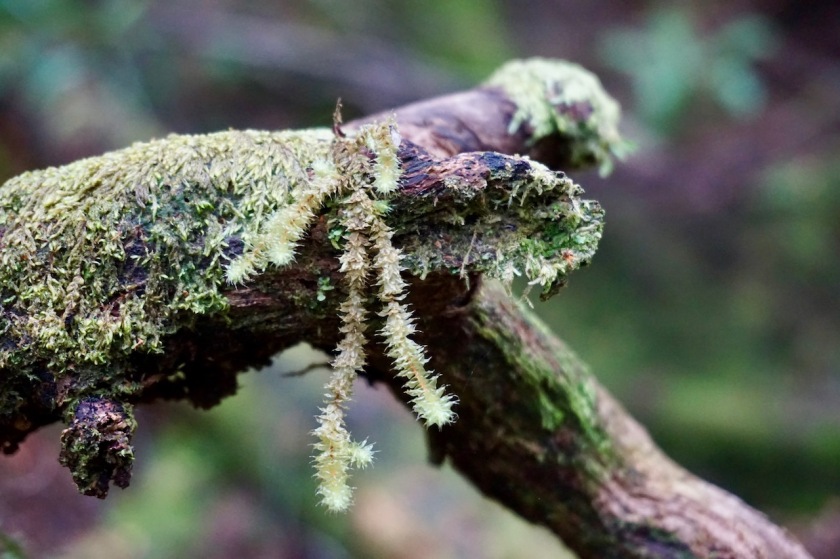
Corinna is an old gold mining place. There are information boards everywhere, telling the history of the place.
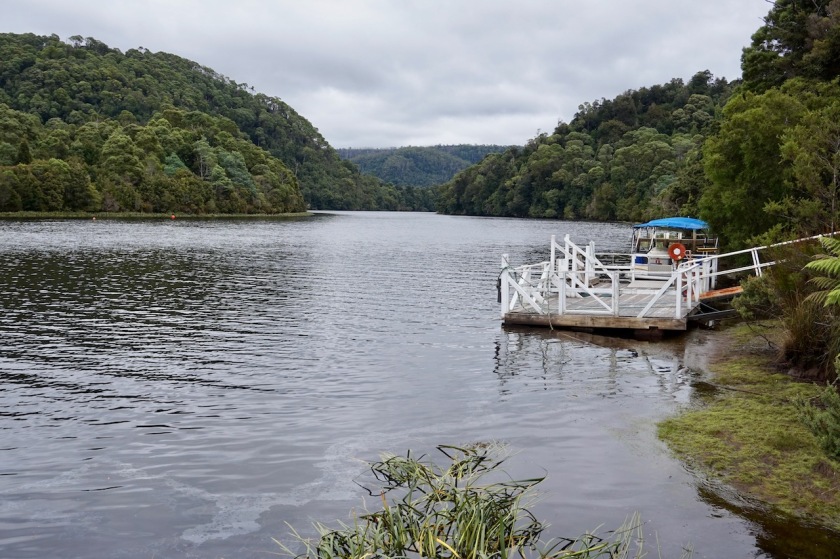
I also make a small hike along the Pieman River.
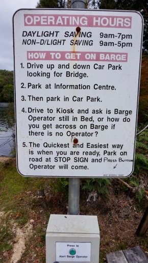
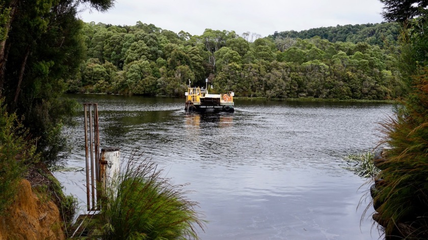
No bridge here. Crossing the river is by barge.
It takes two minutes and costs 13 dollar for a bicycle.
I guess they are saving for a bridge.
 After crossing the Pieman River, the roads climbs steep out of the valley (13 %).
You climb up, lose half of that, climb back up, lose again half of that.
So it goes on for a while until you are at two hundred meters again, when the road becomes undulating and easy all the way to Zeehan, with a few steeper exceptions only.
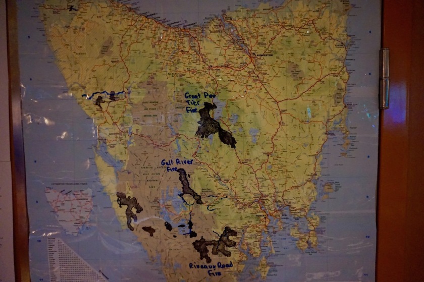
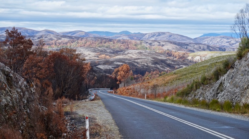
At the junction between the Pieman Road and the Heemskirk Road, the first one is closed due to forest fires that are still going on, despite all the recent rain.
I have to go the other way anyway. First I cross the Tasman River, then head towards Heemskirk Mountain, Heemskirk River before entering a huge section that has been burned completely very recently.
I camp 5 kilometer before Zeehan. It’s not the most picturesque place, but it will do.

Day 11: 18 Febr. 2019
From to 5 km before Zeehan to – 4 km before Macquarie Heads (Strahan)
65,28 km (Total so far: 365,09 km ) – Altitude climbed: 474 m
Weather: Cloudy, rain, light & medium tail wind
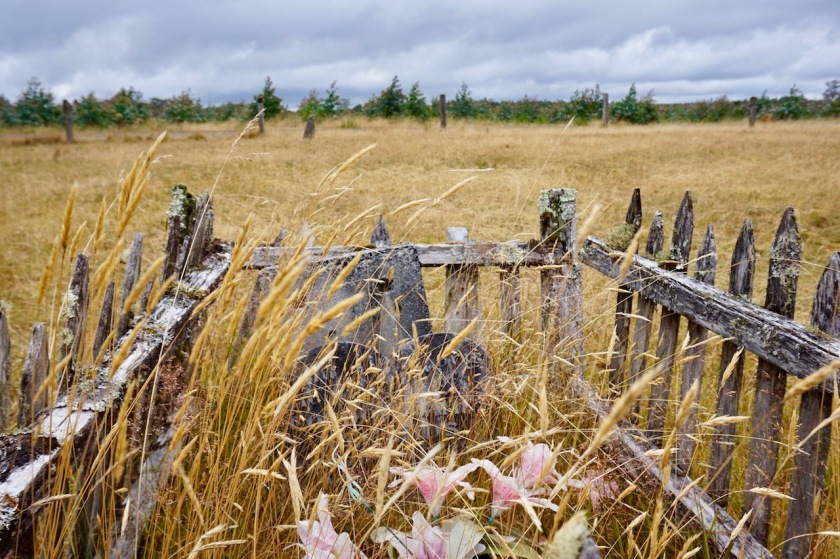
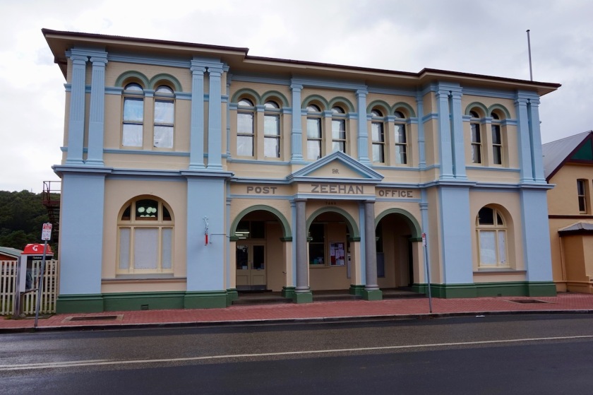
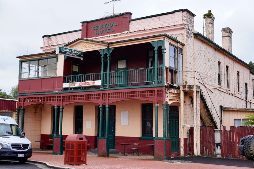
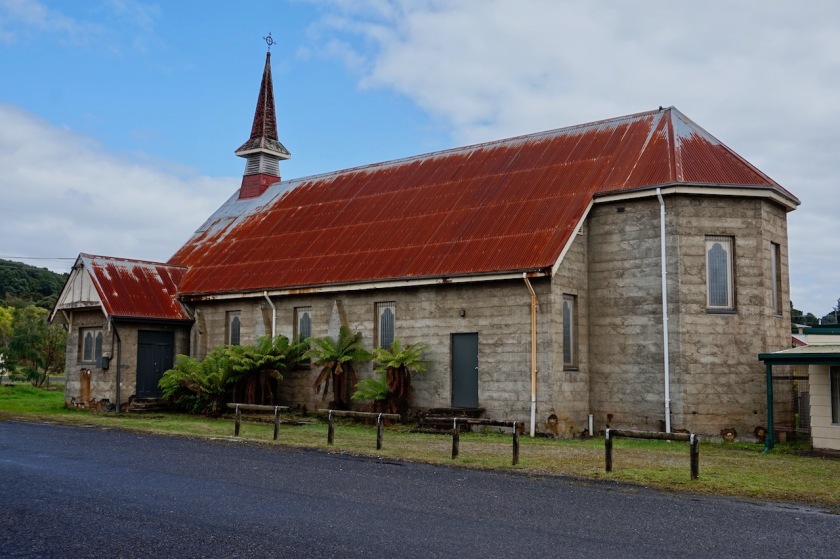
Zeehan used to be the third biggest town in Tasmania. These days are long gone, if you look at the place now. Still, I like it. It has a couple of nice old buildings like the Gaiety Theatre from 1898, the Central Hotel, an old building from the Post, …
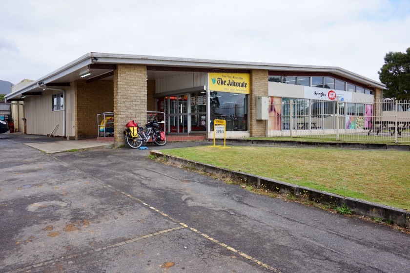
Here, in Zeehan, I visit my first Iga supermarket. During my preparation, I found out it will be the first of many. They are the chain that will supply you in smaller places where the bigger players like Coles and Woolworths won’t go.


After Zeehan I have the option to go directly to Queensland or make a loop via Strahan. I chose the second option, as that seemed like the smaller road on the map, and also because the weather seemed less grey in that direction 🙂
The asphalt road goes through the Mount Dundas Regional reserve. In these weather conditions, grey clouds and frequent rain showers it doesn’t look all too special. The traffic is intense as well, say never a minute between two cars passing you, often less.
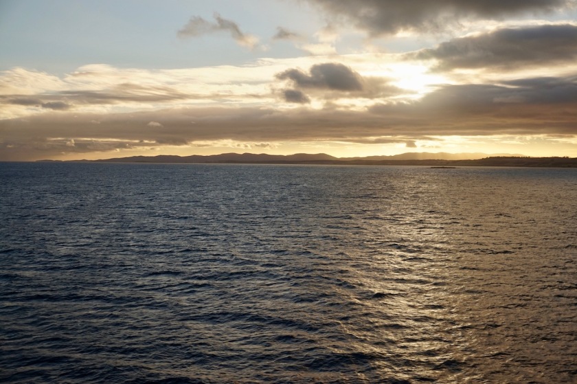
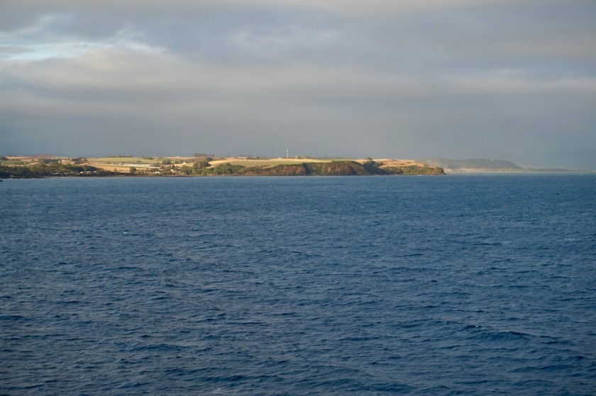
From the hill tops, I have views of the Southern Ocean from time to time.
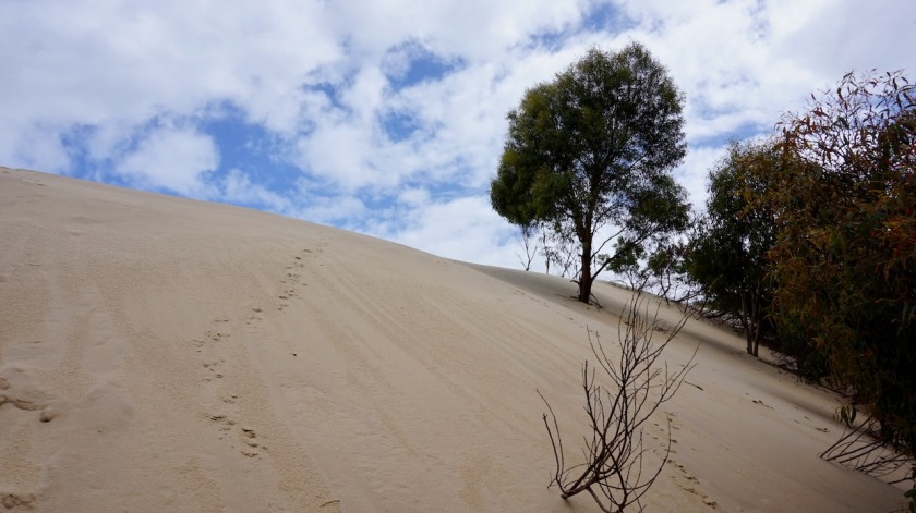
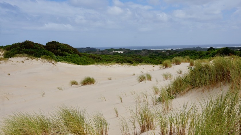
There’s just a short sunny break when I arrive at the Henty Dunes so I take the opportunity to climb the 30 meter high dunes.
The town Strahan of which many people told me it is “sooo lovely”, is nothing really special.
Maybe the fact you can do this lame touristy cruise on the inlet or a short tourist train thing make it appealing for some.
Me, I enjoyed the public shower, went to the Iga and cycled off to the peninsula towards the Macquarie Heads with 12 liters of water and three or four days worth of food to sit out the bad weather and take a rest.
There’s a paid ‘bush camping’ at the end of the peninsula. ‘Paid bush camping’ seems a contradiction to me and surely means smashing car doors, yelling people and crying babies, so I started looking for my own place on the way. Not much to be found. All small bushes, ferns, nowhere a few free square meter out of sight. Until about four kilometer before the end of the road, where there’s a 4WD track up to ocean beach where I find a good place in the forest, well protected from the strong winds.
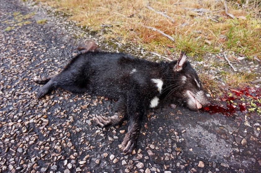
Kangaroos or wallaby’s (I still have to learn more about them to distinguish ‘em) hopping around at night.
Life is all good.
 Next day, I was queuing 3 hrs before we were supposed to fly.