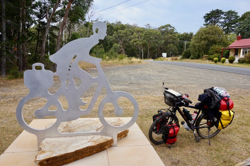
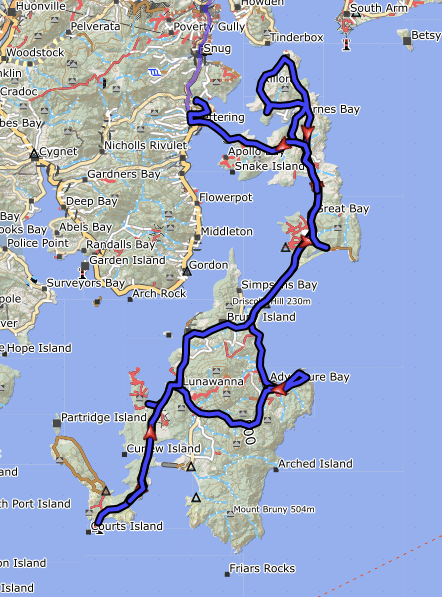
Route: Hobart – Taroona – Kingston – Kettering – Bruny Island
Day 21: 28 Feb. 2019
From Hobart to Bruny Island, Simmonds Bay
61,19 km (Total so far: 792,00 km) – Altitude climbed: 826 m
Weather: Sunny
A busy day.
The camping kitchen closed at 8 pm yesterday, before all my devices were fully charged, so I sat there again this morning for 1,5 hour to finish that.
Via the bike path I rode into town. Part of the way I cycled with some other cyclists who were also hikers and went out every morning on their bike to drink a coffee in town near the marina.
In the town center, I first went to the ‘Find Your Feet’ shop to collect the Garmin inReach Mini I ordered with them. We arranged the subscription with Garmin as well.
From now on, when something serious happens, I just have to push a button and the Flying Doctors, helicopters, ambulances, rescue teams, …. everybody will come to me as quick as they can.
So they say.
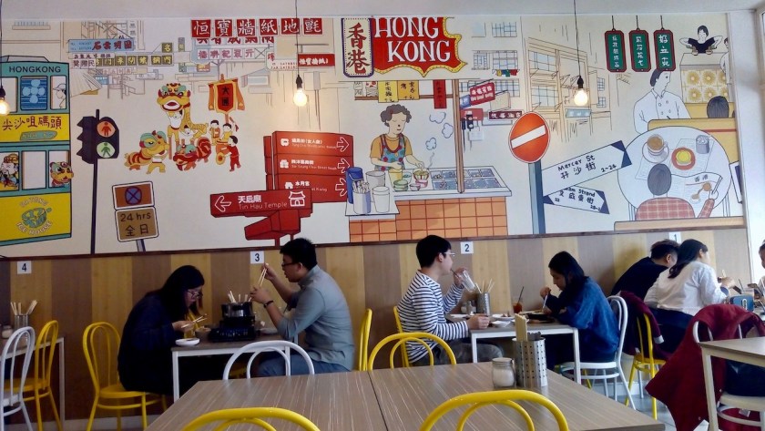
Treated myself to a lunch in an Asian restaurant as well.
Hobart, and I think the whole of Australia, has a lot of Asian immigrants.
East- and Southeast Asians.
Good !
I like to be among these friendly, hard working people and they are a guarantee you can have some very good food, whether it is Thai, Vietnamese, Taiwanese, Chinese, Korean, … always delicious.
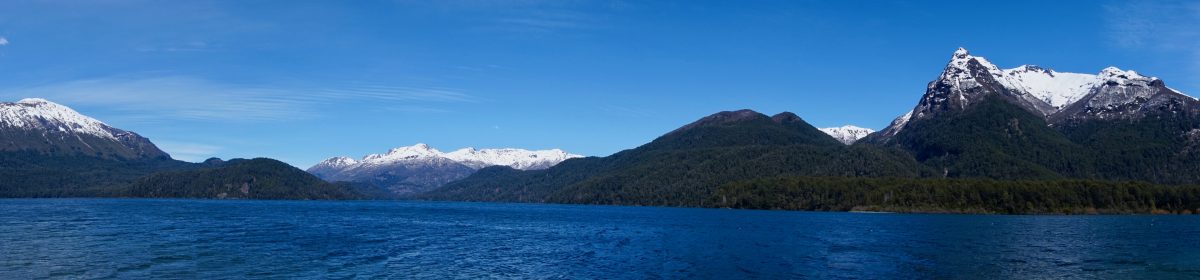
The ride from Hobart to Bruny Island along the coast is just something you have to go through.
Riding out of town towards Sandy Bay is pleasant.
Towards Taroona and Kingston, there are a few hills and most of the road has some form of shoulder. It is not good, but you will survive (although I noticed the other side of the road, on the way back, will be worse).
Kingston is a big place, with a big Coles supermarket, so provisions could still be bought here.
From here the roads gets busier.
Again, often this ‘shoulder’ which we call at home a ‘suicide lane’ for cyclists, but it’s ok. Better then the way into Hobart via the A10.
Between Margate and Snug there’s a new good bike path.
Then one more hill towards Kettering and the ferry to Bruny Island.
I was warned water is not easy to find on Bruny, so I took a lot at the sanitary building in Kettering.
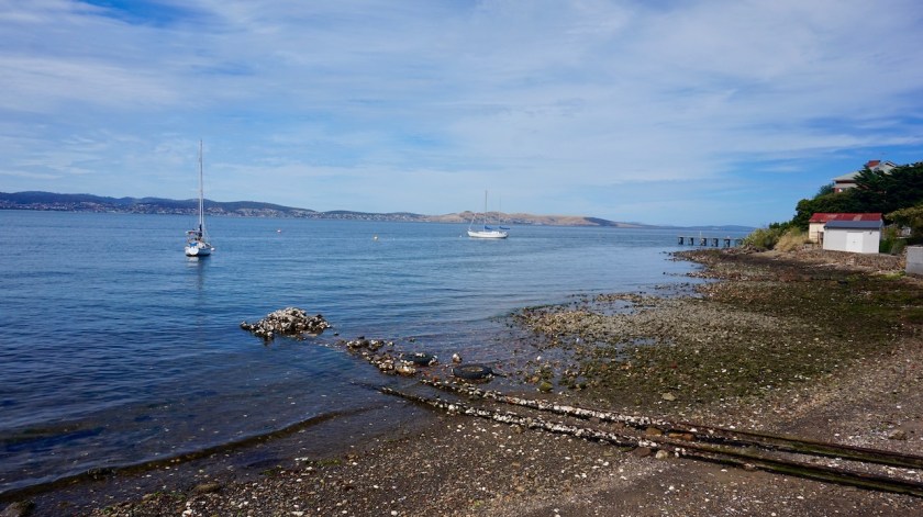
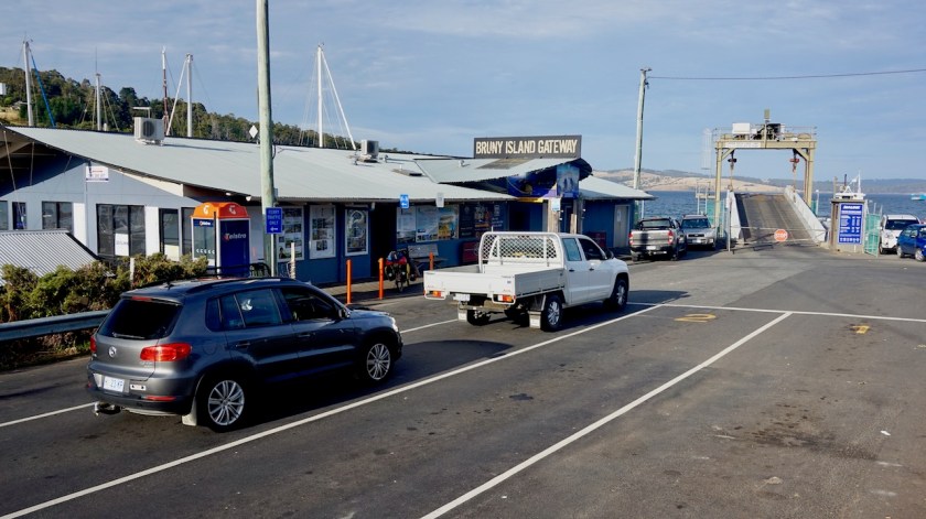
It was the 18:30 hrs ferry I got. The passage takes just 30 minutes. This means I had another hour to find a place for the night before sunset.
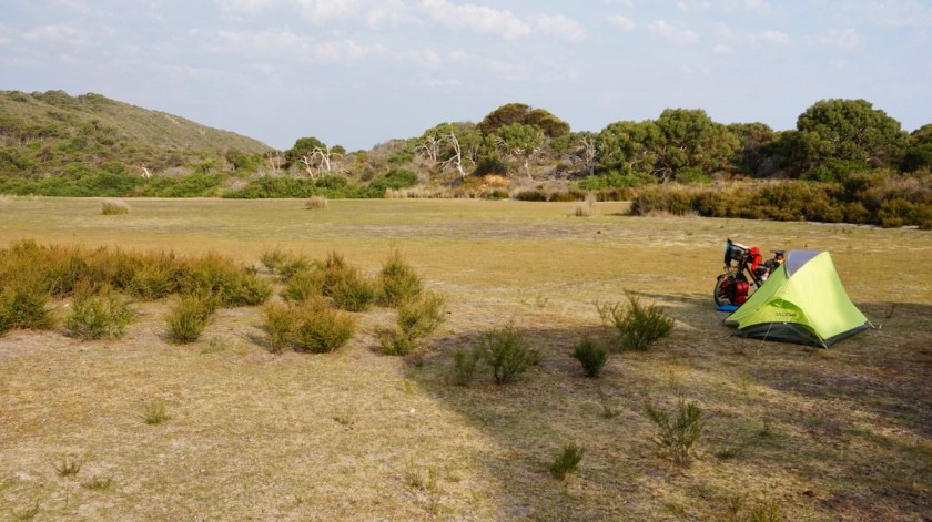
Everything along the main road is fenced off (a lot of sheep farming, I saw), so I descended via Missionary Road towards Simmonds Bay where I found a beautiful spot for the night.
Day 22: 1 March 2019
From Bruny Island, Simmonds Bay to Adventure Bay
40,86 km (Total so far: 832,86 km) – Altitude climbed: 368 m
Weather: Sunny, light tail wind

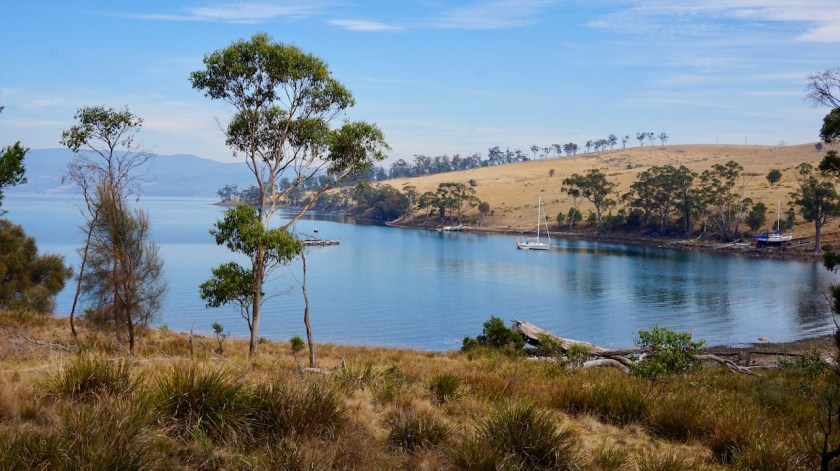
From Simmonds Bay I rode back to the main road and on to Great Bay.
There, I found a really fantastic spot where I hope to camp in a few days, on the way back.
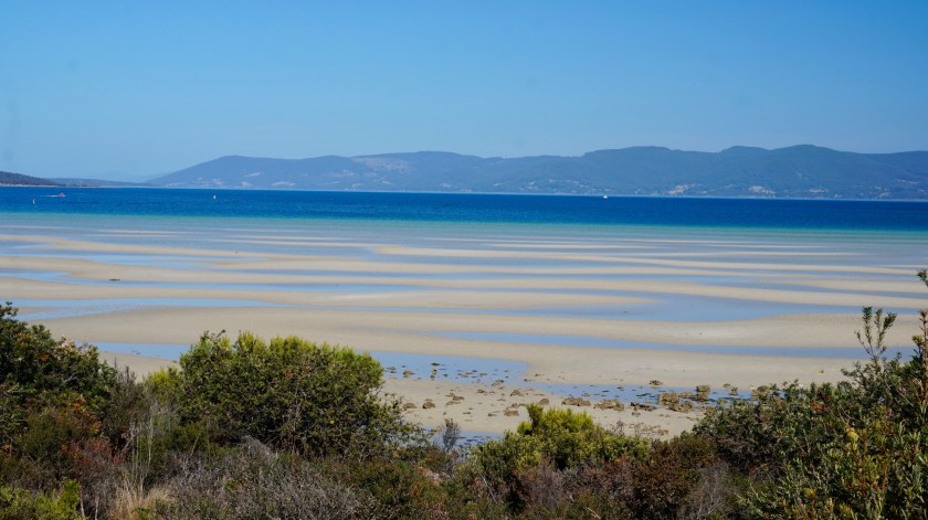
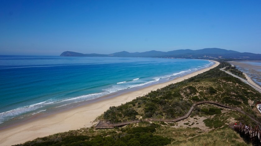
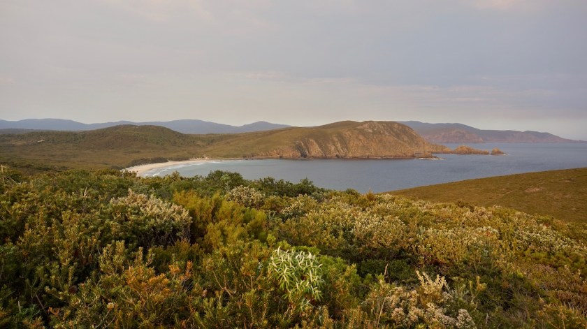
North and south Bruny are separated by an isthmus called ‘The Neck’. There’s a good view point from the top of a dune. Kilometers and kilometers of beach.
Fantastic view.

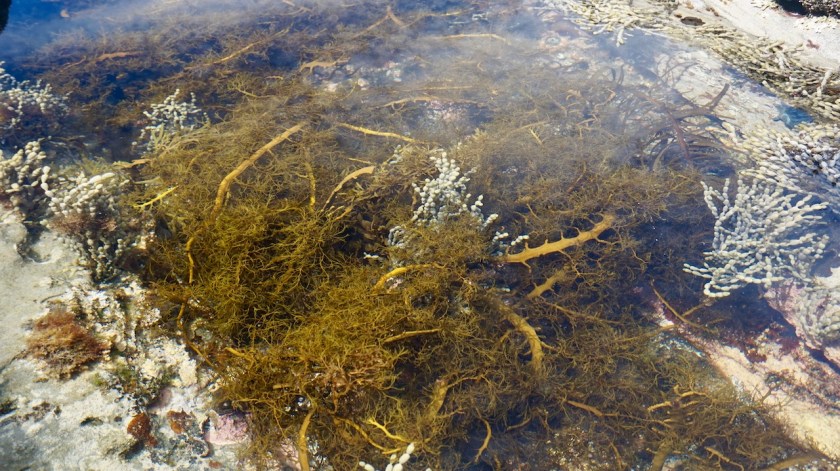
Further on, already on the southern part of the island, don’t forget to stop at ‘Coal Point’ if you are here.
More views, beautiful rocks, sea weed, ..

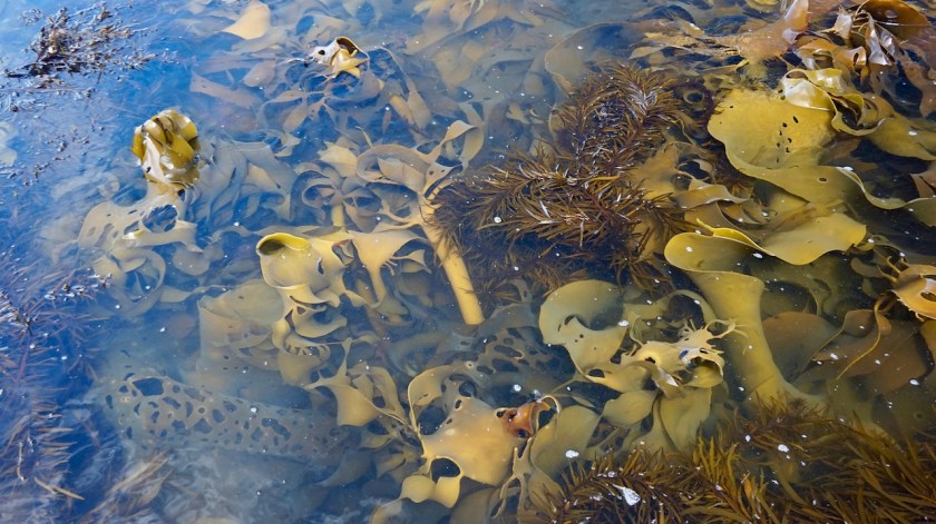
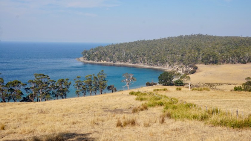
The water at Adventure Bay was colored red on the western side. Maybe due to algae ?
There is a general store here which a good selection of products, but at steep prices.
Near the end of the bay are several monuments referring to the history of the place where famous European Explores landed.
The first was Abel Tasman in 1642, Then James Cook in 1773, Tobias Furneaux a couple of times, and Bruni D’Entrecasteaux (1792) (after whom the island, and the channel between Bruny and Tasmania) is named.
D’Entrecasteaux is a name that will show up more later in the naming of Australian national parks,..
Also William Bligh and Jacques De Labillardiere visited this place.


Me, lacking the funds to have a boat, I arrived on the pushbike and I took a swim in these waters of the Southern Ocean.
And life was good. Very, very good.
Day 23: 2 March 2019
From Adventure Bay to Mable Bay
43,48 km (Total so far: 876,34 lm) – Altitude climbed: 1210 m
Weather: Sunny, hot !
First thing today, I rode back to the far corner of Adventure Bay to hike the Fluted Cape Walk.

Starting off by hiking to the far corner of the beach, then an easy hike along the rocky coast to Grass Point. The water between Bruny Island and Penguin Island is so shallow you could walk to the other island.
From Grass Point at sea level, the trail starts climbing to the top of the cliffs, almost 300 meter higher.
Fan-tas-tic views of these cliffs.
It’s a sometimes steep climb, but totally worth it.
2,5 hours later, I was back at the starting point and went to eat lunch on the bench near the Captain Cook Statue.

The walk was already a bit demanding, but I knew the hardest part still had to come; cycling over the hills towards the other side of the island via the rough Lockleys Road.
It starts oh so gentle but then, after the junction with Resolution Road…. 11%, 12% climb on a stony track.
I have pushed most of the way to the top.
It was burning hot and the sun was in such an angle that most of the time there was no shade to be found on the road.

The downhill is just as demanding and I had to stop each time after about 80 meters descending to cool down the rims. So steep !
There are some good views of Cloudy Bay Lagoon and the hills around on the descent.


In Lunawanna I took some extra water from the toilet building.
If you think like me you’re quickly gonna cycle this 19 km to the lighthouse and come back most of the route,… think again.
Again, it starts gentle but the road becomes hillier as you’re nearing the lighouse.
I arrive at Cape Bruny and the lighouse two hours before sunset. The gates were closed at 5 pm, but you are still allowed to walk in. I pushed the bike through the gate and parked it a bit further beyond the house of the lighthouse keeper;
Immediately a park ranger came up to me and I thought “o-oh, the bike shouldn’t be here”…
But she came out especially to check whether I was fine and if I didn’t need any water.
Now, isn’t that super-friendly !
I gladly took the offer. They were a couple of volunteers to look after the place for a week.
The man told me they also manage the weather station.
Today, when entering the data at 9 am and 3 pm, ‘the system’ asked whether the data was correct, as they were figures never recorded before.
I forgot to ask whether it were records for this day, a 2nd March, or all time records, but I suppose it’s a 2 March record.
26°C at 9 am and 38°C at 3 pm.
That’s in the shade.
The man who does the tours of the lighthouse told them he reckoned it was over 50 degrees in the sun this afternoon.
I told them I had 46,4 degrees on my cyclometer, and I was in the sun all day, so that could be.

From the lighthouse, one can see two little white islands in clear wheather. White because of all the bird droppings. But this late in the day, and with these temperatures, it wasn’t clear enough. These two islands are the southern most point of the Australian continent.
I saw a Swift Parrot near the lighthouse. These endangered species can fly 100 km/hr and are the fastest parrots on the planet.
As the camping at Jetty Beach was crowded, and loud last night till after 2 am, I headed back towards the national park entrance and found myself a quite spot.
Before pitching the tent, I hiked down to the beach at Mabel Bay. Fantastic wild waters, high rocks on both side of the beach and one old schooner on anchor.
The tent was erected just before sunset and a all that’s left to do is prepare a big pot of pasta with a lot of vegetables.


Day 24: 3 March 2019
From Mable Bay to Little Lagoon
41,58 km (Total so far: 917,92 km) – Altitude climbed: 495 m
Weather: Cloudy, sun in the evening
The day started cloudy, but the predicted rain never came.
After yesterday’s hard day, I slept in a bit. I am glad I pushed this few kilometer yesterday evening and have this quite spot for the night instead of the listening to the drinkers and shouters at Jetty Bay.
I heard the crashing of the waves sixty meter below me.
After breakfast, I changed the front break pads and tightened the chain.
The first 14 kilometer of the day were the same as yesterday afternoon, back along Great Taylors Bay, over the hills to Little Taylors Bay and Lunawanna where I washed my clothes and my hair.
To my surprise, the road between Lunawanna and Alonnah is still unpaved. On a Sunday afternoon, there was a bit of traffic, people returning to Hobart, I guess.
In Alonnah I met cyclists again, Aldrik & Amélie, a young French couple who arrived just a few days ago in Hobart and will stay for a year on a working holiday visa.
Allonah has a general store, but smaller than the one in Adventure Bay.
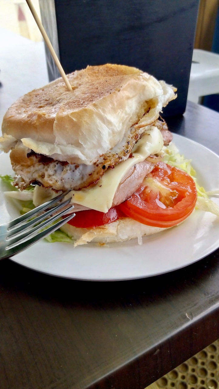
I ate a big hamburger for lunch, needing the calories.

After Allonah, the road leads back to the Isthmus. I stop and climb the 233 steps again to the lookout platform.
Just after the small landing strip, a track leads to Cape Queen Elizabeth. It’s a hiking trail, but wide and flat enough to cycle a large part of the way. ‘Big Lagoon’ on my right hand is completely dry, and so is ‘Little Lagoon’ a bit further on.
The difference between the big and the small one, is that the small one had nice, very short grass inside (eaten by the rabbits and kangaroos, I guess).

I hiked down to Moorina Bay which is the far end of Neck Beach before returning to a brilliant camping spot I found earlier, a few kilometer from the main road, with the sound of the waves at the other side of the dunes, it will be really peaceful tonight.
A lot of snakes around, but they tend to go away when they see me.
Oh, and the sun came out after 6 pm.
Lovely evening, watched thousands of stats and the Milky Way.
Day 25: 4 March 2019
From Little Lagoon to Great Bay
50,18 km (Total so far: 968,10 km) – Altitude climbed: 785 m
Weather: Sunny, moderate head wind in afternoon
A sweet quite night made me wake up just after sunrise. I could see the sky changing it’s colors before the sun came over the hill.
On the program today: visit the northern part of Bruny Island.

The first part of the way I rode already last week, all the way back to my first nights’ camp from where I continued along Simmonds Bay to Barnes Bay.
On Killora road, there’s a moderate climb over the hill and the junction to the Old Quarantine Station which I visit (open Thu. to Mon.).
Really interesting. The volunteer park ranger tells you passionately about the history of the place which served as a quarantine place both for plants and for humans on different occasions.
Two people died here during the quarantine period of the Spanish Influenza after WW I.
The park ranger also told me that hottest day ton 2 March really was the hottest day ever on Bruny, with at one point of the island a record of 39.2 °C.
I hiked to the graves of the two men who died here, visited the old buildings, etc…
Two hours were gone quickly.


After the Quarantine Station follows another climb with excellent views towards Tasmania and the D’Entrecasteaux Channel in between.
Nebraska Beach, towards the northern end of the island is a disappointment. Still beautiful, but compared to the other beaches on the island not so good. Many sheds for boats on the beach, houses, ….

At Dennes Point, the far north one can take water again at the sanitary facilities.
There is nothing else on the northern part of the island. no shops and, as far as I could see, no restaurants.
From Dennes Point the road climbs steep to Dennes hill (120 m asl).
There is a house right at the top. they have views to both sides of the island the the D’Entrecasteaux Channel on one side and Bull Bay on the other side.
Bull Bay, which one views from the top of the hill looks marvelous as well.
I returned to a camping spot I discovered earlier on right next to Great Bay.
Nice sunset, brilliant night sky, … a good day again.


Day 26: 5 March 2019
Great Bay
Weather: Sunny
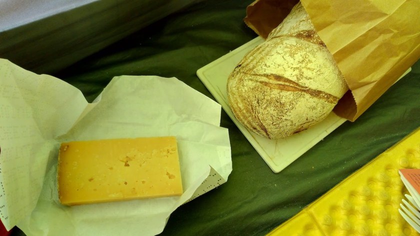
A rest day during which I occupy myself with the usual things, reading on the Kindle, play with the computer as long as battery life permitted me to do so, walked on the beach, slept and oh, I went to the Beer, Cheese and Bread shop two kilometer from my camping spot to buy a bread and a piece of cheese. I finished the shellite in my stove, so can’t cook anymore.

Day 27: 6 March 2019
From Bruny Island, Great Bay to Kettering
20,93 km (Total so far: 989,03 lm) – Altitude climbed: 341 m
Weather: Cloudy, rain, some sun
Last night there was a terrible storm. Looking at the ‘YR’ website, it stated wind force 9 in my area. I was camped just along the D’Entrecasteaux Channel and the wind just blew in from the southwest right into my tent, so it could even have been a bit stronger there.
Windforce 9 means between 75 & 88 km/hr and ‘children are blown away’ according to the Beaufort table.
Windforce 10, adults are blown down. Well, I was laying down in the tent anyway.
I was hoping that tree right behind my tent, of which half came down in a previous storm, would hold up one more time.
It rained, it hailed and sprankels came through the flysheet.
That’s where a good water column comes in handy (dreaming about a Hilleberg Unna again).
When it stopped raining for a moment I went out to fasten the pegs better again.
It calmed down overnight and I could pack a dry tent in the morning.
Squeezed out another hot drink with the last drops of fuel and went to the ferry terminal. Half way a good downpour of course.

This time I got the large ferry to go back to Kettering.
I contacted a Warm Shower host to spend the night. I enjoyed a warm welcome, that shower and even a great diner with Stan and his wife.
Tomorrow, back to the big town, and hopefully a bit further.
Bruny Island was a fantastic experience. I stayed six days and cycled more than 200 kilometer on the island.

Clean crisp manicured towns and (so it seems even) nature. Looks very beautiful at times. Nice to see the photos of you Koen. I had not much idea about Australia in general… Not many people around, isn’t it?
LikeLiked by 1 person
More than enough people for my liking Cindy 😉
It’s of course a very small corner of Australia (Tasmania) you’re seeing here.
The ‘typical’ desert landscapes will surely come.
LikeLike