Route: Renmark – Morgan – Swan Reach – Angaston – Kapunda – Burra – Laura
In this report will appear the first part of my experiences on the Mawson Trail, but first the description off getting there from Renmark.
Day 71 & 72: 19 & 20 April 2019
Renmark Rest days
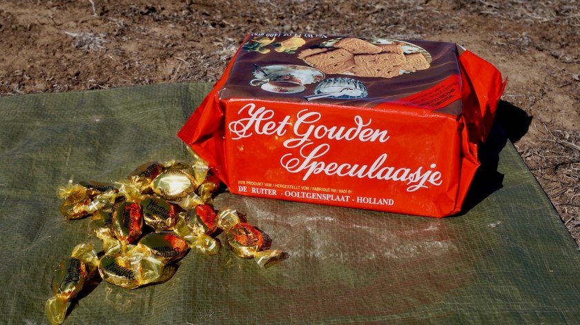
I enjoyed two very pleasant days of at Renmark where I cleaned the bike, changed the chain and my clothes got a good machine wash.
It may seem my active life consists solely of cycling and the occasional hiking, but here in Renmark I picked up a whole new sport. Ian took me to the local golf Club and introduced me to the sport. We played a couple of holes.
I guess I had a good start on my first hole, which should be done in five kicks (I am sure you’re not supposed to say ‘kicks’, but I don’t know the correct term), and I did it in ten.
The second hole, I only was four above par. But then I got worse and worse.
It being Good Friday, luckily hardly anybody was around to judge my performance (except some kangaroos).

After transferring my pictures from the memory card to the laptop, I saw there was again some dust on the sensor. I bought the equipment when I was in Belgium to clean it myself, but never had actually done it before, but is worked perfectly.
When I check online, it seems the Birdsville Track, which I have planned to ride in a month or so, is closed for the moment, due to the flood waters arriving through Coopers Creek from Queensland. Hopefully it will be solved by the time I’m there.
Day 73: 21 April 2019
From Renmark to Overland Corner
52,73 km (Total so far: 3142,12 km) – Altitude climbed: 191 m
Weather: Cloudy, light head, side & tail wind
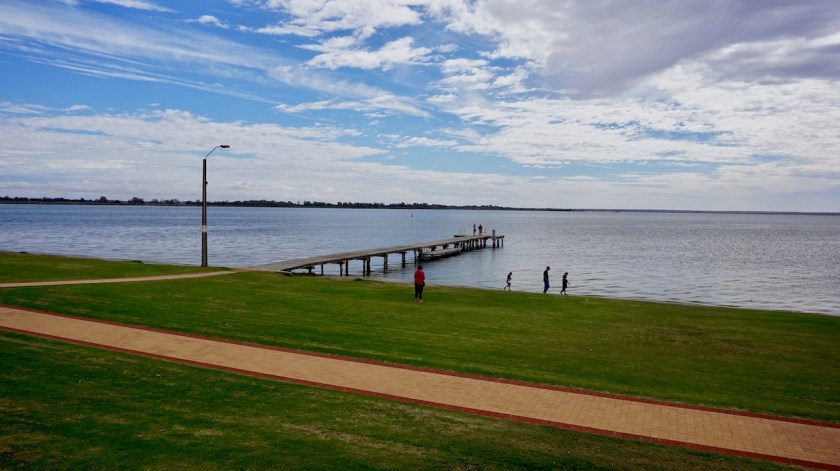
 After being well fed during my stay with Ian and Keryn, Keryn also prepared a nice lunchbox for me on my day of departure which I ate at Lake Bonney. This may be a nice place to pitch a tent most of the year, but not on Easter Sunday. The place was packed.
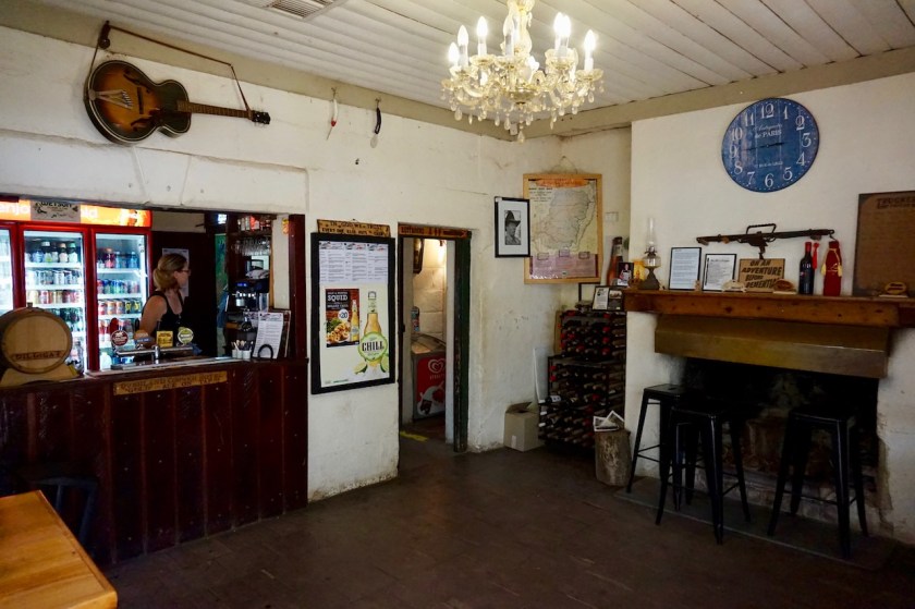
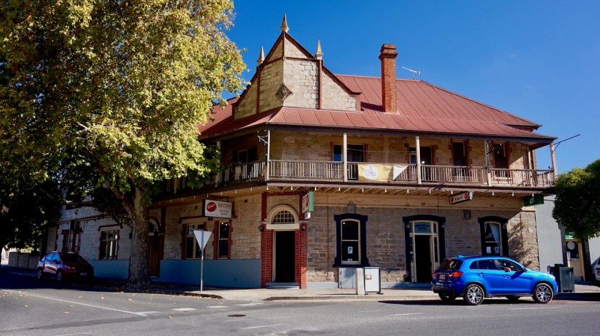
I rode on towards the Overland Corner Hotel, a place from the late 19th century where I had a coke. Pitched the tent a bit further on in the forest.
Which is my new tent. I was seriously in doubt whether to buy a new Hilleberg, or this Marmot Tungsten 2P.

The Hilleberg is top of course, but a full mesh inner is a separate extra again and I am afraid after a year in the Australian deserts, any tent will be ruined, so I delayed that
investment a bit.
But, this Marmot seems at first view excellent. Large, free standing mesh inner, two entrances and two vestibules, a larger and a smaller one.

Day 74: 22 April 2019
From Overland Corner to 3 km passed Waikerie
42,00 km (Total so far: 3184,12 km) – Altitude climbed: 127 m
Weather: Sunny, moderate & strong head and side wind
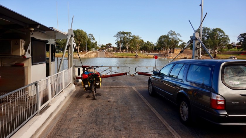
I was happy to be of the Goyder Highway which was way too busy (people traveling home after their holidays ?) Via Devlins pound Road, I arrived back at the Murray River and took the ferry to the other side, Waikerie. Camped a bit out of town between the Murray and Hart Lagoon.
Day 75: 23 April 2019
From passed Waikerie to Morgan
49,24 km (Total so far: 3233,36 km) – Altitude climbed: 311 m
Weather: Sunny, Moderate and strong head and side winds
Undulating, asphalt, head winds.
Another ferry across the Murray River into Morgan which lies at a 90 degree bend in the river. From now it starts flowing south i.o. west.
I discovered I had forgotten my adapter plug when I recharged my phone a bit in the tourist information in Waikerie while I went to the supermarket. thanks to some wonderful help from some staff of the Mid-Murray council, who knew people who would travel tonight from Waikerie to Morgan, I did not have to ride back myself.
So, a short day which I used to look around the beautiful little town, their railway history and the conservation park at the other side of the river, with some nice beaches.


Day 76: 24 April 2019
From Morgan to Swan Reach Conservation Park
82,26 km (Total so far: 3315,62 km) – Altitude climbed: 341 m
Weather: Sunny, moderate and strong head winds
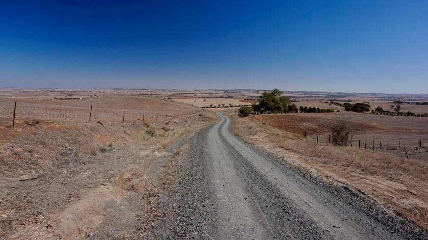
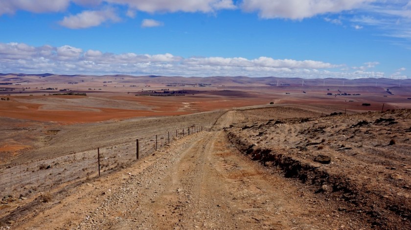
There are two options to travel downstream from Morgan, a paved option along the left bank or a dirt option on the right bank.
I chose the first, as there will be enough sand coming up the next weeks. The river floats here at 10 meter asl, I ride atop the cliffs at 50 meter asl. Some spectacular views of the river along the way and very light traffic make this a beautiful ride (despite the hard head winds).

Near Blanchetown, I have to ride 2,5 km on the busy Sturt Highway, before taking the road to Swan Reach.
In Swan Reach I take another ferry across the river. There is a free camping area but it is too busy with caravans, so I say farewell for good to the Murray and push on a bit towards the Swan Reach Conservation Park, ten kilometer or so further on where I can camp happily on my lonesome in the nature.

Day 77: 25 April 2019
From Swan Reach Conservation Park to Mengler Hill
66,65 km (Total so far: 3382,27 km) – Altitude climbed: 857 m
Weather: Sunny, moderate and strong head winds
Last full day on asphalt for a while. The head wind remains a constant of the last weeks where I was traveling mainly west or south.
As from tomorrow, my wheels turn north. Curious whether I will finally have some tail winds.
I ride through Sedan, which is named after the French Sedan. The local Iga shop is closed in the morning as today is Anzac day.
Sedan is the start (or finish) of the ‘Murray plains Cycle Trek’. I don’t ride it, as it goes in the opposite direction I want to go.
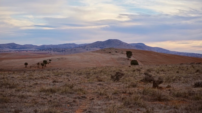
Since yesterday, I have been looking in the far distance towards the Mount Lofty Ranges and now is the time to cross them.
In Sedan, one is already at about hundred meter asl, the top of the ranges is at 450 meter, so nothing too dramatic.
Climbing goes at a steady 7%.
Brilliant views back to the Murray plains.

Angaston is a neat touristic place, with a well stocked Foodland Supermarket.
Back in Morgan, I spoke to an alder guy riding a 1936 Chrysler. He said “you will probably forget it by the time you are there, but when we are in Angaston, we always take people to the Menglers Hill Lookout from where you have a view over the whole Barossa Valley”.
I am not somebody who forgets tips like that, so instead of taking the Barossa Trail directly towards Nuriootpa, I found myself climbing the Barossa Rango to a maximum altitude of 500 meter, and then coasting down to the viewpoint.
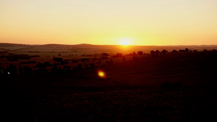
It seems many people had the same idea and I suspect it’s a popular sunset watching point.
I rode back up the hill to pitch the tent in some bushes, as down in the valley, it seems all vineyards.


Day 78: 26 April 2019
From Mengler Hill to The Pines Recreation Reserve
50,22 km (Total so far: 3432,49 km) – Altitude climbed: 422 m
Weather: Cloudy, sunny, moderate tail wind
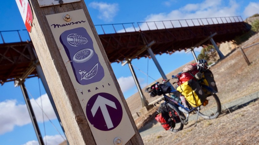
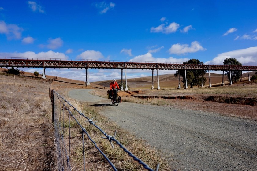
Some rain in the morning and not having written anything down since leaving Renmark, I catch up with that in the morning before rolling back down to Menglers Lookout (no-one around this time) and further down into Tanunda where I pick up the Mawson Trail.
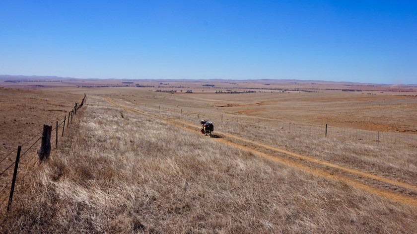
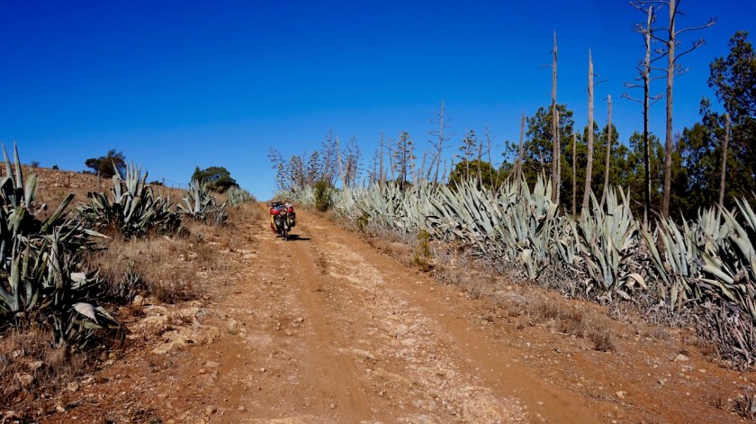
The Mawson Trail is an off-road track, starting just outside Adelaide and goes north towards Blinman, crossing the wine regions of the Barossa and the Clare Valley, then visiting the Flinders Ranges.
Tanunda was a busy affair on this day with a small market in front of the tourist information where you could buy second hand stuff that you would throw away if it was in your own attic.

Via a bike path along the busy Barossa Valley Road, I ride into Nuriootpa, just a few kilometer further on. Not the same charm as Tanunda.
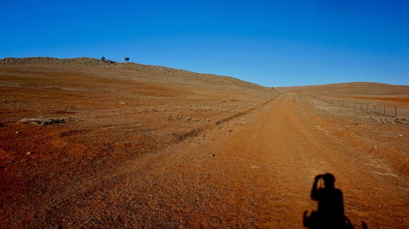
After crossing the Sturt Highway (again) the off-road fun begins. Good, solid dirt roads bring me from hill to hill, never steep.


Kapunda, Australia’s oldest mining town has a huge Catholic Churge.
I pitch the tent in The Pines Recreation Reserve, outside Kapunda.
Temperatures today did not climb over 17 degrees. And quite a bit of rain is predicted as from next Tuesday, which is bad news as it would make many of the tracks unrideable.
Hopefully the forecast will change as I head further north i the coming days.
First impressions of the Mawson: Splendid.


Day 79: 27 April 2019
From The Pines Recreation Reserve to 7 km passed Riverton
51,65 km (Total so far: 3484,14 km) – Altitude climbed: 493 m
Weather: Sunny, moderate tail wind
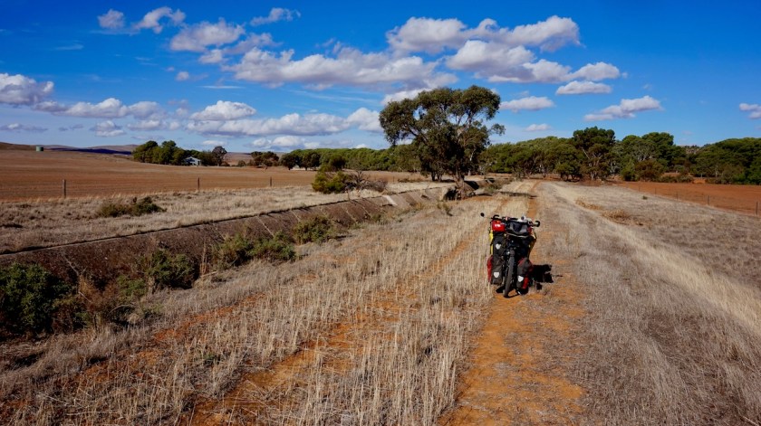
Via really nice and very rideable dirt roads, I worked my way up and over the North Mount Lofty Ranges and back down into Riverton. On my first day after Renmark, I picked up a thick tube, I think from a motorbike, which I wanted to use as a ‘liner’ in my rear wheel to avoid more punctures. I was getting tired of that dirty thing sitting on the back of my bike (you will always see, I had no punctures since), so finally at Riverton I took the time to put in the the rear tyre, whilst charging my electrical devices from a public plug.
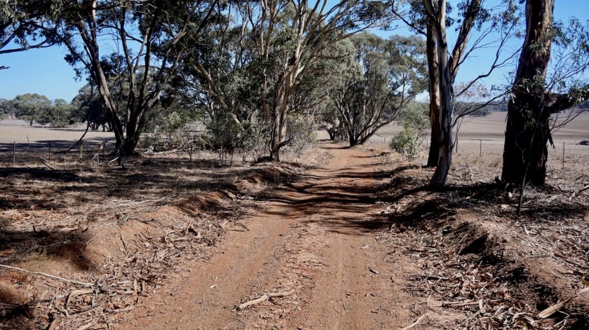
Outside of Riverton, I chose to follow the Ratler Trail i.o. of the Mawson trail to the next town, Auburn.
I found a good spot to pitch the tent next to the rail trail, in between a big tree to protect me from the wind, and a field with cows.
Having erected the tent, prepared and eaten dinner and ready to lay down on the mattress and read a bit after sunset, suddenly a big bull came my way. And was he making a show of it !
Loud moooowing and trying to impress me by throwing dust over himself with his front legs and with his head. It went on and on.
I thought he would give up after a while, but he only came closer, until he was at two meter from the tent.
I got out to chase him away, but made just little impression on him.
Like creating an extra meter, but he continued giving his show and making noises that could be heard kilometers away.
After 45 minutes I gave up. This could continue all night.
I wanted to retreat to another place I saw a kilometer back or so, but the beast just followed me on his side of the fence, continuing to make loud complains.
This wouldn’t work either.
I rode back to collect, and deflate the mattress I had left at the first place.
The bull followed me, but I could see he was getting tired a bit.
Anyways, I rode back to another possible camping spot I saw six kilometer back towards Riverton.
Not a good place, close to the busy Horrocks Road (where are all these people going to and coming from at night ? No large cities nearby).
Day 80: 28 April 2019
From 7 km passed Riverton to Camels Hump Range
47,33 km (Total so far: 3531,47 km) – Altitude climbed: 475 m
Weather: Sunny, moderate tail & side wind
The ride continues along the rail trail, back passed my friend the bull.
When I whistle, he recognizes me and instantly starts furiously throwing dust al over the place haha.
After Auburn, the rail trail is named ‘Riesling Trail’, as that is the grape the Clare Valley is most famous for. Easy cycling, climbing 1 upto 1,5% towards Clare.


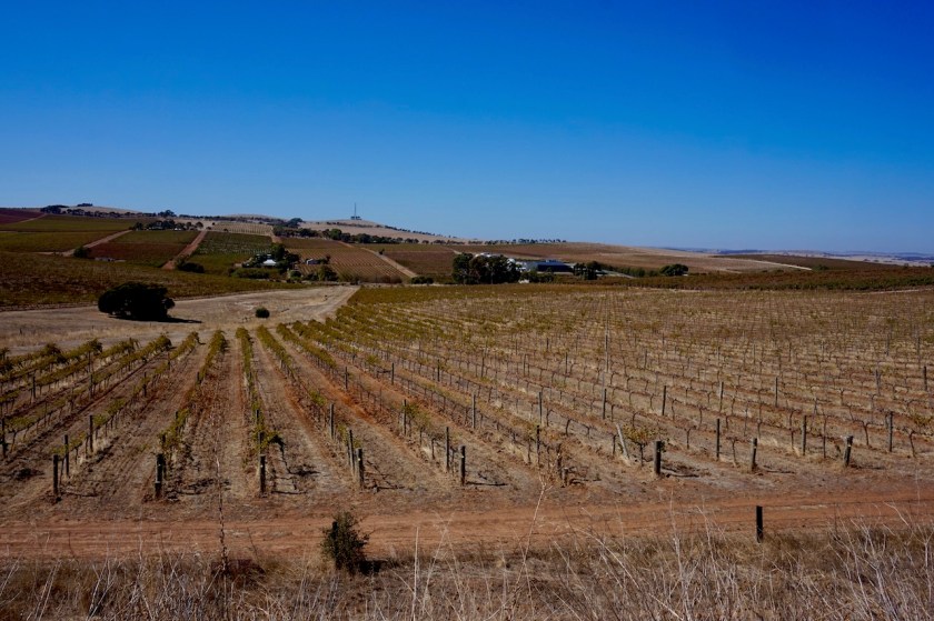

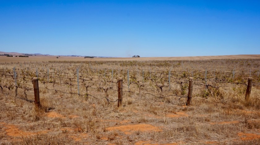
I must say, most of the vineyards, whether it was in the Barossa Valley or here, look pretty sad and dry. As does all the farmland. We’re in autumn here, so probably it’s normal all is a little brown this time of year, but I heard several stories already how it practically hasn’t rained here in two years, how farmers commit suicide because they don’t see a way out anymore.
I spoke today with a lady who is working in one of the vineyards. She said even the bores are dry in some places now.
I can only guess that is one of the reasons why I see so many farms and even vineyards on sale.
I’m not from here, so I can’t say I SEE climate change, but still, it probably is right in your face here.
I finished the two giant books I was reading of Herman Brusselmans and the Burke & Wills book and now started reading David Wallace-Wells’ book ‘The Uninhabitable Earth’, about how we turned this place in a complete mess since WWII.
And all we do is giving extra gas towards hitting the wall.
After Clare, I continue riding the rail trail for a few more kilometers before taking a right turn on the Angus Court Road.
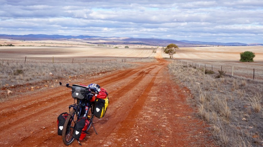
The Old Burra road, a deep red clay track, starts climbing into the hills.
how beautiful it is out here.
Solitude.
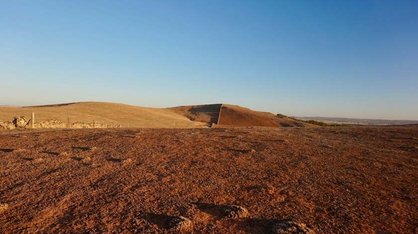
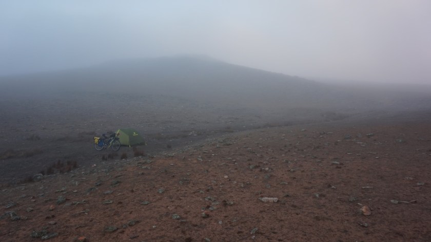
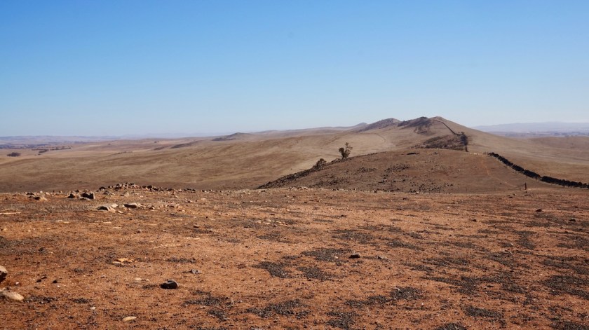
I pitch the tent just before I reach the ridge of the ‘Camels Hump Range’. One of these unforgettable places to arrive for a night.
I climb to the hill tops for superb views all round.


Day 81: 29 April 2019
From Camels Hump Range to Mokota Conservation Park
49,57 km (Total so far: 3581,04 km) – Altitude climbed: 614 m
Weather: Sunny, moderate head wind
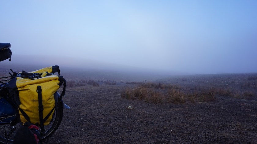
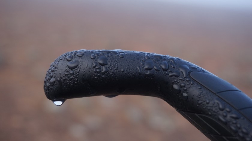
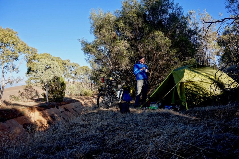
I woke up to a very misty morning. The bike, the tent, all was soaking wet.
Good, the perfect excuse for a slow, late start. As always, I take ample time for breakfast, than I hike to the top of two of the camel humps. Standing on the the top, it is quite a remarkable sights, this long line of humps going towards the horizon.


After two / three days, the Wind Gods have realized I changed direction drastically and riding north now. They do likewise with the wind. The off-road terrain is just as nice and relatively easy as the previous days, but this change in wind direction makes my progress much slower and harder.


By late afternoon I arrive in the town of Burra, once the second biggest in the South-Australia. It’s an old mining town, in which I wished to spend a few more hours, but that would mean I had to stay the night in town as well. After shopping and charging the phone a bit in the local tourist information, I push on.
A steepish climb out of town. On the map, I had seen there was the Mokota Conservation Park 22 kilometer after Burra. A bit too far this late in the day, but I hoped to find a nice camping spot before that.
Impossible.
All land is fenced off.
It’s after sunset when I finally reach the conservation park.
At least two dozens emu’s and even more kangaroos around.
I pitch the tent in the twilight.
All is good.


Day 82: 30 April 2019
From Mokota Conservation Park to Hallet
66,73 km (Total so far: 3647,77 km ) – Altitude climbed: 961 m
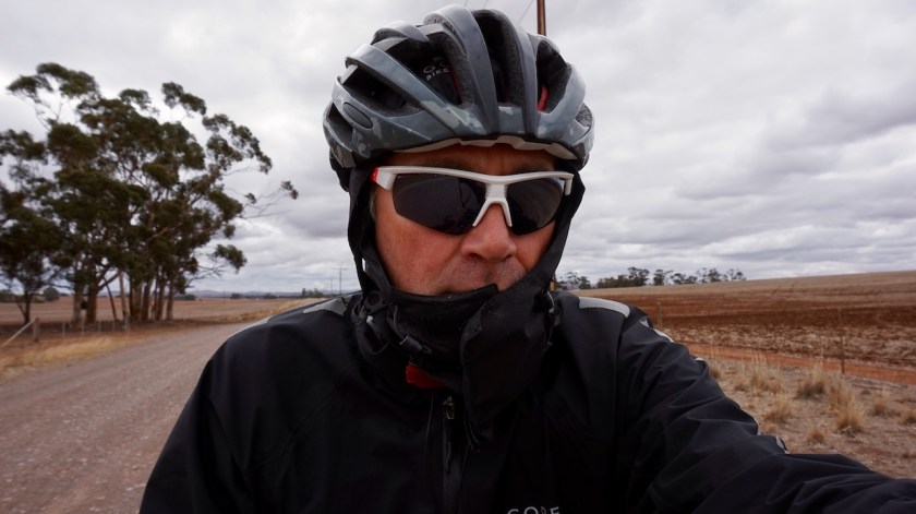
Weather: Cloudy, very strong head wind, rain in the evening and night.
The wind really picked up early morning at my unprotected camp site.
So much the inner tent blew away while I was breaking down the tent.
No need to say these strong winds were of course blowing from where I was riding to, the north.
Beautiful ride, climbing up the Sugar Loaf Range.
I was listening to some episodes of the Cycling Podcast, to have a break from that howling wind in my ears.


It was on of these days where you put on and off your jacket dozens of times. Off when you’re climbing, back on again on the descents and flats.
Since a few days, temperatures are not rising above 20 degrees anymore. More like 17°C or so. And this cold wind doesn’t make it very agreeable.
So strange people say you shouldn’t ride the Mawson trail, or along the Murray River for that matter, before May, as it is too hot.
I’d like it 10 degrees warmer during the day time.
The nights are fine, between 5 & 10°C.

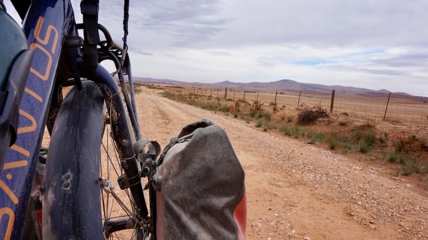
Along Dust Hole Creek, I’m almost blown back towards Adelaide.
It’s a flat track, good quality. I manage a mere 7 or 8 km/hr.
Push, push, push.
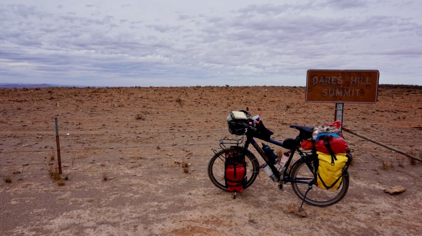
At the junction with Dares Hill Summit Road, I stop for a brief moment. I can take a left turn towards the Old Mount Byran East School, which is open for cyclists along the Mawson Trail or hikers along the Heysen Trail for the night, or I could take a right turn, following the official route via Dares Hill Summit and a big loop taking an extra fifteen kilometer towards Hallett.

It is passed 3 pm. The sun will set in less than three hours. I am still 37 kilometer from Hallett via that official route and with these winds, my odo-meter shows an average speed of 9,81 km/hr for the day. That’s when I’m moving.
You lose more time making pictures, or having a bite.
But, do I wish this Mawson Trail to be shorter ?
No, I love it. I’d like it longer even, so I follow the official route and will see where the ship arrives today.
After a few hundred meter, a hiker comes from a side track. He’s carrying a heavy load and hiking the Heysen Trail. I had seen footsteps already in places where both routes intersect, so am happy to see the face behind them. It’s an older guy, American origin but living in Queensland now. He looks quite battered. He is asking for directions, not sure which way to go.
The bush flies are swarming him.
This is definitely harder then riding the Mawson.
I point him towards the old school house. Just 3,5 km to go, I tell him.
From Dares Summit, I have beautiful view towards the low lands to the east.
Five kilometer after the summit, the route turns almost complete the opposite direction and, for a short while with the wind in my back, I make good progress.

Peppermint Gully would be a good place to pitch a tent. Some smaller trees to give you a break from the wind.
But, as the barometer, which was at a steady 1025 – 1031 hectopascal range the last days is plummeting down, towards 1010, and falling, I expect foul weather and ride on.
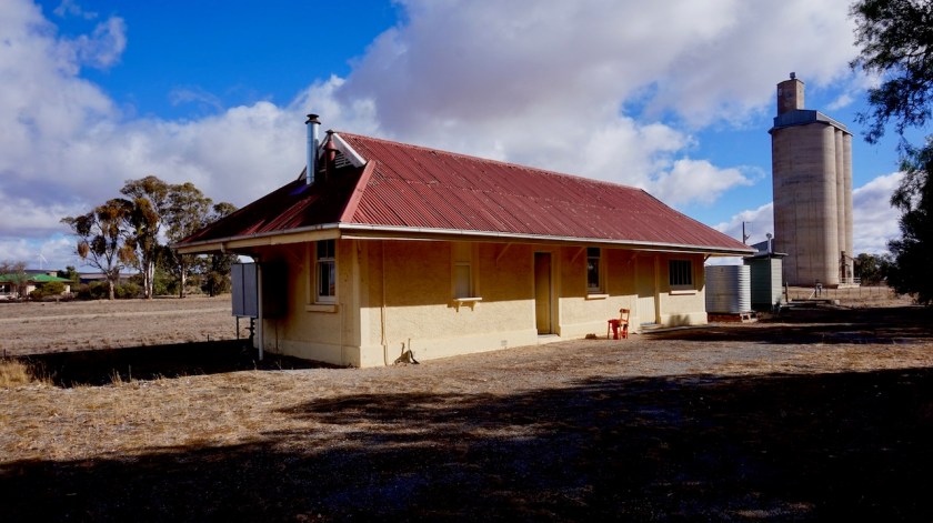
I feel I can easily make it towards the small town of Hallett, where cyclists and hikers can stay the night in the old railway station which is turned into a hut.
On my way into Hallett, after 59 kilometers today, I saw the first car. I told you this trail is a good one.
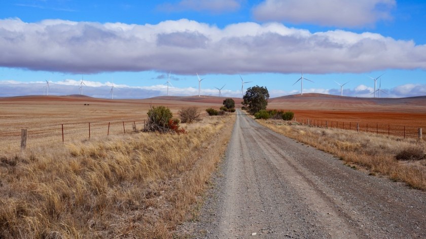
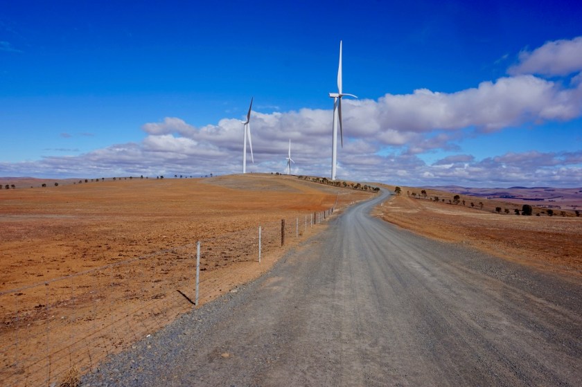
Reading the logbook with entries dating back to 2009, I see that most people, both hikers and cyclists, struggle with ferocious winds in this region. That’s probably why the hills or full with wind mills. Many are complaining about the cold nights.
That’s their own fault.
Take a decent sleeping bag and mattress. They have temperature ranges for a reason.
But most people just look at lightest weight and then have cold nights.
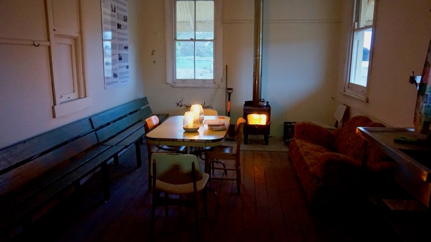
The Hallett Train Station is a wonderful place for the night. It is nicely renovated and has a new sink and a nice pot belly stove which I got going. Very comfy and warm inside.
Checking the Outback Road Warnings, it appears the Birdsville Track is still closed 😦

Day 83: 1 May 2019
Hallett: rest day
Weather: Sunny, cloudy, rain, strong winds
So, everybody keeps telling me how it has hardly rained in the last two years, how green this area normally is, but here I am, and for the second day in a row it has been raining for a couple of hours in the evening.
Wonder what that will do to the track tomorrow.
Have been cleaning the bike a bit, tightened the chain, sat in the sun, behind the strain station, out of the wind. A deserved rest day. It’s been ten days in the saddle since leaving Renmark.
And on the first of May, everybody should take a rest 😉

Day 84: 2 May 2019
From Hallett to Before Bundaleer Reservoir
60,70 km (Total so far: 3708,47 km) – Altitude climbed: 506 m
Weather: Sunny, very strong head wind
Don’t want to moan (because I enjoy this fantastic trail immensely) but it was again the wind that created the biggest difficulty today. That, combined with the trail which has become a bit spongy in parts from the rain. And one biggish climb over Brown Hill Range. But all of that would be nothing, if it weren’t for that constant hard head wind pushing you back to where you came from.

By the time I reach the highest point, we are well in the afternoon and I start to doubt whether I’ll make it beyond Spalding today.
But now the trail is downhill for most of the day, down to Hurricane Ridge (!?) and to the beginning of the Bundaleer (irrigation) Channels.
Lots of gates to be opened and closed.
There are a few possibilities to pitch your tent before Spalding, well sheltered from the wind, but I decide to go on a bit.


Spalding has a convenience store, friendly owner.
Just beyond Spalding, more possibilities to pitch your tent along the channels.
I stop for the day a bit before the Bundaleer Reservoir at a nice spot with a few trees in this otherwise barren landscape.
Again, clouds appear near sunset, very dark clouds, but only a few drops of rain.
Day 85: 3 May 2019
From before Bundaleer Reservoir to just before Bundaleer Forest
29,86 km (Total so far: 3738,33 ) – Altitude climbed: 505
Weather: Sunny, cloudy, drizzle, rain, very strong head wind
A small stretch over the Goyder Highway. Hey, isn’t that that same highway I rode on upon leaving Renmark ?
But soon enough I’m back on dirt into the North Mount Lofty Ranges.
Slowly, very slowly for the same reasons as the previous days.
At the turn-off near Washpool, I find a sheltered place behind a large tree for lunch.
Temperatures won’t go above 14°C today.
“Don’t ride the Mawson Trail before May. It’s too hot”, they tell you.
Don’t believe it.
April might be just ideal.
A steep climb into the ‘Never Never Range’.
It’s not ‘never never wind’, or ‘never never rain’, or never never ugly grey clouds’ because I get all of that.
Also not ‘never never steep’, because I even get to push some part.
But despite all that, it’s still nice. I get to see lama’s, deer and above all, a nice track.


On the southern edge of the Bundaleer Forest, a small piece of greenery in this vast, brown, barren, hilly land, is the Curnow’s Hut. When you make reservation, you could sleep there.
I had no such intentions, but I reckoned on filling up my water bottles there.
The track towards the hut is closed by a gate, locked with a padlock. Well, forget it, I’m not gonna clamber over that. Have enough water if I’m a bit careful.
That whole forest seemed to be fenced of by barb wire.
And for the next kilometers, it’s only young pine trees, neatly planted in rows.
Maybe future commercial value, but no natural value whatsoever.
And worthless terrain to camp.
It starts raining hard now and I decide to ride 2,5 kilometer back to a place I saw just before the turn-off to te Curnow’s Hut.
I sit under my groundsheet for a while, hoping to sit out the rain and pitch the tent when it’s dry again, but of course you cool off rapidly like that.
In the end, I pitch the tent in the downpour and dry it out afterwards with my kitchen towel.
Day 86: 4 May 2019
From just before Bundaleer Forest to Laura
49,29 km (Total so far: 3787,62 km) – Altitude climbed: 380 m
Weather: Cloudy, rain, cold, strong head wind
8 am.
Drizzle.
Opening the tent door just a little bit, I see nothing but dark grey skies.
Doesn’t look very appealing and I contemplate staying here for the day.
Always enough food to be found in the dark corners of my panniers. And when I put my cooking pot outside in the rain yesterday, I gathered a liter of water in just half an hour.
Dry country.
No rain in two years.
Ha !
It stops raining later in the morning and I decide to leavy the muddy camp spot.
Further on in the Bundaleer Forest are bigger trees again and more opportunities for camping.
Tha Manatoo Road is muddy and sucks the tires in like a sponge. Luckily it is downhill and I can keep the train moving.
Here, I’m leaving the North Mount Lofty Ranges behind and am slowly entering the South Flinders Ranges
I arrive in Laura between 3 & 4 pm. The local Iga closed at 2 pm.
Pitch the tent behind the sport stadium.
Part 2 off the Mawson Trail to follow soon.
