Route: Leonora – Menzies – Davyhurst – Ora Banda – Kalgoorlie – Coolgardie
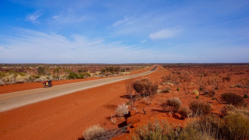
Day 177: 3 August 2019 From few km before Leonora to 12 km before Menzies 105,54 km (Total so far: 8.733,10 km) – Altitude climbed: 287 m Weather: Sunny, strong and moderate tail and side wind
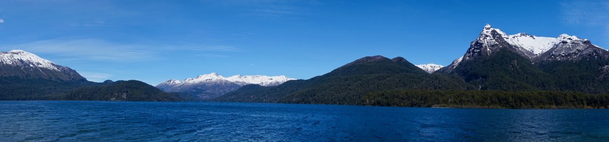
After riding back into town, I first visited Gwalia, an old mining village a few kilometer outside Leonora. The rest of the day was spend on the Goldfields Highway.
Much less busy than f.e. the Stuart Highway, but still too much to make it a pleasant ride. Too much of your time is occupied with watching the rear view mirror and negotiating traffic. Can’t let the mind wander and enjoy.
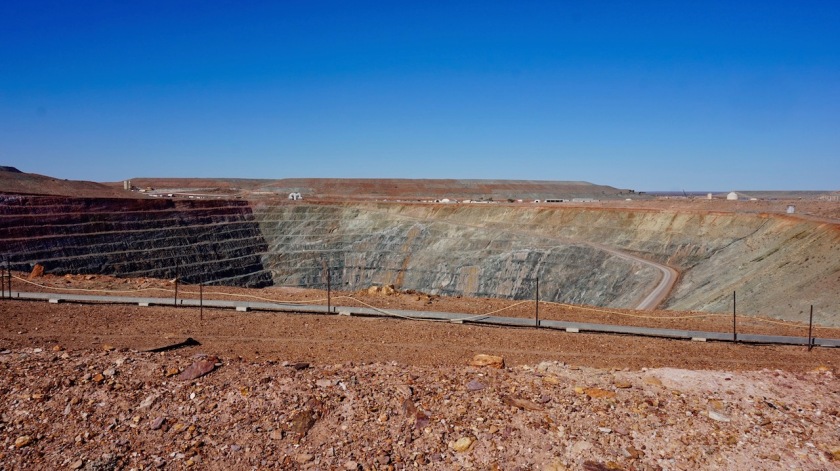
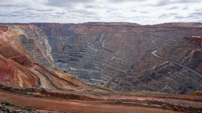
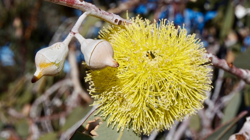
The “mini-superpit” from Gwalia
I find a nice camping spot a bit before Menzies. The spot is nice and although I’m almost 500 meter from the road, the noise of the road trains is too much to call it peaceful.
Tomorrow, back on gravel.
Day 178: 4 August 2019 From 11 km before Menzies to 10 km before Davyhurst 67,44 km (Total so far: 8.800,54 km) – Altitude climbed: 225 m Weather: Sunny, light & strong head and side winds
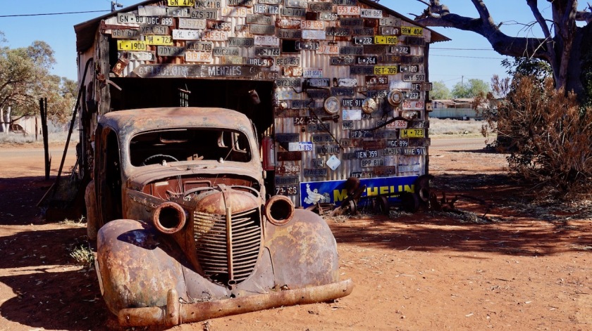
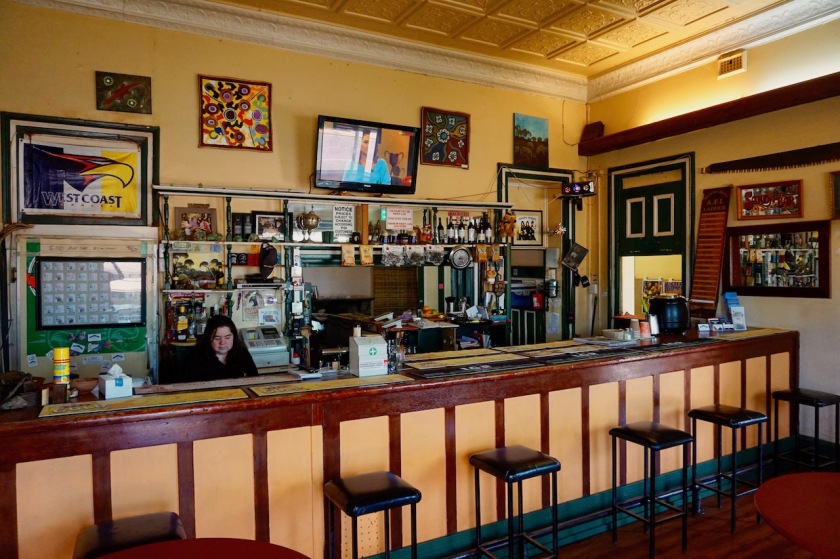
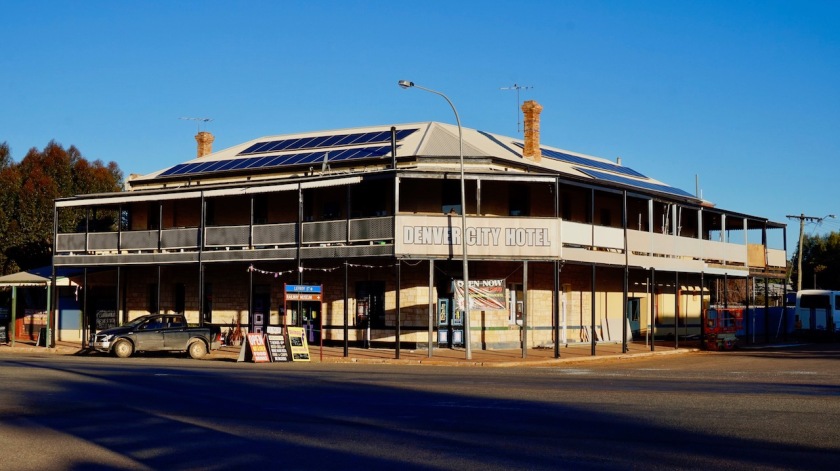
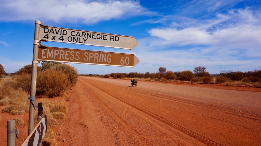
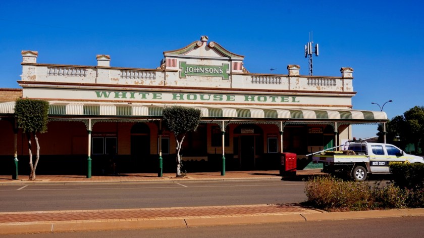
Menzies, an old mining town, is pretty neatly maintained. Lot’s of tourist signs and information about their past. A hotel, a tourist information, a campground, but no shop (the so called ‘general store’ in the hotel is nothing). I drink a coke at the hotel pub before leaving town, back on gravel. 250 kilometer / 3 days on asphalt since Laverton has been enough.
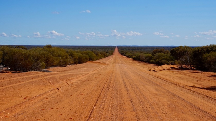
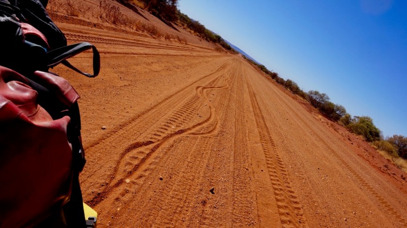
I take the Evanston-Menzies road going west out of town. A light wind from the northwest works against me. If I would have stayed on the highway, it would have been to my advantage. But this is so much better, even when the wind picks up soon after that.
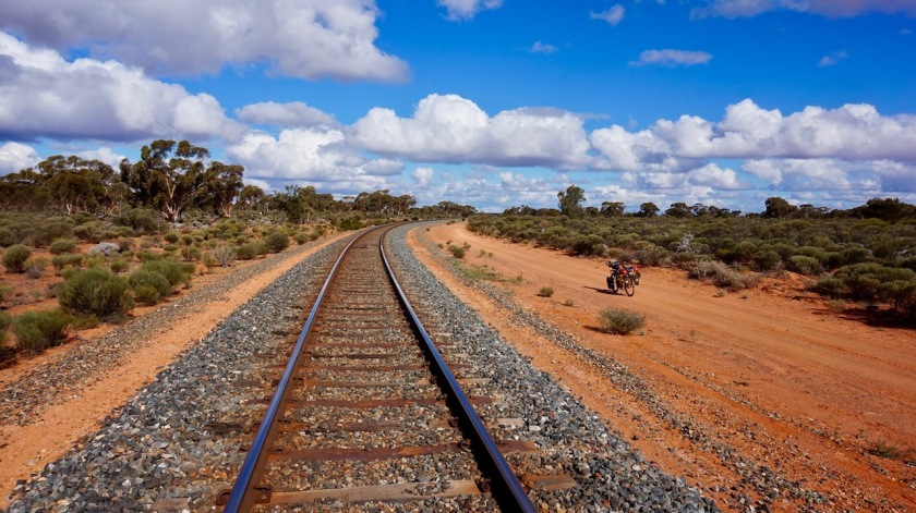
A perfect gravel road, hardly any corrugation, no loose sand.
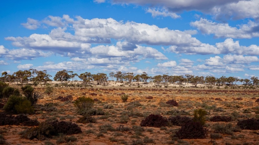
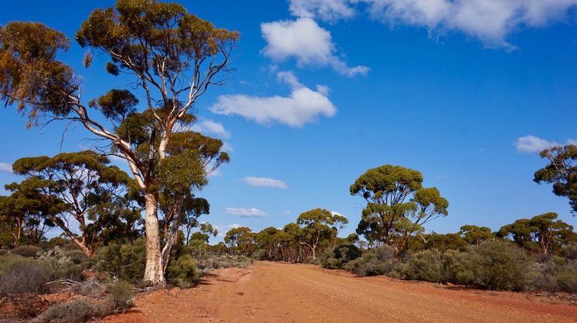
Pretty soon, I get taller trees again. Nice to see, as nothing grew much higher as the six meter mulga trees the last months.
On the 27 kilometer stretch to the junction with the Davyhurst Road, I saw two cars. On the 27 km after the junction, on the Davyhurst Road, still on excellent gravel, zero cars.
Cycling heaven, outback cycling as I had imagined it.
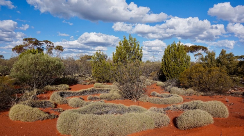
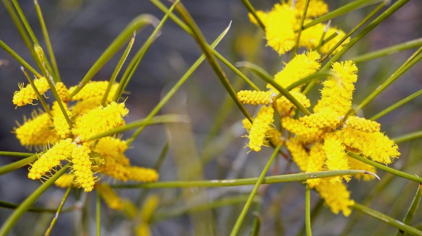
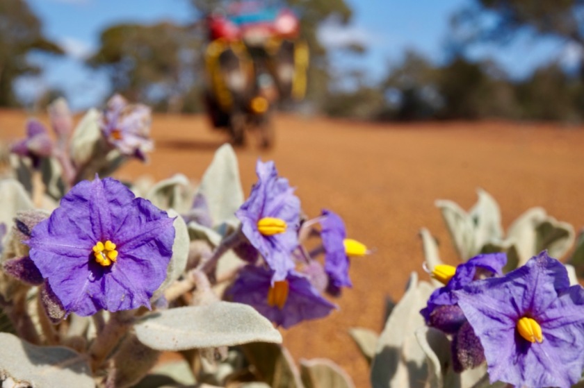
Lots of different plants and trees.
The fauna even feels a bit tropical.
Temperatures are more agreeable as in the tropics. 23 degrees in the shade, 33 degrees in the sun. 8 degrees just before sunrise.
A perfect day.
Sometimes it’s like I’m cycling in a garden, but is just nature creating this.
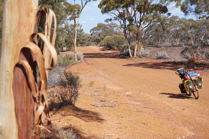
Day 179: 5 August 2019 From 10 km before Davyhurst to few km passed Ora Banda 80,20 km (Total so far: 8.880,74 km) – Altitude climbed: 321 m Weather: Sunny, moderate side and tail wind
Another brilliant day.
Well almost.
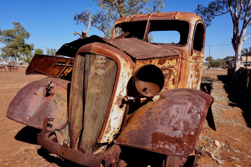
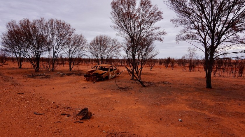
First I rode through Davyhurst. At the map and in the tourist information in Leonora and Menzies, they say it’s abandoned. Well, nothing is left. The hotel once standing there its heydays is just a pile of stones. There is apparently a mining office where you should present yourself when continuing on the road to Kalgoorlie, but I didn’t.
This is a national park, this is a road on the map not marked as private, so they have to leave me alone.
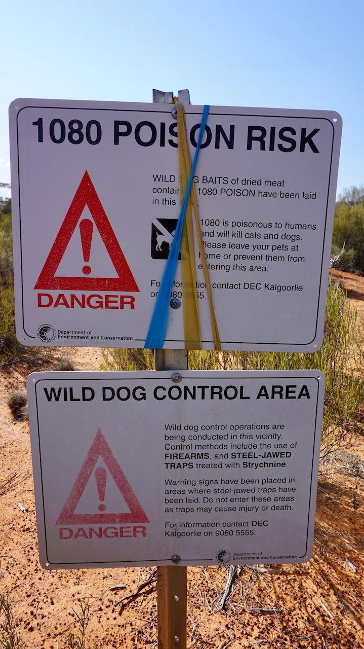
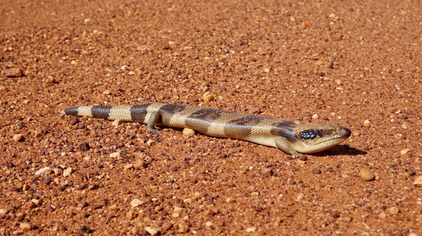
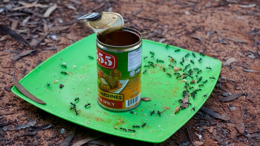
The total lack of wildlife both in Northern Territory and WA surely must have something to do with the poison they lay out everywhere in nature. Strichine and 1080 to kill (wild) dogs, foxes, … Of course other animals will eat from these carcasses and…
The rest of the day cycling towards Ora Banda, the road goes up and down a bit all the time. So much different trees again, it’s fantastic. The first 75 kilometer of the day I see one truck and two motorbike riders, that’s all.
I expected Ora Banda to be deserted as well.
The hotel next to the camp ground burned down recently.
The campground itself is a place for the miners, I think, because mining is what they do here.
A lot !
What I didn’t expect either, was a paved road from Ora Banda. I hoped to be on gravel till rejoining the Goldfields Highway at Broad Arrow.
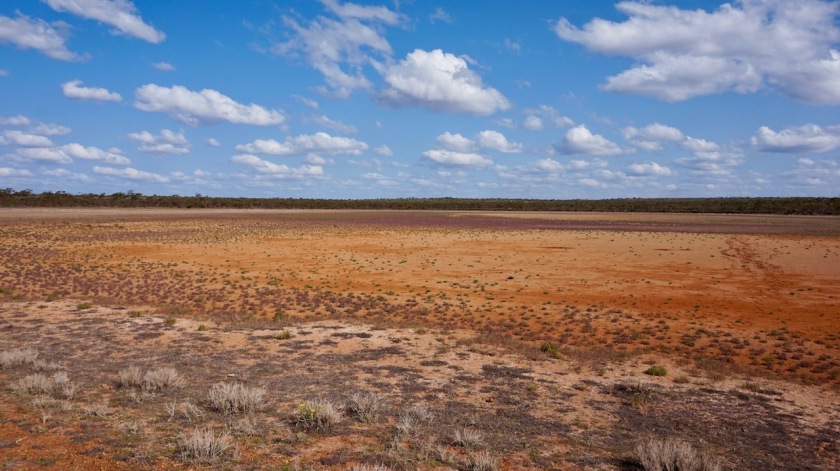
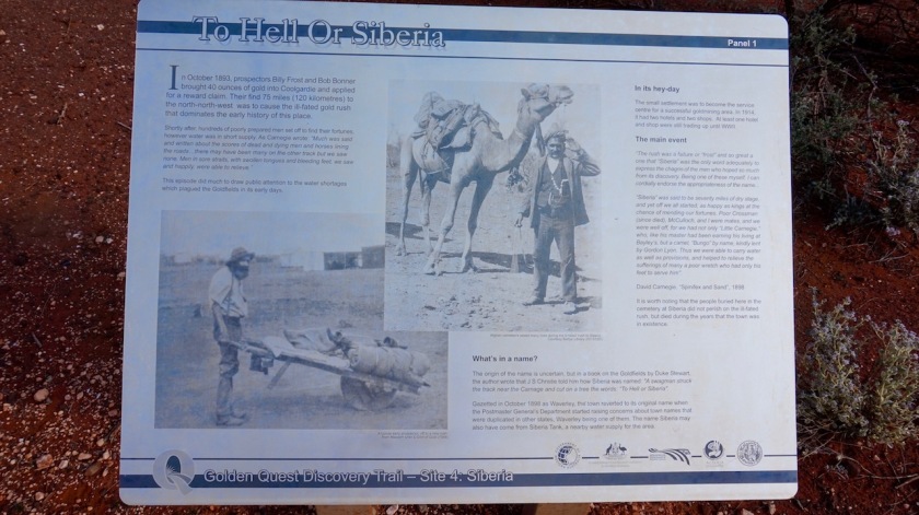
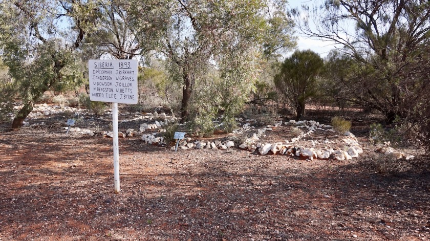
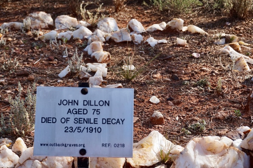
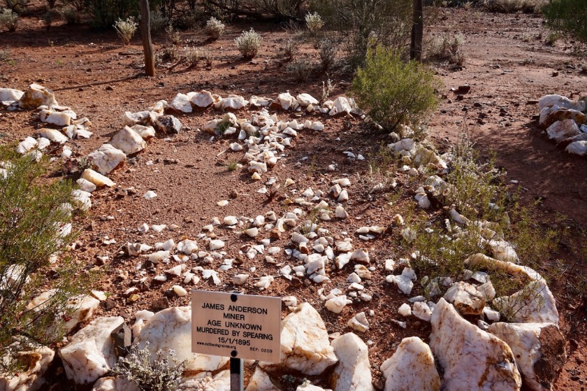
I passed through abandoned Siberia.
Thoses causes of death 🙂
I pitched the tent a few kilometer southeast of Ora Banda. The night was loud with continuous road trains passing the road a few hundred meters away.
To make this a perfect loop, I think you better continue riding the dirt directly to Coolgardie. I wanted to have a real supermarket again, because I haven’t seen one since Alice Springs, 2.500 kilometer ago. Also want to buy a new bottle of shellite for the stove. Kalgoorlie has a Bunnings. The next one would be in Albany only (although I later found out Esperance has a Bunnings store as well).
Day 180: 6 August 2019 From few km passed Ora Banda to Kalgoorlie 62,76 km (Total so far: 8.943,50 km) – Altitude climbed: 173 m Weather: Sunny, moderate tail and side wind
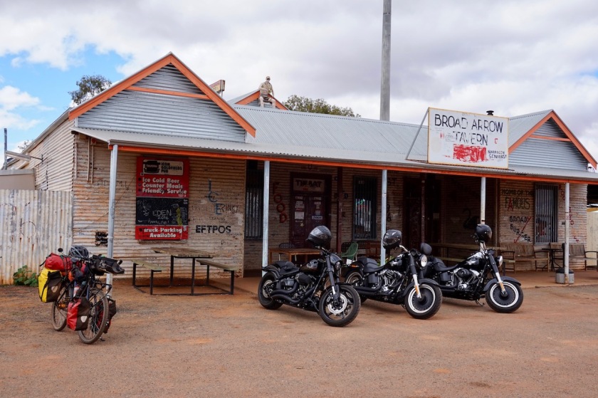
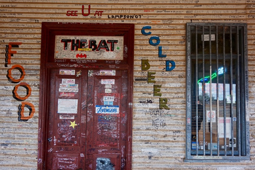
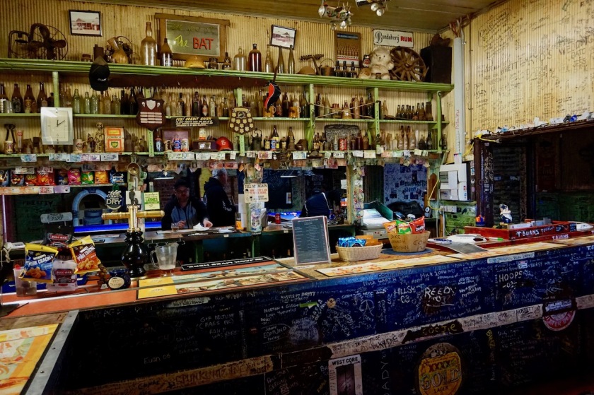
Rode the paved road towards Broad Arrow, where there’s an ancient pub. I asked the bar tender wether there’s a possibility to follow the dirt track along the railway towards Kalgoorlie (instead of the Goldfields Highway) but both he and the people in the kitchen didn’t have a clue. The pub is right beside the railway.
The pub in Broad Arrow. I parked my bike next to the Angels’ rides. The moment I also put my helmet on my mirror, like they do, I think they started to realize I was making fun of the situation.All walls inside and outside are written full.
I took my chances and tried it. First halve, there are a couple of active mines and every time I thought there would be signs that it’s forbidden to enter, but that track along the railway is open all the way down to Kalgoorlie.
Fantastic !
No worries about traffic.
Second half, the scenery improves, but the track becomes a bit more sandy and deeper gravel the last 10 km before Kalgoorlie.
Overall, very recommended.
I can stay two night with Shirley and Eddy in Kalgoorlie. Susie, a teacher I met on the GCR arranged it for me.
Day 181: 7 August 2019 Kalgoorlie Weather: Sunny
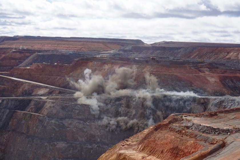
Eddy takes me out in his car to visit Bunnings and a few of the highlights. The main one of course the Super Pit.
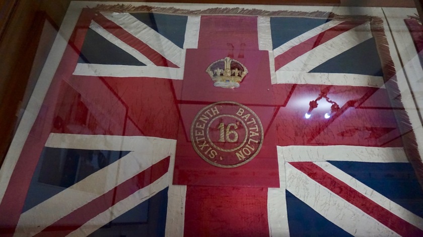
The Super-pit in Kalgoorlie / Boulder, one of the largest gold mines in Australia. It is about 600 meter deep. The largest open pit is near Slat Lake City in the Usa. Over here, they blow out about 15 million ton a year. They find a gram of gold or so in every ton they blow out. Huge environmental impact but good for someones economy.Especially for me, they made a nice explosion which later filled the whole pit with dust.
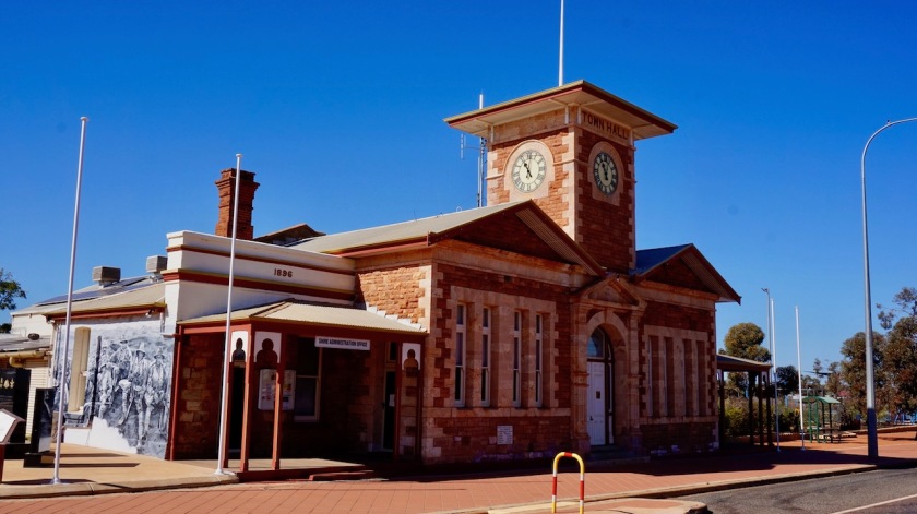
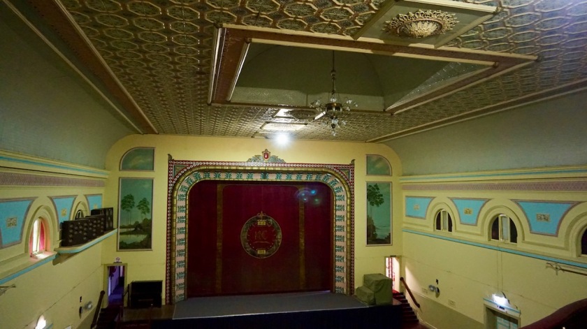
Theatre inside the town hall.
Day 182: 8 August 2019 From Kalgoorlie to the forest a few km outside Kalgoorlie 13,39 km (Total so far: 8.956,89 km) – Altitude climbed: 150 m Weather: Sunny
Shirley and Eddy left town for a couple of days. As I don’t want to go too far south too soon (it’s still winter), I chose to take a few rest days in that forest outside of town. Just load up some good food and enjoy the quietness.
Day 183-185: 9-11 August 2019 Forest, 8 km outside Kalgoorlie
Rest days
Day 186: 12 August 2019 From forest, 8 km outside Kalgoorlie to 6 km passed Coolgardie 59,97 km (Total so far: 9.016,86 km) – Altitude climbed: 347 m Weather: Sunny
Rode back into Kalgoorlie.
Lunch at MacDonalds and shopping at Coles.
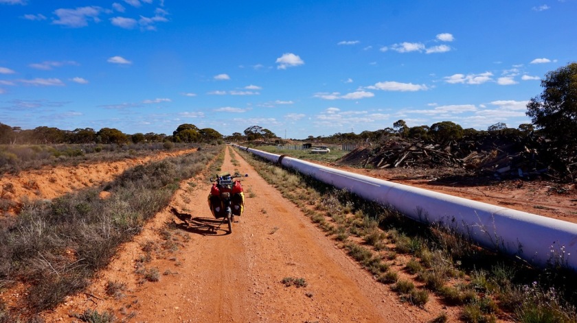
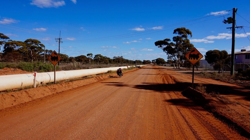
As I found a good road to ride into Kalgoorlie along the railway line, there is also a good option to avoid the highway between Kalgoorlie and Coolgardie.
Studying the map, I saw there was a (water)pipeline running between the two towns, and a maintenance track alongside it.
It is good riding almost all the time.
Most of the time, I stayed south of the pipeline. There is a track north of the pipeline as well, but less scenic.
Once the track south of the pipeline joins the main highway, it is only a few hundred meters before the pipeline goes underground for a bit and you can cross to ride along the track north of the pipeline, away from the highway.
If riding the opposite direction, towards Kalgoorlie, there’s a small hill to tackle just outside Coolgardie. Don’t be discouraged by it, the rest of the road is only slightly undulating and in much better shape.
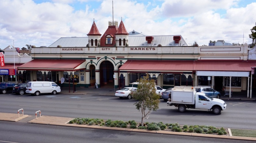
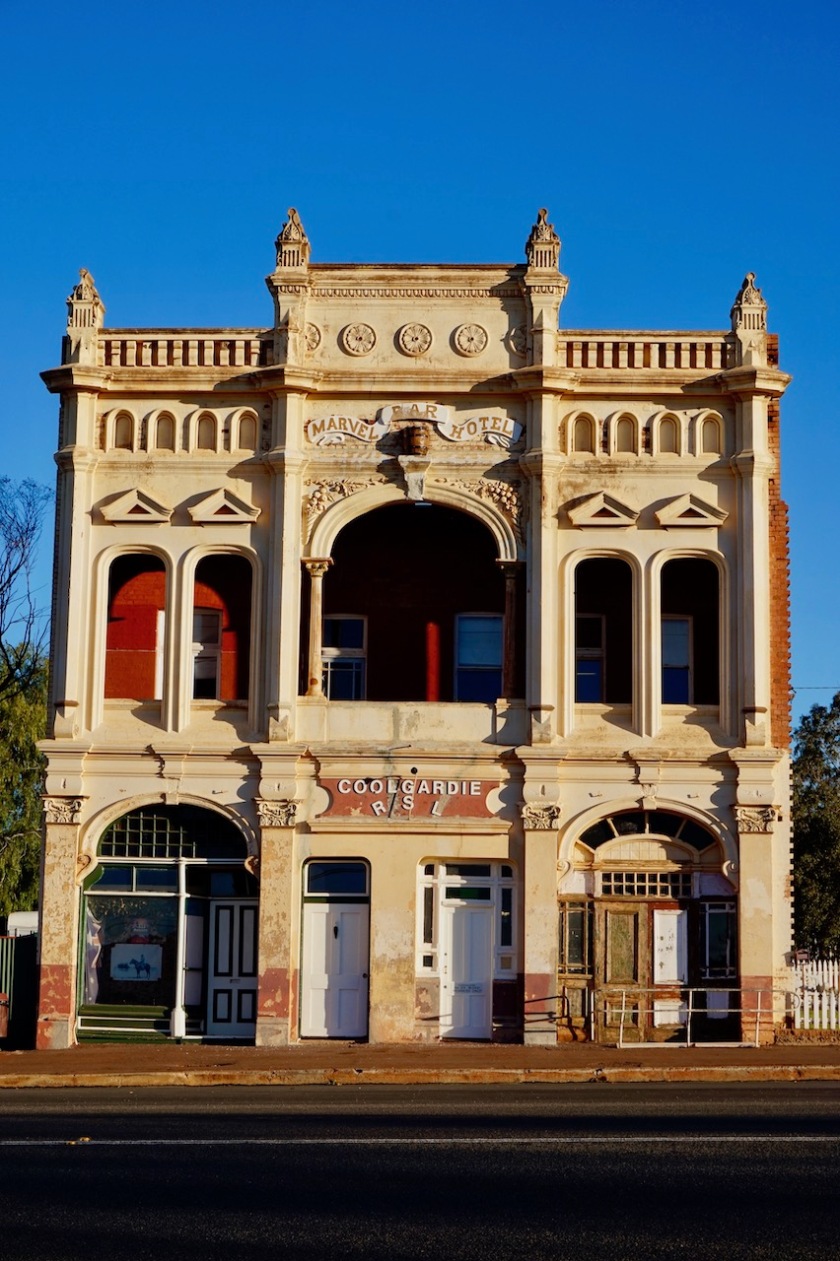
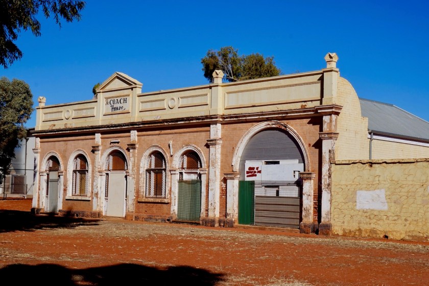
Coolgardie is a historical mining town. The highway runs through it.
Hope to visit the museum when I come back in a few days to buy provisions.
Rain is forecasted for the day after tomorrow, and I don’t want to be in the middle of the dirt track between Coolgardie and Norseman, so I will pitch the tent outside town and wait it out.
There is a campground in Coolgardie, but it is right next to the main road. That will be awfully loud.
Day 187-189: 13 – 15 August 2019 6 km passed Coolgardie
Quite a lot of rain was predicted for Wednesday 14th August. The 13th was still a nice sunny day with blue skies, and what’s more, a pretty strong wind from the north. That would be a tail wind, if I were to ride today. But I didn’t want to be caught up in the bad weather somewhere in the middle between Coolgardie and Norseman on these dirt roads, so I decided to take some more rest days.
14th of August brought indeed a lot of rain.
Around sunset, I heard a thunderstorm coming from my left and another one from my right. Of course, they met each other right above my head.
Hundreds of lightnings, immediately followed by loud thunders, strong wind gusts, rain and hail.
The whole area flooded, my tent standing in two centimeters of water.
Too much to worry about, especially those lightnings above my head, so I decided to distract myself and prepare a nice meal. Cutting broccoli, peppers, carrots, onion to prepare a delicious vegetable curry with couscous.
I heard the water flooding under my tent but I stayed perfectly dry inside.
By the time I started eating, there was some time already between the lightnings and the thunder and by the time I finished my meal the worst was over.
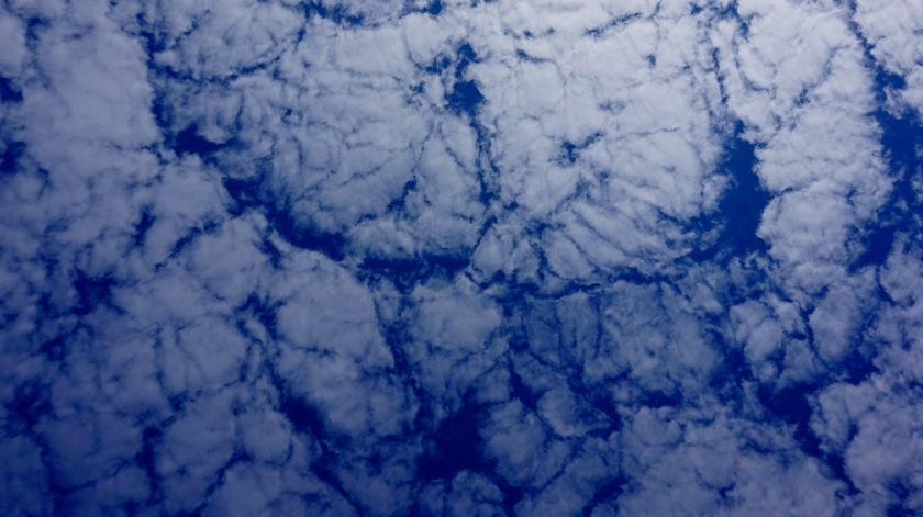
Impressive sky. Looks like lungs.Feeding the local wildlife.
Contrary to the predictions, the 15th was also a rainy day, so I stayed put another day.
Route: Great Central Road: Docker River – Warburton – Leonora
Day 160: 17 July 2019 From 25 km before Docker River to junction GCR & Tjukuria Road 57,44 km (Total so far: 7600,24 km) – Altitude climbed: 88 m Weather: Sunny, moderate tail wind
Started of today with a section of 3,5 km which was pretty good before getting stuck in the sand again. More bike pushing.
The road is paved a few kilometer before and after Docker River.
I rode into the aboriginal community of which I was warned it was a rough place. “Rough” meaning potentially dangerous, as it was brought.
I didn’t think it was rough at all.
But it is a sad, depressing place where I wouldn’t want to live.
Poverty and a lot of rubbish and garbage everywhere, as in most aboriginal places I’ve seen so far, despite plenty of garbage bins provided.
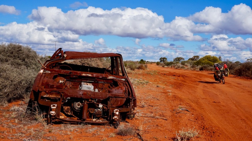
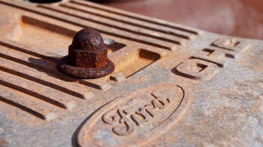
Apart from the small garbage, also the smashed-up, often burned-out car wrecks are everywhere. It is not allowed to make pictures in the Aboriginal Communities.
All people will tell you “The Great Central Road (GCR) will get better from the border with Western-Australia”. It is something they hear, and what is just being repeated.
It does not get better.
The first 27 km I have done now on Australia’s biggest state, Western-Australia, are aweful.
By the way, as I wrote in my first post about Australia, it is the worlds sixth biggest country. If Western Australia would be a country in itself, it would still be among the ten biggest countries on earth.
Leaving the Northern Territory and entering Western-Australia.
Day 161: 18 July 2019 From junction GCR & Tjukuria Road to 25 km before Warakurna 55,43 km (Total so far: 7655,67 km) – Altitude climbed: 134 m Weather: Sunny, moderate tail, side and head wind
Started the day with pushing the bike through several kilometer of deep, corrugated sand. After 33 km, a better section follows, but not for too long. During the better section, I ride through an area with the Australian pine trees. Very picturesque. The needles these trees drop prevent the spinifex from growing and would be nice places to pitch the tent.
More car wrecks along the road, all upside down and burned out.
Maybe it’s a traditional thing ?
I stop early. Could have pushed on till sunset and reach Warakurna, but I was tired, had enough water for an extra night out and this way I can make another short day tomorrow and have time to do laundry at the roadhouse in Warakurna and camp there.
Average speed today: 9,88 km/hr.
And even more telling; maximum speed I had today: 17,15 km/hr.
Yes, it’s a hard road, the Great Central Road.
Oh, and as I entered Western-Australia, the clock is turned back 1,5 hour.
So I am now only 6 hrs away from C.E.T. (Central European Time) at home. When I started in Tasmania, the difference was 11 hrs (opposite winter/summer times also made 2 hr difference by now).
I didn’t turn my clock back 1,5 hour. That would mean I wake up at 6:30 am and be on the road at 8:30 am.
Way too early. That WA time might be convenient for Perth, but that’s a few thousand kilometer away. For the time being, I remain on the same time as the Northern Territory.
All this messing with clocks is good for nothing. From now on, I will live on M.C.T.: Most Convenient Time.
With M.C.T., the sun will rise around 7:30 am.
In Warburton, a few hundred kilometer further west, I will turn back the clock 30 minutes, and then I will review again in Leonora whether I change it another 30 or 60 minutes as I head further west and as spring days get longer.
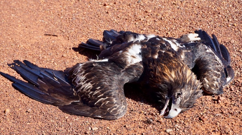
Not too much wildlife around here, but still roadkill.
Day 162: 19 July 2019 From 25 km before Warakurna to Warakurna 22,67 km (Total so far: 7.678,34 km) – Altitude climbed: 63 m Weather: Sunny, moderate head wind
Another hard remaining 25 kilometer into Warakurna with a few short push-a-bike sections. The rest was deep gravel or sand, hard to make progress.
I will stay the night at the camp grounds behind Warakurna Roadhouse.
Clean facilities and a washing machine.
But the night is as expected to be bad, with cars driving around till midnight (must be from the community a bit further down the road), humming generators and dogs and dingo’s and smashing doors,…
But, me and the clothes are clean and the devices are recharged.
Warakaurna Roadhouse. Look at the cages around the fuel pumps.
Day 163: 20 July 2019 From Warakurna to 70 km passed Warakurna 71,34 km (Total so far: 7.750,00 km) – Altitude climbed: 190 m Weather: Sunny, cloudy, very strong head wind
Leaving Warakurna, it is 230 kilometer to Warburton, the next settlement along the GCR.
Riding the 1,6 km from the Roadhouse back to the actual road, I saw the grader must have passed.
For 3,5 kilometer, I had a smooth, hard packed gravel road.
Sweet.
Then followed a section with deep, loose gravel.
The corrugations where graded away, but what remained was unrideable.
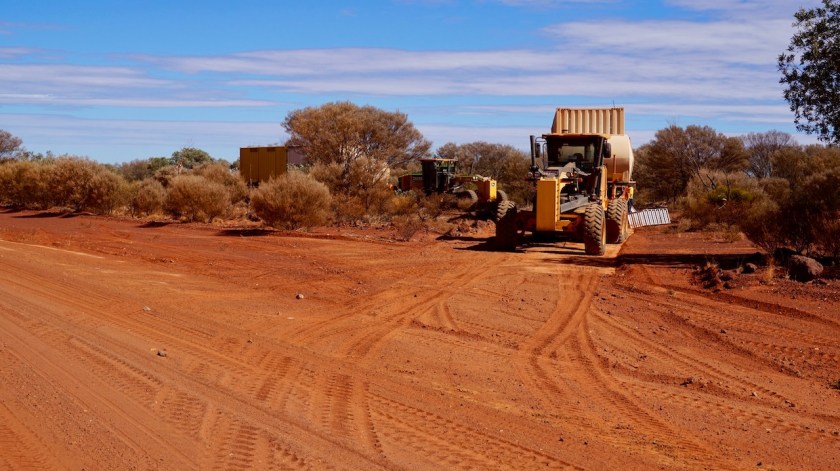
After about 20 kilometer, I passed the grader. The guy told me they are on a 4 week on, 2 week off schedule. Working 7 days a week. They are a team of two man, and have two twenty foot containers on a truck in which they live.
The graders
The track improves a lot now.
But alas, an easy day is never to be had, it seems.
Where I had nice tail winds the last days but still could hardly get my average speed above 10 km/hr due to the devastating quality of the track, now I have Patagonian style head and cross winds with some harder wind gusts from time to time almost knocking you off the bike.
It was again very, very hard going.
But I had to make 70 km in order to reach Warburton in three days.
I made that, fifteen minutes before sunset and was totally exhausted and sore everywhere. The knees, my pulses, my back. Everything hurt.
Average speed on a smooth Great Central Road: 10,1 km/hr.
I am now 50 km past the grader, so he must have been here a few days ago and the track is already getting destroyed again by the people who feel they have to race over it at 130 km/hr, so I have no illusions it will be good for much longer.
A note about wild life. In my seven weeks in the Northern Territory, I saw two kangaroos, hardly any birds or other wild life.
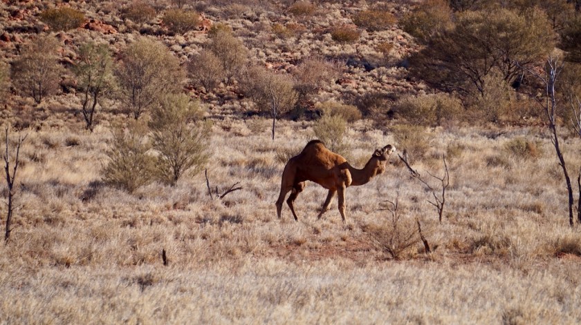
On the Mereenie loop some horses and here on the Great Central Road (GCR) a few camels.
When I read other reports like that of G.J. Coop who seemed to have been surrounded by Cockatoo’s at so many of his campsites, I have hardly none of that.
This is one gigantic dead region. No emu’s, no kangaroos, no wallaby’s, hardly any birds.
His tour was ten years ago, so I wonder whether the wildlife is dying out that rapidly….
Traffic on the GCR: at least 50 cars a day.
Today was quieter for the first time, about 25 cars.
Day 164: 21 July 2019 From 70 km passed Warakurna to abt 75 km before Warburton 84,18 km (Total so far: 7.834,18 km) – Altitude climbed: 201 m Weather: Moderate side, tail and head wind
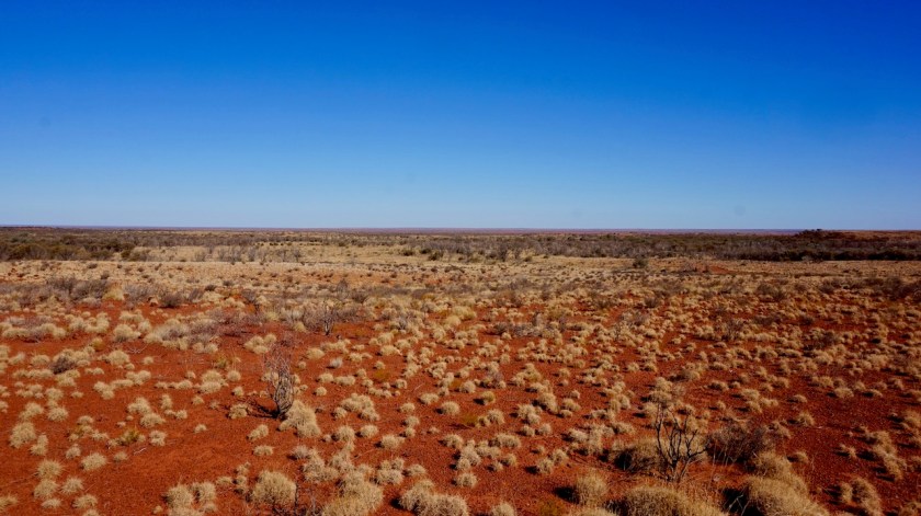
Today is our National holiday and it was the best day so far on the Great Central Road. I still had the advantage in many places of a recently graded road (although less and less, the further I ride west). The area is mostly flat. Few low inclines, but it’s rather tough going up with the winds, the sand and the weight off the bike.
This must still be the Gibson Desert. The map doesn’t show an exact line, but I guess after Warburton it will be the Great Victoria Desert.
Traffic was ok today. A bit in the morning, none for about three hours early afternoon, then quite a bit late afternoon. All in all about 25 / 30 vehicles.
Average speed for the day: a very satisfying 13,47 km/hr.
Day 165: 22 July 2019 From abt 75 km before Warburton to abt 10 km before Warburton 69,28 km (Total so far: 7.903,46 km) – Altitude climbed: 143 m Weather: Sunny, moderate head wind
State of the road today: 70% good, 30% bad.
I’m happy with that and would sign for it to be all the way like that to Laverton.
Wind was again working against me today. Saw quite a few camels.
Abt. 30 kilometer before Warburton is a bore with a windmill. Plenty of water and I took the opportunity to wash myself and the clothes of the last days.
I camped about 10 km before Warburton to stay out of the nightly sound and light show that comes with a settlement like that.
Day 166: 23 July 2019 From abt 10 km before Warburton to abt 50 km after Warburton 64,51 km (Total so far: 7967,97 km) – Altitude climbed: 255 m Weather: Sunny, moderate head and side wind
A rough ten kilometer into Warburton. The place itself is like other communities full of garbage. The general store is pretty good. Big iron gates to secure the store, just like they do at the gas station. Crime must be something here.
I heard from a local the army was brought in during the Christmas Holidays. houses tend to be broken in almost guaranteed if people are away.
So, Warburton is a good opportunity to resupply, although a bit expensive.
From here, it’s 245 kilometer to the next resupply point, Tjukayirla Roadhouse.
I had heard a lot of stories about paved sections of road after Warburton, but as ever, the stories varied immensely.
The first people to tell me about it were a couple of grey nomads at Warakurna. When I asked them how long these stretches were, after debating among each other, they agreed that it was one section of about 30 kilometer.
I asked the graders outside Warakurna about it. A section of 20 kilometer and a section of 50 kilometer, they said.
Some other grey nomads said it were only a few short sections.
The man behind the counter at Warburton Roadhouse said it was one longer section just outside town and then a few short stretches.
A couple in the general store told me “You’re gonna fly to the the next roadhouse over the asphalt”.
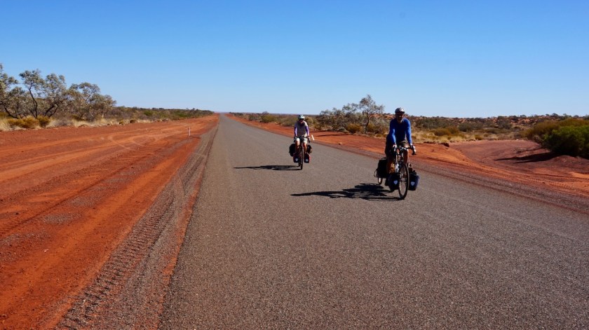
I met my first other cyclists on the GCR, a couple from Queensland. They confirmed I was on the 20 kilometer section of asphalt, and there’s a longer one at the next roadhouse.
So far, I can tell the asphalt starts about 10 kilometer outside of Warburton, and the stretch is 27 kilometer long.
Good camping tonight between the mulga trees.
The only other cyclists I met on the GCR, a couple from Queensland.Typical scenery along the GCR.
Day 167: 24 July 2019 From abt. 50 km passed Warburton to abt. 80 km bf Tjukayirla Roadhouse 123,11 km (Total so far: 8.091,08 km) – Altitude climbed: 355 m Weather: Sunny, cloudy, strong and moderate tail wind
So just like a couple of months ago, it seems I ‘ve just got to moan about never having favorable road and wind conditions and hupsakee, within 48 hrs they are delivered. Today I got what I wanted.
Left the camping spot at 10:00 hrs (MCT). The wind was blowing pretty hard from the south-west, so working against, but it turned and turned all day. From south-west to south, to east to north and ending north-west. So most of the time pretty much in the back and by the time it came from the north, it blew much less strong.
The road surface: smooth gravel for the first 65 kilometer.
Then the second asphalt section started. From what I understood that was only to come tomorrow.
It last for exactly 51 kilometer.
So it starts about 110 kilometer after Warburton, or about 85 kilometer after Tjukayirla if coming from the other side.
Never expected to ride 100 kilometers in a day on the GCR, let alone 123 !
It is my biggest distance in a day so far in Australia.
Average speed of the day: 17,40 km/hr.
Late afternoon it got very cloudy. Seemed like rain but it remained dry.
Temperatures rose to 38 degrees in the sun. Nights are getting warmer us well, around 12 degrees.
Coldest night so far on the GCR was 0 degrees, and that’s mid winter.
Still not much wild life. No camels today, kangaroos are a thing from a distant past, no cockatoos, no parrots, no birds of prey, not even those damned crows anymore.
Three swallows, that’s all I saw.
Day 168: 25 July 2019 From abt. 80 km bf Tjukayirla Roadhouse to abt. 6 km bf Tjukayirla Roadhouse 73,21 km (Total so far: 8.164,29 km) – Altitude climbed: 220 m Weather: Cloudy (few rain drops !), strong head and side wind
Amai, even though I rode 50 kilometer less than yesterday, it felt much, much harder. Excellent conditions can last for maximum one day only of course.
The track was still smoothly graded, best so far apart from the asphalt.
As so often, the problem was that strong head wind. If it is right in front of you, it doesn’t tend to turn around, like yesterdays tail wind.
Nothing to do than to push forward, slowly, and listen to some podcasts. I run out of Tour de France episodes today, and there’s no Telstra coverage in Tjukayirla. I’ll have to download the episodes of the last week in Laverton.
Spoke with the grader driver about 15 kilometer before the road house. A very friendly guy, French origin. He wondered whether those cars were slowing down for me.
Negative, I said.
They won’t for him either, but he refuses to make space for them in his grader. “20 tons of steel, not much they can do to me”.
I pitch the tent a few kilometer before the roadhouse.
Wildlife sightings today: flies.
The bottle of Jim Bean at the dashboard 🙂
Day 169: 26 July 2019 From abt. 6 km bf Tjukayirla Roadhouse to abt. 70 km after Tjukayirla Roadhouse 76,12 km (Total so far: 8.240,41 km) – Altitude climbed: 124 m Weather: Sunny, moderate head and side wind
It’s been a very windy night. Wind from the south-southwest and it increases in force early morning. I consider taking a rest day but I’m not too pleased with my camping spot to stay a full day, so pack up anyway and ride towards the roadhouse.
It’s the usual setup, a gas station, with the pumps completely locked in iron cages to prevent theft, some greasy, unhealthy breakfast, sausages and burgers on offer and a small, very expensive store. Only frozen, white, spongy factory bread.
There’s tap water so a good opportunity to do some laundry.
Also, there’s a small paved section of road, 7 kilometer, at the roadhouse.
Stocked up with Three breads, enough cheese, Nutella, pasta, some vegetables and fruit all the way to the next roadhouse, Cosmo Newberry, 220 kilometer from here.
I have 21 liter of water on board.
Royal Flyoing Doctor Emergency Service Airstrip ahead.You actually ride on the airstrip, the darker asphalt.Fantastic Road Train. 140 mt, 78 wheels on the ground, according to the driver.
The GCR is not as smooth as on the other side of Tjukayirla, much more corrugated, sandy sections, sections with big stones, but stil far, far better than anything east of Warakurna. All is rideable.
The wind has eased off considerably as well.
Twenty kilometer on the road, a friendly couple from Melbourne stops for a chat and offers me some small, frozen water bottles. They had recently done an organized bicycle trip from Geelong to Canberra and ask how the traffic behaves towards me, whether they give me some space and slow down a bit.
I tell them the truth.
They had similar experiences, even riding in a group with a support car, other traffic zipped passed them at 40 or 50 cm at high speeds. They were going for a next bike trip in Europe.
Only minutes after we said our goodbyes, a fool passed me at half a meter a full speed.
The road is 14 meter wide here.
You don’t do this by accident.
You even don’t do this by stupidity.
A monkey could do it better.
You do this on purpose, catapulting gravel on me and having me eating dust.
These brain deaths never take my invitation to stop, don’t have the guts for it I guess.
I always call upon all the known gods they will have a breakdown in the next few minutes.
Six months on the road in Australia, I must have had many hundreds of these XXXXXX, in all my cycling career surely more than ten thousand and one day, one day the gods will give me what I want and I will catch that vehicle. I can assure that no flying doctor, nor any other doctor will have to be called upon for him anymore. Or her.
I need to ride 70 kilometer a day in order to reach Cosmo Newberry in three days. In theory, every day gets easier as the bike gets lighter going through the water and food.
But there are of course other factors, like wind and road quality as well.
All looks good and it starts to feel I’m nearing the end of this little off-road adventure. Only 235 kilometer to go to Laverton and the asphalt, 355 kilometer and I’m in Leonora at the junction of the GCR and the Goldfields Highway.
Day 170: 27 July 2019 From abt. 70 km after Tjukayirla Roadhouse to abt. 75 km bf Cosmo Newberry 76,34 km (Total so far: 8.316,75 km) – Altitude climbed: 104 m Weather: Cloudy, very light head wind
Continuing my long, long way through Australias centre. After 5 pm, just as I am ready to leave the road, a car stops for a chat. They have just gone, and another car approaches. I wait a bit to leave the road, as I prefer nobody sees where I go to sleep. It’s the same driver from a pilot car for heavy transport who stopped already a couple of days ago.
He tells me how he has just returned from an organized trip to Italy to follow the Giro. It’s all very pleasant, but with all this talking the sun is almost behind the horizon and I am still standing on the road..
Luckily, almost anywhere is a good place to camp (as long as you have some wind protection), so just before it’s pitch dark the tent is erected and I can start preparing my evening meal. Still cooking in the tent. The number of flies is much, much less as a few weeks ago, but they are still around.
And it rains.
A steady rain for several hours.Doesn’t happen too often over here, I reckon.
I worry a bit what that will do to the track tomorrow. This red dust can surely be turned into sticky mud that stops all progress.
Day 171: 28 July 2019 From abt. 75 km bf Cosmo Newberry to abt. 8 km bf Cosmo Newberry 70,34 km (Total so far: 8.387,09 km) – Altitude climbed: 140 m Weather: Sunny, light head & tail wind
The rain doesn’t seem to have affected the road too much. It’s still mostly dust. The quality is again a bit worse than yesterday, some bike pushing. Although the days are still warm, and the nights are getting warmer as well, I can feel in the air I am slowly entering a different climate zone. Not that dryness anymore. Feels like spring is in the air.
Also, for the first time since long, condensation on the inside of the tent in the morning (wetter ground).
Day 172: 29 July 2019 From abt. 8 km bf Cosmo Newberry to abt. 18 km bf Laverton 84,09 km (Total so far: 8.471,18 km) – Altitude climbed: 256 m Weather: Sunny, strong tail wind
The shop in Cosmo Newberry settlement only opens at 11:00 am. I just needed water, which was available at a tap.
The first 28 kilometer, the track is still not in the a very good condition. Then, the grader is there. I give the man the thumbs up and thanks to a tail wind, I’m flying towards Laverton.
Cosmo Newberry Airport. At the left in the picture is the airport terminal building.
A bit later, the grader overtakes me and stops. The driver hands me a welcome ice cold coke.
His frist question is how the car drivers behave towards me. I tell him the truth, about how they can’t slow down when traffic comes from the opposite direction as well, how some come on purpose ridiculously close to me.
He has the same complaints. He tells me how he then asks them via vhf why on earth they can’t slow down a bit when they pass the grader. Then they answer “why ?”, or “Well, I passed you already now”.
All selfish, stupid idiots.
The other cyclists told me this stretch was still pretty bad when they were here, but I am lucky.
Could have made it to Laverton today if I wanted, but I prefer another night out in the bush.
Day 173: 30 July 2019 From abt. 18 km bf Laverton to Laverton 18,15 km (Total so far: 8.489,33 km) – Altitude climbed: 22 m Weather: Sunny, strong side wind
Rolled into Laverton. With this side wind, it would have been a good idea to continue towards Leonora. that would have become a fine tail wind, but I feel the body and the mind need a rest.
The mind probably more than the body.
Again, thanks to Libby from Outback Parks & Lodges (http://opl.net.au), I get a nice room for free.
Doctor Charles Laver, a man who rode his bicycle from Coolgardie to Laverton in 1886.
Day 174: 31 July 2019 Laverton
Rest day.
Since a few days there are a lot more flies again. Cattle stations have re-appeared.
Day 175: 1 August 2019 From Laverton to Minera Road 86,48 km (Total so far: 8.575,81 km) – Altitude climbed: 230 m Weather: Sunny, strong tail wind
As it goes on days after a rest day, I have a very late start, and the legs seem very poor the first part of the ride. Luckily, I have a strong tail wind, and it’s all asphalt now for a while.
First part of the ride is still nice, but soon the mining traffic picks up.
All land is fenced off as well, both sides of the road.
Fifty km or so after Laverton, I ride through a completely destroyed area. Open mines. There is a stinky cobalt and zinc plant polluting the air. Haven’t seen these dirty chimneys spewing out their poison in a long while.
At the junction with the road to Minera, a gravel road, I take a left turn. No fences anymore and a good place to pitch the tent for the night.
Month of July was a good cycling month with 2.009 km.
That number has to come down next months, it’s way too much.
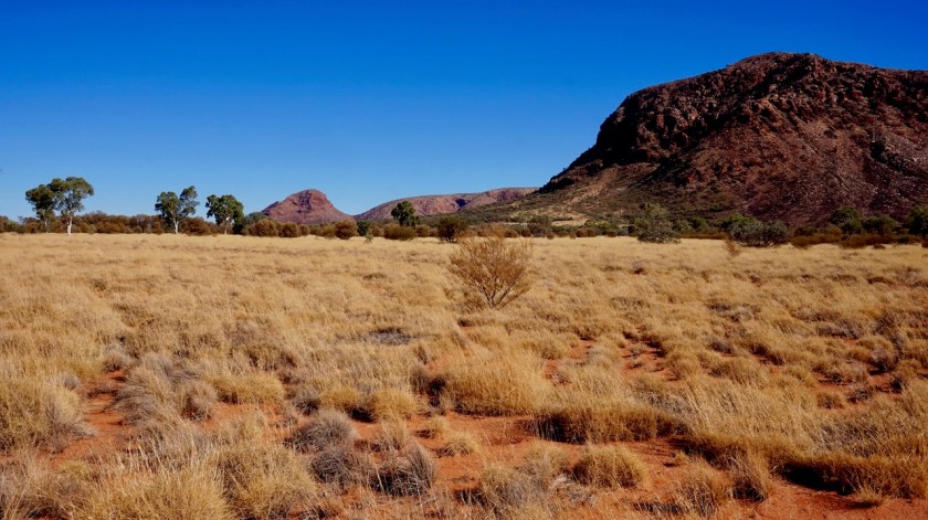
Day 176: 2 August 2019 From Minera Road to few km before Leonora 51,75 km (Total so far: 8.627,56 km) – Altitude climbed: 118 m Weather: Sunny, moderate tail & side wind
Uneventful day. There was a lookout from a hill about 15 km before Leonora with good views over the flat lands.
I rode into Leonora to do some shopping and pick up water, then rode back out of town to camp.