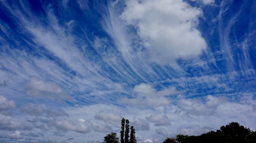
2019 was a good year with a total of 323 days of traveling during which I visited two countries. 288 days in Australia, my only ‘new’ country this year. The other 35 days were spend in Thailand.
Some data about the Australia trip:
* Total kilometers cycled in Australia: 12.441 km
* Total kilometers all trips combined : 116.190 km
* Kilometers cycled per state (chronologically):
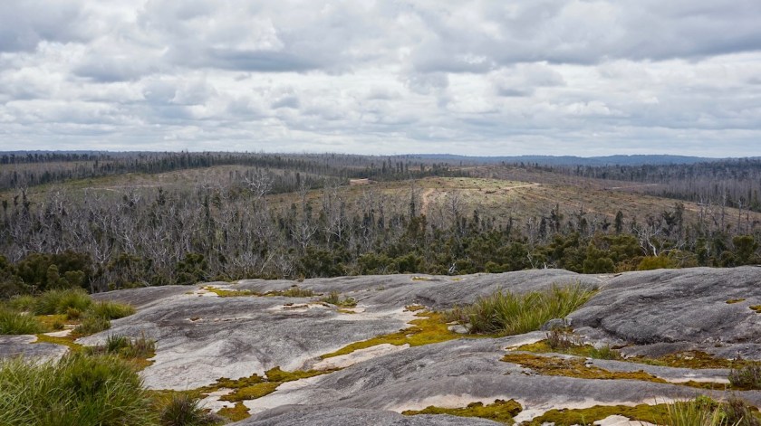
– Tasmania : 1.811 km in 47 days – Victoria : 512 km in 13 days – New South Wales : 712 km in 10 days – South Australia : 2.274 km in 44 days – Northern Territory : 2.291 km in 46 days – Western Australia : 4.841 km in 128 days
* Average kilometer per cycling day: 55,30 km
* Total meters climbed: 85.917 meter
* Shortest cycling day: 5,52 km (Gog Range – Tasmania)
* Longest cycling day : 123,11 km (towards Tjukayirla RH on the Great Central Road, WA)
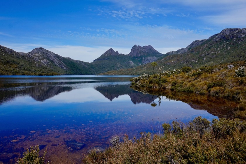
* Highest speed : 69,75 km/hr (on Cradle Mountain Development Road, Tasmania)
* Highest point : 959 m (on Cradle Mountain Development Road, Tasmania)
* Longest day in the saddle: 7 hrs 48 minutes (for 71,77 km near Warakurna, WA)
* Total time in the saddle: 931 hours
* Average time in the saddle on cycling days: 4 hrs 12 minutes
– Hosted by people : 40 nights (14,0 %) – In trail huts : 9 nights (3,1%) – In hotels : 7 nights (2,5 %) – On a boat : 2 nights (0,7 %)
* Flat tyres: 16 (after I changed to real fat and heavy Chinese tubes, it became much better).
* Number of pictures taken: 8.898
* And the info everybody seems to want:
Average cost/day: 31,88 aud (= 19,80 euro, = 21,50 usd)
This includes only my daily cost during the trip for food (probably 80% of the cost), entrance fees, camp grounds and other small purchases like sun cream, tubes, etc…).
This does NOT include any bicycle or camping gear, nor flight tickets to and from Australia or the transfer to and from Tasmania with the m/s Spirit of Tasmania.
Trip highlights:
– Cradle Mountain National Park (Tasmania) – Bruny Island, Maria Island, Freycinet National Park (Tasmania) – Cycling the dirt roads along the Murray River (Vic & NSW) – The Mawson Trail (South Australia) – The Flinders Ranges – The scenery along the Oodnadatta Track (South Australia) – The Sandover Hwy + the small back tracks towards Plenty Hwy (NT) – Harts Range & MacDonnell Ranges (NT) – The endles dirt, corrugations and scenery along the Great Central road (NT & WA) – Cape Le Grand National Park (WA) – The area around Hopetoun (WA) – Stirling Range (WA) – The Munda Biddi Trail (loved the forests) (WA) – The friendliness and openness of a lot of the people I met – The often awesome wild camping spots – Vast open spaces
What I didn’t like so much:
– The behaviour of the majority of car drivers – The flies. – Uluru National Park – Too much traffic on the Oodnadatta Track (due to water in Lake Eyre)
Tips & advice for other cyclists:
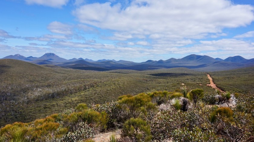
It’s Australia. What makes it special and unique in my opinion are its deserts, its empty, remote areas. Go there and explore it on the dirt roads. With a bit of common sense, you should make it. Yes, you have to look a bit after yourself, carry water and food (sometimes lots), but if disaster strikes, you are not on your own.
When I was doing my research for this trip, people said they wouldn’t even go on the Stuart hwy without a satellite tracker like Spot or Garmin InReach.
That’s ridiculous.
Unless you decide to wander off the track in a random direction, you will have somebody passing you every day. The longest I was on the Great Central Road or Oodnadatta Track without seeing a car was probably 3 or 4 hours. Only a few times I saw nobody the whole day on smaller tracks. So up to you whether you want it. I had an InReach, but in hindsight, I don’t think you really need it. People have been doing this stuff since ages, long before mobile phones and satellite trackers were around.
The Stuart Highway between Darwin and Adelaide seems to be popular with a lot of cyclists. Although I rode only a small part of it south and north of Alice Springs, I think this road is totally unsuitable for bicycle touring due to the amount of traffic, no shoulder and the attitude of the drivers. Same goes for the Lasseter Highway going to Uluru.
It’s a nightmare. Avoid it.
If I would cycle the GCR again, I would ride north of Alice via the Tanami Road, then the Kintore Road, than take the Sandy Blight Junction Road to connect to the GCR. Or, if you want to go via the MacDonnell Ranges, take the Namatjira Drive out of Alice Springs, then connect via Haast Bluff towards Kintore Road, then further as above.
I assume you’ll find provisions in Mount Liebig and in Kintore.
If you do, let me know how it was !
I rode with 26 x 2.0” tyres. Unless you choose to stay on the asphalt (which would be a shame), I think 2.0” tyre width is the minimum you need. Something in 2.25” – 2.5” range would be optimal.
There are lots and lots of corrugations. Invest in a quality bike with the very best wheels you can find, quality racks and quality bags.
And keep it simple. Your Gates belt, your fancy disc or Magura brakes or electronic shifting are recipes for headaches, possibly for disaster.
I went without suspension. Front suspension might be a good idea, but only when it is a very good fork.
A decent double wall tent and a sleeping bag with at least a comfort range of -3 °C should be sufficient for this trip, unless you go to Tasmania outside summer season.
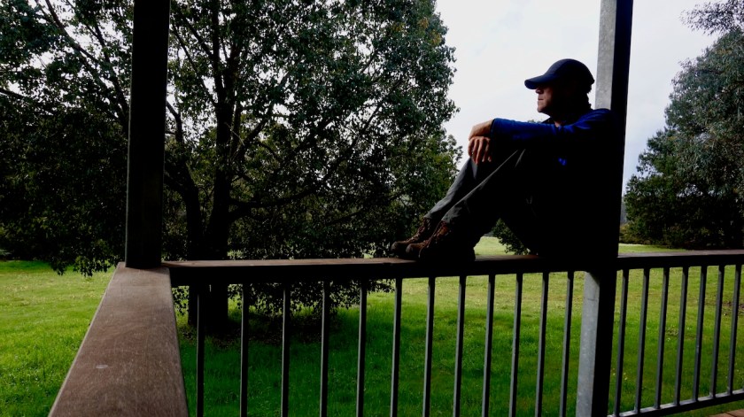
A big thank you to Hans & Claudia, Sophie, Paul, Ian & Keryn, Fred & Wendy, Beth & Denis, Nico & Mykal, Stan & Briony, Dylan, Libby, Eddy & Shirley, Susie, Diana & Rod, Febe, Geoffry, Will & Jenny, Craigh and David & Marianne. All of them accommodated or helped accommodating me and were without exception interesting and very pleasant contacts and a welcome change from the long, long road.
Stay in touch please !
Below, the map from my route on Tasmania and mainland Australia.
All routes can be downloaded from Wikiloc.
Route: Cape Leeuwin – Margaret River – Nannup – Collie – Harvey – Mandurah – Perth
Day 253: 18 October 2019
From Augusta to Boranup Forest
38,98 km (Total so far: 11.373,90 km) – Altitude climbed: 499 m
Weather: Cloudy, sunny, moderate side and head wind
I first went for a long overdue visit to the barber shop in Augusta. I was lucky, because he’s only here on Fridays and Saturdays. Then I ride to the Jewel Cave. I think the entrance fee of 22.50 Aud is a bit hefty, but ok…
It is a beautiful cave.
Inside Jewel Cave
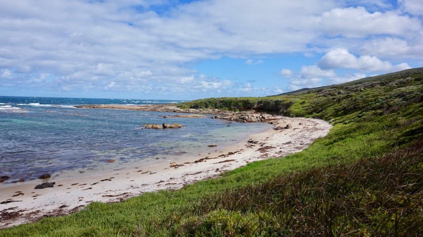
I made a small side trip to the beach at Hamelin Bay. A huge bay, long white sand beach, hardly any people. Nice.
Good I visited that cave first, by the way, as later on it seems I plotted my route exactly on the same single tracks the Cape to Cape (‘C2C’) mountainbike race which is going on today. By the time I arrived at the single tracks, the race was finished. I want to camp in the Boranup forest but it is very much overgrown just next to the single track. I do find a
nice spot just next to the trail. To be sure that race won’t come back tomorrow morning, I check their website. It is safe to camp here, they were here only today, but I find out this Cape to Cape race is not at all a race from cape to cape (Cape Leeuwin in the South to Cape Naturalist in the north of the Margaret River area. It is just four stages making small loops, but in no way do they connect the capes.
A seagull admiring my bike at Hamelin Bay.Spot the tent just next to the single track.
Day 254: 19 October 2019 From Boranup Forest to along rail trail to Cowaramup 48,87 km (Total so far: 11.422,77 km) – Altitude climbed: 390 m Weather: Sunny, moderate tail and side wind
Excellent weather today, blue skies, temperature around 27 degrees in the shade, a wind sideways from the back. The remainder of the ride through the Boranup Forest is great, mostly on single tracks. When I left Augusta, I passed a few magpies that didn’t attack me. Maybe the season is over. But today, I was attacked by a Wattlebird. He swooped me five or six times and was very aggressive.
Then the rail trail to Margaret River, the regions’ capital and more or less famous for its wines. It is Saturday and on top of the usual tourist crowds coming down from Perth in the weekend, the C2C-bikers are here as well. Most of them seem to ride around with bikes on the back of their cars i.o. actually riding their bikes.
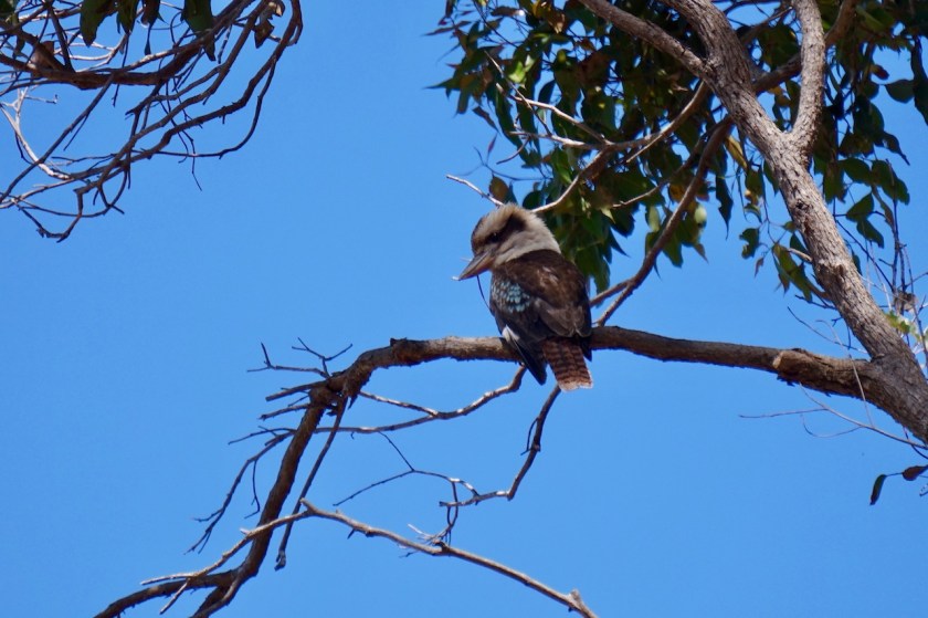
Kookaburra
I enjoy an excellent lunch on the terrace of the Korean Tedis Big Spoon restaurant. Margaret River has a Coles supermarket. Prices seem to be half of what I’ve paid most of the last months. Good, I won’t feel the restaurant visit in ‘my budget’ 🙂
Day 255: 20 October 2019 From along rail trail to Cowaramup to near junction Canebreak & Sabina West Toad 39,68 km (Total so far: 11.462,45 km) – Altitude climbed: 354 m Weather: Sunny, moderate tail wind
Another excellent, sunny day.
Maybe I have to mention I’m doing some zigzagging around the Margaret River Area, because I try to put in some extra kilometers, as my plane to leave from Perth is only on 22nd November. That’s also the reason I enjoy short riding distances. The alternative would have been an extra loop north of Perth into the weath belt, but I think relaxing in this area is nicer.
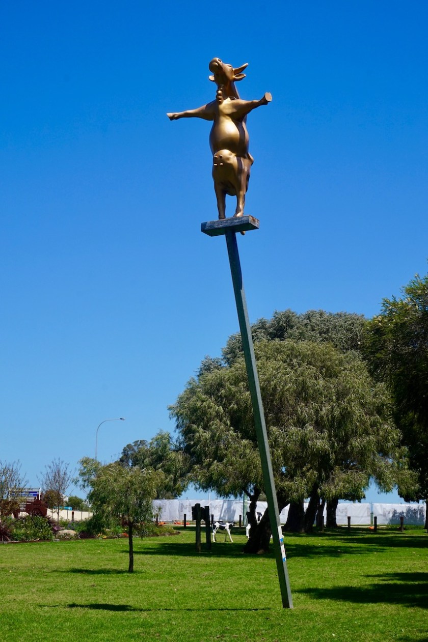
In Cowaramup, everything is about cows because the name of the town starts with ‘cow’. Not very ingenious. There are plastic cows in the park, a candy cow shop, etc, etc…
Here, I ride east, inland, away from the never ending stream of tourists going to and fro between Dunsborough, Busselton and Margaret River. Not five seconds go by without a passing car.
So I choose the small tracks inland. A magpie attacks.
“Hey, the season is over !”.
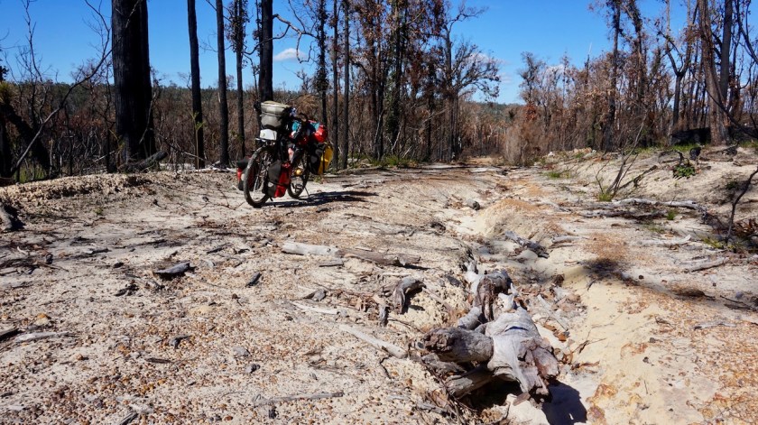
Yeah, forget that, I’ve been attacked another four times today. The magpies will decide when the season is over, not me. I ride through farmland via Bramley River Road but once on Canebreak road, I’m back in the forest. I camp in a forest plantation. Chances are smaller Parks and Wildlife will put that on fire while I’m in there, I guess.
Day 256: 21 October 2019 From near junction Canebreak & Sabina West Toad to along Great West Road 47,95 km (Total so far: 11.510,40 km) – Altitude climbed: 441 m Weather:Sunny, moderate tail and head wind
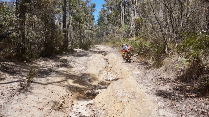
I keep riding east, away from Margaret River. Once one Jalbarragup Road East, things become more interesting but after crossing the sealed Mowen Road, it seems my dirt road sees more traffic. It becomes very corrugated and sandy.
A partly overgrown road to the right, Stellar Road comes to the rescue. The partly overgrown road soon becomes fully overgrown, but only for a while and the second half of Meteor Road is rideable again. A right turn onto Mcatee Road brings me back on my planned road, and now I am riding west, back to Margaret River.
Soon I am on the Great West Road. Don’t imagine too much from its name. It is a sandy track, in parts overgrown, and hasn’t seen any traffic in a long while.
Perfect.
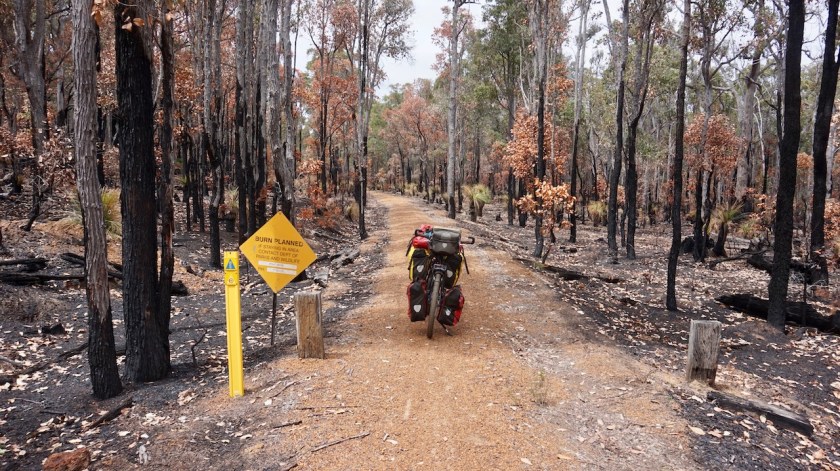
When I start looking for a place to camp, I realize that if Parks and Wildlife Australia wants to burn this down, I surely would never have seen a sign. I joined this section via overgrown paths where they wouldn’t bother to place to signs. It seems this forest hasn’t seen a fire in a while, so it must be high on their wishlist to burn it.
Well, I’ll take the gamble and hope for the best.
Climbing up to a hill top that recently burned down.
Day 257: 22 October 2019 From along Great West Road to along 10 mile Brook Walk/Cycle Track 46,00 km (Total so far: 11.556,40 ) – Altitude climbed: 478 m Weather: Sunny, moderate head wind
I felt a bit weak today and very thirsty for some reason, although I always drink enough.
The Great West Road keeps going west, doesn’t improve in quality, which is good, because I see nobody else. Lot of hills to be tackled as well.
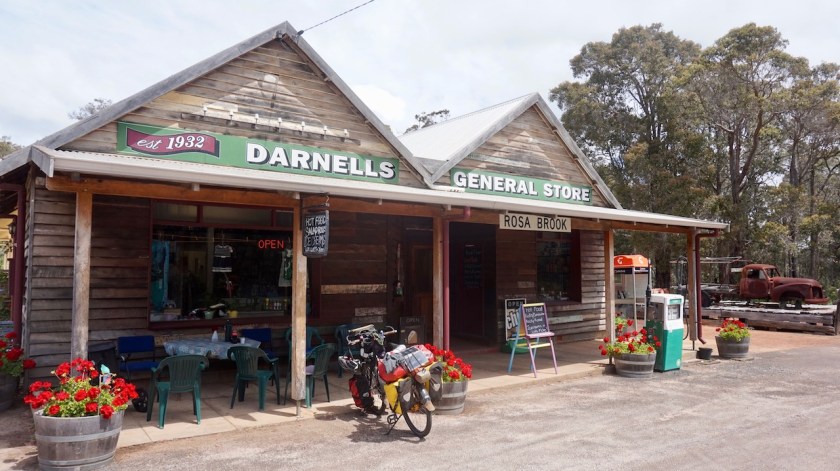
Eventually I reach the sealed Rosa Brook Road. There is a very charming General Store in Rosa Brook. From here the road gets busier.
Via the bike paths of 10 Mile Brook, I ride towards the city. Just after I pitched my tent, I start to smell a fire.
Had to happen of course, it’s been going on in my head too much the last days. As I am riding the Munda Biddi Trail, I keep an eye on the notification they give, and it seems like the whole trail has diversions because Parks and Wildlife is burning the forests down. Surely, some forest must be on fire on the other side of the highway. Well…. I hope it’s on the other side.
White tailed black-cockatoos are flying to and fro, making lots of noise and are completely in panic. Maybe they still have young chicks left behind in the trees on fire ?
What with all the beautiful goanna’s, like I have seen several ?
Can they run in time ?
Sure many of them get burned alive.
And parks and Wildlife Australia is burning forests since weeks already, so many eggs of the birds must have been stil in the nests.
They kill it all.
And if they don’t burn it, also here in the Margaret River area, just as anywhere in Western-Australia and Northern Territory, every few hundred meter there is a sign that the 1080 poison is laying around.
Burn the wildlife, poison it or kill it in traffic…. unreal.
Well, to stop with a positive note, this morning, while breaking down my tent, a mother kangaroo jumped from between the trees with a very small young. It crawled into it’s moms pouch, dad waited, and then the tree of them jumped away.
I also saw ducks with fresh born chicks. A couple of goanna’s as mentioned before, a blue wren and I had a chat with two red tailed black-cockatoos.
Day 258: 23 October 2019 From along 10 mile Brook Walk/Cycle Track to along rail trail 33,07 km (Total so far: 11.589,47 km) – Altitude climbed: 351 m Weather: Cloudy, sunny, rain at night, moderate head and tail wind
After buying provisions in Margaret River, I went out to the beach today, along a 10 kilometer bike path. Luckily that bike path is there, because although it is a dead end road to the coast and it is just a Wednesday, this road carries a lot of traffic.
First I took a look at the little Greek Orthodox church in Prevelly, then I went down to the beach at Surfers Point. It had been cloudy all day, looked like rain, but just as I arrived at the beach, the sun came out, the sky turned all blue and the colours of the sea in front of me were fantastic. Huge waves too, I can see why the beach has this name.
This chapel was constructed in conjunction with the Greek Orthodox communities of Australia as an ongoing symbol of the ties between Greece and Australia. It was built to thank the Greeks who risked and gave their lives to protect and give shelter to allied servicemen during the 1941 Cretan campaign of WWII.Surfers Point at Prevelly, Margaret River
Also the river mouth of Margaret River, just at the end of the road is worth to have a look at.
I hang around for a while, till the clouds return, and I do the same towards Margaret River.
Day 259: 24 October 2019 From along rail trail to Blackwood River 44,90 km (Total so far: 11.634,37 km) – Altitude climbed: 445 m Weather: Sunny, light tail wind, rain at night
After last nights rain, I wake up to a perfectly blue sky. Taking it easy to let the tent dry, rinse out some socks in the little stream next to the tent, I ride into town late morning. I buy provisions for four days in Margaret River and head out east, back to where I left the Munda Biddi Trail last week. A few annoying kilometer on the busy Rosa Brook Road, then turning off onto Rosa Glenn Road, still paved, but much quieter.
I’m back on gravel at Crouch Road and the Great North Road. Haven’t seen a single soul since leaving the asphalt.
There is no real bridge over the Blackwood River here. They’ve made a concrete lane which you can pass if the water is not too high. I find a nice spot to pitch the tent a few meter above the river.
The Blackwood River
Day 260: 25 October 2019 From Blackwood River to Milyeannup National Park 48,39 km (Total so far: 11.682,76 km) – Altitude climbed: 656 m Weather: Cloudy, sunny, no noticeable wind
Pfff, what a day !
After the rains during the night, I woke up to grey, cloudy skies. As the hours went by, the weather became better and better, until I had bright blue skies in the afternoon.
But it was a very hard day. The flies and the horseflies around your head, the mosquito’s around your legs. I grow bit tired of the attacks all day every day of these creatures when cycling off-road. On-road, you can add attacks of magpies and drivers. Because of this, hardly ever a possibility to just take a break along the road, relax and eat something.
The track is much harder as anticipated. Blackwood Road is a very sandy affair, often impossible to ride. Then there are all the little, almost dry, side streams of the Blackwood River that have carved their little valleys. Often I had to push the bike through deep sand up steep hills, from one side stream to the next.
Honestly, I felt pretty miserable during the morning but as the day went on, the sky became blue and the track nicer once I crossed the Brockman Highway, it all ended well in a nice camping spot.
If it were not for the dozens of loud horseflies circling around the tent tirelessly.
So, a bit good and a bit bad today.
Day 261: 26 October 2019 From Milyeannup National Park to Yanmah State Forest 50,54 km (Total so far: 11.733,20 km) – Altitude climbed: 716 m Weather: Cloudy, sunny, light side wind
Same procedure as the last days. Grey sky when I woke up, which is actually very good, because it doesn’t get too hot in the tent when I go through my slow morning rituals.
I find there is not so much bird life on what I call the Margaret River peninsula (the area west of the Vase Highway towards Margaret River). But this morning, a little bird with the most fantastic and varied songs was sitting next to my tent at 6 am, giving a concert of 15 minutes.
I am not sure the track I’m riding is still the Blackwood Road. In Garmin Basecamp it is classified as a ‘G3-track’, which basically means it is not much.
Well, I think often several weeks go by before this track sees a vehicle.
I come to a junction. The ‘main’ track goes left. I go right, because that way, a few kilometer further on, I just have to cross to Vase Highway on yet another track leading me further east.
The track has not been used in a long time and is completely overgrown. Give it a few more seasons and it will be forest again.
These signs are always planted in areas without phone connection.
When I arrive at the Vase highway, the track at the other side has a sign that I can’t enter. Something with disease control.
I remember seeing those signs when I rode the Coronation Road almost two weeks ago.
There is also a sign that cameras are in use to check. Yup, cameras, even in the forest.
Nothing to do then follow the Vase Highway north and then turn right on the Graphite Road. That way, I am adding 19 kilometer of asphalt riding to my route. It’s pleasant, hilly country here.
I stop for lunch at One Tree Bridge, where I resume my ride on the Munda Biddi Trail.
Nice single track again. I have a chat with three other riders, two from Cairns and one from Broome who ride in a southerly direction.
Day 262: 27 October 2019 From Yanmah State Forest to Beaton State Forest 23,85 km (Total so far: 11.757,05 km) – Altitude climbed: 388 m Weather: Sunny
Perfect blue sky in the morning 🙂
I notice I have three cracked tent poles. I put some ducktape around it and hope it will hold for the remainder of the trip.
I ride into Donnelly River with another cyclist who stays there for a few days. Donnelly River is the side of an old timber mill. Anno 2019, only three people live there permanently. They run the small general store and rent out 38 tourist homes (the old houses of the timber mill work force). There are old pictures everywhere. Glorious pictures of though looking guys who mow down 500-year old threes. Very though. With a chain saw mowing down a tree.
I find the pictures terrible, but apparently I am the only one.
After recharging some stuff, I ride out. Detour off the trail because they are cutting down some part of the forest. The whole area is in smog because some burns in other part of the forest.
I camp on top of a hill.
I must go slow, slow, as my plane out of Perth is only on 22nd of November, and I am getting really close to Perth now. More short days ahead of me, but that’s okay, it gives me a lot of time to read.
I told you about flies and horseflies already. Tonight, I had the pleasure to meet some other wildlife.
Just after sunset, as I was eating my diner, I heard a ticking sound on my tent as if it was starting to rain. But it wasn’t that. Hundreds, thousands of flying ants were landing on my tent, both on the outer and the inner. Many thousands of them. I was sitting in a dome, completely covered by flying ants !
No way I could go out, because unzipping the door would mean a thousand of them would fall and fly inside. I switched off my head light. No reading on the e-reader either.
I want them to go away.
What if they would start eating wholes in the inner tent ?
They seemed to calm down after I switched off the light but I could still hear them (hoping it was just flying against the tent, not eating it).
Good night 🙂
Day 263: 28 October 2019 From Beaton State Forest to rail trail towards Jarrahwood 42,18 km (Total so far: 11.799,23 km) – Altitude climbed: 306 m Weather: Cloudy, moderate wind all directions
The inner and outer tents were completely cover with the wings of the flying ants.
Yesterday was the first really warmer day of the season (28 degrees in the shadow). Maybe that is the day these ants come out ?
Maybe they just fly out and then lose their wings ?
Anyway, the tent was full of them. I blew away the wings.
Today was cloudy and ten degrees cooler than yesterday.
Nannup is what is called a ‘historical town’ here. It’s little over hundred years old. At the bakery I see a poster for a bike ride in November towards Margaret River. What’s remarkable is that Marianne Vos is on the poster. And reading it, I see she actually comes to ride it.
Later I talk to a guy who shuttles luggage from riders, and sometimes the riders themselves. He has been the driver of Marianne Vos in the past as well, as it seems she comes every year to ride this ride.
I leave Nannup with the idea of riding towards the Nala Mia hut in Jarrahwood. Tomorrow the weather will still be okay, but Wednesday and Thursday will be wet and windy. There is a rail trail between Nannup and Jarrahwood, so it is easy riding. But then I remember Jarrahwood hut is very close to the Vase Highway, so I decide to camp along the rail trail, the quieter option.
Day 264 – 267: 29 October – 1 November 2019 From rail trail towards Jarrahwood to Jarrahwood 11,78 km (Total so far: 11.811,01 km) – Altitude climbed: 79 m Weather: Very strong, violent wind and very heavy rain showers
The Munda Biddi Hut in Jarrahwood is different from all others. This one is in the village. Not that the village is that much, just a collection of ramshackle houses, most of them abandoned I guess. It is also close to the Vase Highway, just a couple of hundred meters away. It makes it less tranquille than other huts. And it being in a ‘village’, does not have the advantage of shops around, because there is nothing of that in Jarrahwood. Still have to bring all you need, except water.
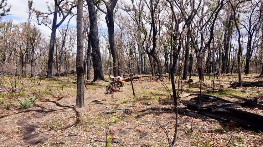
Cycling through more burned down areas between Nannup and Jarrahwood.JarrahwoodJarrahwood
As predicted, the weather becomes really nasty. Temperatures drop. Wednesday I wake up to 8 degrees and it doesn’t get warmer than 12 degrees during the day. Thursday it’s even cooler.
The winds turn from north to west to southwest but remain very strong with regular violent wind gusts. Heavy vertical rain showers torture the walls of the hut. You’d need a strong tent to survive this if you’re camping out now.
On the second night I’m joined by Marek and Catherine, originally from Estonia but now living in Perth.
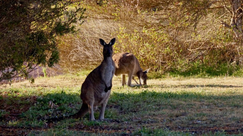
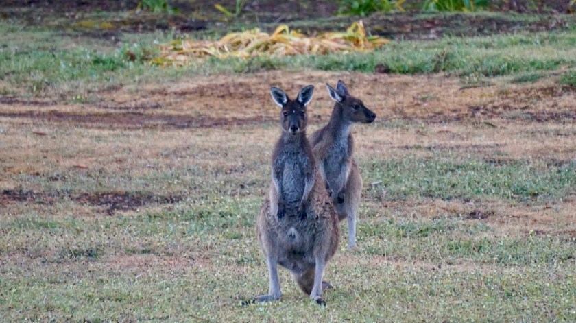
In the evening, a lot of kangaroos came out to the lawn in front of the hut.
See the baby kangaroo.
Day 268 – 288: 2 November till 22 November 2019 From Jarrahwood to Perth 630,34 km (Total so far: 12.441,35 km) – Altitude climbed: 4.061 m
As the end of my trip came nearer, I was occupied by other things in the evening and neglected keeping a diary, so here’s just a small summary of the last three weeks.
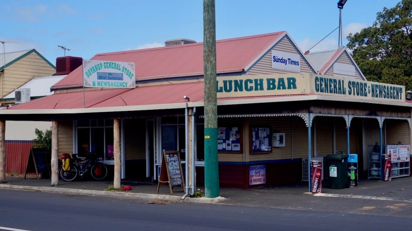
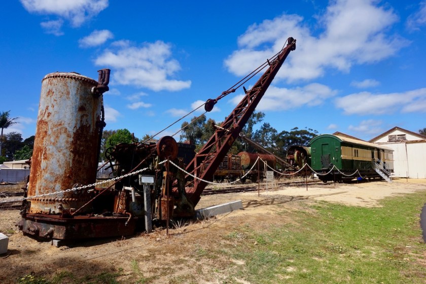
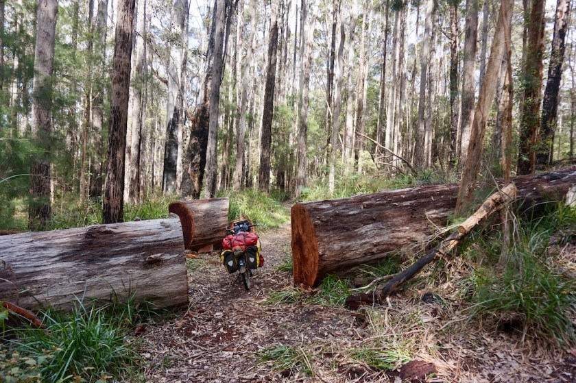
I kept following the Munda Biddi Trail, riding via Donnybrook to Boyanup where Geoffrey, another enthusiast cyclist, hosted me. I made a small side trip to Bunbury before saying goodbye to Geoffrey. Leaving Boyanup, I visited the small railway museum.
The Munda Biddi Trail north of Jarrahwood was closed for months. The park ranger arrived at the hut minutes before I departed to re-open the track. I was the first to go through again.
BoyanupThe little church in BoyanupRailway museum in Boyanup
I left the Munda Biddi south of the big Wellington Reservoir, in order to buy provisions in Collie.
Aiming to stay on dirt tracks as much as possible, I tried to ride the track under the power lines next to the Mungalup Road. I don’t recommend this. It’s hard, loose sand, unmaintained. Also the tracks I chose east of this road, ending up at the eastern shores of of the Mungalup Dam where often none existing (Yabbberup Trail). Better to follow the Mungalup Road, then take a right turn onto the Siding Street.
North of Collie, one can pick up the Munda Biddi Trail again.
The weather was hot and dry, with quite a bit of wind. The alarm for bush fires was on extreme.
Camping in the forrest east of Mornington Road, I found it bizar some trucks were coming through at night. I couldn’t see them from where I pitched the tent, but I worried a lot whether this might be fire trucks. If this place would go in fire, I would have no chance to go anywhere.
Yarri Hut, a beautiful location, but it can only be reached via a single track, surrounded by trees. If it would go on fire, you would have no chance to get out. With the current extreme fire danger warnings, I decided against staying here.
The next morning, I rode on to the Yarri Campsite. This would be the end of the Munda Biddi for me. I understood there are some real steep sections further north. I had made some alternative routes for that, but all the warnings I’m getting for the fires worry me, so I rode a bit back towards Myles Avenue, then descended towards Harvey.
Harvey is a nice little village, famous for the Harvey Meat, Harvey fruit, Harvey milk, …
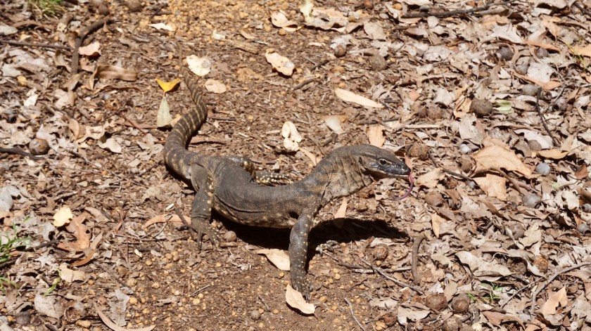
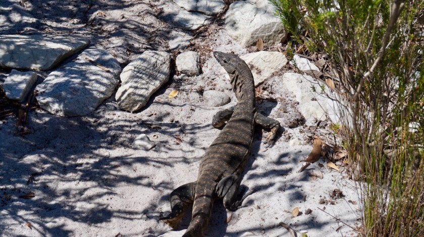
Goanna posing for a nice picture.Even showing his tongue.The Harvey Hotel.
The beach at Myalup is okay, and not crowded at all.
It is just a big shame 4WD are allowed to ride over the beach from Preston to Myalup, messing up this whole beautiful stretch.
Incomprehensible.
Myalup beachKookaburra chick
I rode back to Harvey, then took small backroads towards the Harvey Estuary.
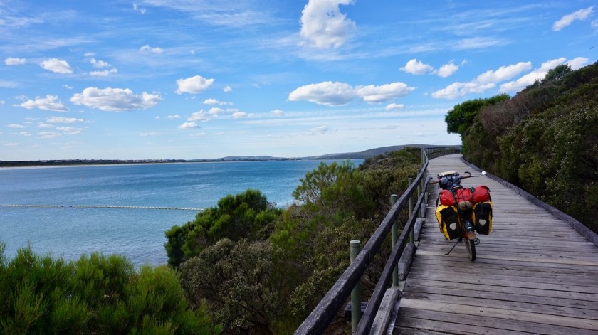
South of Mandurah, some nice bike paths start already along the estuary. The ride along the coast towards Mandurah is excellent as well.
Cycle path into Mandurah.These irregular rock structures rising out of the limestone are called ‘Solution Pipes’.
W. and J. agreed to host me for my stay in town, but due to some last moment events, we unfortunately never got to meet each other, but they agreed I could stay in their place. Incredible trust they showed in me and I had a couple of really relaxing rest days in their nice home.
From Mandurah, one could take the train to Perth, but I chose to take the bike path along the Kwinana Freeway. It was a very, very hot day, the little cycling computer showing temperatures up to 53 degrees as I was riding in the sun.
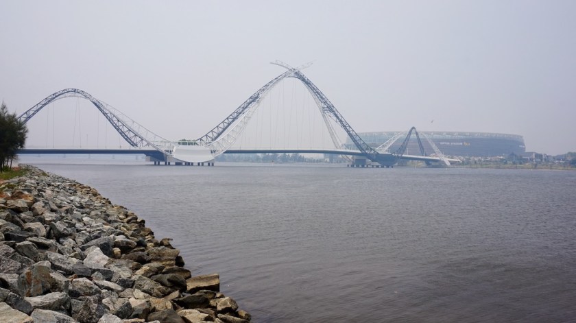
Near Woodman Point Regional Park, I hit the coast again. Good bike paths with constant views to the ocean lead me all the way to Fremantle, the port, the bridge over the Swan River towards Cottesloe.
Fremantle
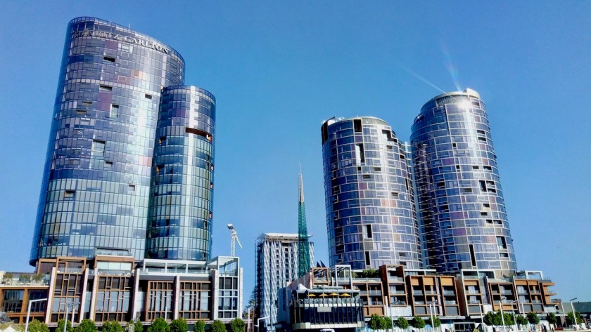
A few weeks earlier, I met Craig who was riding his bike on parts of the Munda Biddi Trail. I happily accepted his offer to stay for a couple of days. Craig has an apartment with a wonderful view towards the Indian Ocean which I enjoyed for hours from the balcony. Craig took me out for a ride by car to get a first view of Perth.
Febe, not a cyclist, guided me around for a day in the modern town.
From Cottesloe on the western side of Perth, I cycled along the Swan River towards Darlington. The whole town was covered in thick smog from bush fires outside of town.
My last nights in Australia, I stayed with David and Marianne. My luck with staying in nice places with brilliant people seems endless. I had my own very beautiful room in David and Marianne’s house, both enthusiast cyclists themselves, mainly in Europe. They even had a bike box waiting for me to pack my bicycle !
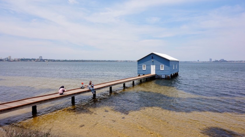
You’ve got to be kidding, no ??? People are riding through these streets with pick-up trucks with the heaviest engines making more noise than a formula 1 car. And then a sign “cyclists please be quiet in residential areas” ??? I saw this sign several times and the only explanation I can rhink of is a deep hate against cyclists. Parking cars or walking on the bicycle lane is, as you can see, not a problem. No signs warning against that.Perth, seen from the bike path along the Swan River.
Craig explained this blue shed is a popular place with Asian tourists.
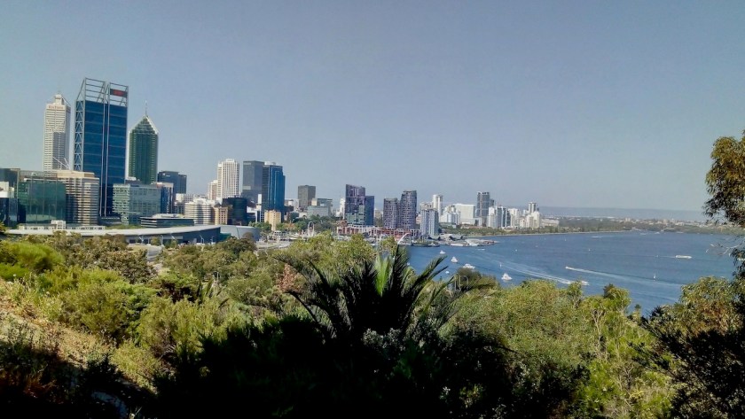
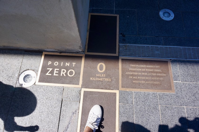
Perth, seen from Kings Park.On the day I cycled to Darlington there was a lot of smog from the bushfires near Perth.At the end of my holiday, at “point zero”, the position appointed in 1925 as the origin of all road distances in Western Australia.
After 288 days I’m leaving Australia. 288 days full of adventure, unique landscapes, the bluest skies imaginable, the most hospitable people, stunning beaches both in Tasmania and mainland Australia, endless sand-, dirt- and washboard roads, desert landscapes, the strangest animals. The country surely delivered.
Below a map of the route since leaving Esperance. As always, the gpx-track can be downloaded from Wikiloc.
I’ll come back with one more post about Australia with some data, gps tracks, etc…
But first, I go to Thailand for a month before returning to Belgium for a few months.
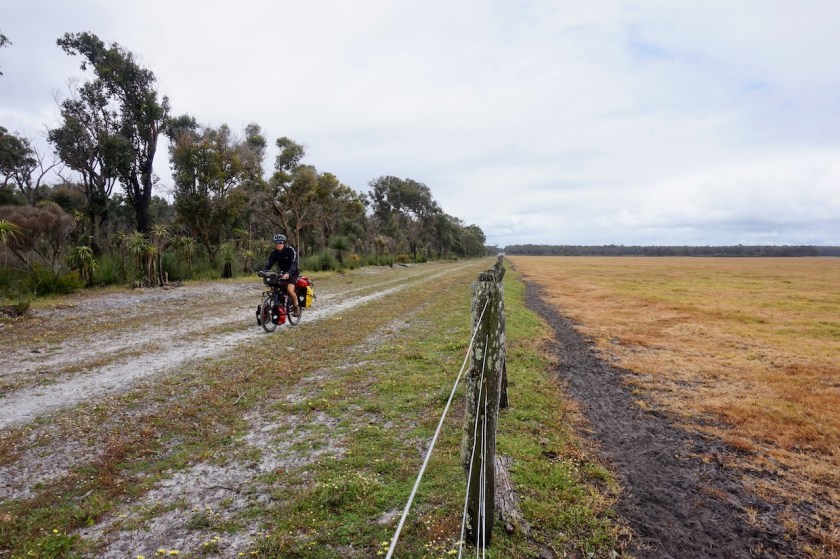
Day 230: 25 September 2019 Albany Weather: Sunny, cloudy
I destroyed my camping stove by accident in Esperance, and survived on bread three times a day the last month. Finally, I find a new stove in Albany.
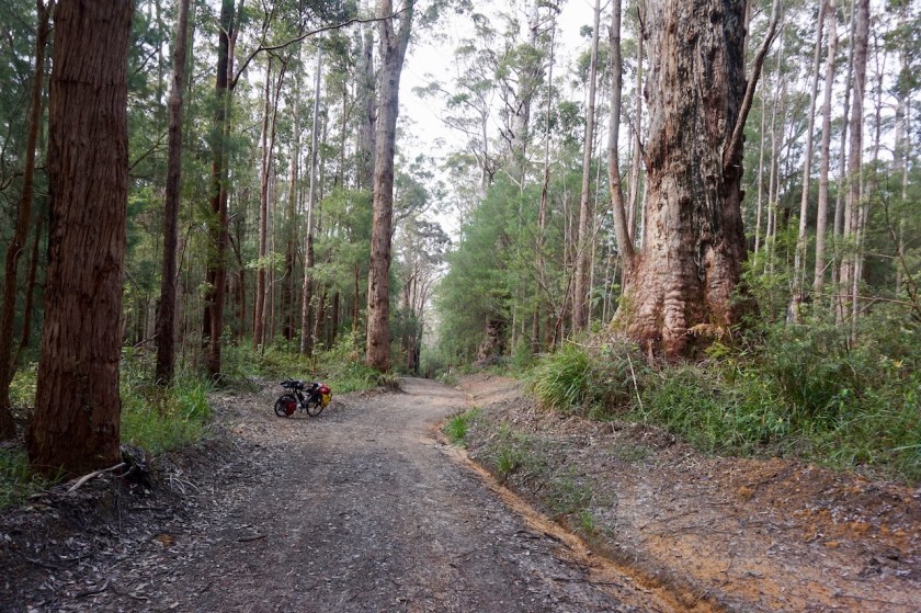
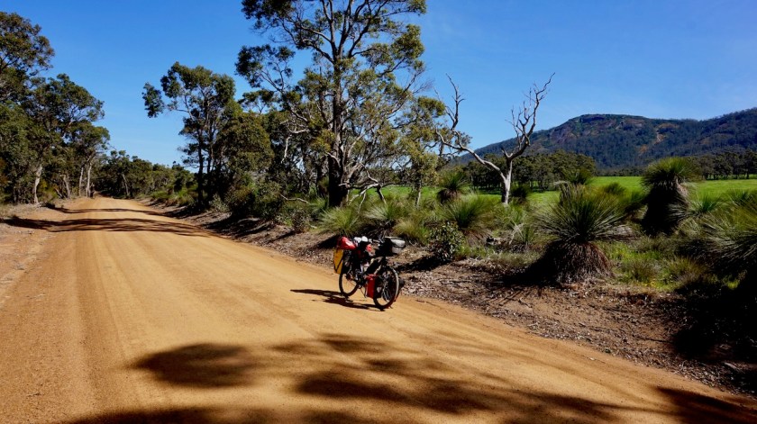
I also went to the official starting point of the Munda Biddi Trail, a 1.000 km mountainbike route route between Perth and Albany. I will extend it a bit towards +/- 1.500 km with rides towards Cape Leeuwin and in the Margaret River Area.
At the southern terminus of the Munda Biddi Trail. Although I’ve send a few things up the road to Perth to ease the weight, I will be carrying more as in this picture. I just went shopping and there’s a baguette in the pannier, causing that strange shape 🙂
Day 231: 26 September 2019 From Albany to along Francis Road 41,96 km (Total so far: 10.595,99 km) – Altitude climbed: 282 m Weather: Cloudy, rain, light tail wind
Denis rode me first into town by car for some shopping. Then I waited till noon time till the rain eased off a bit. I still had a bit of drizzle later in the day, but it was fine.
My first kilometers on the Munda Biddi are ok although it would be nice if they could find an alternative, or some single track, along the Old Elleker Road. But mostly it was pretty nice already. Camping spots were not so easy to find, as most of the trail still goes through farmland here.
With the new stove, cooking on gas now.
Day 232: 27 September 2019 From along Francis Road to along Denmark-Nornalup Rail Trail 50,04 km (Total so far: 10.646,03 km) – Altitude climbed: 292 m Weather: Sunny, light tail wind
It is obvious I am riding one of the more famous Australian cycling routes. The big majority will ride the Munda Biddi Trail in a north to south direction, so riding it the opposite way, I will meet many of them. Today I chatted with two couples riding the last day of their trip. Both of them were riding it leisurely, taking more than three weeks to finish it. Some people try to ride it in the least possible time, riding till midnight and starting again when it is still dark. That is also the reason why I won’t stay in the huts and shelters along the route too often.
After a day in the saddle, sound asleep at 9 pm, I don’t want to be woken up by people arriving and leaving again during my night rest.
Hay River
Good wild camping would be possible on the stretch along Hay River, outside of holiday season (in the season, I assume fishermen and families will park their caravans here). More good wild camping along the rail trail, about 8 kilometer before Denmark.
Denmark has a ‘Super Iga’, which is really well stocked. There’s also a Mitre 10 and a shop selling camping gear.
From Denmark, the Munda Biddi goes south to the coast, but there is also the continuation of the rail trail towards Nornalup. Both suppose to be beautiful rides and I couldn’t make my mind up which way to ride so, I took the easiest option and decided to ride both of them. First down the rail trail, then come back to Denmark via the Munda Biddi, shop again for provisions and ride out again via the rail trail to where it intersects with the Munda Biddi.
Good plan.
Entering Denmark along the rail trail.
Leaving Denmark, there is a sign at the rail trail saying it is only open to hikers.
Ignore it.
There is an old bridge which more or less collapsed. You have to walk down three meter and take the new iron bridge and go back up three meter. I suppose this is such a life threatening action the town of Denmark decided not to take responsibility for that and therefore put the sign in place.
So just go, no worries.
To my surprise there are not many good spots along the track for camping, but you’ll find something eventually.
Day 233: 28 September 2019 From along Denmark-Nornalup Rail Trail to along Denmark-Nornalup Rail Trail 31,29 km (Total so far: 10.677,32 km) – Altitude climbed: 144 m Weather: Sunny, no winds
Continued riding the Heritage Trail almost till I was back at the South Coast Highway. I didn’t ride the last few kilometer as they were flooded.
I saw a blue wren today. Almost riding over snakes also has become a daily occurrence.
Rode back to a suitable spot I saw before, along a field with views to the surrounding hills. Short day, so I can catch up a bit with the daily reports after having fixed my laptop.
Day 234: 29 September2019 From along Denmark-Nornalup Rail Trail to along Denmark-Nornalup Rail Trail 39,09 km (Total so far: 10.716,41 km) – Altitude climbed: 405 m Weather: Sunny, light head wind
After a couple of kilometer on the same track I rode yesterday, I rejoin the Munda Biddi. First some single track in the bush just next to the South Coast Highway before joining William Bay Road. It is Sunday, a long weekend and school holidays.
So it’s busy.
The Carpark at the end of the road is already full at 10:00 am. Cars turning, looking for a place off the road. Crying children, screaming and yelling parents, all of them arriving at the little look-out, seeing this is not the way down to the water, turning their heels to the other track, without even looking out and admiring the view. The yelling from the people, down below at the rocks is louder then the crashing of the waves on these rocks.
Elephant rocks…. beautiful place, but not on a day like this.
Go, go.
There is a dirt road through the dunes to Madfish Bay and Waterfall Beach. A couple of brain deaths races passed me at 80 km/hr. Another idiot thinks it is necessary to fly his drone at a meter from my head. I find him. Ride up to him. Stop next to him. Say nothing.
He feels uncomfortable.
Good. He shouldn’t be doing that.
Then the nice part starts, a single track through the dunes.
And a mistake. My gps track went from Lights Beach over asphalt back to Denmark. Suddenly, no more Munda Biddi markers along the road. I realize I heard people talking about a track along the wind mills. Later I see the gps track must be wrong and I could have continued longer along the beach.
I went to the Iga to buy new provisions. Lots of people in town. The main drag, Strickland Street, was closed and full of old timers. That’s gonna be a hell of a drinking and bbq party at the campground all night.
Not me, I’m off to a wild camp, back along the rail trail. Good enough phone reception to watch the world championship cycling tonight.
Day 235: 30 September 2019 From along Denmark-Nornalup Rail Trail to alongside Kent River 66,99 km (Total so far: 10.783,40 km) – Altitude climbed: 856 m Weather: Sunny, moderate wind all directions, rain afternoon and night
So, the first part of todays ride is the same as what I rode a couple of days ago.
Nothing boring though. In the first kilometer, a big tiger snake is laying rolled up on the track, warming itself in the sun.
Kilometer two; again I get four swooping attacks from that same vigorous magpie. I stared in his eyes when he came down to me. He looked so determined and so aggressive.
Kilometer four, a fox is staring patiently into a small hole, probably hoping his breakfast will come out at some point.
Turning onto Limbourne Road I leave the rail trail and am again on unknown terrain.
A steep climb on Point Hillier Vista, but with magnificent views back to the coast. Then, descending on dirt roads, losing views of the coast. I first hear, then find and see a White Tailed Black-Cockatoo.
On a small single track through the forest, full with wild flowers, I reach my first Munda Biddi Trail Hut, the Jinung Beigabup. Much larger as expected. It is noon time only, so I just stay for lunch.
Jinung Beigabup, the most southern of the Munda Biddi huts.
Mount Lindesay is the main feature of the day, seeing it sometimes to my left, sometimes in front, then to my right as the pad meanders its way through the fields and forests.
The sky at the western horizon is getting greyer and greyer. Don’t like that.
Inevitably rain starts to fall just as I cross the narrow suspension bridge over the Kent River. A handy clearing in the forrest just off the track is all I needed. I pitched the tent in a hurry and tucked in.
Day 236: 1 October 2019 From alongside Kent River to alongside Frankland River 52,98 km (Total so far: 10.836,38 km) – Altitude climbed: 873 m Weather: Cloudy, no wind
Another Munda Biddi Trail rider passed my camp this morning while I was breaking down. I assume he must have ridden 35 km already from the previous hut. He didn’t stop.
When I reach the Booner Mundak hut, the second one on the trail, I see he wrote his name in the guest book and was planning to do the whole ride in seven days.
No time to stop then, of course.
A cyclist I spoke in Albany warned me already there is a ‘killer climb’ this side of Walpole. Also some entries in the visitor book at the hut showed some people really suffered. Well, we’ll see, it’s about 55 kilometer to Walpole and I still have food till tomorrow lunch time.
Some parts of the Middle Road, north and south of the hut, are very sandy and require some pushing. Not too bad now, after the rains, but I guess in dryer periods it might be an issue.
I meet three riders riding north to south and have a chat with two of them.
They don’t seem to be too knocked up from the climb they must have had earlier in the day.
Turning on Thompson Road (this are all dirt tracks), a steep part begins. 17% says the little cyclometer.
I push.
I remember fifteen years ago, in the spring time of my life, I cycled up 18% hills in Thailand.
Don’t even try anymore.
Just take my time and push and look at the giant trees in the forest.
After all I heard and read from this hill, in my imagination it had risen to Mount Ventoux-ian proportions.
It is not a long climb, just a few minutes pushing, no worries.
Near the top I have a chat with a friendly couple hiking the Bibbulman Track ‘the posh way’’, as they say, staying in lodges and hotels.
Steep down, 18%
I ride that, this is great fun.
There is a turn off, 600 meter to the Valley of the Giants.
The hikers told me they just went there and it was horrible. Full of kids, lots of noise. Right on the turn-off, there is ‘carpark 2’.
I guess that means there is a carpark 1 as well, and who knows a nbr 3 and 4 also.
Why would I go and pay an entrance fee to see the same trees I have now all around me, with chirping birds i.o. over exited, yelling humans ? Worrying about leaving the bike behind with all my stuff on it.
I’ll probably miss out on the hot dog, but they are terrible here anyway. They put the sausage between a loaf of this horrible white, spongy toast bread.
Not the good stuff.
I roll down deeper into the forrest of the Walpole-Nornalup National Park. More huge trees, small streams, plants, bushes and birds everywhere. No cars, no people.
No phone reception 🙂
At the bridge crossing the Frankland River I find a nice spot to pitch the tent for the night.
Day 237: 2 October 2019 From alongside Frankland River to Kwokralup Beela Hut 52,08 km (Total so far: 10.888,46 km) – Altitude climbed: 900 m Weather: Sunny, wind a bit from everywhere
It is a very beautiful ride alongside the Frankland River into Walpole. Some short steep sections, both up and down, but pleasant. No need to go for that treetop walk if you’re riding the Munda Biddi. Here, you cycle in the tree tops as the path is at points so high above the narrow valley.
I stay a couple of hours in Walpole to recharge all devices and do the necessary shopping for provisions. The plan was to cycle half way to the next Munda Biddi Hut, 30 kilometer from here and do the remainder of the ride tomorrow morning. As from the afternoon, heavy rain is predict until Sunday. I’m loaded up with food for five days, so I can sit out the bad weather, and ride the two days to the next village, Northcliffe.
The weather was so pleasant, and there was enough time left that I cycled all the way to the hut already, arriving at 5:30 pm with an hour of daylight to spare.
I pitched the tent at one of the designated spots as there was already another couple in the shelter.
Day 238 & 239: 3 & 4 October 2019 Kwokralup Beela Hut Weather: Cloudy, very strong winds and heavy rain
The bad weather was predicted as from noon time on Thursday (3rd). It didn’t look that bad in the morning. Clouds, but from time to time a blue spot in the sky. Still, I decided to move from my tent to the hut. I had brought that food for a reason and it doesn’t pay off to ride two hours in the dry to become soaked later in the day.
But it remained dry all day.
Bummer, I could have gone outside.
Pitched the inner tent so I’m protected from mosquito’s, flies, ants, snakes, ticks, ….
The next day, it was still dry in the morning.
What to do ?
The forecast is for very heavy rain showers.
At times like this, one goes outside, looking at the sky and almost wishing for rain. Otherwise you stay idle without a reason. Finally, by 11:15 it starts. At that time a few guys ride in. Too much excitement, too much noise and testosteron, too many “whooo’s” and “whaaaa’s” from far away in the forrest. As always in a group of guys under thirty years old, there is the tough guy who has to limp a bit. He is so tough, despite his limp he still goes out on the bike. but off the bike…. limping.
This is the soccer player of the group.
They only stay for lunch, and then they go, in the rain.
I read a bit, drink a coffee, eat a cake, fall asleep, clean my bike, laundry was done yesterday already.
I applaud the care for our smallest creatures, as requested at signs in every hut. But what about all these “prescribed burns” going on continually in all the national parks ? “Grass tree leaves grow slowly”, “fallen branches are home to many small creatures”… Does park and wildlife warn and evacuate the small creatures each time they burn the place down ? Do they rebuild their homes, or… is it only visitors of the huts that must take care and once the pyromaniacs of park and wildlife come it is ‘bad luck’ for the small creatures and they are burned alive, together with their homes ? Let alone all the other animals, trees, etc….
Day 240: 5 October 2019 From Kwokralup Beela Hut to 3 km before Yirra Kartta Hut 43,16 km (Total so far: 10.931,62 km) – Altitude climbed: 773 Weather: Cloudy a bit of sun, light head wind
Hmm, cloudy.
Just as cloudy as yesterday. Taking it slow and easy, I leave the hut around 11 am. It’s a bit of a climb up the hill again. Some rain drops from time to time. Not very attractive weather.
There is the junction towards Mount Frankland (410 m), from where you suppose to have nice views.
Not with these clouds.
More rain is coming. As everywhere, even these low hills make their own weather.
I wanted to go to the top, but again let it pass. There is no use in doing so now.
And so, the mountain is a metaphor for your professional life. If the circumstances of going to the top are unfavorable and make you unhappy, move away from it and soon the sun will come out again 🙂 .
Bridge at Fernhook Falls.
And so it did today. Riding away from the hill, the first rays of sun appeared. The ride towards Fernhook Falls is all on single track, very nice.
Fernhook Falls itself is a nice stop, but not overly impressive. So is the ride after the falls. You stay in the forest, which I like a lot. It is not super impressive, but just very good riding, almost all on single tracks.
After crossing the South Western Highway, I have to clear the track from some large branches that probably came down during yesterdays strong winds.
I decide to pitch the tent a few kilometer before the next Munda Biddi hut, Yirra Kartta. It is Saturday and school holidays. Don’t want to push my chances too far. Just want to have a quiet evening.
A very good day on the bike again.
Typical Munda Biddi forest single track.
Day 241: 6 October 2019 From 3 km before Yirra Kartta Hut to 3 km after Northcliff 58,38 km (Total so far: 10.990,00 km) – Altitude climbed: 866 m Weather: Cloudy, moderate head wind, rain in the evening
I am really starting to miss the blue skies and the warm weather of the interior.
(Not the flies though !)
Today was another grey, cold day. Night time temperatures are between 10 & 12 degrees, which is good, but daytime is between 16 & 18 degrees, which is ten degrees too cold.
Luckily, the track was super pleasant riding again.
First I rode into Yirra Kartta Hut where Stephen, a cyclist from Hong Kong was still busy packing up. He rides a Surly Wednesday fat bike, pretty well loaded up. Heavier than mine, I think. But he has the right travel spirit and is in no hurries. The other guys with whom he shared the hut left at first daylight and were already in Northcliff by 9 am, I heard later from other cyclists coming the opposite way. Rather they then me.
Lot’s of trees are cut.
As I said, the riding is all day in the forest on tracks completely free of any traffic. Towards Northcliff the land opens up a bit, some farming. Nice for a change. One sees the hills, but with human habitation also come the swooping magpies, which were very aggressive again.
Mind the head !
Day 242: 7 October 2019 From 3 km after Northcliff to Warren River 23,31 km (Total so far: 11.013,31 km) – Altitude climbed: 281 m Weather: Sunny, no winds
A Bibbulmun hiker passed my tent and stopped for a chat this morning while I was still having breakfast. Generally taking it easy till the tent was dry.
After Northcliffe, there is an asphalt section of about 2,5 km where I had the most aggressive magpie attack so far. It started of with a couple at the beginning of the section, but that only lasted a couple of hundred meters as always. Then, near the end of that asphalt section I was attacked by four magpies at once. Every two seconds another one dived at me. It went on and on for at least 500 meter. That’s a long time ! Super aggressive they were.
Back in the forest, I was safe again but the track passed some more fields and farms, and that’s where the magpies are.
Here are some video’s from Youtube, really worth watching:
The weather was finally sunny again. Down at the Warren River there’s an old wooden bridge. The setting was just too beautiful to pass by. I stopped for the day and camped.
Day 243: 8 October 2019 From Warren River to 12 km passed Pemberton 31,33 km (Total so far: 11.044,64 km) – Altitude climbed: 540 m Weather: Sunny, no wind
I woke up to the most incredible bird sound orchestra ever. Kookaburra’s and dozens and dozens and dozens of other bird songs. (example here)
The sun was out.
A few kilometer into my ride some heavy Caterpillar (the company specialized in making equipment to destroy the planet) machinery was at work clearing forestry roads. Soon, these magnificent trees I am cycling along now, will be cut. It is un-be-lie-va-ble this is still going on. I heard that Australia is, after Brazil, the second largest forest clearing country in the world.
Good on you, Australia !
It makes me mad. I was outraged on my bike, thinking they were going to clear this whole area soon. Should I attack the Caterpillar driver ? It would probably delay things only with an hour and have me labeled as a foreign trouble maker, kicked out of the country.
There is zero hope for this planet if people in so called civilized countries still continue these practices.
Loggers making new tracks through the forrest, so they can erase it.
In my rage, I rode over a snake on a downhill. He was just laying next to a branch. I stopped to check him out. A tiger snake, not fully grown yet. Luckily he was ok. I think the branch caught most of the impact. Don’t want to end up creating road kill myself.
A bit further on, one of this small birds that always hop along with you, from branch to branch landed at a meter and a half from me. Sitting on that branch he/she started to sing a song, showing off that beautiful tail they have.
Fantastic !
But the loggers will soon destroy your habitat my friend.
No worries, it is called ‘managing the forrest’.
There is a nice switchback climb, not steep from East Brook towards the Gloucester Tree area.
Close to the top, I had a flat tyre in the back.
Pemberton has a good supermarket and friendly visitor centre. I talked with some grey nomads from Victoria and Queensland whilst having lunch.
Riding out of Pemberton and hitting the dirt again, the tyre in the back was flat again. I know by now how to fix a tube. To patch was ok, no sharp things stuck in the tyre, the tube even held the air when I blew it again. Changed it for another tube and will fix this one later. I’d like to keept it, as it is one of this really heavy Chinese, more or less puncture resistant.
Some of the Australian bank notes. On the 50 Aud on one side is an Aboriginal guy, David Unaipon. On the other side Edith D Cowan, the first Australian woman to serve as a member of parliament. The 10 Aud shows Banjo Paterson, the guy who wrote Waltzing Matilda. The girl on the 5 Aud is not named. First I thought she’s maybe just an anonymous girl, but later I thought, maybe it’s the queen ??
Day 244: 9 October 2019 From 12 km passed Pemberton to along Parsons Road 38,82 km (Total so far: 11.083,46 km) – Altitude climbed: 705 m Weather: Cloudy, no noticeable winds
A grey and cloudy day.
Temperatures in the low 20’s, so okay for cycling.
A few kilometers into my ride, just as I turn into Ivan Road, a big emu runs out of the bush and crosses the road maybe ten meters in front of me. I can feel the wind it makes. So impressive how it accelerates and runs away with these strong legs and flat feet.
But you don’t want to collide with them, I think.
For a second time I cross the Warren River, the road goes up, a bit down again and I am making the most of the ‘momentum’ for the next hill.
Pea gravel, a bend to the right in the road, 45 km/hr.
(Pea gravel is something typical for this area, but imagine you are riding over ball bearings, strewn a few centimeter thick over the road).
The bike starts to swing all over the place. For a moment it seems I get it under control again, but the edge of the gravel track comes nearer and nearer and I crash hard. On my left knee, the one I had troubles with a while ago, the left shoulder and elbow.
What a shame I don’t have a Gopro and filmed it. I get up and check the bike. It seems ok.
Then I make a few steps. I seem to be ok as well. Big bang on the knee and some blood and some road rash on the left shoulder and elbow. Luckily I was wearing gloves to protect the hands.
It all seems ok, but as the great José De Cauwer always claims when a cyclist falls on tv, the night will be a sleepless one and the real pain will come tomorrow.
We’ll see.
The knee glows a lot, but it functions well up the next hill.
And that’s where José goes wrong. The pain doesn’t come tomorrow, it came after 6 kilometer.
Also the left elbow and the palm of my right hand hurt. Can’t even remember I used my right hand in the crash.
José De Cauwer
I take it easy the rest of the day. Still had a close encounter with a Western Brown snake, the small bush flies are out now, after the good weather yesterday and some aggressive magpies swooped me a bit in Quinninup.
There is a very steep hill out of Quinninup, 15% up, 12% back down.
I meet another cyclist from Hobart with quite a bit of experience in South-America, Mongolia, China, Taiwan, …
“The bird population is in decline as many of their nesting trees with large suitable hollows are no longer available for them”. This is a picture hanging out the Quinninup tourist info. It is exactly here a lot of logging is going on, cutting down the old forrest with the kind of trees this birds need. Than they ‘replant’ worthless trees, neatly in lines. Worthless forrest, supporting barely any wildlife.
I pitch the tent just beyond a stretch of forest that has been completely cleared by loggers.
Apart from the crash, good cycling tracks today.
Day 245: 10 October 2019 From along Parsons Road to Karta Burna Hut 60,65 km (Total so far: 11.144,11 km) – Altitude climbed: 786 m Weather: Sunny, moderate head wind
A perfect sunny day, temperatures mid twenties.
Beautiful tracks towards Manjimup, the biggest place since Denmark, I think (the two big supermarkets Coles and Woolworths are here). I went for lunch in ‘The Two Black Birds’ (Burmese Curry Chicken Samosa) while I was recharging my devices.
As rain is predicted for tomorrow, I push on the the next Munda Biddi Hut, so I can wait it out in the hut. But I pitch my tent a bit away from the hut so I can have a sound sleep.
Two other cyclists are in the hut, Marcus and Daniel, whom I met just outside Manjimup already.
Good cycling day, apart from the puncture in the front 1,5 km before reaching the hut. The tyres, having 11.500 km now over often very rough terrain are really getting at the end of their life span.
Day 246: 11 October 2019 Karta Burna Hut Weather: Rain
Stayed in the hut, repairing the tyre, changing brake pads, reading, sleeping, …
Day 247: 12 October 2019 From Karta Burna Hut to near power line service track 61,64 km (Total so far: 11.205,95 km) – Altitude climbed: 472 m Weather: Cloudy, sunny, light and moderate head wind
This hut being at one of the higher points along the Munda Biddi, the day starts with a downhill along a switchback single track. Lots of switchbacks, so easy both going down or up.
At the bridge over the Donnelly river, I leave the Munda Biddi Trail for a while to visit the Margaret River area. Soon I can leave the asphalt road again, taking a left turn on Coronation Road.
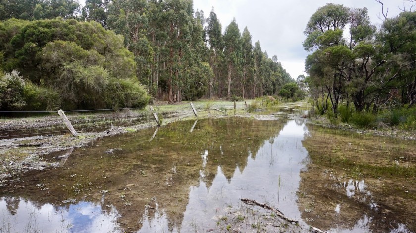
When I’m on Four Acres Road, I am a bit disappointed, it being a wide, straight dirt road, not too exciting. But, there is a small track branching off to the right, into an unnamed national park. No hesitation, and I steer the wheels in that direction. It is sometimes a bit sandy, there are some muddy pools from the recent rains, but the scenery is nice and the sense of adventure is there.
Trying to stay on the smallest tracks, I eventually end up on the service track under the power line. This one goes straight up and over every hill and is sandy quite often.
I find a nice protected spot for the night, on grounds that would drain the rain very well. Bad weather predicted for the night.
The track under the power lines, apparently named ‘Warren Blackwood Stock Route’.
Day 248: 13 October 2019 From near power line service track to forest along Courtney Road 40,74 km (Total so far: 11.246,69 km) – Altitude climbed: 121 m Weather: Rain, moderate head and side wind
A miserable day.
They morning rain stopped around 10 am, and it looked like it could be an ok day. I packed a dry tent away and got going by 11 am. The track under the power lines was much better as yesterday and soon I reached the asphalt Milyeannup Road.
I should have followed this one south towards Governor Broome Road, but no … I saw a smaller, lesser travelled option.
Often I am rewarded that way, but today this became a bit of an ordeal. The tracks were very sandy, or, more often, flooded. Sometimes even temporary rivers, one of them 90 centimeter deep. I made very slow progress, traversed some planted commercial forest (with ‘keep out !’ signs), I build some temporary bridges with branches to cross flooded areas, …
In short, the going was slow, and in the end, the feet got wet anyway.
The track is a bit moist.
Around 2 pm it started raining and I had travelled only about 18 kilometer so far. Drizzle alternated with rain, it was grey, windy, depressing weather. Actually, since leaving Hopetoun, the weather has not been really fantastic.
Just like on the Mawson Trail, where they recommend to ride it in April, they recommend to ride the Munda Biddi in September or October.
All wrong !!
I understand you don’t like cycling by 40 degrees, but also 16/17 degrees, or less the last week, is not pleasant.
I think November and March are ideal for this trails. A bit warmer.
I Pitched the tent at the edge of a tree plantation
Day 249: 14 October 2019 From forest along Courtney Road to Skippy Rock Road 51,09 km (Total so far: 11.297,78 km) – Altitude climbed: 484 m Weather: Cloudy, cold, moderate head wind
I made a little loop to avoid as much as possible riding on the Brockman Highway, but a stretch of about five kilometer can’t be avoided, as the highway has the only bridge over the Blackwood River. Taking the Glenarty Road, I pass the first vineyards of the Margaret River area.
Augusta, the little town sitting here at the edge of the Australian landmass is touristy. They’ve made a nice path of a few kilometer right at the edge of the Blackwood river. Some old wooden piers still standing.
I save my visit to the light house for tomorrow but ride already in that direction, camping along Skippy Rock Road. It is a very windy night, but I am perfectly protected by the bushes.
Day 250 – 252: 15 – 17 October 2019 Augusta 37,14 km (Total so far: 11.334,92 km) – Altitude climbed: 311 m Weather: Cloudy, sun, rain
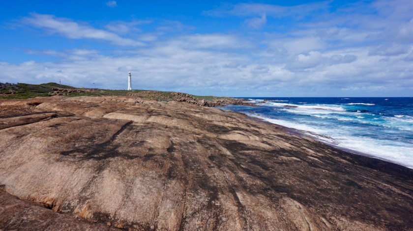
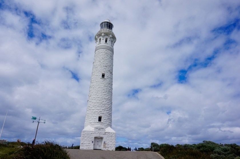
Just around the corner from where I pitched my tent, I have a spectacular view towards the Cape Leeuwin Lighthouse below me. This lighthouse, at the southwestern extremity of Australia is the tallest lighthouse of mainland Australia. It is not as old as some of the lighthouses we have in Europe, but then again, nothing is here.
I am lucky the sun is out in the morning, although there are still too many white and grey clouds in the distance to prevent making nice pictures.
It costs six pounds to visit the grounds of the lighthouse, twenty for a guided visit. Zero to view the lighthouse from a distance.
I opt for the 6 Aud option.
Quarry BayOyster CatcherAnother Oyster Catcher.Cape Leeuwin lighthouse in the background.
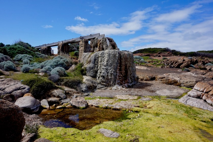
Old waterwheel.
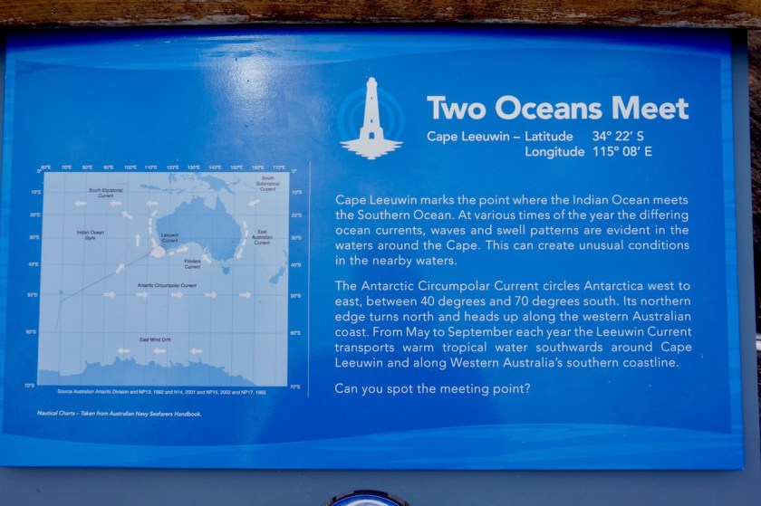
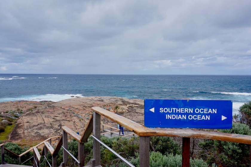
That’s because I want to go behind the lighthouse. This is not only the southwestern most point of Australia, it is also the place where two oceans meet, the Southern Ocean and the Indian Ocean. You can see the waves rolling into each other from two angles.
You could say that this way, I am seeing the third ocean since I’m in Australia, The Indian and Southern Ocean here, and the Pacific Ocean also in Tasmania.
But I don’t know whether that statement is entirely correct. It depends which source you use.
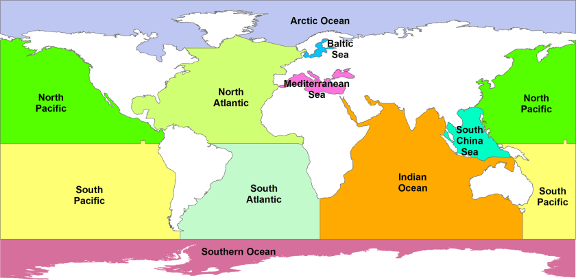
The IHO (International Hydrographic Organization – considered the authority for such conventions) draws maps where the border of the Southern Ocean comes nowhere near the Australian landmass.
I found this on Wikipedia: “Australian standpoint: A map of Australia’s official interpretation of the names and limits of oceans and seas around Australia In Australia, cartographical authorities define the Southern Ocean as including the entire body of water between Antarctica and the south coasts of Australia and New Zealand, and up to 60°S elsewhere.[35] Coastal maps of Tasmania and South Australia label the sea areas as Southern Ocean[36] and Cape Leeuwin in Western Australia is described as the point where the Indian and Southern Oceans meet.”
A map of Australia’s official interpretation of the names and limits of oceans and seas around AustraliaAnd the generally more accepted limits of different oceans, showing Australia to be entirely surrounded by the Indian & Pacific Oceans only.View out to the Southern Ocean. Or is it the Indian Ocean, after all ?
Route: Hopetoun – Fitzgerald River National Park – Jerramungup – Ongerup – Stirling Range National Park – Mount Barker – Porongurup National Park – Albany
Day 220: 15 September 2019 From Hopetoun to along Hamersley Drive 50,01 km (Total so far: 10.109,86 km) – Altitude climbed: 540 m Weather: Cloudy, rain, moderate tail wind
It’s a cloudy, cool day when I leave Hopetoun. Not bad circumstances to cycle, but the views won’t be too good. As I approach Culham Inlet and have a better view off the Eyre- and Whoogarup Range, I see they are almost completely covered in clouds.
I work my way up again that 17% climb towards East Mount Barren.
Glad I came out here on Friday when the weather was glorious and circumstances to climb the hill much better.
The road keeps going up and down, first towards Mylies Beach, then up, inland towards Sepulcralis Hill.
Regularly there’s a sign off the road indicating “water”. I checked them, and I think those are water points for when there’s a fire in the park. It is not drinking water. But this are good places to pitch your tent, as all the rest is densely covered with bushes. I stop at a nice waterhole with some colorful flowers.
Today there were several periods with drizzle, but never serious rain.
View from Sepulcralis Hill.
Day 221: 16 September 2019 From along Hamersley Drive to along Middamidjup Road 74,06 km (Total so far: 10.183 km) – Altitude climbed: 553 m Weather: Sunny, moderate side and tail wind
Continuing my ride on Hamersley drive, I have magnificent views of the different small mountain ranges in the park. About seven kilometer before the junction with the South Coast Highway, I take a left turn onto the Old Ongerup Road to continue riding on dirt i.o. on the highway.
As I experienced already before riding into Hopetoun, the magpies are aggressively swooping down at me. It ’s quite impressive.
He got a bit agitated.
It is incredible how these things work, but today, I was thinking that it has been a really long time since I had a flat tyre. Those Chinese super-thick tubes, and the extra tube around it as a liner make the bike heavy, but it works effectively against punctures.
And then…. I had a puncture.
In the front, no worries.
Day 222: 17 September 2019 From along Middamidjup Road to along Gnowangerup Jerramungup Road 71,40 km (Total so far: 10.255,32 km) – Altitude climbed: 452 m Weather: Sunny, strong head and side wind
Uneventful day, riding against the wind. this whole ride between the Fitzgerald and Stirling Ranges National Park is nothing special on its own. Just riding through agricultural land, but I am avoiding the busy highway, which was the main objective.
Jerramungap has an Iga supermarket and a coffee shop.
Originally, I planned to continue via small dirt roads south of the Gnowangerup-Jerramungup Road, but for tomorrow they predict a lot of wind from the wrong direction, and I want to make the ride into Ongerup as short and as flat as possible, so I choose the main road.
I crossed the Rabbit Proof Fence nbr. 2 today (not much left of it, the rabbits have won the battle).Part of the rabbit proof fence.
Day 223: 18 September 2019 From along Gnowangerup Jerramungup Road to Ongerup Caravan Park 26,93 km (Total so far: 10.282,25 km) – Altitude climbed: 240 m Weather: Sunny, very strong head wind
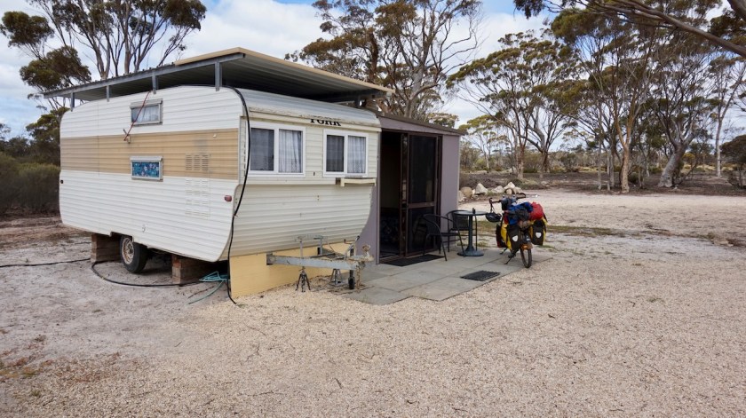
A short but tough ride to Ongerup. More storm predicted for the afternoon, night and tomorrow, so I rent a caravan in the caravan park to shelter for two days.
Very comfortable.
Day 224: 19 September 2019 Ongerup Caravan Park Weather: Rain, very strong winds
Sitting out the bad weather, watching some Belgian tv on the laptop and an oil change for the Rohloff.
While I did the small ride with the cleaning oil in the Rohloff, I spotted two beautiful yellow Regent Parrots.
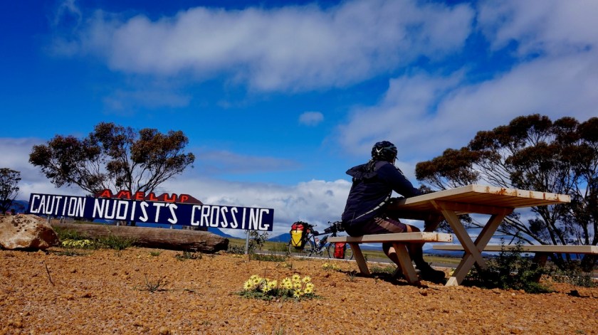
Day 225: 20 September 2019 From Ongerup Caravan Park to between Borden & Amelup 39,81 km (Total so far: 10.322,06 km) – Altitude climbed: 211 m Weather: Rain, strong head wind
A late start due to some problems with my credit card.
The laptop seemed hacked as well. All the memory was constantly eaten away, even when I was deleting gigabytes and gigabytes of data.
Lousy weather.
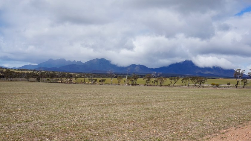
Day 226: 21 September 2019 From between Borden & Amelup to Stirling Ranges National Park 50,64 km (Total so far: 10.372,70 km) – Altitude climbed: 586 m Weather: Cloudy, rain, strong side and head wind
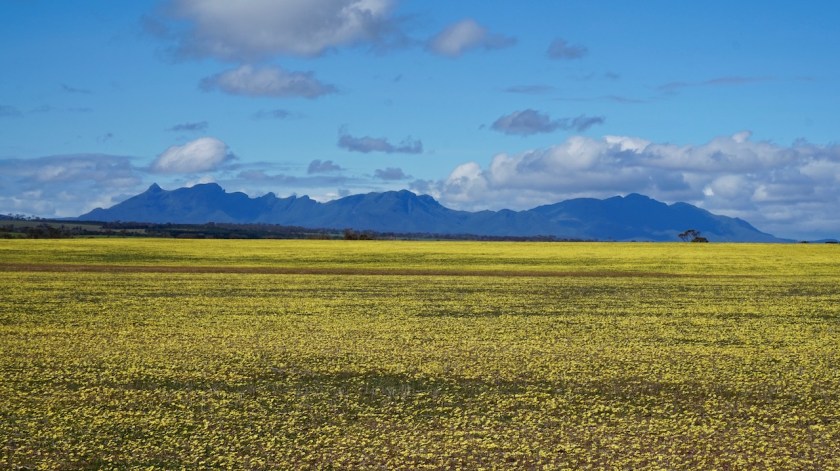
The goal today was to climb Bluff Knoll (1.094 meter) but the thing was covered in clouds as I was riding towards it. But then, some wind, the clouds were blown away, the sun came out.
But all that only for a brief moment. Soon the miserable conditions returned. Vertical rain and cold temperatures are not the conditions for a hike to a mountain top, even if it’s only a thousand meter high.
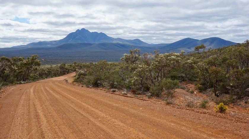
I continued riding, left Chester Pass Road and took Stirling Range Drive, a gravel road meandering its way through the park. Plenty of wild camping options.
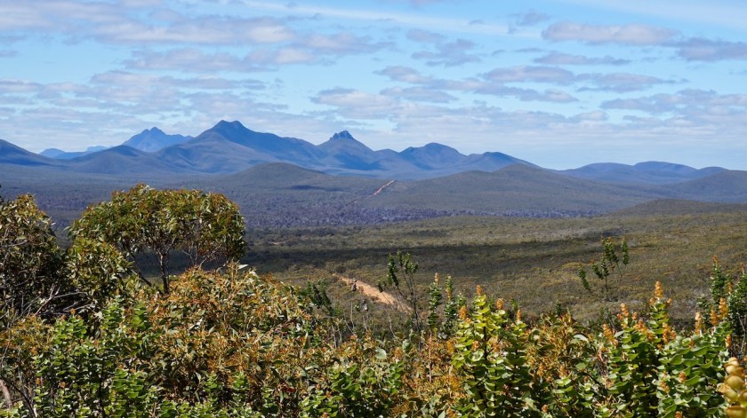
Stirling Range.Even bats are hit by traffic.
Bluff Knoll.
Day 227: 22 September 2019 From Stirling Ranges National Park to south of Kendenup 55,70 km (Total so far: 10.428,40 km) – Altitude climbed: 873 m Weather: Sunny, light tail wind
Aaah, the sun is back !
The wind, although having lost all its force, has turned toward the east and is giving me a helping hand.
The ride, it is beautiful. Gravel Road, just a handfull of cars, viewpoints, birds and at the end of the day a super-nice couple, Fred and Wendy, hosting me for the night.
I get my own lovely room and to top it off, the best pizza in years is prepared from their own wood fired oven.
A very good day.
View from the Central Look-out. That’s the dirt road I’m riding through the Stirling Range.
View from the Western Look-out.
Day 228: 23 September 2019 From south of Kendenup to Porongurup National Park 37,39 km (Total so far: 10.465,79 km) – Altitude climbed: 475 m Weather: Sunny, moderate side wind
Today, all my troubles (with credit card) were taken away.
No more worries. Well, there’s the laptop which is down, but we’ll see what can be done about that.
Fred and Wendy rode part of the way with me towards Mount Barker. Then, a short stretc of less than two kilometer on the Albany Highway, but there was a reasonable shoulder before the cycle path appeared.
A very nice Iga in town and friendly folks at the tourist info.
My original plan was to ride via O’Neill Road towards the Porungurups, but luckily Fred informed me that is not a through road.
The Mount Barker-Porungurup Road which I took instead was almost traffic-free.
I rode up the western slopes of the Porungurups and pitched my tent in the forest.
At Mount Barker. This must be the most important pedestrian crossing in the little town. There are four (!) of these little red and white triangles at this crossing and one are two of the green ones you see in the middle of the street to warn you not to dare, in your wildest dreams, to disturb the car traffic. Also note they refuse to paint a zebra crossing. As a pedestrian (or cyclist), even at the heart of a shopping area, you shall give way to the almighty car. Amen.
Day 229: 24 September 20219 From Porongurup National Park to Albany 88,24 km (Total so far: 10.554,03 km) – Altitude climbed: 772 m Weather: Sunny, moderate tail wind
Continued my route riding south of the Porongurups. I was in no hurry, so made myself a nice route almost all on dirt towards Albany. Once passed Oyster Harbour it’s all on separate bike paths into town. Really neat.
I was hosted again by a fabulous couple, Beth and Denis.
Instead of taking the South Coast Highway, I did my best to find the road less travelled again, riding mostly on dirt roads, except for a few kilometer before and after Munglinup for stocking up on provisions.
Day 206: 1 September 2019 From Esperance to Monjingup Lake Nature Reserve 15,33 km (Total so far: 9.741,88 km) – Altitude climbed: 197 m Weather: Sunny, rai in the evening, storm head wind
This was not a head wind, but a head storm. I am exhausted and have sour knees after ten kilometer so decide to call it a day at the first opportunity. I pitch my tent behind a tree and some bushes giving some reasonably good wind shelter. I think technically I’m not supposed to camp in the Monjingup Lake Nature Reserve, but I feel there was no other option.
Day 207: 2 September 2019 From Monjingup Lake Nature Reserve to near junction Browning and White Road 49,12 km (Total so far: 9.791,00 km) – Altitude climbed: 314 m Weather: Sunny, very strong head wind
I first roll down towards the Monjingup Lake. They have built a small but nice shelter with information, there is a clean toilet and a nice shelter for bird watching at the lake’s edge.
I must say the responsible people for all this infrastructure do an excellent job, the bike path, the very well maintained waterfront all along the town, the infrastructure at the lakes around town,…
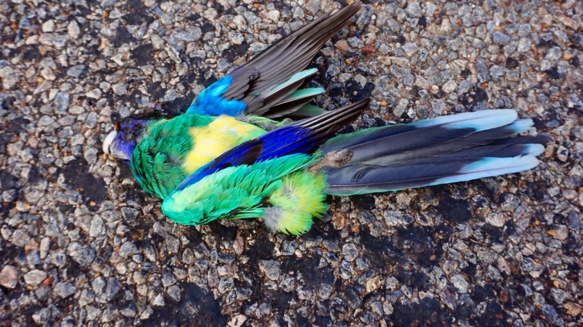
A (Carnaby’s ?) Black-Cockatoo on a Banksia tree. These birds are getting rarer and rarer as a result of historic persecution and continued loss of habitat.
I am riding in a westerly direction over the Telegraph Road. A few kilometer to my north is the South Coast Highway, which I want to avoid desperately, and to the south are some high dunes. All maps show the Telegraph road ends after a few kilometer and you have to loop back to the Highway. My map on the computer showed a tiny red line continuing westward.
At the junction with Bates Road, a sign says the Telegraph Road won’t continue, but I
ignored it. I was rewarded with a completely free sandy road, a bit undulating and views to some really high dunes. Some sections were too sandy and I had to push, but this is wayyyy better than the highway.
I spot a flock of Black Cockatoo’s. Really beautiful birds.
Telegraph RoadWhy ride a highway if you got this !
I hit the asphalt again at the junction with Murray Road, riding through a swarm of wasps for 50 meter. None of them stung, but it was a strange experience hitting all these wasps.
I have to ride 1,5 kilometer on the highway before I take a right turn on the Dalyup Road where I am again on dirt and completely traffic free.
Apart from the traffic on the highway I only saw a school bus in the end of the afternoon.
Very hard day against the wind. And the forecast is it will continue. the wind will shift to southwest, but so will my driving direction as well.
Day 208: 3 September 2019 From near junction Browning and White Road to along Jonegatup Road 65,82 km (Total so far: 9.856,82 km) – Altitude climbed: 338 m Weather: Sunny, cloudy, very strong head wind
Another day battling against a fierce head wind. Not long into my ride I see a snake taking a sun bath on the road. He/she is about 90 cm long. After I stamp the ground a few times with me feed, he/she wakes up and makes a quick exit to the side of the road.
The rest of the day is quite uneventful, just that hard work against the elements. I remain on the undulating dirt roads north of the highway. Kilometers and kilometers of fields with yellow flowers.
Cheerful place to wake up 🙂
Day 209: 4 September 2019 From along Jonegatup Road to along Doyle Road 38,00 km (Total so far: 9.894,82 km) – Altitude climbed: 321 m Weather: Sunny, cloudy, lot of rain at night, very strong head wind
From my well sheltered camping spot, I could hear the wind in the trees as it was picking up force after sun rise. And boy was it a head wind again. My track was climbing at one percent, and combined with this head wind I was moving forward at something between 4 and 5 km/hr.
Eventually I hit the South Coast Highway again.
Five kilometer later I’m in Munglinup, where there’s a roadhouse, my reason for going shortly on the highway. They sell drinks, bread, chips, ice-cream, chocolat. I eat a warm unhealthy lunch of fries and ….. I don’t know, some mysterious things which I imagine counts as the meat of my meal.
Good, stocked up with water and bread I continue. Another 3,5 km/hr on the highway, then I take aleft turn to another dirt track. The ladies in the roadhouse said I shouldn’t take this road towards Hopetoun. “Too dangerous.”
“Why ?”, I ask them.
“There could be snakes on the road.”
Well, I think those snakes are far less dangerous as the car drivers on the highway. Especially snakes on the road, which I see from far away.
Snakes in the bush, when I am searching for a camping spot, that’s another story maybe.
I call it a day pretty early as it seems it might start raining. I pith the tent along a little side track of this dirt road.
Only half perfectly sheltered for the wind. Hopefully it will be sufficient.
It was much easier to find good sheltered places in the desert as here in this agricultural region.
I can see kilometers and kilometers of new land is cleared from forest to make new farmland.
It is not only Brazil which is a problem. Everywhere on the planet we are doing the best we can to destroy it. But of course, ‘this little bit is not going to make any difference…’.
Day 210: 5 September 2019 From along Doyle Road to 12 Mile Beach 70,18 km (Total so far: 9.965 km) – Altitude climbed: 404 m Weather: Sunny, moderate head wind
It rained a lot last night and the little dirt road towards the main dirt road is flooded. My main dirt road is mostly dry but so soft it feels like riding over a sponge. Combine that with more head winds and little hills and the going was slow again.
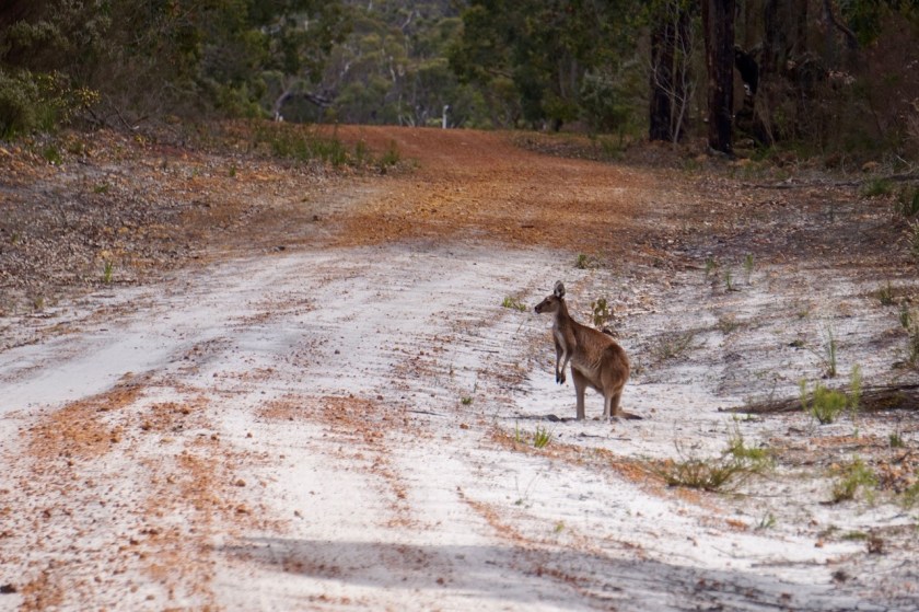
To my surprise there is almost no traffic on that little road skirting the shores of the Southern Ocean. Four cars all day. I see a few kangaroos and a fox.
There are not many direct views of the beach, as the dunes are in between and the road is mostly a few kilometer from the shore. There are a few lakes between my road and the dunes, the biggest one Lake Shaster.
Starvation Bay is one of the few places where one can actually go on the beach.
It is also the beginning (or end) of the Rabbit Proof Fence, an 1.832 km fence running all the way to Port Headland. I didn’t see any fence though.
Starvation Bay
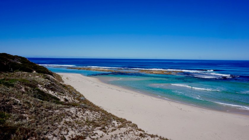
Day 211: 6 September 2019 From near 12 Mile Beach to Near 2 Mile Beach 29,06 km (Total so far: 9.994,06 km) – Altitude climbed: 217 m Weather: Sunny, light tail and head wind
Today my route runs much closer to the beach with a lot of possibilities to go over the dunes and have a look at the fantastic empty white beaches and the blue ocean.
Jerdacuttup Lakes
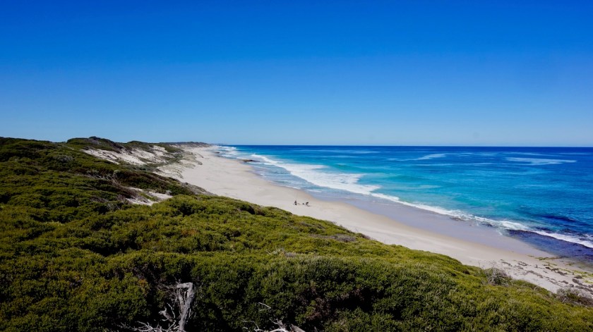
Day 212-219: 7 September – 14 September 2019 Hopetoun 65,79 km (Total so far: 10.059 km) – Altitude climbed: 856 m Weather: Sunny
I took some rest days in Hopetoun. It is a perfect place for me. It is just a small village, at the end of a death end road. I guess it gets busier during holidays but for now, it’s all peace and quiet.
The beaches are spectacular, both sides of town.
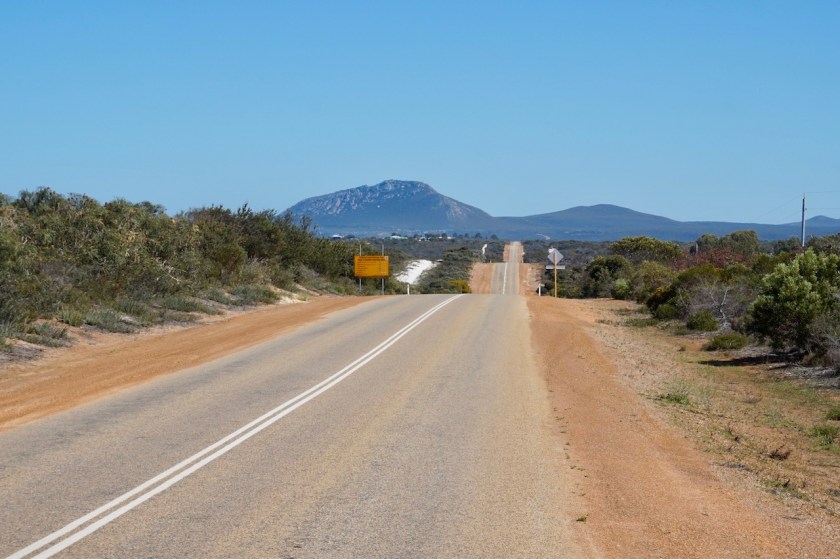
I also made a trip to East Mount Barren. I will pass there on my way out, but I wanted to make a full day trip of it and take my time to enjoy it.
There is a new road, just opened a month ago, running between the Southern Ocean and the Culham Inlet. Then there’s a steep climb up the flanks of East Mount Barren.
The hike to the top takes about 45 minutes. The views to the coast and to the Fitzgerald River National Park and the Whoogarup Range are spectacular. I was more lucky with the weather then when I wanted to climb Frenchman Peak in Cape Le Grand National Park.
The roller coaster road towards East Mount Barren.East Mount Barren, rising up out of the Southern OceanOnly a short bit at this gradient, but it makes your heart pumping.
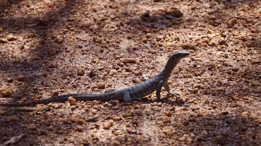
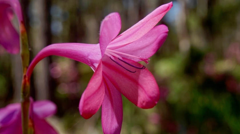
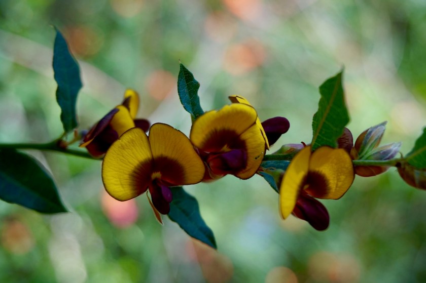
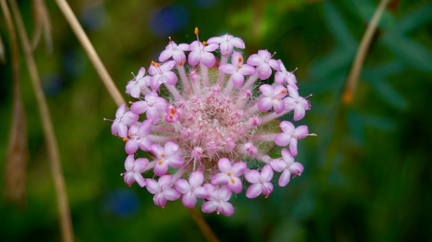
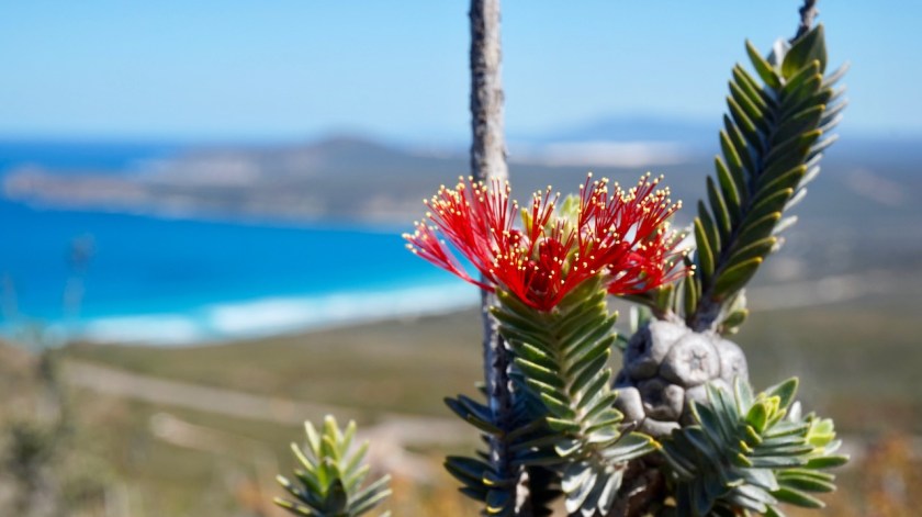
Royal HakeaConeflowerRacehorse Goannaconeflower
Enjoyning the view from the top of East Mount Barren.This view ! 😀 To the left, Culham Inlet, to the right the Southern Ocean.My road when leaving Hopetoun, through Fitzgerald River NP. In the distance, the Whoogarup Range