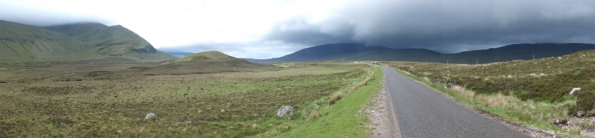
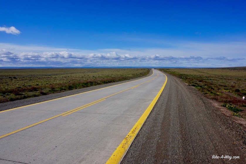
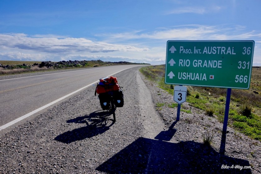
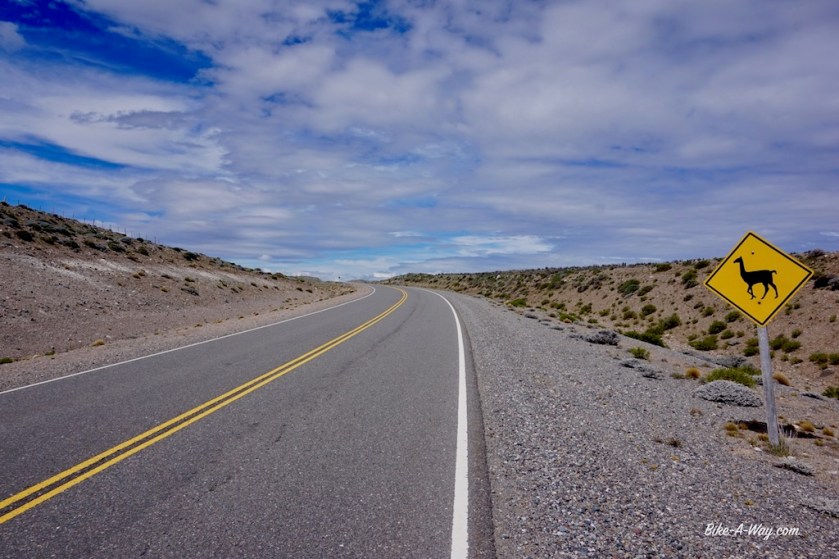
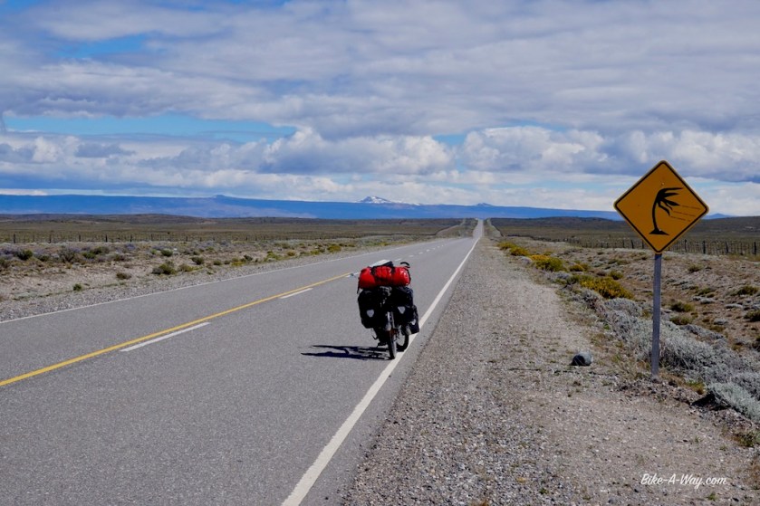
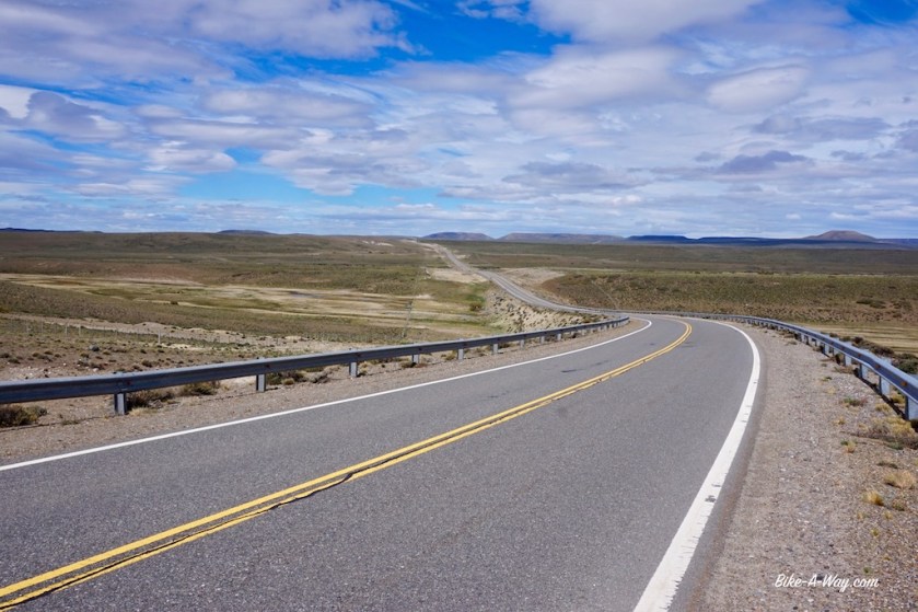
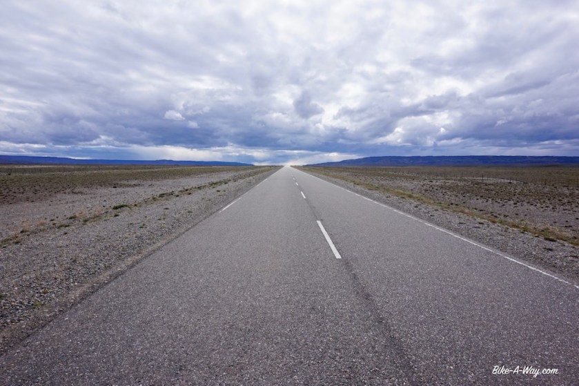
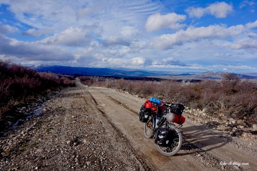
Route: Punta Delgada – Cerro Sombrero – San Sebastian – Rio Grande – Lago Yehuin – Tolhuin – Ushuaia
I’m on Tierra del Fuego. Dreamed about that a long time.
Before the finalization of the Panama Canal, the Strait of Magellan was the place were the Pacific and Atlantic Ocean met and through which most of the marine traffic came.
Apparently, the Strait itself belongs to the Pacific Ocean and the whole strait belongs to Chile.
The island Tierra del Fuego is half Chilean, half Argentinean, so I have to cross borders a couple of times.
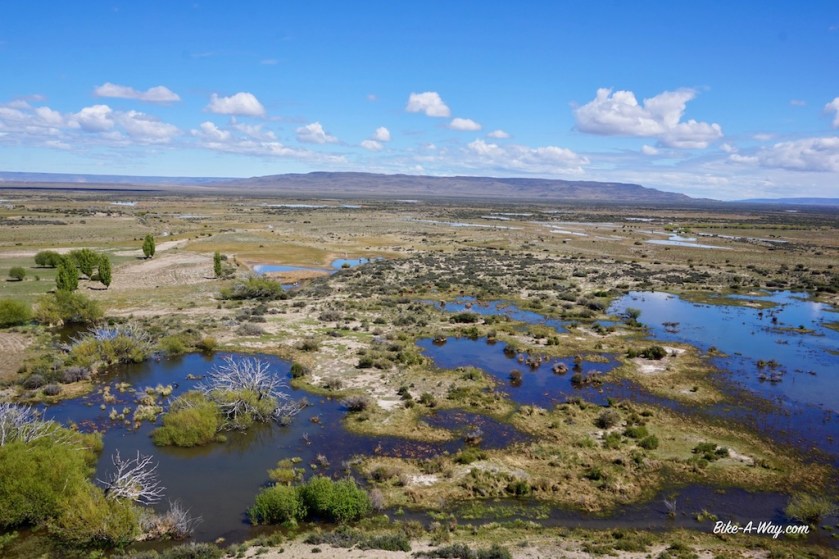
The name Tierra del Fuego is used for a whole archipelago of islands, of which Isla Grande is the biggest, with an area of 48.000 km2 it’s 1,5 times bigger as Belgium.
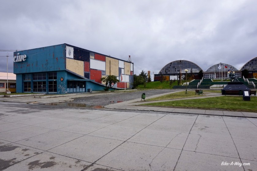
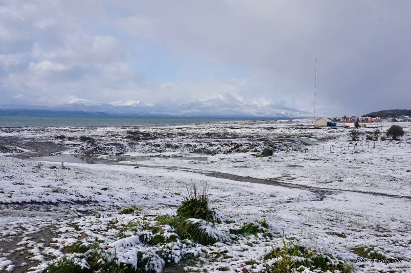
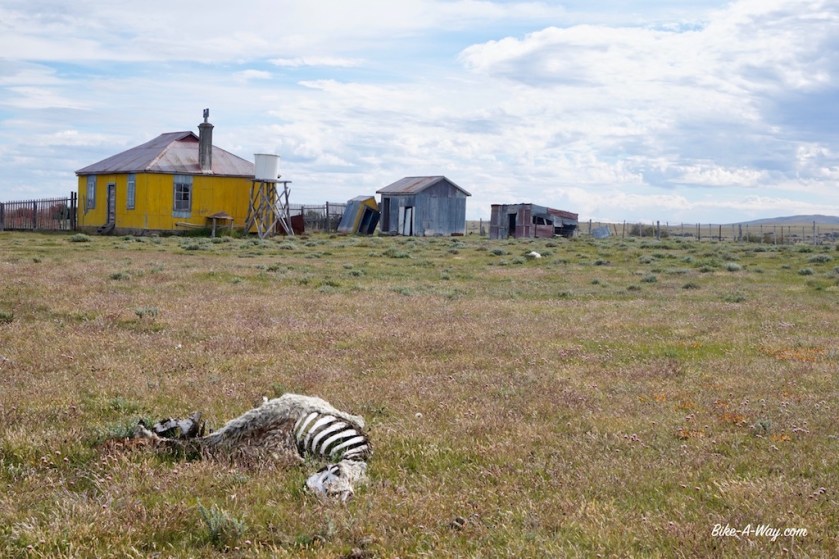
At the end of the afternoon of my first day on the island, I entered the little ‘town’ of Cerro Sombrero. The camp ground is closed, because they’re messing around building some kind of ugly dike. But I was lucky a friendly citizen spontaneously offered me to pitch my tent in his garden. There’s a brand new tourist info, with a very qualified guy working there and spotlessly clean toilets and showers.
@ Cerro SombreroThe cold and windy Macadam road out of Cerro Sombrero
A bit out of Cerro Sombrero, the island becomes a bit hilly. A welcome change for the flat steppes I travelled through the last weeks. It’s a wet and windy day and I was told there’s nothing until the border post at San Sebastian.
But look, in the afternoon, just as I’m leaving the hilly terrain and enter the flatlands again, I see a building along a road, the ‘Hotel Tierra del `Fuego’.
Excited I put my bike against it and enter the building, but there’s nobody to welcome the guests. It’s a one room hotel only, so I thought “maybe they come along in the morning”.
The room clearly wasn’t rented out yet, and I don’t think it’s the kind of place you can make reservations for on booking.com. First come will get it, so I prepared myself for the night.
Laying down there, I saw all the holes in the walls. Would locals shoot at the walls, like they sometimes do with traffic signs ? It wouldn’t be nice to get a bullet in my ass overnight. Hearing the wind picking up outside, I didn’t have much of a choice then spending the night in this hotel, so I hoped for the best.
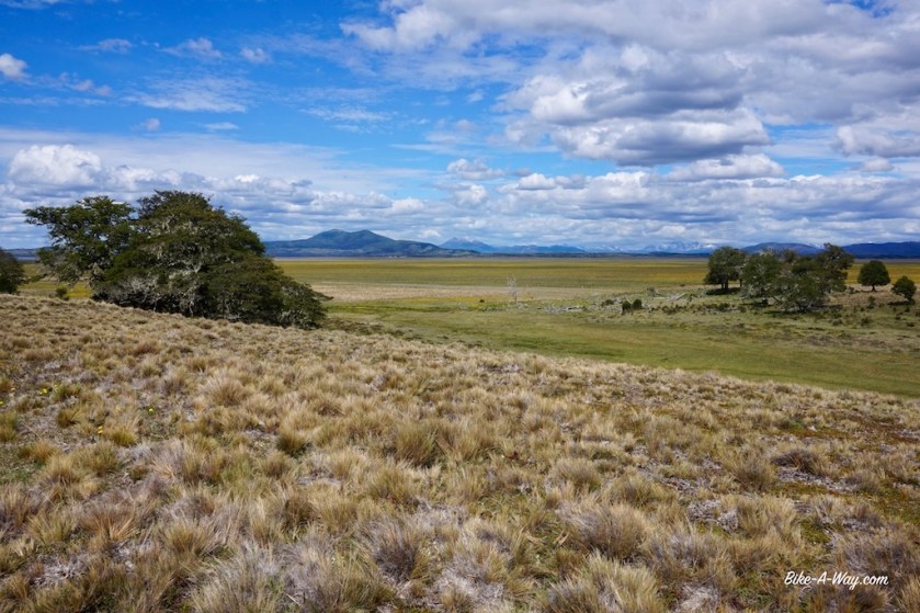
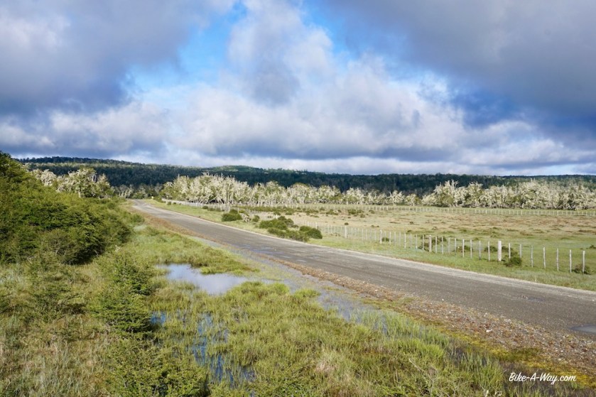
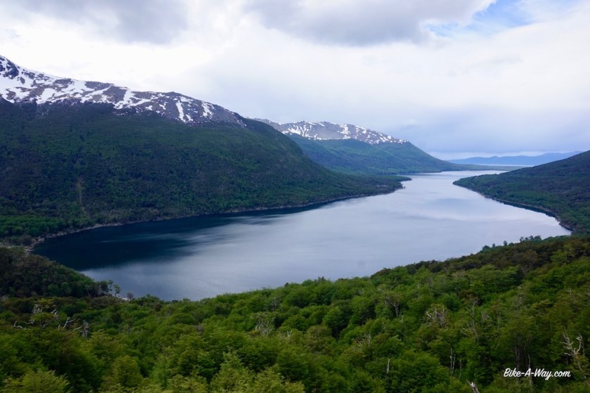
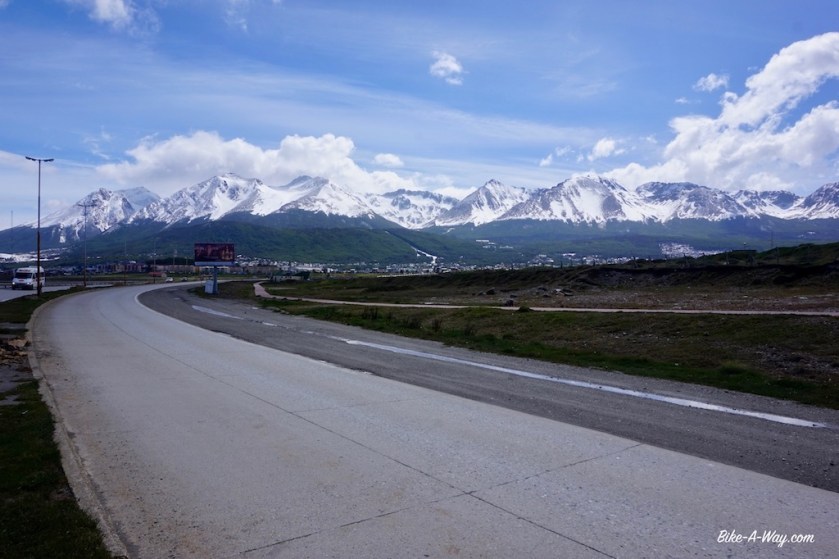
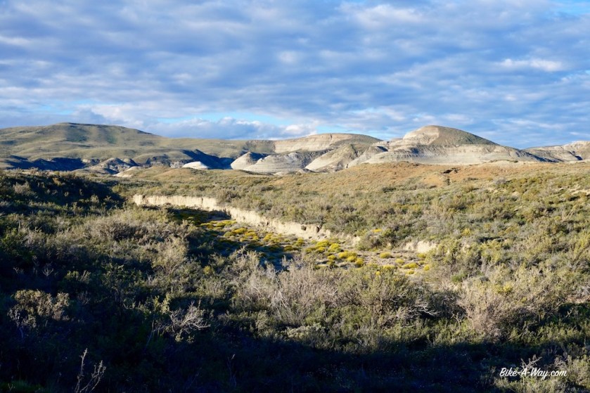
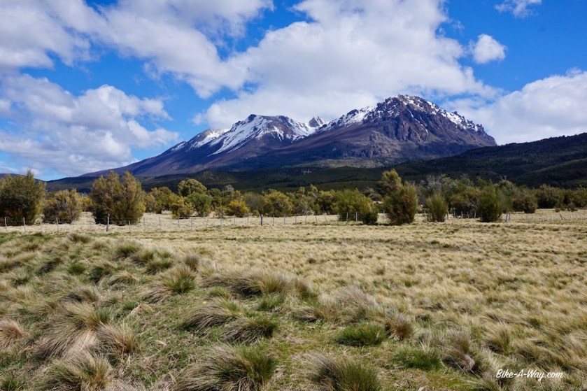
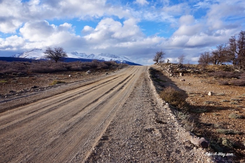
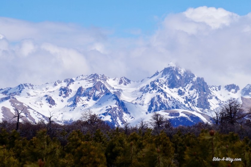
The center of Tierra del Fuego is a bit hillier, and nicer.
This Argentinian guy was pulling a cart of 120 kg. He started at Bahia Lapataia, 25 km west of Ushuaia and intended to visit every provincial capital of Argentina, before continuing north (to Alaska ?). And sometimes I think I have a hard life 😉My hotel ‘Tierra Del fuego’ which saved me from a terribly windy night in this barren pampa.
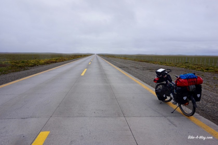
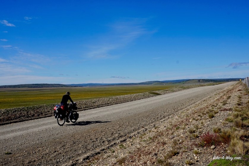
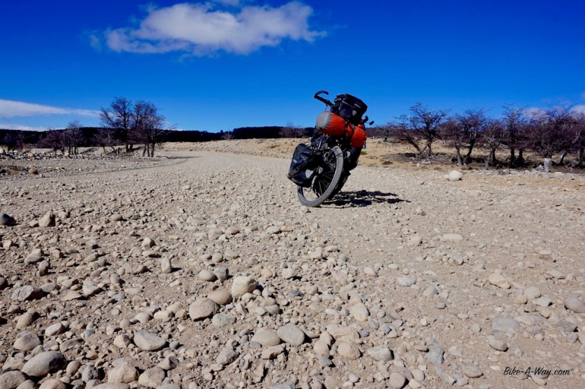
Next day, I had to battle hard again against the storm, but there were good prospects. 25 km down the road, I ‘m gonna turn left, towards the east, and have it in my back. The wind blew me quickly towards the border post at San Sebastian. It’s still a dirt road here, but they’re building a macadam road, so you should be fine in the near future. There’s a hostel and a very small kiosko at the Chilean site of the border.
To my surprise, there was a long line of people waiting. A bus with backpackers and they have to take all their luggage out of the bus and it has to go one by one through a scanner.
I got a special treatment, was stamped out and waved through without any checking or problems.
Thanks Chilean officials ! 🙂
The Chilean site of the border at San Sebastian
It’s about 10 km to the Argentinean immigration. That bus only caught up with me just before I arrived, and I made a lot of photo stops, so that must be a hell of a bus ride, coming from Punta Arenas, crossing border 3 times. That’s why that bus rides takes 12 hours I guess.
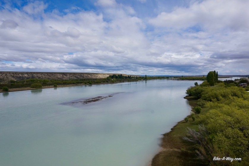
I was stamped back into Argentina without a problem and had the Atlantic ocean in sight again.
I read many stories of cyclist who end up sleeping in a room at the Chilean border. The room is their, I saw it, but it’s not gonna be quiet.
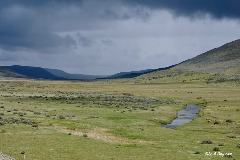
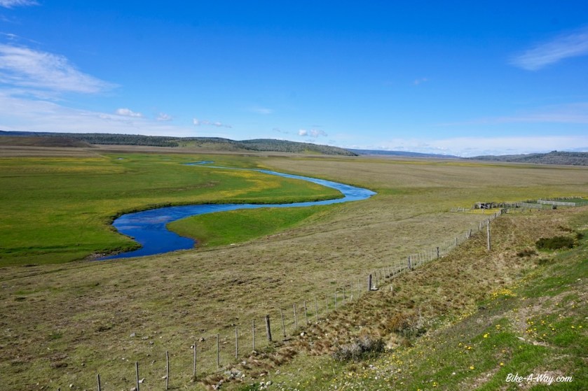
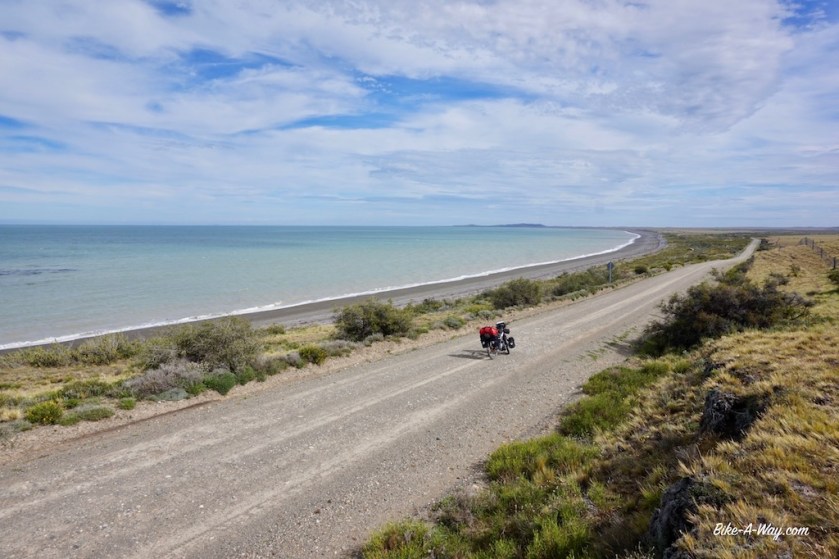
Better ride on, because after the Argentinean border, once you’re along the coast, there are some nice camping spots between the hills.
Near the road RN 3, between San Sebastian and Rio Grande. I got enough shelter from this small ridge. Atlantic Ocean in the background.
Coming this way, I had no choice but to enter Rio Grande, quite a big town on the Atlantic side of the island. It’s hell. It looks like hell, it sounds like hell, the traffic is hell.
I limit my stay to a visit of the local Carrefour and try to get out of this place a.s.a.p.
Simpler said then done, with the road works going on.
About 15 km south of Rio Grande, I turn inland, on dirt road nbr 9 (road ‘F’ on older maps).
Instantly life is good again. After a few kilometers, the trees re-appear.
Brilliantly beautiful trees with lichen.
Somewhere aong the first kilometes on this dirt road, I pass the 25.000 kilometer mark of this trip.
I jump a fence and find a nice camping spot.
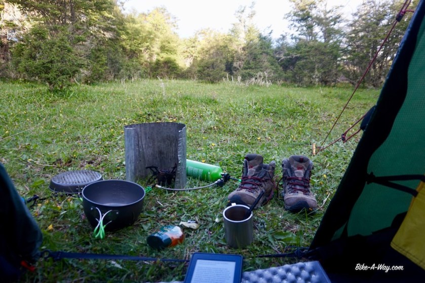
Camping on a grassy spot, between trees, but open enough for some sunshine; that’s perfect.
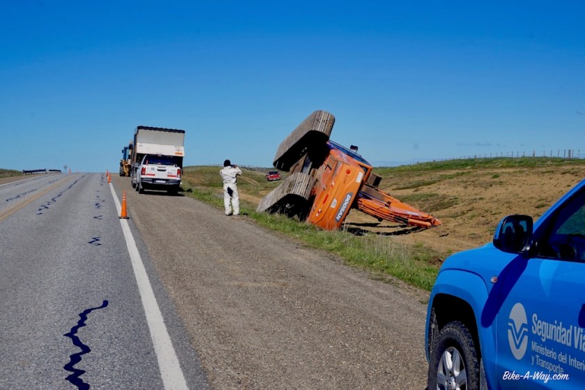
This crane was blown of the trailer at the top of a hill outside Rio Grande.A grassy wild camping spot, sheltered by trees, a bit of sun, a book to read …. life is good.
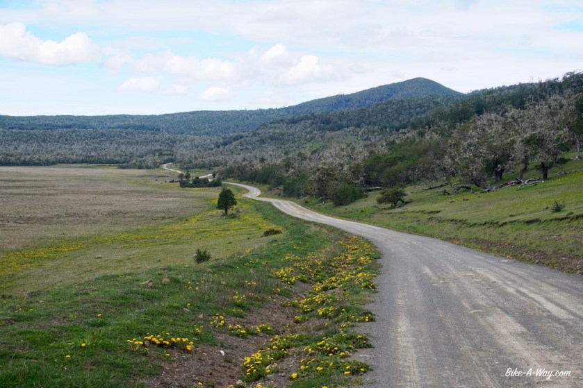
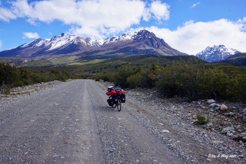
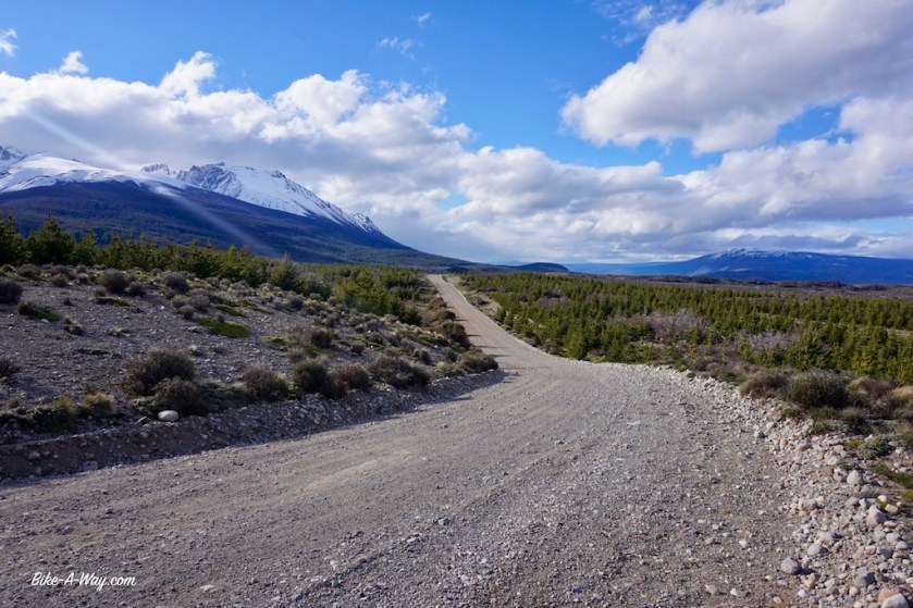
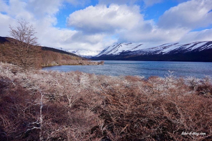
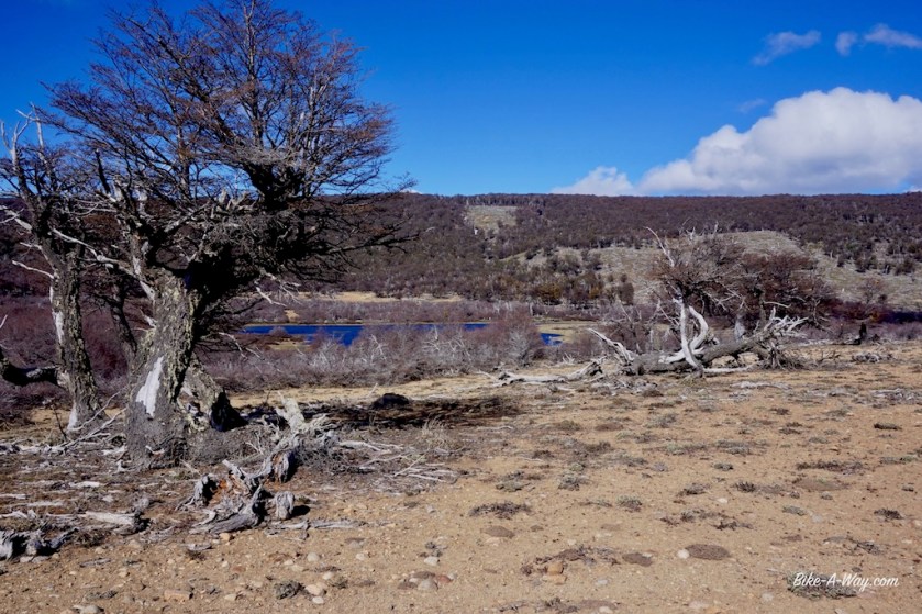
I ride another two days on these roads, going from one hill to the next, taking a small road down to the ‘Lago Yehuin’, often described as ‘the center of Tierra del Fuego’.
There’s an abandoned small holiday resort (completely in ruins) and some grassy fields where you could camp if you like.
All the graffiti on the walls suggested the place is frequented by stupid idiots from time to time, and the wind was blowing in from the lake, so I went on a bit further to find a good spot where I sure would be on my own for the night.
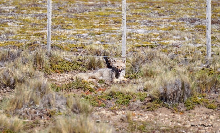
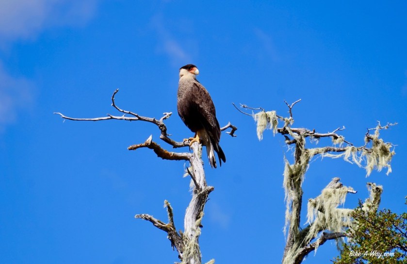
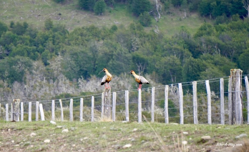
‘Southern Crested Caracara’. They are not shy and love to tear the plastic sacks you pull over your saddle at night. Then start picking your saddle (because it’s salty from sweat ?)
I have been incredibly lucky the past weeks with the weather.
Sure, I’ve had my fare share of head winds, but the temperatures have been above 20 degrees with lots of sunshine. Now, however, it’s changing and I end up taking shelter under a barn for an hour.
Trees full of Guido Belcanto hair
‘Buff Necked Ibis’, you see them often here
Soaking wet, I arrive in Tolhuin, a place famous among cyclists in South-America.
The bakery ‘Panadería Unión’ is also a Casa de Ciclistas, and virtually every cyclist riding down to Ushuaia stops here.
And so am I 🙂
All afternoon, evening and the next morning I stuff myself with the delicious things they’re baking here.
The sleeping room at the bakery in Tolhuin.
The Paso Garibaldi is the last main obstacle between Tolhuin and Ushuaia.
The weather at the other side of the pass is so awful I quickly dive into a field and pitch my tent on soggy ground.
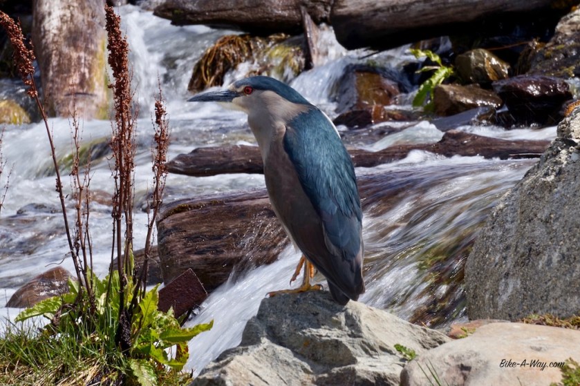
‘Black-Crowned Night-Heron’Just as I missed the 25.000 km mark on my odo-meter outside Rio Grande, I also missed the 3.000 km marker of RN 3. But this one will do nicely.Lago Escondido (the ‘Hidden Lake’)
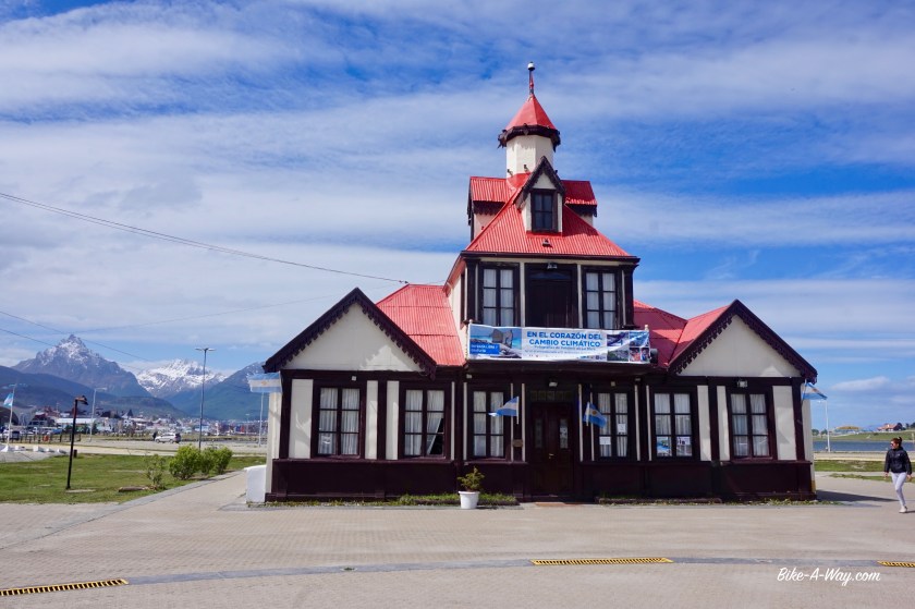
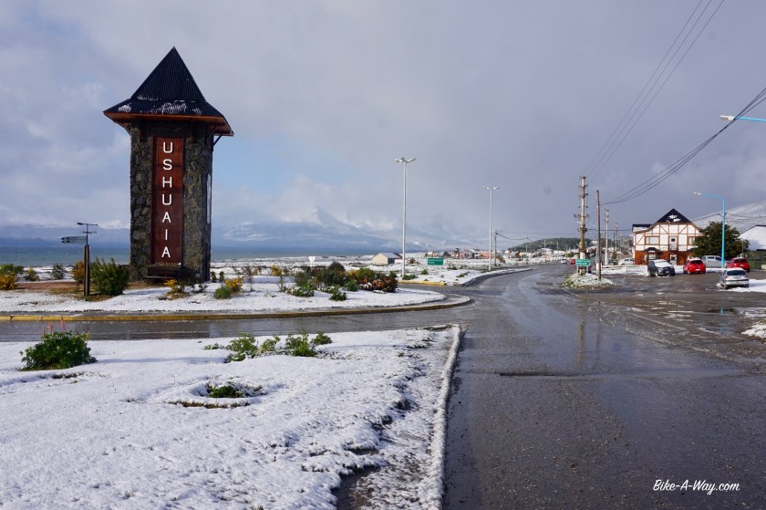
Then, on 17/11/17 I arrive in Ushuaia, the southern most city in the world.
I started this trip on 16/4/16. I have to keep in mind to make it to important points on easy to remember dates.
After crossing the Strait Of Magellan, I ‘m now cycling along the Beagle Channel, this other famous maritime route, unbelievable.
What’s also quiet unbelievable, is the harsh conditions in this place.
Ushuaia is located at 55 degrees in the southern hemisphere. In the northern hemisphere, you ‘d be at Copenhagen, which has a much milder climate.
Last year, I was standing with my bike at the North Cape, only 2.102 kilometer from the North Pole and well within the Arctic Circle, while I haven’t passed the Antarctic Circle here and I’m almost double as far from the South Pole (3.926 kilometer).
BUT, Ushuaia is only 1.000 kilometer from Antarctica, which I guess will be one of the reasons for the extreme weather here.
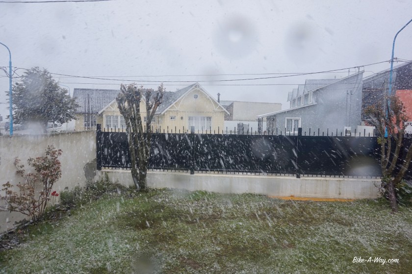
That weather really turned for the worst during my first day. Instead of 20+ degrees days, I now have temperatures just above freezing, lots of snow, rain, storm. Local paved roads are being washed out. A submarine disappears. I hear the trails in the National Park are closed because many trees toppled over.
So, lucky to be warm inside the hostel for four days.
Not being a ‘hostel-guy’, I do have to say I enjoyed my stay in ‘La Posta’ Hostel. It’s a bit outside of the center, but it’s spotlessly clean, modern and with a descent breakfast and slow wifi.
But wifi is slow everywhere in Argentina.
Beagle Channel
The mountains above Ushuaia.
Buenos Aires – Ushuaia
Distance: 4.511 km
Average km per cycling day: 64,44 km
Altimeter: 32.868 m
Route: Gobernador Gregores – Comandante Luis Piedra Buena – Rio Gallegos – Monte Aymond – Punta Delgada
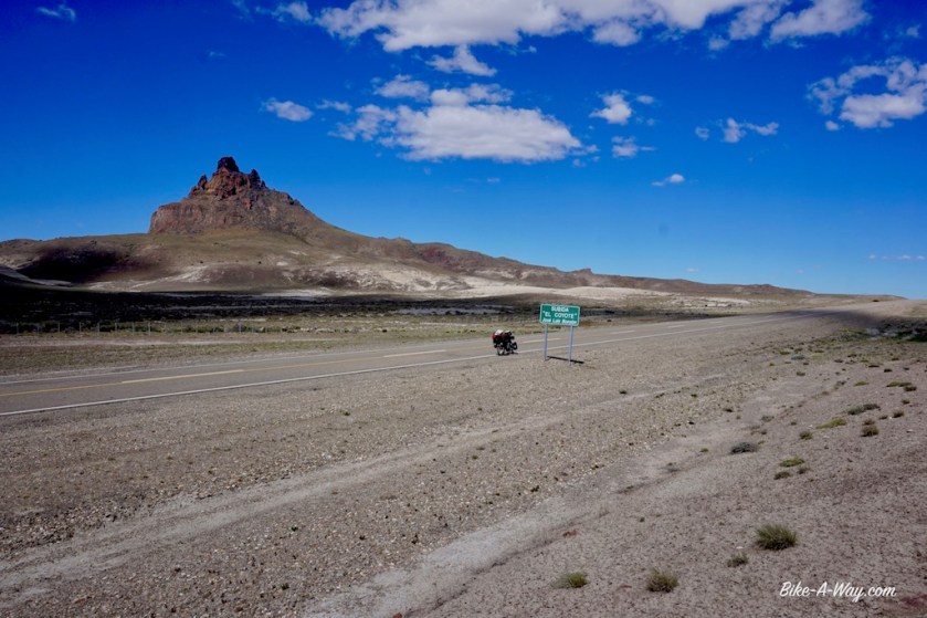
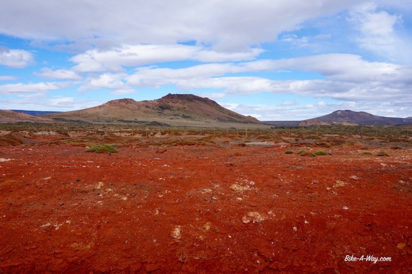
I decided to leave the Ruta 40 and take road nbr 27 towards the Atlantic coast to visit another national park. The first 60 km are really beautiful in the valley of the Rio Chico with some spectacular shaped hills. On my left side is the ‘Gran Altiplancie Central’ which I’m descending now. That Altiplancie isn’t that ‘alti’ by the way. On my right (southern) side is again a steppe like landscape. I can imagine the winds going like hell here, but today it’s quiet and sunny. About 6 km before the junction of ruta 27 and 71 the road goes a bit down into a valley. I unload the bike to lift everything over the fences and push the bike a whole way into the valley to find a fantastic spot for the night. Heaven after yesterdays hell at the campground in Gobernador Gregores. The full moon is out, I’ve got a few birds singing, some geese and a few horses in the distance. Don’t know if I’ve got puma’s as well. People keep warning me about them. But people are afraid of everything nowadays.
I complained about all the fences before, but here I see for the first time they use barb wire, for which I see no reason (to keep sheep inside ??? – no barb wire needed). At several points, I saw guanaco’s who didn’t make it and must have suffered a horrible, long and painful death. And again … for what reason ??Brilliant camping spot.
Two days later, after another night camping in a gravel pit, the entrance into the little town ‘Comandante Luis Piedra Buena’ must be the dirtiest entrance to a town ever. They’ve got an open garbage dump in the valley just outside of town. With the Patagonian winds, everything blows around kilometers wide, all the way onto the hills, garbage everywhere.
Disgusting.
I only stop in town to buy provisions and head down south on highway 3.
My view all day long to the left of the road. To the right, it’s identical 🙂There were two death dogs at the gravel pit, obviously killed, which was fine by me because they didn’t look like friendly chaps at all, but I could smell them even down below in the gravel pit.This gravel pit was quite deep, but still a lot of wind in here.
After 27 kilometer, I arrive at the park headquarters of Monte Leon. The park rangers were gone already but there’s a notice at the door. It claims the park is closed because part of the road into the park is washed out.
Excellent news !
It being a Saturday, I was afraid there might be groups of people, bbq-ing late into the night, screaming and shouting as they like to do here.
Now I would have the park all for myself and very quiet.
They’ve printed two pictures under the notice. Yes, it’s clear, you can’t pass by car.
But I saw no problems for a bike.
The actual road into the park was a few kilometers further down RN 3.
As they closed the fence, I again had to unload the bike and lift everything over it, like I have to do almost every night in order to pitch the tent somewhere.
From the main road, it’s a 20 kilometer ride down to the coast.
The little wash outs could be repaired in a day I think, but apparently they don’t do it.
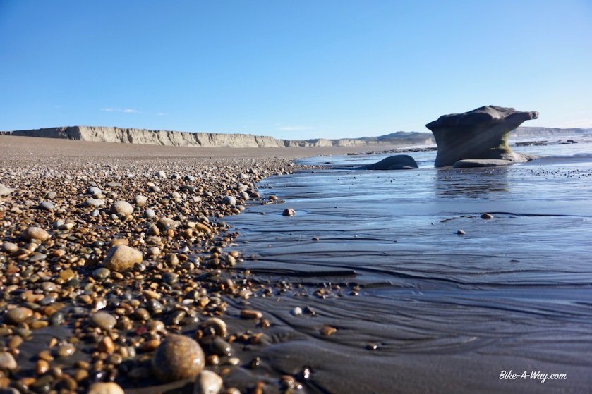
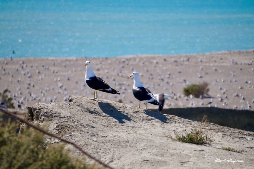
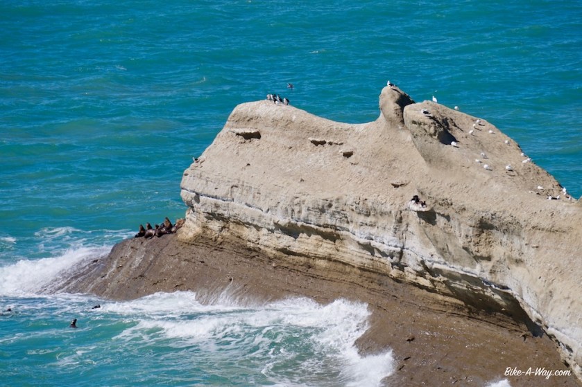
After a very, very windy night, I first go and have a look at Monte Leon Island, with thousands of seagulls and cormorants. Then I cycle to the point where you can see the sea lions.
I just mounted the bike again when a motorbike approaches me and stops aggressively. A guy in a green uniform, obviously a ‘guardaparque’ shows his dissatisfaction of me being here. I play dumb a bit, but nothing to do about it, I have to leave the park. A whole explanation of ‘seguridad’ and that blablabla that’s always used nowadays to restrict people of doing anything.
He literally follows me on his motorbike, but I calmed him down a bit, explaing I came from the other side of the world, especially to see this beautiful park.
The milky white Rio Santa Cruz at Comandante Luis Piedra BuenaAlong the dirt road in Parque Nacional Monte LeonP.N. Monte LeonI’m back at the Atlantic Coast.
If I have to believe the signs, the park must be teeming with pumas. Every trail had a sign warning you shouldn’t enter alone (apparently puma’s only attack loners ?). A bit hard, when there’s no one around.
Monte Leon island, full of sea gulls and cormorants.
The sea lions. You can clearly see the big male.
It’s a slow ride, as I have to climb onto the plateau again. After a few kilometers, we arrive at the track that’s going down to the penguins, the reason why I’m here, so I give it a shot and ask the guardaparque whether he doesn’t feel like visiting the penguins ?
A big ‘NO !’ haha.
Back on RN 3, There’s a strong north wind which blows me quickly down the road. Unfortunately, it becomes a side wind later, but pitching my tent that evening along the borders of the Rio Coig, I had 142 kilometers in the legs. Not much protection from the wind here. I found some bushes that were a bit higher then the average 30 cm scrub growing here, but it sure was a beautiful place to spend the night.
The huge valley of the Rio Coig. Nothing but scrub, no real trees for protection against the wind.I pitched the tent behind the biggest (thorny) bushes around for kilometers. But they gave good protection.Nice couple. The road was full of their death friends.
In order to avoid a night in Rio Gallegos, the capital of Santa Cruz province, I stopped at the campground 25 kilometer west of town at the bridge over the river, in Guer Aike. It’s a reasonably quiet place, so good for a rest day. Last days, I had excellent weather, temperatures mid twenties and mostly a tail wind.
Getting close to the Falkland Islands, known as ‘Las Malvinas’ in Argentina.
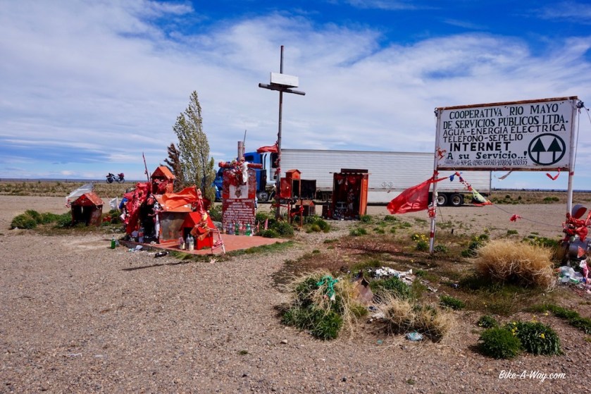
Shrine for ‘San Expedito’, my protector 🙂
Rio Gallegos is bigger, louder and uglier as expected. After buying provisions and a few near death experiences because of the total idiots driving around, I leave town. Luckily, a few kilometer south of town, the road becomes quiet again. I pushed on towards Laguna Azul, a crater lake about 9 kilometer north of the border with Chile. I pitched the tent down in the crater, next to the lake. That’s a descent of 55 meter into that crater. It’s so steep I have to unload the bike and go three times down and back up again to gather all my stuff. And get up a fourth time after pitching the tent to make pictures of course.
Getting nearer and nearer.The crater lake ‘Laguna Azul’, the ‘Blue Lagoon’. No Brooke Shields however, of which I’m glad. I’m not waiting for an angry Andre Agassi next to my tent.Beautiful pitch inside the crater.The lake hasn’t stolen it’s name. I was hoping a bit for warm water inside this volcano but it wasn’t meant to be. Ice cold.
A brilliant spot to spend the night, but I estimated I’d need at least two hours to get my bike and stuf back to the rim the next morning. Again I had to travel four times up and down, but every time you make a step 30 centimeters up, your feed sinks down 20 centimeter in the loose gravel, so in fact you climb it each time three times.
Allas, after an hour I was up. In the nine kilometer to the border, I ate an apple and three carrots, as you’re not allowed to bring those into Chile. This border region is pretty beautiful, with extinct volcanos on both side of the road.
For one or the other bizar reason, I didn’t get an exit stamp from Argentina, but the Chileans made no problem stamping me in.
After the border control, I soon see the Strait Of Magellan. There’s a tiny grey line on my map, right next to the Strait, and I decide to leave the main road for this one. Now, I’m riding a few meters away from the Strait of Magellan, what I find a magical experience. This strait with all it’s history, but also the knowledge that I’m riding my bike right on the southern edge of ‘The America’s”. Sure, there’s still Tierra del Fuego further south, but that’s an island. This is the far end of the American mainland.
After sleeping in a crater yesterday, I’m pitching my tent tonight pretty close to the shores of the Strait.
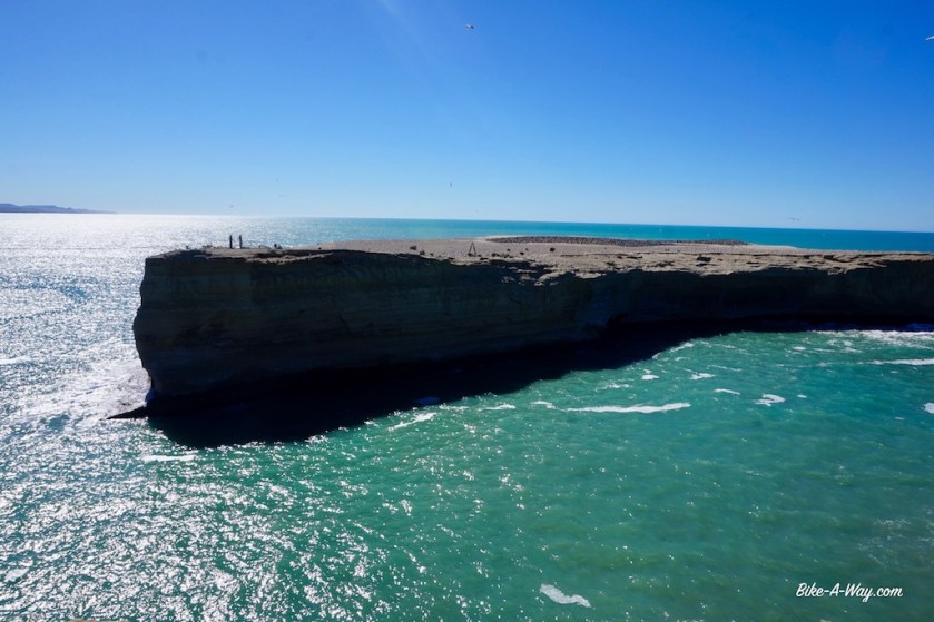
The famous Strait of Magellan, separating Tierra del Fuego from the American mainland.
It was a Belgian, Roeland van Brugge, who was the first person of the Magellan expedition to see the Pacific Ocean. Together with a few other guys, Roeland van Brugge was send ahead in a dinghy to check whether the Strait was a dead end or not. They checked several bays and in the end, Roeland climbed a mountain and could see with his own eyes that the Strait ended in the Pacific. That mountain is known to this day as ’Monte Campana de Roldán’.
The ripio road along the Strait of Magellan
The weather Gods punished my early stop yesterday with a strong head wind today. But never mind, that early stop was needed, because my desire to sleep one night next to the Strait of Magellan was too big. And I needed to make bread.
I took the ferry across the Strait at Punta Delgada and left the American mainland behind, towards Tierra del Fuego.
Fire Land ! Magic ! 🙂
The end of the road at Punta DelgadaLighthouse at Punta Delgada
Route: Gobernador Costa – Rio Mayo – Perito Moreno – Gobernador Gregores
I stayed at the municipal campground in Gobernador Costa. I first inquired whether they had showers. “Sure”, the man who received the camping fee said, and he showed them to me. When I went for a shower, undressed …. no water of course. Still, the man didn’t lie, there were showers.
I dressed and went to his house. Only an older woman, probably his mother, was there. I explained the situation as best as I could.
She gave me the keys to another building, in the middle of the campground. There were showers as well, she said.
The woman didn’t lie. There were showers. But no water.
I gave up, washed my self at the little sink in the first building. As a little revenge, I washed my clothes under the sign which forbade you to wash your clothes, and hung them on the woman’s cloth line.
The real strong wind had eased down a bit the next day, but is was still blowing considerably good and, and from the northwest, so in my back.
Despite starting at noon time only (updating website in the Ypf gas station), I had my biggest day so far in South-America, 135 km.
Traveling this far, meant I traversed a whole latitude on the map in one day on the bike, namely from S44°02 to S.45.04. It must have happened before of course during my travels, but it’s the first time I’ve noticed it.
Traveling at this speed, the landscape which my guidebook describes as ‘boring’, is actually rather interesting. I’m crossing the ‘Pampa Apeleg’ here, flat land overgrown with tiny bushes and see to my right the Andes in the distance, some other hills closer by to the left.
At Los Tamariscos, about half way between Gobernador Costa and Rio May, you can get some extra water.
I pitched the tent in a gravel pit, which only slightly protected me from the wind.
I continued to have a super strong tail wind for another 50 kilometer, till the junction for Comodoro Rivadavia and Rio Mayo. I wanted to go in the direction of the latter and descended towards the river. Great camping spots between trees here if you want. I just stopped to have lunch.
Climbing out of the river, I cycled for 30 centimeter. As I made an almost 180 degrees turn, I had that strong wind bang in the face now. Nothing to do than to push the bike out of the valley. Even more winds when I was out of it.
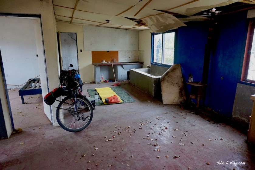
I looked down at the river, the trees, the gras in between ….. what the heck, I had a long day yesterday, and pushing against this wind is ridiculous. I went back down to look for a place for the tent. But that wasn’t even necessary. There’s an abandoned bungalow which I, after sweeping it out a bit, made mine for the night. When I heard the wind blowing in the trees and banging some loose metal part of the bungalow, I was pretty glad to be inside.
‘Ceferino Namuncura’ another Argentinian Saint or something. They offer water bottles to him. Plenty of water bottles.Gauchito Gil is here as well of course.I guess hanging a clothes line equals claiming the property.Inside, the place was in decay, but I swept out my little corner of the place, so it was good for a night.
The wind blew severely all night. Only between 6 am and 8 am it was a bit quieter.
I aimed for an early start the next morning, as the wind tends to pick up during the day. I half succeeded, as I was on the road by 9 o’clock, which is early for me. Pushing the bike back out of the river valley, it slammed me in the face as what seemed double as hard as yesterday.
I made an attempt to cycle, but that was ridiculous. Before I could even swing my leg over the saddle, I was blown back already.
Incredible these winds.
I pushed the bike, walking in the gravel shoulder of the road. I ‘ve got to stay off the road, because with this wind, you here nothing coming from behind.
After half an hour pushing, the odo meter showed I made 1,56 kilometer progress.
After an hour of pushing my bike against this constant wind, I was 3,1 kilometer from the place I’d spend the night.
Two hours into this ordeal, I managed 6 kilometer. At least, my performance was consistent.
After 19 kilometer, there was a little bend in the road. I have been pushing my bike 6 hour to get here. I’ve been blown down twice. One time, before I even realized it, I was sitting on my left knee with my bike on top of me, the saddle poking in my liver or kidneys or whatever is in that region. It’s hard to get up when you’re half under your heavy bike, and the wind is doing everything to press it down further on you.
I started calculating. I’m always calculating something on the bike. Most of the time my progress in percentages. To the end of the day, in case I have something in mind, or to a goal a bit further in the future, Ushuaia f.e., or what percentage of the mountain I climbed, ….
Now it were footsteps. Against this storm and pushing this heavy bike, my steps surely weren’t bigger as 50 cm, so that’s 2000 steps per kilometer.
That means around 38.000 steps in these circumstances the last 19 kilometer.
After this bend in the road, it was another 32 kilometer to Rio Mayo, which took me almost another 4 hours.
This day is in the top 3 of my hardest cycling days. And it wasn’t even cold or wet, so you can imagine.
I checked in a hotel for two nights. After 18 days of cycling, a rest day was needed.
The wind was still blowing after the rest day. It turned a few degrees further to the west as well, which is bad news, given the direction I was going.
A little climb out of Rio Mayo, then it became flat. I started cycling in 8th gear, but soon had to shift down to 7, then to 6, the speed going down accordingly, well into single digits.
A small curve in the road, few degrees to the right. It meant only a few degrees more into the wind.
Shift down to 4th gear. Speed, around 7 or 8 km/h. But I wasn’t complaining. At least I could cycle and made reasonable progress. Further small bends in the road slowed me further down to 6 km/h, or sometimes back up to 12 km/h.
It’s not cold, but still I have to ride with a merino wool shirt and my soft shell. Sometimes sunny, sometimes cloudy. Apart from the wind, excellent conditions.
Only …. I hurt everywhere. My thighs and the bottom of my feet from pushing the pedals so hard, my arms and shoulders from pushing the bike so hard the day before yesterday, my back, from this constant pressure of the wind, and also from pushing the bike, my cracked up fingers from the dry wind and the sun (and bad blood circulation ?), also my lips are suffering from these windy conditions. Even my ass hurts, which normally never happens.
In the afternoon, I’m passing the provincial border and leave the province of Chubut behind. I entered Santa Cruz, the southern most province of the Argentinian mainland (There’s of course still the island of Tierra Del Fuego south of that).
I’m riding in the ‘Pampa Verdun’ now.
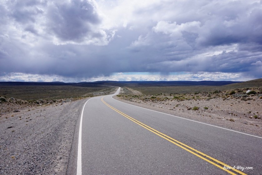
I must say that after Gobernador Costa, Ruta 40 was quiet. The traffic thinned out even further south of the junction with Ruta 26.
This morning, I intended to ride 65 kilometer today, the half way point between Rio Mayo and Perito Moreno. There wasn’t anything in this wide pampa that would protect me a bit from the wind overnight, so I consulted my map. It showed a blue line, named ‘Canada El Puma’. The blue line suggested a river, but Canada suggest more like a valley, I guess. Probably it’s a thing that’s only flooded during heavy rains, butI hoped it would have trees in between which I would find shelter for camping. The only trees in this otherwise completely barren landscape.
But it wasn’t meant to be. The Canada was a valley, no water, no trees.
I went back up to where I came from. I saw a small dirt track going from the main road, along which I found a pretty good place, half sheltered from the wind.
A wind that died out after 10 pm. I should go cycle now !
But I missed too many nights of sleep in the past on my job, so my night rest is sacred now.
What does a typical day in the saddle look like for me:
07:00: Sunrise
07:00 – 08:30: Wake up slowly.
08:30 – 08:35: Release the air from my air mattress, forcing myself to get up.
08:35 – 11:00: Breakfast, relax, break up camp
11:00 – 17:30: Cycling (eating, make pictures, take a break, start looking for a camp spot)
18:00 – 20:30: finding a spot for the night, pitch the tent, make & eat diner, dishes
20:30: Sunset
20:30 – 22:00: reading book in tent
22:00 – 08:30: sleep
There are of course many other tasks I have to squeeze in this already tight schedule:
Maintenance of the bike and it’s bags, of my stove, my water filter and the tent (cleaning zippers), shopping for provisions, laundry, keeping website up-to-date, route planning, …
This guy has a front yard of 10 km ! 🙂
As a result of my long day out of Rio Mayo, I only have to cover 52 km the next day to Perito Moreno. The conditions haven’t changed and I’m still battling against side and head winds.
In the towns’ ‘Banco National’ I can finally get money from the ATM again. No other ATM south of Bariloche would give me anything (I didn’t try in El Bolson). The provincial banks don’t accept bank cards with a chip. All my cards, debet and credit have a chip of course. Even when you go inside the bank during opening hours, they can’t help you. The maximum amount you can take with your card is 2.000 Argentinian pesos. That’s a bit under 100 euro. The local bank charges you 107 pesos each time, so that’s 5,37% of the amount, apart from what your own bank might charge.
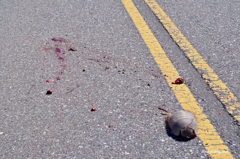
This guy was still alive 30 seconds ago. He was crossing the road in a nice straight line. A car came from the other side, and it’s driver must have seen him. If not, I pointed it out to him. But he didn’t slow down the slightest little bit and just smashed his head off. These guys run pretty fast, so if he slowed down 3 seconds, he would be alive. All this ‘accidental’ road kill is already sad enough, but here they do it on purpose. Just like speeding at centimeters from cyclists, while there’s no traffic coming from the other side. They just do it for fun. And after almost 3.000 kilometer here, I noticed these drivers actually do know how to veer around an obstacle. If there’s a pothole in the road, they can do it. I even noticed the concept of ‘anticipation’ isn’t completely alien to them. When there’s a pothole in their lane, and a car coming from the other side, they slow down a bit, so they can then go around the pothole. But not so for cyclists or animals. Their suspension is more important. Fuckers.Look at the letters on the door of this church…
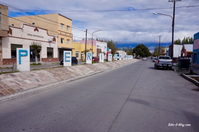
I stayed the night at the camping municipal in Perito Moreno.
Terrible affair. There’s a loud engine somewhere out of the campground running very loud all night. Camping in these little towns is always a very loud and stressful affair. But camping spots aren’t easy to find is this windy pampa, therefore my choice.
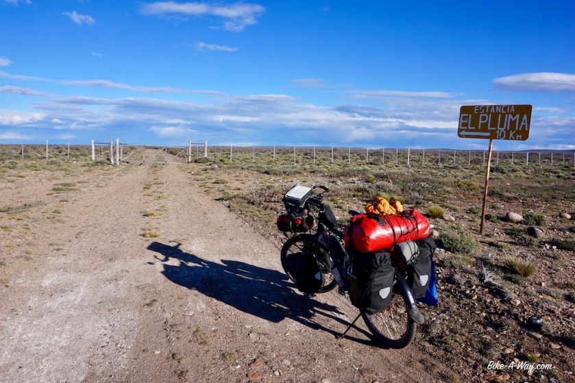
The next settlement, south of Perito Moreno is Bajo Caracoles, 130 kilometer away. Too far to do it in one day. After about 50 kilometer, the road starts to climb a little bit more, and I enter a beautiful area with colorful hills. There’s also an exit towards ‘Cueva de los Manos’ a cave full of paintings of hands. It’s a Unesco thing, but I ‘m not really interested of old paintings of hands. What would be interesting, is the ripio track to the cave, but I decide against it. If I ‘lose’ a day here, I’ll get into problems with my provisions.
There are many opportunities to wild camp in these colorful hills (jumping fences required). Also at Rio Pinturas wild camping is possible (but not as good as in the hills). It was still early afternoon so I decided to carry on a bit
Wrong decision of course.
At the next river, Rio Ecker is an estancia where you could camp, but no wild camping opportunities. Eventually, I pitch the tent 35 km before Bajo Caracoles, just of the road.
Weird skies
The landscape continues to be interesting, south of Perito Moreno.
The Rio Blanco carves it’s way through an impressive, wide valley. I’m sure many days of the year, cycling would be impossible here due to the strong westerly winds. But I’m lucky today, there is some head wind of course, but nothing too terrible and I make good progress. With ten minutes to spare, I arrive just before the siesta in Bajo Caracoles. Only to discover I hurried so much without reason.
There’s no shop here !
There’s just a gas station with a hotel and it’s bar sells some cookies, pasta and cans of tuna if you like.
I decide to take lunch. An expensive meal, where I got a big bone, with some white fat attached to it. After a bit of searching, I found a little piece of meat on it as well. I also had a carrot, a piece of corn, a potato and a steamed onion (??). Not much for the next stretch, which has no services and no villages for the next 230 kilometer.
When I leave the settlement two hours later, the wind has picked up considerably, but after climbing out of the valley, I had it in my back.
Ruta 40 is still a nice and quiet road here. Almost all trucks passing me are Chilean. I guess they provide Punta Arenas and Puerto Natales, two Chilean cities in the deep south that can only be reached by road via Argentina. The Chileans often drive these beautiful old American trucks, Kenworths, Peterbilts, Freightliners, Mack…
They always give me a lot of space as well.
Wildlife: What do I see along the road in this part of the world.
Well, often armadillos, lots of guanaco’s, nandu’s (Patagonian ostriches). That’s about it.
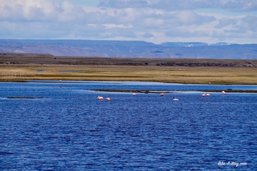
Oh, flamingo’s are here as well. I’m surprised to see them in this cold region.
The temperature during the day is between 12 and 14 degrees, but once the wind picks up from the west, it brings a cold chill from the Andes and it feels much colder. The nights are still very cold, but it hasn’t frozen lately.
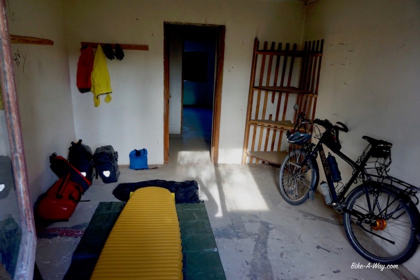
30 kilometer after Bajo Caracoles, I saw some abandoned buildings at the left of the road. It used to be the ‘Hotel El Olnie’. As the sun was out, I wanted to ride a bit longer, but such a nice opportunity to spend the night out of the wind, without pitching the tent … I couldn’t let it pass.
As I couldn’t buy any bread at Bajo Caracoles, I now had some time and a good place to make and bake some myself.
Even hooks to hang my clothes 🙂
I’d checked the internet back in Bajo Caracoles and knew it was going to rain today.
Not only rain, I was battling against the wind, always from the west/southwest, coming diagonally against me, battering me from the right. After 7,5 kilometer it started raining. Temperatures dropped instantly from 7 to 2 degrees Celsius. Soon I had it all, a mixture of rain, snow, hail. And wind. A pity I didn’t have a bit of sun as well. My progress was slow, and although I was all ‘Gore-Texed’ up, I was shivering.
Since years I carry a special balaclava for extreme temperatures with me. Today I used it for the first time ever. Nice and warm, but with this weather, your nose is running all the time, with only one way for the snot to go, inside the balaclava.
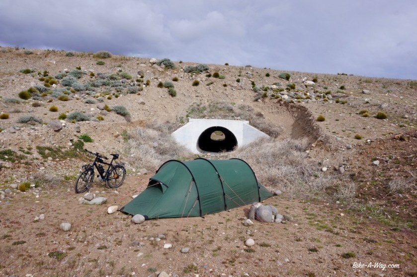
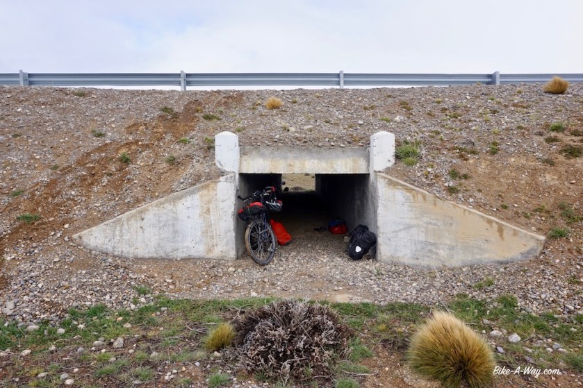
After 30 kilometer I took shelter in one of the drainage pipes under the road. They ‘re about 1,5 meter high and 1,5 meter wide.
The ice cold wind was blowing through it as well, and I put on more clothes. In many blogs I saw cyclists had spent the night in one of these pipes under the road, but I hoped I wouldn’t have to do that. After 1,5 hour in the pipe, the rain stopped and I continued my road, but only for a couple of kilometers, when the sky became black again, and I saw it raining a bit further in front of me.
Another pipe under the road.
I guess it’s my turn today to spent the night in such a thing. I laid out my plastic tarp, to protect my mattress and sleeping bag a bit from the mud and dust, put on more clothes and made a basic pasta. I don’t understand what’s happening, but it seems like I physically can’t cope with the cold anymore. Two degrees isn’t exactly tropical, but I was perfectly able to ride in colder temperatures in the past.
Now I lay with a pair of thin socks, a pair of thick merino wool socks and a pair of Sealskinz neoprene socks, merino wool long underpants, my regular long pants, 2 merino wool long sleeved shirts, a fleece, a down jacket and a woolen hat in my 850 cuin down sleeping bag, comfort rated – 14 degrees Celsius. Ok, apart from the little bare part of my face, I wasn’t cold, but what will I do when it gets really cold ??
Also the physical problems don’t improve. Both my thumbs have open wounds since six weeks. The other fingers heal sometimes for a few days, so the cracks aren’t that deep. Everything I do hurts: opening my Ortlieb bags, stuffing my sleeping bag in it’s compression sack; even just touching the screen of my e-reader hurts.
It’s not my most cozy night, in a windy pipe under the road, but better then having my tent blown to pieces on this barren pampas.
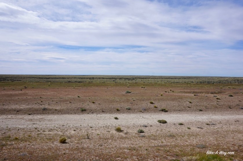
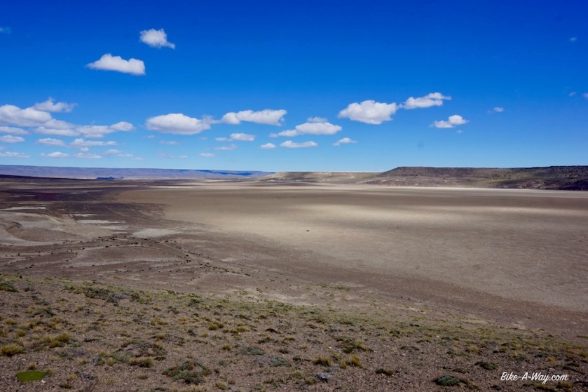
No wind protection to be found. I’m on the ‘Pampa del Asador’ now. Pampas, all with a different name, but they all look the same.
Try to imagine the winds blowing here. Now multiply it by x …I know the helmet looks funny, but the hood would just blow off without it.
NOT the nicest place to spent a night, but the only option in this open lands without any wind cover for the tent.
In the morning, I’m glad no water flew through my pipe. I’m early (for me) on the road, by 9:30 am. I’ve got to make some progress after yesterday’s short day. That wind still blowing diagonally from the right in my face.
But I have nice perspectives.
45 kilometer further down the road, ruta 40 makes a 90 degrees curve to the east, so I will have that wind nicely in my back.
I’m pushing and pushing the pedals and make actually acceptable progress. I’m counting down the kilometers. 30 km to go, 25 km to go, 22,5 km to go, I’m half way, ….
Then 4 kilometer before the bend in the road at Las Horquetas …. can you believe it ??
The wind made a turn and is now blowing in my face a bit from the left side. I’ll have it right back in my face after the road makes that turn to the east.
Unbelievable !
Push, push, push.
Las Horquetas. All guide books mention it’s nothing more but an abandoned hotel. It was a bit my goal for yesterday. But they are renovating the place, so you could spend the night there now, and I guess even get a meal.
I push on. I have to, if I want to make it to the next town with provisions tomorrow. And although I have the wind, against, it’s not too bad. I compare everything now to that day I had to push towards Rio Mayo. As long as I can actually sit on the bike and push, it’s ok.
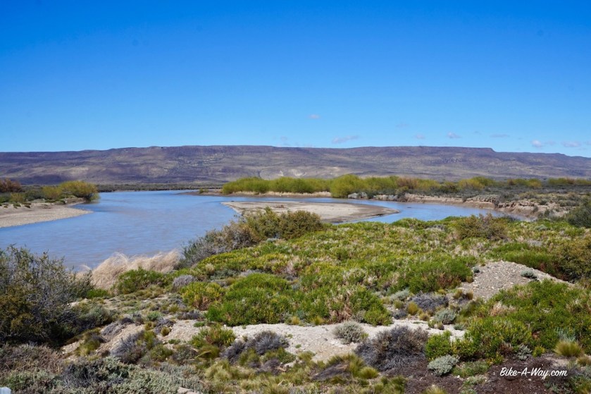
And how nice when the little plan you have in your head works out. On my map, I saw a bridge over the Rio Chico, 67 km before Gobernador Gregores and hoped there would be some trees and a place to pitch the tent. It even had some grass 🙂
And while I was pushing all day to stay ahead of rain showers that seems to be a few kilometer behind me, even the sun came out late afternoon. A much, much nicer end of the day then yesterday. Ooh, how happy I am to be in my tent. It still beats abandoned hotels, and sure beats drainage pipes.
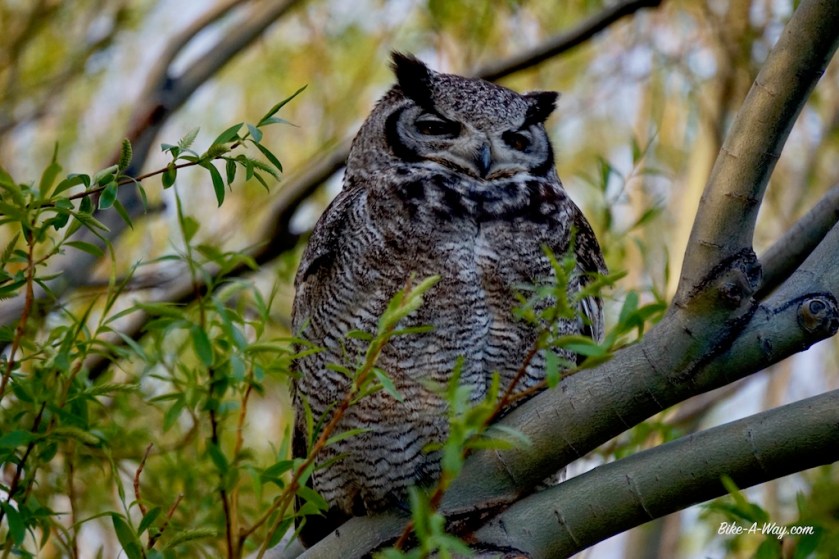
This camping spot was so beautiful and quiet, and I had sufficient food, so I took a rest day here at the borders of the Rio Chico. The weather was brilliant. Apart from reading in the sun, I did a lot of laundry, cleaned my bike, brushed the zippers of the tent (yes, that’s necessary). In the evening I had two big owls next to my tent. This is also one of the advantages of traveling alone. You’re silent at your camping spot, so the wild life shows itself.
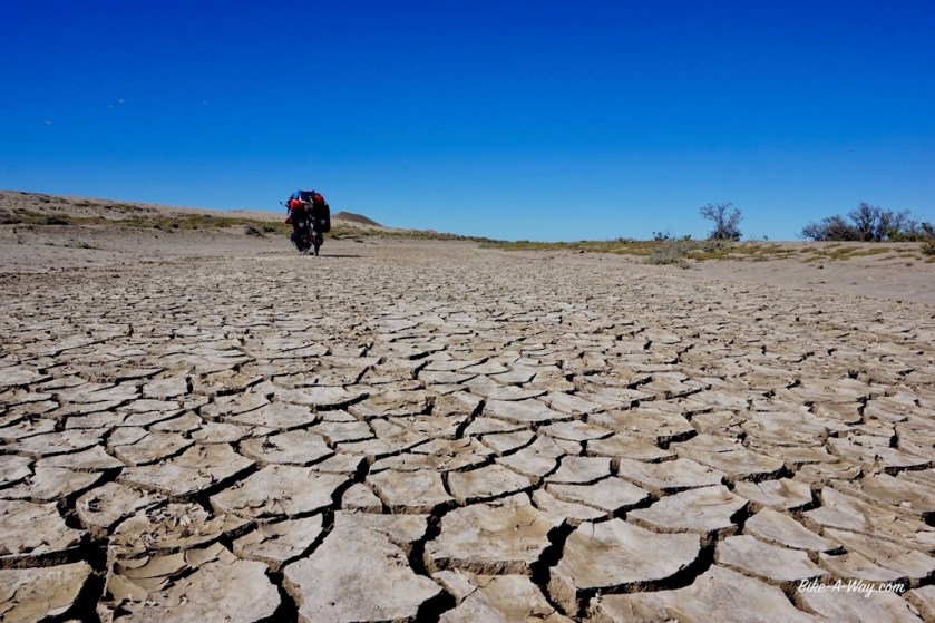
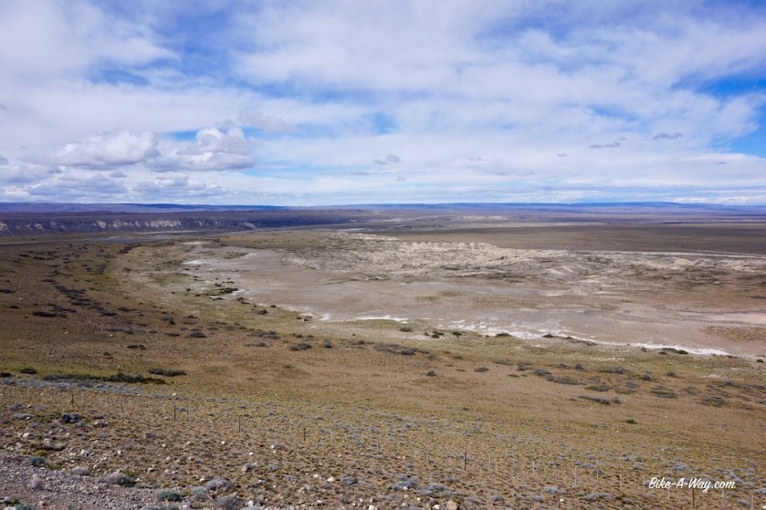
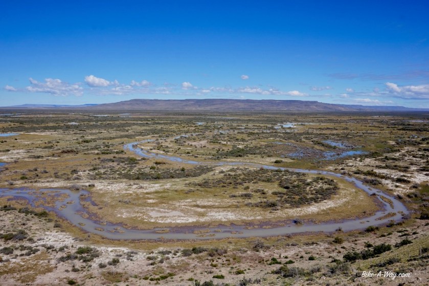
The ride to Gobernador Gregores goes through interesting landscape. First I travelled on a high plateau in a long bend along the Rio Chico, with fantastic views to the river and the many, many curves it makes here. Further on towards Gobernador Gregores I’m suddenly in a desert like landscape.
I was in a good mood today. For the first time since Neuquen province, about 2.000 km back, I could wear my hat again. Talk about arriving in town in style hehe.
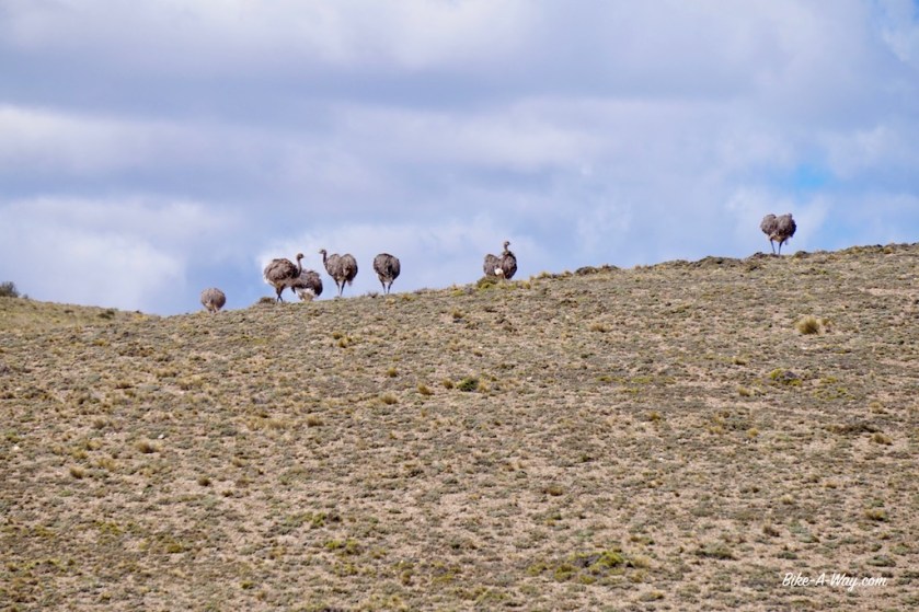
Nandu’s. They are very shy and hard to photograph.
Gobernador Gregores has a ‘La Anonima’ supermarket, and that’s the only reason to visit this place. The camping municipal charges four times the price of other camping municipals. The camp ground is lighted better then a football stadium and like in every other Argentinian town, folks are driving around, and around, and around in cars without exhaust pipes all night long, without a brake. Add shouting people and barking dogs to that and it makes me wonder …. who likes to be in places like this ???
Tomorrow, I’ll be back ‘in the wild’.
(PS: There are good wild camping possibilities before you enter town at the left side of the road. Better use them).
At 10 pm, just as I was about to go to sleep, a guy with a big backpack and a guitar arrives at the campground. Damn, he’s coming towards me.
I don’t like backpackers with guitars.
Already meters away, his hand is stretched out towards mine, ready to great me, big smile on his face.
“The face of the fools”, I think to myself.
He introduces himself and I instantly forget his name.
“Musica ?”, he asks.
“No, gracias”, I say.
These guys really always think they are the one thing missing with there stupid tjingle-tjangle on their cheap guitar. As if the whole world is waiting for them to arrive and start ‘playing and singing’.
“I go to bed now”, I tell him.
It’s of course no coincidence he arrives just after 10 pm. Typical for these guys, sneaking in camp grounds ‘for free’, …
He doesn’t have a tent and slept in a very bad quality sleeping bag on a piece of cardboard against the toilet wall. He hasn’t moved yet in the last 1,5 hour when I write this the next morning.
I wonder whether he survived the cold night and if I should check on him.
I decide against it.
He could’ve b(r)ought a tent instead of a guitar.
Leaving Corcovado on ripio road 44, I finally feel very happy in Argentina. It’s a much, much more interesting (and challenging) option as the paved main road Ruta 40.
This is what I’m here for. A rough gravel road, no traffic, and mountains to the left and right. The range directly to the left is bathing in the sun, but snow and wet snow is being dumped on the Andean peaks to my right.
I’m in between.
The wind blowing from the north west brings some sparkles of wetness towards me, but never much. The weather is improving during the day.
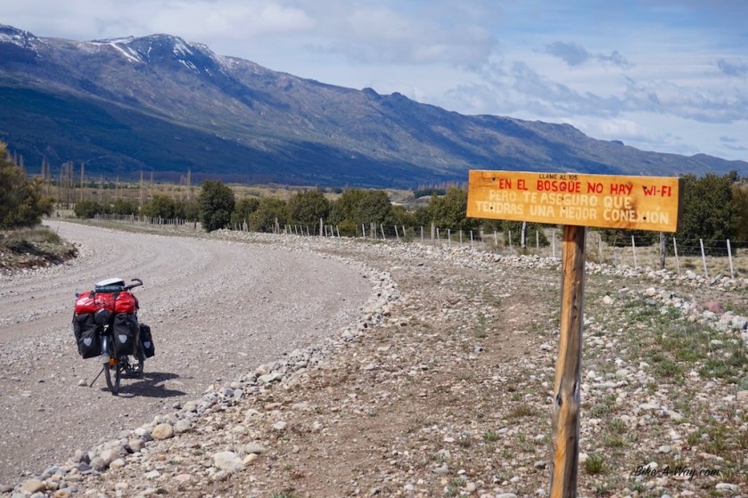
Looks rather wet up the mountainNo wifi, good !
The first 20 kilometer are relatively easy and I start to think the two locals who warned me the road is difficult and steep exaggerated a bit.
But then comes the pass.
A Lance Armstrong podcast and Lady Gaga’s ‘The Fame’ and ‘The Fame Monster’ albums later, I reach the top.
I pushed my bike 80% of the climb. Nothing to be ashamed about. Pushing a heavy, fully loaded touring bike up this steep hill, the road consisting of big lose stones….. think not many people are up to cycling it all the way.
But it’s beautiful here !
Desolate landscape, not a sole in sight.
Only 2 cars passed me after Corcovado. That’s still 50% too much, but I can live with that 😉
I camped near the Lago Guacho (yes Guacho, not gaucho), which was a bit further from road 44 as anticipated and made me plough through some snow fields, slush, mud and ankle deep water pools and had me made my bike lift over fallen trees.
I saw some old foot prints in the snow of only one other soul who’s been here after winter. It’s going to be a cold, but definitely quiet night.
Lago Guacho
Next day, my progress wasn’t slowed down by a hard climb, but by the quality of the ripio road. Stones as big as fists thrown in loose sand. My bike is bumping uncontrollably from left to right, all over the road, gusting wind helping a hand sometimes.
Once I leave the large Lago Vintter behind, it’s blowing straight in my back, but still my speed mostly is about 7 or 8 km/hr on the bumpy, surface. I had to work real hard all day in order to have he next village, Rio Pico in reach the next day before siesta time.
The big stones, making progress slow, and torturing the bike and bags. My stove, my laptop, everything is torn apart by the bumps all day.
Today, zero cars passed me.
I saw nobody ! 😀
And I had a brilliant camping spot in a grassy field, nicely protected from the wind.
Some snow in the morning, but the sun came out soon enough, dried the tent and I was back on the road by 10:30 am.
I estimated I ‘d need 2 days to cycle down towards Governador Costa, back at ruta 40, but I had such a formidable tail wind, I arrived there at 15:00 hrs, having started north of Rio Pico, wow !!.
With such favorable conditions, I should have continued, but the supermarket’s siesta only finishes at 17:30, and I need to buy more provisions for the long stretch south into the big nothingness.