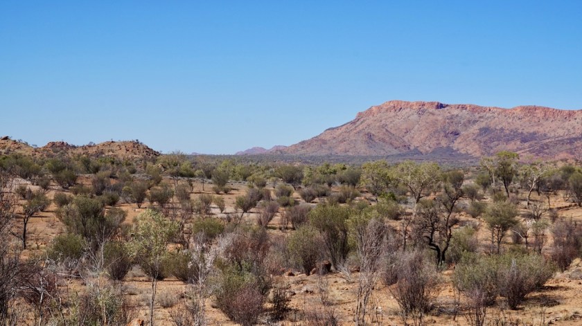
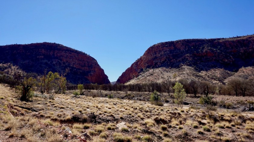
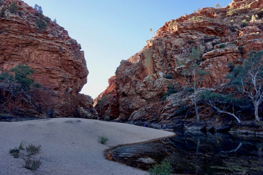
Route: Alice Springs – West MacDonnell Range – Mereenie Loop – Kings Canyon – Yulara – Kata Tjuta – Docker River
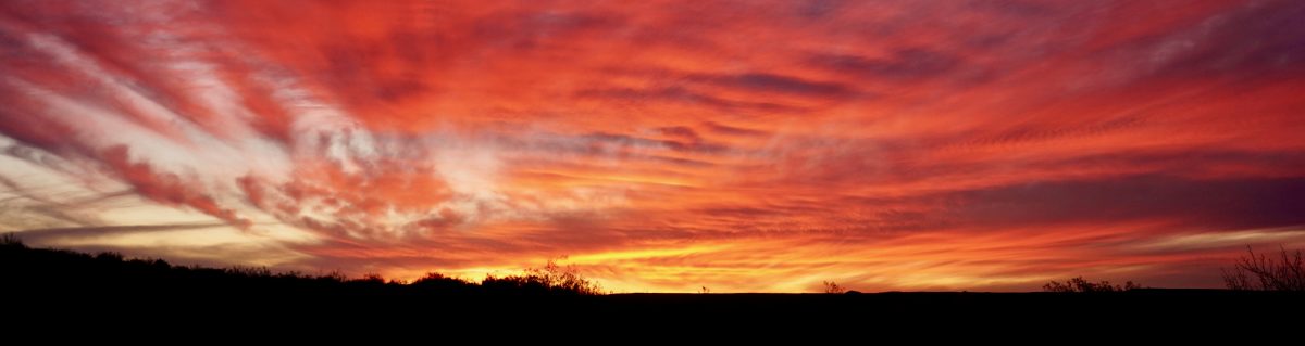
I wanted to take a little brake from writing every day, so this post mainly has a few pictures with a comment here and there. Still the headers with the daily info is there.
Day 139 – 141: 26-28 June 2019
From Alice Springs to passed Emily Gap
22,58 km (Total so far: 6.452,06 lm) – Altitude climbed: 43 m
Weather: Sunny, moderate head wind
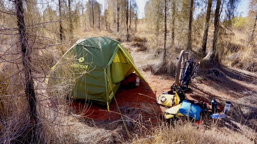
Rest days in the tent, away from town.
Day 142 – 143: 29-30 June
From passed Emily Gap to Alice Springs
28,24 km (Total so far: 6.480,30 km) – Altitude climbed: 219 m
I rode back into Alice Springs. Cycling on the bike path along the dry Todd River I was stopped by Libby. She was very interested in my trip and found it so fantastic I was offered a place to sleep in the brand new ‘Alice Village’, a branch of Outback Parks & Lodges, a ten minute bike ride out of the centre. I enjoyed another two rest days.
Day 144: 1 July 2019
From Alice Springs to road towards Standley Chasm
69,32 km (Total so far: 6.549,62 km) – Altitude climbed: 326 m
Weather: Sunny, moderate head wind


Day 145: 2 July 2019
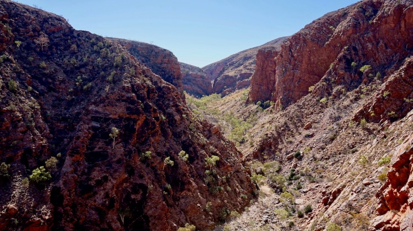
From road towards Standley Chasm to passed Ellery Creek
72,60 km (Total so far: 6.622,22 km) – Altitude climbed: 584 m
Weather: Sunny, moderate tail wind

Day 146: 3 July 2019
From passed Ellery Creek to Pioneer Creek
58,62 km (Total so far: 6.680,84 km) – Altitude climbed: 564 m
Weather: Sunny, moderate tail wind & side wind


Day 147: 4 July 2019
From Pioneer Creek to Redbank Gorge
33,79 km (Total so far: 6.714,63 km) – Altitude climbed: 319 m
Weather: Sunny, strong tail wind

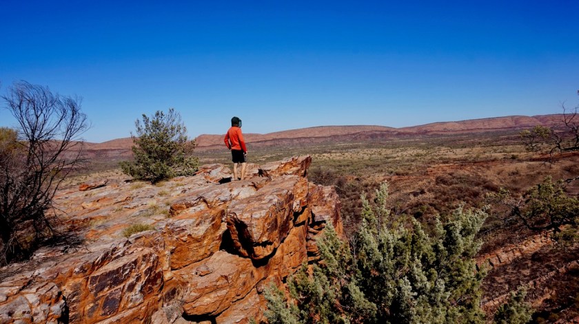
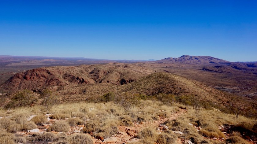
Day 148 – 149: 5-6 July 2019
From passed Redbank Gorge to along Mereenie Loop
107,99 km (Total so far: 6.822,62 km) – Altitude climbed: 610 m
Weather: Sunny, light tail, side & head wind

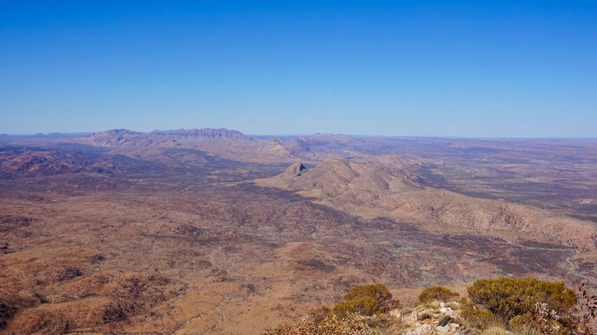

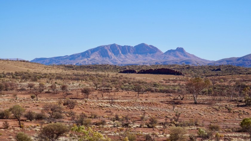
Day 150: 7 July 2019
From along Mereenie Loop to passed Morris Pass lookout
83,60 km (Total so far: 6.906,22 km) – Altitude climbed: 321 m
Weather: Sunny, all winds

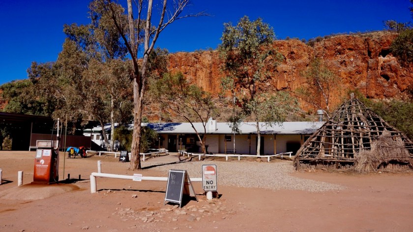
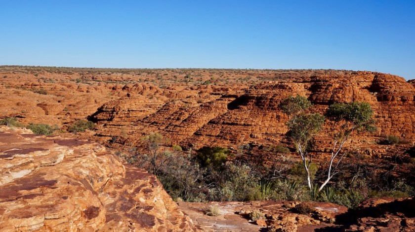
Day 151: 8 July 2019
From passed Morris Pass lookout to between Kings Canyon & Kathleen Creek
53,60 km (Total so far: 6.959,91 km) – Altitude climbed: 128 m
Weather: Sunny, moderate side & head wind


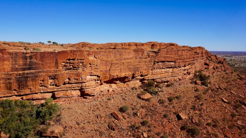

Day 152: 9 July 2019
From between Kings Canyon & Kathleen Creek to 3 km passed Luritja/Ernest Giles Hwy
88,82 km (Total so far: 7/048,73 km) – Altitude climbed: 205 m
Weather: Sunny, strong & moderate head wind
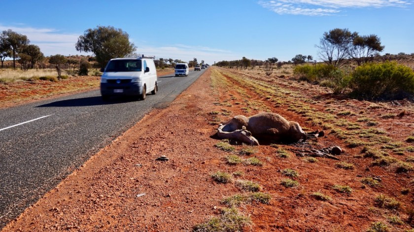
This whole part of the trip was during the three week July school holiday. The roads were EXTREMELY busy, impatient drivers. So far, my trip in Australia has been very good, but these first three weeks of July, the riding was just terrible. Avoid this period (and also Easter holiday). If you happen to be here, hibernate under a stone, because the Australians ALL go out. While they are kind enough to give you space on the road as long as it is suitable to them, you are fine. From the moment traffic comes from the opposite side, they will NOT, I repeat NOT slow down. No one.
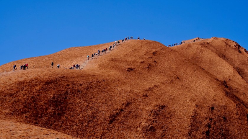
As climbing Uluru will be forbidden as from October 2019, it seems every Australian came down here to climb it now. Out of pure frustration, and self-preservation, I put branches under the bungees of my bike, sticking out a meter to the road, forcing the cars to give me some space. It worked often, but regularly, they just went straight ahead and drove the branches to pieces, flying inches from my legs.
Day 153: 10 July 2019
From 3 km passed Luritja/Ernest Giles Hwy to Along Lasseter Hwy
87,71 km (Total so far: 7.136,44 km) – Altitude climbed: 241 m
Weather: Sunny, strong head wind
No pictures, trying to survive.
Day 154: 11 July 2019
From Along Lasseter Hwy to 22 km bf Yulara
96,20 km (Total so far: 7.232,64 km) – Altitude climbed: 167 m
Weather: Sunny, moderate tail & side wind


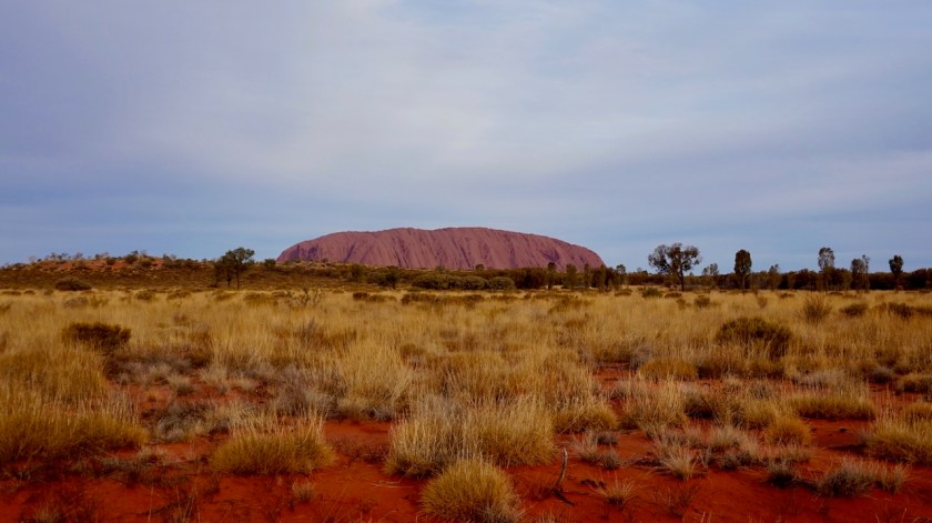
Day 155: 12 July 2019
From 22 km bf Yulara to Uluru NP
39,11 km (Total so far: 7.271,75 km) – Altitude climbed: 77 m
Weather: Sunny, moderate side wind
Day 156: 13 July 2019
From Uluru NP to passed the Olga’s
100,15 km (Total so far: 7.371,90 km) – Altitude climbed: 200 m
Weather: Sunny, moderate side, head & tail wind
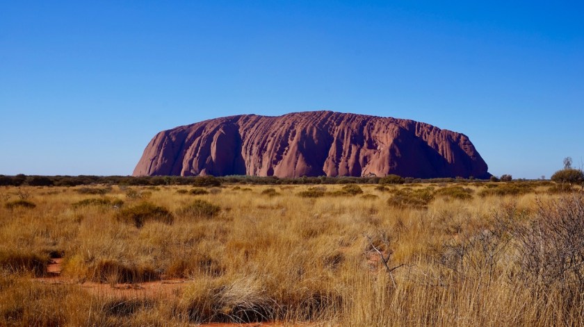
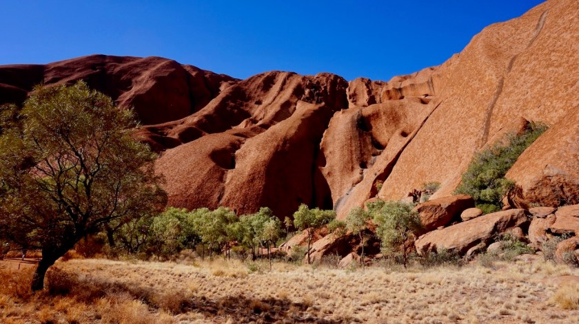
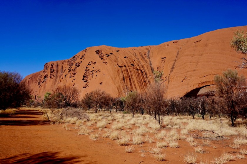


As you could read from the above, I did not have the best experience coming down to Ayers Rock / Uluru. Due to the insane traffic, there was zero fun and as explained, people have no empathy at all for cyclists.
They will be friendly towards you when they stop, but once in their car…
They will just mow you off the road, but I have to give it to them, they will do it with a smile whilst waving at you.
Between the park entrance (25 AUD) and the rock, I again stopped at a lookout and took some branches to force the drivers to give me some space (by law in Australia they must give you 1,5 meter, but even the police won’t do it, let alone they would enforce that law). I had a brain death going into discussion with me along the Lasseter Highway who claimed they had to give me 50 centimeter if they drove 60 km/hr. first of all, nobody drives that slow there, and second of all, it shows their mentality, just making up stories.
I wonder if I drive at those speeds next to their kids, what they would say (of course, cycling is something for children, and only on the way between their house and the kids’ school. All other roads must be free from cyclists).
I had people saying they don’t slow down because they are on cruise control ! Yeah, setting the cruise-control again is worse then killing a cyclist.
Inside the park, a park ranger forced me of the road into the ditch and in a very arrogant way, almost pushing his ranger pass into my face, behaving ridiculously authorative, he made “a report”. I explained to him it was the only way to survive this madness, as nobody seemed to enforce the 1,5 meter (I would already be more then happy if a meter was given) rule. Then he started to argue I couldn’t bring wood in the park. I told him I just picked it up when I was already in the park. Then he said I couldn’t pick up any wood from the park.
I said “one in three cars passing us here has wood on his trailer for camp fires. You say nothing of that, and you make a problem of my few branches ??”.
It was his business to deal with that, he said.
I had to remove the branches. He took pictures of me for his “report”.
(Speeding cars, people bringing fire wood in the park, people parking cars where there are signs it is forbidden, they are all left alone).
Next day, again past the park entrance and after again a few very close calls with drivers who don’t have a second to lose, I take a branche from the side of the road and put it under my bungee.
Not two kilometer I could ride before another park ranger literally drives me off the road, jumps out of his car and yells at me aggressively how his colleague yesterday had said I could not put a branch on my bike (did they arrange a meeting about this very important point ??).
Then some ‘very impressive’ talking into a walky talky, and like yesterday I was threatened to be thrown out of the park.
“Fine by me, I am on my way out anyway”, I said.
Then he started to warn me I had to be out before 7:30 pm. Nobody allowed in the park later than that.
I rode that night till passed The Olgas, a few meter west of the sign of the park entrance (and made that easily in time, Mr. Park Ranger). I think they came and check whether I really made it, because there were some cars between 7:30 pm and 8:00 pm. (dear park rangers, I heard quite a lot of cars riding in and out your park at night…. but hey, they ain’t cyclists… you got to have your priorities, right ?)
Clearly, a cyclist fending for his life is the biggest worry of the Uluru Park Rangers.
When the ladies at the entrance of the national park asked how my trip was going, I told them about my frustrations and suggested they could make a bicycle path from Yulara (the village about 25 kilometer from the rock where everybody stays) to the rock. They were ready with all sorts of excuses. “We can’t take land from the national park”. “Well, you could take land to make a road, you could take land to make a car park, you could take land to make an overflow car park, you could take land to make a view point for car drivers, you could take land to make a view point for people visiting by bus, for sunrise and sunset areas, for a visitor centre, …. but not for a 1,5 meter bike path ?”.
You would think a national park would encourage its visitors to visit the park in an ecological way, instead of driving in and out three times (a sunrise, a climb later in the morning and a sunset visit) with their heavy 4WD.
Well, not over here.
I have cycled through some national parks in my life, and some had their oddities, but I can, with my hand on my heart, declare that Ulura-Kata Tjuta National Park is the most bicycle unfriendly national park in the world.
Big thumbs down.
Day 157: 14 July 2019
From just passed Olgas to along Tjukaruru Road
55,71 km (Total so far: 7427,61 km) – Altitude climbed: 235 m
Weather: Sunny, strong head and tail wind
Against a very strong head wind I ride back from my camping spot towards the Olgas where I meet Brandon, a cyclist from New Zealand. He is riding a fat bike from west to east in Australia, but mostly just through the desert, away from traffic. Very good idea !
He has a trailer, but it broke on the way in. He gave it to a car that transported it to Yulara for repairs. That promises for the road awaiting me, because his material seems pretty sturdy.

As all other ‘attractions’, the car park at Kata Tjuta is over full. Cars are left behind on the way in already. I walk to the first look-out point and just can’t find the courage to continue in this circus. I turn back to my bike.
I want to get away from these people, these crowds.

That strong head wind is now my companion and blows me west. Fantastic.
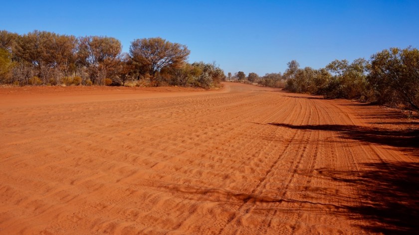
Soon the asphalt stops and I’m back on an unpaved road. Sometimes smooth gravel, but mostly very stony, or bull dust sandy with deep corrugations.
Next asphalt will appear again in about 1.000 kilometer in Laverton ! First 160 km of this dirt on Tjukaruru Road to docker River, where the Great Central Road starts.
Just when I push my bike of the road towards a camping spot, I hear what I think is a small branch stuck in my rear wheel.
But no, it is a broke spoke !
I never had a broken spoke on my rear wheel.
And it is a complete new wheel for this trip.
Yes, there is a lot of weight on it, and the road is awfull, but I ride very carefully and slow. (Later I see damage to the rim as well, so I guess the spoke was hit by a big stone).
It could not have happened at a worse place.
Back to Alice Springs is maybe 700 km, and absolutely unthinkable of going back there.
Foreward the next bike shop is…. I don’t know, maybe in Kalgoorlie, 1.500 km away from here.
I do have spare spokes, but I never touched a spoke myself in my life, let alone replaced one.
Sigh, …. will try in the morning.
Day 158: 15 July 2019
From along Tjukaruru Road to along Tjukaruru Road
45,67 km (Total so far: 7473,28 km) – Altitude climbed: 110 m
Weather: Strong tail wind
Forty five kilometer today. And I am exhausted.
First replacing that broken spoke.
Taking the tire of, replacing it, pumping the tire again.
Let’s wait and see whether I did a good job.
By 11:00 am I was on the road.
Average speed of the day: 8,49 km/hr.
I must have pushed the bike half of the distance through deep bull dust. The other half I managed to ride, through less deep bull dust and heavy corrugations.
Very demanding for both the rider and the equipment.
Hope it will improve.
A pity that strong tail wind I finally have is not able to blow me forward as it could on a better track.


Day 159: 16 July 2019
From along Tjukaruru Road to 25 km before Docker River
69,52 km (Total so far: 7542,80 km) – Altitude climbed: 111 m
Weather: Sunny, strong tail wind
A more decent distance after a hard days work. Just under 70 km with an average of 10,50 km/hr. And that’s with a continuous strong tail wind. Still sections where I had to push the bike through the sand, but less then yesterday. The landscape is more interesting as expected with hills both north and south of the road. I think these are the Petermann Ranges.
Tomorrow, I ride into Australia’s biggest state, and I can tell already things will clear up again. The holiday period is over in a few days and cycling will became much finer again in the next post 🙂
