Route: Cape Leeuwin – Margaret River – Nannup – Collie – Harvey – Mandurah – Perth
Day 253: 18 October 2019
From Augusta to Boranup Forest
38,98 km (Total so far: 11.373,90 km) – Altitude climbed: 499 m
Weather: Cloudy, sunny, moderate side and head wind
I first went for a long overdue visit to the barber shop in Augusta. I was lucky, because he’s only here on Fridays and Saturdays. Then I ride to the Jewel Cave. I think the entrance fee of 22.50 Aud is a bit hefty, but ok…
It is a beautiful cave.


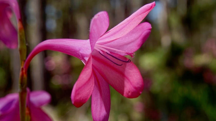
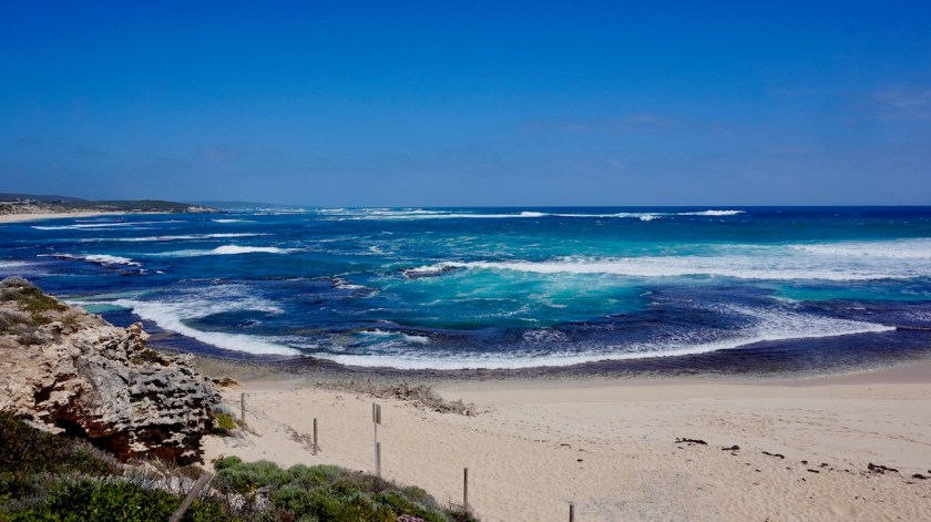
I made a small side trip to the beach at Hamelin Bay. A huge bay, long white sand beach, hardly any people. Nice.
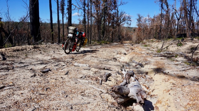
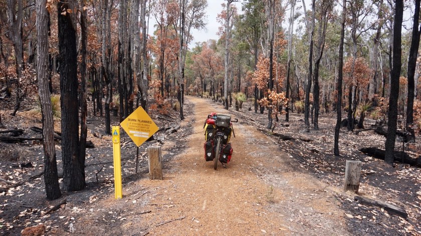
Good I visited that cave first, by the way, as later on it seems I plotted my route exactly on the same single tracks the Cape to Cape (‘C2C’) mountainbike race which is going on today. By the time I arrived at the single tracks, the race was finished. I want to camp in the Boranup forest but it is very much overgrown just next to the single track. I do find a
nice spot just next to the trail. To be sure that race won’t come back tomorrow morning, I check their website. It is safe to camp here, they were here only today, but I find out this Cape to Cape race is not at all a race from cape to cape (Cape Leeuwin in the South to Cape Naturalist in the north of the Margaret River area. It is just four stages making small loops, but in no way do they connect the capes.


Day 254: 19 October 2019
From Boranup Forest to along rail trail to Cowaramup
48,87 km (Total so far: 11.422,77 km) – Altitude climbed: 390 m
Weather: Sunny, moderate tail and side wind
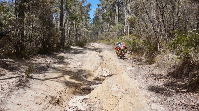
Excellent weather today, blue skies, temperature around 27 degrees in the shade, a wind sideways from the back. The remainder of the ride through the Boranup Forest is great, mostly on single tracks. When I left Augusta, I passed a few magpies that didn’t attack me. Maybe the season is over. But today, I was attacked by a Wattlebird. He swooped me five or six times and was very aggressive.
Then the rail trail to Margaret River, the regions’ capital and more or less famous for its wines. It is Saturday and on top of the usual tourist crowds coming down from Perth in the weekend, the C2C-bikers are here as well. Most of them seem to ride around with bikes on the back of their cars i.o. actually riding their bikes.


I enjoy an excellent lunch on the terrace of the Korean Tedis Big Spoon restaurant. Margaret River has a Coles supermarket. Prices seem to be half of what I’ve paid most of the last months. Good, I won’t feel the restaurant visit in ‘my budget’ 🙂
Day 255: 20 October 2019
From along rail trail to Cowaramup to near junction Canebreak & Sabina West Toad
39,68 km (Total so far: 11.462,45 km) – Altitude climbed: 354 m
Weather: Sunny, moderate tail wind
Another excellent, sunny day.
Maybe I have to mention I’m doing some zigzagging around the Margaret River Area, because I try to put in some extra kilometers, as my plane to leave from Perth is only on 22nd November. That’s also the reason I enjoy short riding distances. The alternative would have been an extra loop north of Perth into the weath belt, but I think relaxing in this area is nicer.
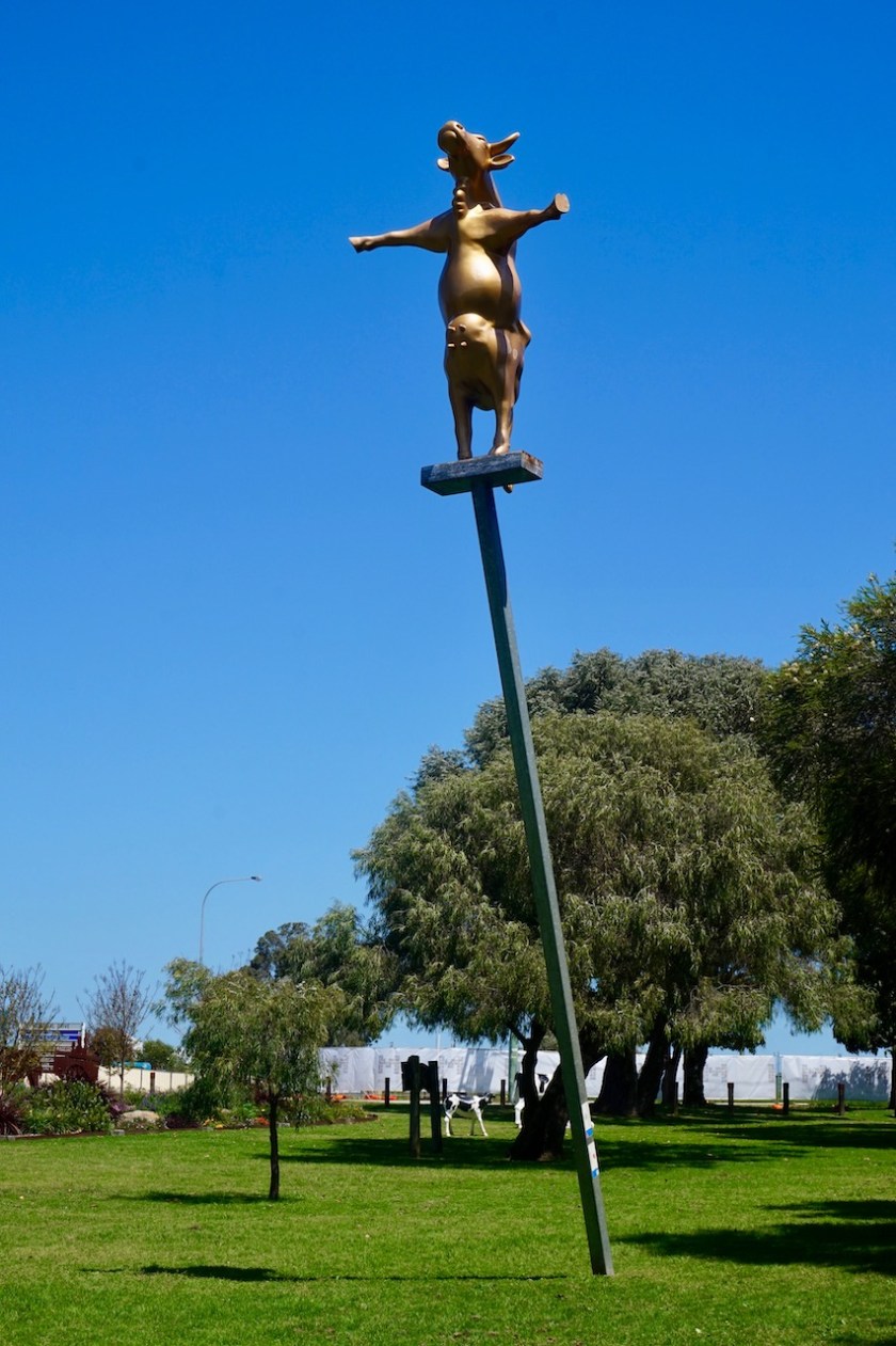
In Cowaramup, everything is about cows because the name of the town starts with ‘cow’. Not very ingenious. There are plastic cows in the park, a candy cow shop, etc, etc…
Here, I ride east, inland, away from the never ending stream of tourists going to and fro between Dunsborough, Busselton and Margaret River. Not five seconds go by without a passing car.
So I choose the small tracks inland. A magpie attacks.
“Hey, the season is over !”.
Yeah, forget that, I’ve been attacked another four times today. The magpies will decide when the season is over, not me. I ride through farmland via Bramley River Road but once on Canebreak road, I’m back in the forest. I camp in a forest plantation. Chances are smaller Parks and Wildlife will put that on fire while I’m in there, I guess.
Day 256: 21 October 2019
From near junction Canebreak & Sabina West Toad to along Great West Road
47,95 km (Total so far: 11.510,40 km) – Altitude climbed: 441 m
Weather:Sunny, moderate tail and head wind
I keep riding east, away from Margaret River. Once one Jalbarragup Road East, things become more interesting but after crossing the sealed Mowen Road, it seems my dirt road sees more traffic. It becomes very corrugated and sandy.
A partly overgrown road to the right, Stellar Road comes to the rescue. The partly overgrown road soon becomes fully overgrown, but only for a while and the second half of Meteor Road is rideable again. A right turn onto Mcatee Road brings me back on my planned road, and now I am riding west, back to Margaret River.
Soon I am on the Great West Road. Don’t imagine too much from its name. It is a sandy track, in parts overgrown, and hasn’t seen any traffic in a long while.
Perfect.


When I start looking for a place to camp, I realize that if Parks and Wildlife Australia wants to burn this down, I surely would never have seen a sign. I joined this section via overgrown paths where they wouldn’t bother to place to signs. It seems this forest hasn’t seen a fire in a while, so it must be high on their wishlist to burn it.
Well, I’ll take the gamble and hope for the best.
Day 257: 22 October 2019
From along Great West Road to along 10 mile Brook Walk/Cycle Track
46,00 km (Total so far: 11.556,40 ) – Altitude climbed: 478 m
Weather: Sunny, moderate head wind
I felt a bit weak today and very thirsty for some reason, although I always drink enough.
The Great West Road keeps going west, doesn’t improve in quality, which is good, because I see nobody else. Lot of hills to be tackled as well.
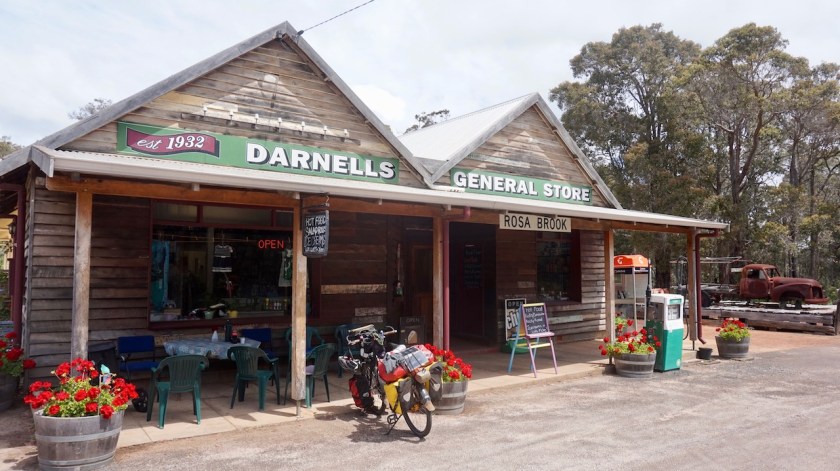
Eventually I reach the sealed Rosa Brook Road. There is a very charming General Store in Rosa Brook. From here the road gets busier.
Via the bike paths of 10 Mile Brook, I ride towards the city. Just after I pitched my tent, I start to smell a fire.
Had to happen of course, it’s been going on in my head too much the last days. As I am riding the Munda Biddi Trail, I keep an eye on the notification they give, and it seems like the whole trail has diversions because Parks and Wildlife is burning the forests down. Surely, some forest must be on fire on the other side of the highway. Well…. I hope it’s on the other side.
White tailed black-cockatoos are flying to and fro, making lots of noise and are completely in panic. Maybe they still have young chicks left behind in the trees on fire ?
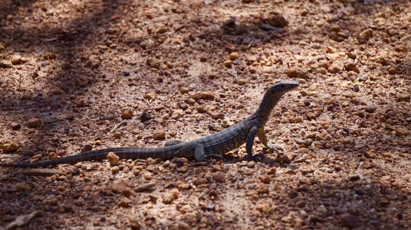
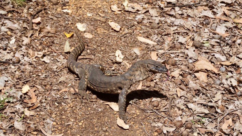
What with all the beautiful goanna’s, like I have seen several ?
Can they run in time ?
Sure many of them get burned alive.
And parks and Wildlife Australia is burning forests since weeks already, so many eggs of the birds must have been stil in the nests.
They kill it all.
And if they don’t burn it, also here in the Margaret River area, just as anywhere in Western-Australia and Northern Territory, every few hundred meter there is a sign that the 1080 poison is laying around.
Burn the wildlife, poison it or kill it in traffic…. unreal.
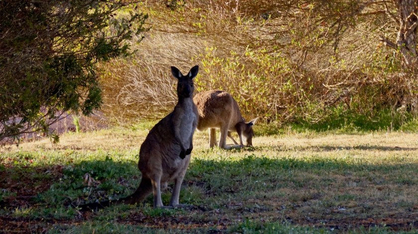
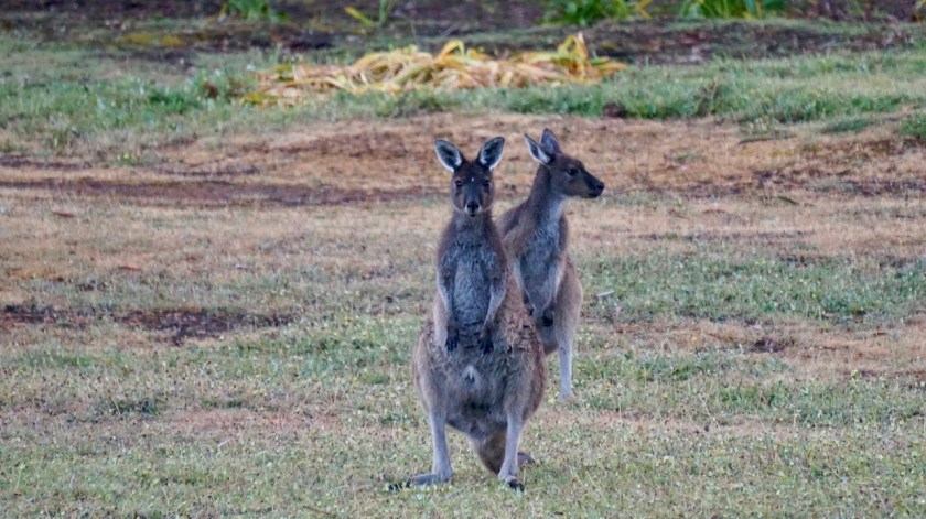
Well, to stop with a positive note, this morning, while breaking down my tent, a mother kangaroo jumped from between the trees with a very small young. It crawled into it’s moms pouch, dad waited, and then the tree of them jumped away.
I also saw ducks with fresh born chicks. A couple of goanna’s as mentioned before, a blue wren and I had a chat with two red tailed black-cockatoos.
Day 258: 23 October 2019
From along 10 mile Brook Walk/Cycle Track to along rail trail
33,07 km (Total so far: 11.589,47 km) – Altitude climbed: 351 m
Weather: Cloudy, sunny, rain at night, moderate head and tail wind
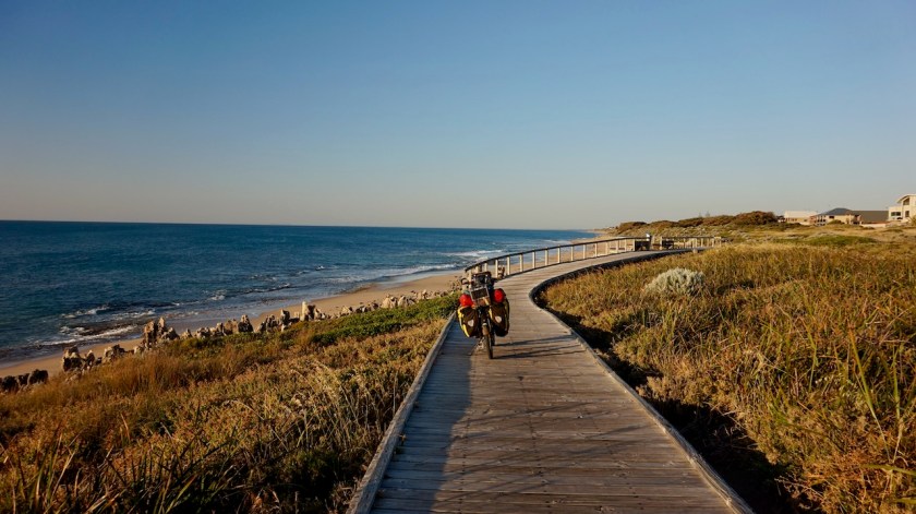
After buying provisions in Margaret River, I went out to the beach today, along a 10 kilometer bike path. Luckily that bike path is there, because although it is a dead end road to the coast and it is just a Wednesday, this road carries a lot of traffic.
First I took a look at the little Greek Orthodox church in Prevelly, then I went down to the beach at Surfers Point. It had been cloudy all day, looked like rain, but just as I arrived at the beach, the sun came out, the sky turned all blue and the colours of the sea in front of me were fantastic. Huge waves too, I can see why the beach has this name.

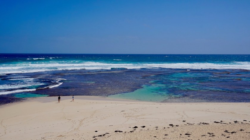
Also the river mouth of Margaret River, just at the end of the road is worth to have a look at.
I hang around for a while, till the clouds return, and I do the same towards Margaret River.

Day 259: 24 October 2019
From along rail trail to Blackwood River
44,90 km (Total so far: 11.634,37 km) – Altitude climbed: 445 m
Weather: Sunny, light tail wind, rain at night
After last nights rain, I wake up to a perfectly blue sky. Taking it easy to let the tent dry, rinse out some socks in the little stream next to the tent, I ride into town late morning. I buy provisions for four days in Margaret River and head out east, back to where I left the Munda Biddi Trail last week. A few annoying kilometer on the busy Rosa Brook Road, then turning off onto Rosa Glenn Road, still paved, but much quieter.
I’m back on gravel at Crouch Road and the Great North Road. Haven’t seen a single soul since leaving the asphalt.
There is no real bridge over the Blackwood River here. They’ve made a concrete lane which you can pass if the water is not too high. I find a nice spot to pitch the tent a few meter above the river.

Day 260: 25 October 2019
From Blackwood River to Milyeannup National Park
48,39 km (Total so far: 11.682,76 km) – Altitude climbed: 656 m
Weather: Cloudy, sunny, no noticeable wind
Pfff, what a day !
After the rains during the night, I woke up to grey, cloudy skies. As the hours went by, the weather became better and better, until I had bright blue skies in the afternoon.
But it was a very hard day. The flies and the horseflies around your head, the mosquito’s around your legs. I grow bit tired of the attacks all day every day of these creatures when cycling off-road. On-road, you can add attacks of magpies and drivers. Because of this, hardly ever a possibility to just take a break along the road, relax and eat something.
The track is much harder as anticipated. Blackwood Road is a very sandy affair, often impossible to ride. Then there are all the little, almost dry, side streams of the Blackwood River that have carved their little valleys. Often I had to push the bike through deep sand up steep hills, from one side stream to the next.


Honestly, I felt pretty miserable during the morning but as the day went on, the sky became blue and the track nicer once I crossed the Brockman Highway, it all ended well in a nice camping spot.
If it were not for the dozens of loud horseflies circling around the tent tirelessly.
So, a bit good and a bit bad today.

Day 261: 26 October 2019
From Milyeannup National Park to Yanmah State Forest
50,54 km (Total so far: 11.733,20 km) – Altitude climbed: 716 m
Weather: Cloudy, sunny, light side wind
Same procedure as the last days. Grey sky when I woke up, which is actually very good, because it doesn’t get too hot in the tent when I go through my slow morning rituals.
I find there is not so much bird life on what I call the Margaret River peninsula (the area west of the Vase Highway towards Margaret River). But this morning, a little bird with the most fantastic and varied songs was sitting next to my tent at 6 am, giving a concert of 15 minutes.
I am not sure the track I’m riding is still the Blackwood Road. In Garmin Basecamp it is classified as a ‘G3-track’, which basically means it is not much.
Well, I think often several weeks go by before this track sees a vehicle.
I come to a junction. The ‘main’ track goes left. I go right, because that way, a few kilometer further on, I just have to cross to Vase Highway on yet another track leading me further east.
The track has not been used in a long time and is completely overgrown. Give it a few more seasons and it will be forest again.

When I arrive at the Vase highway, the track at the other side has a sign that I can’t enter. Something with disease control.
I remember seeing those signs when I rode the Coronation Road almost two weeks ago.
There is also a sign that cameras are in use to check. Yup, cameras, even in the forest.
Nothing to do then follow the Vase Highway north and then turn right on the Graphite Road. That way, I am adding 19 kilometer of asphalt riding to my route. It’s pleasant, hilly country here.
I stop for lunch at One Tree Bridge, where I resume my ride on the Munda Biddi Trail.
Nice single track again. I have a chat with three other riders, two from Cairns and one from Broome who ride in a southerly direction.
Day 262: 27 October 2019
From Yanmah State Forest to Beaton State Forest
23,85 km (Total so far: 11.757,05 km) – Altitude climbed: 388 m
Weather: Sunny
Perfect blue sky in the morning 🙂
I notice I have three cracked tent poles. I put some ducktape around it and hope it will hold for the remainder of the trip.
I ride into Donnelly River with another cyclist who stays there for a few days. Donnelly River is the side of an old timber mill. Anno 2019, only three people live there permanently. They run the small general store and rent out 38 tourist homes (the old houses of the timber mill work force). There are old pictures everywhere. Glorious pictures of though looking guys who mow down 500-year old threes. Very though. With a chain saw mowing down a tree.
I find the pictures terrible, but apparently I am the only one.


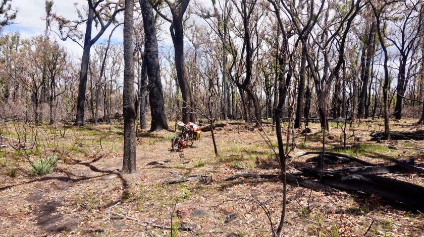
After recharging some stuff, I ride out. Detour off the trail because they are cutting down some part of the forest. The whole area is in smog because some burns in other part of the forest.
I camp on top of a hill.
I must go slow, slow, as my plane out of Perth is only on 22nd of November, and I am getting really close to Perth now. More short days ahead of me, but that’s okay, it gives me a lot of time to read.


I told you about flies and horseflies already. Tonight, I had the pleasure to meet some other wildlife.
Just after sunset, as I was eating my diner, I heard a ticking sound on my tent as if it was starting to rain. But it wasn’t that. Hundreds, thousands of flying ants were landing on my tent, both on the outer and the inner. Many thousands of them. I was sitting in a dome, completely covered by flying ants !
No way I could go out, because unzipping the door would mean a thousand of them would fall and fly inside. I switched off my head light. No reading on the e-reader either.
I want them to go away.
What if they would start eating wholes in the inner tent ?
They seemed to calm down after I switched off the light but I could still hear them (hoping it was just flying against the tent, not eating it).
Good night 🙂
Day 263: 28 October 2019
From Beaton State Forest to rail trail towards Jarrahwood
42,18 km (Total so far: 11.799,23 km) – Altitude climbed: 306 m
Weather: Cloudy, moderate wind all directions
The inner and outer tents were completely cover with the wings of the flying ants.
Yesterday was the first really warmer day of the season (28 degrees in the shadow). Maybe that is the day these ants come out ?
Maybe they just fly out and then lose their wings ?
Anyway, the tent was full of them. I blew away the wings.
Today was cloudy and ten degrees cooler than yesterday.
Nannup is what is called a ‘historical town’ here. It’s little over hundred years old. At the bakery I see a poster for a bike ride in November towards Margaret River. What’s remarkable is that Marianne Vos is on the poster. And reading it, I see she actually comes to ride it.
Later I talk to a guy who shuttles luggage from riders, and sometimes the riders themselves. He has been the driver of Marianne Vos in the past as well, as it seems she comes every year to ride this ride.

I leave Nannup with the idea of riding towards the Nala Mia hut in Jarrahwood. Tomorrow the weather will still be okay, but Wednesday and Thursday will be wet and windy. There is a rail trail between Nannup and Jarrahwood, so it is easy riding. But then I remember Jarrahwood hut is very close to the Vase Highway, so I decide to camp along the rail trail, the quieter option.
Day 264 – 267: 29 October – 1 November 2019
From rail trail towards Jarrahwood to Jarrahwood
11,78 km (Total so far: 11.811,01 km) – Altitude climbed: 79 m
Weather: Very strong, violent wind and very heavy rain showers
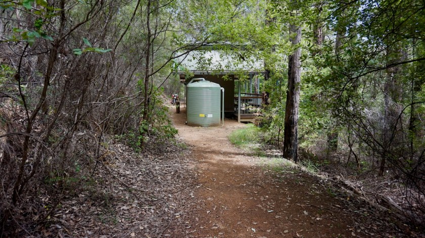
The Munda Biddi Hut in Jarrahwood is different from all others. This one is in the village. Not that the village is that much, just a collection of ramshackle houses, most of them abandoned I guess. It is also close to the Vase Highway, just a couple of hundred meters away. It makes it less tranquille than other huts. And it being in a ‘village’, does not have the advantage of shops around, because there is nothing of that in Jarrahwood. Still have to bring all you need, except water.


As predicted, the weather becomes really nasty. Temperatures drop. Wednesday I wake up to 8 degrees and it doesn’t get warmer than 12 degrees during the day. Thursday it’s even cooler.
The winds turn from north to west to southwest but remain very strong with regular violent wind gusts. Heavy vertical rain showers torture the walls of the hut. You’d need a strong tent to survive this if you’re camping out now.
On the second night I’m joined by Marek and Catherine, originally from Estonia but now living in Perth.


Day 268 – 288: 2 November till 22 November 2019
From Jarrahwood to Perth
630,34 km (Total so far: 12.441,35 km) – Altitude climbed: 4.061 m
As the end of my trip came nearer, I was occupied by other things in the evening and neglected keeping a diary, so here’s just a small summary of the last three weeks.
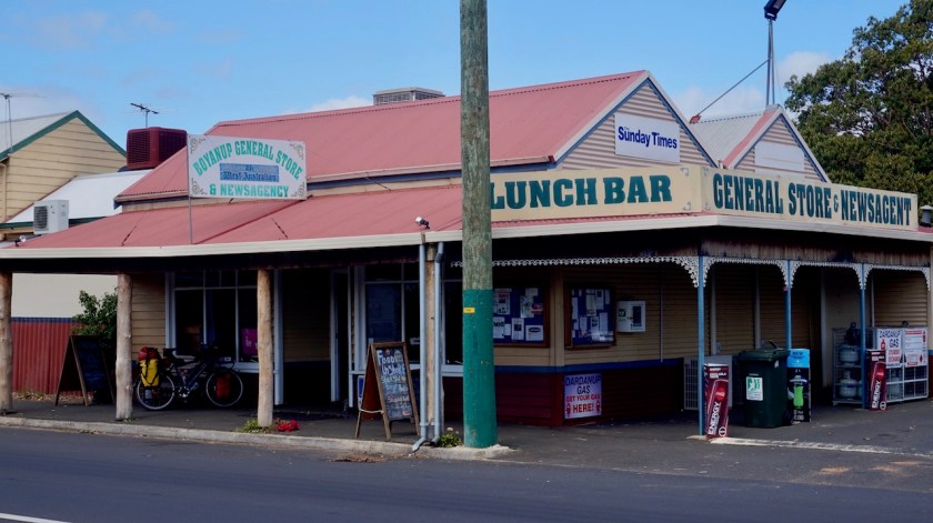
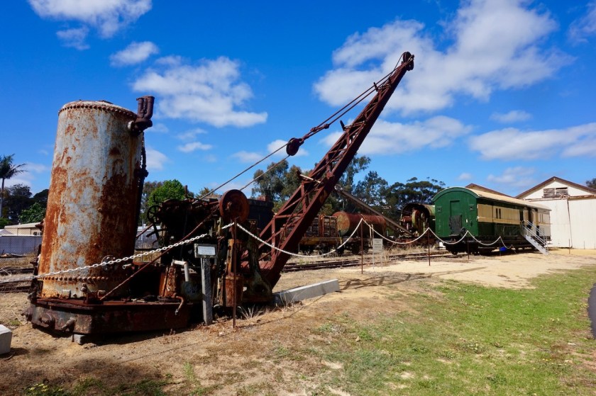
I kept following the Munda Biddi Trail, riding via Donnybrook to Boyanup where Geoffrey, another enthusiast cyclist, hosted me. I made a small side trip to Bunbury before saying goodbye to Geoffrey. Leaving Boyanup, I visited the small railway museum.


I left the Munda Biddi south of the big Wellington Reservoir, in order to buy provisions in Collie.
Aiming to stay on dirt tracks as much as possible, I tried to ride the track under the power lines next to the Mungalup Road. I don’t recommend this. It’s hard, loose sand, unmaintained. Also the tracks I chose east of this road, ending up at the eastern shores of of the Mungalup Dam where often none existing (Yabbberup Trail). Better to follow the Mungalup Road, then take a right turn onto the Siding Street.
North of Collie, one can pick up the Munda Biddi Trail again.
The weather was hot and dry, with quite a bit of wind. The alarm for bush fires was on extreme.
Camping in the forrest east of Mornington Road, I found it bizar some trucks were coming through at night. I couldn’t see them from where I pitched the tent, but I worried a lot whether this might be fire trucks. If this place would go in fire, I would have no chance to go anywhere.
The next morning, I rode on to the Yarri Campsite. This would be the end of the Munda Biddi for me. I understood there are some real steep sections further north. I had made some alternative routes for that, but all the warnings I’m getting for the fires worry me, so I rode a bit back towards Myles Avenue, then descended towards Harvey.
Harvey is a nice little village, famous for the Harvey Meat, Harvey fruit, Harvey milk, …


The beach at Myalup is okay, and not crowded at all.
It is just a big shame 4WD are allowed to ride over the beach from Preston to Myalup, messing up this whole beautiful stretch.
Incomprehensible.


I rode back to Harvey, then took small backroads towards the Harvey Estuary.
South of Mandurah, some nice bike paths start already along the estuary. The ride along the coast towards Mandurah is excellent as well.

W. and J. agreed to host me for my stay in town, but due to some last moment events, we unfortunately never got to meet each other, but they agreed I could stay in their place. Incredible trust they showed in me and I had a couple of really relaxing rest days in their nice home.

From Mandurah, one could take the train to Perth, but I chose to take the bike path along the Kwinana Freeway. It was a very, very hot day, the little cycling computer showing temperatures up to 53 degrees as I was riding in the sun.

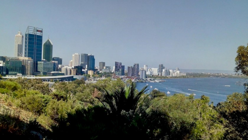
Near Woodman Point Regional Park, I hit the coast again. Good bike paths with constant views to the ocean lead me all the way to Fremantle, the port, the bridge over the Swan River towards Cottesloe.


A few weeks earlier, I met Craig who was riding his bike on parts of the Munda Biddi Trail. I happily accepted his offer to stay for a couple of days. Craig has an apartment with a wonderful view towards the Indian Ocean which I enjoyed for hours from the balcony. Craig took me out for a ride by car to get a first view of Perth.
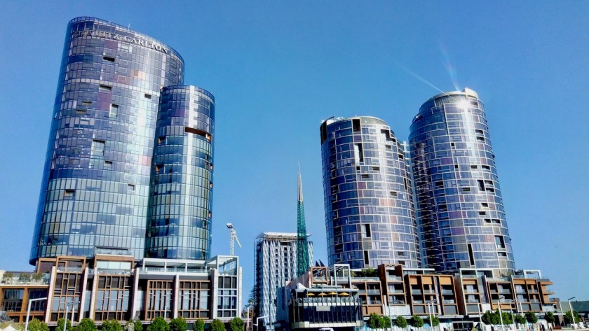
Febe, not a cyclist, guided me around for a day in the modern town.

From Cottesloe on the western side of Perth, I cycled along the Swan River towards Darlington. The whole town was covered in thick smog from bush fires outside of town.
My last nights in Australia, I stayed with David and Marianne. My luck with staying in nice places with brilliant people seems endless. I had my own very beautiful room in David and Marianne’s house, both enthusiast cyclists themselves, mainly in Europe. They even had a bike box waiting for me to pack my bicycle !


After 288 days I’m leaving Australia. 288 days full of adventure, unique landscapes, the bluest skies imaginable, the most hospitable people, stunning beaches both in Tasmania and mainland Australia, endless sand-, dirt- and washboard roads, desert landscapes, the strangest animals. The country surely delivered.
Below a map of the route since leaving Esperance. As always, the gpx-track can be downloaded from Wikiloc.
I’ll come back with one more post about Australia with some data, gps tracks, etc…
But first, I go to Thailand for a month before returning to Belgium for a few months.

Hi Koen,
Glad you made it safe out of Australia, was getting slightly “worried” with all the bushfires going on you being out there. You again had quite some adventures the last few weeks of your stay, magpie attacks, swarmed with flying ants, fire danger…
From what you wrote I take it you are back in Belgium again, or could you not leave Thailand 🙂 ?, anyway I hope you had a nice and relaxing time there.
What are your future plans? You mentioned staying in Belgium for a bit… if at some point you happen to be in or near Utrecht and need a place to crash… let me know.
Take care and am looking forward to following you on your future adventures.
Inge
LikeLike
Hoi Inge,
Yep, ik heb Thailand kunnen verlaten en ben terug in België voor enkele maanden.
De Plannen ?
Na de laatste twee jaar vnl tijd in Zuid-Amerika & Australië doorgebracht te hebben ga ik waarschijnlijk opnieuw voor een tochtje door Europa startend late lente of vroege zomer. Misschien blijf ik hier wel rondtoeren in 2021 ook. Hoewel ook Korea, Japan & Taiwan constant door mijn gedachten spoken, net als opnieuw tochten in Noord-Amerika gaan maken, waar zoveel lange off-road routes voor het oprapen liggen.
Spoilt for choice dus 😉
Als ik een keertje door Utrecht kom laat ik het zeker weten.
Als je nog info nodig hebt ivm je Australië trip, laat je het maar weten he.
LikeLike