Argentina: The Amazing Puna de Atacama

Route: Belén – El Eje – Antofagasta de la Sierra – Salar de Pocitos – Paso de Sico

Since days I’m in doubt whether to continue my route north via ruta 40, which goes along some spectacular ravines and over the Abra del Acay, Argentina’s highest mountain pass (4.972 meter), or via Antofagasta de la Sierra through the ‘Puna de Atacama’, a very desolate high plateau.
The website from the ‘Vialidad’, that must be the Argentinian organization responsible for the roads, says since a while the road over Abra del Acay is closed due to flooding.
Not very promising.
On the other hand, two cyclist I met further south who came via Antofagasta de la Sierra said it would be horrible to cycle that road in a northerly direction.
Tough choices to make, as both options seem to throw their difficulties at me.
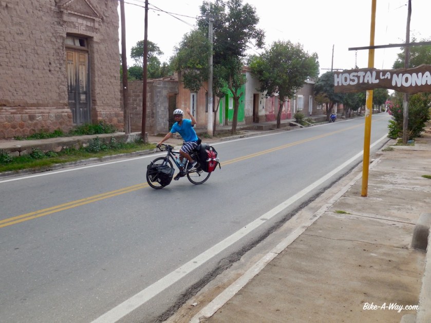
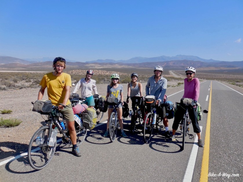
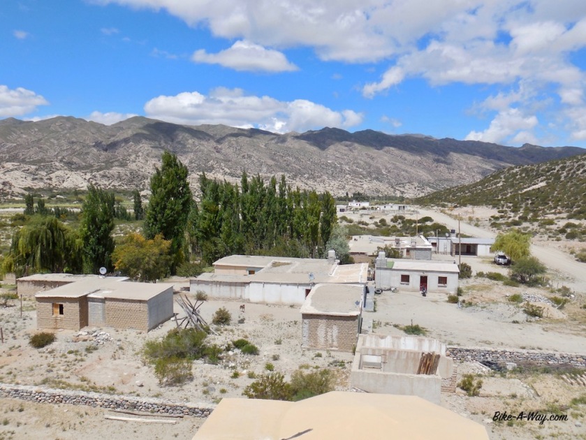
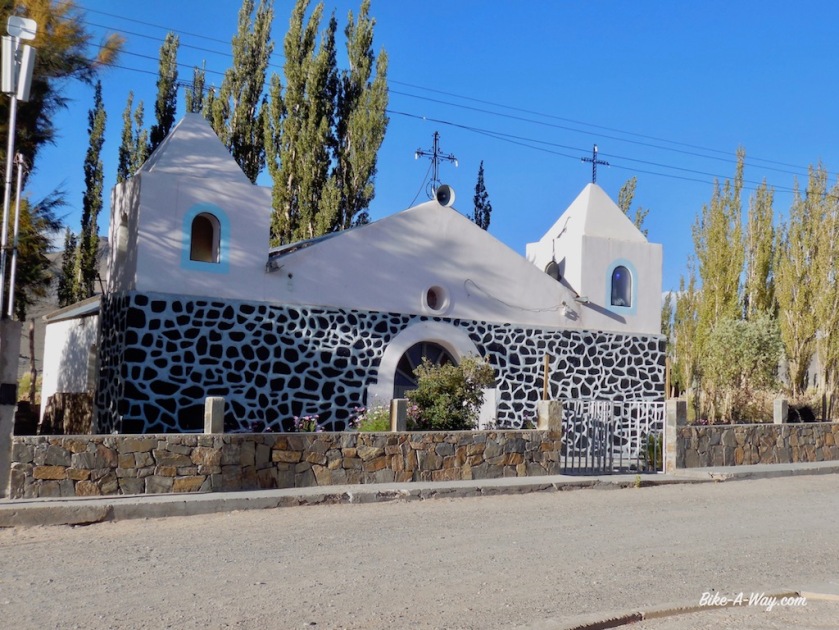
In Belén, I ride into Frederic again, a French cyclist I briefly met further south in Villa Union.

DSCN3794

Together with him I ride that same day towards EL Ejen and decide to ride the route via the Puna, towards Antofagsta de la Sierra.
Starting from Londres at 1.200 meter, El Eje at 1.775 meter, we cycle up towards a height of 3.992 meter at Portezuelo de Pasto Ventura.

DSCN3808
Hamlet along the road to Antofagsta DLS.

DSCN3820

DSCN3828

DSCN3838
The first day of our climb onto the Puna (altiplano), the weather was still cloudy, until we climbed out of this valley.

DSC03016

DSCN3843

DSCN3847

The straight road of 20 kilometer into the hamlet ‘El Peno,’, at 3.350 meter seemed to take forever against the strong Puna winds.
It seems the elevation doesn’t affect me too much so far, but both Frederic and I have diarrhea, probably from water we took from a pipe at El Bolson. And diarrhea sucks a lot of energy out of your body.

DSC03024
Cerro Laguna Blanca, just above or just under 6.000 m, depending on which source you use.
DSC03031
Vicunas, not as rare anymore as a couple of years ago.

DSCN3865

DSC03037

DSC03038
Again, Cerro Laguna Blanca

DSC03039

DSC03045

DSC03047
Find the car to appreciate the grandeur of this landscape.

DSC03053

DSCN3889

DSCN3892

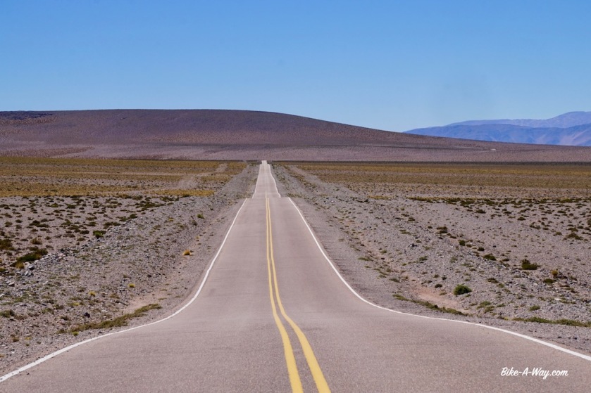
Sixty three kilometers separate El Penon from Antofagasta de la Sierra with only 400 climbing meters. Luckily the wind was quiet. If you have it in the face here, it’ll be a terrible day.
Frederic continues his route towards Antofalla and I stop and check in the hostel in Antofagasta de la Sierra to have a half day rest and a good meal tonight.

DSC03055

DSCN3906
You can see me cycling in the distance 🙂

DSCN3915

DSCN3928

DSCN3935
A new asphalt road is being built between El Penon and Antofagasta de la Sierra, but so far, traffic still has to take the sandy roads right & left of it. We cycled the asphalt.
DSC03059
Llamas at a lake just outside Antofagasta DLS.

DSCN3946

DSC03067
And flamingo’s, which I saw all the way from the cold lowlands of Tierra del Fuego, all the way through Patagonia and also here high up in the Puna.

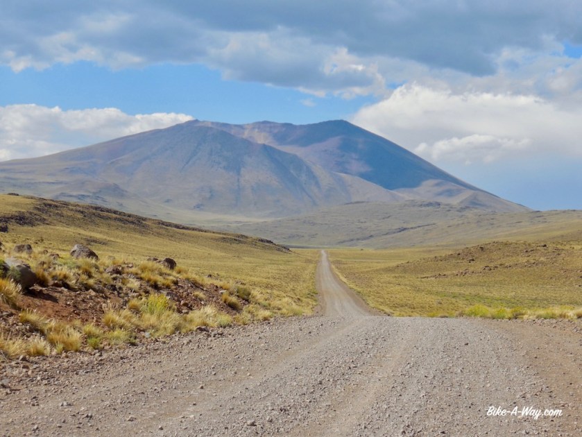
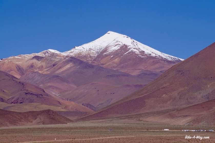
The big test comes after Antofagasta DLS, the climb from 3.300 meter to the ‘Abra Falda Cienaga’, a pass at 4.442 meter.
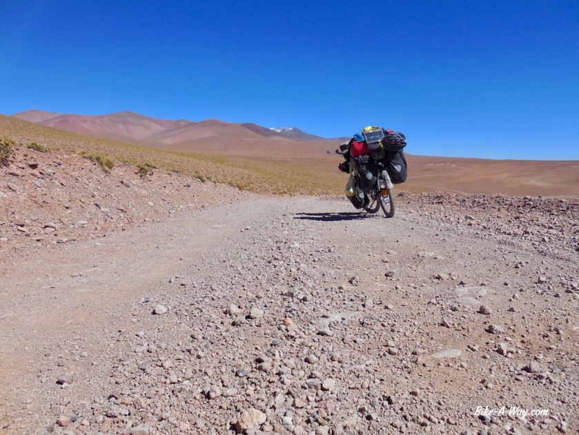
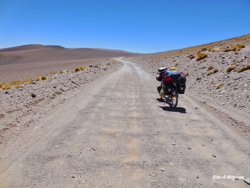
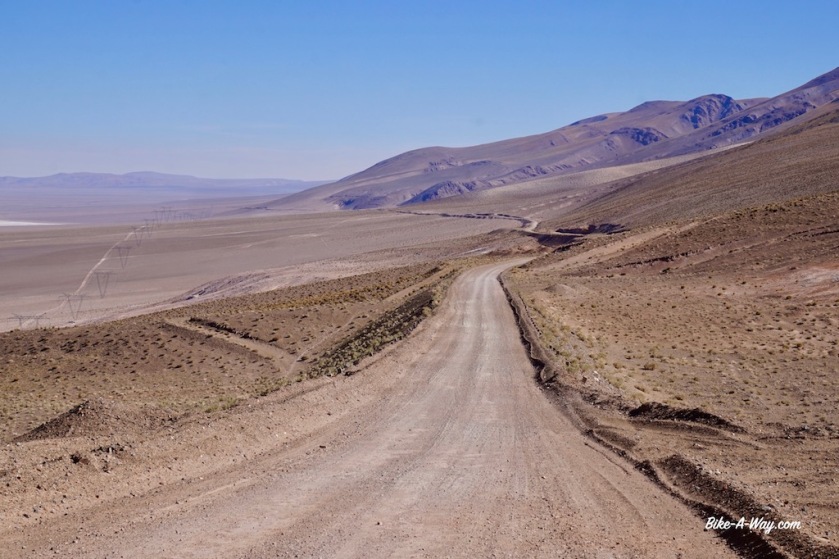
Riding stretches like this, it is not only elevation what makes it difficult. The road promises to be a mess, there’s the wind at this altitudes, the total absence of water, no villages for provisions and the sun which is burning immensely now in summer. The days are hot, but after the sun sets, it cools down very rapidly.

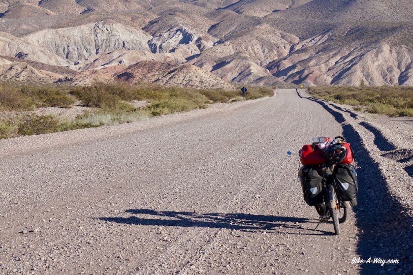
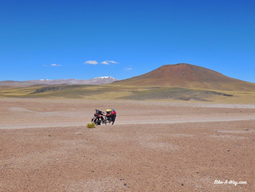
I leave town with four days worth of food, i.e. 1,2 kg of bread, two large packages of chocolate, six tins of paté, a pot of ‘dulcé de leche’ (which I find awful, but is easy to carry), two cans of tuna, two tins sardines, 500 grams oats meal, 500 grams rice, 500 grams spaghetti, three tomato’s, two peppers, three onions, garlic, parmesan cheese, a lot of cookies, an apple, a banana, dried fruit, nuts, tomato sauce, curry powder, milk powder, chocolate milk powder, tea, instant coffee and …. sixteen liters of water.
I hope to ride to Salar de Pocito’s, the next hamlet 220 kilometer away in three days.
So I’ll have 5 liters of water a day to drink and for cooking, dishes and 0,33 liter/day to brush my teeth.
Three Imodium tablets should keep the intestines at bay.

DSCN3957
Antofagasta de la Sierra, the ‘loneliest’ town in Argentina.

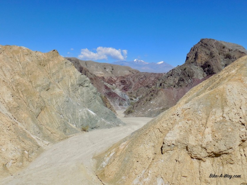
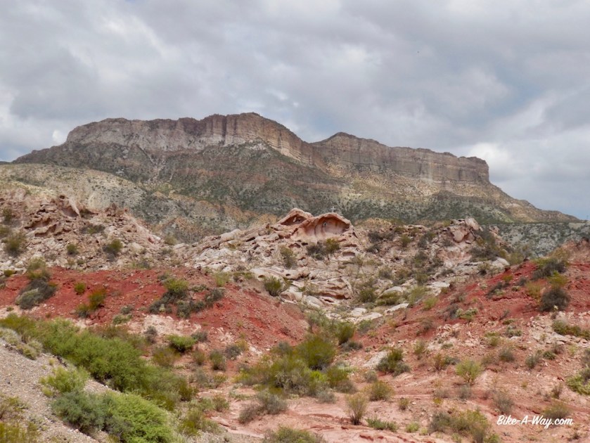
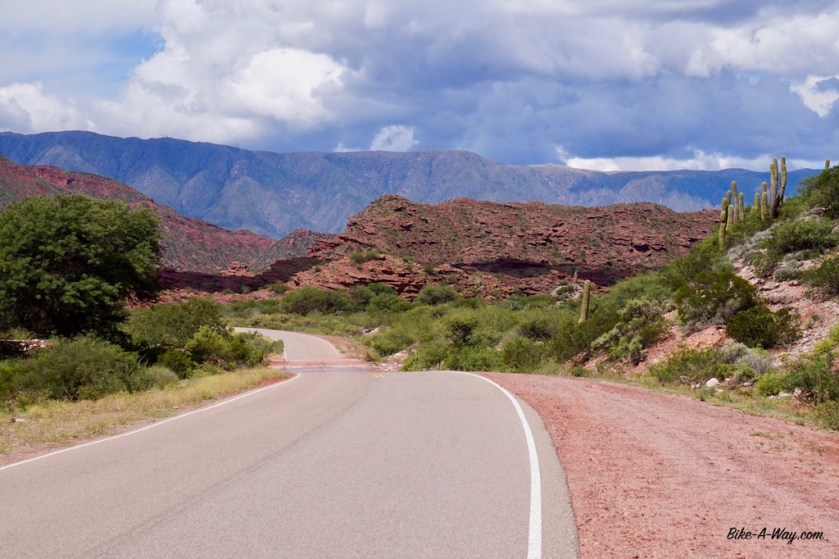
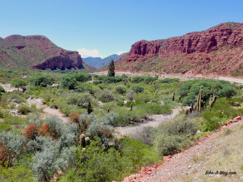
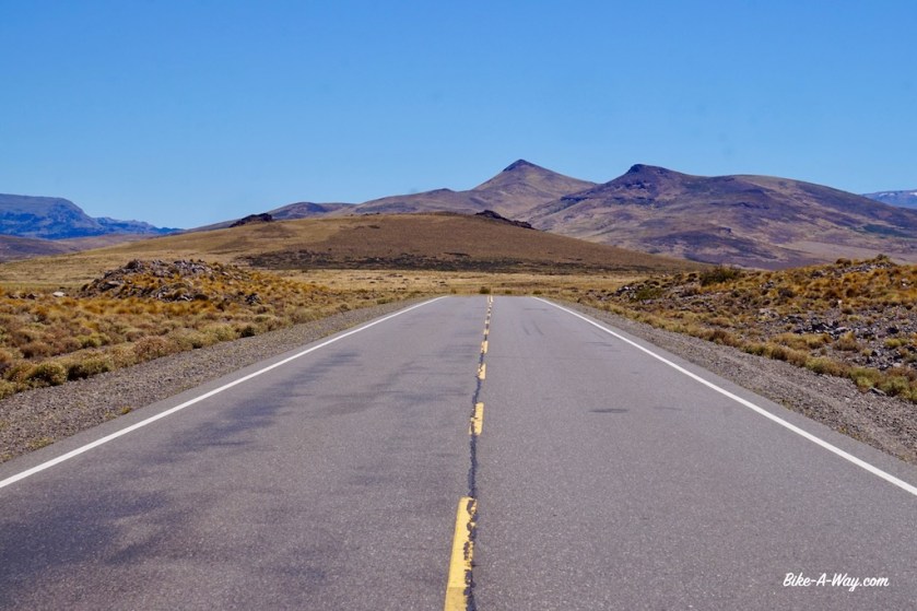
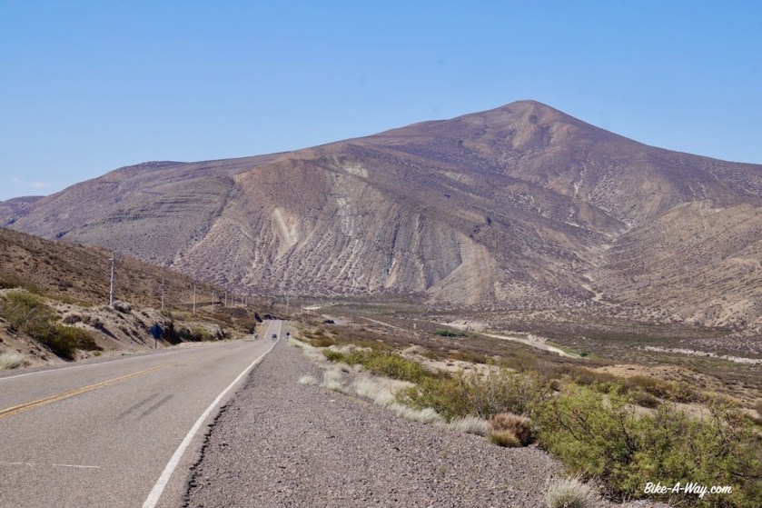
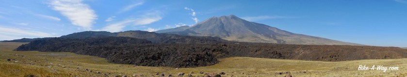
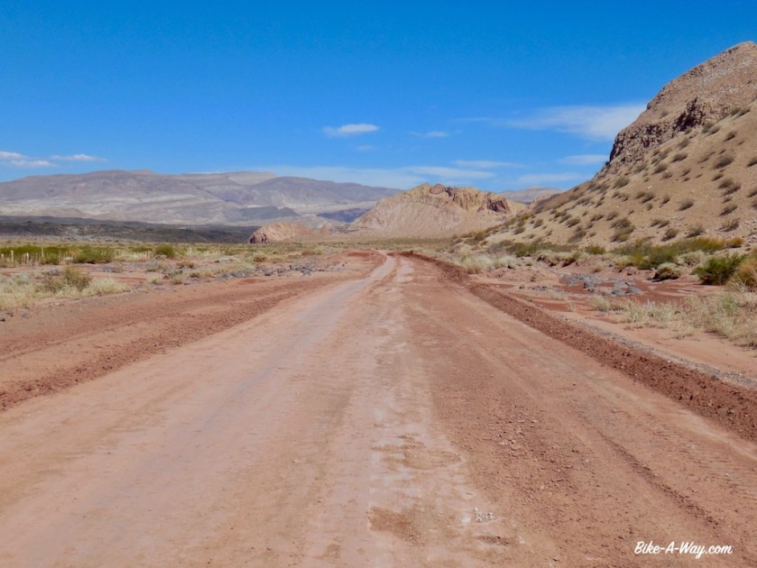
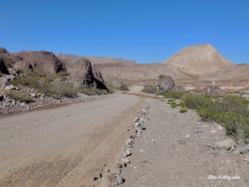
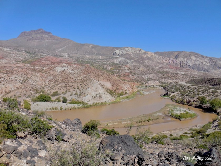
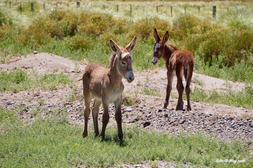
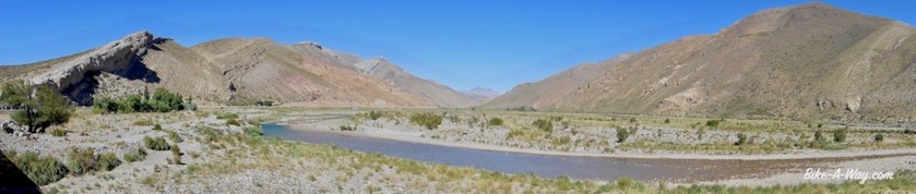
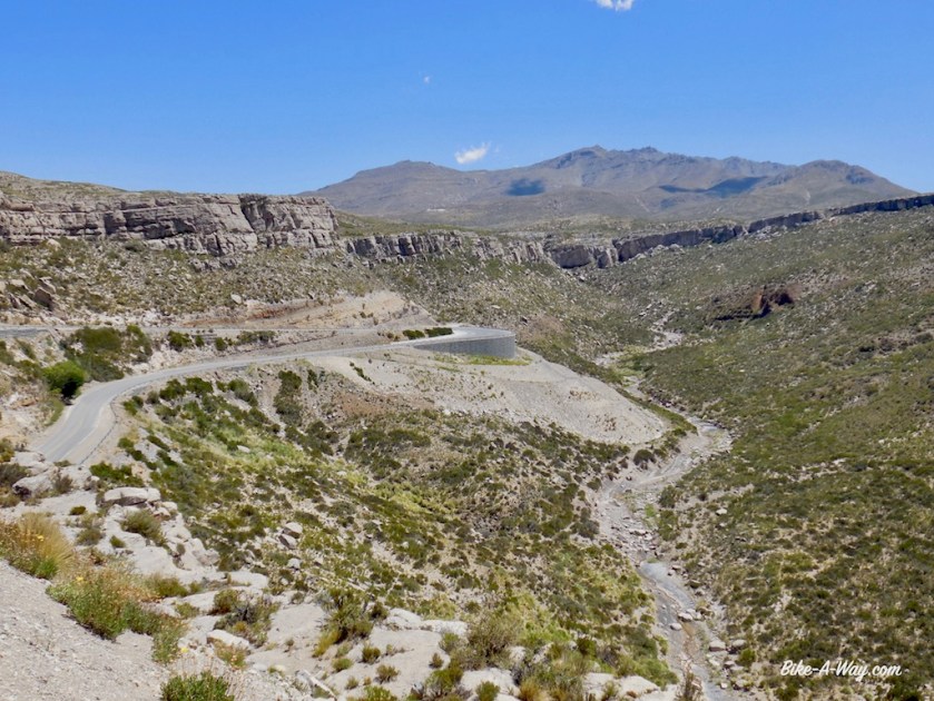
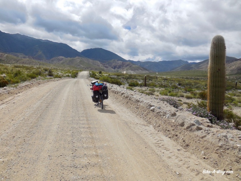
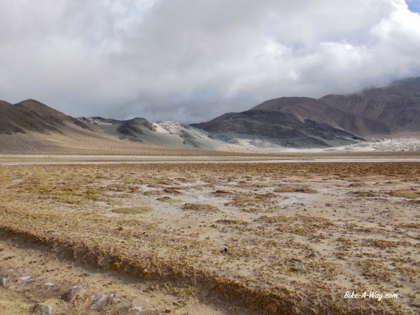
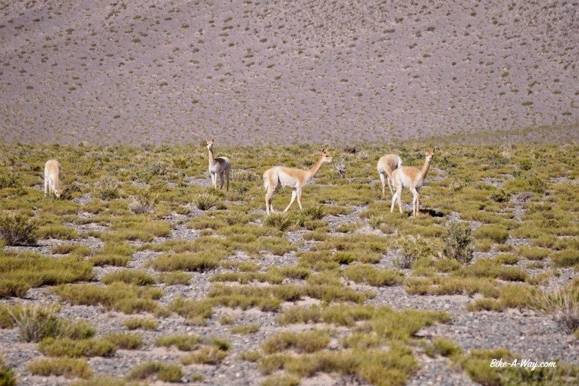
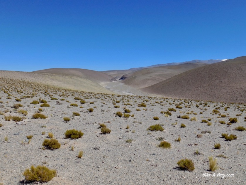
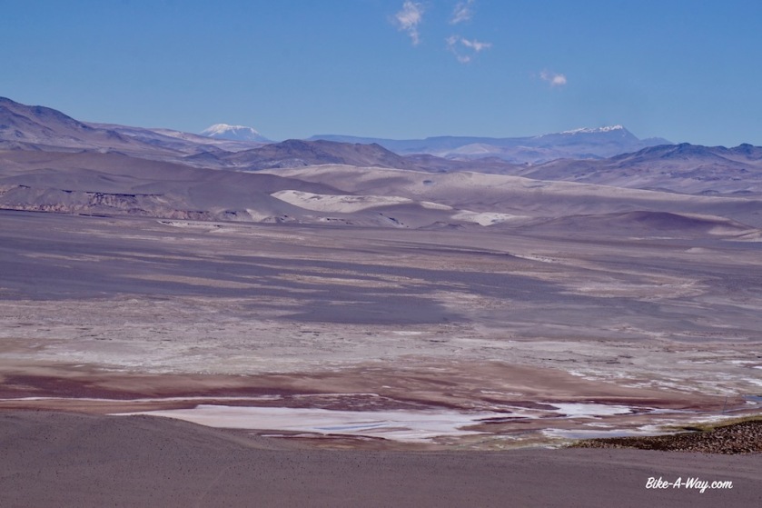
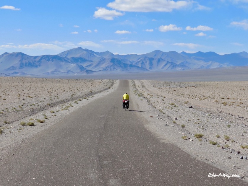
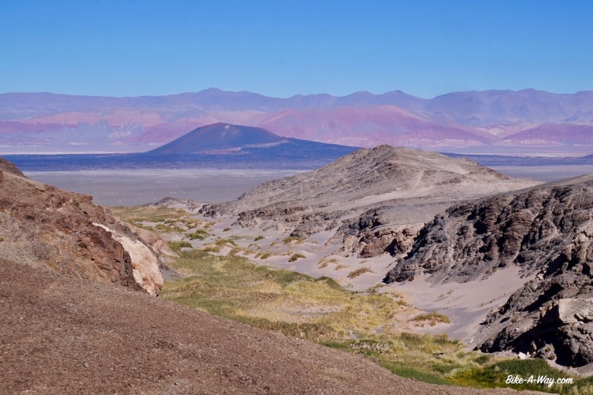
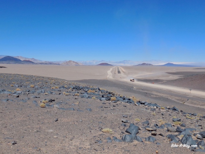
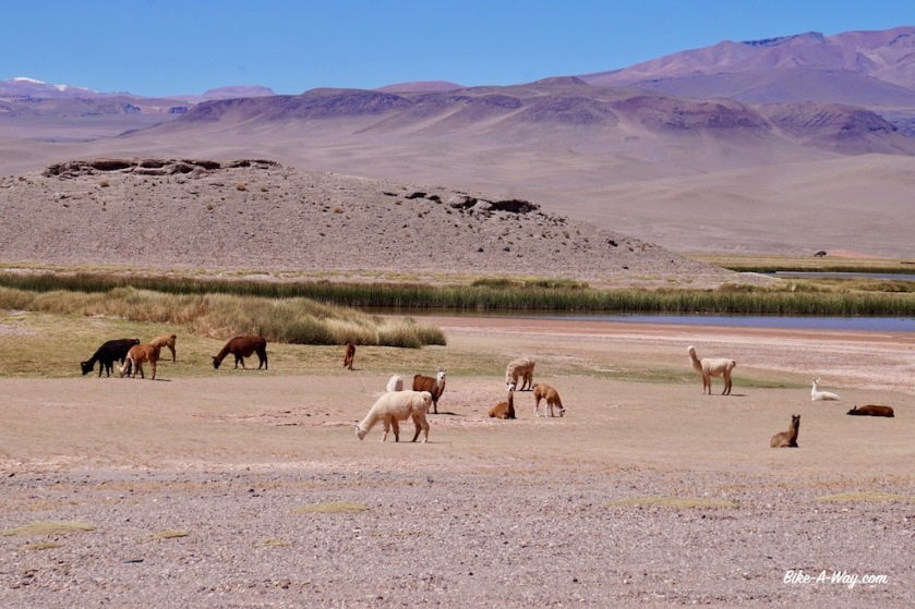
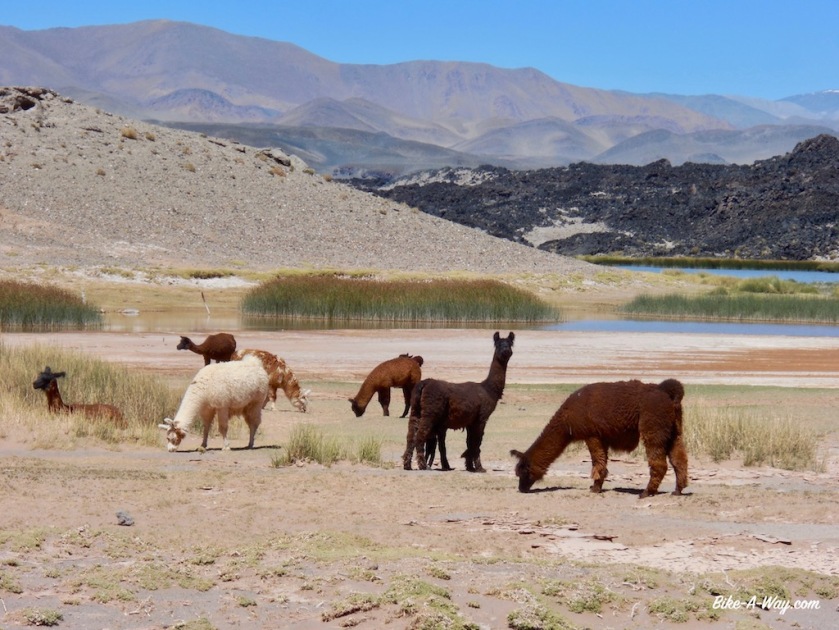
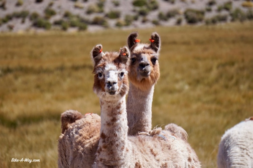
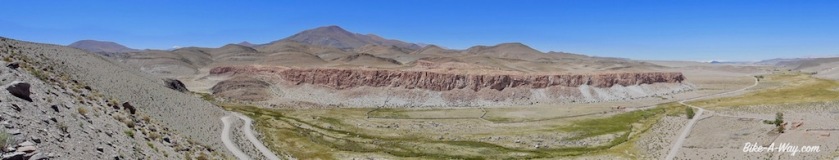
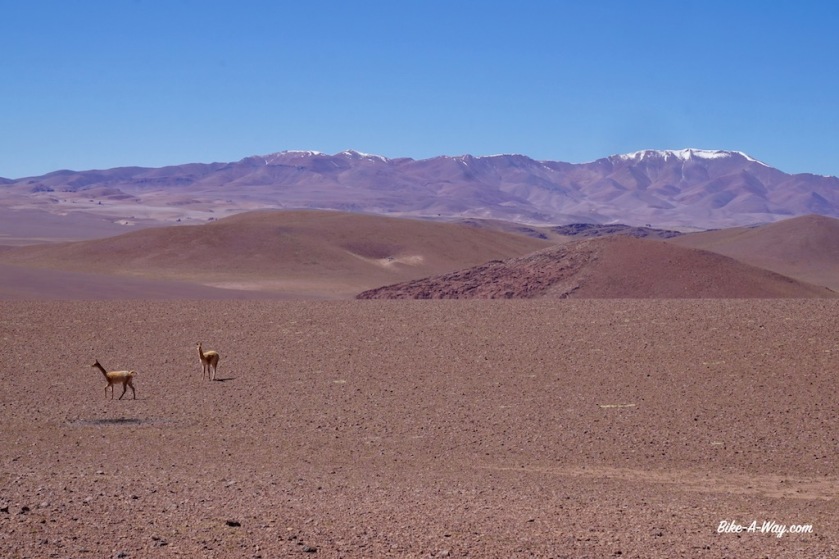
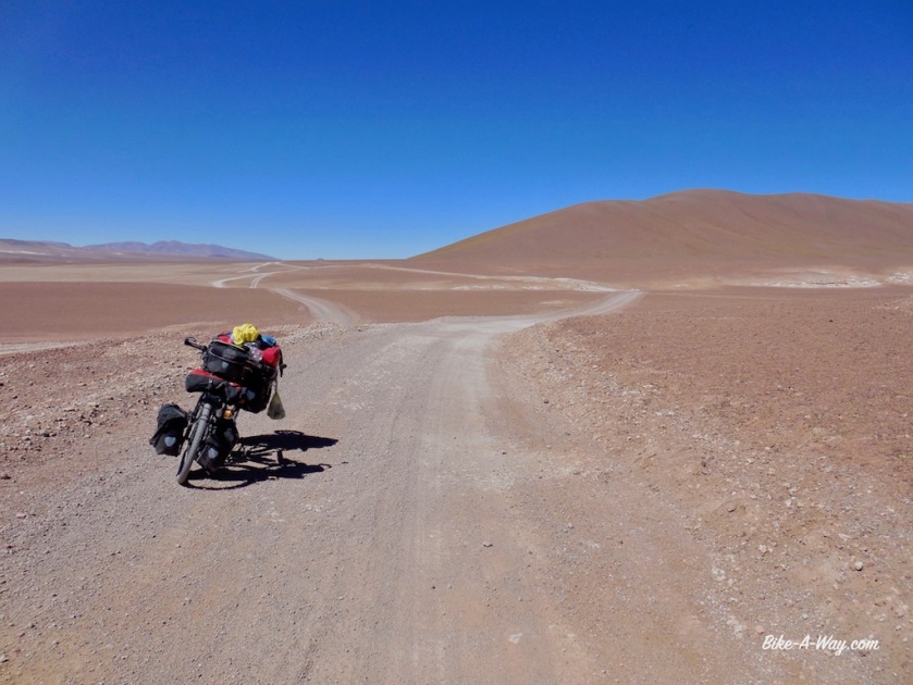
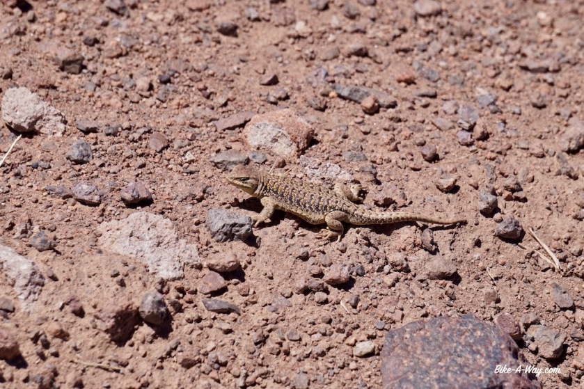
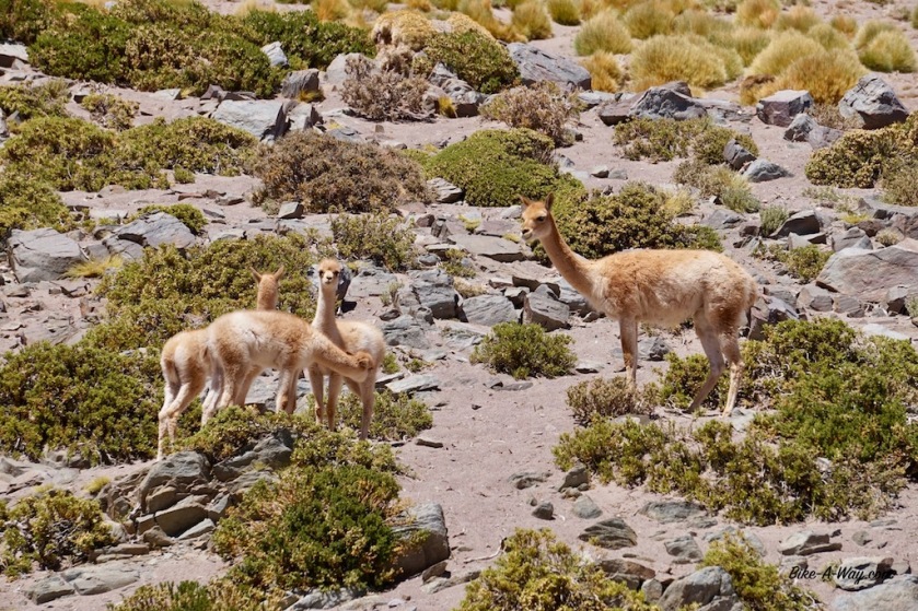
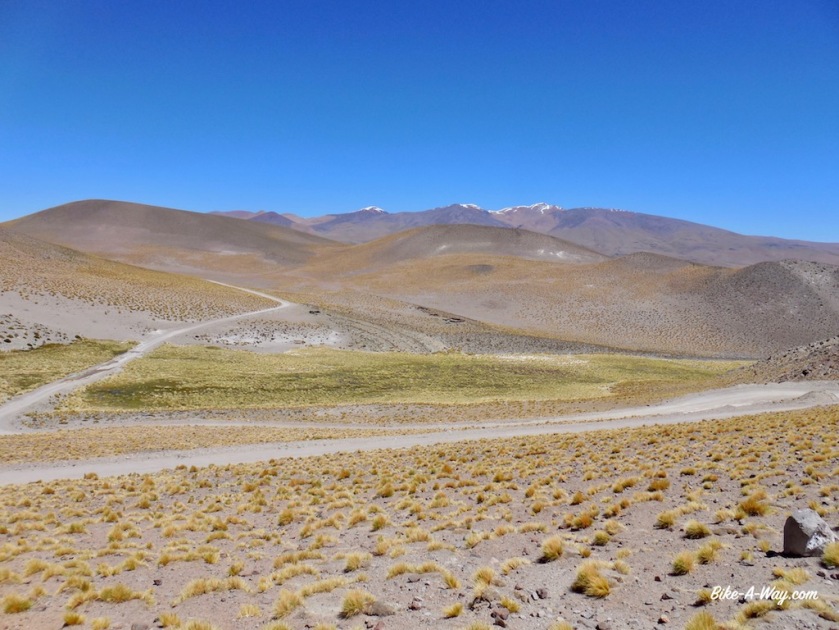
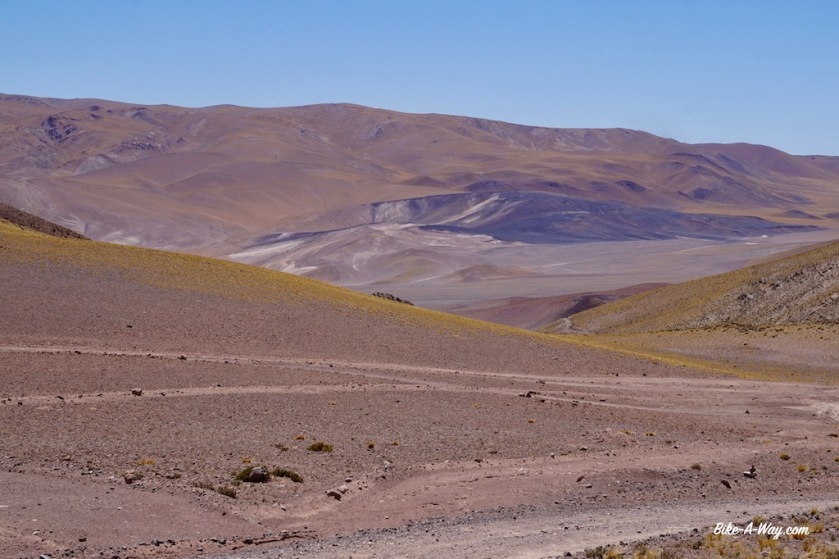
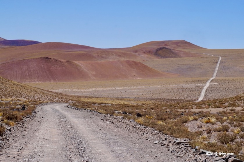
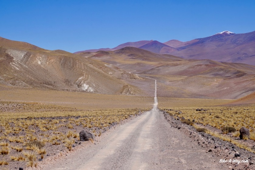
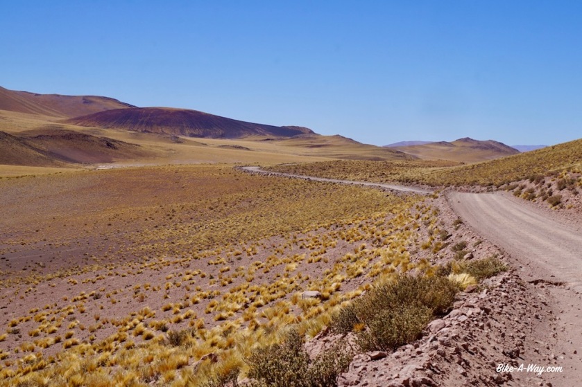
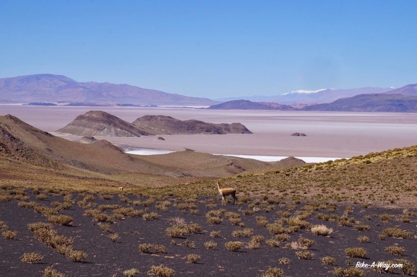
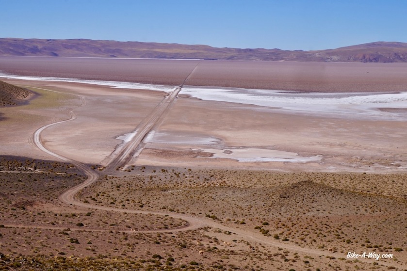
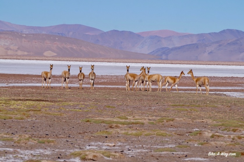
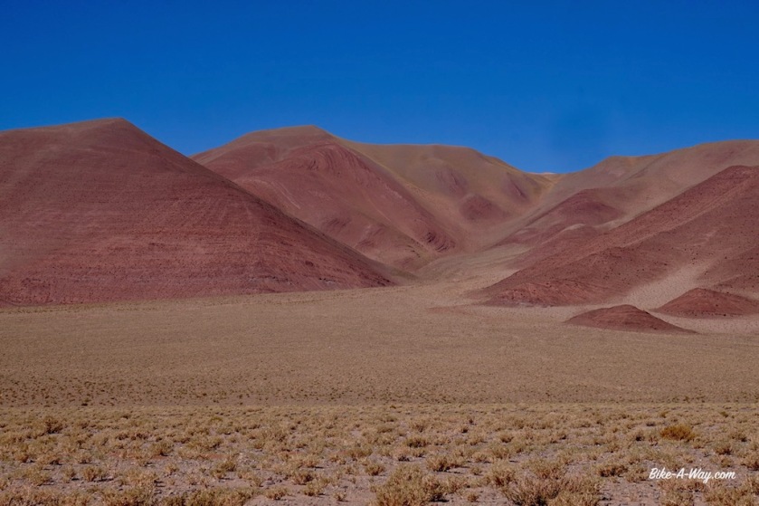
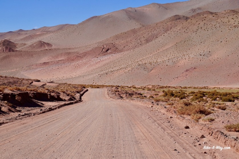
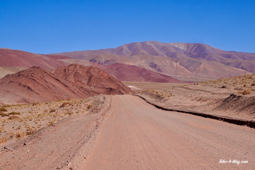
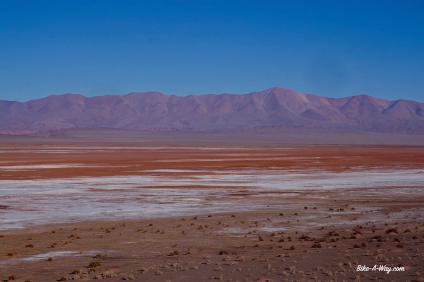
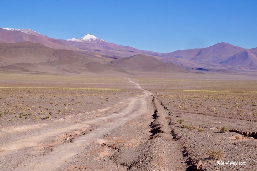
The road starts to climb seriously at Paycuqui, a hamlet of three or four houses. I thought the Puna would be a colorless, desolate high plateau, but it is much, much more beautiful as expected. Mountains in grey, yellow, green and red, many Vicunas and …. a little tail wind to help me up !
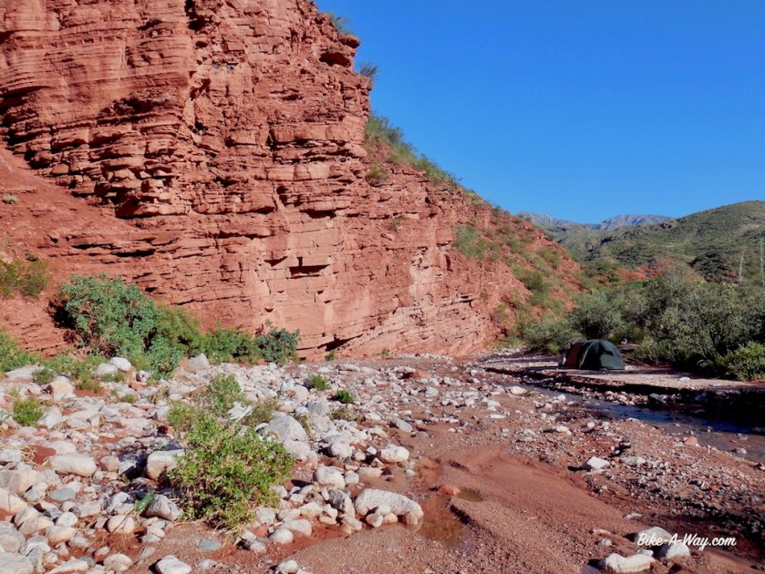
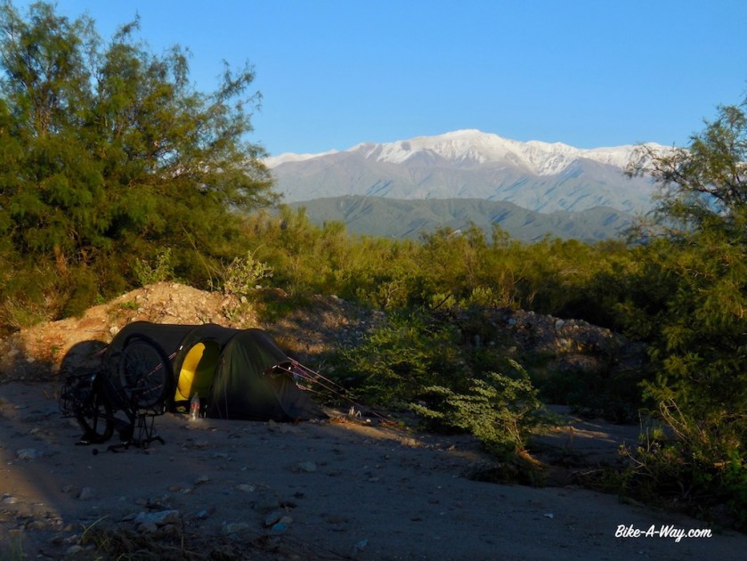
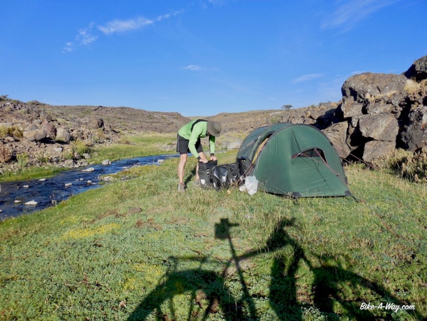
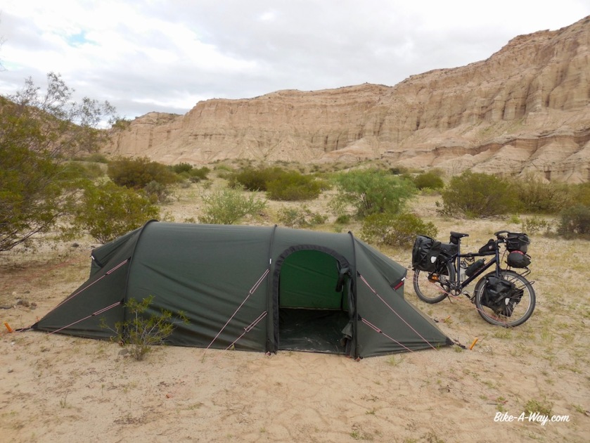
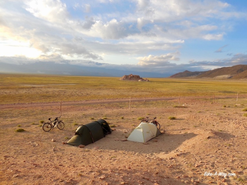
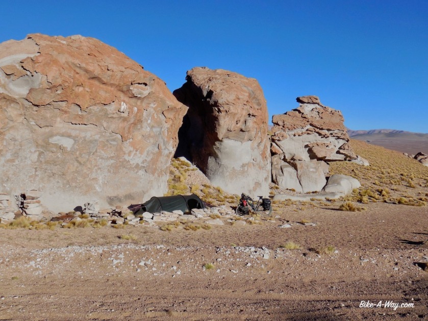
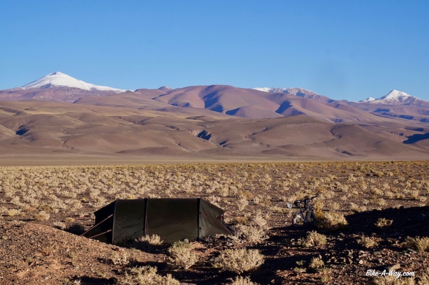
I camp just under the pass at an elevation of 4.358 meter, my highest camping spot ever. Some large rocks protect me well from the wind.
Many cyclists I meet seem to get by on a diet of just pasta with tomato sauce or even only olive oil, but that doesn’t work for me.
So as the sun sets at 19:45, I’m cutting peppers, onions and garlic to make a nice rice & curry dish, with some tuna at this altitude
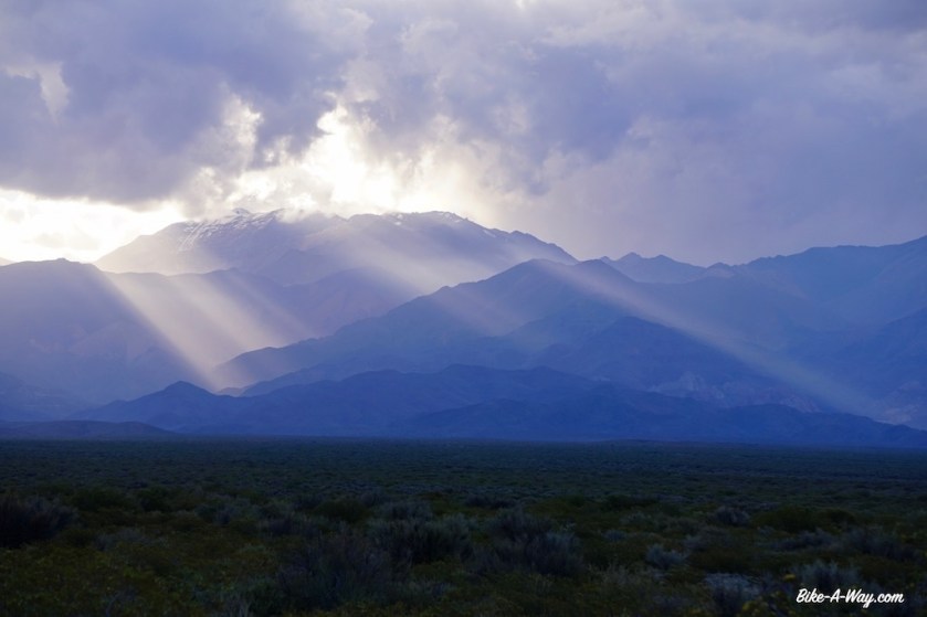
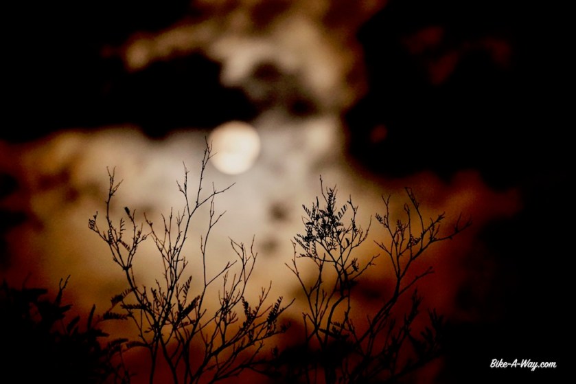
At 22:00, I shortly leave the tent again. The last brightness from the sun in the west is gone. The moon rises after midnight today. No light pollution for hundreds of kilometer, and at this elevation, the night sky is simply unreal. A shame I don’t have a camera anymore with which I could catch it, but I’ll always remember it.

DSC03074

DSCN3978

DSCN4011

DSC03087

DSC03088

DSCN4024
My highest camp so far at 4.358 meter, well protected from the winds.

From my camp spot the next day, the road undulates for a while and it seems to take forever to reach the pass. A while ago I downloaded a bunch of episodes from ‘The Date on Friday’ from 2016 and 2017 (De Afspraak op vrijdag), a program from Belgian television discussing the political events of the last week. So I’m getting a little bit up-to-date again.
After 20 kilometer or so, I’m finally at the top. 4.432 meter according to my gps readings. I also passed the 30.000 kilometer since I started this trip in April 2016.

DSCN4042

DSCN4045
Wobble, wobble, wobble…
DSC03092
Some vicuna’s, surviving one way or the other above 4.000 m.

DSCN4053

DSCN4058
It keeps going up and down for a while before I finally reach the highest point, but what a spectacular environment.
DSC03093
This guy lives at + 4.400 meter.
DSCN4061
‘Abra Falda Cienaga’, the highest point on this Argentinean Puna route at 4.432 meter.

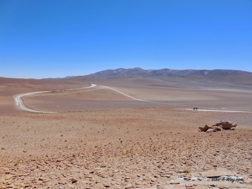
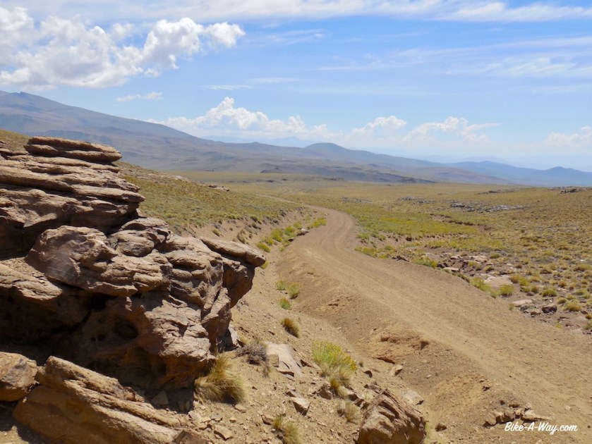
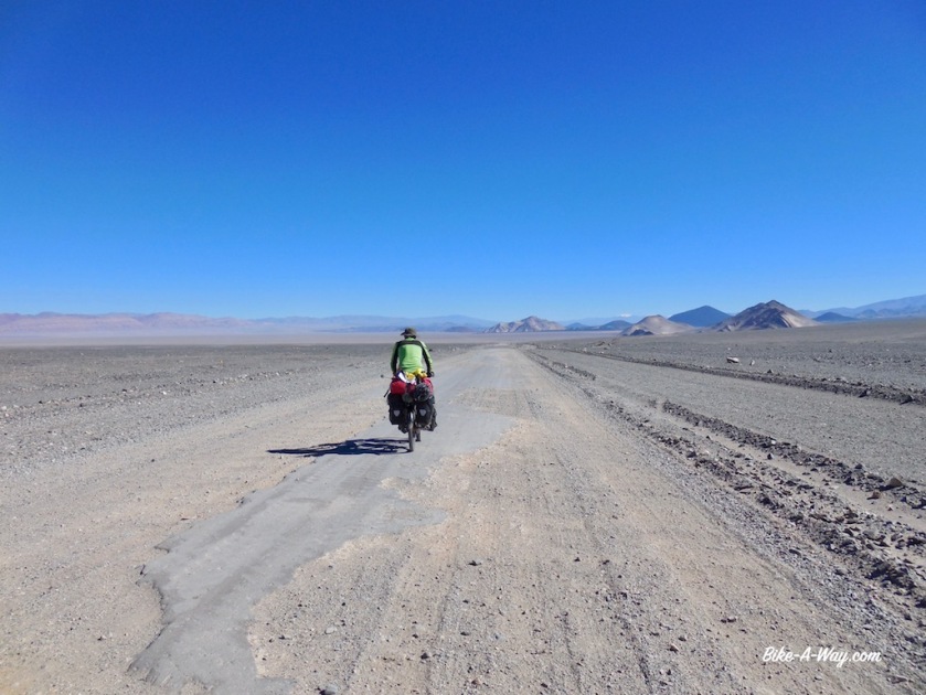
After yesterdays short day of 47 kilometer, I was hoping to make some better progress today but the road keeps descending and climbing. I cycle slow but even then I still stop to just look around. It’s like I’m cycling on Mars.
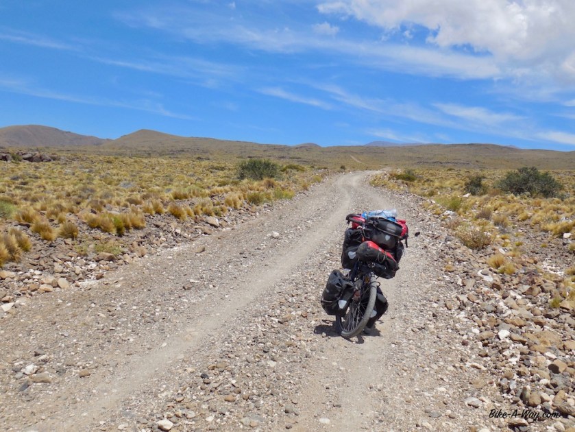
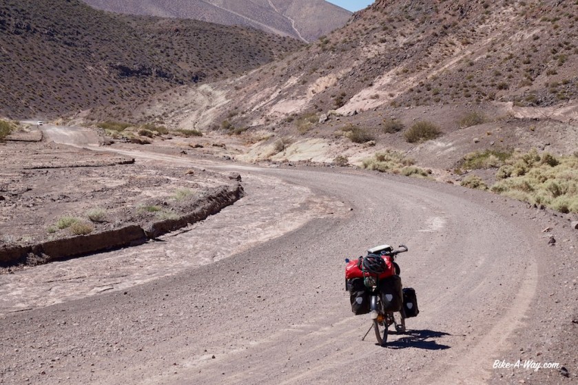
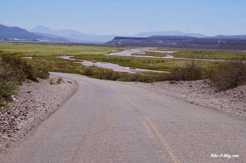
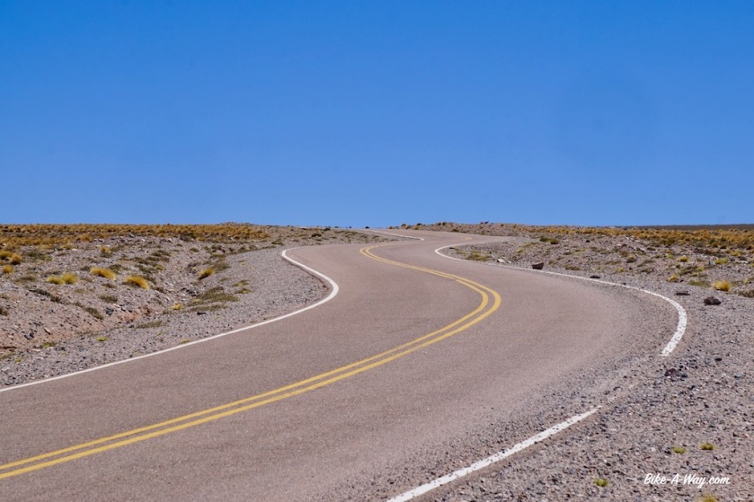
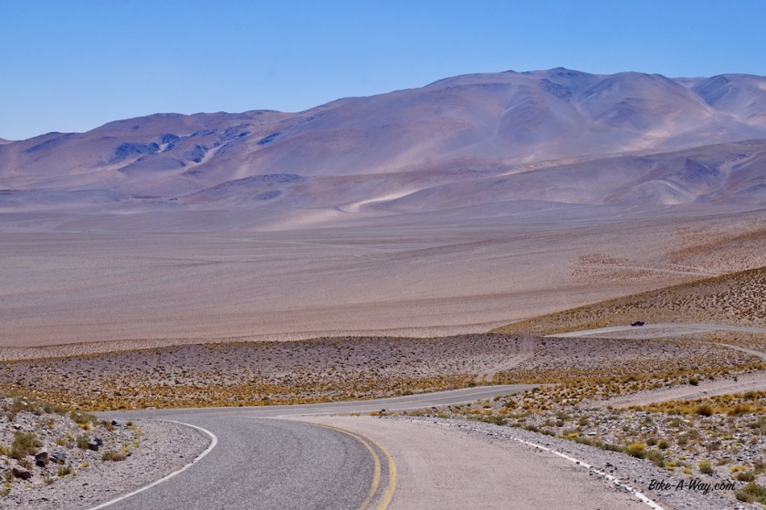
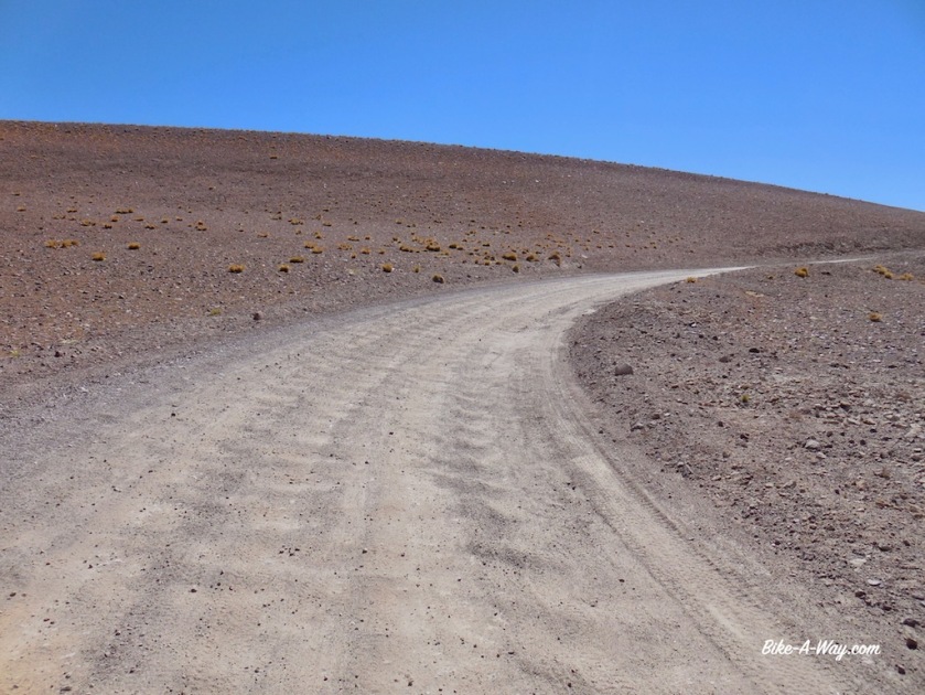
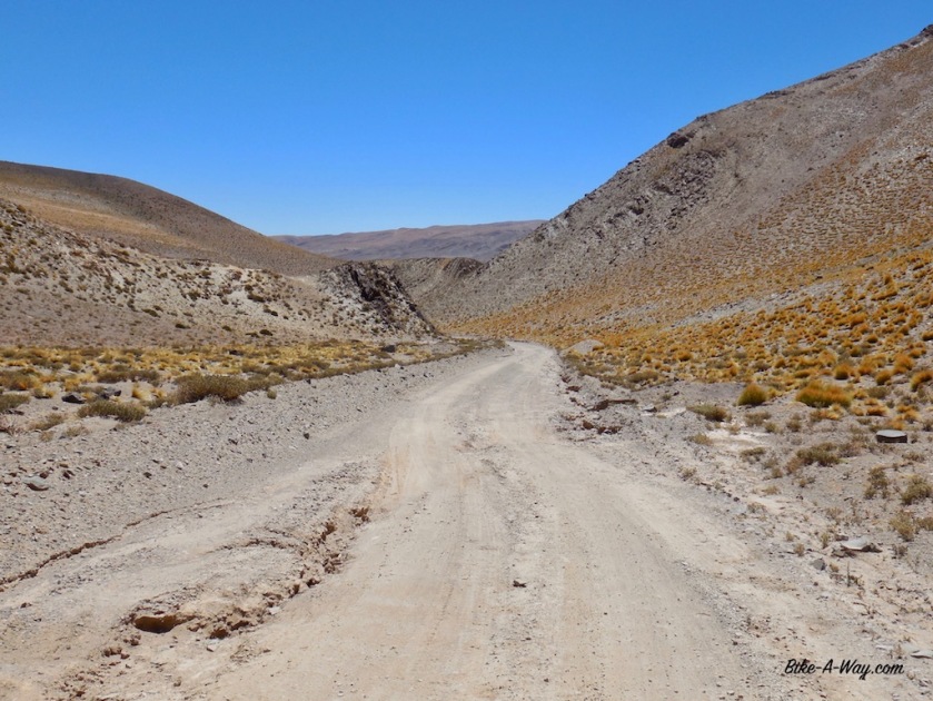
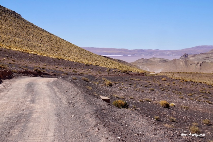
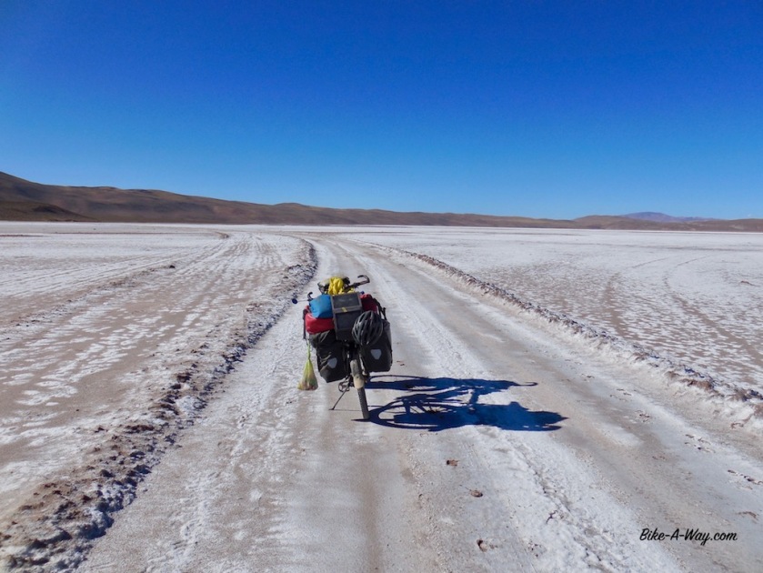
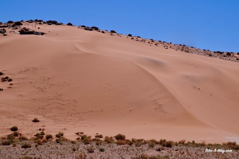
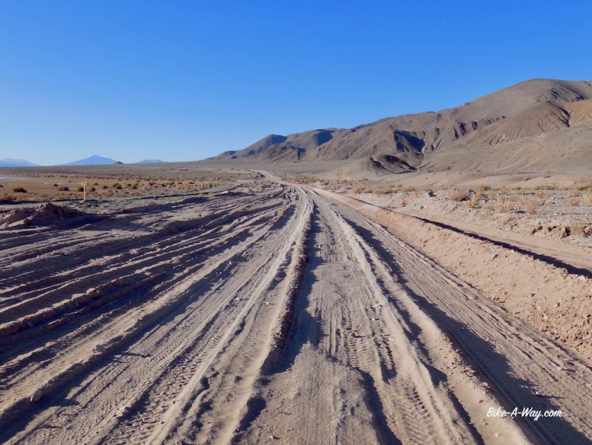
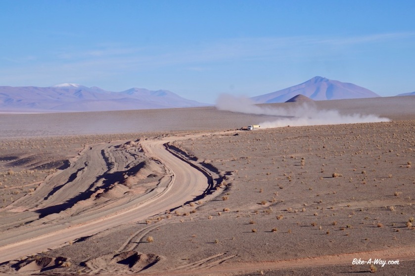
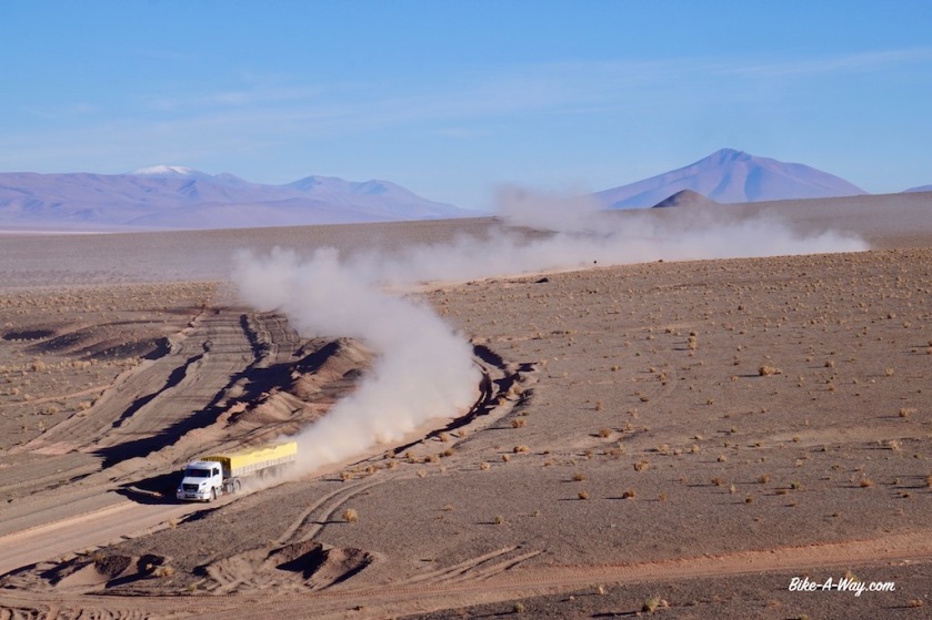
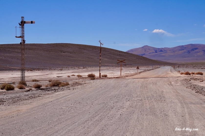
The road is dramatically bad. It’s washboard all the time, with often deep sand thrown in to it. Many times I need to push the bike, which sinks into the sand with all that weight. I breathe heavily at this altitude.
Good, rideable sections are short.
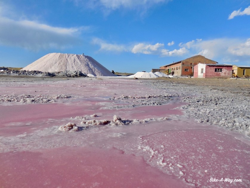
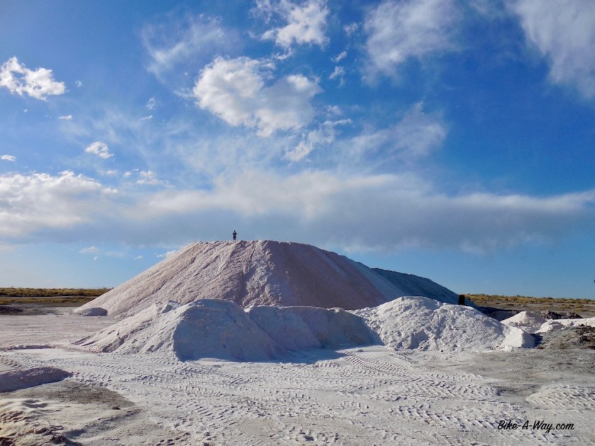
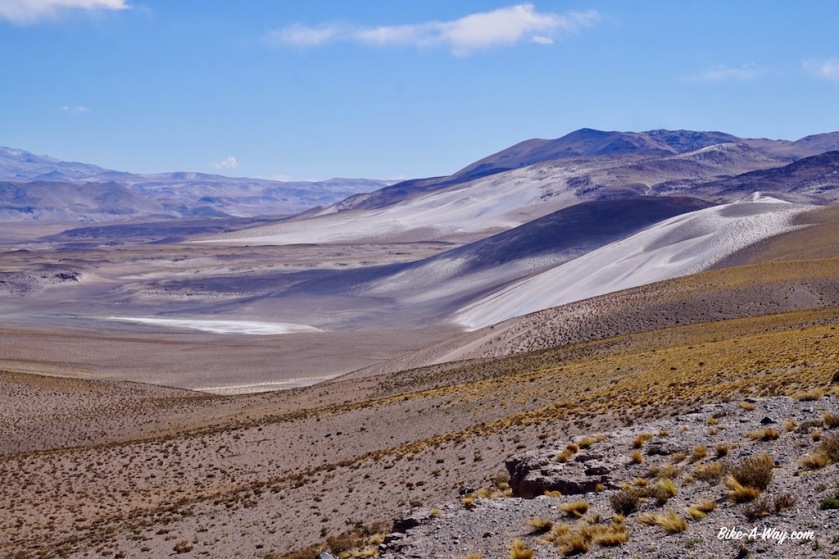
Especially the downhill towards the ‘Salar del Hombre Muerto’ (salt plain of the death man) is awful, as are some parts of the track around it.
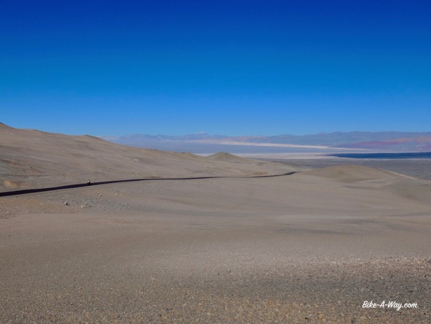
After cycling all day above 4.000 meter, the salar is at an elevation of 3.980 meter.

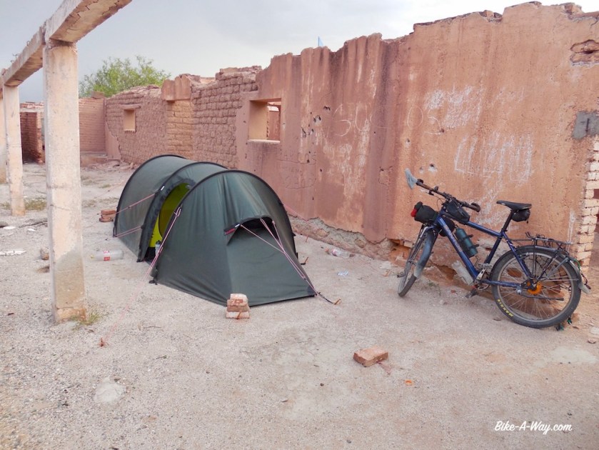
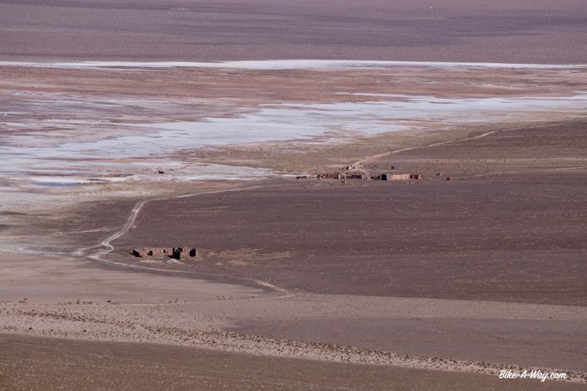
After sixty kilometer I arrive at the unmanned police post north of the salar. It’s basically just two containers which are unfortunately locked. They have a water tank behind them, which I opened from the top. The water was lukewarm from the sun all day, so I had a nice shower in this dry high altitude desert.
I pitch the tent behind one of the containers. Less scenic then the day before, but again properly sheltered from the wind.
Now I’m already 32 kilometer ‘behind schedule’, so it’s good I took again too much food.
I filtered water from the tank, which I use for cooking, do the dishes and brushing teeth. Even with a day extra, I should be fine with the water to reach Salar de Pocitos.

DSC03096

DSC03098
The stretch between‘Abra Falda Cienaga’ and Salar del Hombre Muerto was definitely the most spectacular (and no traffic apart from three jeeps in the morning with ‘adventure tourists’ visiting the salar.

DSCN4087

DSCN4089
Another little, unnamed salt plain.
DSCN4090
Every 0,7 seconds your back, pulses, shoulders get smashed on these roads. It’ll make you stronger.

DSC03099

DSCN4095

DSC03101

DSC03105

DSC03110

DSC03108

DSC03109

DSC03107

DSC03112
A vicuna on his lonesome admiring the Salar del Hombre Muerto.

DSC03114

DSC03115
Salar del Hombre Muerto, 3.980 meter above sea level.
DSC03116
There are two roads to the other side. The straight one in the middle seemed too muddy so I took the long way around to the left, adding +/- 15 kilometer to the trip.

DSCN4128

DSC03117

DSC03118

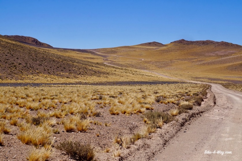
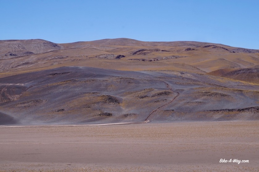
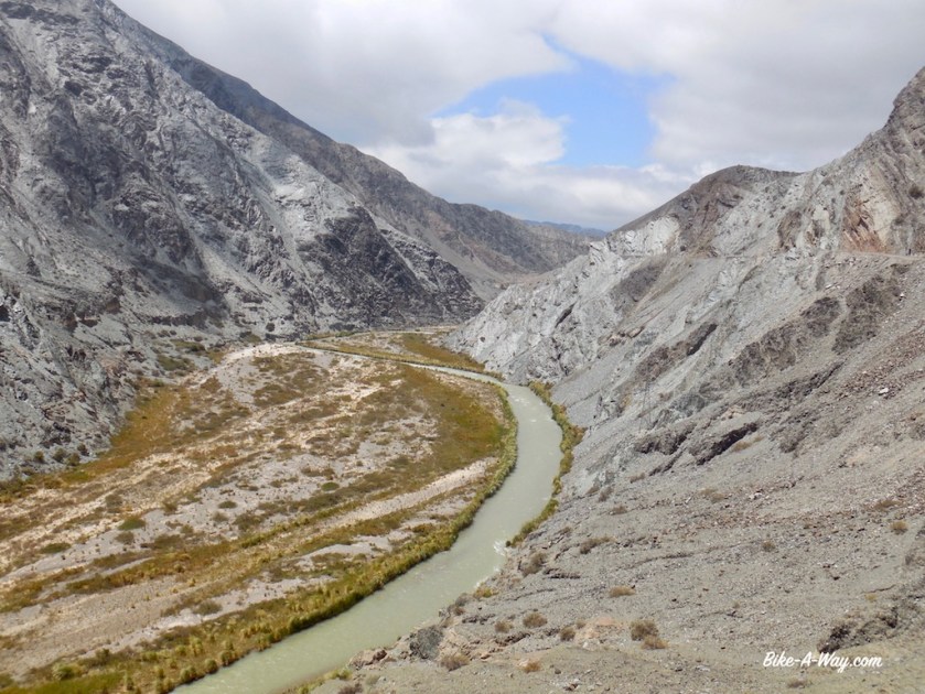
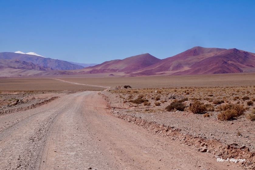
North of the Salar del Hombre Muerto, I have to climb another unnamed pass of 4.195 meter. The road is better for a while but becomes again really sandy and bumpy as the day carries on. As I was virtually on my own between Antofagasta de la Sierra and the salar, now north of this salt plain there is again some traffic of pick-up trucks and big trucks.
None of them symphatic enough to slow down the slightest and leaving me in a cloud of dust every time.
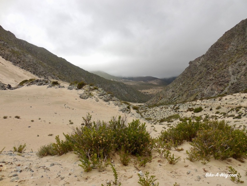
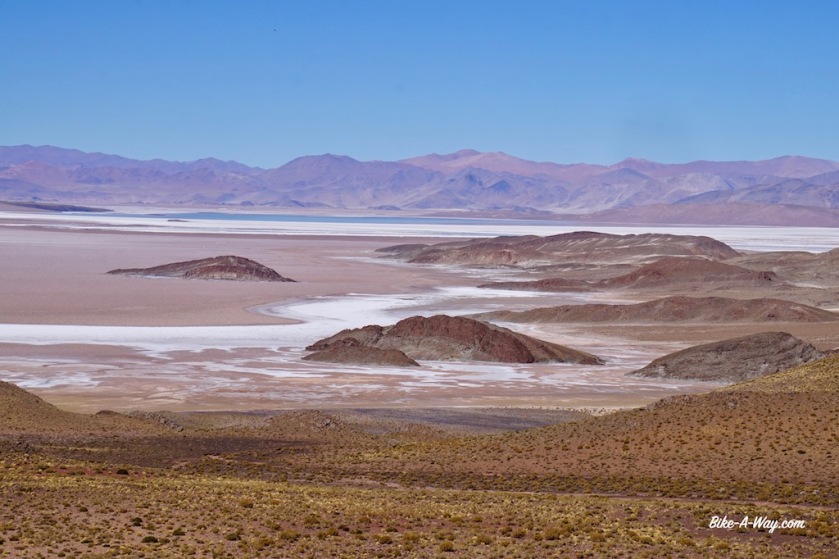
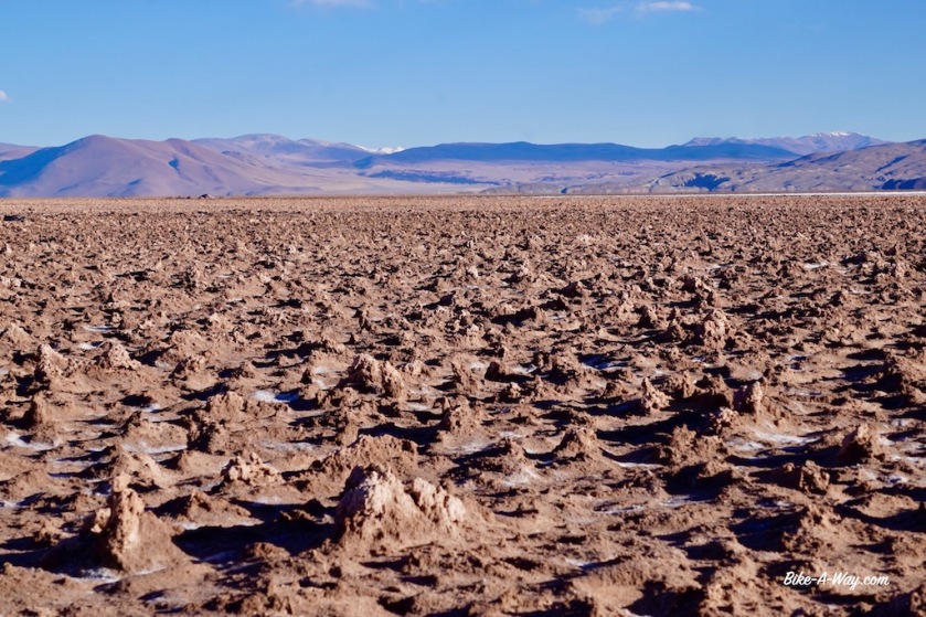
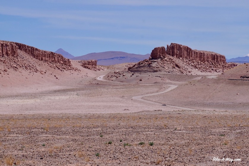
The landscape offers an incredible variety of colors again, with even some sand dunes.

DSC03119

DSC03121
As if red, green, brown and yellow rocks and salt flats aren’t enough to keep you busy, nature throws in some sand dunes for you to admire as well.

DSC03124

DSC03136

DSC03127

DSC03140

DSC03142

DSCN4190

DSCN4196

DSC03146

DSC03149
You might think, “what is he always moaning about this traffic..”, well watch this truck coming …..
DSC03154
This is where he passes you, never slowing down the least bit. See how you’re in that dust cloud for minutes, all sticking to your body covered in sun cream.

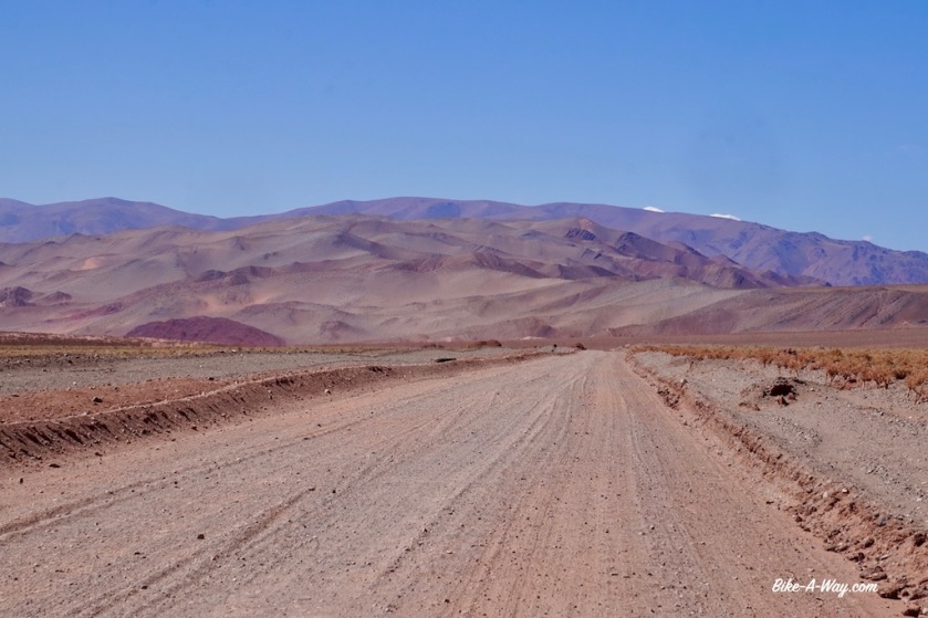
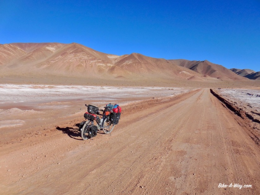
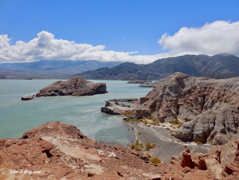
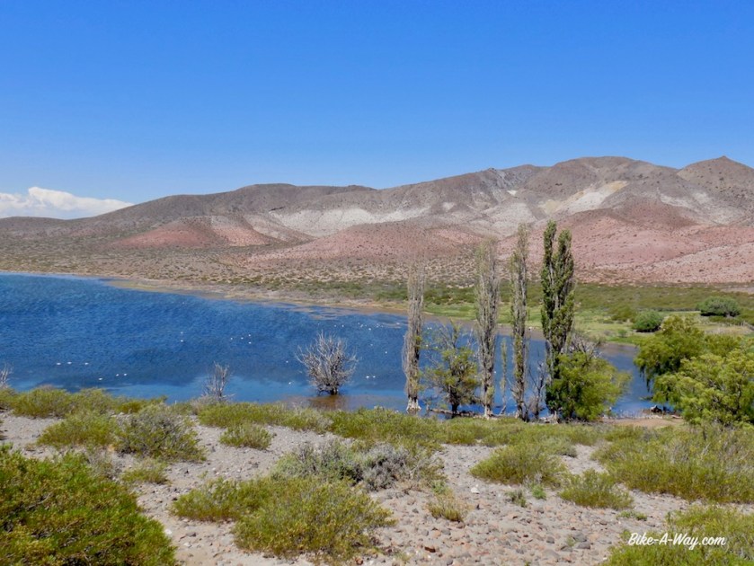
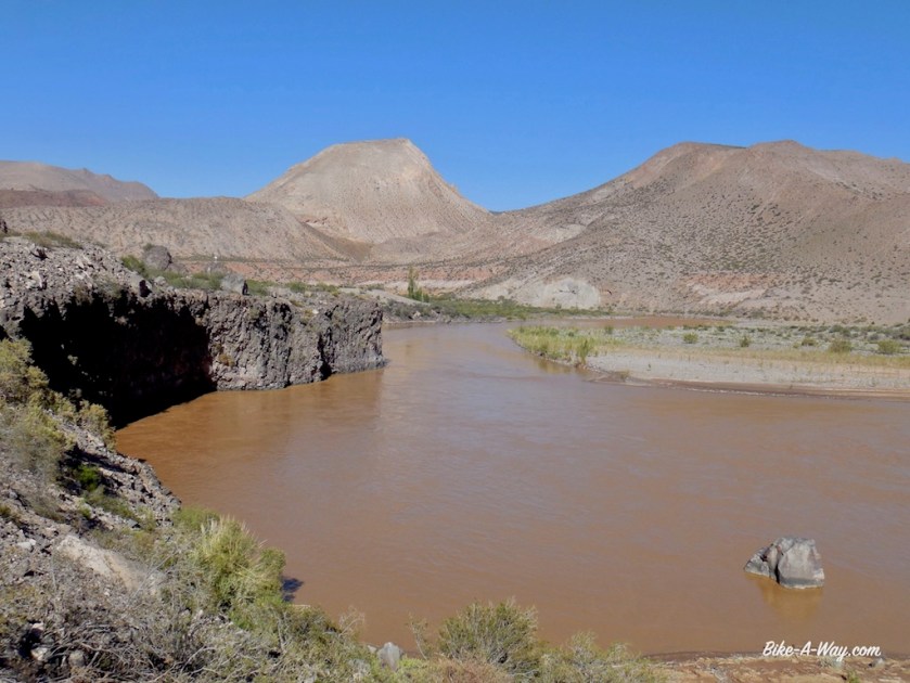
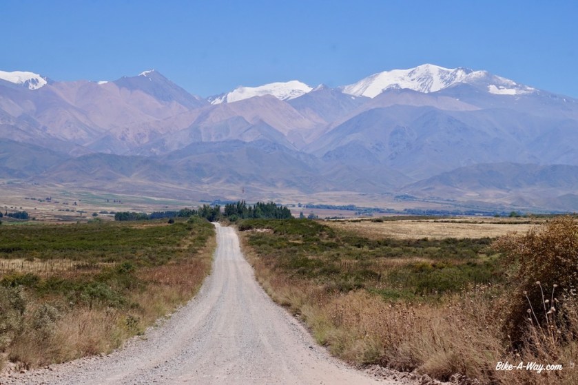
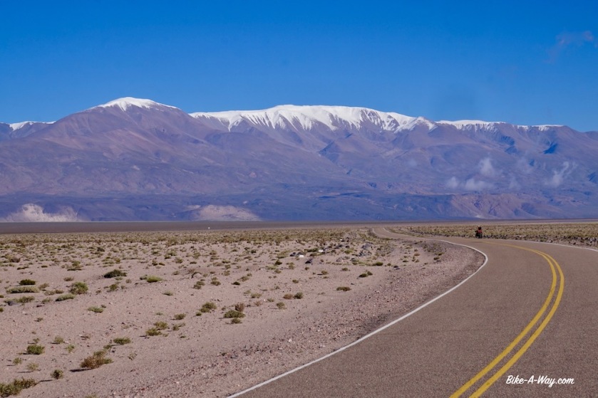
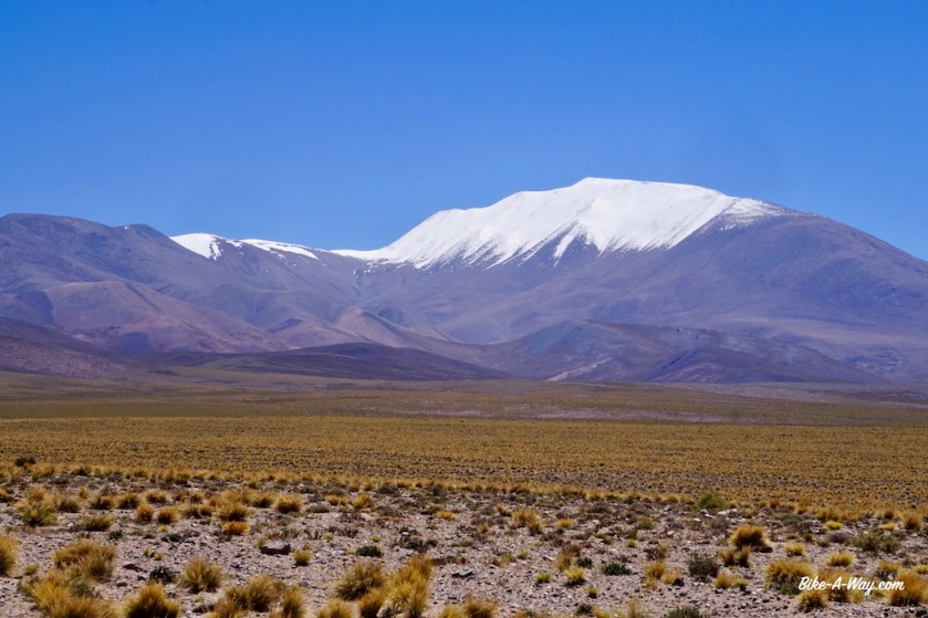
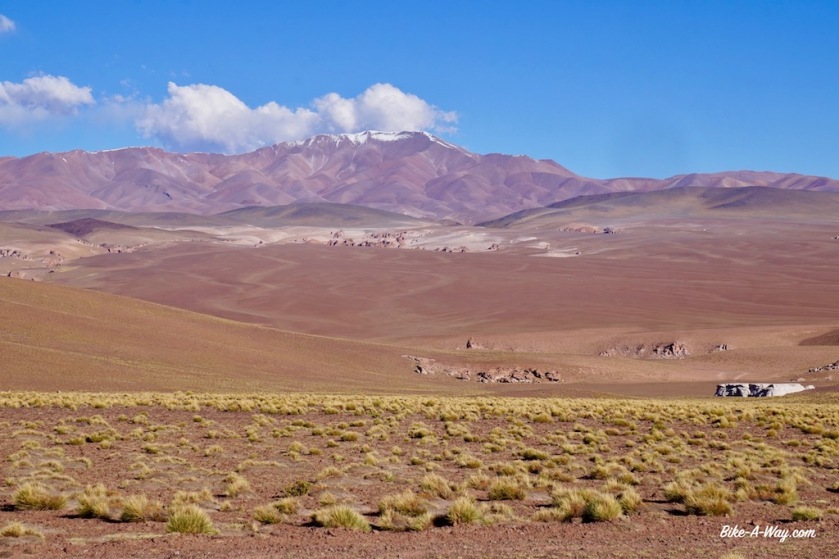
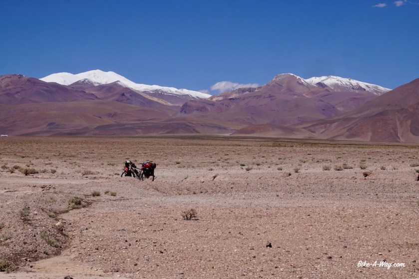
Next day, riding along the salar in a combination of white and red colors, the Volcan Galantop (6.740 m) behind it, I stop for lunch in Salar de Pocitos. Still on ripio road, I climb again to a hill top over 4.000 meter and set up camp for the day looking at Volcan Queva (6.130 m) from the porch of my tent and Cerro del Rincon (5.606 m) on the other side of the tent.

DSCN4203
The red house on the left is the restaurant and the village shop. They can give you a place to sleep as well. Service was friendly and the food was simple but okay.

DSC03165

DSC03173

DSC03177

DSC03188
I took this short cut from the ruta 27, out of Solar de Pocito’s towards ruta 51.
DSC03191
Nice place to spend the night, again above 4.000 meter, admiring Volcano Queva (6.130 m)

My last kilometers in Argentina are, yet again, along a difficult to ride stretch of ripio and loose sand road along the Salar del Rincon. I met an Argentinean guy on my way up who was invited to stay the night at the immigration post. Also the Japanese cyclist I met in Londres could stay there.
As I had still a lot of vegetables which the Chilean customs would confiscate, I cooked a warm meal at the border post. No shops after the border to stock up on new vitamins.
To my surprise, Frederic arrives as well. I thought he would be a day ahead of me by now.
For whatever reason, we were not allowed to spend the night at the immigration. They send us out at 16:30 hrs, a few hrs before sunset, and with a big climb still ahead of us, the wind blowing like hell from the west. Three kilometer after the immigration, we found some rocky boulders which gave minimal shelter from the hard wind and called it a day.
Tomorrow up and over the Paso de Sico for a final, short stretch in Chile.

DSC03198
Salar del Rincon on the left.
DSC03199
Salar del Rincon

DSC03213

Passo Icalma – Paso Sico
Distance: 2.568 km (of which 238 km by bus)
Average km per cycling day: 58,25 km
Altimeter: 23.707 meter

Nights slept inside: 11 (8 in hostel, 2 in the refugio Volcan ‘El Tromen’ and 1 at Salar del diamante)
Nights slept outside: 35 (of which 34 wild camping and on in hell-Camping El Festival in Tunuyan)
Flat tires: 3

The GPS track can be downloaded from Wikiloc

Argentina: Uspallata to Belén

Route: Uspallata – Calingasta – Iglesia – Rodeo – San José de Jachal – Villa Union – Chilecito – Alpasinche – Belén

Route nbr 40 between the provincial capitals Mendoza and San Juan will probably not be a big joy to ride, so I chose a smaller option closer to the Andes range, Ruta 149 from Uspallata towards Calingasta, Rodeo and San José de Jachal.
My map suggested the road from Uspallata to Calingasta would be paved all the way. A false claim.
Pretty soon I’m back on gravel.
The map also showed on various points ‘Qhapaq Nan’. I had no clue what it was. Along the road, I learned this means ‘Inca Road’, and I’m now on the southern most section of this historic trail (the Incas’ southern progress was stopped here by the Mapuches).

DSC02896

DSC02909

To my west, I have views of the Cordillera del Tigre with again a bunch of 5.000 + m high mountains.
Unfortunately, Parque Nacional El Leoncito was closed, due to serious damages in the park after the heavy rains.
Proceeding north, the Sierra del Tigre now the east of me, I visit the stunning Cerro El Alcazar.

DSCN3422
It being rainy season, I encountered regular rain showers and electrical storms.
DSCN3437
View from Cerro el Alcazar

DSCN3464

DSCN3492
You can see the  bike down in the valley.

DSCN3504

While having lunch at the ‘plaza’ in Calingasta, I learn from a teacher who’s waiting for the bus to Villa Nueva there wouldn’t be any possibilities to buy provisions there. But she promises to refill my water bottles in the school tomorrow.
On the way in the next day, I meet some German guys who drove a big chunk of the South-American continent with their Paris-Dakar style moto’s the last three months.
They warn me for the upcoming stretch of ripio, saying it was some of the hardest they encountered. They even had to dismount their motor bikes in the loose sand.

DSC02933

I don’t see the teacher back in Villa Nueva, but she told her colleagues I would show up.
Talking way too long with them, and the German guys, it’s already afternoon, and very hot, when I leave Villa Nueva.
I enquired with the teachers whether there wasn’t a small kiosko or anything to buy some bread, but they said there wasn’t. You could only buy alcohol here.
But, on my way out, of ‘town’, there was a small wooden sign outside a shed that claimed they sold food and beverages.
Entering the building, a fragile centenarian was just having his lunch.
He had some basic stuff, like cans of tuna, pasta, olives, …
No bread.
I bought some extra pasta, tuna, onions and dry, tasteless cookies. Then I saw his fridge.
Aaah, “a cold coke please”, I asked.
But indeed, he only had beer in that fridge.
What a shame. I told him he should put some coke in there for passing cyclist.
I would have bought one, and who knows another cyclist will show up on his doorstep later today ?
In the end, he gave me also what was left of his bread, so I was good to go.
Eighty kilometer of very bad road was coming up, he said.

It wasn’t all that bad at first. Lot’s of washboard. Up and down. Some sandy stretches.
But no traffic.
Nothing.
What a good road !
At the beginning of a particularly bad stretch, I was just trying to push my last meters before dismounting, I saw a cyclist coming from the other side.
On a Santos bike ! 🙂
It was John, a Dutchman cycling from Brazil to Santiago de Chile, then flying out to New-Zealand.
We chatted for quite some time. He warned me a stretch of 8 kilometer was coming up. Like a dried out river, full of loose sand and stones. Eight kilometer of pushing.
This was my fourth longer conversation in 24 hours.
Good, but that’s enough socializing for this month 😉
I pitched the tent a bit further on, leaving the hard part for tomorrow.

DSCN3536
John, the Dutch cyclist going the opposite way.

Having that part behind, I reached the pass (2.655 m) at a place cold Tocota.
Only thing here is a police check point. Reluctantly, they gave me some water. They claimed they didn’t have much themselves.

DSCN3548
The 8 km section of loose sand.

DSCN3554

DSC02935
This little chap was hiding low after he saw me. When walking, they have legs a few cm high.

DSCN3566

DSCN3572

DSCN3579

At the town of ‘Iglesia’, I’m back on asphalt, and there are some shops.
Both my guide book and map claimed I should visit ‘Capilla de Achango’, an old chapel, some three kilometer from the main road, along a bad gravel path.
I went down.
‘If the chapel is closed, you can get the key from the house next door’, the guidebook said.
Not when nobody’s home of course.

DSC02952

In Rodeo, I went to the park headquarters of the Parque Nacional San Guillermo.
It was closed.

Just after Rodeo, at the ‘Dique Cuesta del Viento’, they’ve built a dam in the Rio Jachal, thus creating one of the top windsurfing spots in the world, just at the foot of the Andes mountains. Apparently, in summer wind is blowing almost every day here at speeds upto 120 km/hr. It wasn’t blowing that hard the morning I passed, but the wind sure made me work hard until half way down the road to San José de Jachal. In this town, one should visit the ‘Iglesia Sande Jachal’ with it’s black Madonna.
It was closed.

DSCN3610
The lake at Cuesta del Viento
DSCN3627
Rio Jachal
DSCN3645
Another road victim.

DSCN3649

Since halfway between Rodeo and San José de Jachal, I felt this strange ‘wobble’ in my back wheel. I trust my rims, since they are Belgian made Rigida touring rims, so it had to be the tyre. And sure enough, it was torn for about 20 cm right where it fits in the rim (this is not the tyre I repaired back in Chile, that one is still holding out).
I limped into town. A Maxxis mountainbike tyre was the bast I could get

San José de Jachal is also the place where I have to decide whether I ‘ll make the detour via Parque Natural Provincial Ischigualasto, better known as ‘Valle de la Luna’ and Parque Nacional Talampaya. Both are renowned to be among the most beautiful in Argentina.
BUT, both can be visited under guidance of a ‘guardaparque’ only.
Now, it is claimed you can get a guardaparque on a bike in ‘Valle de la Luna’, but I can see from here they probably don’t have a bike, or it’s broken, or ….
Furthermore, I heard (part of ?) the park is flooded by the heavy rains and can’t be visited.
Nothing of all these question can be confirmed or denied in San José de Jachal, so I decide not to take my chances and ride directly north through the Cuesta de Huaco towards Guandacol and Villa Union, again on Ruta 40.

DSCN3669

DSCN3701

DSCN3708

DSCN3710

It’s still rainy season here (till end of March) and almost every evening and night there’s a thunderstorm with a spectacular light show. That’s nice enough as long as there’s not a real storm coming with it, or hail, which I don’t like on the tent.
Some nights, I’m out in the open pampa and my tent with it’s three aluminium poles the highest thing around for kilometers, which makes me worry not to get hit by the lightning.

After the horse flies further south, there are now smaller flies, only a few millimeter long which annoy me. They do bite as well.
And ants.
Zillions of ants. Everywhere. Just before Guandacol, every spot I inspected was even infested with red ants.

DSC02972

I’ve been cycling between beautiful red rocks for a couple of days now, but 40 kilometer after Villa Union, when one starts climbing towards the Cuesta de Miranda, suddenly I spot the first big cacti along the road. It’s like a wild west country here.

DSC02990

DSC03000

DSCN3743
Terrific wild camping spot just under the top of the Cuesta de Miranda
DSCN3749
Near the top of Cuesta del Miranda, red & green scenery here.

DSC03004

DSCN3764

DSCN3768

Continuing traveling along Ruta 40, I pass Chilecito, Pituil, and cycle into Londres, one of the oldest little towns of the province Catamarca. For the first time since quiet a while it’s raining heavily and when I see a loaded touring bike at the hostel in Londres, I call it a day as well. The bike was from a Japanese cyclist, heading south.
We go for diner together later that night. He’s a university student at the Kyoto university.

DSCN3769
Between Nonogasta and Chilecito is one of the very few cycling lanes in Argentina. Lot’s of wild camping options next to it.
DSC03011
Ah, choices, choices…
DSCN3784
Not one of the most beautiful spots, but it gave me perfect shelter from the winds.
DSCN3787
The Japanese cyclist I met in Londres, one of the oldest towns in Argentina.

Argentina: Lago Aluminé to Uspallata

Route: Lago Aluminé – Las Lajas – Chos Malal – Bardas Blancas – Malargüe – San Rafaël – Tunuyan – Tupungato – Potrerillos – Uspallata

27/01/2018
After having spend the night in the no men’s land between the Chilean and Argentinean immigration posts, I descend towards Lago Alumine. Coming from the Icalma Pass (1.335 m), I get a beautiful birds eye view of the lakes. Being back in Argentina, I can enjoy their bakery culture again, with a bigger variety as their Chilean neighbors.

I slowly ride along the northern shores of the big Aluminé lake, stopping sometimes to check out the beach and the water.

DSC02771

Route 23, again a gravel route of the worst kind, with rough wasboard, loose sand (yes, that combination is possible) or just a bunch of stones slows me down on the flat parts to 6 or 7 km/hr.
Luckily, the gradient is much, much gentler as what I had in Chili. Slowly my road climbs up the valley of the Rio Litran. I spot a few possible camping spots along the river, but the fire pits, broken bottles, rubbish and car tracks suggest I might get company in the evening, so I press on, finding a nice spot under an araucania tree in the bed of a dried up stream, a few hundred meters from the road.

DSC02780

Next day there are only a few, bumpy kilometer left to the highest point of the road at 1.621 meter. The ‘road’ stays high up for a while before descending towards the paved road 242 on which I have an easy way down towards the town of Las Lajas.
To ensure a quiet night, I chose to wild camp next to the Las Lajitas River, a few km before town.

DSCN2847

DSC02783 2

DSCN2904

After Las lajas, I suddenly seem to enter another world again. After having spend the last months in a wet and green environment, I’m suddenly back in the dry and hot desert. I was a bit careless about that upon leaving Las Lajas, and should have taken more water.
Luckily, there’s some sort community building for Mapuche’s at Coihueco where I can refill my bottles.

DSC02788

DSCN2921
Due to the strong winds, I need to put my helmet on top of my sombrero to keep it on.

DSC02796

DSCN2930

After a rest day in Chos Malal, I had to choose between the paved Ruta 40, or a small white road on the map, going through the ‘Reserva Nacional Tromen’, via the ‘El Tromen’ Volcano.
The latter, off-road route is way more interesting of course.
I fill up all the water bottles and the water bladder before taking off. As soon as I leave the Ruta 40, I’m on ripio again. Still some traffic. Nineteen cars until the junction to Tricao Malal.
After that, I would encounter one more car until the end of the day at Laguna Tromen.
As there aren’t any sheltered places to pitch the tent, I opt to sleep in the refugio near the Guardaparques. The climb isn’t too steep, but the temperatures went up to 47,5 degrees in the sun. As there’s no shade here, that’s the only temperature that counts.
To the west of me is the ‘Cordillera del Viento’, which luckily doesn’t create to much of a wind this time around. But from what I’ve heard, it can get pretty bad here.
After an extra rest day in the refugio, it’s only a short climb to the top off the pass at 2.277 meter.

DSC02804

DSCN2962

DSC02805

DSCN3002
Volcan ‘El Tromen’

DSCN3008

DSCN3009

DSCN3014

DSCN3046

DSCN3049
The huge lava field below El Tromen.

DSCN3052

DSCN3066

DSCN3069

DSCN3074
Highway 37

DSCN3084

DSCN3094

DSC02818

DSCN3109

Between the little town of Barrancas and Bardas Blancas, I encounter a much longer, and also much worse ripio stretch as I expected. I camp somewhere in the middle along the Rio Grande (one of so many Rio Grande’s). It’s a brownish fast flowing river, suitable to get a quick wash of the body, but useless to drink.

DSCN3115
A Canadian family + 1 friend, cycling from Ecuador to the Southern tip of South-America.

DSCN3123

DSC02823

DSC02825

DSCN3135

DSCN3143

DSCN3144

The area to my east is the Reserva Provincial El Payén, a huge area with more or less the highest volcano density in the world. To the west of me, there’s the Sierra de Cochico, and the the Andes of course.

DSC02828

DSCN3158

DSCN3160

DSCN3162

DSCN3164

DSC02829

DSC02834

DSC02837

DSCN3170

DSCN3179

DSCN3182

Thirty kilometer south of Malarguë, the misery starts again: brain death drivers speeding at centimeters passed your legs. I thoroughly enjoyed the ride all the way from where I entered Argentina again near the Lago Aluminé, but it couldn’t last.
I really wonder how this works. Do these people have a perimeter of about 30 kilometer from their town which they never leave, or do they change their attitude if they do so ?

DSCN3185

DSC02842

The only thing I do in Malarguë, besides buying provisions, is having lunch in the YPF gas station and use their pretty good wifi connection.
A Swiss guy comes ver for a chat. He came down to South-America a couple of months ago for a big cycling trip but has given up since. Reason: The way people behave on the road. He bought a car in Chile and is now traveling in that.

I’m facing a little problem. Ruta 40 has an unpaved section a bit further north of here. It’s 163 kilometer long, and apparently in a very bad state, pushing required in some sections.
Not a problem normally.
On the contrary, I would look forward to it, but I’ve had so much ripio lately in Chile, then had the hard ripio climb via El Tromen, after that the bad ripio sections between Barrancas and Bardas Blancas.
It has come to a point where my hands, pulses and especially my shoulders really hurt. So now I plan to follow the paved (longer) route via San Rafael, which most cyclists seem to take.
I worry a bit I will end up in San Rafael in the weekend of 11 & 12 February. The internet tells me that’s when carnaval is celebrated.
I am not looking forward to share my time with drunk, excited, loud carnaval party goers.
When I enquire with the lady at the gas station if she knows if they have carnaval celebrations in San Rafael, she doesn’t know. But tonight there s some kind of “fiesta” here in Malarguë, she says cheerfully, as if i’m the luckiest guy in the world to arrive just at this day.
I pretend to be excited by this news, but can’t hurry enough to leave town. At the far end of town is a tourist information, where I again try to find out about possible carnaval celebrations in San Rafael. Both guys working there don’t have a clue, but, we have a fiesta tonight in Malarguë.
Thanks guys…

I cycled of into the wind and found an excellent place to pitch the tent. There was an open gate, leading to a row of trees. Behind the trees some of these big rolls off grass behind with I pitched the tent. Perfect shelter. The wind blew super strong from the mountains, making lot’s of noise in the trees, but the tent hardly moved.

DSCN3193
Nice, wind sheltered place.

In the morning, the gate was closed, of course.
Back on the road, I had to cover another 40 kilometer towards El Sosneado.
Strong side wind blowing from the Andes, but I didn’t worry. In El Sosneado, I would turn east and have this wind in my back. It would blow my fast and easy towards San Rafael (in two days).
And yes, after refilling my water bottles at the police station, I left switched ruta 40 for ruta 144.
I hardly had to peddle to get the speed above 30 km/hr.
Wow, this is insane, I have to be careful, or I will arrive in San Rafael tonight already.

Five kilometer it lasted.
Five kilometer, then one big wind gust in my face.
My speed went down to 20 km/hr.
The wind turned immediately.
It never blows from the north east.

Excepted when karma has it’s roll to play.
Now I moved like a turtle at 8 km/hr. Even that I ‘ve learned to accept by now. But not on roads like this, with that much traffic. Eyes locked on the rear view mirror.
Losing your concentration for four or five seconds is immediately rewarded with a near death experience from the next passing cars.
I hate them.
I truly hate these Argentinean and Chilean drivers.
They won’t slow down, ever.
I tried everything, claiming 1/3 of the lane, so here’s no actual space to pass me when another car or truck is coming from the other side.
They don’t care.
They go a little, little bit closer to the centre of the road, hoping the car from the other side goes a bit to the side, but if he doesn’t, your done.
I tried claiming half of my lane.
Sure no place now for them to come in between me and the car from the other side.
They are not impressed.
None of them.
They keep coming at full speed.
As a cyclist you have two options. Dive in the ditch, or end up in a wheel chair (if you’re lucky).
I can’t count the times I feared for my life today.
I cycled 115 kilometer and ended up sleeping at the ‘Salar del Diamante’. Not one suitable place to pitch your tent on this windy pampa.
The commercial operations on the Salar seem to be something of the beginning of the previous century, with very, very old trucks, machinery still showing names of English manufacturers. It must have been a state of the art, modern thing back then, but it seems not much has been invested or maintained since those days.
From San Rafael I will take the bus. The road going north connects with Mendoza. this are the two biggest cities of the province, so I know already what that will be like.
I’ve completely had it with the sick attitude of these drivers. And that’s 99% of what’s out on the road here.

DSCN3202

DSCN3203
Salar del Diamante

DSCN3216

DSCN3223

DSCN3224

DSC02853

DSCN3233
My home for the night at the Salar del Diamante

I gave up on cycling the potential death road between Malarguë and San Rafael. An employee of the salar gave me a lift into town. There I went straight to the bus station and bought a ticket out of town, to Tunuyan, a place south of Mendoza. It appeared a small place on the map, but is much bigger as expected.
The campground, ‘El Festival’, where I write this at 1 am in the morning.
It hasn’t stolen it’s name. It seems like a festival here. Tents are pitched at 50 centimeters interval. I placed mine in the only corner with still a bit place left, but at 23:00 hrs, four guys arrived in an old Ford Sierra. Before they pitched their tent, they built their ‘sound system’, with huge loud speakers.
Now, at 1 am, people are still arriving and building their tent at less then 50 centimeter of mine.
Three couples with small kids and toddlers.
At 1 am !
Am I strange if I find all this abnormal ?
Either way, I’m getting sick of the fact it is never quiet in South-America.
Argentina and Chile not very populated ?
Don’t make me laugh.
They are everywhere, they are loud and if there’s one thing nobody seems to do here, it’s thinking about other people.
Why on earth are peoples with kids & toddlers still building tents at 1:30 am (they have troubles erecting it).
There’s a buggy almost standing inside my tent.
I truly wonder how much I can have before I….
The tent next door, kids start to cry.
I’m pretty close to crying myself as well.

At 2:45, they finally had their tents up. They struggled a bit with the last one.
Well, they struggled with that one over an hour. No wonder when you’re trying to pitch it inside out !
“Now it’s time to start the bbq”, I wanted to joke, but no need for that, because that’s exactly what they did.
Kids, all under five years old, still running around.
At 3:45, a couple of the babies are brought inside the tent, not all of them.
The other kids have to go in the tent at 4:15.
Babies start to cry.
Now the parents start the car stereo.
Some of the adults go to sleep.
Drunk snoring mixes with the ‘music’.

DSCN3246
Camping ‘El Festival’ at Tunuyan, the worst campground ever.

So it went on and on all till morning.
I went inside my tent, exhausted at 4:45 am.
Woke up two hours later. Two of the guys were still siting outside, obviously drunk and under influence of other drugs. Only way to manage the sleep deprivation, I guess. They’ll probably hit the road later on in their cars.
I start to make some noice with pots and pans to have my little revenge on those sleeping.
By 9 am, freshly showered but overly tired, I leave the campground.
The Carrefour in town is the first ever around the world not selling any fruits, vegetables and bread.
The yellow roads on the map, indicating minor paved roads west of Tunuyan are still traffic infested.
Probably more then a few of them on drugs and alcohol. I anticipated that and made a route on gravel roads towards Tupungato with the help of the great online routeplanner ‘BRouter’.
This routeplanner seems to be able to come up with great options the world all over.
I got it thanks to a tip of one of my idols, Frank Deboosere. He’s got a great webpage, including a blog section about his cycling trips.
Apart from Ben Crabbé, Frank Deboosere and his colleague Sabine Hagedooren are the only decent people left on the BRT.
Anyways, that BRouter is a great tool.

DSCN3250
An old Vailant car 🙂 

I pitch my tent a bit off the road a few kilometer past the village San José, at the start of the climb towards Uspallata.
It isn’t the very best of places, but I’ve got a tiny irrigation channel passing by, which means I don’t have to use any of my drinking water to do the dishes (and it makes a calming sound like a little pont with a bubbling stone), andI’ve got a line of trees protecting me from the wind if needed.
The only nuisance a fair amount of traffic passing by till after sunset.
The tent is pitched by 6 pm. I start reading a bit inside the tent but fall asleep within minutes.
One way or the other, I find energy to make diner around sunset.
Apart from the occasional barking dog, the night was quiet and I decide to take a rest day here. I badly need that after the horrible day in traffic on route 144 to San Rafael, the bus ride to Tupuyan and the worst night of my life on the worst camp ground I ever encountered in that same place.
All is good again.

Well the ground under my tent is a bit bumpy. No problem at night as the excellent Therm-A-Rest NeoAir filters all that out, but it’s not very comfortable during the day.

The road soon turned to ripio again after my wild camping spot. I’m entering a part of the Andes with some of it’s highest mountains. The very highest, Aconcagua (6.960 m) is not visible from here, but I have terrific views of it’s smaller brothers, Volcan San Jose (5.856 m), Cerro Tupungato (6.570 m) and Cerro Juncal (6.072 m). The views from the unnamed pass I’m taking today, 2.292 meter high, are splendid.

DSC02867

DSC02882

DSCN3311
The traffic on Route 7, the main highway between Buenos Aires, Mendoza and Santiago de Chile is of course busy, but somehow not as bad as expected. The scenery again is amazing.
I leave the bike in a hostel in Uspallata and take the bus up and down to Santiago de Chile for a day.

DSCN3313

DSCN3316

DSC02884
Old railway infrastructure built by the English.
DSCN3317
Typical roadside garbage. For one reason or another, diapers are everywhere, often bags full. Why can’t they throw that away at home instead of throwing full bags of that along the road ? Another favorite is bottles with yellos liquid. and it ain’t Fanta.
DSC02887
The old railway tunnels which could be easily converted into the most spectacular cycling track.

DSCN3326

DSCN3329

DSCN3330

There is a huge, huge, huge potential here in creating the worlds most spectacular bike path.
An old railway line, build by the English, is climbing from Mendoza, via Uspallata towards the Cristo Redentor (= Paso Los Libertadores) Pass (3,200 m). The line runs at the other side of the Mendoza River for most of the way and most of the tunnels and bridges are still intact.
On the Chilean side, another railway line, completely out of use is going down.
If both governments would invest in a bit of asphalt, or even just take the railway away and level the ground, not any other bike path in the wold could match this.
Thousands of cyclist would come to ride this, hostels and restaurants on the way up would get good business, it would be one of these ‘little adventures’ one must do.
But they prefer to just let it crumble to pieces, just like the rest of the lines in the southern half of South-America.
What a pity.

DSCN3355

DSCN3368
Passo Cristo Redentor on the Chilean side. Spectacular downhill (I did this by bus, going up & down into Santiago de Chili from Argentina for a day).
DSCN3362
Taken from the back window of the bus. Spectacular road, but I don’t want to be here on my bike with that traffic.