Route: Aluminé – Junin de los Andes – Villa La Angostura – Bariloche – El Bolson
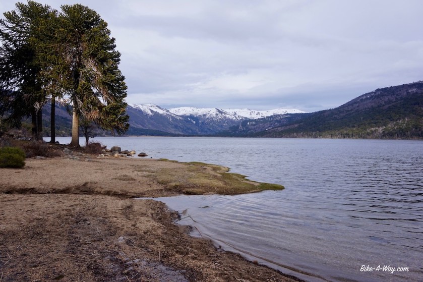
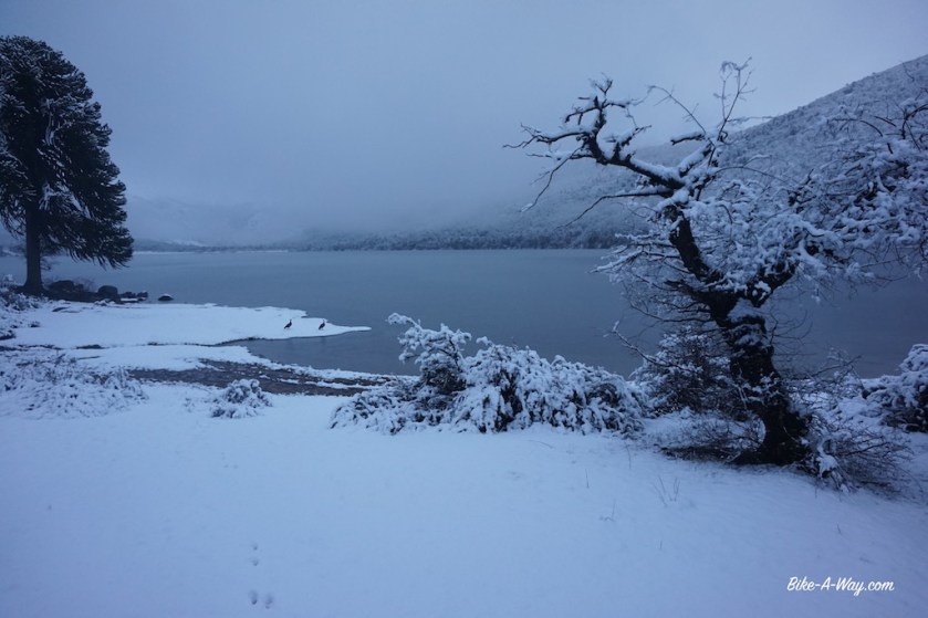
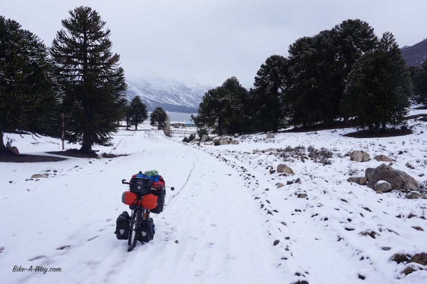
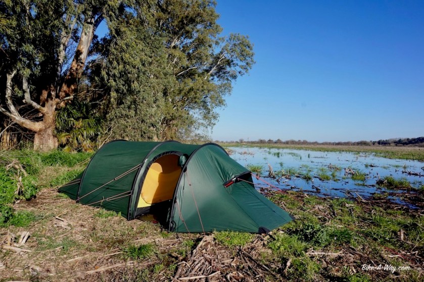
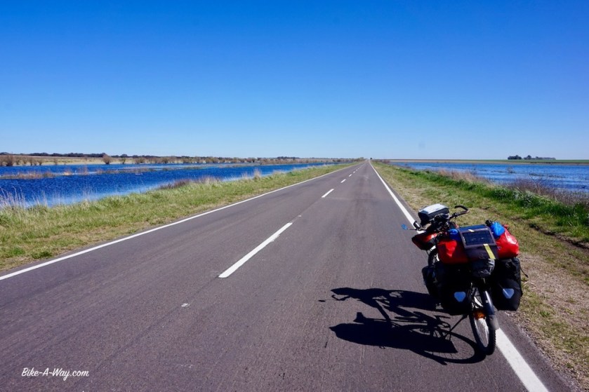
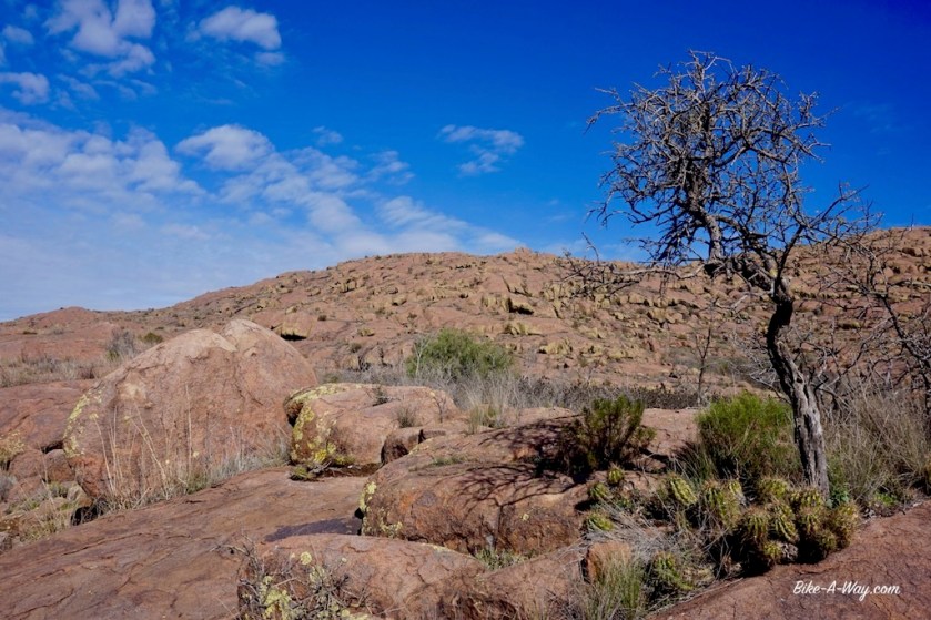
Having entered Argentina’s ‘Lake Region’, I headed down to the first lake within reach. One of the smaller ones, ‘Lago Ruca Choroi’, at the end of a 30 km dead end road, west of Aluminé. It’s a ripio road, but too my disappointment much busier then expected. There are small Mapuche settlements at regular intervals, and I have the impression they all drive up and down to Aluminé this evening. As I’m getting deeper into the Andes, temperatures drop quickly and my progress is slower as expected. After sunset I enter Parque Nacional Lanin (named after the volcano Lanin), which covers the northern half of the lake region. I pitch the tent next to the lake, near some trees for wind cover (which would turn out to be a bad decision). During my second night at the lake, it snowed. Well, first it rained during the day, then wet snow, then snow. In the morning, all this frozen icy wet snow started to drop from the branches on my tent in pretty big and heavy chunks. No damage, but I packed my stuff quicker then usual that morning.
The road back to Aluminé was a muddy affair.
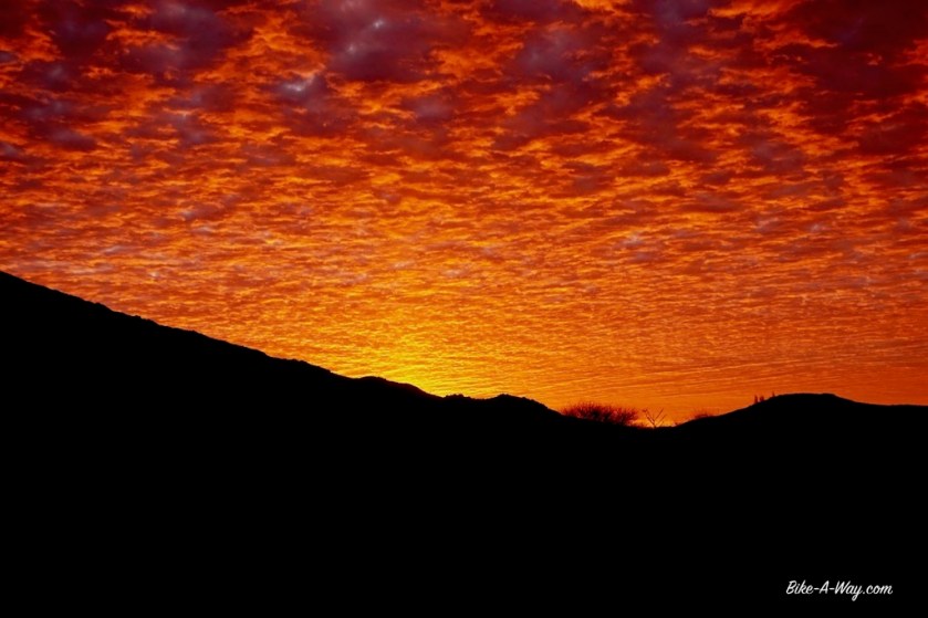
What difference a night of snow can make 🙂
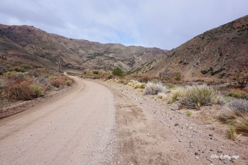
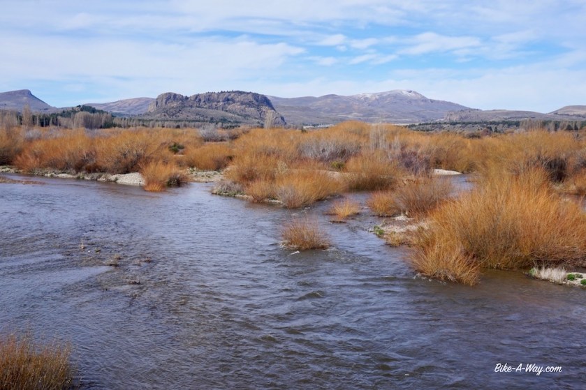
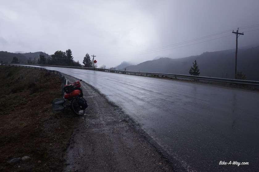
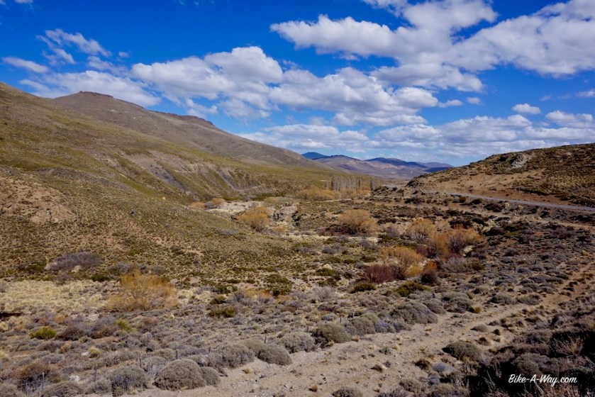
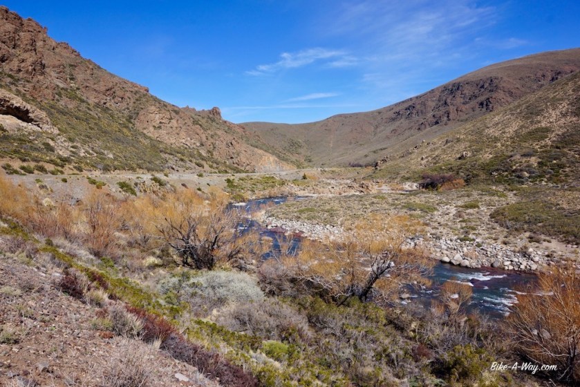
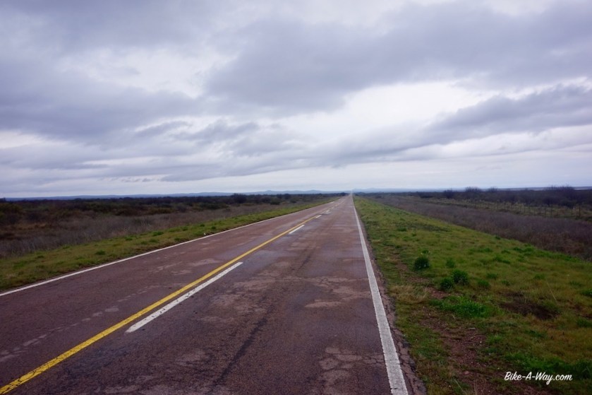
After Rahue, I took ripio road 23 riding south along the river, a nice and quiet option. I wanted to visit some other lakes at the end of some dead end roads further west, but the weather wasn’t really inviting.
Ruta 23, with the Rio Aluminé to the right
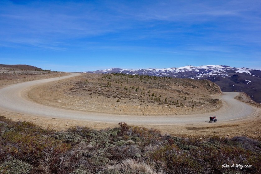
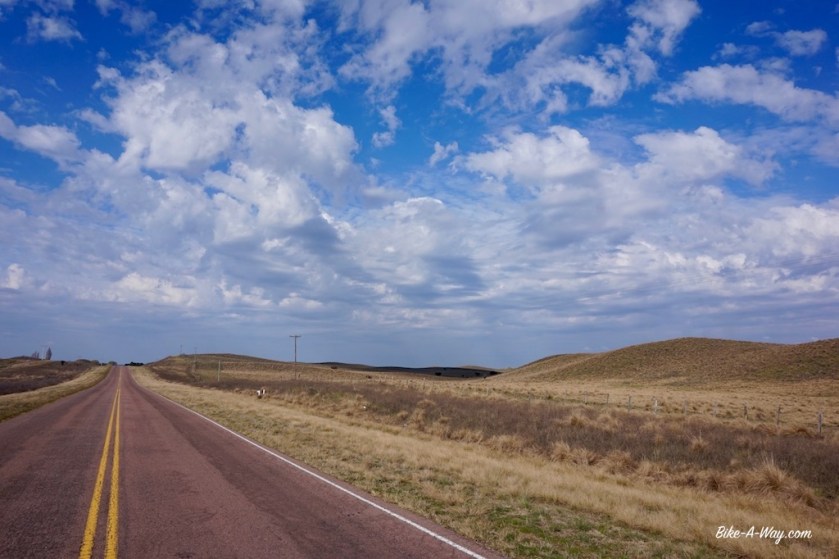
THIS is the kind of roads I like ! 🙂
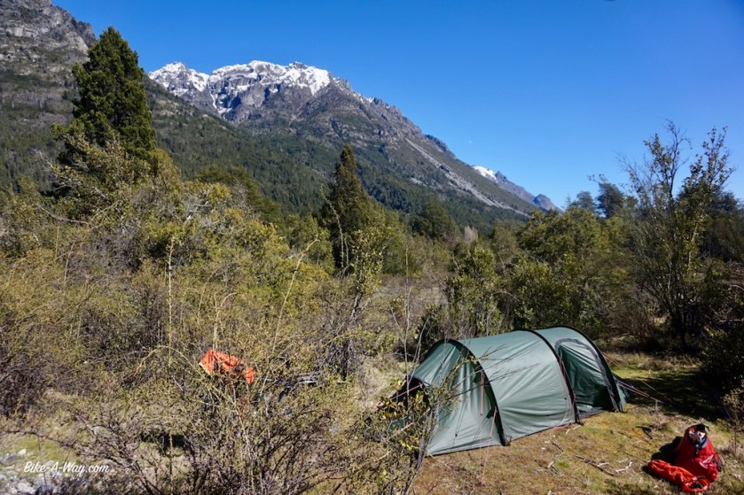
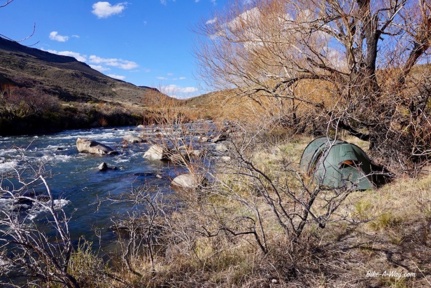
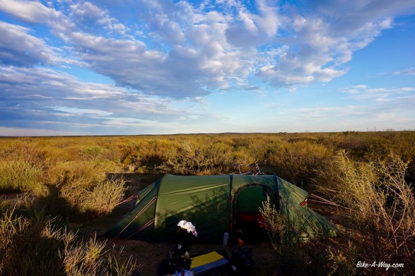
This turned out to be an excellent camping spot. Wind was blowing hard that night, but there was a hill with some forest back to where I took this picture from which sheltered me perfectly.
The next ‘town’, Junin de los Andes lays just above the 40th latitude.
All was fine till there.
South of Junin de los Andes, having crossed the 40th latitude, it immediately became clear why the area south of that is famous as the ‘roaring forties’ among sailors.
I got into a true Patagonian storm as I hadn’t experienced before.
Riding a bike ?
Forget it !
Pushing a touring bike ?
Well, I could do one, two, three steps.
Stop.
Recover (Holding the brakes to avoid being blown back).
One, two, three steps….
It starting raining, which soon became wet snow.
Passing cars sprayed it all over you.
Good rain gear or not, I got cold.
Push, one, two, three.
Stop.
Recover.
I can hardly hold the bike, so much wind.
Then a pick-up truck stopped and offered me a ride.
I gratefully accepted.
This was way too extreme and dangerous along this relatively busy road (I rejoined ruta 40 just north of Junin).
No places to pitch the tent and wait it out.
A shame I missed part of the region, but so be it.
The bad weather lasted for four days. I sat it out in a hostel in ‘Villa La Angostura’.
Chocolate shops, pizza restaurants and outdoor stores. That about sums it up as for as Villa La Angostura is concerned.
The outdoor stores are of the sort where you can buy shoes and jackets. Don’t think a decent tent or multi fuel stove is on offer.
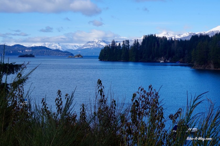
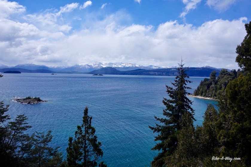
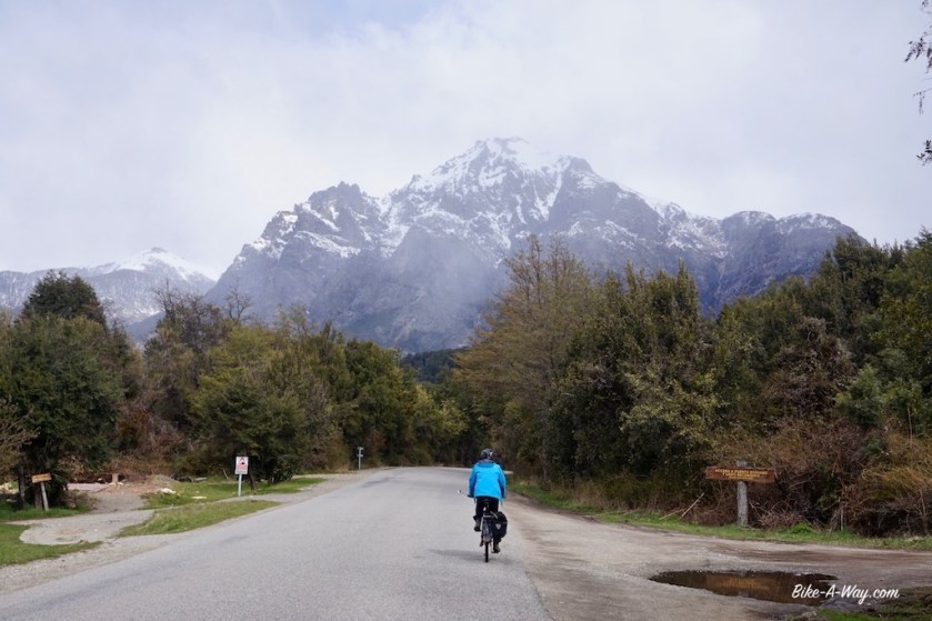
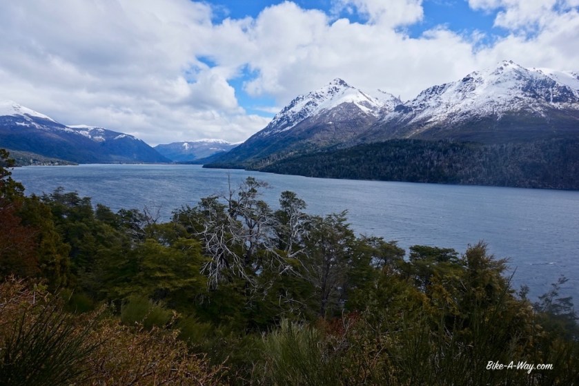
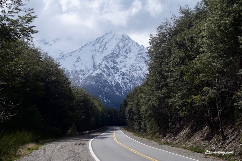
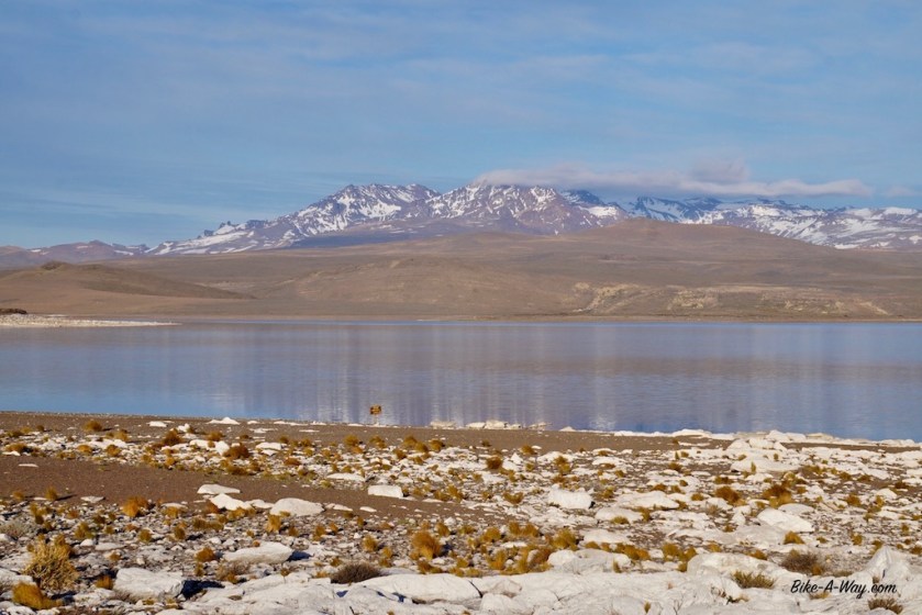
I’m now in Parque Nacional Nahuel Huapi and am riding the northern shore of the lake Nahuel Huapi, with it’s 557 km2 the biggest lake in Northern Patagonia. The snow line is only 30 / 40 meter above the road.
Ruta 40 is still busy, and I’m here at the beginning of October, as low as low season can go. I don’t want to imagine what this route is like in high season, and can’t understand why so much cyclists rave about it.
Yes, the scenery is great, but the cycling not really with the speeding, continuous stream of traffic. You’ve got a car passing you every 15 seconds or so, often a stream of multiple cars. When I was lucky, there were intervals of 45 seconds between cars.
San Carlos de Bariloche. It seems to be the most famous tourist town in this region. It’s much, much bigger as I expected. Much bigger as shown on both the maps I carry. I don’t like the place. Guide books that rave about the towns architecture haven’t visited the place in decades I guess. The air is thicker with heavy diesel fumes as it is in Bangkok.
I meet up with Sebastian, a German cyclist and we make a nice day ride, known as the ‘circuito chico’ here along the southern shore of the lake (nice but ooh…. that traffic 😦 ).
After the famous Llao Llao hotel, we visit a few beautiful view points and return to Bariloche passing what they call here Colonia Suiza and Moreno lake, named after Perito Moreno.
Now, this guy must have done something right, having a lake, a mountain, a town, a national park and the most famous glacier in the southern hemisphere named after him.
There’s a museum about him in Bariloche where you can find it out.
Joske Vermeulen
The Llao Llao hotelThe desire to be “The Switzerland of Argentina” takes at times extremes and sad proportions…
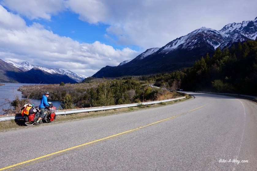
Together with Sebastian, I leave Bariloche. The scenery is again amazing.
We’re riding along several lakes, Lago Gutiérrez, Lago Mascardi, Lago Guillelmo, …
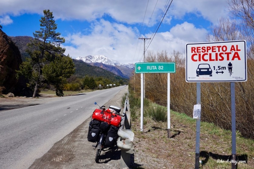
In Argentininan Castellano Spanish, this means keep one point five centimeter distance of cyclists.
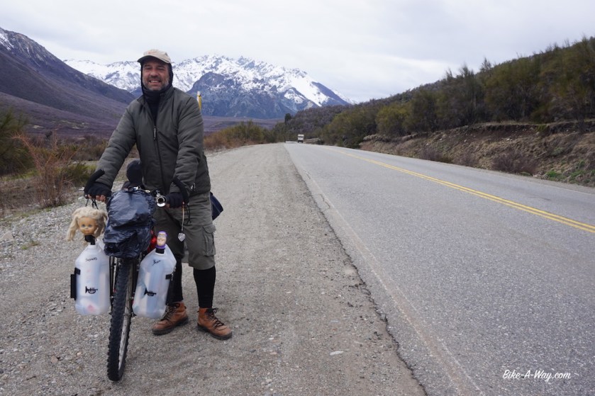
Sebastian
Argentinian cyclist heading north
Sebastian
Sebastian has an address to stay with somebody in El Bolson. As I didn’t like that town either (busy streets, stinking diesel fumes), I left town immediately after buying provisions.
While for a mysterious reason, Ruta 40 was more or less ok between Bariloche and El Bolson, south of El Bolson, all hell was loose again.
Since the beginning of this trip, I’m keeping a spreadsheet, classifying the countries drivers’ abilities from A to E, so from very good being ‘A’ to very bad, being ‘E’.
I never expected I’d have to add category ‘F’ to it, but I feel I might have to.
As I’m such a nice guy I won’t do it.
For now.
My gps showed a small ripio route just west of ruta 40 to El Hoyo. Closer to the mountain, no traffic, cycling was great again.
South of El Hoyo and back on ruta 40, I met an experienced Argentinian cyclist, Patricia who recommended me to camp next to Lago Epuyén, a bit further south.
Daylight was running out and I didn’t make it that far, but found a really nice spot right next to the Rio Epuyén.
Still cold nights.
One of the many stars along Argentina’s roads, indicating somebody died here in traffic. It doesn’t seem to leave a big impression to the drivers.
The hotel, where I planned a rest day in Zapala, was a sad and expensive story, so I left after one night.
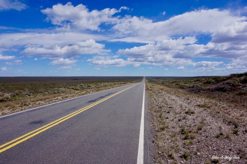
My first kilometers on the famous Ruta 40.
Even a smooth, separate bike line for a few kilometer. Way to go ! 🙂
Already after 10 kilometer I left the RN 40 and turned right towards my second National Parc, Laguna Blanca.
The best bicycle lane in Argentina !
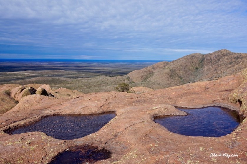
The tent space at Laguna Blanca sucks. It’s close to the road, on a rocky & gravel surface. Almost impossible to put a stake in the ground and to pitch a tunnel tent. The weather cleared out late afternoon, so I could enjoy good view and a nice sunset over Cerro Cachil.
Blue sky, crystal blue lake, a snowy mountain and the shadow of a happy man.
And then, finally ….. I’m in the mountains. Today I’m crossing the ‘Sierra de Catan Lil’, a range in front of the Andes. Whole morning I have more amazing views over the Cerro Cachil, with 2.839 meters the (I think) highest peak of this sierra.
Contrary to the weather forecast, the sun is shining brilliantly and …. I have a strong tail wind wooooooow 🙂 I take a hundred pictures this day.
When I look right, it seems like I’m in a completely other world as when I look left.
Snowy mountains on my right side, on my left side some sort of hilly, Mongolian like steppe. Some volcanos thrown in in between.
I find a beautiful spot to pitch the tent right next to the Rio Catan Lil. A worthy place to rest my head after such a beautiful day.
This region is inhabited by the Mapuche’s. These are the people that stopped the progress of the Incas a bit further north from here.
The next day in the Sierra de Catan Lil, the sun is still out, and the tail wind even stronger.
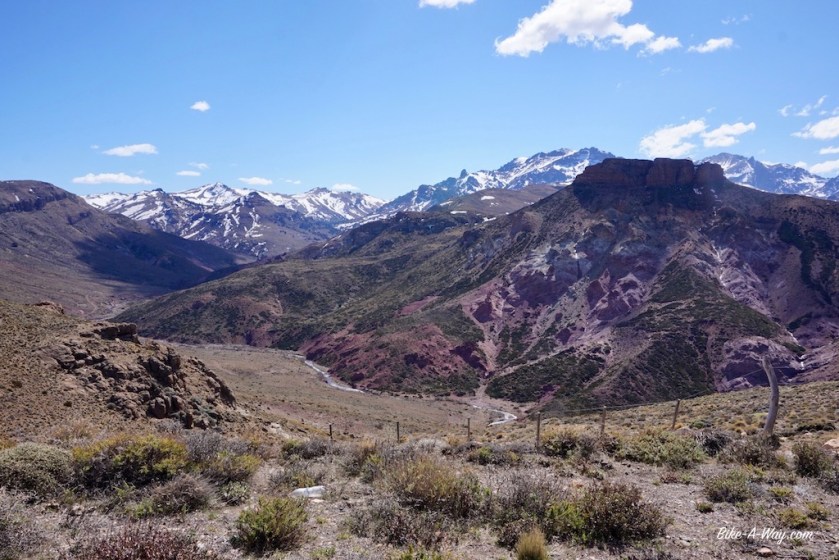
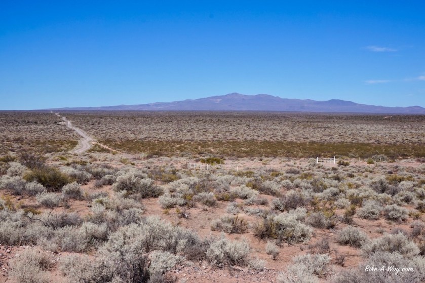
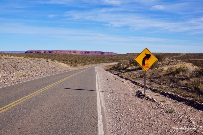
There are three passes to cross, between the National Park and the crossing with road 23 at Rahue. On top of the last on, the road is ripio here, I have my first real view of the Andes.
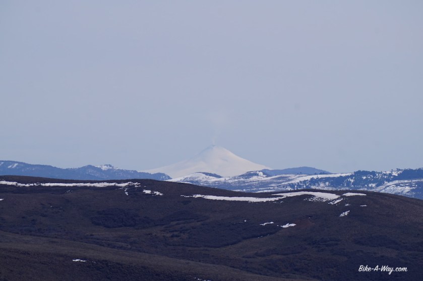
A mount Fuji look alike volcano, named ‘Volcan Lanin’, 3.776 meter high. Further to the right, a bit further away, a perfect cone; completely covered in snow from top to bottom. Smoke coming from the top. Probably the volcano ‘Villarica’ in Chile ?
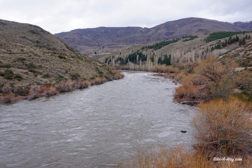
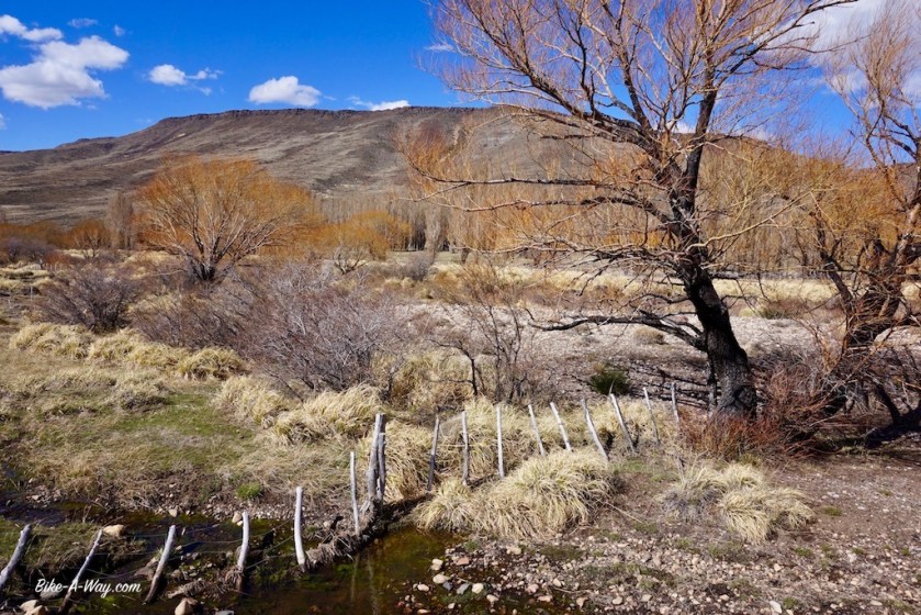
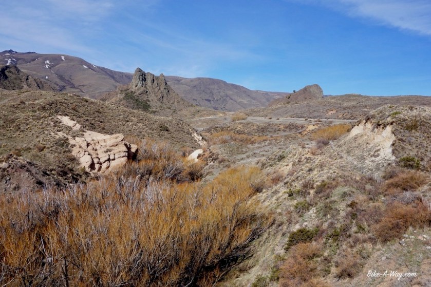
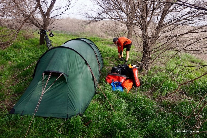
Just after the junction in Rahue, I pitch the tent again next to a river, Rio Aluminé this time.
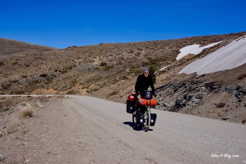
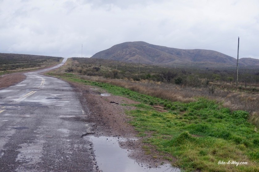
While temperatures are still ok during the day, it’s chilly at the windy passes. At night, the temperatures go below zero. -3°, -4° C.
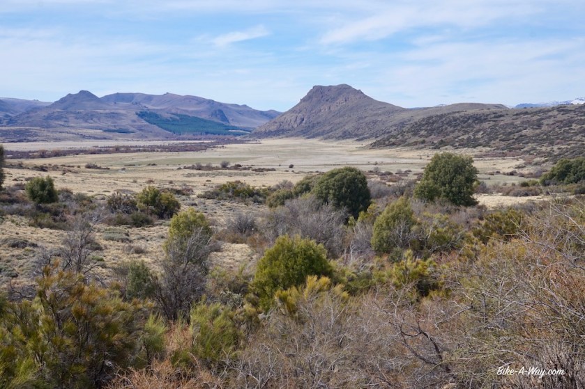
Route: Casa de Piedra – 25 de Mayo – Rincón de Los Sauces – Añelo – Zapala
Immediately after turning my handle bars 180 degrees on that dam in the Rio Colorado, I’m on a 100 km long ripio (loose stones) road now, without traffic.
And soon without fences ! 🙂
But alas, the pleasure wasn’t to last.
Halfway down the road to ’25 De Mayo’ I see the first oil rigs. I’m entering an area where they drill a lot for oil. It seems they don’t have pipelines and everything has to be transported by trucks. By taking the little road via Penas Blancas I was hoping to find tranquility again.
In vain.
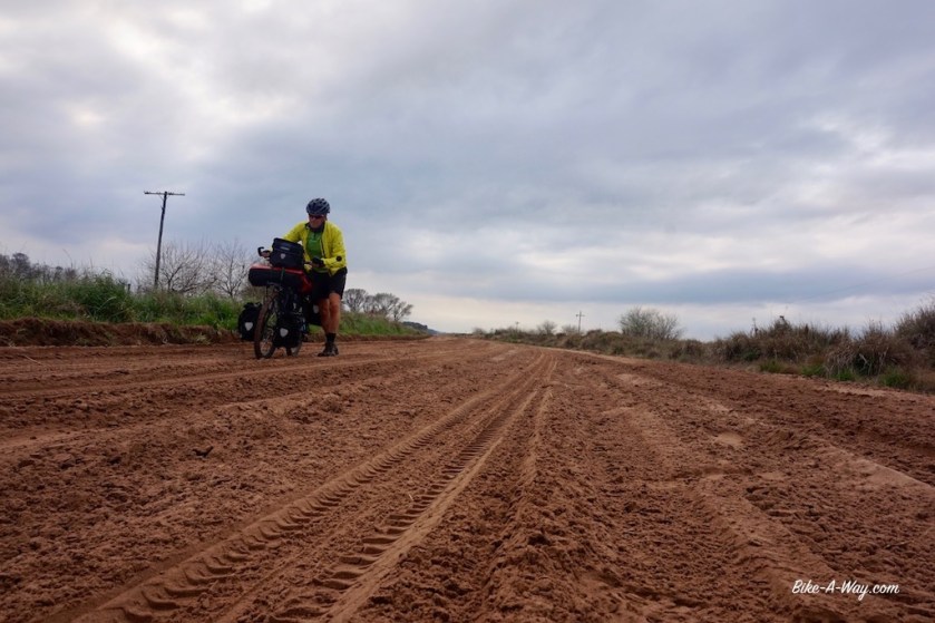
This petrol area in northern Patagonia is much larger as expected. The ripio road is much worse as expected too (washboard).
Nice white cotton gloves to protect my fingers from cracking up further due to sun & dryness.
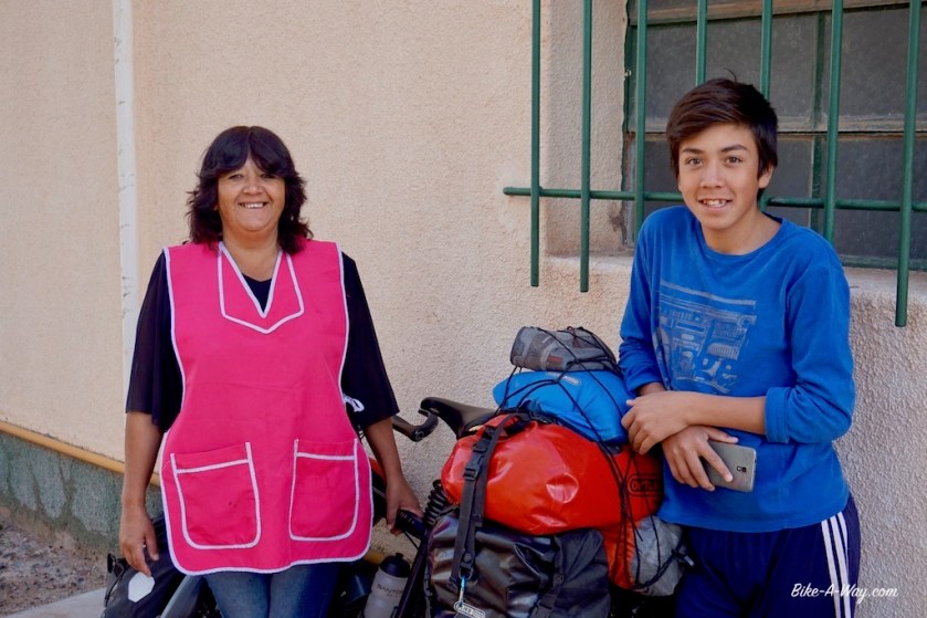
In Penas Blancas I’m lucky to stay the night in a school. It feels like paradise after such a hard day on the road. Got a shower, milk and even diner from the friendly boy who invited me. Next day, when the kids arrive I’ve got to explain them a bit about the bike of course. Hopefully a little seed is planted and a next generation of Argentinian bike tourers will show up in a couple of years.
The kid who arranged a night at the school for me and his mom.Somebody offered a tv to the Gauchito.The green catita’s are gone. Here, I’ve got this kind of parrots.Nobody seems to like my hat, but I like it, so I wear it.
After a quiet night wild camping on the Patagonian steppe, I soon hit the paved road towards Rincon de los Sauces, the capital of the ‘petróleros’. The road is quiet here and on my left side I can admire all the time the volcano Auca Mahuida which lays here in the Patagonian flat lands like some Argentinian Mont Ventoux.
Auca MahuidaHe’s got a nice hat as well.
And the suddenly ….. wow, I mean WOW !!
Another huge snowcapped volcano in front of me in the distance. It’s Mount Tromen.
A volcano left of me, one in front, Roxette’s fabulous song ‘Cinnamon Street’ in my ears …. “Spring time is here and the air is so dry and sweet – I walk in a cloud, the smell of cinnamon bread”
Life is good.
It’s even better when I’m invited to stay the night indoors in Rincon de los Sauces with Walter and his friendly family. Again a shower, and throw a beer and some pizza on top of it.
Yep, life sure is good.
Next morning, looking at Tromen in all it’s glory, I wanna go there.
I really, really want to go there.
But I’ve got to control myself. Keep some interesting stuff for when I’m on the way up again.
Volcano Tromen in the back, civilasation in the front.Auca Mahuida
The yellow road on my map, from Rincon to Añelo was to be a quiet one in my imagination.
But then reality kicks in. It’s doable until I reach the junction with RP7.
A whole lot of petroleum activity here. Luckily, these petróleros all drive very considerate, not too fast and give you ample space when they pass. The trucks likewise. And all with a lot of greetings. Very friendly folks.
One pick-up truck stops a bit further down the road to give me a big bottle of cool water.
The next day, another guy stops and gives me two power bars.
More shrines for the Gauchito on the little pass between Rincon de los Sauces and Añelo.
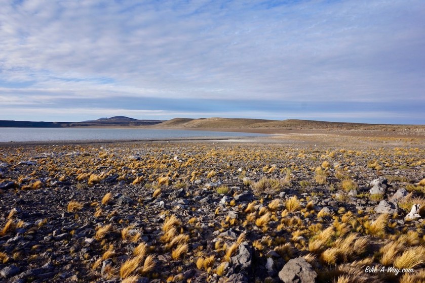
Much of the water, lakes and rivers, is salt here.
The tiny road number 1 between Añelo and Zapala appeared to be a busy ripio road, so I chose the paved option towards Cutral Co, where I would hit the Route National 22.
A red road on the map 😦
The last days I made some extra kilometers so I could ride it on a Sunday, hoping that would be a bit quieter. Leaving Cutral Co, I notice a sign that the maximum speed on this road is 80 km/hr.
They all go 180.
It’s been a while since I drove a car and maybe I don’t recall very well, but is it such a hard effort to move that steering wheel ,just slightly, a few centimeters to the left when you pass a cyclist ?
They all have to cover distances of hundreds of kilometer on this road, but don’t imagine they can ‘loose’ a hand full of seconds by slowing down for you ?
Braking isn’t even required, just release the gas a little bit before you’re passing me, just at the exact moment that truck is coming from the other side.
Oh no, wait, that’s called anticipation.
Anticipation requires some brain function, but it seems like about every driver here is a brain death idiot.
Oh yeah, just like in the Buddhist countries, where they hang the Buddha at the rear view mirror for protection and then start driving like mad men, over here they stop to offer to Gauchito Gil, pray for protection and safety, step in their car, turn on the engine, switch of the brain and GO !
I can’t figure out how it is possible, that difference like day and night how the petroleros behave on the road, and then … the rest.
I think they’re not only offering empty beer cans and wine bottles (they make sure to empty that first) in those shrines, but leave their brains behind there as well.
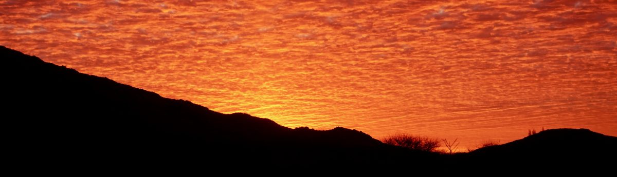
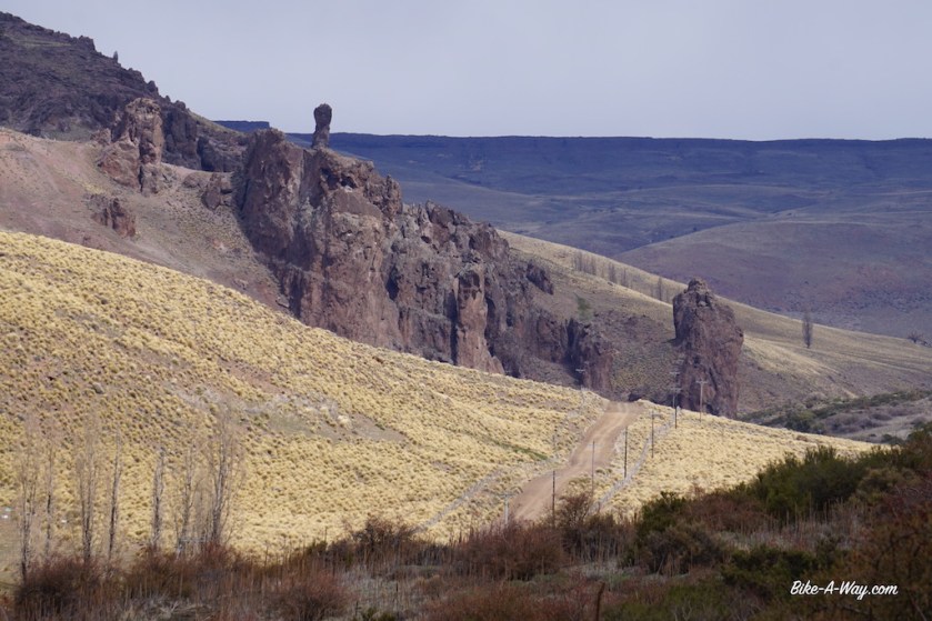
A nice wild camp spot in a dry river bed, very well sheltered from the wind on the road towards Cutral Co.A sky on FIRE and the outlines of the Sierra de Catan Lil in the distance.
These drivers weren’t my only problem that day.
This wind.
No, this storm. Brutal !
Imagine riding in a windtunnel.
For 70 km.
With hills to tackle in between.
Completely wasted from the wind and gaga from the traffic, I arrived in Zapala.
Average speed for the day: 9,08 km/hr.
Route: Mercedes – Navarro – 25 de Mayo – Saladillo – Guamini – Macachin – General Acha – Casa de Piedra
South-America. Argentina. Buenos Aires.
The past year, while I enjoyed cycling in Europe very, very much, mentally I was quiet often at this side of the planet already. A 14 hour flight, the longest direct flight from Amsterdam Airport, was all that separated me from this new continent. Not being a town guy, I decided to stay three days in the city nevertheless.
I didn’t like it. But that’s no problem. I’m not here for the city. Not any city for that matter.
What I do want, is to discover the country, the nature, the plains of the Pampa, the Andean mountains, the glacier lakes. Getting to know the country that produced celebrities like Che Guevara, Juan Manuel Fangio, Gabriela Sabatini, Guillermo Vilas, Jorge Luis Borges and certainly the most famous of them all, Diego Armando Maradona.
Plaza 25 de Mayo
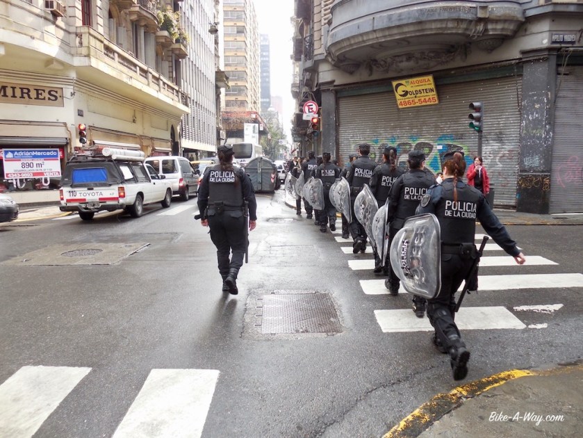
I got a police escort on my first day in town 🙂
A big uncertainty for me was ‘how to leave Buenos Aires’. That huge metropolis, with it’s 12 million people more populated than the country I was born in, a city sprawling out to the west over 60 km. Cycling out of town was plan C only.
I’ve cycled out of big cities before; Bangkok, Saigon.
That was ok.
These were Southeast Asian towns, were I felt comfortable. Buenos Aires didn’t give me that feeling the few days I was there. So, the only viable options were train or bus.
The train was plan A, but according to the first information I found, trains were only running twice a week, on Tuesdays and Fridays, leaving Buenos Aires in the evening and arriving at my destination at night. I heard horror stories how my bike would have to go in a freight wagon, and I could only hope everything would still be there on arrival.
Plan B was the bus. I went to Retiro bus station in town, but with my limited knowledge of the Spanish language couldn’t succeed in getting a deal. ‘Bike on bus’ seemed a problem.
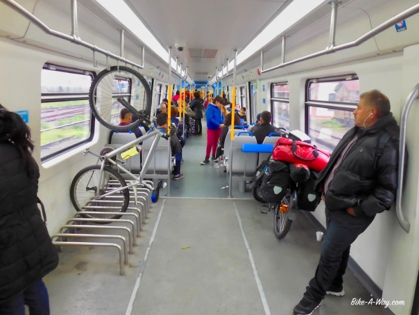
Luckily I found Once train station. Over there, trains leave every 10 minutes and, with a stop over in Merlo or Moreno, you can go as far as Lobos or Mercedes, both about 100 km west of the center of Buenos Aires. For 12 pesos (0,60 euro, the bike is free), you can roll your bike on a modern train.
Changing trains in Moreno was a bit of a hassle, as I had to change platforms (stairs vs heavy bike), but all in all, this seems to be the ideal way to leave the big town.
Modern train from Buenos Aires to Moreno.A bit more rustique train from Moreno to Mercedes.
My destination was the terminus of the train, the little town of ‘Mercedes’. This sounded like a great place to start my trip. Moreover, Mercedes was the place where I would meet Cycling Cindy for a bit of a pre-trip chat. We spent a couple of nights camping in soggy fields, exchanging travel experiences and just a lot of chit chat. And I learned baking my own bread !
Cindy, having covered Patagonia in winter (!) will continue on her own itinerary , while I go south from here, chasing spring to the deep south.
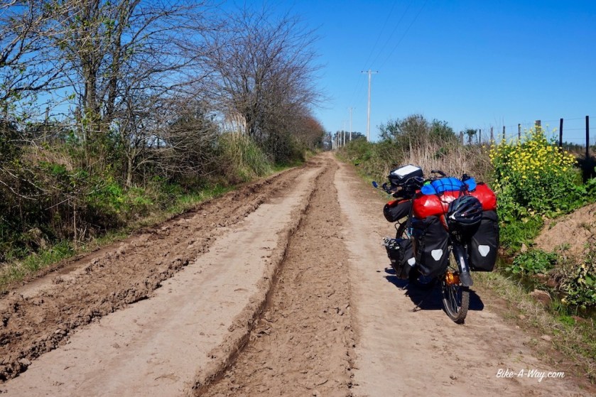
Leaving Mercedes via little sandy roads was immediately a big succes. Zero traffic, the first taste of ‘the pampas’, blue skies and mild temperatures. The rain of the past days however left some parts of these sandy roads completely flooded. A few times I had to take my shoes off and wade through the mud. Finding a camping spot appeared surprisingly difficult. All land is fenced off, and all gates are locked with a chain. The first day, I have to jump a fence and load all my bags and bike over it. But a good place to rest my head always is important.
After 30 km’s or so on the busy Provincial Road 41, I’m more than happy to be on the sand road, direction ’25 de Mayo’, another small town. Dates are important in Argentina and many villages and streets carry the name of important historical dates.
The road is bumpy, the sand sometimes is too loose to bike and at other times to sticky to get through, but again, everything beats traffic.
After two more beautiful wild camps, I approach 25 de Mayo while it rains. The last 10 km on the sand road took me almost 2 hours, so the only sound option was to take a left turn on PR 51, down to Saladillo. Fierce head winds slowed me down to 8 or 9 km/hr.
If a truck came from the other side, it almost brought me to a stand still.
When a truck comes from behind while there’s upcoming traffic (almost all the time on these busy roads), I HAVE to dive into to side of the road. It’s that or being run over by the truck. They will NOT slow down.
I arrive completely exhausted from wind and traffic in Saladillo and end up in a hotel.
Not exactly where I wanted to be (not the hotel & not the town).
Next day brings more rain. But hey, I’ve got excellent rain gear and it’s a Sunday, probably the best day to be out on the busy National Road 205.
After 8 km, I take a break in the last gas station of the town. It’s freezing cold, the wind is even fiercer as yesterday. I can hardly keep my bike up at times. If a truck comes by, it’s even harder to stay on the bike. But after a coffee, I ‘m heading out again.
For 3,5 km.
Then I stop at the side of the road.
If this isn’t plain ridiculous, it sure is plain stupid. It’s way too dangerous; the narrow sealed road with it’s fast traffic, trucks, rain and strong winds.
There’s nothing between this place and the next town, San Carlos De Bolivar, 150 kilometer away.
I turn back to the gas station and decide to try to get a lift to S.C. De Bolivar. A very, very wise decision. This gas station doesn’t see a lot of customers on a Sunday. While I sit there, the weather deteriorated even more, into a thunder storm with hail.
The electricity goes down.
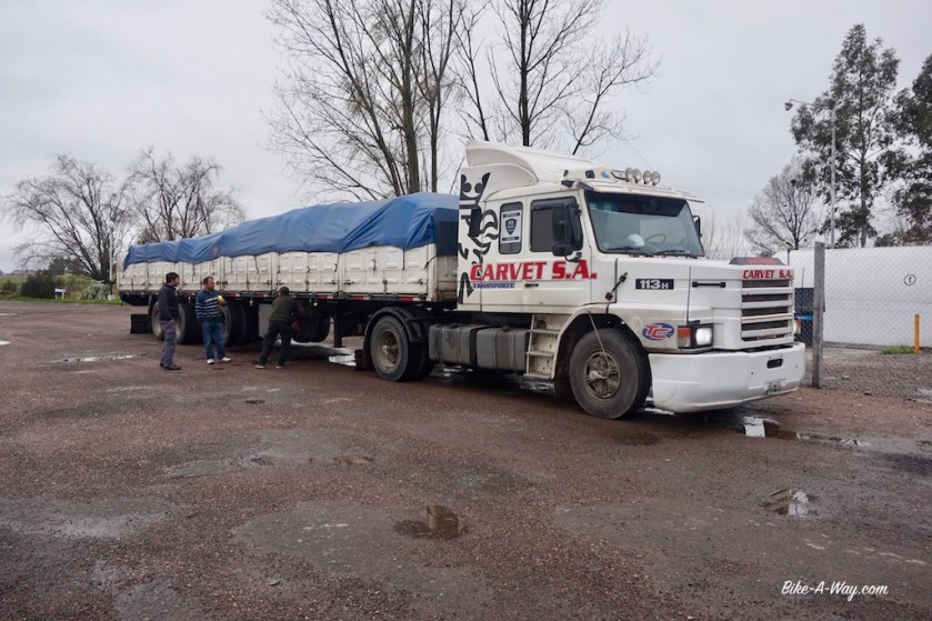
At 16:00 hrs, there’s finally a truck stopping that’s going to S.C. De Bolivar and that has some space for me and my bike.
I’m very, very lucky. It’s a Scania with a nose, one of the nicest trucks ever made, and it’s driver, Martin proved to be a super nice guy.
Soon it was decided I would join him to Guamini, a place about 300 km west of Saladillo. The road between S.C. De Bolivar and Guamini was just as narrow, busy and dangerous as the one to S.C. De Bolivar.
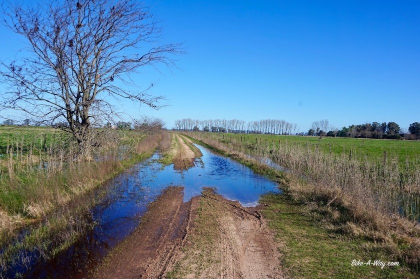
All land left and right from the road is flooded. For hundreds of kilometer.
There’s a reason this region is called ‘La Pampa Humeda’.
My ride further west, ab brilliant Scania with a nose.How the roads looks from a truck. You can imagine a cyclist has nowhere to go when there’s traffic coming from the opposite side, and these guys won’t slow down…Martin, my friendly driver to the west 🙂
It’s past 20:00 hrs when we arrive at the roundabout in Guamini. I say goodbye to Martin and cycle into the little town to the camping municipal.
From Guamini, I still had to cycle abt. 23 km on the busy RN 33, but then I turned west on the RP 60, a quiet road connecting RN 33 & RN 35.
Guamini police stationGuaminiThe map of Argentina, projected on Europe. Same distance as going from the North Cape to the Greek coast.
The size of things here is incredible. This provincial road between two national roads covers 170 km. Barely a few centimeters on my map, while this is probably the same distance as going from the north of Belgium all the way south to the French border.
It’s along this RP 60 I’m leaving Buenos Aires province (with it’s 300.000 km2 it’s 10 times bigger then Belgium) and enter La Pampa province. Having the first 500 cycling kilometer under my belt, what are the things that strike me in this country ?
Still a lot of very, very old cars driving around. Magnificent !
Dacia cars are being sold as Renault here, so you have Renault Logan, Renault Duster, ….
They have big VW and Ford trucks we never see in Europe.
The VW Polo is called ‘VW Gol’ here, while the Golf remains Golf. So they have a Gol and a Golf.
Almost every small town has it’s Chinese supermarket.
The canned tuna is grinded into a spongy mess that looks like cat food.
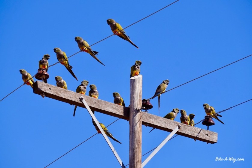
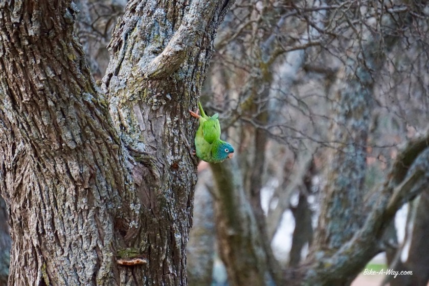
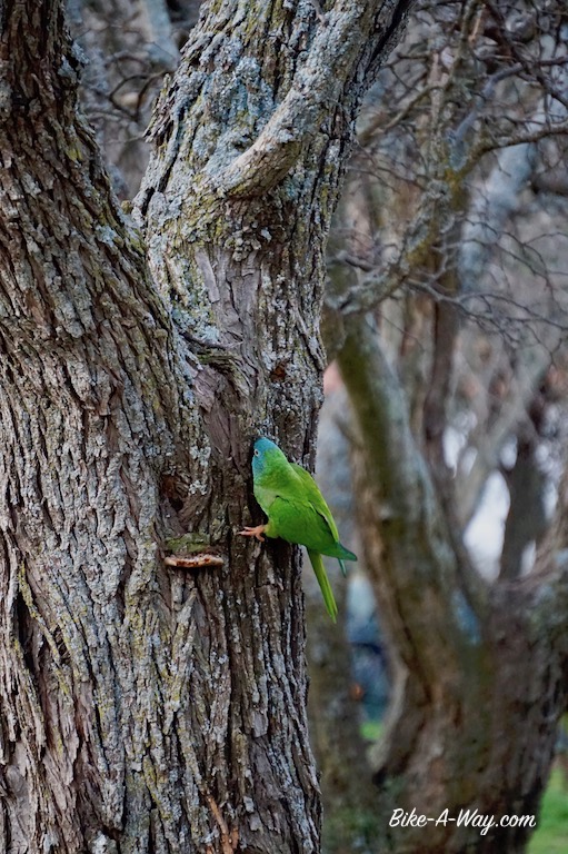
Every night, there’s a giant nest with a dozen green parrots (called ‘catita in Spanish) right above my tent.
Fences. Argentinians sure like their fences. Typically, they’re about 140 cm high and consist of seven (!) wires at a 20 cm interval. No idea why they need seven wires, but that must be millions of kilometer of steel wire in the country. Literally ALL land is fenced off.
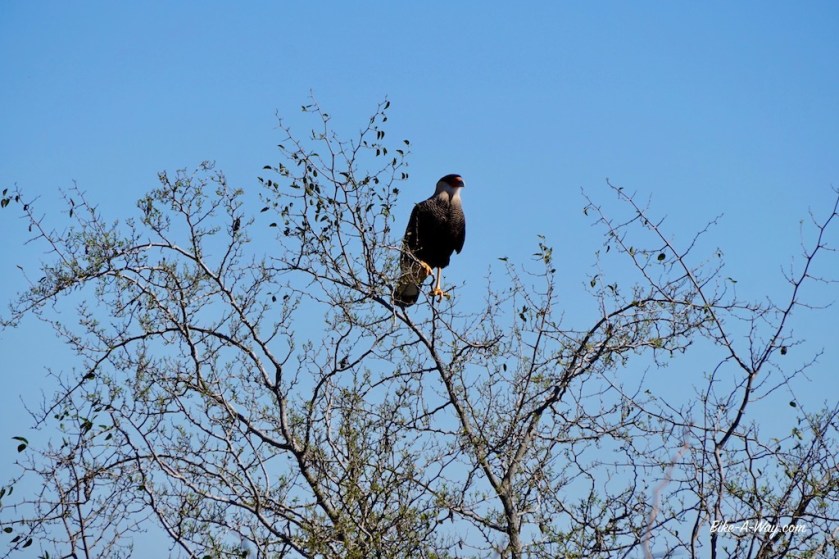
A lot of birds on the pampa. I saw a group of flamingo’s already.
I have to rethink my route as well. At home, I’d had put some time in making a nice route south all via small sandy roads. But as they’re all flooded, I’m already much further to the west as planned.
Baking my own bread in the morning.
For the cyclists going this way. The little town of Quehué has a brilliant, brand new gas station with good wifi and clean showers. It might even be a good place to camp. If not, further on towards General Acha, about 10 k before you hit the RN 152, there’s a paved road going to the right. At the end (abt. 1 km), there’s a laguna with a camping municipal where I was, this time of the year, the only guest.
After buying provisions for a couple of days in General Acha, I cycled on to my first national park in the country.
I also left the ‘Pampa Humeda’ for the ‘Pampa Secca’.
It rained.
For three days.
Some wind, but not too bad for Patagonia.
I’m cycling through flat land with nothing but scrub. The grey sky, rain, wind and temperatures of about 8 degrees aren’t helping to cheer up the place.
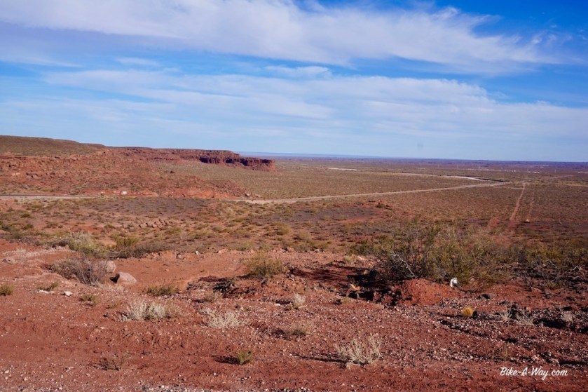
Two days after General Acha, I reach ‘Parque National Lihué Calel’.
Parque National Lihué Calel:
(= Sierra de la Vida / Range of Life)
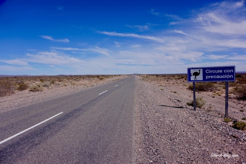
The puma is a native cat here. I assumed encounters with it would be more theoretical then it would happen for real, but the rangers seem to take their puma’s serious here.
You get an explanation on how to avoid encounters, what to do in case you meet one, and how to respond in case you get attacked (fight back, just like you do with grizzlies 🙂 ).
On my first rest day in the park, the rain continued till about 3 pm. Then suddenly, lying in my tent, … is that for real, a ray of sunlight ?
Yup, I head out immediately and start the hike up the Cerro de la Sociedad Cientifica Argentina.
(What a name for a mountain… In the park, they just call it ‘Cerro Alto’).
It’s too late and too windy to go all the way to the top, but I get some magnificent views of the landscape already.
Some of the birds visiting me at my tent in the National Park.Catita.
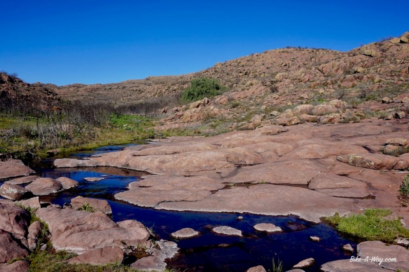
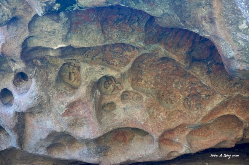
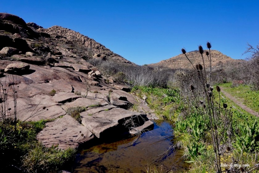
On my second restday, after doing some laundry, I hike up to the ‘Valle de las Pinturas’, a 12,5 km round trip. A nice and easy hike on which I got to see my first guanaco’s. At the end of the trail are a few rock paintings of circa 1300 years old.
On the third rest day, after some more laundry job, I finish what I started on my first day here. You can’t call the hike up Cerro de la Sociedad Cientifica Argentina ‘mountaineering’, but it gets a bit technical at some stages.
In the afternoon, I made a new route, driving straight west towards the Andes via the little town of Zapala. That way, I can go down from there, visiting the Argentinian ‘Lake Region’ in October i.o. next February (busiest tourist season).
Patagonian winds:
Everybody has heard of them.
Everybody imagines them in their own way (it sure can’t be that bad, right).
And then you have to ride it…..
My day from a wild camp in the middle of nowhere to Casa de Piedra was the toughest so far in Argentina. I was pushing and pushing, but unable to get the speedometer out of the single digits. Wind gusts must have blown me of the road about 25 times that day. I had to make it to Casa de Piedra, as I wouldn’t have enough water for another night at wild camp.
It took me over 8 hours to cover 80 km.
Pure madness, but the can of beer in the evening and the rest day the day after were only sweeter.
The unsettling this is, I know it can still be much, much worse here.
After this long ordeal, another rest day was needed. Unfortunately there seems to be no wifi at Casa de Piedra. I’m further investigating my route options from here. Going (north) west from here along the ‘Embalsa Casa de Piedra’, then west to the Andes or going south south towards General Roca and then through the middle of the Patagonian lands towards Esquel. The route going directly west to the Andes, then via the Lake Region to Esquel seems to be 500 kilometer longer.
Going all the way down to Ushuaia, then back up, that would mean more then 5.000 kilometer before I arrive at Vill’O Higgins to start the famous Carreterra Austral’. But sure, riding the mountainous lake region just after winter will give me spectacular snowy landscapes, and there won’t be many other tourists. That way, I could stay on the Chilean side om my way up again, so I could visit the Lake Region over there as well.
Yes, that surely is the nicest option.
Waking up the next morning, I’m not so sure about making the detour via the Lakes Region.
Sure, the pass I will have to take to get there will still be full of snow, maybe camping will be difficult if there’s still snow everywhere, do I really need to see all the lakes both in Argentina and Chili ?
And then that distance…
Psychologically, having that below 5.000 km before reaching the Carreterra Austral also means something.
Yes, it is decided. I’m going to follow my original plan and cycle in a direct line, through the middle of nowhere to Esquel. A shorter option through very desolate country, rarely visited by other tourists. That will be very interesting.
During breakfast, I ‘m studying my maps a bit more, and new doubts are slipping into my mind.
The deserted Patagonian lands.
Or the Lake Region ?
It will be so beautiful and quiet there now.
After a shower, I hop on my bike.
Left turn is Lake route, right turn, over the huge dam, is the direct route through Patagonia.
I turn right.
It’s the shortest route and will give me the chance to visit some rarely visited places. And as I like to be out of Ushuaia before Christmas, it will give me less ‘time pressure’.
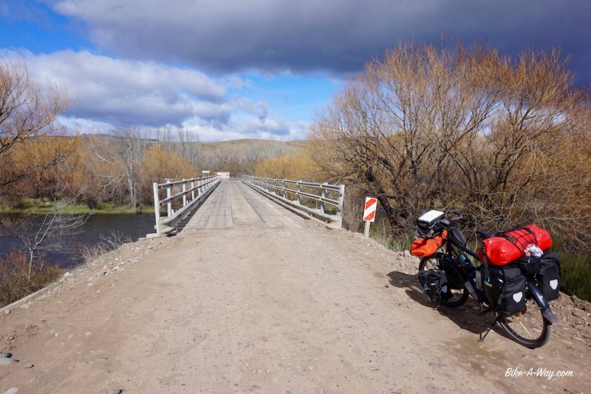
Happy to have made that decision, I put my bike on the side of the road when I’m about two kilometer on the bridge to make a picture of the lake.
Then I turn the bike 180 degrees and ride back where I came from, past my camping place and the gas station, taking a left turn on towards 25 de Mayo and the Lakes Region.
What was I thinking ?
Shorter routes ?
Ha ! I don’t have any time pressure.
My flight home is going in a couple of days and I never intended to take that anyway.
No, Let’s go to the lakes !
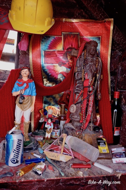
Gauchito Gil:
Everywhere along Argentina’s roads, you’ll find little red shrines. A bit like they have in Southeast-Asia. Here, you’ll find a little statue of a gaucho inside, ‘Gauchito Gil’. The shrines are always surrounded by red flags, old cd’s and water bottles. Drivers make offerings of cigarettes, wine, sun glasses, engine part, helmets, etc….
The Gauchito would ensure safety on the road and could help in other difficult circumstances. Some pics of the shrines and the Gauchito himself below (click to enlarge).