Australia Prt 18, WA: Hopetoun to Albany

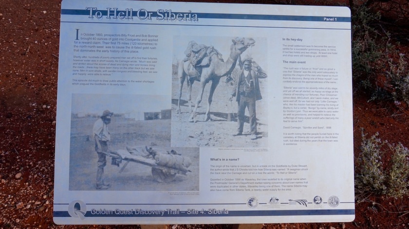
Route: Hopetoun – Fitzgerald River National Park – Jerramungup – Ongerup – Stirling Range National Park – Mount Barker – Porongurup National Park – Albany

Day 220: 15 September 2019
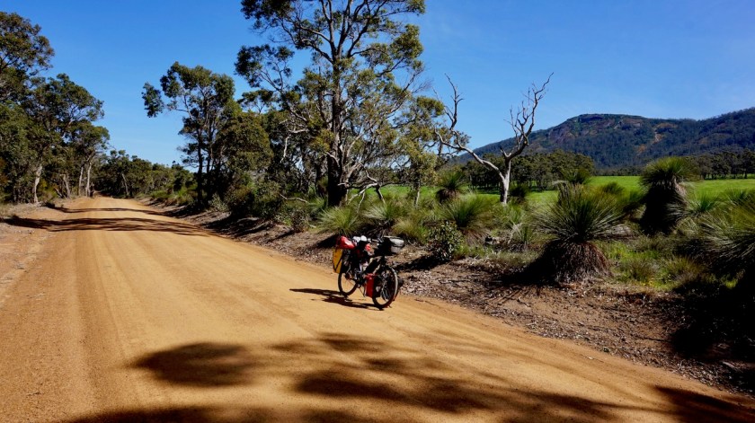
From Hopetoun to along Hamersley Drive
50,01 km (Total so far: 10.109,86 km) – Altitude climbed: 540 m
Weather: Cloudy, rain, moderate tail wind

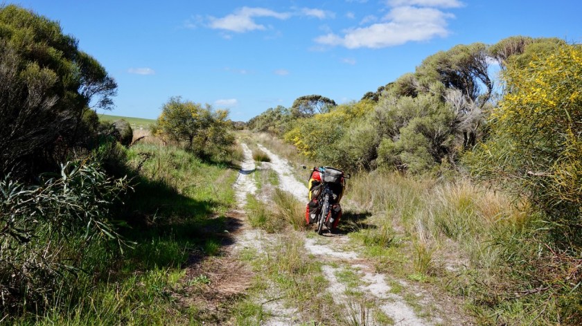
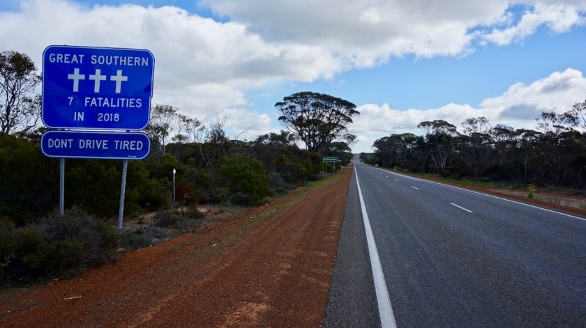
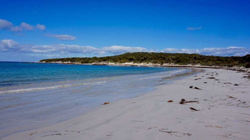
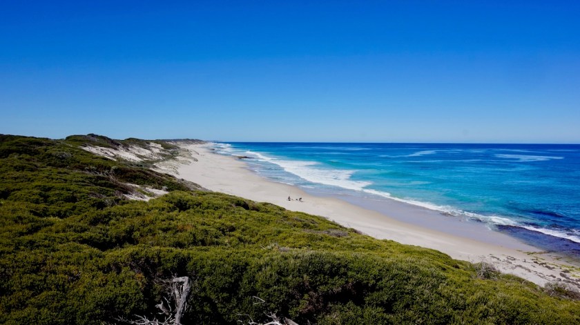
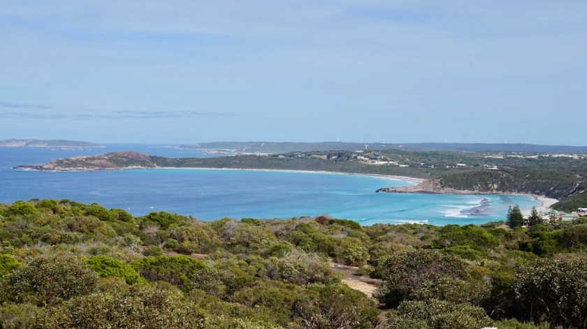
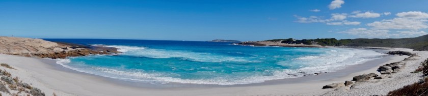
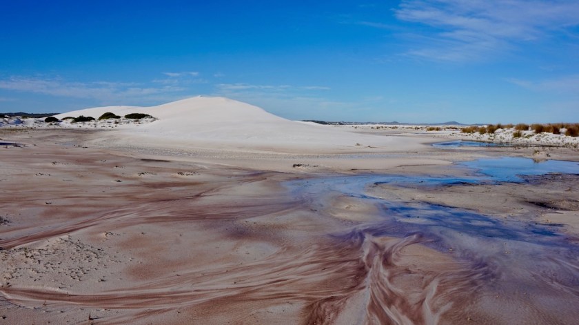
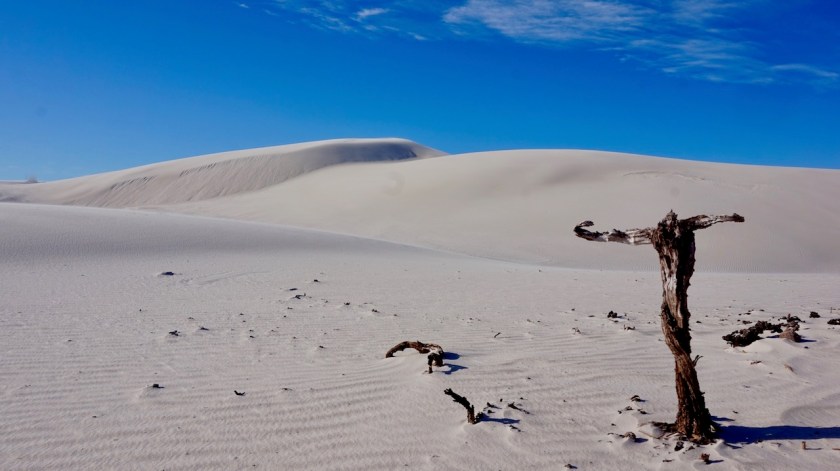
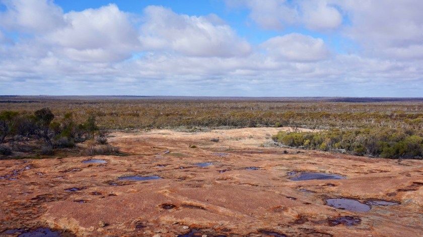
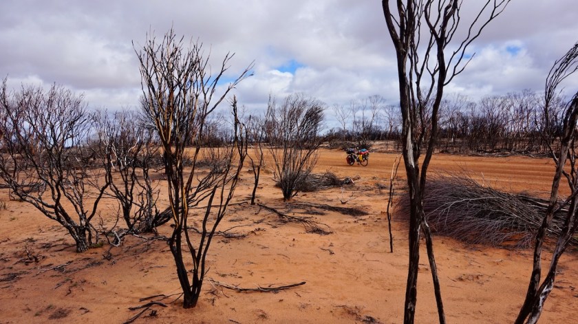
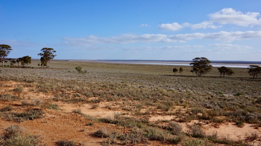
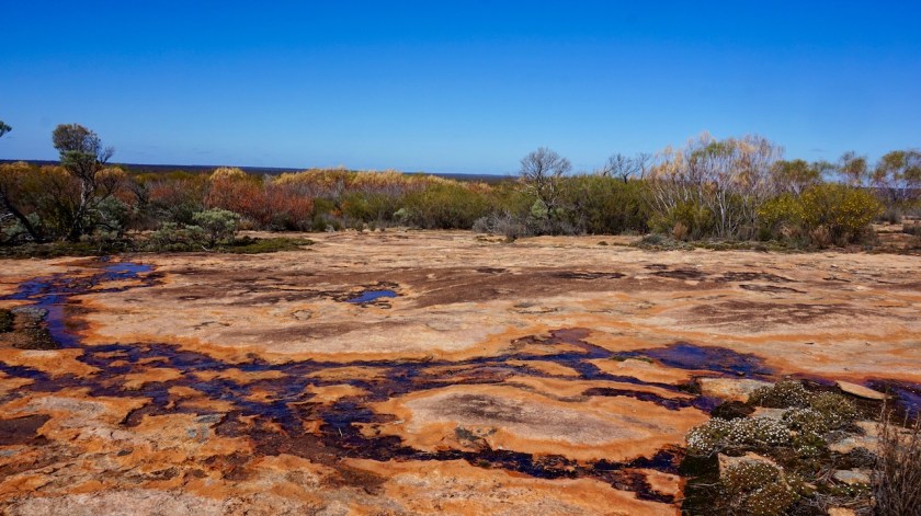
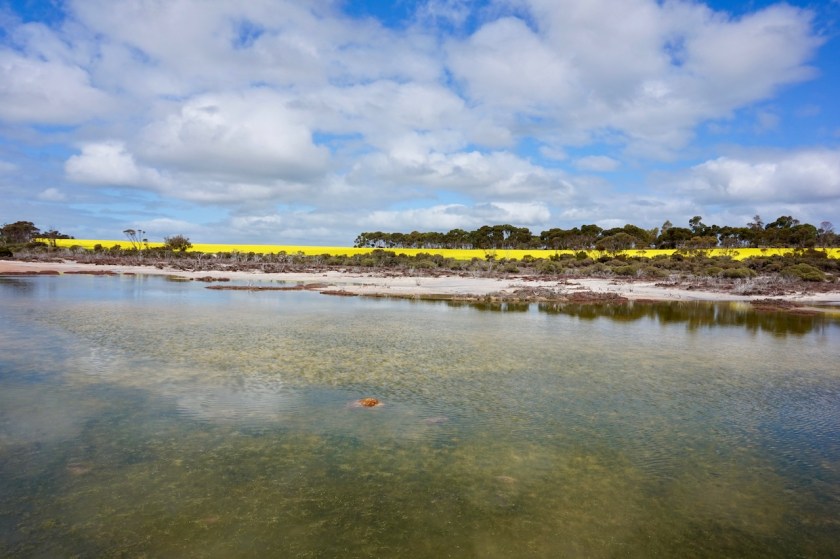
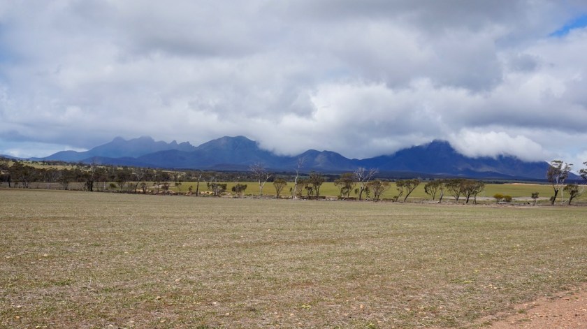
It’s a cloudy, cool day when I leave Hopetoun. Not bad circumstances to cycle, but the views won’t be too good. As I approach Culham Inlet and have a better view off the Eyre- and Whoogarup Range, I see they are almost completely covered in clouds.

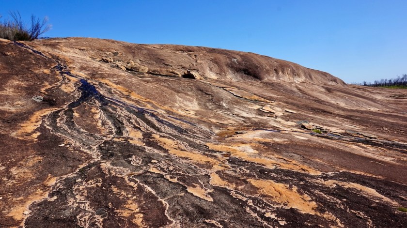
I work my way up again that 17% climb towards East Mount Barren.
Glad I came out here on Friday when the weather was glorious and circumstances to climb the hill much better.

DSC01620

The road keeps going up and down, first towards Mylies Beach, then up, inland towards Sepulcralis Hill.
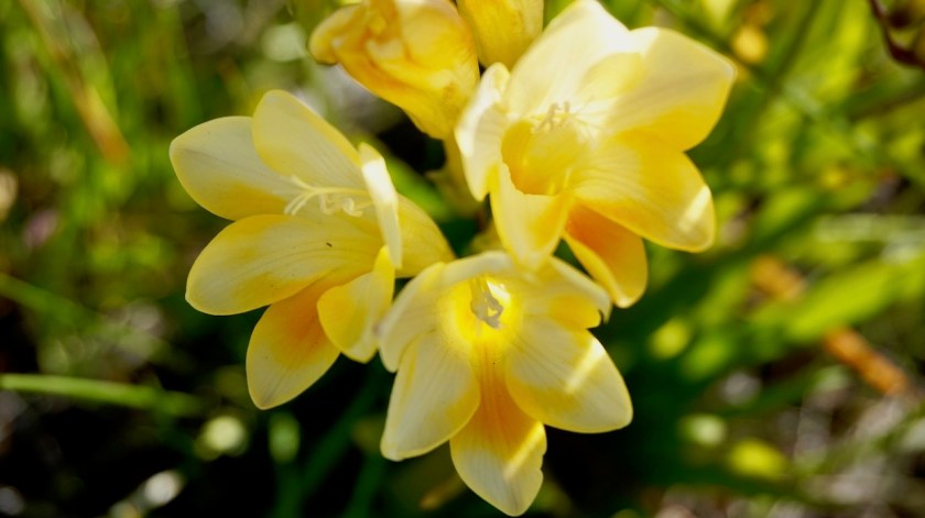
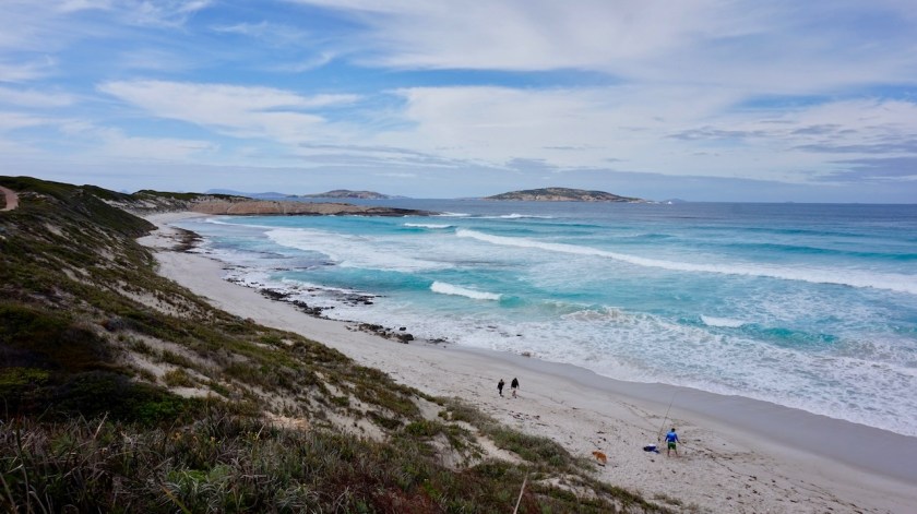
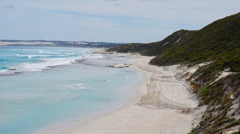
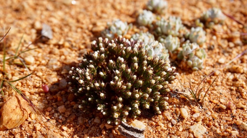
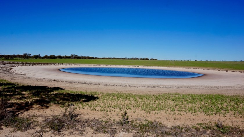
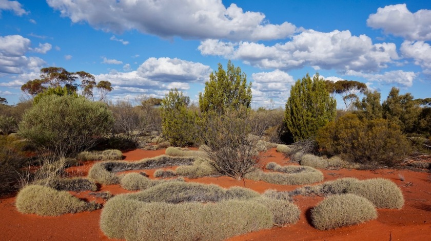
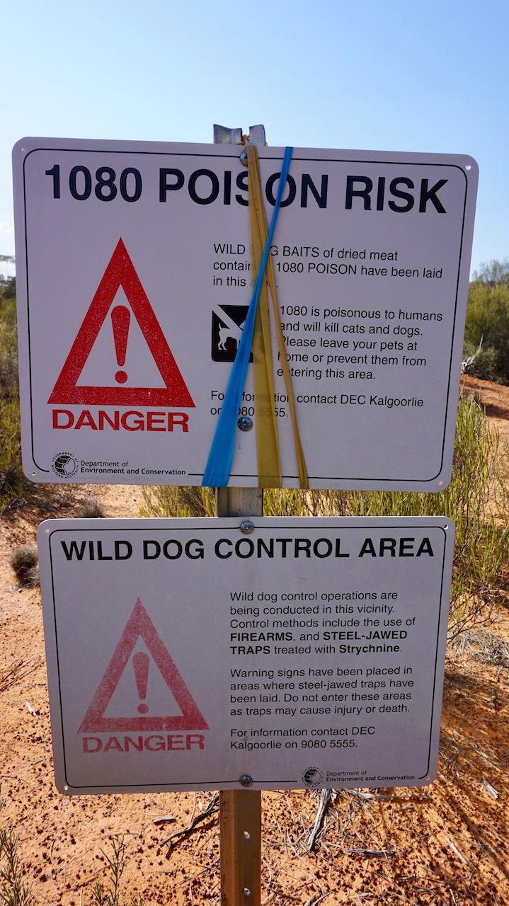
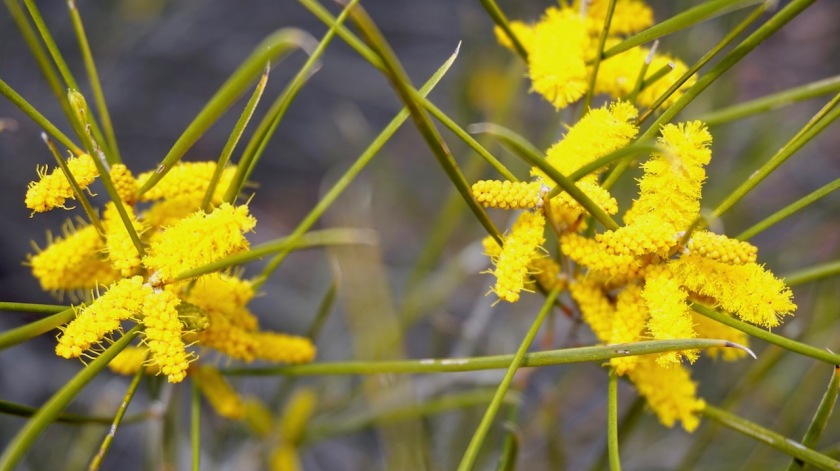
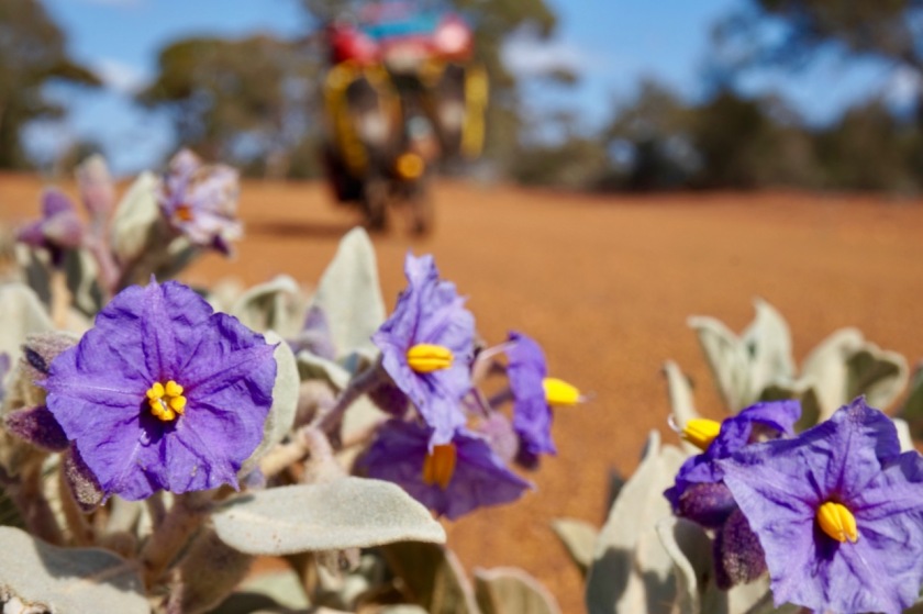
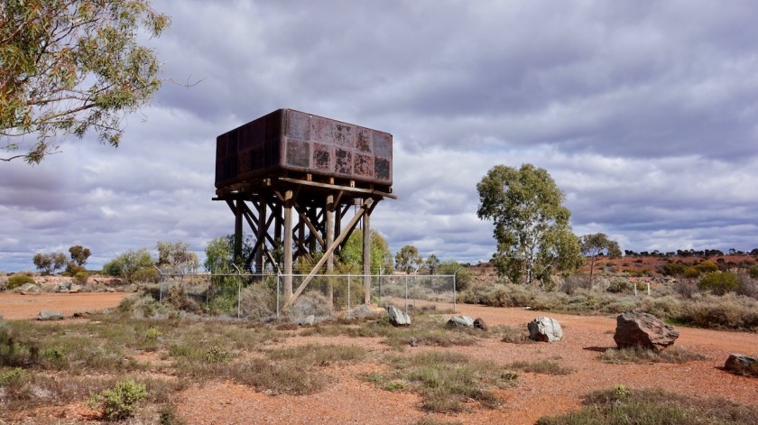
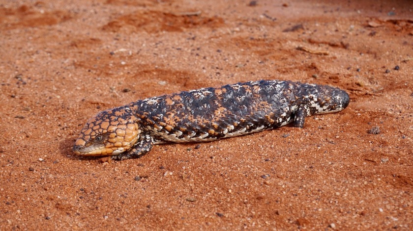
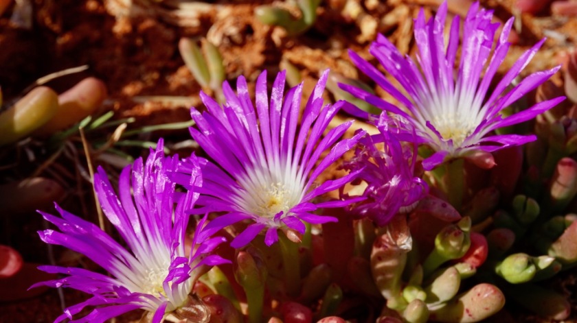
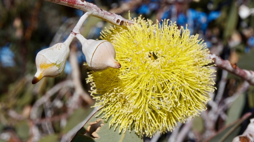
Regularly there’s a sign off the road indicating “water”. I checked them, and I think those are water points for when there’s a fire in the park. It is not drinking water. But this are good places to pitch your tent, as all the rest is densely covered with bushes. I stop at a nice waterhole with some colorful flowers.
Today there were several periods with drizzle, but never serious rain.

DSC01625
View from Sepulcralis Hill.

Day 221: 16 September 2019
From along Hamersley Drive to along Middamidjup Road
74,06 km (Total so far: 10.183 km) – Altitude climbed: 553 m
Weather: Sunny, moderate side and tail wind

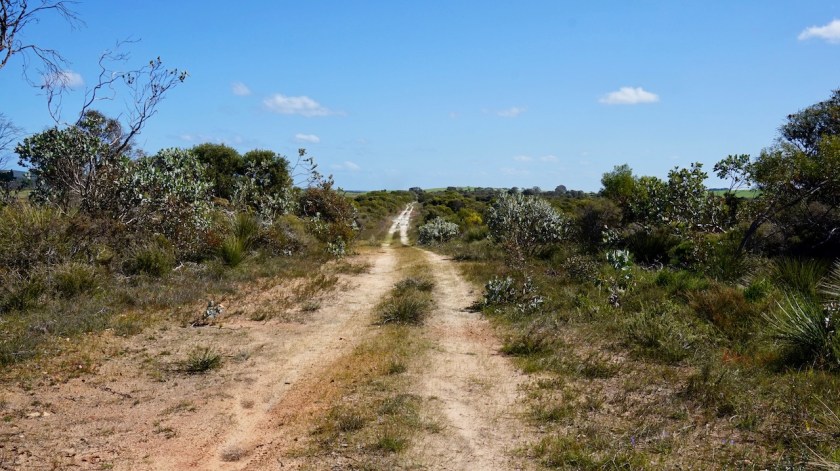
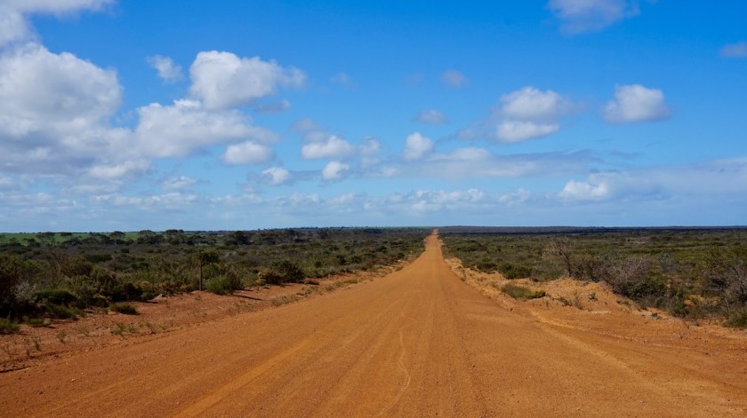
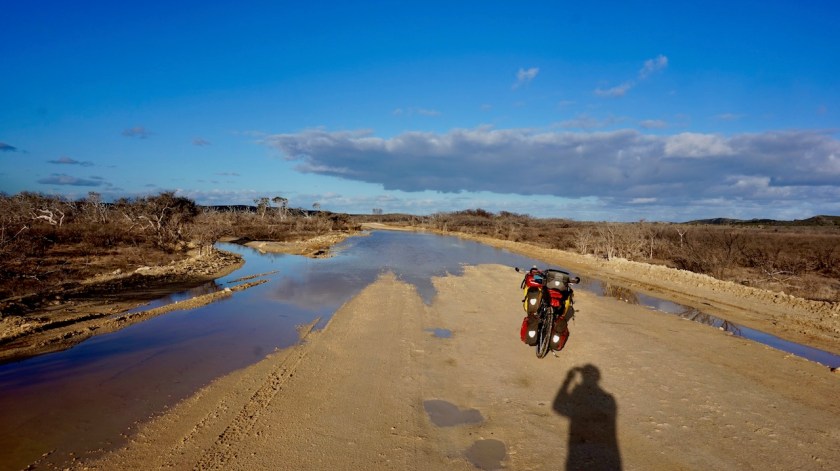
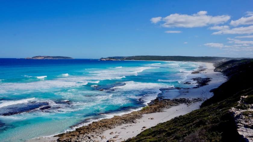
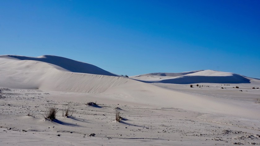
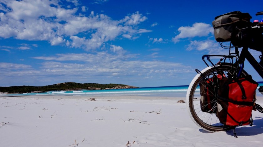
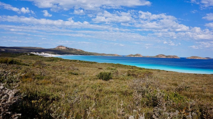
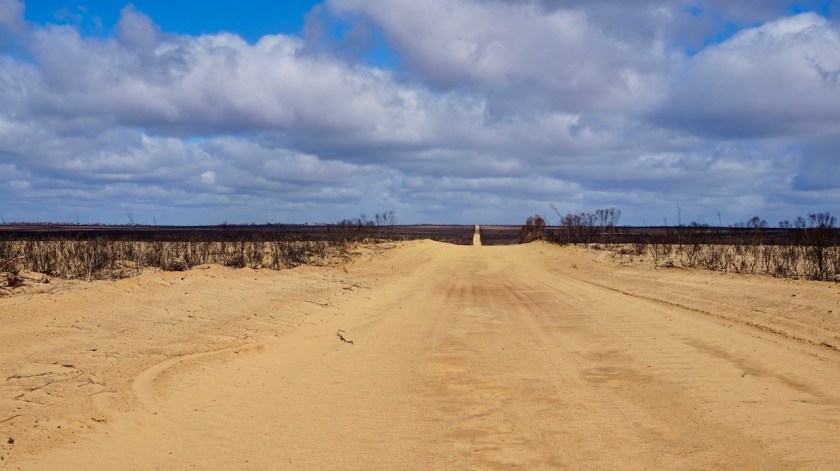
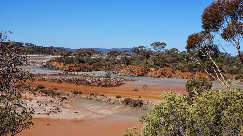
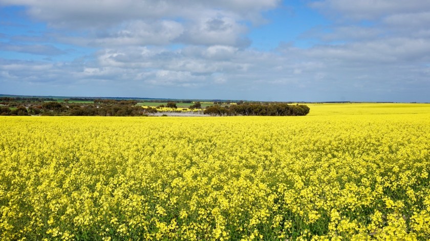
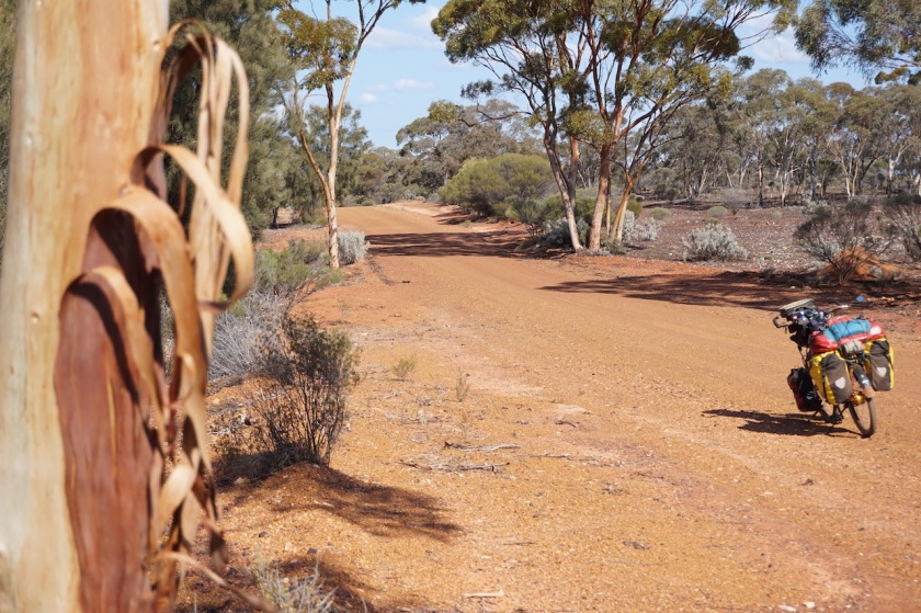
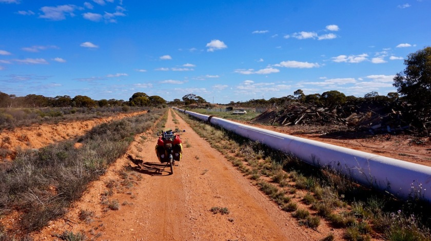
Continuing my ride on Hamersley drive, I have magnificent views of the different small mountain ranges in the park. About seven kilometer before the junction with the South Coast Highway, I take a left turn onto the Old Ongerup Road to continue riding on dirt i.o. on the highway.
As I experienced already before riding into Hopetoun, the magpies are aggressively swooping down at me. It ’s quite impressive.

DSC01630

DSC01635

DSC01640

DSC01646 (1)
He got a bit agitated.

It is incredible how these things work, but today, I was thinking that it has been a really long time since I had a flat tyre. Those Chinese super-thick tubes, and the extra tube around it as a liner make the bike heavy, but it works effectively against punctures.
And then…. I had a puncture.
In the front, no worries.

DSC01643

Day 222: 17 September 2019
From along Middamidjup Road to along Gnowangerup Jerramungup Road
71,40 km (Total so far: 10.255,32 km) – Altitude climbed: 452 m
Weather: Sunny, strong head and side wind

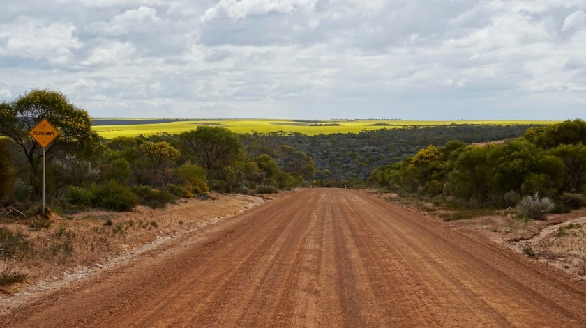
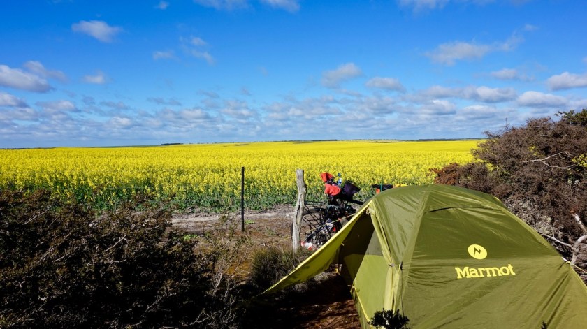
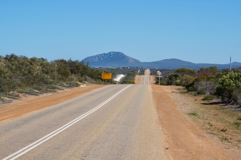
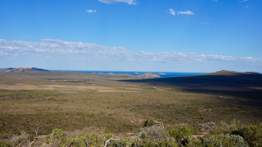
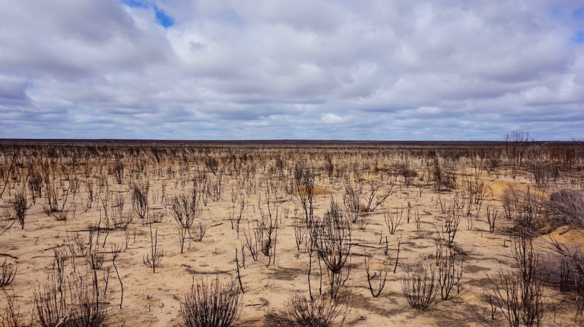
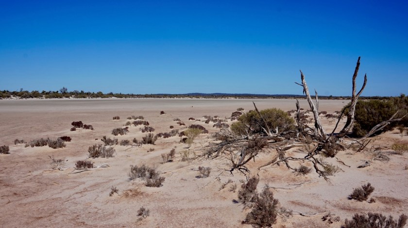
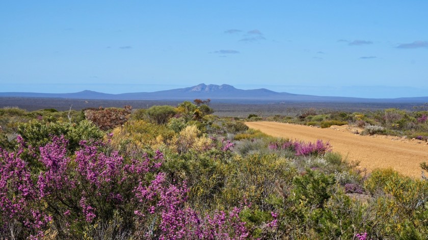
Uneventful day, riding against the wind. this whole ride between the Fitzgerald and Stirling Ranges National Park is nothing special on its own. Just riding through agricultural land, but I am avoiding the busy highway, which was the main objective.
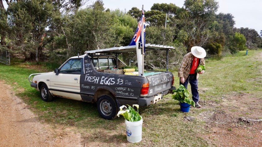
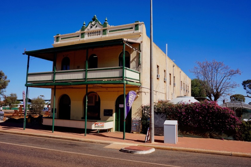
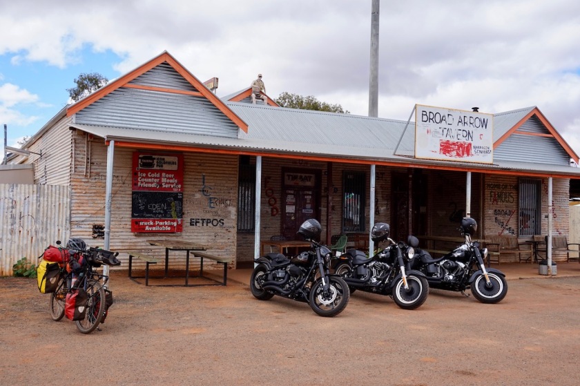
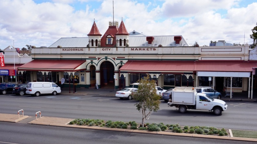
Jerramungap has an Iga supermarket and a coffee shop.
Originally, I planned to continue via small dirt roads south of the Gnowangerup-Jerramungup Road, but for tomorrow they predict a lot of wind from the wrong direction, and I want to make the ride into Ongerup as short and as flat as possible, so I choose the main road.

DSC01649
I crossed the Rabbit Proof Fence nbr. 2 today (not much left of it, the rabbits have won the battle).
DSC01652
Part of the rabbit proof fence.

Day 223: 18 September 2019
From along Gnowangerup Jerramungup Road to Ongerup Caravan Park
26,93 km (Total so far: 10.282,25 km) – Altitude climbed: 240 m
Weather: Sunny, very strong head wind

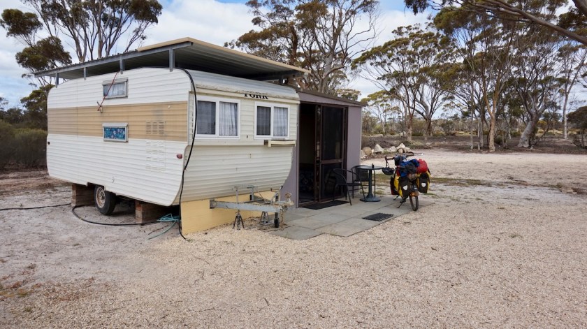
A short but tough ride to Ongerup. More storm predicted for the afternoon, night and tomorrow, so I rent a caravan in the caravan park to shelter for two days.
Very comfortable.

DSC01654

Day 224: 19 September 2019
Ongerup Caravan Park
Weather: Rain, very strong winds

Sitting out the bad weather, watching some Belgian tv on the laptop and an oil change for the Rohloff.
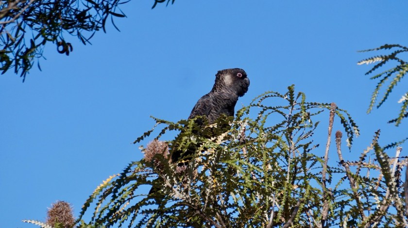
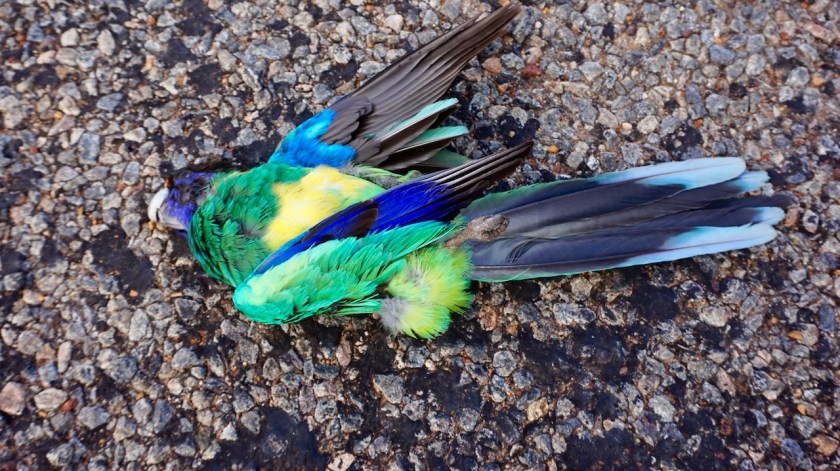
While I did the small ride with the cleaning oil in the Rohloff, I spotted two beautiful yellow Regent Parrots.

Day 225: 20 September 2019
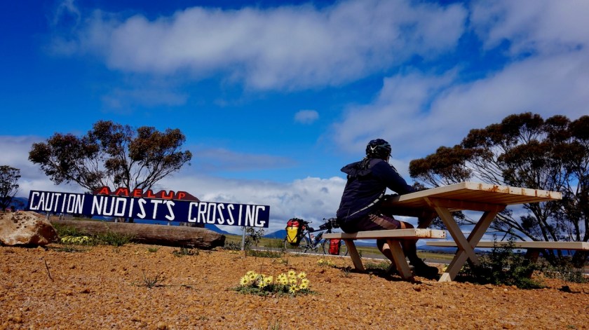
From Ongerup Caravan Park to between Borden & Amelup
39,81 km (Total so far: 10.322,06 km) – Altitude climbed: 211 m
Weather: Rain, strong head wind

A late start due to some problems with my credit card.
The laptop seemed hacked as well. All the memory was constantly eaten away, even when I was deleting gigabytes and gigabytes of data.
Lousy weather.

DSC01655

DSC01656

Day 226: 21 September 2019
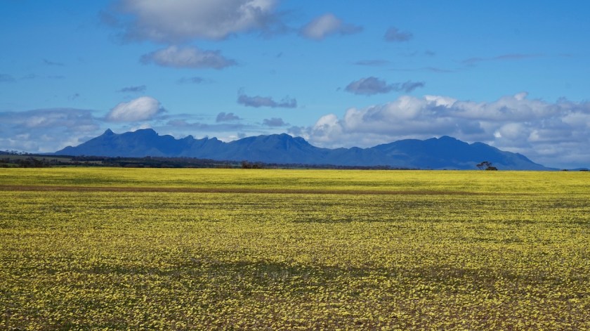
From between Borden & Amelup to Stirling Ranges National Park
50,64 km (Total so far: 10.372,70 km) – Altitude climbed: 586 m
Weather: Cloudy, rain, strong side and head wind

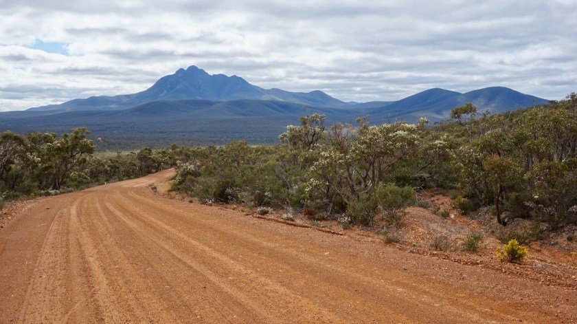
The goal today was to climb Bluff Knoll (1.094 meter) but the thing was covered in clouds as I was riding towards it. But then, some wind, the clouds were blown away, the sun came out.
But all that only for a brief moment. Soon the miserable conditions returned. Vertical rain and cold temperatures are not the conditions for a hike to a mountain top, even if it’s only a thousand meter high.
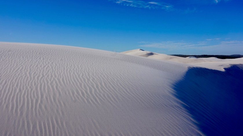
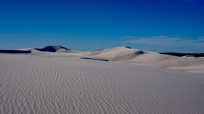
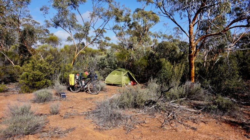
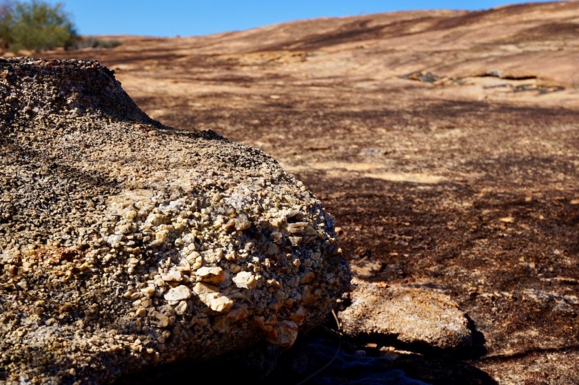
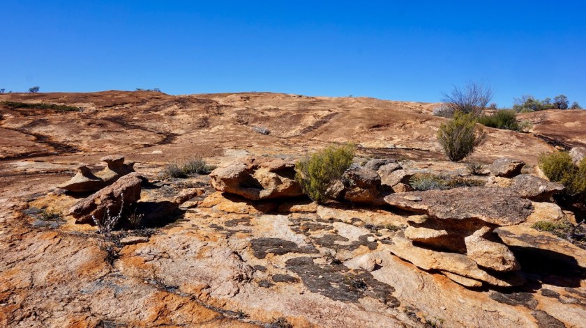
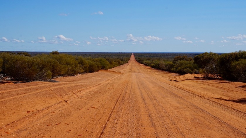
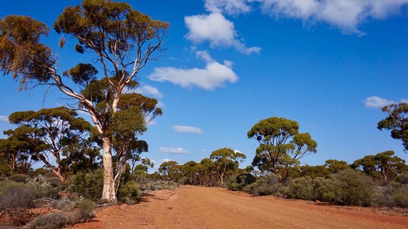
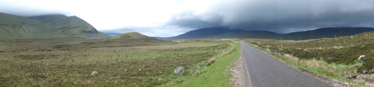
I continued riding, left Chester Pass Road and took Stirling Range Drive, a gravel road meandering its way through the park. Plenty of wild camping options.

DSC01658
Stirling Range.
DSC01664
Even bats are hit by traffic.

DSC01668

DSC01669

DSC01672
Bluff Knoll.

DSC01676

Day 227: 22 September 2019
From Stirling Ranges National Park to south of Kendenup
55,70 km (Total so far: 10.428,40 km) – Altitude climbed: 873 m
Weather: Sunny, light tail wind

Aaah, the sun is back !
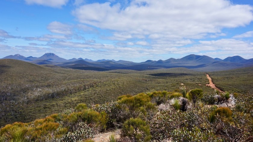
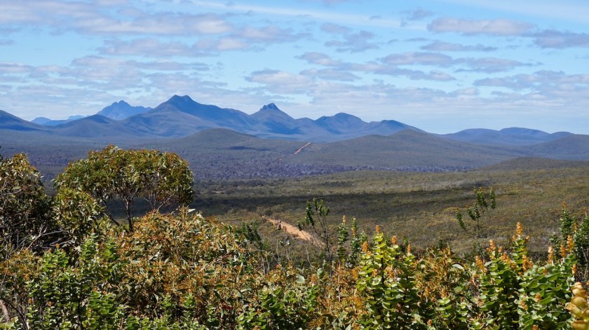
The wind, although having lost all its force, has turned toward the east and is giving me a helping hand.
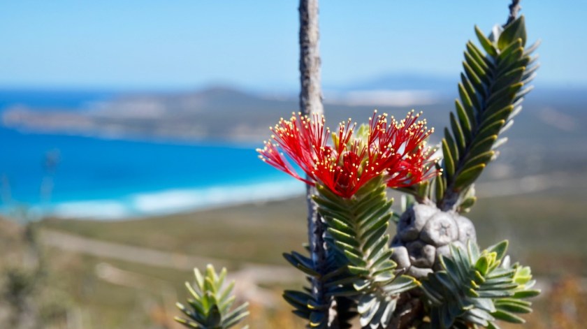
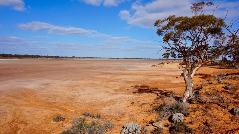
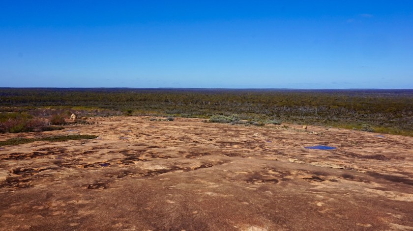
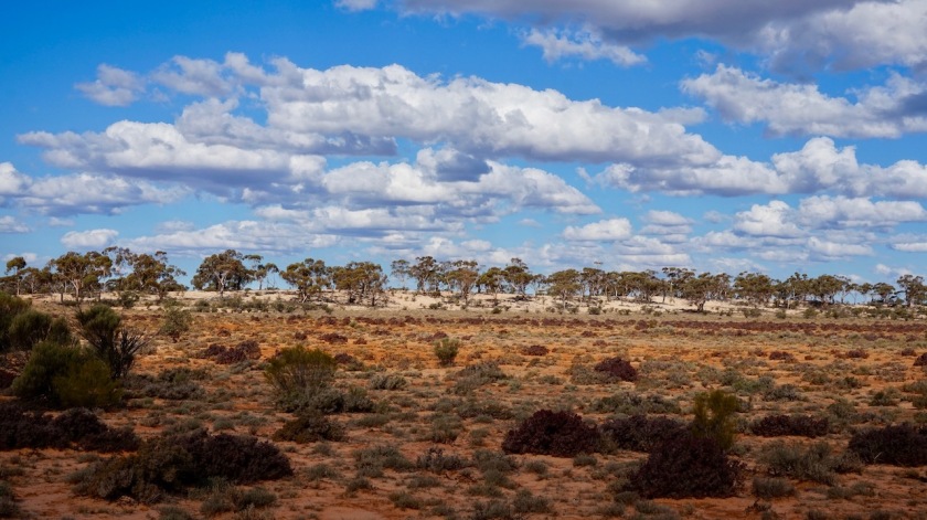
The ride, it is beautiful. Gravel Road, just a handfull of cars, viewpoints, birds and at the end of the day a super-nice couple, Fred and Wendy, hosting me for the night.
I get my own lovely room and to top it off, the best pizza in years is prepared from their own wood fired oven.
A very good day.

DSC01690

DSC01695
View from the Central Look-out. That’s the dirt road I’m riding through the Stirling Range.

DSC01701

DSC01703

DSC01709
View from the Western Look-out.

IMG_6012 (1)

Day 228: 23 September 2019
From south of Kendenup to Porongurup National Park
37,39 km (Total so far: 10.465,79 km) – Altitude climbed: 475 m
Weather: Sunny, moderate side wind

Today, all my troubles (with credit card) were taken away.
No more worries. Well, there’s the laptop which is down, but we’ll see what can be done about that.
Fred and Wendy rode part of the way with me towards Mount Barker. Then, a short stretc of less than two kilometer on the Albany Highway, but there was a reasonable shoulder before the cycle path appeared.
A very nice Iga in town and friendly folks at the tourist info.
My original plan was to ride via O’Neill Road towards the Porungurups, but luckily Fred informed me that is not a through road.
The Mount Barker-Porungurup Road which I took instead was almost traffic-free.
I rode up the western slopes of the Porungurups and pitched my tent in the forest.

DSC01713
At Mount Barker. This must be the most important pedestrian crossing in the little town. There are four (!) of these little red and white triangles at this crossing and one are two of the green ones you see in the middle of the street to warn you not to dare, in your wildest dreams, to disturb the car traffic. Also note they refuse to paint a zebra crossing. As a pedestrian (or cyclist), even at the heart of a shopping area, you shall give way to the almighty car. Amen.

Day 229: 24 September 20219
From Porongurup National Park to Albany
88,24 km (Total so far: 10.554,03 km) – Altitude climbed: 772 m
Weather: Sunny, moderate tail wind

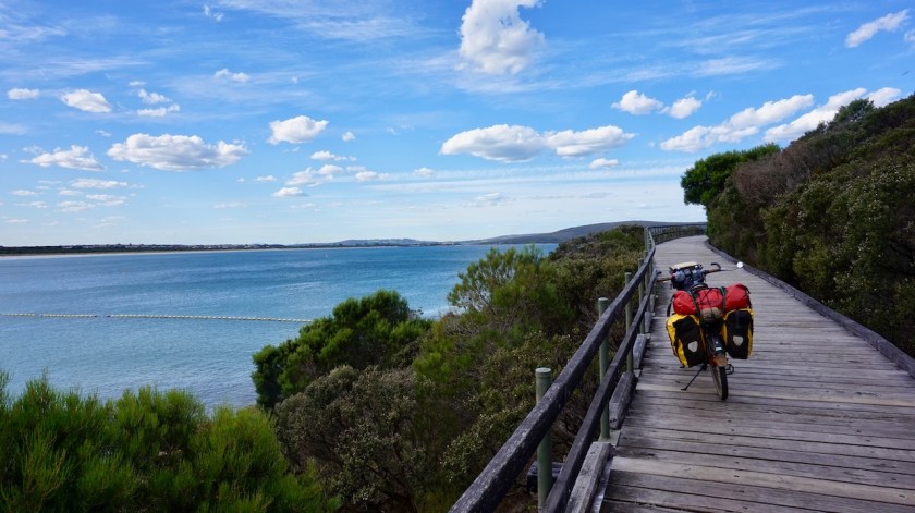
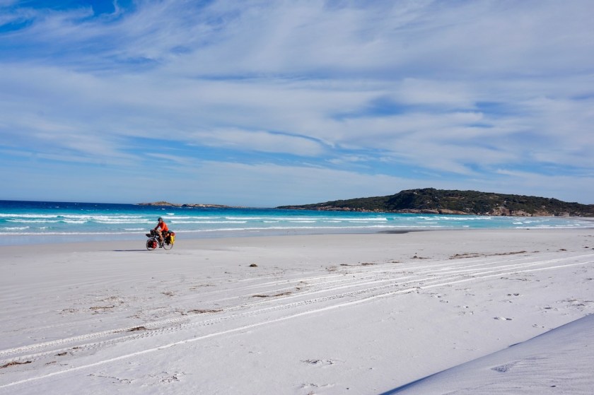
Continued my route riding south of the Porongurups. I was in no hurry, so made myself a nice route almost all on dirt towards Albany. Once passed Oyster Harbour it’s all on separate bike paths into town. Really neat.
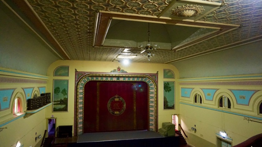
I was hosted again by a fabulous couple, Beth and Denis.

DSC01717
Porongurups.

DSC01724

DSC01731
The cycle path going around the hill in Albany.

DSC01739

DSC01737

Australia Prt 17, WA: Esperance to Hopetoun

Route: Esperance – Munglinup – Hopetoun

Instead of taking the South Coast Highway, I did my best to find the road less travelled again, riding mostly on dirt roads, except for a few kilometer before and after Munglinup for stocking up on provisions.

Day 206: 1 September 2019
From Esperance to Monjingup Lake Nature Reserve
15,33 km (Total so far: 9.741,88 km) – Altitude climbed: 197 m
Weather: Sunny, rai in the evening, storm head wind

This was not a head wind, but a head storm. I am exhausted and have sour knees after ten kilometer so decide to call it a day at the first opportunity. I pitch my tent behind a tree and some bushes giving some reasonably good wind shelter. I think technically I’m not supposed to camp in the Monjingup Lake Nature Reserve, but I feel there was no other option.

Day 207: 2 September 2019
From Monjingup Lake Nature Reserve to near junction Browning and White Road
49,12 km (Total so far: 9.791,00 km) – Altitude climbed: 314 m
Weather: Sunny, very strong head wind

I first roll down towards the Monjingup Lake. They have built a small but nice shelter with information, there is a clean toilet and a nice shelter for bird watching at the lake’s edge.
I must say the responsible people for all this infrastructure do an excellent job, the bike path, the very well maintained waterfront all along the town, the infrastructure at the lakes around town,…

DSC01382
A (Carnaby’s ?) Black-Cockatoo on a Banksia tree.  These birds are getting rarer and rarer as a result of historic persecution and continued loss of habitat.

I am riding in a westerly direction over the Telegraph Road. A few kilometer to my north is the South Coast Highway, which I want to avoid desperately, and to the south are some high dunes. All maps show the Telegraph road ends after a few kilometer and you have to loop back to the Highway. My map on the computer showed a tiny red line continuing westward.
At the junction with Bates Road, a sign says the Telegraph Road won’t continue, but I
ignored it. I was rewarded with a completely free sandy road, a bit undulating and views to some really high dunes. Some sections were too sandy and I had to push, but this is wayyyy better than the highway.
I spot a flock of Black Cockatoo’s. Really beautiful birds.

DSC01391
Telegraph Road
DSC01392
Why ride a highway if you got this !

I hit the asphalt again at the junction with Murray Road, riding through a swarm of wasps for 50 meter. None of them stung, but it was a strange experience hitting all these wasps.

I have to ride 1,5 kilometer on the highway before I take a right turn on the Dalyup Road where I am again on dirt and completely traffic free.
Apart from the traffic on the highway I only saw a school bus in the end of the afternoon.
Very hard day against the wind. And the forecast is it will continue. the wind will shift to southwest, but so will my driving direction as well.

DSC01397

Day 208: 3 September 2019
From near junction Browning and White Road to along Jonegatup Road
65,82 km (Total so far: 9.856,82 km) – Altitude climbed: 338 m
Weather: Sunny, cloudy, very strong head wind

Another day battling against a fierce head wind. Not long into my ride I see a snake taking a sun bath on the road. He/she is about 90 cm long. After I stamp the ground a few times with me feed, he/she wakes up and makes a quick exit to the side of the road.

The rest of the day is quite uneventful, just that hard work against the elements. I remain on the undulating dirt roads north of the highway. Kilometers and kilometers of fields with yellow flowers.

DSC01403

DSC01410

DSC01412

DSC01416
Cheerful place to wake up 🙂

Day 209: 4 September 2019
From along Jonegatup Road to along Doyle Road
38,00 km (Total so far: 9.894,82 km) – Altitude climbed: 321 m
Weather: Sunny, cloudy, lot of rain at night, very strong head wind

From my well sheltered camping spot, I could hear the wind in the trees as it was picking up force after sun rise. And boy was it a head wind again. My track was climbing at one percent, and combined with this head wind I was moving forward at something between 4 and 5 km/hr.

Eventually I hit the South Coast Highway again.
Five kilometer later I’m in Munglinup, where there’s a roadhouse, my reason for going shortly on the highway. They sell drinks, bread, chips, ice-cream, chocolat. I eat a warm unhealthy lunch of fries and ….. I don’t know, some mysterious things which I imagine counts as the meat of my meal.

DSC01419

DSC01420
Good, stocked up with water and bread I continue. Another 3,5 km/hr on the highway, then I take aleft turn to another dirt track. The ladies in the roadhouse said I shouldn’t take this road towards Hopetoun. “Too dangerous.”
“Why ?”, I ask them.
“There could be snakes on the road.”
Well, I think those snakes are far less dangerous as the car drivers on the highway. Especially snakes on the road, which I see from far away.
Snakes in the bush, when I am searching for a camping spot, that’s another story maybe.
I call it a day pretty early as it seems it might start raining. I pith the tent along a little side track of this dirt road.
Only half perfectly sheltered for the wind. Hopefully it will be sufficient.
It was much easier to find good sheltered places in the desert as here in this agricultural region.
I can see kilometers and kilometers of new land is cleared from forest to make new farmland.
It is not only Brazil which is a problem. Everywhere on the planet we are doing the best we can to destroy it. But of course, ‘this little bit is not going to make any difference…’.

DSC01433

DSC01438

Day 210: 5 September 2019
From along Doyle Road to 12 Mile Beach
70,18 km (Total so far: 9.965 km) – Altitude climbed: 404 m
Weather: Sunny, moderate head wind

It rained a lot last night and the little dirt road towards the main dirt road is flooded. My main dirt road is mostly dry but so soft it feels like riding over a sponge. Combine that with more head winds and little hills and the going was slow again.

To my surprise there is almost no traffic on that little road skirting the shores of the Southern Ocean. Four cars all day. I see a few kangaroos and a fox.

There are not many direct views of the beach, as the dunes are in between and the road is mostly a few kilometer from the shore. There are a few lakes between my road and the dunes, the biggest one Lake Shaster.

Starvation Bay is one of the few places where one can actually go on the beach.
It is also the beginning (or end) of the Rabbit Proof Fence, an 1.832 km fence running all the way to Port Headland. I didn’t see any fence though.

DSC01447

DSC01450

DSC01455

DSC01459
Starvation Bay

DSC01461

DSC01468

Day 211: 6 September 2019
From near 12 Mile Beach to Near 2 Mile Beach
29,06 km (Total so far: 9.994,06 km) – Altitude climbed: 217 m
Weather: Sunny, light tail and head wind

Today my route runs much closer to the beach with a lot of possibilities to go over the dunes and have a look at the fantastic empty white beaches and the blue ocean.

DSC01473

DSC01475

DSC01484

DSC01488
Jerdacuttup Lakes

DSC01490

DSC01495

Day 212-219: 7 September – 14 September 2019
Hopetoun
65,79 km (Total so far: 10.059 km) – Altitude climbed: 856 m
Weather: Sunny

I took some rest days in Hopetoun. It is a perfect place for me. It is just a small village, at the end of a death end road. I guess it gets busier during holidays but for now, it’s all peace and quiet.
The beaches are spectacular, both sides of town.
I also made a trip to East Mount Barren. I will pass there on my way out, but I wanted to make a full day trip of it and take my time to enjoy it.
There is a new road, just opened a month ago, running between the Southern Ocean and the Culham Inlet. Then there’s a steep climb up the flanks of East Mount Barren.
The hike to the top takes about 45 minutes. The views to the coast and to the Fitzgerald River National Park and the Whoogarup Range are spectacular. I was more lucky with the weather then when I wanted to climb Frenchman Peak in Cape Le Grand National Park.

DSC01517

DSC01520
The roller coaster road towards East Mount Barren.
DSC01536
East Mount Barren, rising up out of the Southern Ocean
DSC01538
Only a short bit at this gradient, but it makes your heart pumping.

DSC01545 Southern Plains Banksia

DSC01560 Royal Hakea
Royal Hakea
DSC01565
Coneflower
DSC01585
Racehorse Goanna
DSC01586 Coneflower
coneflower

DSC01590

DSC01601
Enjoyning the view from the top of East Mount Barren.
DSC01596
This view ! 😀   To the left, Culham Inlet, to the right the Southern Ocean.
DSC01611
My road when leaving Hopetoun, through Fitzgerald River NP.  In the distance, the Whoogarup Range

Australia Prt 16, WA: Esperance and Cape Le Grand NP

I had some fantastic days in the Esperance / Cape Le Grand area. Sorry, an overflow of beach pictures in this post, but I hope it is a welcome change after all the red sand pictures 🙂

Day 199: 25 August 2019
Esperance
Weather: Sunny

Rod takes me out on a drive. We visit the Rotary Lookout and ride the loop along Ocean Road and Pink Lake. What fantastic scenery !
Tomorrow, I repeat this on my bicycle.

DSC01027

DSC01029

DSC01039
There are signs everywhere along the beach, asking you to stay below the water line and out of the dunes as not to disturb the nesting birds. Fifty meters further on, the dunes and beach is full of 4WD tracks. And it is allowed ! As the kangaroos must go to the kangaroo school where they should learn not to jump in front of the cars (yes, they are responsible for their own death), the birds must go to the bird school to learn not to put their nests / eggs on beaches where people like to drive 4WD’s.
DSC01048
Ron buying vegetables from a local farmer 🙂

Day 200: 26 August 2019
Esperance
Weather: Sunny

Esperance must be one of the neatest towns I’ve seen so far in Australia.
Melbourne and Renmark were nice as well, but they can’t compete with the setting of Esperance right at the coast of the Archipelago of the Recherche.
AND, Esperance has quite a bit of bike paths.
Today, I follow the bike path going west out of town, towards West Beach. From West Beach, I ride to Salmon Beach and on the Twilight Beach.
Yesterday, by car, we rode the whole loop, via Ten Mile Lagoon, …. but the pike path doesn’t go that far. It goes inland here, crossing the hill directly towards Pink Lake after which it loops back into Esperance.
Really nice ride !

DSC01053
The old pier in Esperance
DSC01055
Clock tower, Esperance
DSC01058
West Beach

DSC01061

DSC01062
Blue Haven Beach
DSC01070
Blue Haven Beach
DSC01088
The excellent bike path out of Esperance.
DSC01101
Riding down to Salmon Beach

DSC01102

DSC01108

DSC01112

DSC01121

DSC01132


DSC01142
11 mile Beach

DSC01163

DSC01164

DSC01174
National Park put the island on fire. “Managing nature”….
DSC01178
The whole bay was covered in smog by late afternoon.

Day 201: 27 August 2019
Esperance
61,48 km (Total so far: 9584,01 km) – Altitude climbed: 499 m
Weather: Sunny

I forgot to reset the gps and odo-meter yesterday, so above figures are from yesterdays and todays ride.
Today I rode out of town towards the east to Esperance Bay.
Kilometers long white beach, only for me.
Brilliant day again.

DSC01180

DSC01181
Bandy Creek Harbour
DSC01184
The beach at Esperance Bay

Day 202: 28 August 2019
From Esperance to near Dunns Beach
61,93 km (Total so far: 9.645,94 km) – Altitude climbed: 240 m
Weather: Sunny, moderate head wind

The first ten kilometer or so, I backtrack the road I rode when I came into town.
South of the Myrup Airstrip, I take a right turn. Nice scenery as I’m riding along the Mullet Lake Nature Reserve.
A few steep hills and a bit more traffic as expected.

DSC01188

Looking at maps the previous days, I was not sure how far east I wanted to ride. First I settled for Dukes of Orleans Bay, just south of Condingup, but as the weather looks bad for Friday and Saturday, I only have today and tomorrow with fine weather.
So, I take a right turn on Dunn Rock Road (mainly because that’s a gravel road to the coast, the others are paved haha).

DSC01192

A nice +/- 17 km ride brings me down the Dunns Rocks and Dunns Beach.
Wauw !!!
A kilometers long bay, paper white sand, water in various tints of blue, big white dunes a bit further on. And no one around.
I must be the happiest person on Earth for a while.
I climbed the rock for better views, then rode my bike on the hard packed sand of the beach towards the dunes.
Spectacular.
The sea water is way to cold to swim. It’s still winter here and there’s nothing between the Southern Ocean and Antarctica.

DSC01193

DSC01197
The beach west of the Dunn Rocks

DSC01206

DSC01221

DSC01229

DSC01235

DSC01239

DSC01240

DSC01255

DSC01261

DSC01264

DSC01267

DSC01270

DSC01278

DSC01282

DSC01284

DSC01286

DSC01289

DSC01299

DSC01293

DSC01298

DSC01299

DSC01302

DSC01303

Day 203: 29 August 2019
From near Dunns Beach to near Merivale Rd & Cape Le Grand Rd
45,06 km (Total so far: 9.691,00 km) – Altitude climbed: 369
Weather: Sunny, strong head wind

I had to break my tent down before breakfast. The night was already very windy, but nothing to worry about. After sunset, the wind gusts just got stronger, so best not to take any risks with the tent.
There are two possibilities to go from Dunns Rock towards Luck Bay.
Back via the road I came and then take the asphalt road into the park, a total distance of about 50 kilometer.
Or straight over the beach, a distance of 10 kilometer.
The latter option required waiting for low tide for a few hours. I know worse ways to spend your time than waiting for low tide on this stunning beach.
So, lay down on the sand I did for a while.
Around 1 pm the moment was right to start the trip.
The first 1,5 km it was a bit of riding and a bit of pushing as the sand was sometimes too soft.
Then followed a five kilometer section which I could ride perfectly. The last three kilometer I had to push again.

DSC01312
Rossiter Bay, which I cycled east to west

DSC01315

DSC01318
The bike, waiting for low tide and hard sand.

DSC01333

Via a gravel road I passed Lucky Beach & Thistle Cove.
One of my goals in the park was to climb Frenchman Peak.
I started it, took the first steep part up, but as the track went up, it got more and more exposed to the north and the wind gusts almost threw me off my feet.
I didn’t continue all the way up, too dangerous. but the views I had from halfway up were already pretty nice.

DSC01352
Lucky Bay
DSC01367
Frenchman Peak
DSC01361
View from half way up Frenchman Peak

Unfortunately I could not go down to Cape Le Grand itself. The road was blocked off for ‘controlled burn-offs’. They do that all the time. These park rangers are a bunch of pyromaniacs. Nature was coping pretty good, even without our burn-offs, but the national parks here seem to think it is necessary to burn the place down regularly.
Woody island was completely on fire a few days ago, I read a lot of sections in the national parks along the Munda Biddi Trail are closed for burn-offs.
Yes, …. we people know how to do it.

DSC01370

Day 204: 30 August 2019
Near Merivale Rd & Cape Le Grand Rd
Weather: Rain

As predicted it rained. I stayed put in the tent.

Day 205: 31 August 2019
From near Merivale Rd & Cape Le Grand Rd to Esperance
35,55 km (Total so far: 9.726,55 km) – Altitude climbed: 142 m
Weather: Sunny, very strong head wind

I ride back to Esperance the same way I came out here, via the Merivale Road. Riding out, I was battling against an easterly wind, riding back, I am battling my way against an even harder westerly wind. At times, I can make 8 km/hr only on the flat.

I stay one more night in Esperance before starting the last stage of the trip, westward towards Perth.

Australia Prt 15, WA: Coolgardie to Esperance

Route: Coolgardie – Lake Johnston – Norseman – Esperance

Day 190: 16 August 2019
From 6 km passed Coolgardie to 45 km passed Coolgardie
52,26 km (Total so far: 9.069,12 km) – Altitude climbed: 247 m
Weather: Sunny, moderate side wind

I rode back to Coolgardie to restock supplies, take water, visit the museum and have a shower in the community centre for the friendly price of 3 Aud.

DSC00642

DSC00644
What a bizar sign. You’d have to smash your head through the glass before you could put your head inside the helmet.

All the ground beside the road is this sticky red mud which sticks like mud to your shoes and tyres, but the road itself is in good condition.
This is salmon gum country. The road is slightly undulating and when at high points, when one stands on the pedals, one has a brilliant view over the forrest, hundreds of
kilometers nothing but salmon tree forrest. Only saw two other cars on the road today.

DSC00654

Day 191: 17 August 2019
From 45 km passed Coolgardie to somewhere along Victoria Rock Road
63,09 km (Total so far: 9.132,21 km) – Altitude climbed: 386 m
Weather: Sunny, very strong head wind

I had a really nice camp site last night. Beautiful scenery, good sheltered from the wind, quite a lot of bird life around again (a lot of Lorikeets among others) and well drained for the rain that fell again during the night.
But before the rain, I saw a splendid full moon rising.
Also, perfect quietness. Not a sound apart from the birds and the wind.

DSC00657

It’s that wind that made the day today as one of the hardest I had here in Australia. Most of the time, I managed a meagre 8 km/hr on the flat.

After a few kilometer, I arrived at Queen Victoria Rock. It is towering only about 50 meter above the surrounding landscape, but you have amazing views. The strong southerly wind almost blew me off the rock. I enjoyed this rock much more than Ayers Rock, although it has nothing of its grandeur. You are here on your own to enjoy it.

DSC00663

DSC00668
Endless views from the Queen Victoria Rock.

DSC00680

DSC00683

DSC00689

About five kilometer after Victoria Rock I started riding through an area which must have been on fire recently. It lasts for thirty kilometer. Thirty kilometer through a completely burned down area where nothing stops the wind.
I had a rain shower and rode through a sandstorm here as well.

DSC00694

DSC00695
As far as you can see, in all directions, everything is burned.

DSC00697

DSC00700

DSC00702

DSC00703

DSC00709

DSC00711

Then the sun came out and the only car I saw today stopped to offer me some chocolate and fill a water bottle.

The variety of greenery is enormous today. A lot of salmon gum trees but also so much other plants, bushes and trees. Also saw an emu.
I passed the junction with the Holland Track. I think that must be a beautiful track to cycle as well. I continued straight south on the Victoria Rock Road.
Very few times the road becomes too sandy and only a very few sections with corrugation. This is a much, much nicer ‘outback road’ again as the more famous GCR & Oodnadatta.

DSC00720

DSC00727
Junction with the Holland Track.

Again, I pitch the tent in a very scenic places and spend a night in all quietness.
My right knee hurts. It started half way during the day. Probably from working so hard against the wind with that heavy bike. It continuous to bother me all night.
Hopefully it will get better again.

Day 192: 18 August 2019
From somewhere along Victoria Rock Road to Disappointment Rock
61,97 km (Total so far: 9.194,18 km) – Altitude climbed: 187 m
Weather: Sunny, strong head wind

My knee hurts terrible. Kept me awake at night.
After more than 110.000 km bicycle touring, I think I have my first injury.
I wonder wether the rest days before the windy day of yesterday could have something to do with it. The first twelve kilometer, I stop three times to give my knee a rest.
What to do, what to do ??
I don’t want to stop. Too many nice things to look forward to in the remaining kilometers in Australia.

DSC00734

DSC00738

So I carry on and hope for the best.
The road I’m following, still free of traffic and the environment lift the spirits a bit.
For the first time since long, a kangaroo hops away over the road.

The road meanders between some lakes. Mostly dry, or muddy now after the recent rains. I walk through the mud to an island in the lake.

DSC00765

DSC00774

DSC00787

DSC00788

At the junction with the Hyden-Norseman Road I turn left. This road carries a bit of traffic, say a car every fifteen minutes.
The road winds its way around Lake Johnston. The western side of the lake is forested with salmon gums, the eastern side almost barren with some low bushes only.
I camp opposite Disappointment Rock. Too late in the day to hike to the top. Give that knee some well deserved rest. It doesn’t seem to get any better.
Well,…. maybe I’ve got to admit I reached the autumn of my life. It’s not going to get better from here.

DSC00798

DSC00805

Day 193: 19 August 2019
From Disappointment Rock to 16 km before Norseman
68,03 km (Total so far: 9.262,21 km) – Altitude climbed: 300 m
Weather: Sunny, light head and side wind

First cross the street and up to the rock. I thought this was going to be a quick run up the hill, but no… it’s much more interesting. There is an interpretive trail with little signs and interesting information. The views are fantastic. I stayed 1,5 hour on Disappointment Rock, but never found out why it’s called that.

DSC00817

DSC00823
You could find fresh water here.

DSC00829

DSC00841
Again, endless views, this time from disappointment Rock.

DSC00849

DSC00854

Rest of the day is relaxed cycling through the salmon gum forrest.
‘The knee’…. I was thinking.
The knee is much better !
Yes, I still feel something, but definitely not the pain from the previous days. Pedaling goes rather smooth.
Ah, let’s face it, after all, I am still in the high summer of my life.
Things look good, no reasons to worry, forward with the goat !

DSC00860

Day 194: 20 August 2019
From 16 km before Norseman to along Dundas Heritage Trail
28,53 km (Total so far: 9.290,74 km) – Altitude climbed: 256
Weather: Sunny, light side wind

Every day has its highlight.
Today, for some that might be the first phone connection in five days, or it may be that hot shower you can take next to the visitor info centre (2 Aud, but much, much less clean as the facilities in Coolgardie).
But I think the real highlight was Lake Cowan, the big salt lake I crossed before entering Norseman. And also the first part of the ‘Dundas Heritage Trail’, a 25 kilometer dirt road going south from Norseman. Excellent to avoid the highway. I camp at the highest point of the track, a hill top with great views to the forested flat lands to the east.
I wanted to take some rest days at Norseman, but next two days a light northern wind is forecasted, and I’m going to take advantage of that, riding south to the coast.
Rain is expected on day three though.

DSC00866
The track crossing Lake Cowan.

DSC00868

DSC00872
It is a pitty people here have to ride on everything with their 4WD. Also in the desert, tracks literally everywhere, on beautiful plains. They will be there for years. And in a country where so many things are forbidden, this isn’t.

DSC00879

DSC00890

DSC00892

DSC00894
It is wild flower season.

DSC00895

DSC00897

Day 195: 21 August 2019
From along Dundas Heritage Trail to Gilmore Lake Nature Park
67,38 km (Total so far: 9.358,12 km) – Altitude climbed: 252 m
Weather: Sunny, moderate tail and side wind

Continued along the Dundas Heritage Trail. Only one car passed me here. It’s a beautiful track and interesting trail.
Recommended.

DSC00910
A favorite ! 😛
DSC00917
Dundas Heritage Trail.

Eventually, I arrive back at the highway which I have to follow for about 40 kilometer. The original plan was to ride via Peak Charles (which would involve only a 30 kilometer ride over the highway) but with the recent problems with me knee, I decide to take it easier.

From the highway I have views to the beautiful Lake Gilmore.
At Beete Road, a dirt track running south of the lake, I leave the highway behind. Agricultural land and forest along the road.

DSC00930
As everywhere, an idiot has to drive his 4WD here.

DSC00931

DSC00936
I tried to cycle the dirt track along the railway as much as possible to avoid the asphalt.
DSC00938
Lake Gilmore
DSC00948
Suddenly…. back in farm land. Grass as far as the eye can see.

DSC00951

Day 196: 22 August 2019
From Gilmore Lake Nature Park to near junction Styles Road and Truslove Road
99,37 km (Total so far: 9.457,49 km) – Altitude climbed: 455 m
Weather: Sunny, strong tail wind

A beautiful cycling day on quiet country roads, all unpaved, less than a handful of cars. It is nothing spectacular, just relaxed cycling. Lot’s of grassland, fields with yellow flowers, vistas to Peak Charles in the distance and lots of small lakes. And the lakes have water now. Due to the salt and minerals, they can have all colours. Some are red, others green and another one blue.
The farmland is fenced off, but there are several ‘islands’ of forest where one can camp.
North of the junction with Styles Road and Truslove Road is a bigger forest of 15 km or so.

DSC00963
From now on the lakes have water (salt).

DSC00966

DSC00969
I found this water reservoit. No idea why they once covered it.

Day 197: 23 August 2019
Near junction Styles Road and Truslove Road
Weather: Rain

a wet day, and as I don’t like cycling in the rain, I stay a day in the tent, give the knee some more rest, read a bit and make a short walk around a small lake.

DSC00988
The little lake where I camped.

DSC00983

DSC00989

DSC00997

DSC01000

Day 198: 24 August 2019
From near junction Styles Road and Truslove Road to Esperance
65,04 km (Total so far: 9.522,53 km) – Altitude climbed: 170 m
Weather: Cloudy, moderate head wind

I am surprised to hit the asphalt already 40 kilometer before Esperance.
But the road stays quiet until the junction with Dempster Road and Fisheries Road, at which point I’m almost in Esperance.
And back at the sea for the first time since leaving Melbourne.
I am lucky to have people hosting me. It is again arranged by Susie whom I met on the GCR and who had arranged already my stay in Kalgoorlie.
Now I stay with Diana and Rod, both originally from New-Zealand.

DSC01004

DSC01005
Everywhere along the road I see these empty jerry cans of poison. Are they just dumped, or does it have a certain meaning ?
DSC01006
Salt lakes in every colour along the route.
DSC01011
I notice very frequently people like to wear out there tyres asap.

DSC01012

DSC01020

Below a map of the route since leaving Alice Springs. The gpx-track can be downloaded from Wikiloc

ik

Australia Prt 14, WA: Leonora to Coolgardie

Route: Leonora – Menzies – Davyhurst – Ora Banda – Kalgoorlie – Coolgardie

Day 177: 3 August 2019
From few km before Leonora to 12 km before Menzies
105,54 km (Total so far: 8.733,10 km) – Altitude climbed: 287 m
Weather: Sunny, strong and moderate tail and side wind

After riding back into town, I first visited Gwalia, an old mining village a few kilometer outside Leonora. The rest of the day was spend on the Goldfields Highway.
Much less busy than f.e. the Stuart Highway, but still too much to make it a pleasant ride. Too much of your time is occupied with watching the rear view mirror and negotiating traffic. Can’t let the mind wander and enjoy.

DSC00385

DSC00386

DSC00388

DSC00398

DSC00402

DSC00408

DSC00409

DSC00413
The “mini-superpit” from Gwalia

I find a nice camping spot a bit before Menzies. The spot is nice and although I’m almost 500 meter from the road, the noise of the road trains is too much to call it peaceful.
Tomorrow, back on gravel.

DSC00418

Day 178: 4 August 2019
From 11 km before Menzies to 10 km before Davyhurst
67,44 km (Total so far: 8.800,54 km) – Altitude climbed: 225 m
Weather: Sunny, light & strong head and side winds

Menzies, an old mining town, is pretty neatly maintained. Lot’s of tourist signs and information about their past. A hotel, a tourist information, a campground, but no shop (the so called ‘general store’ in the hotel is nothing). I drink a coke at the hotel pub before leaving town, back on gravel. 250 kilometer / 3 days on asphalt since Laverton has been enough.

DSC00423

DSC00424

DSC00425
I take the Evanston-Menzies road going west out of town. A light wind from the northwest works against me. If I would have stayed on the highway, it would have been to my advantage. But this is so much better, even when the wind picks up soon after that.
A perfect gravel road, hardly any corrugation, no loose sand.
Pretty soon, I get taller trees again. Nice to see, as nothing grew much higher as the six meter mulga trees the last months.

DSC00430
On the 27 kilometer stretch to the junction with the Davyhurst Road, I saw two cars. On the 27 km after the junction, on the Davyhurst Road, still on excellent gravel, zero cars.
Cycling heaven, outback cycling as I had imagined it.
Lots of different plants and trees.
The fauna even feels a bit tropical.
Temperatures are more agreeable as in the tropics. 23 degrees in the shade, 33 degrees in the sun. 8 degrees just before sunrise.
A perfect day.

DSC00435

DSC00439
Sometimes it’s like I’m cycling in a garden, but is just nature creating this.

Day 179: 5 August 2019
From 10 km before Davyhurst to few km passed Ora Banda
80,20 km (Total so far: 8.880,74 km) – Altitude climbed: 321 m
Weather: Sunny, moderate side and tail wind

Another brilliant day.
Well almost.
First I rode through Davyhurst. At the map and in the tourist information in Leonora and Menzies, they say it’s abandoned. Well, nothing is left. The hotel once standing there its heydays is just a pile of stones. There is apparently a mining office where you should present yourself when continuing on the road to Kalgoorlie, but I didn’t.
This is a national park, this is a road on the map not marked as private, so they have to leave me alone.

DSC00443
The total lack of wildlife both in Northern Territory and WA surely must have something to do with the poison they lay out everywhere in nature. Strichine and 1080 to kill (wild) dogs, foxes, … Of course other animals will eat from these carcasses and…

DSC00446

DSC00448

DSC00465

DSC00473
The rest of the day cycling towards Ora Banda, the road goes up and down a bit all the time. So much different trees again, it’s fantastic. The first 75 kilometer of the day I see one truck and two motorbike riders, that’s all.
I expected Ora Banda to be deserted as well.
The hotel next to the camp ground burned down recently.
The campground itself is a place for the miners, I think, because mining is what they do here.
A lot !
What I didn’t expect either, was a paved road from Ora Banda. I hoped to be on gravel till rejoining the Goldfields Highway at Broad Arrow.

DSC00491

DSC00499

DSC00502
I passed through abandoned Siberia.

DSC00503

DSC00506
Thoses causes of death 🙂

DSC00509

I pitched the tent a few kilometer southeast of Ora Banda. The night was loud with continuous road trains passing the road a few hundred meters away.
To make this a perfect loop, I think you better continue riding the dirt directly to Coolgardie. I wanted to have a real supermarket again, because I haven’t seen one since Alice Springs, 2.500 kilometer ago. Also want to buy a new bottle of shellite for the stove. Kalgoorlie has a Bunnings. The next one would be in Albany only (although I later found out Esperance has a Bunnings store as well).

Day 180: 6 August 2019
From few km passed Ora Banda to Kalgoorlie
62,76 km (Total so far: 8.943,50 km) – Altitude climbed: 173 m
Weather: Sunny, moderate tail and side wind

Rode the paved road towards Broad Arrow, where there’s an ancient pub. I asked the bar tender wether there’s a possibility to follow the dirt track along the railway towards Kalgoorlie (instead of the Goldfields Highway) but both he and the people in the kitchen didn’t have a clue. The pub is right beside the railway.

DSC00537

DSC00553
The pub in Broad Arrow. I parked my bike next to the Angels’ rides. The moment I also put my helmet on my mirror, like they do, I think they started to realize I was making fun of the situation.
DSC00550
All walls inside and outside are written full.

DSC00545
I took my chances and tried it. First halve, there are a couple of active mines and every time I thought there would be signs that it’s forbidden to enter, but that track along the railway is open all the way down to Kalgoorlie.
Fantastic !
No worries about traffic.

DSC00559

DSC00560
Second half, the scenery improves, but the track becomes a bit more sandy and deeper gravel the last 10 km before Kalgoorlie.
Overall, very recommended.
I can stay two night with Shirley and Eddy in Kalgoorlie. Susie, a teacher I met on the GCR arranged it for me.

DSC00563

DSC00569

DSC00571

DSC00578

Day 181: 7 August 2019
Kalgoorlie
Weather: Sunny

Eddy takes me out in his car to visit Bunnings and a few of the highlights. The main one of course the Super Pit.

DSC00584
The Super-pit in Kalgoorlie / Boulder, one of the largest gold mines in Australia.  It is about 600 meter deep.  The largest open pit is near Slat Lake City in the Usa.   Over here, they blow out about 15 million ton a year.  They find a gram of gold or so in every ton they blow out.  Huge environmental impact but good for someones economy.
DSC00588
Especially for me, they made a nice explosion which later filled the whole pit with dust.

DSC00594

DSC00595
Theatre inside the town hall.

DSC00596

DSC00598

Day 182: 8 August 2019
From Kalgoorlie to the forest a few km outside Kalgoorlie
13,39 km (Total so far: 8.956,89 km) – Altitude climbed: 150 m
Weather: Sunny

Shirley and Eddy left town for a couple of days. As I don’t want to go too far south too soon (it’s still winter), I chose to take a few rest days in that forest outside of town. Just load up some good food and enjoy the quietness.

Day 183-185: 9-11 August 2019
Forest, 8 km outside Kalgoorlie

Rest days

Day 186: 12 August 2019
From forest, 8 km outside Kalgoorlie to 6 km passed Coolgardie
59,97 km (Total so far: 9.016,86 km) – Altitude climbed: 347 m
Weather: Sunny

Rode back into Kalgoorlie.
Lunch at MacDonalds and shopping at Coles.

As I found a good road to ride into Kalgoorlie along the railway line, there is also a good option to avoid the highway between Kalgoorlie and Coolgardie.
Studying the map, I saw there was a (water)pipeline running between the two towns, and a maintenance track alongside it.
It is good riding almost all the time.
Most of the time, I stayed south of the pipeline. There is a track north of the pipeline as well, but less scenic.

DSC00614
Once the track south of the pipeline joins the main highway, it is only a few hundred meters before the pipeline goes underground for a bit and you can cross to ride along the track north of the pipeline, away from the highway.
If riding the opposite direction, towards Kalgoorlie, there’s a small hill to tackle just outside Coolgardie. Don’t be discouraged by it, the rest of the road is only slightly undulating and in much better shape.

DSC00615

DSC00624

DSC00632

Coolgardie is a historical mining town. The highway runs through it.
Hope to visit the museum when I come back in a few days to buy provisions.
Rain is forecasted for the day after tomorrow, and I don’t want to be in the middle of the dirt track between Coolgardie and Norseman, so I will pitch the tent outside town and wait it out.
There is a campground in Coolgardie, but it is right next to the main road. That will be awfully loud.

DSC00635

DSC00636

Day 187-189: 13 – 15 August 2019
6 km passed Coolgardie

Quite a lot of rain was predicted for Wednesday 14th August. The 13th was still a nice sunny day with blue skies, and what’s more, a pretty strong wind from the north. That would be a tail wind, if I were to ride today. But I didn’t want to be caught up in the bad weather somewhere in the middle between Coolgardie and Norseman on these dirt roads, so I decided to take some more rest days.
14th of August brought indeed a lot of rain.
Around sunset, I heard a thunderstorm coming from my left and another one from my right. Of course, they met each other right above my head.
Hundreds of lightnings, immediately followed by loud thunders, strong wind gusts, rain and hail.
The whole area flooded, my tent standing in two centimeters of water.
Too much to worry about, especially those lightnings above my head, so I decided to distract myself and prepare a nice meal. Cutting broccoli, peppers, carrots, onion to prepare a delicious vegetable curry with couscous.
I heard the water flooding under my tent but I stayed perfectly dry inside.
By the time I started eating, there was some time already between the lightnings and the thunder and by the time I finished my meal the worst was over.

DSC00640
Impressive sky. Looks like lungs.
DSC00641
Feeding the local wildlife.

Contrary to the predictions, the 15th was also a rainy day, so I stayed put another day.