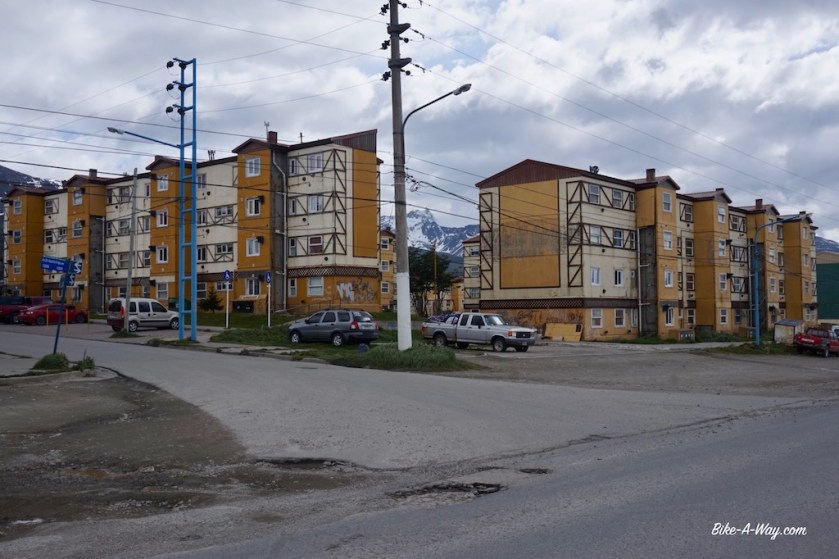
07/12/2017
After a night in a hotel in Puerto Natales, I took the bus onward to El Calafate, back in Argentina and from there straight onto another bus to El Chaltén. In hindsight, I’m happy with my decisions not to cycle this stretch through the pampa, against the relentless winds again. Only the stretch between El Calafate and El Chaltén on the routa 40 is much nicer as I anticipated, and there I regretted it not to be on my bike.
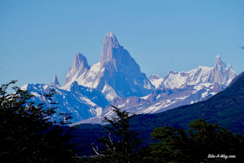
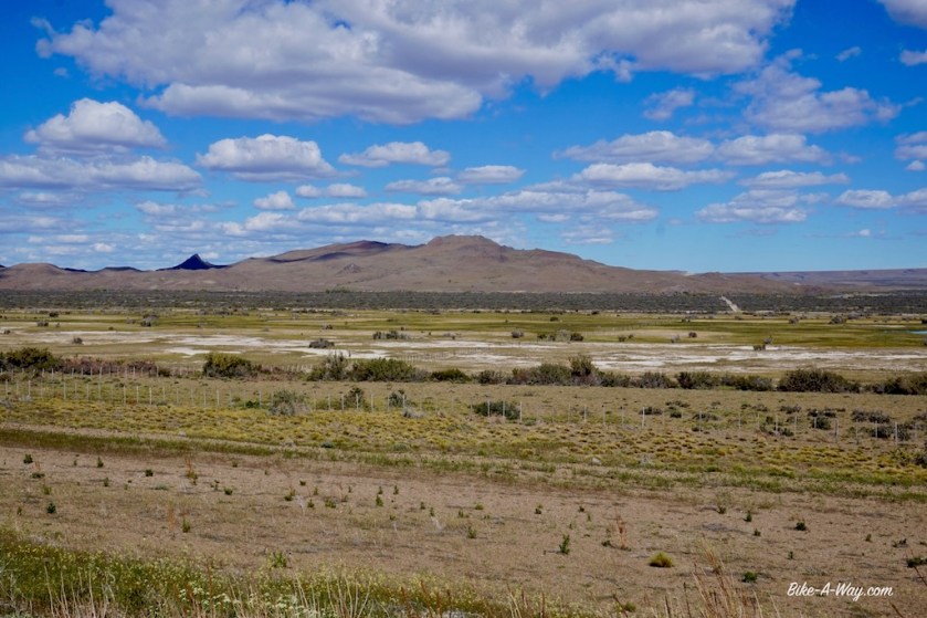
Approaching El Chaltén, I had my first views of the magnificent and iconic Mount Fitz Roy, named after the Beagle’s Captain Robert Fitzroy.
While I was completely battered from the bus ride and wanted to take a rest day the day, the weather was brilliant again. That’s an opportunity one can not let by here, so at 07:30 hrs I was walking out of town already into the norther section of Parque Nacional Los Glaciares towards the ‘Lago de los 3’ trail. This is a trail of about 10 kilometer (one way) leading you up to a lake at the foot of Mount Fitz Roy. To my surprise, I was almost alone on the trail. The last kilometer is steep and a bit harder, but the rewards is awesome and the pictures speak for themselves.
I do get it on my nerves of all this people who nowadays have to pose with outstretched armes in front of every natural attraction, as if they discovered or created them.
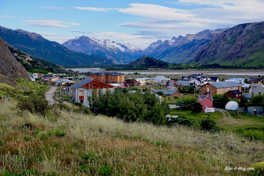
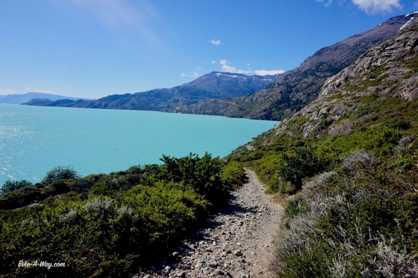
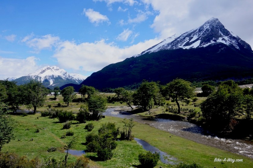
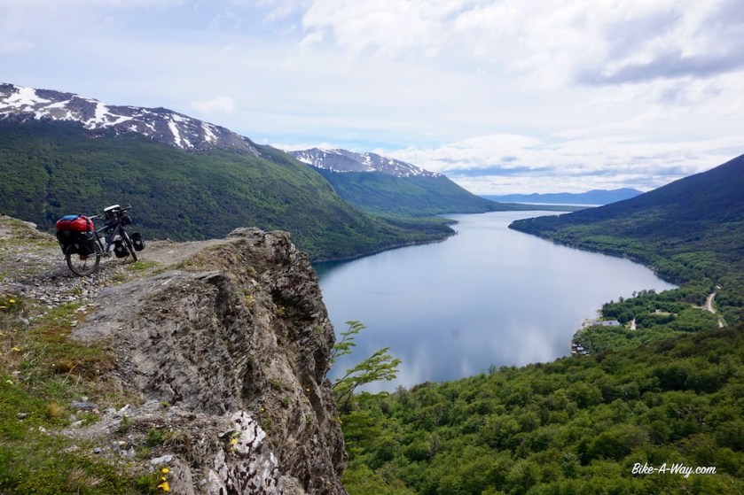
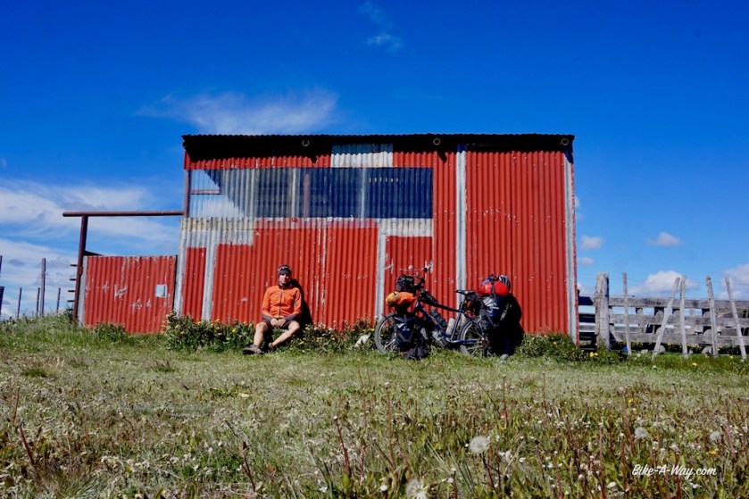
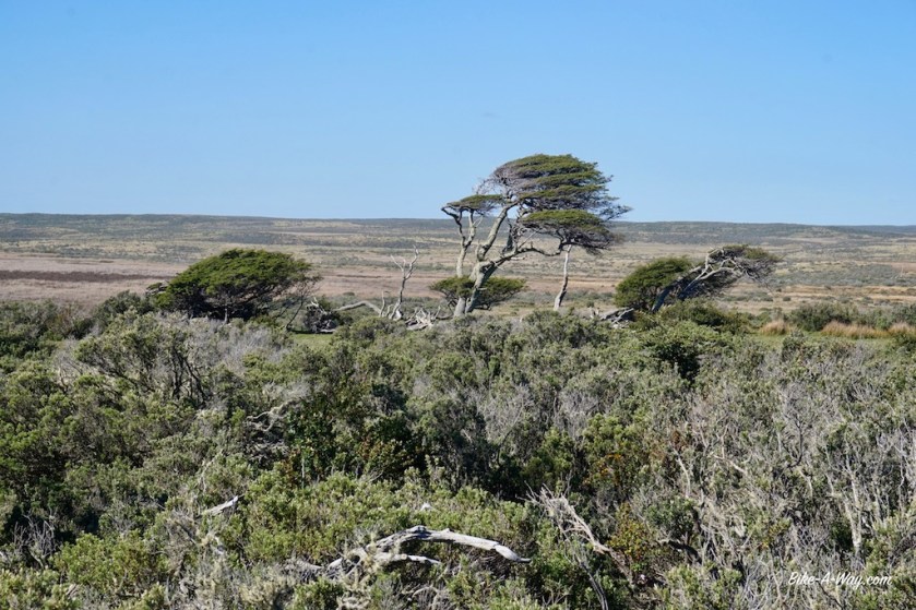
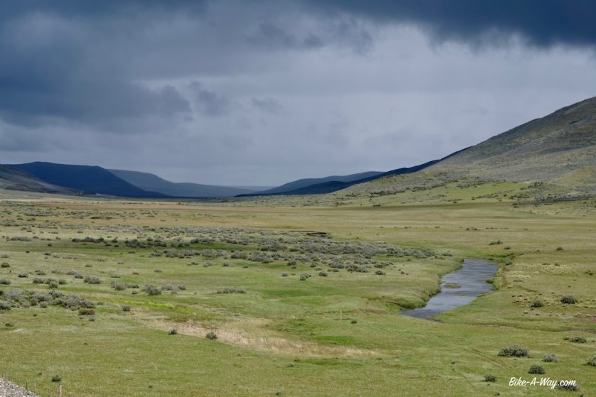
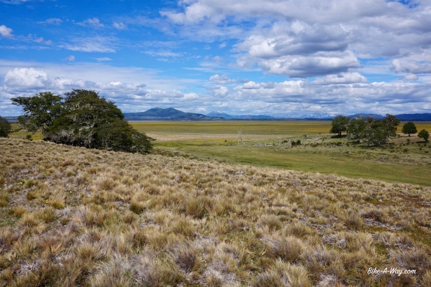
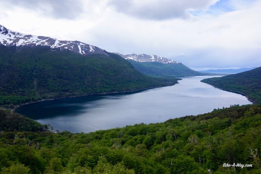
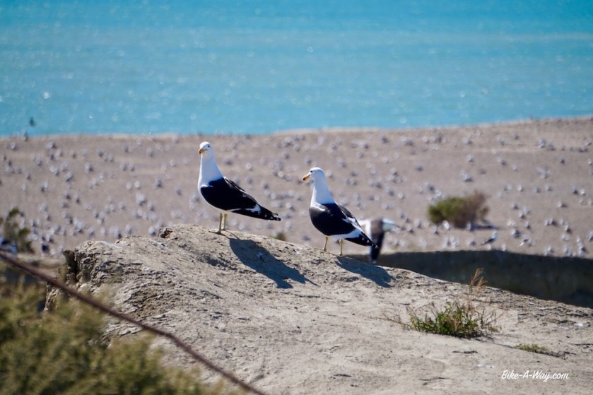
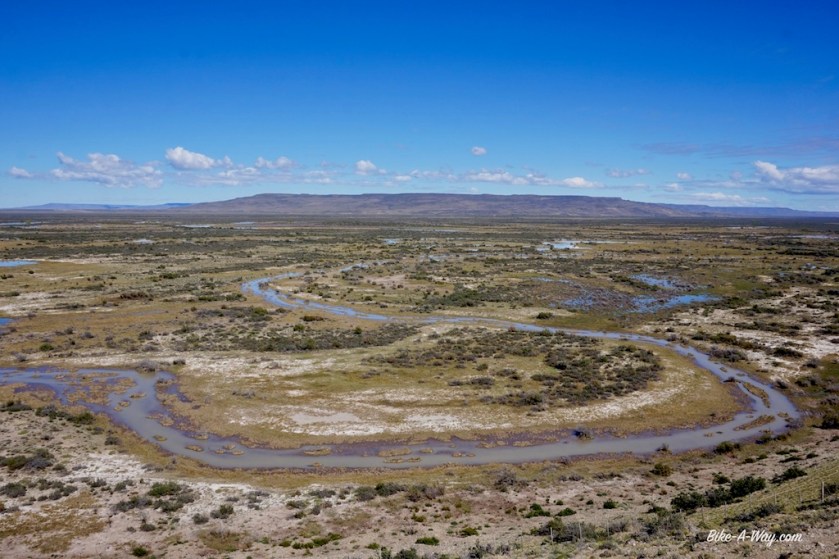
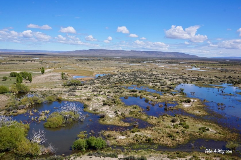
El ChalténThe valley I would cycle through a few days later towards Lago del Desierto.The last bit up to the ‘Lago de los 3’ lookout.And what a reward, standing so close to one of worlds famous mountains. Mount Fitz Roy (3.375 meter)
On my way down, I crossed busloads of people climbing, struggling up. It was a good decision to leave that early. I’m surprised to see so many people, twenty years my junior who are sitting along the trail, panting, totally exhausted. People are even more out of shape as I thought.
Luckily, about two kilometers on the way back, I can take a right turn to a trail which connects the hiking trail to Mount Fitz Roy to another trail, the day hike towards Cerro Torre.
It was still pretty early, so I decided to do both trails in a day. On the connecting trail of 8 kilometer, I only met one couple and one single hiker. It’s an easy trail along few lakes. Very beautiful and inside the forest, so you’re pretty sheltered from the high winds.
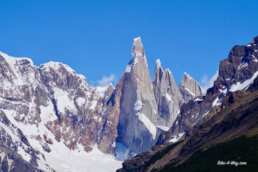
On the trail towards Cerro Torre, there’s no protection for the wind anymore, which blows with enormous forces right in your face. I headed on but really quickly the white clouds which covered the famous peak became darker and darker, the already storm like wind fiercer and fiercer.
I decided to turn back, as this would lead to nothing. I couldn’t see anything of the peak, and wasn’t eager to continue in the rain or snow.
Amazingly, I still saw people totally unprepared going on towards the Cerro Torre, carrying no rain gear, without decent shoes. And then they are surprised they have to be rescued.
Around 4 pm, I was back in El Chaltén, having hiked 30 km and 1.800 altimeter.
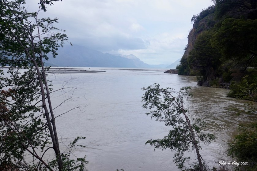
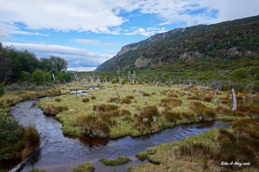
The valley towards El Torre, covered in clouds, but stil spectacular.
Saturday was a rainy and windy day which I used to do an oil change in the Rohloff hub and book my ferries on the Lago del Desierto and Lago O’Higgins. I skipped the famous and touristy Perito Moreno Glacier, but only because I had a boat trip to the O’Higgins Glacier in mind.
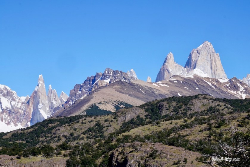
Sunday was a real warm and sunny day again, so I retraced my steps towards the look-out point of Cerro Torre. How lucky I am. Some people sit in El Chaltén for a week and never get to see a thing, and here I am sitting in a t-shirt looking at these spiky Andean peaks against a blue sky, drinking pure water from the streams floating down of them.
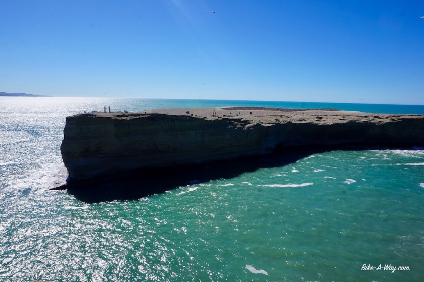
Cerro Torre at the right left, Fitz Roy on the right.Cerro Torre (3.102 meter high)
Late Sunday, I got the message I urgently had to go to the people from ‘Exploradores’, where I booked my ferries. It seemed the ferry on Lago O’Higgins had a serious problem and would surely not run again until Christmas. A big bummer. There’s a second, smaller boat doing the trip, but their website still shows sailing schedules of last year, and it’s not clear whether and when they would go to the O’Higgins Glacier. I booked my transfer online. The people of ‘Exploradores’ office did a really great job in tracking me down, calling all the hotels, hostels and guesthouses in town until they found me, in order to advise me the ferry broke down and give me my money back.
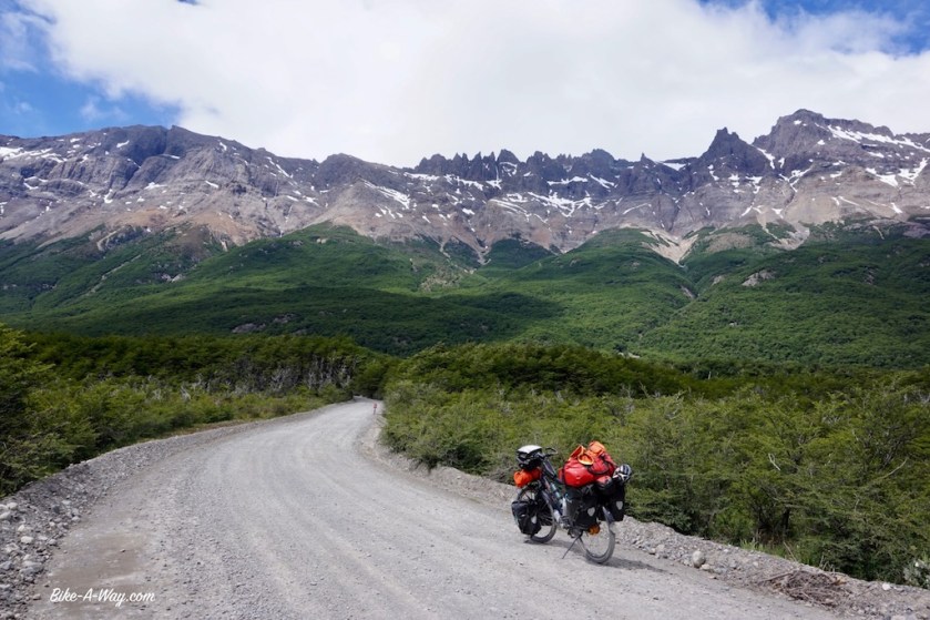
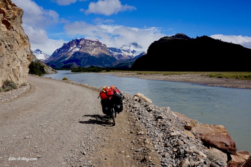
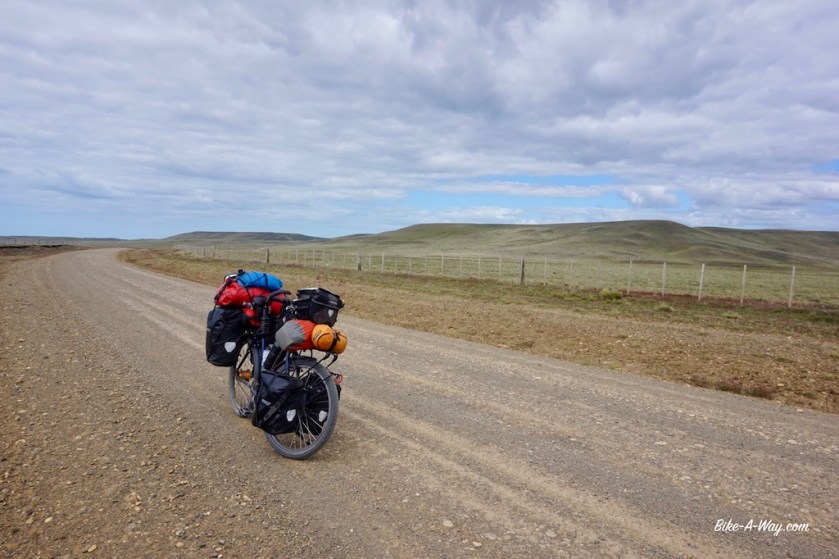
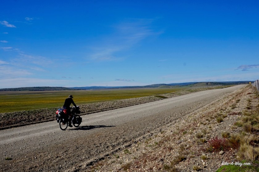
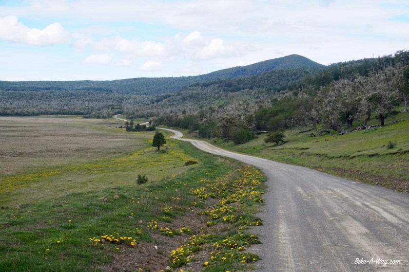
On Monday I cycled the 40 km from El Chaltén towards Lago del Desierto. A beautiful gravel road, many times in bad condition. But the scenery makes up for it. I stop at a beautiful waterfall, cycle between snowy mountains, cross rivers, along lakes, ….
On the way down, I got interviewed by a friendly Italian lawyer who writes in his spare time for a cycling magazine. Again I posed for a few pictures 🙂
On all my previous trips before South-America, I only got interviewed once for the local tv of Nong Kai in Thailand but now it’s one after the other.
The Italian cyclist.
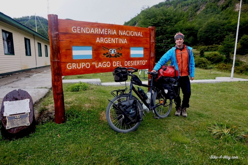
At 16:30 my ferry leaves for the one hour crossing towards the Northern edges of Lago del Desierto.
My original plan was to camp near the Argentinian border post, where I’d have spectacular views of the back side of Mount Fitz Roy. It was too cloudy to see anything now, and as I understood the little ferry I booked to cross Lago O’Higgins would go on Tuesday ‘somewhere in the morning’. There wouldn’t be any more crossings later this week, due to the upcoming bad weather. I could not do otherwise than start the famous and hard crossing towards the Chilean side in the evening. The Argentinian border guards were surprised I was still taking that stretch on so late in the day.
This must be one of the most peculiar border crossings in the world. The Argentinian immigration sitting down at the Lago Del Desierto, the Chileans at the Lago O’Higgins. From the Argentinian side, there’s only a mule trail going steep up towards the pass, separating both posts. The path is often a gully, one meter deep and just as wide only. The first part I have to unload most of my backs, go up and down a few hundred meter to carry the first load, come back down to pick up the second load, bring that up, come back down to collect the bike and push that up again, so doing the stretch five times. Luckily, it’s mostly dry, but at some parts I got some drizzle.
I push and push, carrying my stuff over rocks, through another gully, through several larger and smaller streams, through a muddy swamp, until at 22:00 hrs, half an hour after sunset I pitch my tent on a flat part in the middle the trail. I guess there’s no chance at all anybody will come through here at night.
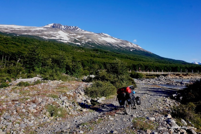
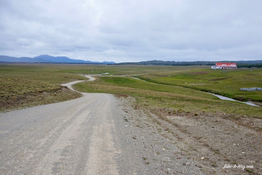
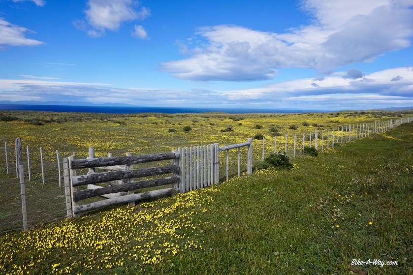
Lago del DesiertoThe one and only road between the Argentinean and Chilean border.The swamp you’ll have to cross. Luckily, there are a few river crossing before and after this, so your feet are wet already, and you’ll get a chance to wash of the mud off later on.
Camping on the ‘road’ between the Argentinian and Chilean immigration.
I wake up at 6 am. I’m about one kilometer from the pass and the official border. Just before this border, there would be better camping opportunities on a nice grassy field.
Crossing this border also means my seventh Argentinian / Chilean border crossing this trip, and also my third crossing of the Andes range.
The Chileans luckily made a ripio track up to the border, which makes the going a lot easier. It’s again a glorious day today and looking back, I still have some sights of the back side of Mount Fitz Roy in the distance.
Despite the many photo stops I take, I still arrive with the Chilean border guys down at the lake around 9:30. It seems I’m just in time, as a small boat approaches the jetty at Candelario Mancilla, as this place is called.
The Chileans have constructed a nice ripio road at their part of the border.They even construcred bridges, so no more wet feet.
Eventually, I still got a nice view of the back side of Mount Fitz Roy, seen here from the Chilean side.First views to Lago O’Higgins.
I’m the only person present, but soon seven other cyclists and a bunch of hikers descent from the campground which lays a bit above the jetty.
The Captain told me today he doesn’t do any glacier trips, as he has to bring some solar panels to a farm further down the lake.
He’ll be back around 2 pm to bring us to the other side of the lake.
Apparently, the boat is allowed to take 16 passengers only. We are eighteen people. Everybody seems to have their own reason to justify why they could board the ship instead of others. Even those (most of them) who had a booking for the other company which doesn’t run. They were stuck here since five days already. The weather was too bad on this side of the Andes to run the boat.
A group of five French cyclists seems to be really arrogant about their ‘right’ to take this boat. The female part of an Austrian cycling couple starts crying a bit, and suddenly they earned their right to be on board as well. Emancipation, equality and feminism only go that far apparently…
As the boat doesn’t make a trip towards the glacier today, and the captain promised to do another run tonight around 7 pm, I decided I did not want to be part of this unsympathetic bunch for a few hours on a small ship and instead enjoy the local scenery a bit longer on this side. A French hiker kindly gave up his place on board as well, to make space for the crying Austrian girl. The male part of this Austrian couple asked me ‘What currency do you pay in Belgium ? ….’
I thought I heard it all in my life, but apparently ….
The little boat that takes you in a bit more than two hours to the other side. The crossing at the middle of the lake was very, very rough, this little boat rolling and pitching to all sides.
Needing a few ‘real’ rest days, I pitched my tent a few kilometer outside Villa O’Higgins. Luckily, the weather was bad, So all the more reasons to stay in the tent to read and rest, without having the feeling I should be on my bike 🙂
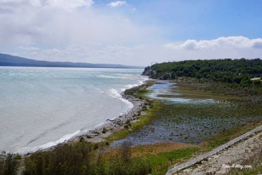
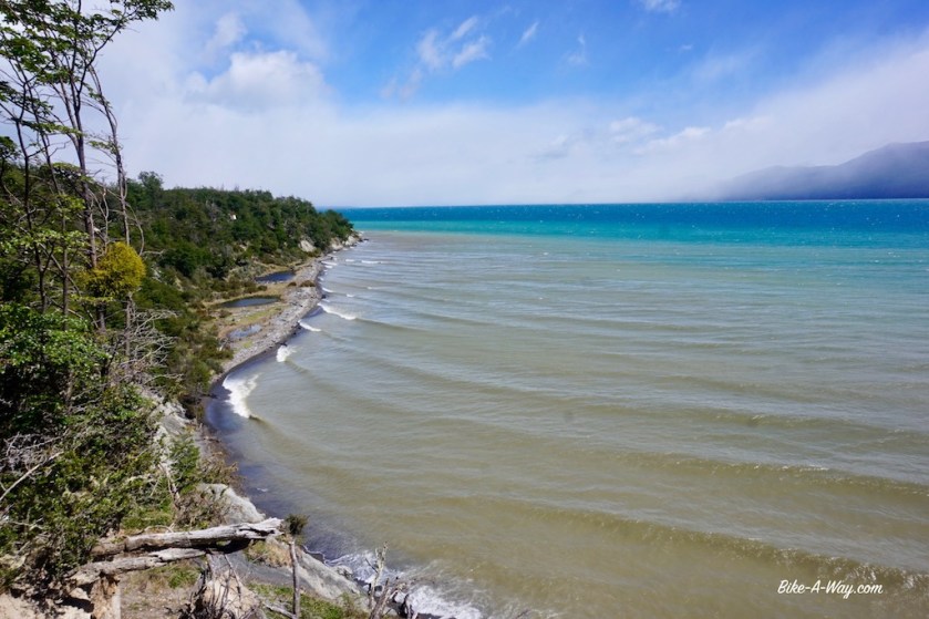
O’Higgins Lake is called San Martin Lake on the Argentinian side of the border (Both O’Higgins in Chili and San Martin in Argentina were important independence heroes for their country, living and fighting at the same time as the famous Bolivar ).
The lake has a very irregular shape, with eight arms, four in each country. With a maximum depth of 836 meter, it’s the deepest lake in the Americas. The lake’s surface is at an elevation of abt. 250 meters, which means the bottom at some parts is at almost 600 meter below sea level !
The lake is fed by multiple glaciers of the huge ‘Campo `de Hielo Sur’, the Southern ice Field.
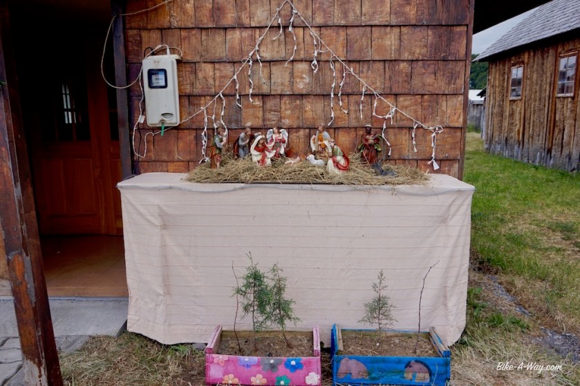
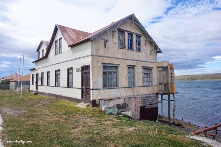
Villa O’HigginsThe Christmas stal at Villa O’Higgins.
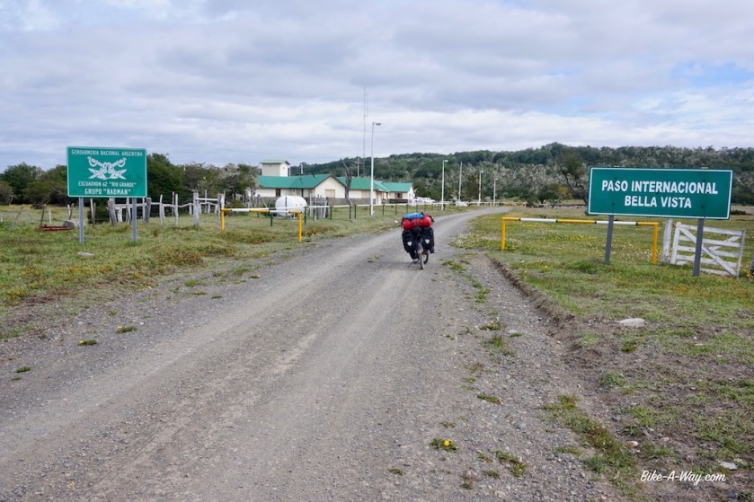
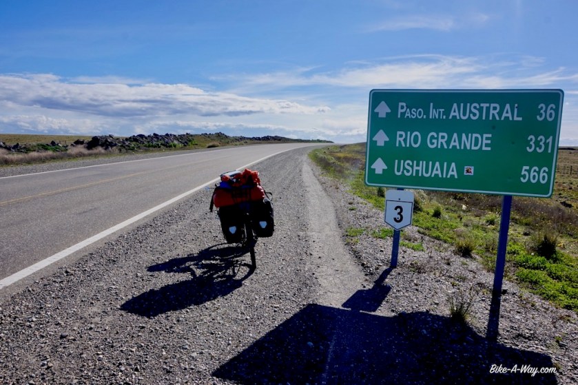
Route: Ushuaia – Tolhuin – Rio Grande – Radman – Cameron – Porvenir
Being at ‘The End of the World’, I now turn my wheels 180 degrees and cycle back towards the equator and turn my back to Antartctica. A good feeling.
I slowly made my way out of Parque National Tierra del Fuego back towards Tolhuin, stopping briefly in Ushuaia to buy provisions. A couple had a chat with me in front of the super market and I was asked for an autograph for the first time in my life. I camped a night before the Passo Garibaldo at an ‘designated free camping area’. As was to be expected at a place like this, it’s littered with empty plastic and glass bottles , plastic bags, toilet paper, tins, food residues and the corps of a dead dog.
Humans…..
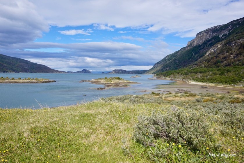
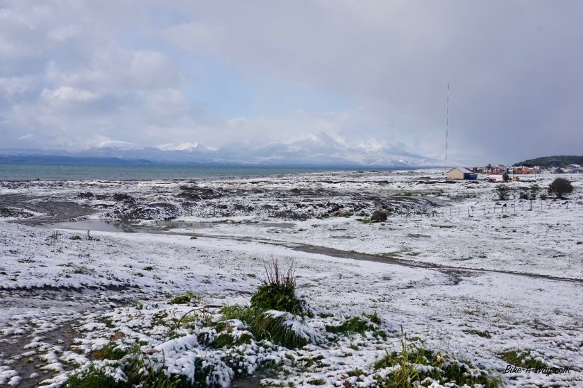
Parque Nacional Tierra Del FuegoCerro Guanaco. The trail up the mountain was closed due to snow.Isla Redonda in the Beagle Channel
Bahia Lapataia, where the road really, really ends.
The Beagle ChannelHousing at the outskirts of UshuaiaAnd of course, the obligatory picture 🙂
Before reaching Tolhuin, one can take a small ripio road that leads through a forest along the banks of Lago Fagnano, Tierra del Fuego’s biggest lake. There are several nice spots to pitch a tent. Better to avoid the weekend, as it’s also a place where local people come to bbq, which must come along with drinking, throwing empty bottles around and car stereo’s at maximum level, arriving and leaving cars with removed sound reducers.
Today, I got sunshine, two snow storms and lots of wind.
Santos Travelmaster, mastering the art of travel @ Lago Escondido – Tierra Del Fuegolago FagnanoLago Fagnano – the bad weather fast approachingUntil onmy minuts later I was in a snow storm.
I stayed a second night at the Casa de Ciclistas in Tolhuin. On my way down to Ushuaia, this was the place where I met the first other cyclist since Trevelin. Bad night of sleep this time. I shared the room with an Argentinian young cyclist who was one of these guys who prided himself on “spending no money at all” (which basically means living on everybody else’s back). He stayed everywhere as long as he could ‘for free’. He was already three nights in the Casa de Ciclistas. I think he stays everywhere until they kick him out. He doesn’t buy anything in the bakery, but goes asking old stuff for free. His main diet is eating the leaves of the Dandelium. Even cows don’t eat these leaves.
He also rings at farm houses along the road and asks if he can ‘buy’ some food, counting on the fact they’ ll give it for free, etc, etc, etc…
Then Gerard arrived. A 70 year old French guy on a recumbent bike. He looked very fit and has a great tour coming up. But …… Gerard snored louder as all the Mirages jets from the French army combined.
After a sleepless night, I retraced my steps into the interior of Tierra del Fuego. First I had to do 20 more horrible km on the busy RN 3 with it’s speeding madmen, brainless drivers.
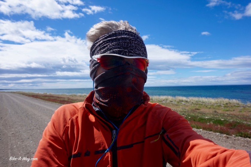
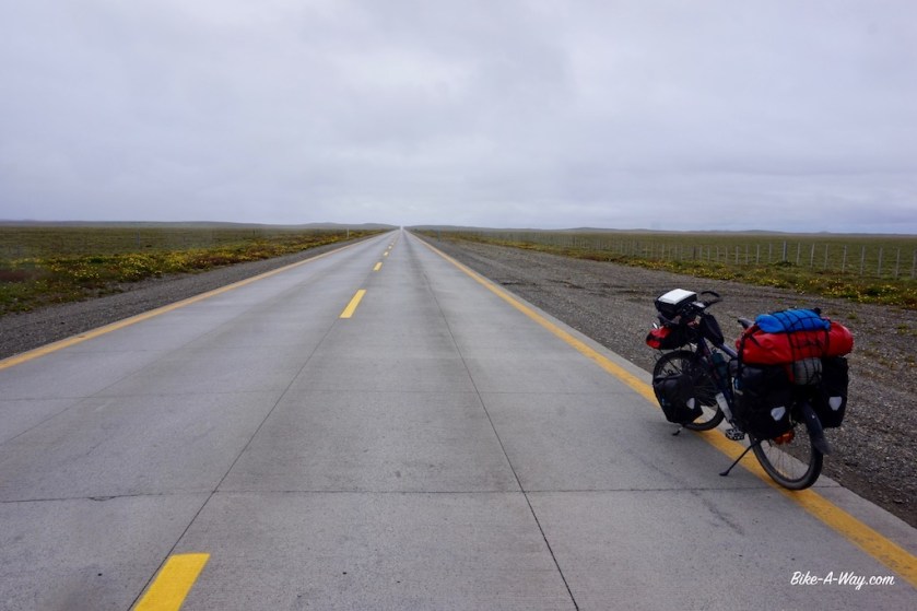
Once I was on the ripio road RP 18, it was quiet. Except for the wind. Again, I was into riding single digit speeds all day. I was freezing to death when I was speaking to a friendly German couple in their Mercedes Unimog who travelled the length of the American continent the last four years, I was sweating, battling in my rain gear against the wind, I am producing two liter of snot a day in these conditions, which is damn annoying to get rid of, wearing thick gloves, but …. I was having a hell of a great time, as I was where I wanted to be and I could look around to these small trees with there special forms, overgrown by liches, listening to the wind, or to some music sometimes.
All that in stark contrast to riding the national roads in this country, where one has to watch his little rear view mirror 75% of the time in order to avoid being killed.
Gerard, 70 year old French guy still going very strong.
28/11/2017
The sun came out yesterday evening and the wind got down completely all night.
The days are getting long this far south as summer is approaching. Sunrise is around 5 am and it sets a bit before 22:00 hrs.
By the time I got on the bike again this morning , the wind was out in full force again. I stopped at Estancia Los Cerros to replenish some water. After the estancia, the road makes a 90 degrees bend, and so does the wind. It’s again a very, very hard day in the saddle. The short cut I was hoping to make near estancia Ruby, north to the road that leads to the Radman / Bella Vista border was fenced of, which was a disappointment because now I had to make the whole detour via RN 3 again. I pitched the tent about 10 km before RN 3 near the edge of the forest.
Sleeping another night under the Belcanto trees.
29/11/2017
Can you believe it !?
After battling the last 100 km against the wind from Tolhuin to come down here, I’m starting today with a tailwind. This is terrible news, because after only 9 km, I’m turning on RN 3 to do some shopping on the outskirts of Rio Grande, before make a more or less u-turn on the ripio road west towards Porvenir. Turning west, so again against the wind.
There will be no possibilities to buy any provisions for the next 350 kilometer.
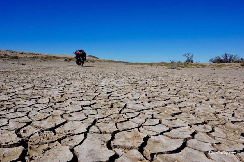
I filled up my water bottles at the police post at the corner of RN 3 & RP B. The dirt track goes up and down all the time between 20 & 95 m asl. Nothing too bad but there’s this one constant, that brutal, violent head wind. Just like the two previous days, I manage to cycle the 60 km I planned to do but I am completely, and I mean completely exhausted by the end of the day.
The dirt tracks RP 9 & RP 18, just south of where I’m now are going through forests, but now I’m in completely barren land again. Not one single tree. Grasland with not a single bush growing higher than 30 cm. No shelter, not to take a break for lunch, nor for camping.
I first tried to pitch my tent today after 57 km in a gravel pit. The first spot I saw today that could give the tiniest bit of wind break.
After inserting the second pole in the fly sheet, I just couldn’t hold it anymore. The tent was like a parachute. No way it would hold out a full night. I stuffed it back in it’s stuff sack and continued cycling again.
It was passed 7 pm already.
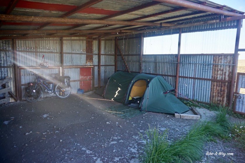
On my gps, I saw there was a river a bit further on, but I had zero hopes there would be some trees along it over here. But again, I was so lucky this time. I saw it from the hill top already. Just before the river a small shed. I could only hope that one way or another, I could enter it.
It appeared to be a solid corrugated iron structure, three walls, open on the lee side. I think it’s used to shave the sheep. Perfect flat concrete floor, and 100% sheltered from the wind. It felt like the Hilton to me.
Outside were some wooden beams I used to pitch the tunnel tent on the concrete floor. The storm was banging the walls of the structure violently. Made a nice vegetable curry with a heap of rice. Fell asleep by 9:30 pm. I’m back to nights of 11 hrs of sleep.
30/11/2017
It required all my courage to leave my perfect shelter this morning. It was a great day though, blue sky and reasonably warm. From the first meter, I battle against the storm again. It’s like constantly climbing a high col. For the last 200 km, and the col will go on for another 300 km.
At km 44 and 52, there are small ‘forest’ where it would be good to camp.
At km 56, there’s an abandoned house where you could probably sleep. I spend the night in a small chapel, about 5 kilometer before the border. I still had a lot of vegetables and sausages the Chilean customs would take from me, so decided to spend the night before the border.
A nice German couple traveling in a Jeep decided likewise and showed up in front of my chapel just as I was reading a bit in the sun.
I covered 37,73 km today. That took me 4 hours and 24 minutes of riding time, which is at an average speed of 8,57 km/h. Says enough, I’m afraid
But ! It gives me a lot of time to look at the landscape. Only two cars passed me today.
Oh, I saw my first two condors today. Biiiiiiig !!!!!
One of the condors that suddenly flew over me. Look at the tree in the corner to appreciate the wind force.
The little chapel where I spent the night.
01/12/2017
The formalities at both the Argentinian and Chilean side went without problems. I wasn’t even searched this time by the Chilean customs. They wouldn’t have found anything. I carry no fruit, vegetables, honey, meat, dairy products, nada. All that’s left to eat the coming days is in powder form or in tins.
If needed, it would be possible to sleep inside at the Argentinian border post. They’ve got some sort of ‘recreation center’ there. You can take water as well.
There’s something strange going on at the Argentinian side of Tierra del Fuego.
All the cattle in the field are bulls. Everywhere bulls. no cows.
Normally it’s the other way around and you only rarely see a bull.
Outside the Chilean border control, I opened my passport to check what stamp they gave me. I forget the Chileans always put a little paper inside which you’ve got to present at the next border post. A wind gust blew the paper away, to the other side of the road. By the time my bike was on it’s kick stand, the paper was behind the fence I had to climb now in front of the immigration. I ran through the field behind my paper until I was almost back in Argentina.
The winds are crazy.
When you want to eat a cookie, by the time your hand reaches your mouth, the cookie is blown away and you end up with just a few crumbs between your fingers. The coffee you’re trying to drink is blown out of your mug.
My clothes are literally being blown apart.
Today was a tough day again. I didn’t make the 60 km I should have done.
Made 56,20 km far today, and I rode a little way back when I was on top of a hill and saw the trees stopped for a while. It took me some time to clear a space in the forest, which was full of fallen trees, branches and thorny bushes I had to remove. The little saw on my Swiss Army knife comes in very handy here. I’m pretty good sheltered from the hard wind, which makes a lot of noise in the trees just above me but doesn’t really impact the tent.
I always liked forests a lot, but since Patagonia, I love them.
I fail to understand why so many people find it boring to ride for days on in the forest, like f.e. in Scandinavia or Canada. I really like doing that. The trees give you shelter from the wind if it blows hard, from the sun if it burns, the forest smells good after it rained, but it smells good as well when it’s really hot, it makes it easy to hide away for wild camping, there are a lot of animals you can spot. It’s also much cooler in the forest on really warm days.
Anyway, I think there’s not enough forest in Patagonia and Tierra del Fuego.
A hard days work, and I managed an average speed of exactly 10 km/h today. Better then yesterday, but I’m here in my tent, totally wasted.
02/12/2017
What a super day I had today.
Normally, the wind quiets down for a while overnight, but last night it just continued on and on. But the tent was perfectly sheltered. I woke up again to a blue sky, took my time in the morning, as usually and hit the road by 11 am.
Near Russfin, I washed my clothes in the river. The weather was good enough to have them dry by the evening. The stretch between Russfin and Cameron is the most beautiful part so far, coming from RN 3 (from RN 3 to Tolhuin is equally beautiful). I ride through long valleys, going up and down. Good camping opportunities between km 81 and 79.
I entered the village of Cameron to replenish water. Although it’s a village of moren then 200 people, there ‘s no kiosko, no panaderia, nothing. The village is at a beautiful bay, sheltered between some hills, but they managed to make it an ugly place, and are continuing to make it uglier with the new houses they’re building. I don’t understand, if they’re building something new, why they can’t make it a bit nicer.
NOW you’ll understand Patagonian winds.
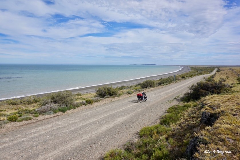
I reached the ‘Bahia Inutil’, the huge bay in the Strait of Magellan. The English wanted to make a port here, but because the water is so shallow, they called it ‘Useless Bay’. Nowadays, they would send in some dredgers and make it useful.
From Cameron …. I had a tailwind !!!
The gravel road meanders along the bay, up and down over the hills. So beautiful. the sun shines, temperatures of 16 degrees. The only thing missing to make the day really perfect, is some good, spicy Thai food and a beer.
About 20 kilometer before I reach the penguin station, I start to look for a place to camp, but it seems I missed my chance. Nothing there that would give sufficient shelter in case the weather turns bad overnight. The wind blows straight from the Cordillera Darwin and picks up over the bay here, so can get pretty violent.
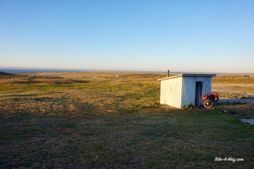
Just before the penguin station, there’s a sheltered place in the downhill on the right side near Estancia 3 Hermanos. There’s also an emergency shelter on the left side, in which I retreated.
Should’ve pitched the tent instead. The bed in the shelter is terrible.
03/12/2017
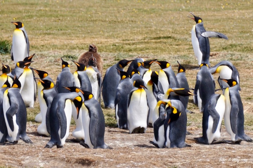
Went to the penguins first thing in the morning. The penguins here at the tip of Baja Inutil are the King Penguins. With their average height of 90 centimeter, they are the second largest penguins after the ‘Emerald Penguins’, which are only found on Antarctica. The King Penguin lives here, in the Sub-Antarctic. With 126 units and a few new borns, this is one of the smallest colonies on earth. There are about 1,5 million King Penguins on earth. Much larger groups live on the Falkland Islands, Sandwich Islands, some Islands south of Tasmania and New-Zealand and the biggest group, about a million, lives on South Georgia, a bit to the east of the Falklands.
It are very funny creatures to observe.
The brown hairy ones are the new chicks.The chicks seem to be suffering from “the heat” 🙂
Morning and first half of the afternoon, the weather was brilliant again, even really warm. I had a head wind again, but it wasn’t hard. Just outside the ‘Pinguïneria’ I had a nice long talk with three Germans traveling in a mini-van. I also had a talk with an Italian motor traveler, a group of an American & three Italians and a Dutch-Italian couple. A very social day today 🙂
Traffic really picked up from the Pinguïneria, which resulted in a much more destroyed ripio road with a lot of washboard and loose gravel.
As always, you can imagine which direction I was cycling…
4/12/2017
Man, man, man, how did I suffer today.
Where I had yesterday an easy day with only a very light headwind, and the day before even half of the ride a tail wind, today it was full head on again. Many times I couldn’t go faster then 5 km/h on the flat and I had to push many an uphill. I averaged 9,14 km/h on a 41 kilometer day.
The wind blows strait from the Andes, over the Strait of Magellan into my face.
The views were good, but nothing too spectacular. Much less traffic, probably because the ferry between Porvenir and Punta Arena doesn’t run on Mondays.
Pitched the tent in a field. I’m not very happy with the shelter I have, so fingers crossed for a quiet night…
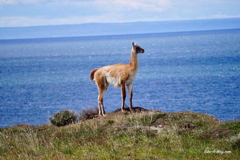
Guanaco at the edge of the Bahía Inútil
5/12/2017
Once I left the little canyon where I pitched the tent, I realized it was much better sheltered as I anticipated. The wind was torturing me all the final twenty kilometer into Porvenir. The road seemed to go up and down endlessly.
Arriving in Porvenir, 450 out of the last 470 km have been on ripio.
Here, I take the ferry to Punta Arenas, leaving Tierra del Fuego island after 25 days.
From Punta Arenas, I’ll find a way to get to El Chaltén or directly to the Carreterra Austral at Puerto Yungay.
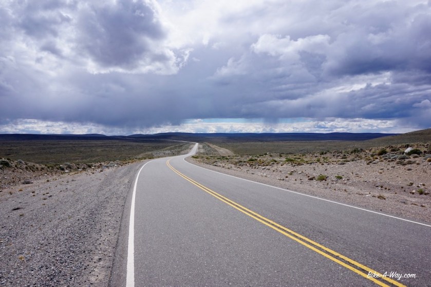
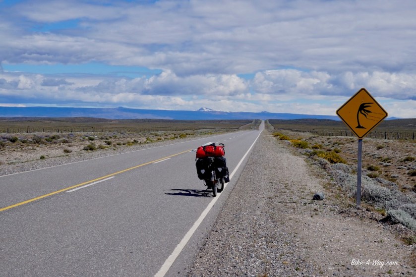
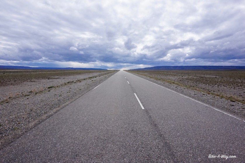
I’ve been riding over 5.000 km in South-America now, of which a couple of thousand against relentless head winds over the pampa, without shelter for me or my tent.
While places like Torres del Paine, Perito Moreno Glacier and Mount Fitz Roy should be highlights, in the course of the last weeks, I was dreading more and more the prospect of going there.
The roads between these place are busy with trucks heading to and from Punta Arenas and with the brain death car- and especially minibus drivers for the tourists between these places.
Driving into Torres Del Paine would undoubtedly be a magical thing, if I wouldn’t have to be concentrated 150% all the time on the road, watching my rear view mirror every other second to check on upcoming traffic. Concentrated on the road, i.o. on the landscape. I spoke with several people in Ushuaia and also the last days near the Pinguinerïa. Tourists who told me they were in Torres del Paine last week. They tried to make reservations for the campsites four weeks in advance. All but one were full already.
So that was over 5 weeks ago. I don’t stand a chance of finding something, and when I heard there stories of congested ‘hiking trails’ with actual traffic jams …. no, that’s not my thing.
I would hate every single second of it. I don’t make reservations months in advance to pitch my tent somewhere and I definitely not going to stand in line to see a mountain like I’m in Disneyland. And it seems that what’s this region has become: the Disneyland of the Andes.
That may be highlights for people who are transported down here by plane or in buses, but I’ll find my own highlights on quieter, more genuine places.
The bizar entrance to Porvenir
14:00 hrs. The ferry leaves Porvenir with only a few minutes delay.
Once we leave the sheltered harbour and enter the Strait of Magellan, you feel the forces of the wind and the waves on the ship’s hull. We can’t be more then a kilometer or so on the Strait when the Captain announces the port of Punta Arenas is closed due to the strong winds and we have to return to Porvenir.
I felt that gale all morning and find it strange the ship left at all. I guess they contacted Punta Arenas only after we departed.
I saw another freighter taking our place at the only ramp in the little harbour, so I’m curious whether we’ll go on anchorage, or that ship will have to leave again.
Swinging the vessel in the Strait of Magellan felt like a dangerous operation. We had to turn 180 degrees and took full wind now, and getting in the current. The ship was rolling heavily left to right. Fantastic !
I was keeping an eye on where to swim to in case we would capsize and wondered whether I would be able to swim back to the shore in this ice cold water. I doubt it. I’m already freezing in an outdoor swimming pool in summer in Europe.
But I needn’t swim; we entered the port again all right.
The little freighter was send back to anchorage and we could come alongside.
Most passengers left the ferry and drove the long detour to Punta Delgada, where I crossed last month on Tierra Del Fuego. Hopefully for them, this much shorter crossing will be operational.
An hour after we were back in the port, the Captain announced a new departure was scheduled for 19:00 hrs. Many passengers were gone already. Two rather fat and older ladies in their late forties came to sit next to me. Like many of these people that are gifted with the talent to sleep anywhere at anytime, they soon dozed off. One of them snored like a pig, with her mouth wide open. I stared at my Swiss knife…
At 18:00 hrs, it was announced the weather was still to rough, and earliest departure was foreseen for 07:00 hrs the next day. We were send ashore, not allowed to spend the night on board. The little harbour is five kilometer outside Porvenir, and I didn’t feel anything to cycle back there, get up the next morning at 4:30 am in order to leave the hotel by 05:15, to arrive back in the port by 06:00 hrs (when you apparently needed to get your ticket stamped with a new date). The little terminal ashore remained open, which I shared with a fat Chilean guy who missed a couple of front teeth. He snored like a mammoth.
Tierra Del Fuegoan Iron Maiden fan.
Around 22:00 hrs I saw how our ferry went adrift. The ropes couldn’t hold it anymore. They tried to lower the anchor, but to no avail. The vessel took full wind from the side and was blown to the opposite shore rapidly. They managed to get control just in time and bring the ship back to the quay.
The departure next morning was again delayed from 07:00 to 08:30 hrs, but then finally, off we went. This is an old Greek ferry, built for the Mediterranean. I wonder whether it is suitable for crossings on the rough Strait of Magellan, more than 35 kilometer wide between Porvenir and Punta Arenas. Crossing the Strait took about two hours.
I spent only a couple of hours in Punta Arenas, which actually seemed to be a rather nice town. The bus company didn’t make any objections on me carrying my bike on the bus. Riding that road between Punta Arenas and Puerto Natales, I was glad I wasn’t cycling it. Too much traffic.
Route: Punta Delgada – Cerro Sombrero – San Sebastian – Rio Grande – Lago Yehuin – Tolhuin – Ushuaia
I’m on Tierra del Fuego. Dreamed about that a long time.
Before the finalization of the Panama Canal, the Strait of Magellan was the place were the Pacific and Atlantic Ocean met and through which most of the marine traffic came.
Apparently, the Strait itself belongs to the Pacific Ocean and the whole strait belongs to Chile.
The island Tierra del Fuego is half Chilean, half Argentinean, so I have to cross borders a couple of times.
The name Tierra del Fuego is used for a whole archipelago of islands, of which Isla Grande is the biggest, with an area of 48.000 km2 it’s 1,5 times bigger as Belgium.
At the end of the afternoon of my first day on the island, I entered the little ‘town’ of Cerro Sombrero. The camp ground is closed, because they’re messing around building some kind of ugly dike. But I was lucky a friendly citizen spontaneously offered me to pitch my tent in his garden. There’s a brand new tourist info, with a very qualified guy working there and spotlessly clean toilets and showers.
@ Cerro SombreroThe cold and windy Macadam road out of Cerro Sombrero
A bit out of Cerro Sombrero, the island becomes a bit hilly. A welcome change for the flat steppes I travelled through the last weeks. It’s a wet and windy day and I was told there’s nothing until the border post at San Sebastian.
But look, in the afternoon, just as I’m leaving the hilly terrain and enter the flatlands again, I see a building along a road, the ‘Hotel Tierra del `Fuego’.
Excited I put my bike against it and enter the building, but there’s nobody to welcome the guests. It’s a one room hotel only, so I thought “maybe they come along in the morning”.
The room clearly wasn’t rented out yet, and I don’t think it’s the kind of place you can make reservations for on booking.com. First come will get it, so I prepared myself for the night.
Laying down there, I saw all the holes in the walls. Would locals shoot at the walls, like they sometimes do with traffic signs ? It wouldn’t be nice to get a bullet in my ass overnight. Hearing the wind picking up outside, I didn’t have much of a choice then spending the night in this hotel, so I hoped for the best.
The center of Tierra del Fuego is a bit hillier, and nicer.
This Argentinian guy was pulling a cart of 120 kg. He started at Bahia Lapataia, 25 km west of Ushuaia and intended to visit every provincial capital of Argentina, before continuing north (to Alaska ?). And sometimes I think I have a hard life 😉My hotel ‘Tierra Del fuego’ which saved me from a terribly windy night in this barren pampa.
Next day, I had to battle hard again against the storm, but there were good prospects. 25 km down the road, I ‘m gonna turn left, towards the east, and have it in my back. The wind blew me quickly towards the border post at San Sebastian. It’s still a dirt road here, but they’re building a macadam road, so you should be fine in the near future. There’s a hostel and a very small kiosko at the Chilean site of the border.
To my surprise, there was a long line of people waiting. A bus with backpackers and they have to take all their luggage out of the bus and it has to go one by one through a scanner.
I got a special treatment, was stamped out and waved through without any checking or problems.
Thanks Chilean officials ! 🙂
The Chilean site of the border at San Sebastian
It’s about 10 km to the Argentinean immigration. That bus only caught up with me just before I arrived, and I made a lot of photo stops, so that must be a hell of a bus ride, coming from Punta Arenas, crossing border 3 times. That’s why that bus rides takes 12 hours I guess.
I was stamped back into Argentina without a problem and had the Atlantic ocean in sight again.
I read many stories of cyclist who end up sleeping in a room at the Chilean border. The room is their, I saw it, but it’s not gonna be quiet.
Better ride on, because after the Argentinean border, once you’re along the coast, there are some nice camping spots between the hills.
Near the road RN 3, between San Sebastian and Rio Grande. I got enough shelter from this small ridge. Atlantic Ocean in the background.
Coming this way, I had no choice but to enter Rio Grande, quite a big town on the Atlantic side of the island. It’s hell. It looks like hell, it sounds like hell, the traffic is hell.
I limit my stay to a visit of the local Carrefour and try to get out of this place a.s.a.p.
Simpler said then done, with the road works going on.
About 15 km south of Rio Grande, I turn inland, on dirt road nbr 9 (road ‘F’ on older maps).
Instantly life is good again. After a few kilometers, the trees re-appear.
Brilliantly beautiful trees with lichen.
Somewhere aong the first kilometes on this dirt road, I pass the 25.000 kilometer mark of this trip.
I jump a fence and find a nice camping spot.
Camping on a grassy spot, between trees, but open enough for some sunshine; that’s perfect.
This crane was blown of the trailer at the top of a hill outside Rio Grande.A grassy wild camping spot, sheltered by trees, a bit of sun, a book to read …. life is good.
I ride another two days on these roads, going from one hill to the next, taking a small road down to the ‘Lago Yehuin’, often described as ‘the center of Tierra del Fuego’.
There’s an abandoned small holiday resort (completely in ruins) and some grassy fields where you could camp if you like.
All the graffiti on the walls suggested the place is frequented by stupid idiots from time to time, and the wind was blowing in from the lake, so I went on a bit further to find a good spot where I sure would be on my own for the night.
‘Southern Crested Caracara’. They are not shy and love to tear the plastic sacks you pull over your saddle at night. Then start picking your saddle (because it’s salty from sweat ?)
I have been incredibly lucky the past weeks with the weather.
Sure, I’ve had my fare share of head winds, but the temperatures have been above 20 degrees with lots of sunshine. Now, however, it’s changing and I end up taking shelter under a barn for an hour.
Trees full of Guido Belcanto hair
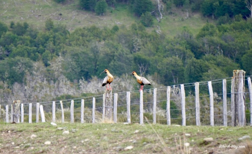
‘Buff Necked Ibis’, you see them often here
Soaking wet, I arrive in Tolhuin, a place famous among cyclists in South-America.
The bakery ‘Panadería Unión’ is also a Casa de Ciclistas, and virtually every cyclist riding down to Ushuaia stops here.
And so am I 🙂
All afternoon, evening and the next morning I stuff myself with the delicious things they’re baking here.
The sleeping room at the bakery in Tolhuin.
The Paso Garibaldi is the last main obstacle between Tolhuin and Ushuaia.
The weather at the other side of the pass is so awful I quickly dive into a field and pitch my tent on soggy ground.
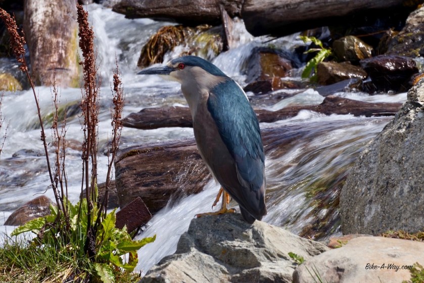
‘Black-Crowned Night-Heron’Just as I missed the 25.000 km mark on my odo-meter outside Rio Grande, I also missed the 3.000 km marker of RN 3. But this one will do nicely.Lago Escondido (the ‘Hidden Lake’)
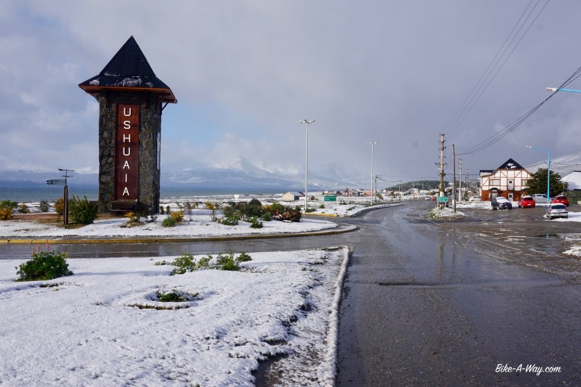
Then, on 17/11/17 I arrive in Ushuaia, the southern most city in the world.
I started this trip on 16/4/16. I have to keep in mind to make it to important points on easy to remember dates.
After crossing the Strait Of Magellan, I ‘m now cycling along the Beagle Channel, this other famous maritime route, unbelievable.
What’s also quiet unbelievable, is the harsh conditions in this place.
Ushuaia is located at 55 degrees in the southern hemisphere. In the northern hemisphere, you ‘d be at Copenhagen, which has a much milder climate.
Last year, I was standing with my bike at the North Cape, only 2.102 kilometer from the North Pole and well within the Arctic Circle, while I haven’t passed the Antarctic Circle here and I’m almost double as far from the South Pole (3.926 kilometer).
BUT, Ushuaia is only 1.000 kilometer from Antarctica, which I guess will be one of the reasons for the extreme weather here.
That weather really turned for the worst during my first day. Instead of 20+ degrees days, I now have temperatures just above freezing, lots of snow, rain, storm. Local paved roads are being washed out. A submarine disappears. I hear the trails in the National Park are closed because many trees toppled over.
So, lucky to be warm inside the hostel for four days.
Not being a ‘hostel-guy’, I do have to say I enjoyed my stay in ‘La Posta’ Hostel. It’s a bit outside of the center, but it’s spotlessly clean, modern and with a descent breakfast and slow wifi.
But wifi is slow everywhere in Argentina.
Beagle Channel
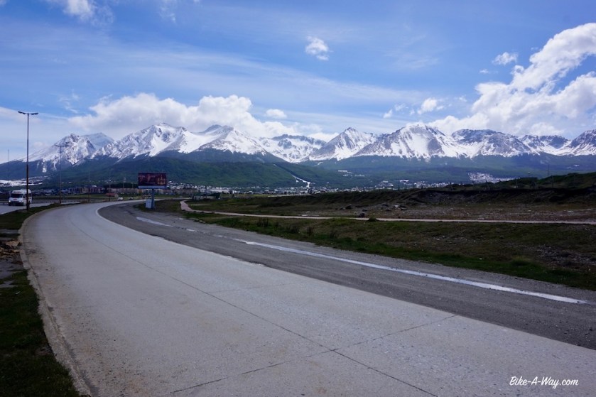
The mountains above Ushuaia.
Buenos Aires – Ushuaia
Distance: 4.511 km
Average km per cycling day: 64,44 km
Altimeter: 32.868 m
Route: Gobernador Gregores – Comandante Luis Piedra Buena – Rio Gallegos – Monte Aymond – Punta Delgada
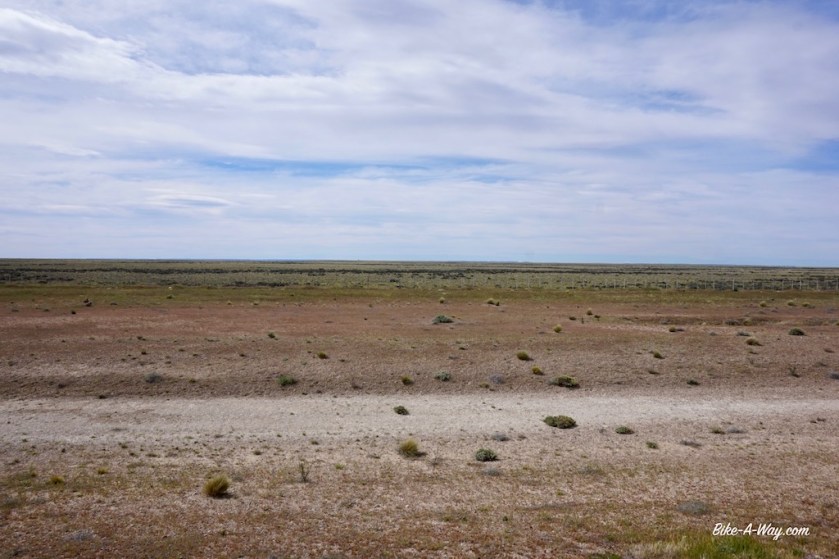
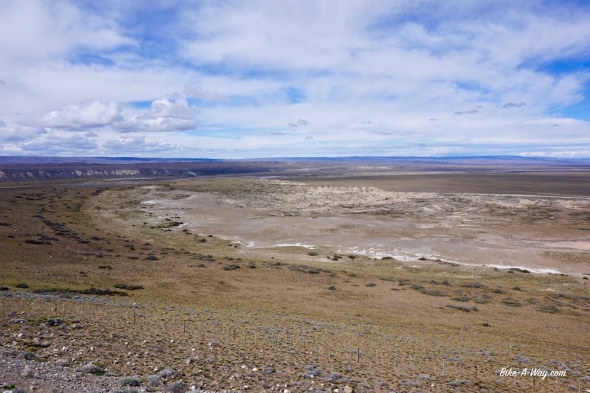
I decided to leave the Ruta 40 and take road nbr 27 towards the Atlantic coast to visit another national park. The first 60 km are really beautiful in the valley of the Rio Chico with some spectacular shaped hills. On my left side is the ‘Gran Altiplancie Central’ which I’m descending now. That Altiplancie isn’t that ‘alti’ by the way. On my right (southern) side is again a steppe like landscape. I can imagine the winds going like hell here, but today it’s quiet and sunny. About 6 km before the junction of ruta 27 and 71 the road goes a bit down into a valley. I unload the bike to lift everything over the fences and push the bike a whole way into the valley to find a fantastic spot for the night. Heaven after yesterdays hell at the campground in Gobernador Gregores. The full moon is out, I’ve got a few birds singing, some geese and a few horses in the distance. Don’t know if I’ve got puma’s as well. People keep warning me about them. But people are afraid of everything nowadays.
I complained about all the fences before, but here I see for the first time they use barb wire, for which I see no reason (to keep sheep inside ??? – no barb wire needed). At several points, I saw guanaco’s who didn’t make it and must have suffered a horrible, long and painful death. And again … for what reason ??Brilliant camping spot.
Two days later, after another night camping in a gravel pit, the entrance into the little town ‘Comandante Luis Piedra Buena’ must be the dirtiest entrance to a town ever. They’ve got an open garbage dump in the valley just outside of town. With the Patagonian winds, everything blows around kilometers wide, all the way onto the hills, garbage everywhere.
Disgusting.
I only stop in town to buy provisions and head down south on highway 3.
My view all day long to the left of the road. To the right, it’s identical 🙂There were two death dogs at the gravel pit, obviously killed, which was fine by me because they didn’t look like friendly chaps at all, but I could smell them even down below in the gravel pit.This gravel pit was quite deep, but still a lot of wind in here.
After 27 kilometer, I arrive at the park headquarters of Monte Leon. The park rangers were gone already but there’s a notice at the door. It claims the park is closed because part of the road into the park is washed out.
Excellent news !
It being a Saturday, I was afraid there might be groups of people, bbq-ing late into the night, screaming and shouting as they like to do here.
Now I would have the park all for myself and very quiet.
They’ve printed two pictures under the notice. Yes, it’s clear, you can’t pass by car.
But I saw no problems for a bike.
The actual road into the park was a few kilometers further down RN 3.
As they closed the fence, I again had to unload the bike and lift everything over it, like I have to do almost every night in order to pitch the tent somewhere.
From the main road, it’s a 20 kilometer ride down to the coast.
The little wash outs could be repaired in a day I think, but apparently they don’t do it.
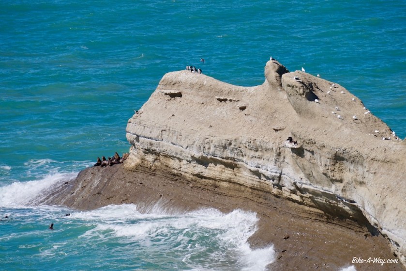
After a very, very windy night, I first go and have a look at Monte Leon Island, with thousands of seagulls and cormorants. Then I cycle to the point where you can see the sea lions.
I just mounted the bike again when a motorbike approaches me and stops aggressively. A guy in a green uniform, obviously a ‘guardaparque’ shows his dissatisfaction of me being here. I play dumb a bit, but nothing to do about it, I have to leave the park. A whole explanation of ‘seguridad’ and that blablabla that’s always used nowadays to restrict people of doing anything.
He literally follows me on his motorbike, but I calmed him down a bit, explaing I came from the other side of the world, especially to see this beautiful park.
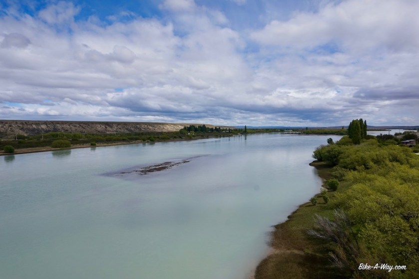
The milky white Rio Santa Cruz at Comandante Luis Piedra BuenaAlong the dirt road in Parque Nacional Monte LeonP.N. Monte LeonI’m back at the Atlantic Coast.
If I have to believe the signs, the park must be teeming with pumas. Every trail had a sign warning you shouldn’t enter alone (apparently puma’s only attack loners ?). A bit hard, when there’s no one around.
Monte Leon island, full of sea gulls and cormorants.
The sea lions. You can clearly see the big male.
It’s a slow ride, as I have to climb onto the plateau again. After a few kilometers, we arrive at the track that’s going down to the penguins, the reason why I’m here, so I give it a shot and ask the guardaparque whether he doesn’t feel like visiting the penguins ?
A big ‘NO !’ haha.
Back on RN 3, There’s a strong north wind which blows me quickly down the road. Unfortunately, it becomes a side wind later, but pitching my tent that evening along the borders of the Rio Coig, I had 142 kilometers in the legs. Not much protection from the wind here. I found some bushes that were a bit higher then the average 30 cm scrub growing here, but it sure was a beautiful place to spend the night.
The huge valley of the Rio Coig. Nothing but scrub, no real trees for protection against the wind.I pitched the tent behind the biggest (thorny) bushes around for kilometers. But they gave good protection.Nice couple. The road was full of their death friends.
In order to avoid a night in Rio Gallegos, the capital of Santa Cruz province, I stopped at the campground 25 kilometer west of town at the bridge over the river, in Guer Aike. It’s a reasonably quiet place, so good for a rest day. Last days, I had excellent weather, temperatures mid twenties and mostly a tail wind.
Getting close to the Falkland Islands, known as ‘Las Malvinas’ in Argentina.
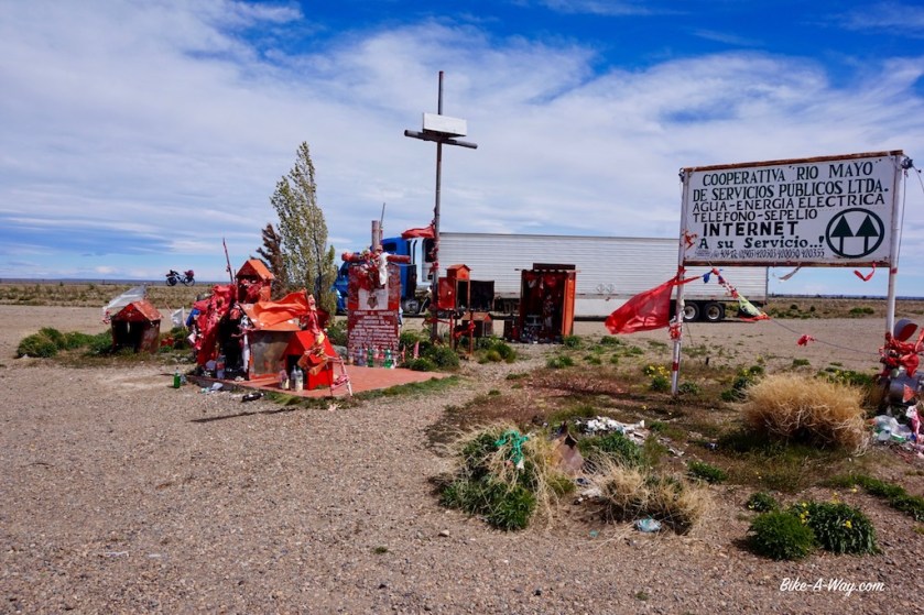
Shrine for ‘San Expedito’, my protector 🙂
Rio Gallegos is bigger, louder and uglier as expected. After buying provisions and a few near death experiences because of the total idiots driving around, I leave town. Luckily, a few kilometer south of town, the road becomes quiet again. I pushed on towards Laguna Azul, a crater lake about 9 kilometer north of the border with Chile. I pitched the tent down in the crater, next to the lake. That’s a descent of 55 meter into that crater. It’s so steep I have to unload the bike and go three times down and back up again to gather all my stuff. And get up a fourth time after pitching the tent to make pictures of course.
Getting nearer and nearer.The crater lake ‘Laguna Azul’, the ‘Blue Lagoon’. No Brooke Shields however, of which I’m glad. I’m not waiting for an angry Andre Agassi next to my tent.Beautiful pitch inside the crater.The lake hasn’t stolen it’s name. I was hoping a bit for warm water inside this volcano but it wasn’t meant to be. Ice cold.
A brilliant spot to spend the night, but I estimated I’d need at least two hours to get my bike and stuf back to the rim the next morning. Again I had to travel four times up and down, but every time you make a step 30 centimeters up, your feed sinks down 20 centimeter in the loose gravel, so in fact you climb it each time three times.
Allas, after an hour I was up. In the nine kilometer to the border, I ate an apple and three carrots, as you’re not allowed to bring those into Chile. This border region is pretty beautiful, with extinct volcanos on both side of the road.
For one or the other bizar reason, I didn’t get an exit stamp from Argentina, but the Chileans made no problem stamping me in.
After the border control, I soon see the Strait Of Magellan. There’s a tiny grey line on my map, right next to the Strait, and I decide to leave the main road for this one. Now, I’m riding a few meters away from the Strait of Magellan, what I find a magical experience. This strait with all it’s history, but also the knowledge that I’m riding my bike right on the southern edge of ‘The America’s”. Sure, there’s still Tierra del Fuego further south, but that’s an island. This is the far end of the American mainland.
After sleeping in a crater yesterday, I’m pitching my tent tonight pretty close to the shores of the Strait.
The famous Strait of Magellan, separating Tierra del Fuego from the American mainland.
It was a Belgian, Roeland van Brugge, who was the first person of the Magellan expedition to see the Pacific Ocean. Together with a few other guys, Roeland van Brugge was send ahead in a dinghy to check whether the Strait was a dead end or not. They checked several bays and in the end, Roeland climbed a mountain and could see with his own eyes that the Strait ended in the Pacific. That mountain is known to this day as ’Monte Campana de Roldán’.
The ripio road along the Strait of Magellan
The weather Gods punished my early stop yesterday with a strong head wind today. But never mind, that early stop was needed, because my desire to sleep one night next to the Strait of Magellan was too big. And I needed to make bread.
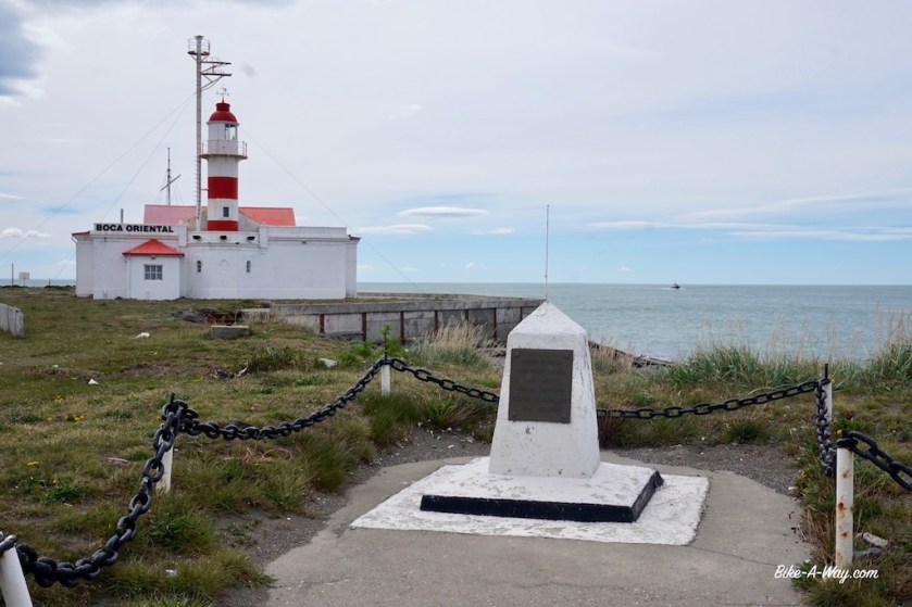
I took the ferry across the Strait at Punta Delgada and left the American mainland behind, towards Tierra del Fuego.
Fire Land ! Magic ! 🙂
The end of the road at Punta DelgadaLighthouse at Punta Delgada
Route: Gobernador Costa – Rio Mayo – Perito Moreno – Gobernador Gregores
I stayed at the municipal campground in Gobernador Costa. I first inquired whether they had showers. “Sure”, the man who received the camping fee said, and he showed them to me. When I went for a shower, undressed …. no water of course. Still, the man didn’t lie, there were showers.
I dressed and went to his house. Only an older woman, probably his mother, was there. I explained the situation as best as I could.
She gave me the keys to another building, in the middle of the campground. There were showers as well, she said.
The woman didn’t lie. There were showers. But no water.
I gave up, washed my self at the little sink in the first building. As a little revenge, I washed my clothes under the sign which forbade you to wash your clothes, and hung them on the woman’s cloth line.
The real strong wind had eased down a bit the next day, but is was still blowing considerably good and, and from the northwest, so in my back.
Despite starting at noon time only (updating website in the Ypf gas station), I had my biggest day so far in South-America, 135 km.
Traveling this far, meant I traversed a whole latitude on the map in one day on the bike, namely from S44°02 to S.45.04. It must have happened before of course during my travels, but it’s the first time I’ve noticed it.
Traveling at this speed, the landscape which my guidebook describes as ‘boring’, is actually rather interesting. I’m crossing the ‘Pampa Apeleg’ here, flat land overgrown with tiny bushes and see to my right the Andes in the distance, some other hills closer by to the left.
At Los Tamariscos, about half way between Gobernador Costa and Rio May, you can get some extra water.
I pitched the tent in a gravel pit, which only slightly protected me from the wind.
I continued to have a super strong tail wind for another 50 kilometer, till the junction for Comodoro Rivadavia and Rio Mayo. I wanted to go in the direction of the latter and descended towards the river. Great camping spots between trees here if you want. I just stopped to have lunch.
Climbing out of the river, I cycled for 30 centimeter. As I made an almost 180 degrees turn, I had that strong wind bang in the face now. Nothing to do than to push the bike out of the valley. Even more winds when I was out of it.
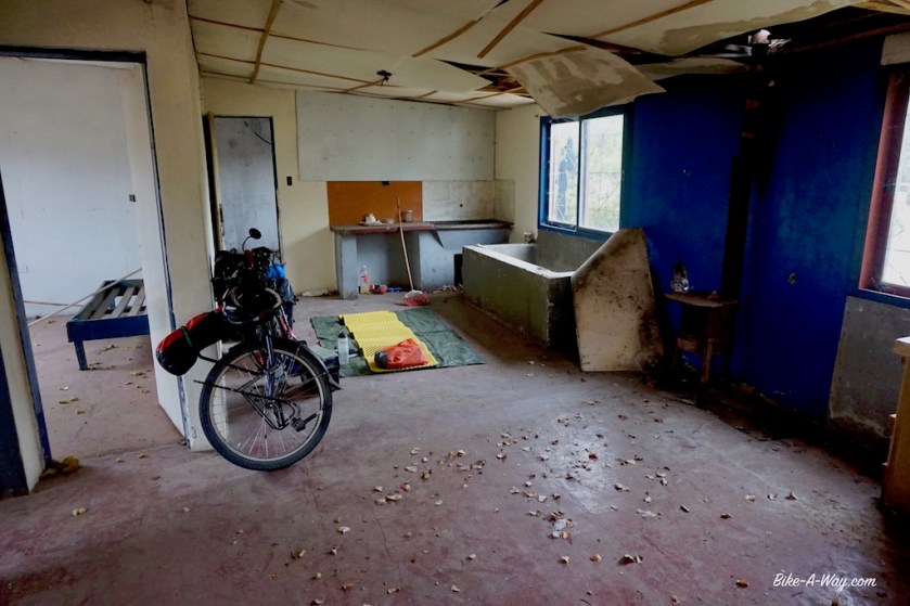
I looked down at the river, the trees, the gras in between ….. what the heck, I had a long day yesterday, and pushing against this wind is ridiculous. I went back down to look for a place for the tent. But that wasn’t even necessary. There’s an abandoned bungalow which I, after sweeping it out a bit, made mine for the night. When I heard the wind blowing in the trees and banging some loose metal part of the bungalow, I was pretty glad to be inside.
‘Ceferino Namuncura’ another Argentinian Saint or something. They offer water bottles to him. Plenty of water bottles.Gauchito Gil is here as well of course.I guess hanging a clothes line equals claiming the property.Inside, the place was in decay, but I swept out my little corner of the place, so it was good for a night.
The wind blew severely all night. Only between 6 am and 8 am it was a bit quieter.
I aimed for an early start the next morning, as the wind tends to pick up during the day. I half succeeded, as I was on the road by 9 o’clock, which is early for me. Pushing the bike back out of the river valley, it slammed me in the face as what seemed double as hard as yesterday.
I made an attempt to cycle, but that was ridiculous. Before I could even swing my leg over the saddle, I was blown back already.
Incredible these winds.
I pushed the bike, walking in the gravel shoulder of the road. I ‘ve got to stay off the road, because with this wind, you here nothing coming from behind.
After half an hour pushing, the odo meter showed I made 1,56 kilometer progress.
After an hour of pushing my bike against this constant wind, I was 3,1 kilometer from the place I’d spend the night.
Two hours into this ordeal, I managed 6 kilometer. At least, my performance was consistent.
After 19 kilometer, there was a little bend in the road. I have been pushing my bike 6 hour to get here. I’ve been blown down twice. One time, before I even realized it, I was sitting on my left knee with my bike on top of me, the saddle poking in my liver or kidneys or whatever is in that region. It’s hard to get up when you’re half under your heavy bike, and the wind is doing everything to press it down further on you.
I started calculating. I’m always calculating something on the bike. Most of the time my progress in percentages. To the end of the day, in case I have something in mind, or to a goal a bit further in the future, Ushuaia f.e., or what percentage of the mountain I climbed, ….
Now it were footsteps. Against this storm and pushing this heavy bike, my steps surely weren’t bigger as 50 cm, so that’s 2000 steps per kilometer.
That means around 38.000 steps in these circumstances the last 19 kilometer.
After this bend in the road, it was another 32 kilometer to Rio Mayo, which took me almost another 4 hours.
This day is in the top 3 of my hardest cycling days. And it wasn’t even cold or wet, so you can imagine.
I checked in a hotel for two nights. After 18 days of cycling, a rest day was needed.
The wind was still blowing after the rest day. It turned a few degrees further to the west as well, which is bad news, given the direction I was going.
A little climb out of Rio Mayo, then it became flat. I started cycling in 8th gear, but soon had to shift down to 7, then to 6, the speed going down accordingly, well into single digits.
A small curve in the road, few degrees to the right. It meant only a few degrees more into the wind.
Shift down to 4th gear. Speed, around 7 or 8 km/h. But I wasn’t complaining. At least I could cycle and made reasonable progress. Further small bends in the road slowed me further down to 6 km/h, or sometimes back up to 12 km/h.
It’s not cold, but still I have to ride with a merino wool shirt and my soft shell. Sometimes sunny, sometimes cloudy. Apart from the wind, excellent conditions.
Only …. I hurt everywhere. My thighs and the bottom of my feet from pushing the pedals so hard, my arms and shoulders from pushing the bike so hard the day before yesterday, my back, from this constant pressure of the wind, and also from pushing the bike, my cracked up fingers from the dry wind and the sun (and bad blood circulation ?), also my lips are suffering from these windy conditions. Even my ass hurts, which normally never happens.
In the afternoon, I’m passing the provincial border and leave the province of Chubut behind. I entered Santa Cruz, the southern most province of the Argentinian mainland (There’s of course still the island of Tierra Del Fuego south of that).
I’m riding in the ‘Pampa Verdun’ now.
I must say that after Gobernador Costa, Ruta 40 was quiet. The traffic thinned out even further south of the junction with Ruta 26.
This morning, I intended to ride 65 kilometer today, the half way point between Rio Mayo and Perito Moreno. There wasn’t anything in this wide pampa that would protect me a bit from the wind overnight, so I consulted my map. It showed a blue line, named ‘Canada El Puma’. The blue line suggested a river, but Canada suggest more like a valley, I guess. Probably it’s a thing that’s only flooded during heavy rains, butI hoped it would have trees in between which I would find shelter for camping. The only trees in this otherwise completely barren landscape.
But it wasn’t meant to be. The Canada was a valley, no water, no trees.
I went back up to where I came from. I saw a small dirt track going from the main road, along which I found a pretty good place, half sheltered from the wind.
A wind that died out after 10 pm. I should go cycle now !
But I missed too many nights of sleep in the past on my job, so my night rest is sacred now.
What does a typical day in the saddle look like for me:
07:00: Sunrise
07:00 – 08:30: Wake up slowly.
08:30 – 08:35: Release the air from my air mattress, forcing myself to get up.
08:35 – 11:00: Breakfast, relax, break up camp
11:00 – 17:30: Cycling (eating, make pictures, take a break, start looking for a camp spot)
18:00 – 20:30: finding a spot for the night, pitch the tent, make & eat diner, dishes
20:30: Sunset
20:30 – 22:00: reading book in tent
22:00 – 08:30: sleep
There are of course many other tasks I have to squeeze in this already tight schedule:
Maintenance of the bike and it’s bags, of my stove, my water filter and the tent (cleaning zippers), shopping for provisions, laundry, keeping website up-to-date, route planning, …
This guy has a front yard of 10 km ! 🙂
As a result of my long day out of Rio Mayo, I only have to cover 52 km the next day to Perito Moreno. The conditions haven’t changed and I’m still battling against side and head winds.
In the towns’ ‘Banco National’ I can finally get money from the ATM again. No other ATM south of Bariloche would give me anything (I didn’t try in El Bolson). The provincial banks don’t accept bank cards with a chip. All my cards, debet and credit have a chip of course. Even when you go inside the bank during opening hours, they can’t help you. The maximum amount you can take with your card is 2.000 Argentinian pesos. That’s a bit under 100 euro. The local bank charges you 107 pesos each time, so that’s 5,37% of the amount, apart from what your own bank might charge.
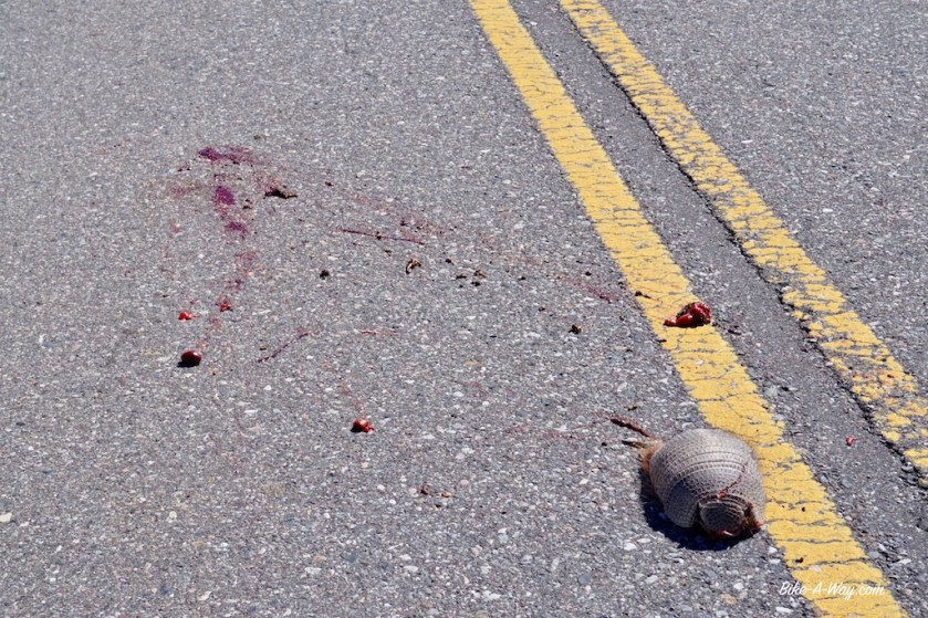
This guy was still alive 30 seconds ago. He was crossing the road in a nice straight line. A car came from the other side, and it’s driver must have seen him. If not, I pointed it out to him. But he didn’t slow down the slightest little bit and just smashed his head off. These guys run pretty fast, so if he slowed down 3 seconds, he would be alive. All this ‘accidental’ road kill is already sad enough, but here they do it on purpose. Just like speeding at centimeters from cyclists, while there’s no traffic coming from the other side. They just do it for fun. And after almost 3.000 kilometer here, I noticed these drivers actually do know how to veer around an obstacle. If there’s a pothole in the road, they can do it. I even noticed the concept of ‘anticipation’ isn’t completely alien to them. When there’s a pothole in their lane, and a car coming from the other side, they slow down a bit, so they can then go around the pothole. But not so for cyclists or animals. Their suspension is more important. Fuckers.Look at the letters on the door of this church…
I stayed the night at the camping municipal in Perito Moreno.
Terrible affair. There’s a loud engine somewhere out of the campground running very loud all night. Camping in these little towns is always a very loud and stressful affair. But camping spots aren’t easy to find is this windy pampa, therefore my choice.
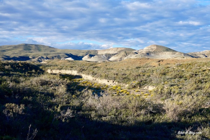
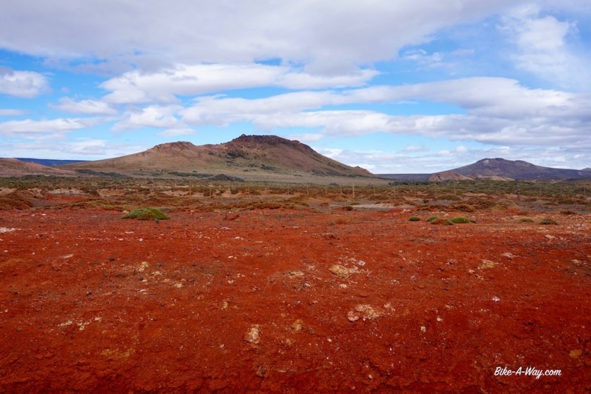
The next settlement, south of Perito Moreno is Bajo Caracoles, 130 kilometer away. Too far to do it in one day. After about 50 kilometer, the road starts to climb a little bit more, and I enter a beautiful area with colorful hills. There’s also an exit towards ‘Cueva de los Manos’ a cave full of paintings of hands. It’s a Unesco thing, but I ‘m not really interested of old paintings of hands. What would be interesting, is the ripio track to the cave, but I decide against it. If I ‘lose’ a day here, I’ll get into problems with my provisions.
There are many opportunities to wild camp in these colorful hills (jumping fences required). Also at Rio Pinturas wild camping is possible (but not as good as in the hills). It was still early afternoon so I decided to carry on a bit
Wrong decision of course.
At the next river, Rio Ecker is an estancia where you could camp, but no wild camping opportunities. Eventually, I pitch the tent 35 km before Bajo Caracoles, just of the road.
Weird skies
The landscape continues to be interesting, south of Perito Moreno.
The Rio Blanco carves it’s way through an impressive, wide valley. I’m sure many days of the year, cycling would be impossible here due to the strong westerly winds. But I’m lucky today, there is some head wind of course, but nothing too terrible and I make good progress. With ten minutes to spare, I arrive just before the siesta in Bajo Caracoles. Only to discover I hurried so much without reason.
There’s no shop here !
There’s just a gas station with a hotel and it’s bar sells some cookies, pasta and cans of tuna if you like.
I decide to take lunch. An expensive meal, where I got a big bone, with some white fat attached to it. After a bit of searching, I found a little piece of meat on it as well. I also had a carrot, a piece of corn, a potato and a steamed onion (??). Not much for the next stretch, which has no services and no villages for the next 230 kilometer.
When I leave the settlement two hours later, the wind has picked up considerably, but after climbing out of the valley, I had it in my back.
Ruta 40 is still a nice and quiet road here. Almost all trucks passing me are Chilean. I guess they provide Punta Arenas and Puerto Natales, two Chilean cities in the deep south that can only be reached by road via Argentina. The Chileans often drive these beautiful old American trucks, Kenworths, Peterbilts, Freightliners, Mack…
They always give me a lot of space as well.
Wildlife: What do I see along the road in this part of the world.
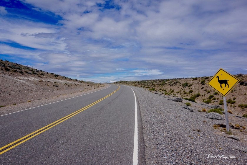
Well, often armadillos, lots of guanaco’s, nandu’s (Patagonian ostriches). That’s about it.
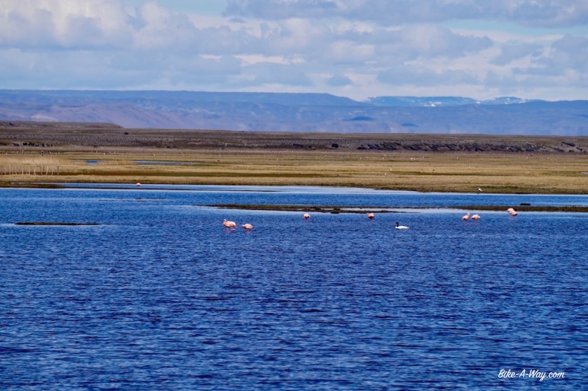
Oh, flamingo’s are here as well. I’m surprised to see them in this cold region.
The temperature during the day is between 12 and 14 degrees, but once the wind picks up from the west, it brings a cold chill from the Andes and it feels much colder. The nights are still very cold, but it hasn’t frozen lately.
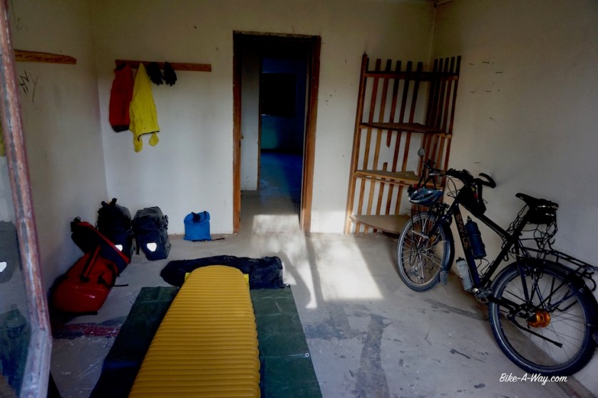
30 kilometer after Bajo Caracoles, I saw some abandoned buildings at the left of the road. It used to be the ‘Hotel El Olnie’. As the sun was out, I wanted to ride a bit longer, but such a nice opportunity to spend the night out of the wind, without pitching the tent … I couldn’t let it pass.
As I couldn’t buy any bread at Bajo Caracoles, I now had some time and a good place to make and bake some myself.
Even hooks to hang my clothes 🙂
I’d checked the internet back in Bajo Caracoles and knew it was going to rain today.
Not only rain, I was battling against the wind, always from the west/southwest, coming diagonally against me, battering me from the right. After 7,5 kilometer it started raining. Temperatures dropped instantly from 7 to 2 degrees Celsius. Soon I had it all, a mixture of rain, snow, hail. And wind. A pity I didn’t have a bit of sun as well. My progress was slow, and although I was all ‘Gore-Texed’ up, I was shivering.
Since years I carry a special balaclava for extreme temperatures with me. Today I used it for the first time ever. Nice and warm, but with this weather, your nose is running all the time, with only one way for the snot to go, inside the balaclava.
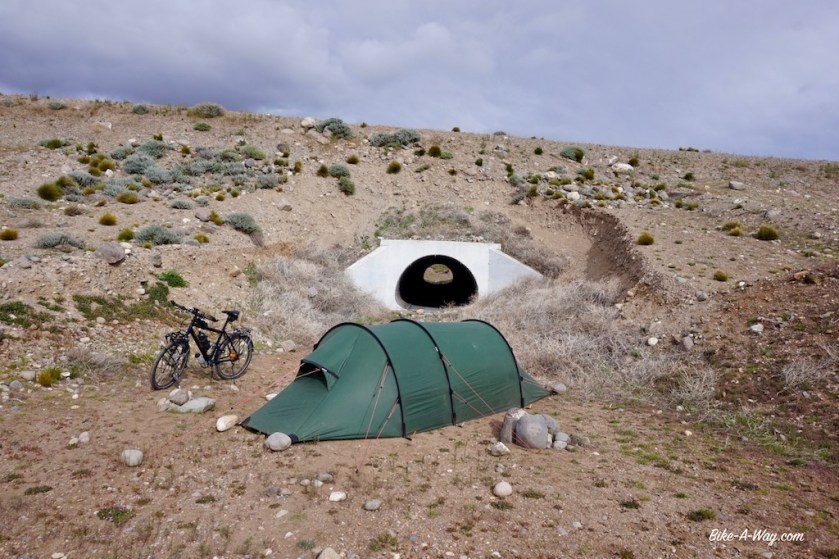
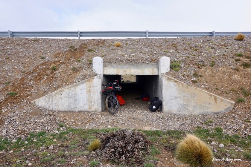
After 30 kilometer I took shelter in one of the drainage pipes under the road. They ‘re about 1,5 meter high and 1,5 meter wide.
The ice cold wind was blowing through it as well, and I put on more clothes. In many blogs I saw cyclists had spent the night in one of these pipes under the road, but I hoped I wouldn’t have to do that. After 1,5 hour in the pipe, the rain stopped and I continued my road, but only for a couple of kilometers, when the sky became black again, and I saw it raining a bit further in front of me.
Another pipe under the road.
I guess it’s my turn today to spent the night in such a thing. I laid out my plastic tarp, to protect my mattress and sleeping bag a bit from the mud and dust, put on more clothes and made a basic pasta. I don’t understand what’s happening, but it seems like I physically can’t cope with the cold anymore. Two degrees isn’t exactly tropical, but I was perfectly able to ride in colder temperatures in the past.
Now I lay with a pair of thin socks, a pair of thick merino wool socks and a pair of Sealskinz neoprene socks, merino wool long underpants, my regular long pants, 2 merino wool long sleeved shirts, a fleece, a down jacket and a woolen hat in my 850 cuin down sleeping bag, comfort rated – 14 degrees Celsius. Ok, apart from the little bare part of my face, I wasn’t cold, but what will I do when it gets really cold ??
Also the physical problems don’t improve. Both my thumbs have open wounds since six weeks. The other fingers heal sometimes for a few days, so the cracks aren’t that deep. Everything I do hurts: opening my Ortlieb bags, stuffing my sleeping bag in it’s compression sack; even just touching the screen of my e-reader hurts.
It’s not my most cozy night, in a windy pipe under the road, but better then having my tent blown to pieces on this barren pampas.
No wind protection to be found. I’m on the ‘Pampa del Asador’ now. Pampas, all with a different name, but they all look the same.
Try to imagine the winds blowing here. Now multiply it by x …I know the helmet looks funny, but the hood would just blow off without it.
NOT the nicest place to spent a night, but the only option in this open lands without any wind cover for the tent.
In the morning, I’m glad no water flew through my pipe. I’m early (for me) on the road, by 9:30 am. I’ve got to make some progress after yesterday’s short day. That wind still blowing diagonally from the right in my face.
But I have nice perspectives.
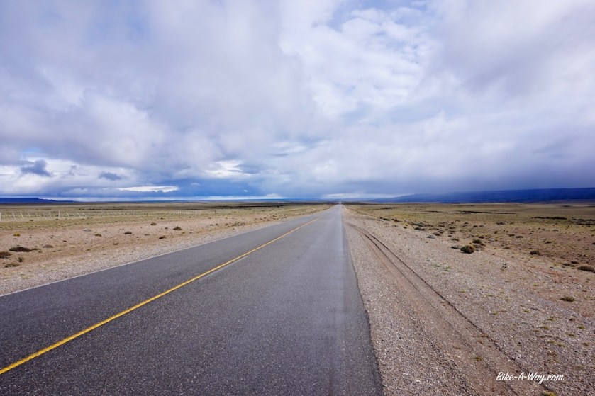
45 kilometer further down the road, ruta 40 makes a 90 degrees curve to the east, so I will have that wind nicely in my back.
I’m pushing and pushing the pedals and make actually acceptable progress. I’m counting down the kilometers. 30 km to go, 25 km to go, 22,5 km to go, I’m half way, ….
Then 4 kilometer before the bend in the road at Las Horquetas …. can you believe it ??
The wind made a turn and is now blowing in my face a bit from the left side. I’ll have it right back in my face after the road makes that turn to the east.
Unbelievable !
Push, push, push.
Las Horquetas. All guide books mention it’s nothing more but an abandoned hotel. It was a bit my goal for yesterday. But they are renovating the place, so you could spend the night there now, and I guess even get a meal.
I push on. I have to, if I want to make it to the next town with provisions tomorrow. And although I have the wind, against, it’s not too bad. I compare everything now to that day I had to push towards Rio Mayo. As long as I can actually sit on the bike and push, it’s ok.
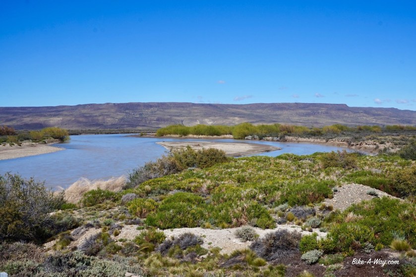
And how nice when the little plan you have in your head works out. On my map, I saw a bridge over the Rio Chico, 67 km before Gobernador Gregores and hoped there would be some trees and a place to pitch the tent. It even had some grass 🙂
And while I was pushing all day to stay ahead of rain showers that seems to be a few kilometer behind me, even the sun came out late afternoon. A much, much nicer end of the day then yesterday. Ooh, how happy I am to be in my tent. It still beats abandoned hotels, and sure beats drainage pipes.
This camping spot was so beautiful and quiet, and I had sufficient food, so I took a rest day here at the borders of the Rio Chico. The weather was brilliant. Apart from reading in the sun, I did a lot of laundry, cleaned my bike, brushed the zippers of the tent (yes, that’s necessary). In the evening I had two big owls next to my tent. This is also one of the advantages of traveling alone. You’re silent at your camping spot, so the wild life shows itself.
The ride to Gobernador Gregores goes through interesting landscape. First I travelled on a high plateau in a long bend along the Rio Chico, with fantastic views to the river and the many, many curves it makes here. Further on towards Gobernador Gregores I’m suddenly in a desert like landscape.
I was in a good mood today. For the first time since Neuquen province, about 2.000 km back, I could wear my hat again. Talk about arriving in town in style hehe.
Nandu’s. They are very shy and hard to photograph.
Gobernador Gregores has a ‘La Anonima’ supermarket, and that’s the only reason to visit this place. The camping municipal charges four times the price of other camping municipals. The camp ground is lighted better then a football stadium and like in every other Argentinian town, folks are driving around, and around, and around in cars without exhaust pipes all night long, without a brake. Add shouting people and barking dogs to that and it makes me wonder …. who likes to be in places like this ???
Tomorrow, I’ll be back ‘in the wild’.
(PS: There are good wild camping possibilities before you enter town at the left side of the road. Better use them).
At 10 pm, just as I was about to go to sleep, a guy with a big backpack and a guitar arrives at the campground. Damn, he’s coming towards me.
I don’t like backpackers with guitars.
Already meters away, his hand is stretched out towards mine, ready to great me, big smile on his face.
“The face of the fools”, I think to myself.
He introduces himself and I instantly forget his name.
“Musica ?”, he asks.
“No, gracias”, I say.
These guys really always think they are the one thing missing with there stupid tjingle-tjangle on their cheap guitar. As if the whole world is waiting for them to arrive and start ‘playing and singing’.
“I go to bed now”, I tell him.
It’s of course no coincidence he arrives just after 10 pm. Typical for these guys, sneaking in camp grounds ‘for free’, …
He doesn’t have a tent and slept in a very bad quality sleeping bag on a piece of cardboard against the toilet wall. He hasn’t moved yet in the last 1,5 hour when I write this the next morning.
I wonder whether he survived the cold night and if I should check on him.
I decide against it.
He could’ve b(r)ought a tent instead of a guitar.