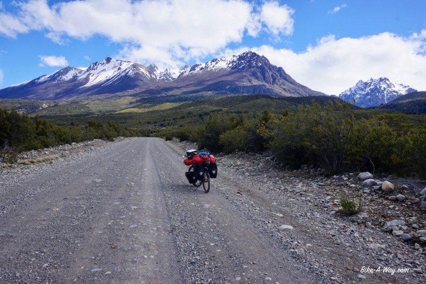
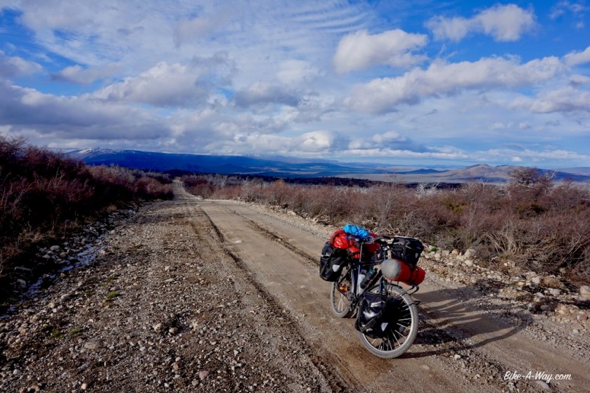
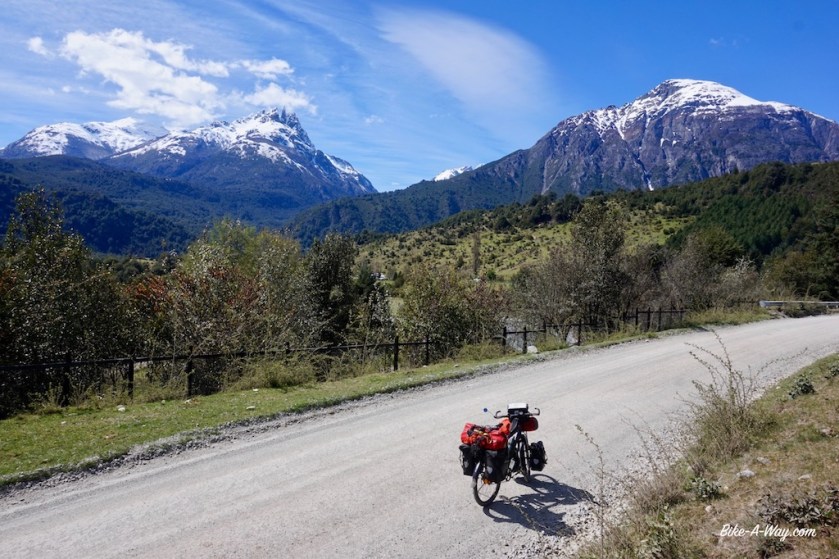
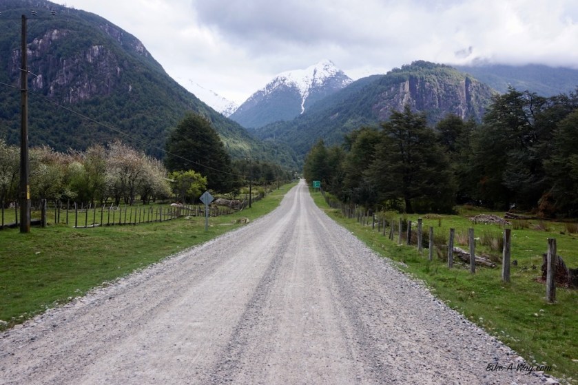
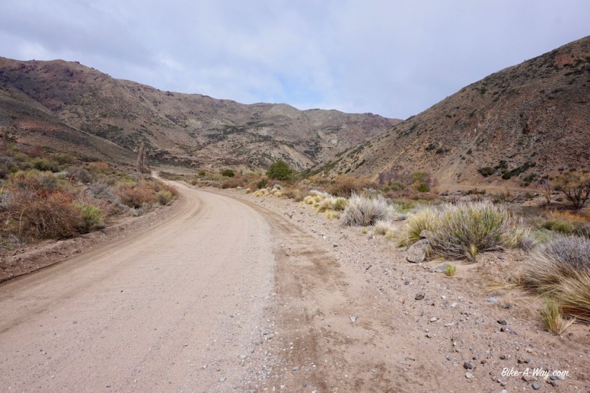
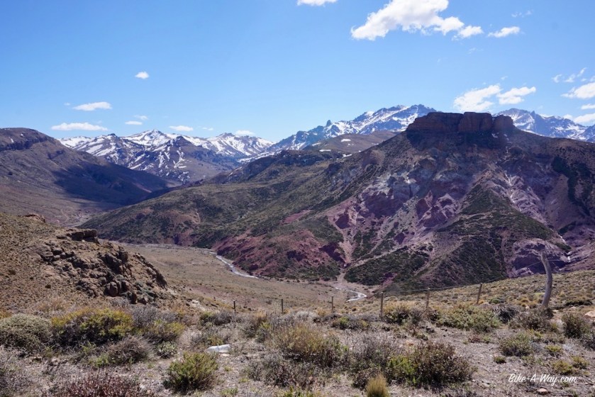
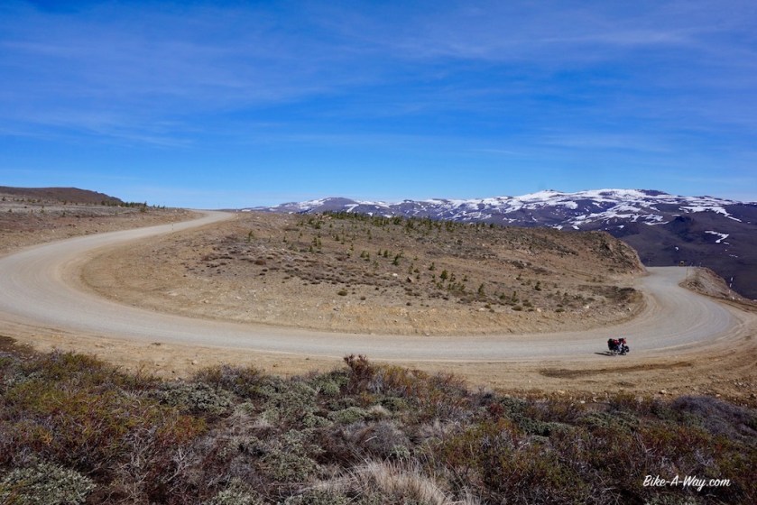
Leaving Corcovado on ripio road 44, I finally feel very happy in Argentina. It’s a much, much more interesting (and challenging) option as the paved main road Ruta 40.
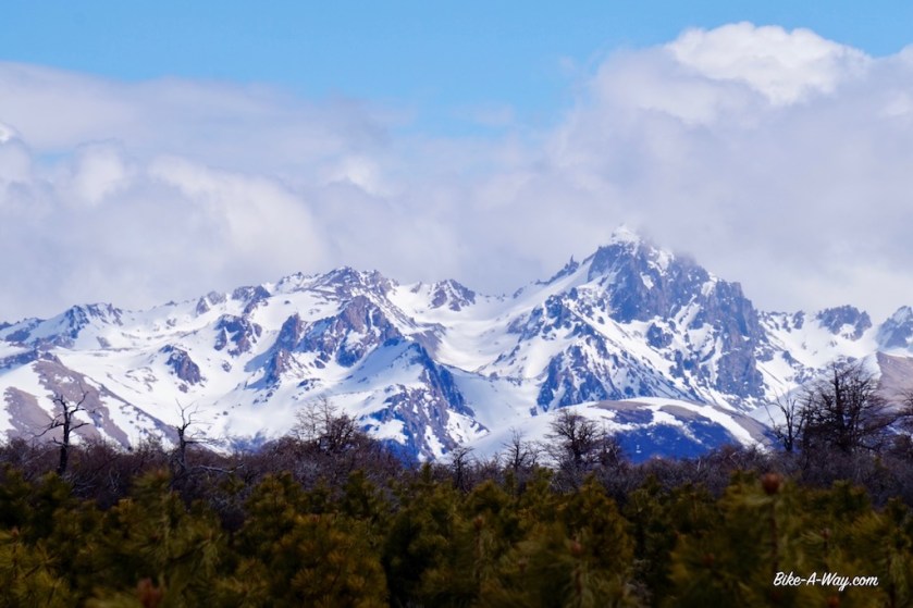
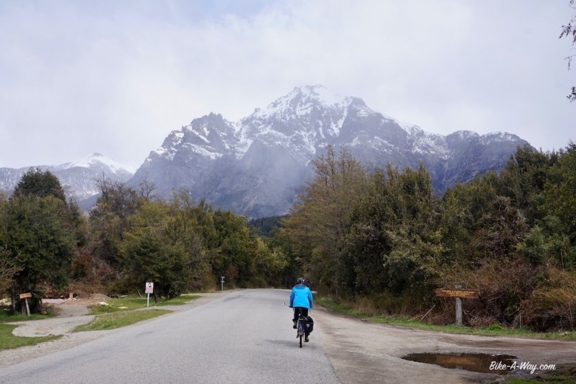
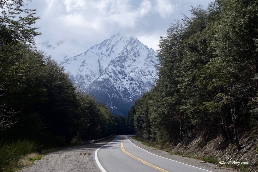
This is what I’m here for. A rough gravel road, no traffic, and mountains to the left and right. The range directly to the left is bathing in the sun, but snow and wet snow is being dumped on the Andean peaks to my right.
I’m in between.
The wind blowing from the north west brings some sparkles of wetness towards me, but never much. The weather is improving during the day.
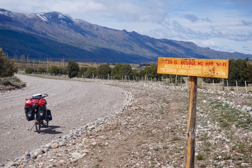
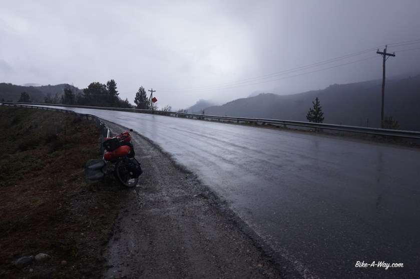
Looks rather wet up the mountainNo wifi, good !
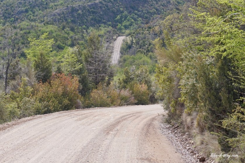
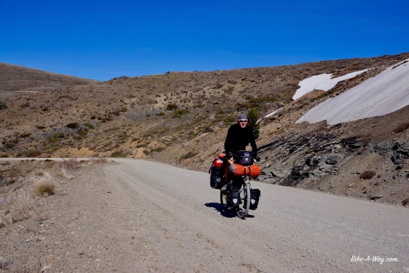
The first 20 kilometer are relatively easy and I start to think the two locals who warned me the road is difficult and steep exaggerated a bit.
But then comes the pass.
A Lance Armstrong podcast and Lady Gaga’s ‘The Fame’ and ‘The Fame Monster’ albums later, I reach the top.
I pushed my bike 80% of the climb. Nothing to be ashamed about. Pushing a heavy, fully loaded touring bike up this steep hill, the road consisting of big lose stones….. think not many people are up to cycling it all the way.
But it’s beautiful here !
Desolate landscape, not a sole in sight.
Only 2 cars passed me after Corcovado. That’s still 50% too much, but I can live with that 😉
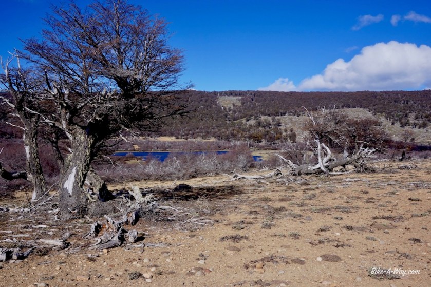
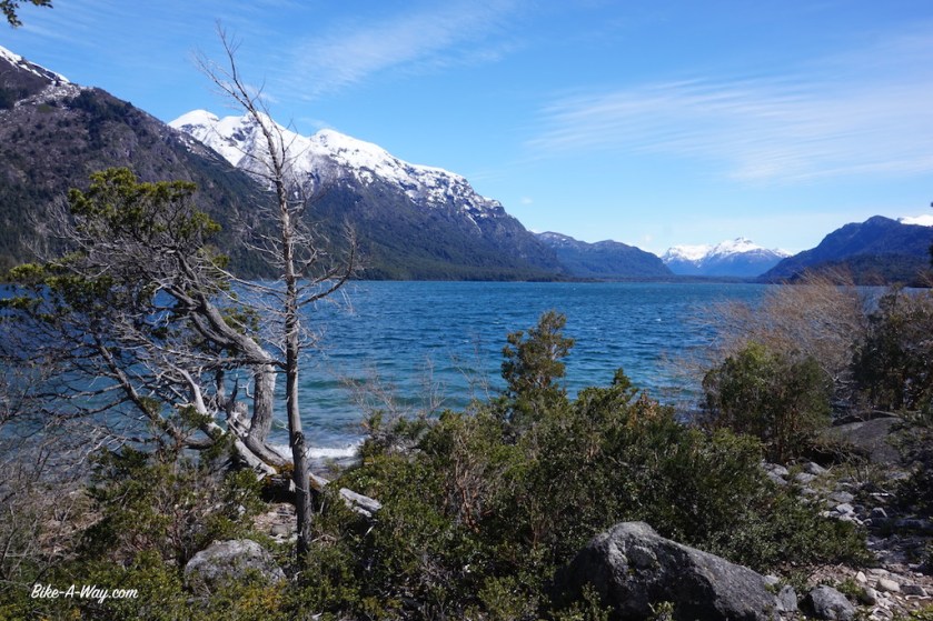
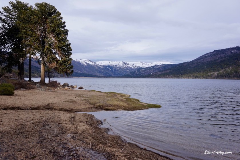
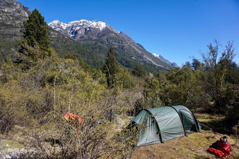
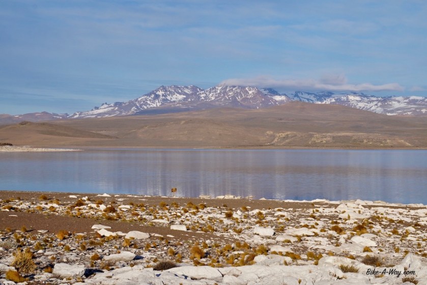
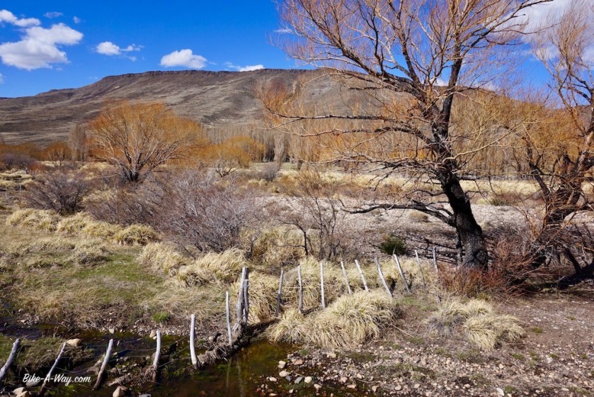
I camped near the Lago Guacho (yes Guacho, not gaucho), which was a bit further from road 44 as anticipated and made me plough through some snow fields, slush, mud and ankle deep water pools and had me made my bike lift over fallen trees.
I saw some old foot prints in the snow of only one other soul who’s been here after winter. It’s going to be a cold, but definitely quiet night.
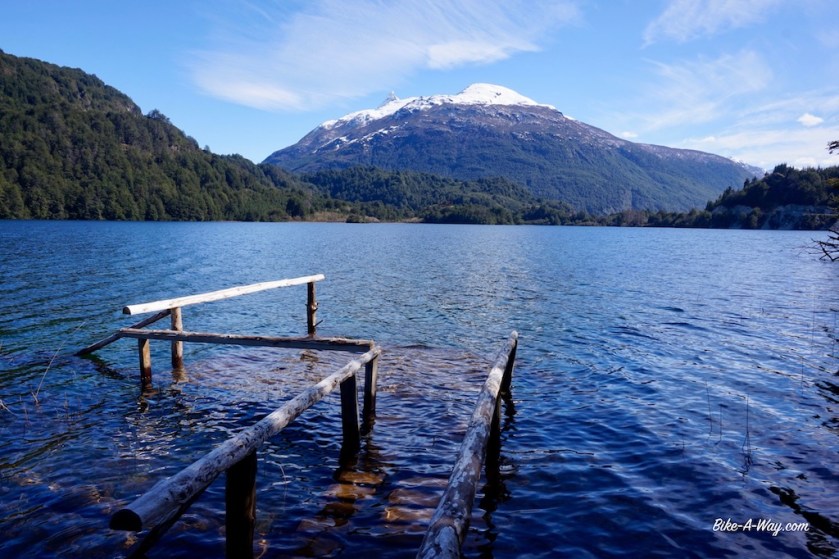
Lago Guacho
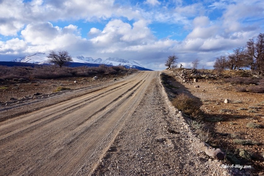
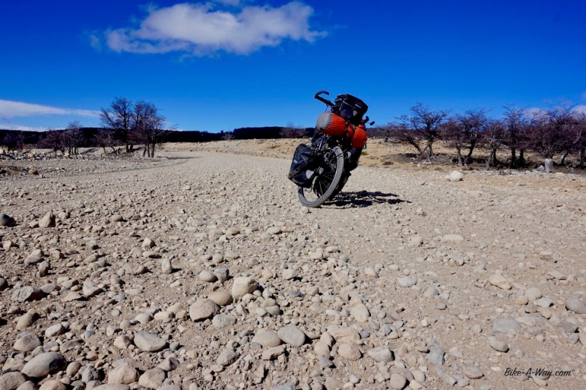
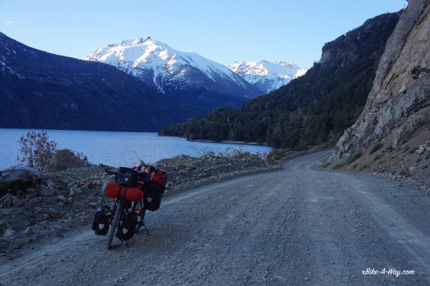
Next day, my progress wasn’t slowed down by a hard climb, but by the quality of the ripio road. Stones as big as fists thrown in loose sand. My bike is bumping uncontrollably from left to right, all over the road, gusting wind helping a hand sometimes.
Once I leave the large Lago Vintter behind, it’s blowing straight in my back, but still my speed mostly is about 7 or 8 km/hr on the bumpy, surface. I had to work real hard all day in order to have he next village, Rio Pico in reach the next day before siesta time.
The big stones, making progress slow, and torturing the bike and bags. My stove, my laptop, everything is torn apart by the bumps all day.
Today, zero cars passed me.
I saw nobody ! 😀
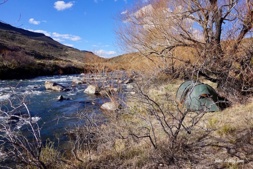
And I had a brilliant camping spot in a grassy field, nicely protected from the wind.
Some snow in the morning, but the sun came out soon enough, dried the tent and I was back on the road by 10:30 am.
I estimated I ‘d need 2 days to cycle down towards Governador Costa, back at ruta 40, but I had such a formidable tail wind, I arrived there at 15:00 hrs, having started north of Rio Pico, wow !!.
With such favorable conditions, I should have continued, but the supermarket’s siesta only finishes at 17:30, and I need to buy more provisions for the long stretch south into the big nothingness.
In my quest to avoid ruta 40 a bit, I headed for the small town of Trevelin, south of Parque Nacional Los Alerces (i.o. to Esquel at the ruta 40). From Trevelin, there’s a ripio road going south directly to Corcovado. But there’s another option, making a small loop through Chile. It’s much longer of course, but I would get to see the valley of the Rio Futaleufu.
The first 10 km out of Trevelin, there’s quiet a bit of traffic on the ripio road, but then it thins out.
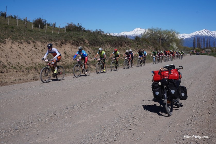
The snowy tops of the Andes, always a stown throws away.There was a mountain bike race going on on the road towards the Chilean border. Must have been more then a hundred participants, among whome the owner of the campground in trevelin where I stayed the night. He was pretty far behind 🙂
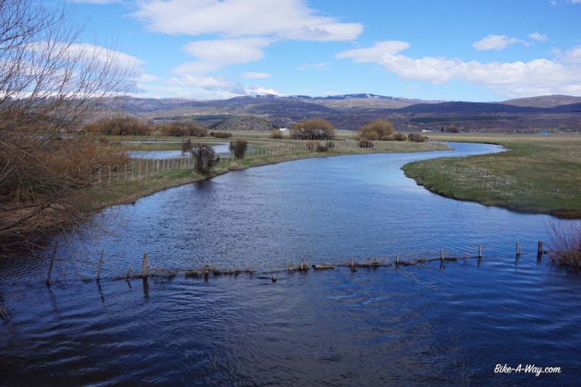
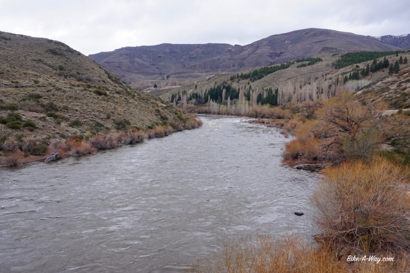
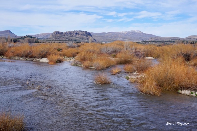
Rio Aluminé.
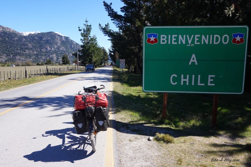
After crossing into Chile, I’m back on asphalt for 10 km until the small town Futaleufu. This is actually the first town that I like a bit here in South America.
But not enough to stay 😉
From the border to Futaleufu, the Chileans constructed a smooth paved road. After that, it’s the same ripio as in Argentina. Same thing would happen a bit further south, before entering Argentina again. The last stretch is asphalted. It’s as if they want to show off towards Argentina ? Why otherwise only pave the ends of the road ?
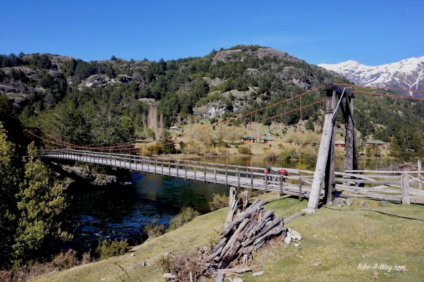
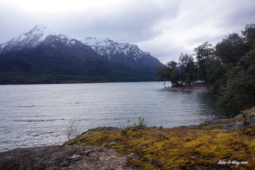
I camp along Lago Espolon, a bit south of town. It’s two kilometer of the route, and a steep 14% climb. The camping seems to be closed, but a friendly farmer let me camp on his land, right next to the lake.
I couldn’t choose between this picture and the next, so you get to see them both :-). I camped at the shores of this lake, just outside Futaleufu.
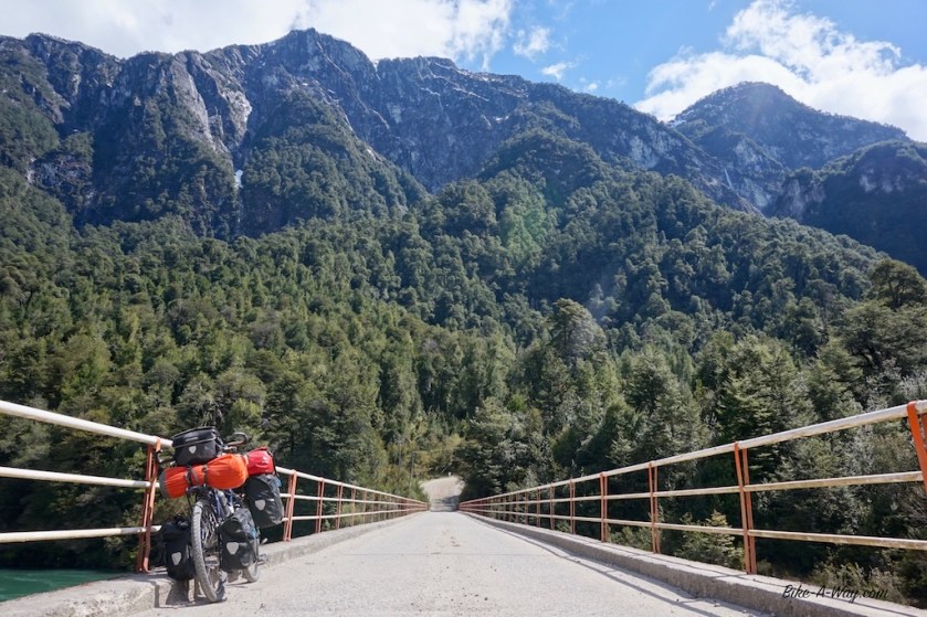
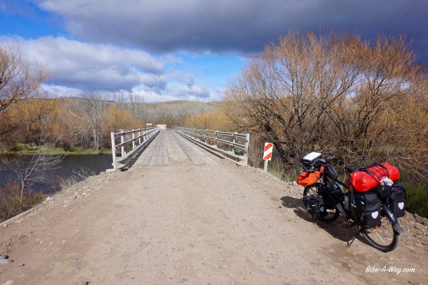
The suspension bridge to the farm and my private camping ground for the night.
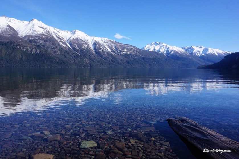
Another lake awaits me next morning, Lago Lonconao. I’m enjoying it while listening the Lance Armstrongs ‘The Forward’ podcast. He had a really good podcast of the Tour de France as well and it’s nice listening to him while riding.
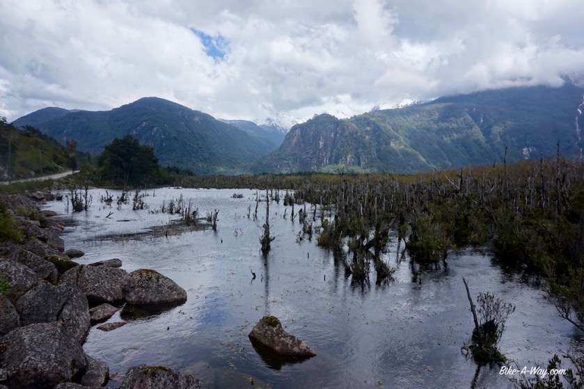
High tide on the lake ?
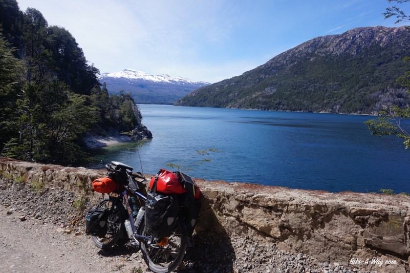
A bit over half way between Futaleufu and Puerto Ramirez, there are a lot of wild camping options.
At Puerto Ramirez, I’m almost back at sea level here, I take road nbr 235 towards Palena and back to the Argentinian border.
This little loop through Chile is definitely worth it, very beautiful scenery, but the Chilean roads are STEEP. With every hill you’ll get to tackle a 13 / 14% climb. The odo meter even shows higher figures sometimes.
Oh, and you can not take fruits, vegetables, dairy products, meat or honey from Argentina to Chile.
Vice versa, no problem.
Roller coaster ride, from one steep hill to the next.
Back in Argentina, it seemed the Chilean road engineers suddenly constructed the roads here as well. It keeps going steep up and down.
I hop some fences and pitch my tent in the forest 15 km before Corcovado and am joined by cows and horses.
Next day, I reach Corcovado ten minutes before siesta time. It’s always a struggle to avoid being held up in towns or villages for hours because the shops are closed. And I need the provisions, as it will be another 2 days to the next village, Rio Pico.
South of El Bolson is a national park I was really looking forward to ride through, the ‘Parque Nacional Los Alerces’.
Alerces are trees, upto 4000 years old and the oldest living creatures on this planet.
WWO 1 just happened recently for them.
Christoffel Columbus you say ?
7/8 of these trees life time happened before he discovered America.
Julius Ceasar or Jesus Christ ?
These trees lived half of their life before that.
Than, 20th century. An idiot with a chain saw comes along. One minute later, the tree is gone.
4000 years it’s standing there, we mow it away in a blink of an eye.
Progress and $$$.
So the few that are left are now protected in a national park.
Lets hope they don’t fall victim to pollution if it isn’t for the chain saw.
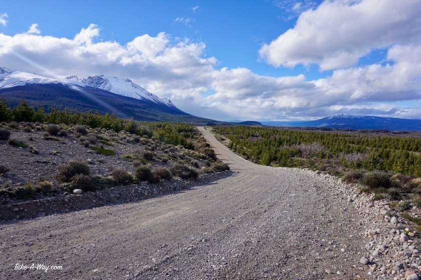
Along the ripio road before actually entering the National Park.
I was riding till early evening in order to reach the first camp ground at the park entrance.
I camped two nights in the national park on designated camp grounds. Both nights I had mice in my tent. I never had that before, and now two nights in a row. The park must be infested with them. But is is a very beautiful ride.
What a shame preparations seem to be under way to pave the road through the park.
My first day in the park, the day starting with a nice blue sky and even warm temperatures.
Around noon time, the clouds rolled in, but no rain.
A cloudy afternoon or ….a sunny morning 🙂
I met another Argentinian biker in the park who took me to the top of a spectacular waterfall.
He explained me all the fallen trees in the park weren’t caused by storms but by the exceptional heavy snow load they had to endure last winter.
Outside the southern end of the park, on the way to Trevelin.
Route: Aluminé – Junin de los Andes – Villa La Angostura – Bariloche – El Bolson
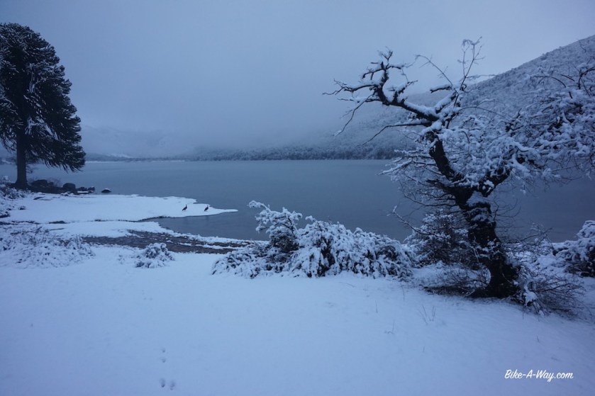
Having entered Argentina’s ‘Lake Region’, I headed down to the first lake within reach. One of the smaller ones, ‘Lago Ruca Choroi’, at the end of a 30 km dead end road, west of Aluminé. It’s a ripio road, but too my disappointment much busier then expected. There are small Mapuche settlements at regular intervals, and I have the impression they all drive up and down to Aluminé this evening. As I’m getting deeper into the Andes, temperatures drop quickly and my progress is slower as expected. After sunset I enter Parque Nacional Lanin (named after the volcano Lanin), which covers the northern half of the lake region. I pitch the tent next to the lake, near some trees for wind cover (which would turn out to be a bad decision). During my second night at the lake, it snowed. Well, first it rained during the day, then wet snow, then snow. In the morning, all this frozen icy wet snow started to drop from the branches on my tent in pretty big and heavy chunks. No damage, but I packed my stuff quicker then usual that morning.
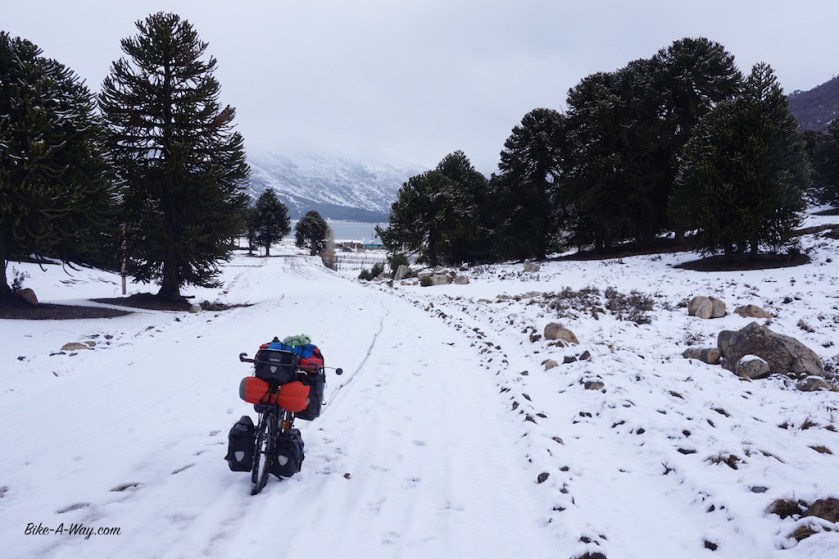
The road back to Aluminé was a muddy affair.
What difference a night of snow can make 🙂
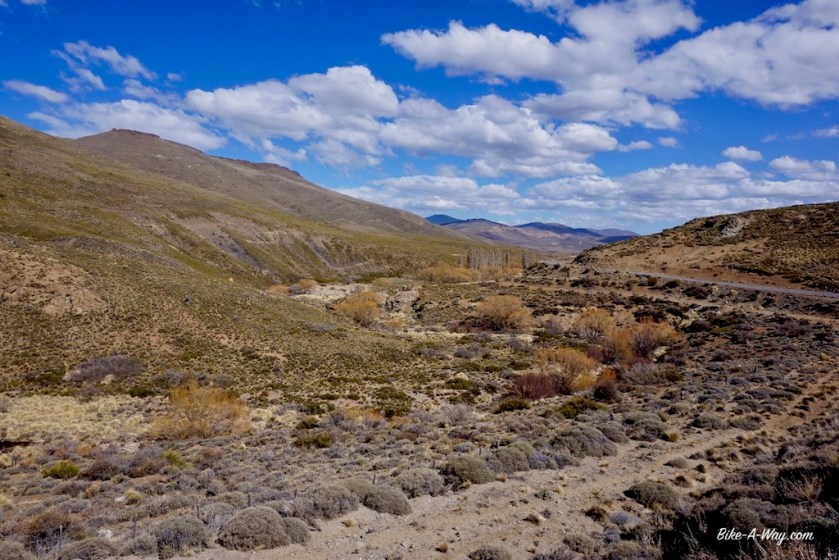
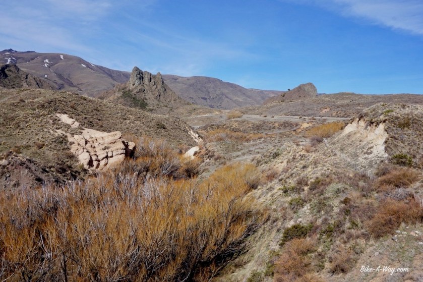
After Rahue, I took ripio road 23 riding south along the river, a nice and quiet option. I wanted to visit some other lakes at the end of some dead end roads further west, but the weather wasn’t really inviting.
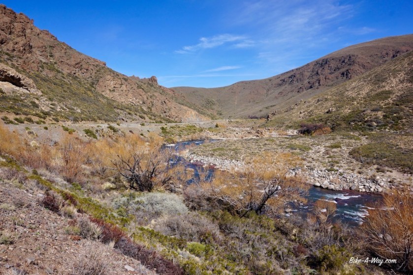
Ruta 23, with the Rio Aluminé to the right
THIS is the kind of roads I like ! 🙂
This turned out to be an excellent camping spot. Wind was blowing hard that night, but there was a hill with some forest back to where I took this picture from which sheltered me perfectly.
The next ‘town’, Junin de los Andes lays just above the 40th latitude.
All was fine till there.
South of Junin de los Andes, having crossed the 40th latitude, it immediately became clear why the area south of that is famous as the ‘roaring forties’ among sailors.
I got into a true Patagonian storm as I hadn’t experienced before.
Riding a bike ?
Forget it !
Pushing a touring bike ?
Well, I could do one, two, three steps.
Stop.
Recover (Holding the brakes to avoid being blown back).
One, two, three steps….
It starting raining, which soon became wet snow.
Passing cars sprayed it all over you.
Good rain gear or not, I got cold.
Push, one, two, three.
Stop.
Recover.
I can hardly hold the bike, so much wind.
Then a pick-up truck stopped and offered me a ride.
I gratefully accepted.
This was way too extreme and dangerous along this relatively busy road (I rejoined ruta 40 just north of Junin).
No places to pitch the tent and wait it out.
A shame I missed part of the region, but so be it.
The bad weather lasted for four days. I sat it out in a hostel in ‘Villa La Angostura’.
Chocolate shops, pizza restaurants and outdoor stores. That about sums it up as for as Villa La Angostura is concerned.
The outdoor stores are of the sort where you can buy shoes and jackets. Don’t think a decent tent or multi fuel stove is on offer.
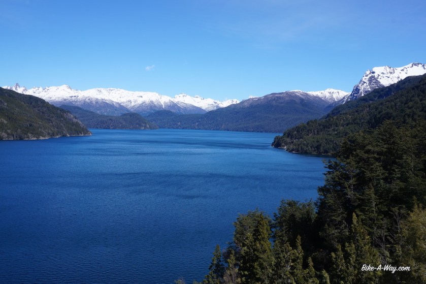
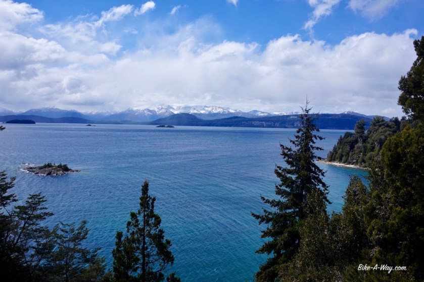
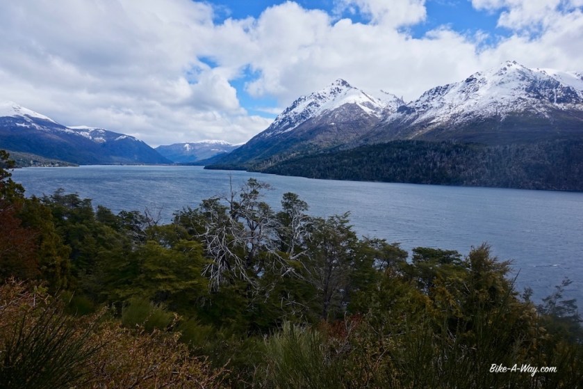
I’m now in Parque Nacional Nahuel Huapi and am riding the northern shore of the lake Nahuel Huapi, with it’s 557 km2 the biggest lake in Northern Patagonia. The snow line is only 30 / 40 meter above the road.
Ruta 40 is still busy, and I’m here at the beginning of October, as low as low season can go. I don’t want to imagine what this route is like in high season, and can’t understand why so much cyclists rave about it.
Yes, the scenery is great, but the cycling not really with the speeding, continuous stream of traffic. You’ve got a car passing you every 15 seconds or so, often a stream of multiple cars. When I was lucky, there were intervals of 45 seconds between cars.
San Carlos de Bariloche. It seems to be the most famous tourist town in this region. It’s much, much bigger as I expected. Much bigger as shown on both the maps I carry. I don’t like the place. Guide books that rave about the towns architecture haven’t visited the place in decades I guess. The air is thicker with heavy diesel fumes as it is in Bangkok.
I meet up with Sebastian, a German cyclist and we make a nice day ride, known as the ‘circuito chico’ here along the southern shore of the lake (nice but ooh…. that traffic 😦 ).
After the famous Llao Llao hotel, we visit a few beautiful view points and return to Bariloche passing what they call here Colonia Suiza and Moreno lake, named after Perito Moreno.
Now, this guy must have done something right, having a lake, a mountain, a town, a national park and the most famous glacier in the southern hemisphere named after him.
There’s a museum about him in Bariloche where you can find it out.
Joske Vermeulen
The Llao Llao hotelThe desire to be “The Switzerland of Argentina” takes at times extremes and sad proportions…
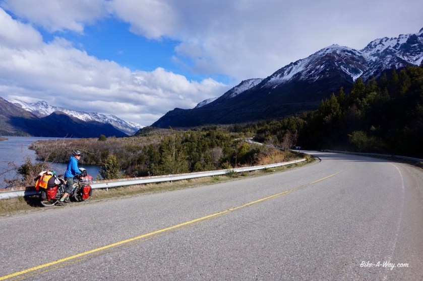
Together with Sebastian, I leave Bariloche. The scenery is again amazing.
We’re riding along several lakes, Lago Gutiérrez, Lago Mascardi, Lago Guillelmo, …
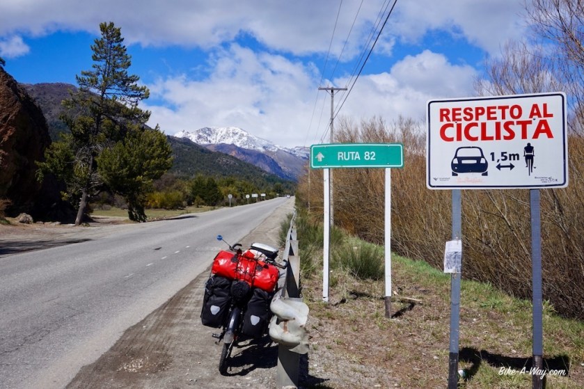
In Argentininan Castellano Spanish, this means keep one point five centimeter distance of cyclists.
Sebastian
Argentinian cyclist heading north
Sebastian
Sebastian has an address to stay with somebody in El Bolson. As I didn’t like that town either (busy streets, stinking diesel fumes), I left town immediately after buying provisions.
While for a mysterious reason, Ruta 40 was more or less ok between Bariloche and El Bolson, south of El Bolson, all hell was loose again.
Since the beginning of this trip, I’m keeping a spreadsheet, classifying the countries drivers’ abilities from A to E, so from very good being ‘A’ to very bad, being ‘E’.
I never expected I’d have to add category ‘F’ to it, but I feel I might have to.
As I’m such a nice guy I won’t do it.
For now.
My gps showed a small ripio route just west of ruta 40 to El Hoyo. Closer to the mountain, no traffic, cycling was great again.
South of El Hoyo and back on ruta 40, I met an experienced Argentinian cyclist, Patricia who recommended me to camp next to Lago Epuyén, a bit further south.
Daylight was running out and I didn’t make it that far, but found a really nice spot right next to the Rio Epuyén.
Still cold nights.
One of the many stars along Argentina’s roads, indicating somebody died here in traffic. It doesn’t seem to leave a big impression to the drivers.
The hotel, where I planned a rest day in Zapala, was a sad and expensive story, so I left after one night.
My first kilometers on the famous Ruta 40.
Even a smooth, separate bike line for a few kilometer. Way to go ! 🙂
Already after 10 kilometer I left the RN 40 and turned right towards my second National Parc, Laguna Blanca.
The best bicycle lane in Argentina !
The tent space at Laguna Blanca sucks. It’s close to the road, on a rocky & gravel surface. Almost impossible to put a stake in the ground and to pitch a tunnel tent. The weather cleared out late afternoon, so I could enjoy good view and a nice sunset over Cerro Cachil.
Blue sky, crystal blue lake, a snowy mountain and the shadow of a happy man.
And then, finally ….. I’m in the mountains. Today I’m crossing the ‘Sierra de Catan Lil’, a range in front of the Andes. Whole morning I have more amazing views over the Cerro Cachil, with 2.839 meters the (I think) highest peak of this sierra.
Contrary to the weather forecast, the sun is shining brilliantly and …. I have a strong tail wind wooooooow 🙂 I take a hundred pictures this day.
When I look right, it seems like I’m in a completely other world as when I look left.
Snowy mountains on my right side, on my left side some sort of hilly, Mongolian like steppe. Some volcanos thrown in in between.
I find a beautiful spot to pitch the tent right next to the Rio Catan Lil. A worthy place to rest my head after such a beautiful day.
This region is inhabited by the Mapuche’s. These are the people that stopped the progress of the Incas a bit further north from here.
The next day in the Sierra de Catan Lil, the sun is still out, and the tail wind even stronger.
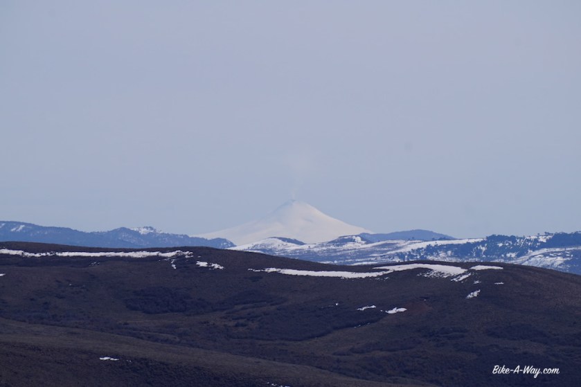
There are three passes to cross, between the National Park and the crossing with road 23 at Rahue. On top of the last on, the road is ripio here, I have my first real view of the Andes.
A mount Fuji look alike volcano, named ‘Volcan Lanin’, 3.776 meter high. Further to the right, a bit further away, a perfect cone; completely covered in snow from top to bottom. Smoke coming from the top. Probably the volcano ‘Villarica’ in Chile ?
Just after the junction in Rahue, I pitch the tent again next to a river, Rio Aluminé this time.
While temperatures are still ok during the day, it’s chilly at the windy passes. At night, the temperatures go below zero. -3°, -4° C.