Route: Alice Springs – Arlparra – Mount Swan – Aititjere – Arltunga – Trephina Gorge – Alice Springs
Day 122: 9 June 2019
From Alice Springs to Yambah junction
64,86 km (Total so far: 5671,28 km) – Altitude climbed: 278 m
Weather: Sunny, strong head wind
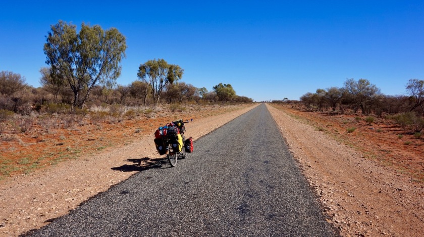
One last day (hopefully) on the dreadful Stuart Highway.
As always it takes a bit longer to get packed and organized when leaving on a new stage. By the time I went to the bakery and leave town, it’s noon.
There is again a strong head wind. It has been blowing from the east since days, but today it is from the north, the direction I’m traveling.
Slowly I climb from 500 meter to 730 meter above sea level, the highest point on the highway between Adelaide in the south and Darwin in the north.
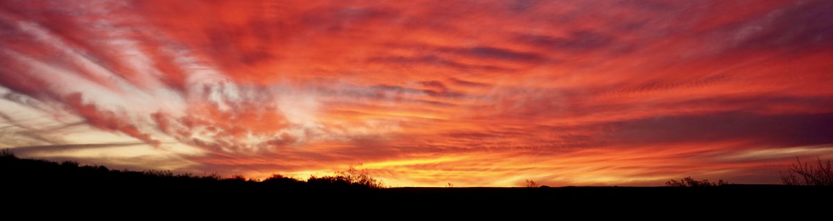
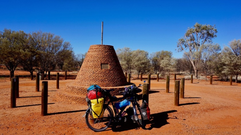
A few kilometer further on I cross the Tropic of Capricorn and I’m back in the tropics for the first time since leaving them in June last year in Ecuador.


Again at least a handful off brain deaths on the road that would have ridden right over me wouldn’t I have been looking my mirror.
Due to the late start and the strong head wind, I don’t get far and have to stop ten kilometer before the junction with the Plenty highway.

Day 123: 10 June 2019
From Yambah junction to 14 km before junction to Ti Tree
103,30 km (Total so far: 5774,48 km) – Altitude climbed: 18 m
Weather: Sunny, light head wind
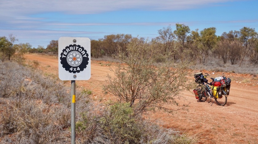
(Info: The Stuart and Barkly Highway are paved highways with a lot of traffic – to be avoided. The Sandover and Plenty Highways are unsealed outback roads and on my wishlist.)
Big surprise at the junction of the Stuart and Plenty Highways.
The big information sign says the Sandover Highway is closed after Ammaroo Station. When I checked the road closures the day before yesterday in Alice Springs, it was open.
Even when someone would have made a mistake and the wrong sign is still on, this would mean there’s likely not going to be any through traffic on the Sandover Highway. Which is good, because even less traffic, but it also means, if I can get through beyond Ammaroo Station, I am probably out there completely on my own. 325 kilometer to the next settlement.
That’s a lot of water to carry, probably too much, and if something goes wrong, well….
We’ll see.
I turn off anyway and will check what the situation is once at Ammaroo, 250 kilometer from here.
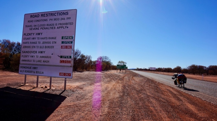
The Plenty Highway is open for 4WD to Boulia, but I don’t want to be on that Outback Road now for two reasons: That desert race is finishing today, and part of the participants and spectators from the East Coast will return home via this road, and I don’t want to be in that traffic. Also, if I take the Plenty Highway now, and the Sandover is indeed closed, and remains closed, that means I have to come back the same way over the Plenty Highway, which is not fun (doing the same thing twice), or turn back to Alice via the Barkly Highway and the Stuart Highway, which is no option at all.

The Plenty Highway is still paved at the beginning, although only one lane for both directions.
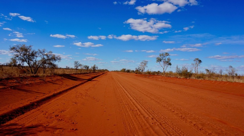
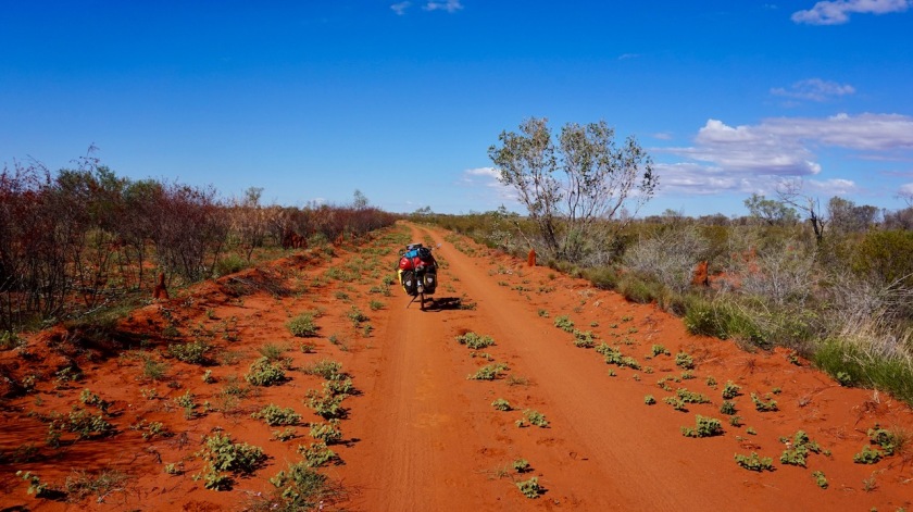
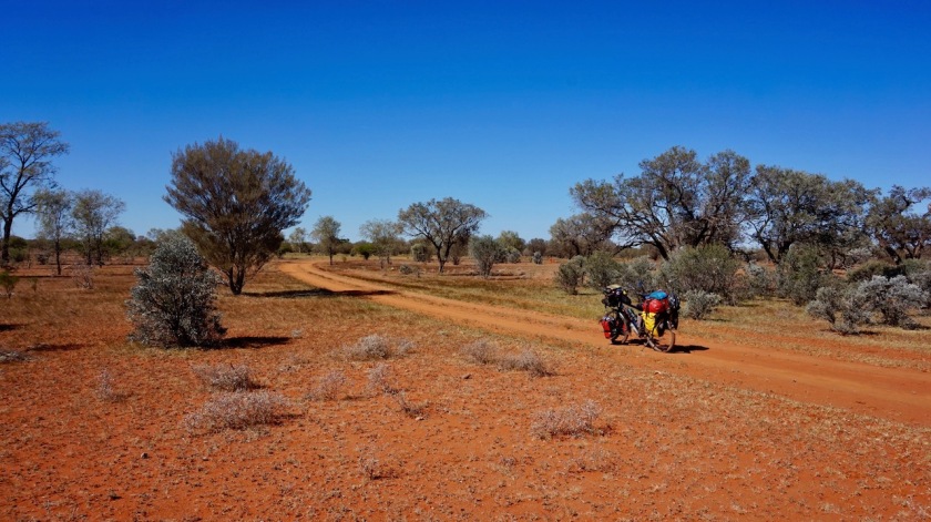
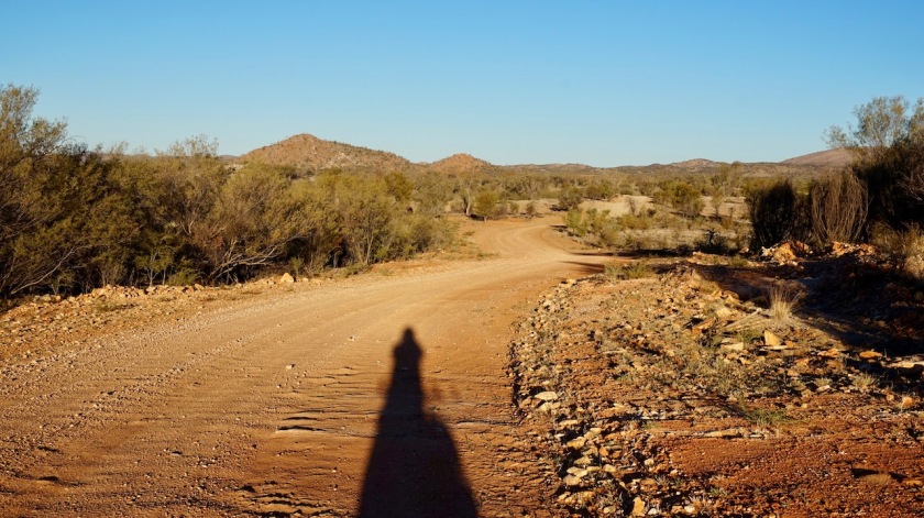
After 28 kilometer I turn off the Plenty on to the Sandover Highway. Red Sand. A true Outback Road. Let the fun begin, I think.
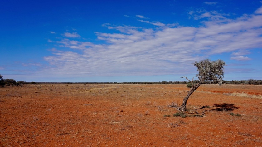
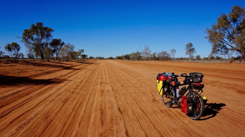
Soon, sections with deep, unrideable sandy section appear. Some doubts, but I carry on. As it turns out, 95% of todays section is actually excellent riding and I make very good progress. Almost no wind today. One has to be concentrated all the time as sometimes a small section with deep sand appears and your front wheel skids away but mainly it is pure joy being in the outback again. A clear blue sky, some white little clouds, low green trees and hundreds, no thousands and thousands of termite hills everywhere.
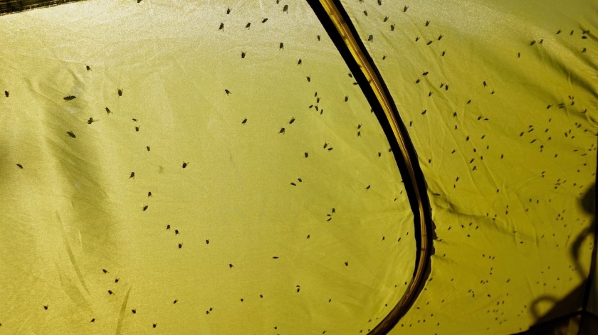
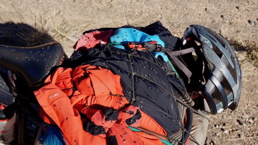
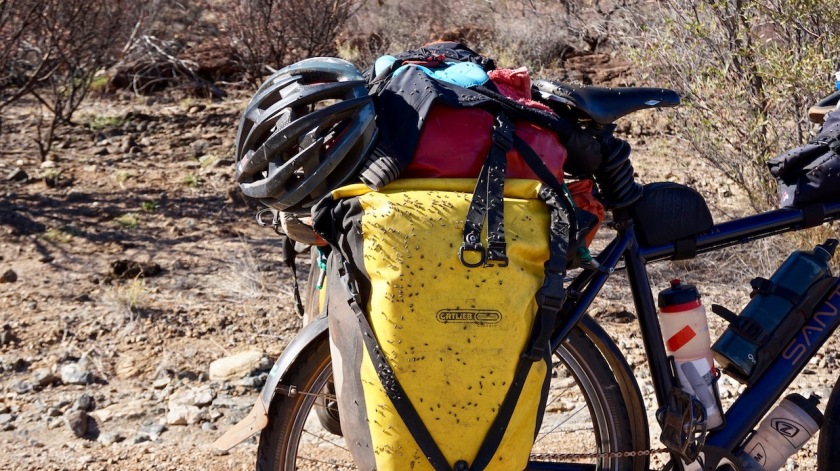
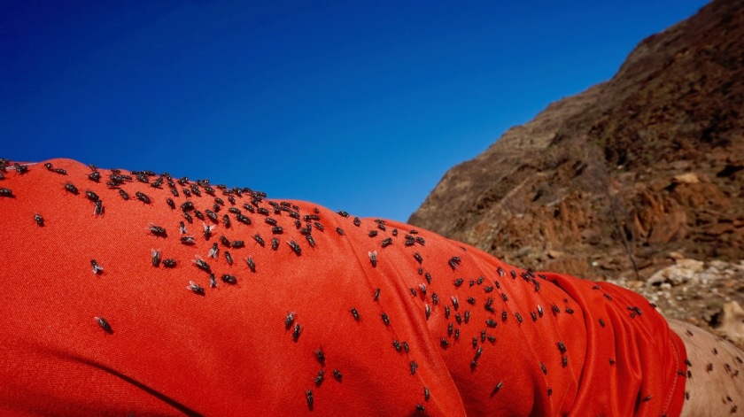
Only one negative: the bush flies are out as bad as ever again.
Alice Springs is maybe only 150 kilometer south from here but since crossing that imaginable Tropic of Capricorn, the temperatures have indeed gone up a lot, also at night, which means they just keep breeding.
All in all, about 10 cars pass me on the Sandover today. Only the last one of the day stops. A Swiss man and a woman from Fiji. They offer me water and don’t stop giving after one container, but insist on filling up all.
Very kind.


Day 124: 11 June 2019
From 14 km before junction to Ti Tree to 20 km before Arlparra
72,84 km (Total so far: 5847,32 km) – Altitude climbed: 74 m
Weather: Sunny, strong and light head wind
For the first time since ages I didn’t sleep well in the tent.
As a test, I tried drinking a little less during the day to see where this would bring me.
Well, I still drank five liter and was so thirsty that within half an hour after pitching the tent, I drank another two liter. And I remained thirsty all night long. Add some cooking, dishes, a little body wash and brushing teeth and I really need ten liter per day in this dry, warm environment.

The quality of the track is much less then yesterday. I spoke to a few of the people passing me, but none were riding beyond Ammaroo Station.


Day 125: 12 June 2019
From 20 km before Arlparra to 6 km before Redgum Store
52,64 km (Total so far: 5899,96 km) – Altitude climbed: 50 m
Weather: Sunny, light head and side wind
The road got even worse than yesterday. Just before noon time, I reach the Aboriginal settlement of Alparra. There is a decent general store which closes between 12:00 & 14:00 hrs.
I talk a bit to the local Aboriginals and also with a Kiwi lady who runs the community centre here. I’m invited to wash my clothes and myself there.
She tells me how today, for the first time ever, there is a court hearing in the village itself.
In the past, people had to travel to Alice Springs, today the judge and the lawyers came over. They plan to do this now four times a year.
I later spoke with one of the police officers who said it was kind of an honor to him this happened to him and his colleague. Everybody seemed happy with this new situation.
Even the lawyers that came over from Alice Springs were happy. They came out yesterday and slept in the community centre.
I didn’t speak to the judge haha.
There seems to be no thru traffic on the Sandover whatsoever and I don’t get a clear answer on the exact state of the track further on. I can’t take the risk to go on and get blocked by a mud field at the border with Queensland. That would be a ride of 500 – 600 kilometer (go & come back) to water sources. It’s not worth the risk.
So I go for plan B, connecting the Sandover and Plenty highways via small backroads.

After a late morning start, a late afternoon start with all this talking and washing.
Soon after the turn-off towards Kurrajong, I cross the dry Sandover River. It doesn’t happen often this thing has water in it, but when it does, it must be wild. It’s a wide, sandy river bed.
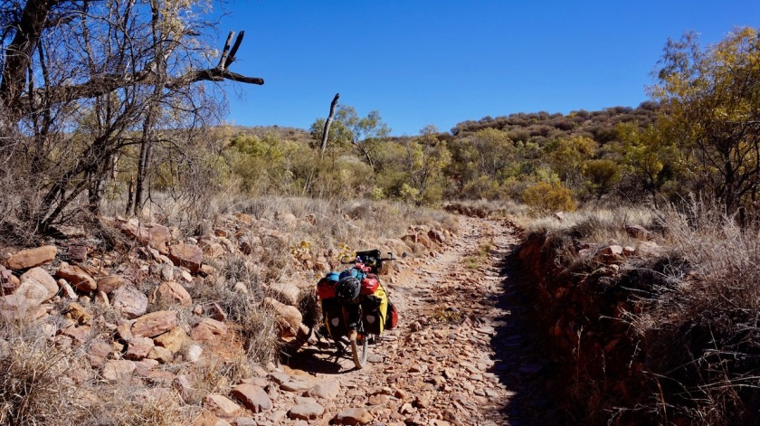
After the landfill, the track becomes deep sandy corrugated bull dust. Maybe just rideable with a fat bike, but definitely not on a loaded touring bike with 2.0 inch tires.
Fifteen kilometer of bike pushing through deep sand, dust eating, no progress, sunset getting ever nearer and realizing you won’t leave this section of the track anymore today..
And those flies….. aaaaghhhhrrrr.


I pitch the tent a bit before Redgum Store.
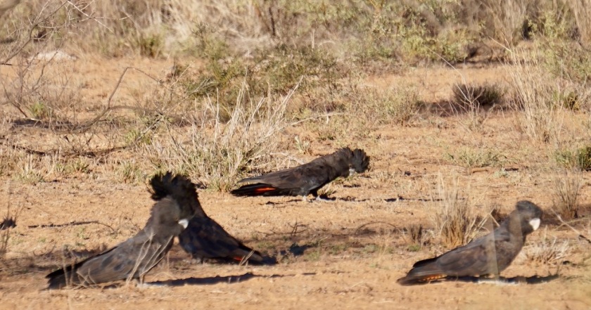
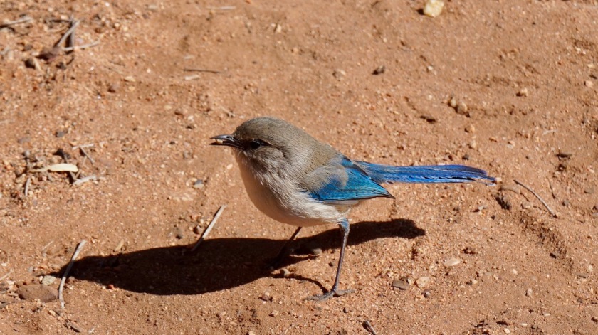
I hardly see any animals since leaving Alice Springs. Not one kangaroo, only one wedge tailed eagle, a few small birds, not many.
Yesterday in the distance something ran over the track, the size of a possum, but definitely something else. And a few cows, that’s all.
Day 126: 13 June 2019
From 6 km before Redgum Store to Tower Rock
46,91 km (Total so far: 5946,87 km) – Altitude climbed: 156 m
Weather: Strong and light head wind
It remained warm last night. At 22:30 hrs, it was still above 20 degrees and some flies were still out. At 3 am the wind suddenly picked up considerably. Good I had decided to pitch the tent here, between some smallish trees. Closer to Redgum Store, as I could see later this morning, it was just spinifex grass and thousands of termite hills, but no protection from the wind.

Redgum Store is a small, typical outback general store. The owner looked with big eyes to me when I rolled up. “You are the first person ever to arrive with a pushbike here”, he says, and asks whether he can make a picture of me.
I am offered an egg and bacon sandwich and a coffee for the occasion.
Aboriginals come and go in their old cars. A female Korean and male Brazilian backpacker work in the shop.
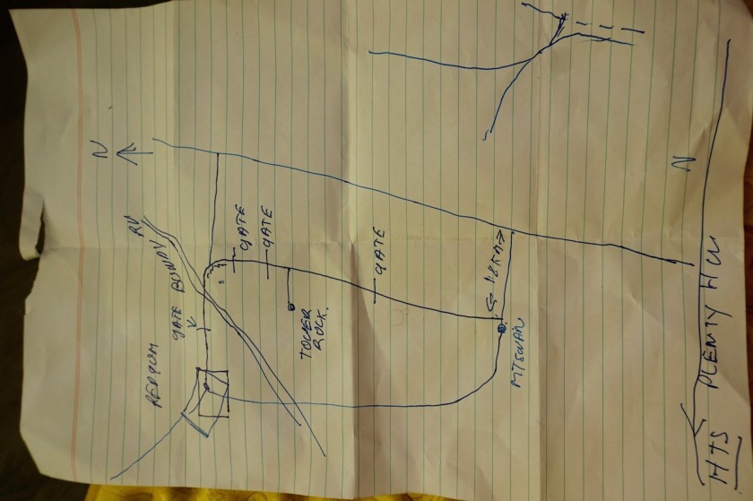
Acquiring with the boss about the road ahead, he offers me an alternative from the road on the map, or even the gps via Tower Rock towards Mount Swan. It’s 60 km instead of 45 kilometer he says.
He draws a map for me and his brother takes his scooter out to show me the correct route the first kilometer or so, as my paths branch off. The brother tells me their parents owned the place already.
That claim of being the first ever to arrive here on a bicycle may hold some truth then, as they surely should know.

The wind is blowing straight in the face. I don’t understand it anymore. Traveling west on the Oodnadatta, straight in the face, north on the Stuart, likewise, east or northeast on the Sandover, same again, after a sharp turn riding south, the wind follows me. What are the chances ?
There’s a big low front south of the continent, one of the owners told me, and it will remain a southerly for a while.
Good, because I am traveling that direction the next days and am used to it now.


And anyways, after the hardship of the 15 kilometer bull dust yesterday, I feel I have nothing to complain about. Nothing at all.
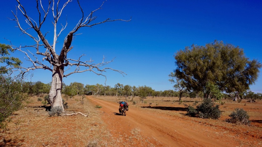
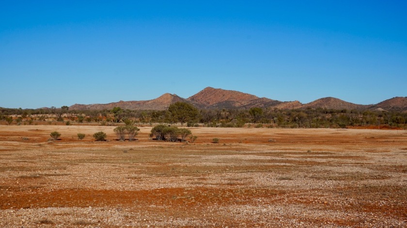
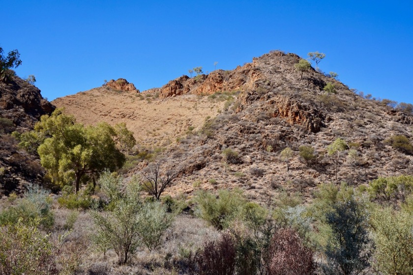
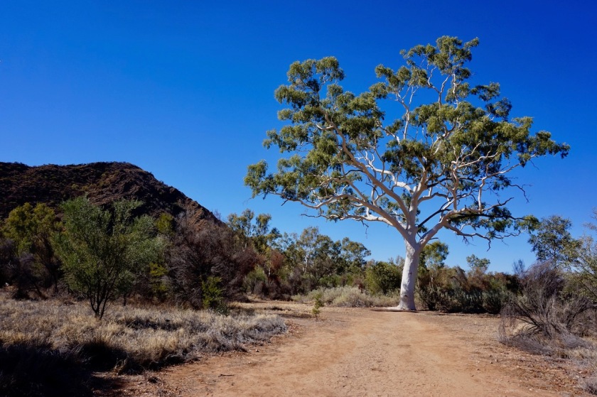
No, this here is exactly what I wanted. I am on a narrow track, no traffic at all, no corrugations, pretty hard packed sand on a track not even known by the gps. Temperatures in the mid twenties, a landscape with some variation. Sometimes low scrub, then spinifex grasses, even a part with green weed and trees, the dry river bed of the Bundey River, a low hill range to my left, towering about eighty meters above the landscape, …
I can look around, listen to the wind, the sounds my bike and luggage make on the track, some music or a podcast, I can think, and I don’t have to pay any attention to that rear view mirror nor do I hear the horribly loud noise of off-road tires on asphalt roads approaching you with terrifying high speed.
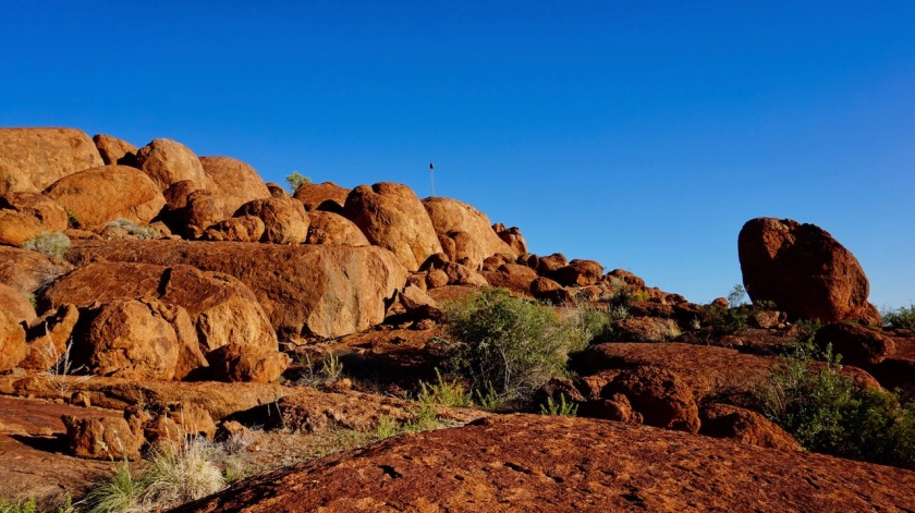
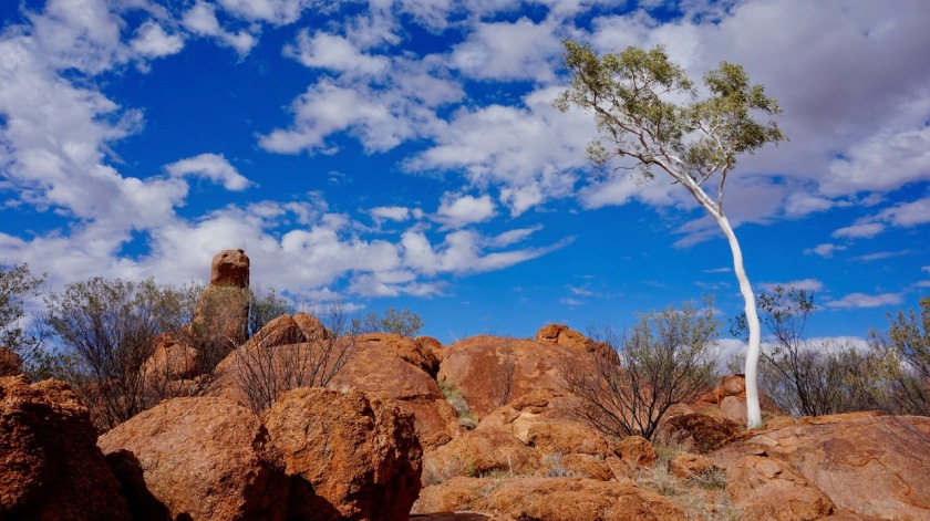
AND, I have a destination for the day: ‘Mac & Rose Chalmers Conservation Reserve’ with the ‘Tower Rock’.
“Something like the Devils Marbles”, the owner had said.


Due to many picture stops and me wanting to go slow, I arrived 1,5 hour before sunset.
The big, rocky hills, red in themself already, were glowing in the late afternoon sun.
“There’s phone reception at the top”, the owner had assured me.
That really didn’t work out, as I worked my way to the top off the hill. But it isn’t important.
Days without phone reception, without 3, 4 or whatever number of G’s they like to fry our brain with, are the best.


These south winds also have a huge advantage.
It cools down in the evening. Even less flies, but still, till midnight some of them are out.
Just about a perfect day in the outback.
Day 127: 14 June 2019
From Tower Rock to near Mount Swan
35,79 km (Total so far: 5982,66 km) – Altitude climbed: 152 m
Weather: Light head wind
Just before the (spectacular) sunrise, my thermometer showed 13 degrees.
Nice.
I linger a bit in the tent, reading long, take my time for a long breakfast. Three coffees.
I climb back to the top of Tower Rock.
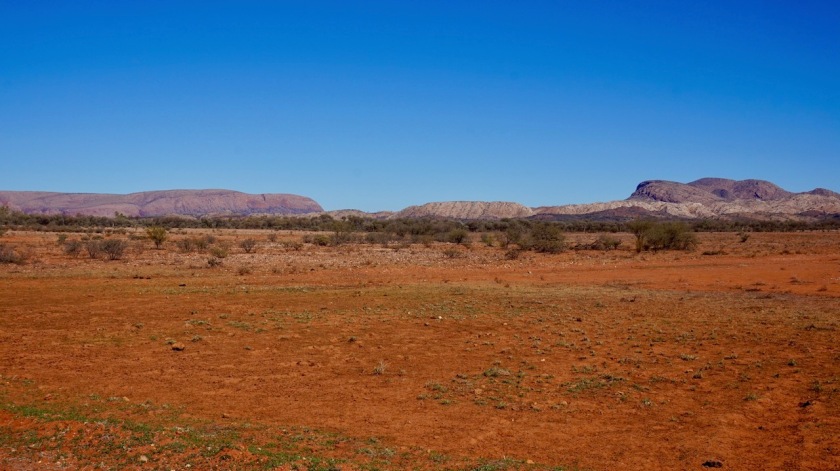
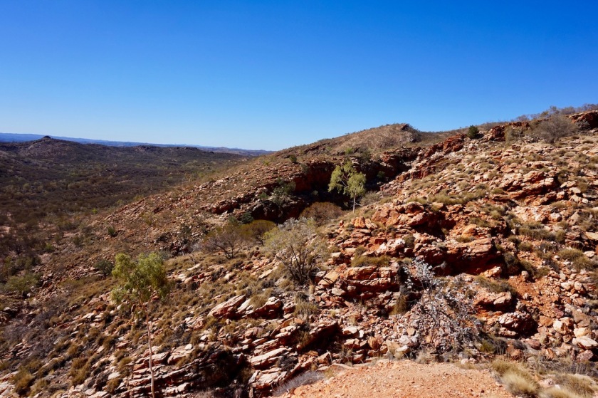
Although it towers less than hundred meter above the surrounding landscape, the 360 degrees views are amazing. In the distance, to the south, I clearly see the MacDonnell Ranges and a bit to the left the Harts Range. To the west, the Dulcie Range is clearly visible, but mainly, it is flat land. The Simpson desert behind that. Not one antenna, no powerlines, no buildings, only the tiny, red dirt track leading to this place. No other human interference in sight. Nothing.
Not a sound of a car, a truck or an airplane.
Just the wind.


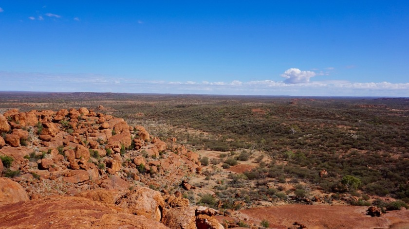
Two kangaroos hopping by at the base of the hill. Not many of them around.
I’ve heard the locals kill everything to eat.
A shame, but less so than when they become stinking road kill on the highways.
After an hour on the top, I go back down to the bike. It’s about 25 kilometer to Mount Swan, the next station with a little shop.
At the junction with the ‘main’ road between the Plenty Highway and the Redgum Store I turn right, as this was how the map was drawn. It should be approximately one kilometer to Mount Swan.
After four kilometer I passed the airstrip, but nothing else in side, so I retrace my steps, back to the junction, going straight now.
Soon I reach the buildings of the Mount Swan Station.

Two English girls are operating the store. They expect two more temporary workers next week to help repair fence lines.
Here too, the first reaction was that never somebody arrived here on a bike. But the girls only worked here since six weeks, so not sure how valid that claim is.
I bought extra water, an expired bottle of coke, a six months expired package of custard, a bag of chips with an unreadable expire date, took some extra water from an outside water hose for doing dishes and washing the self later on but washed my hair already at the water hose.
So far, on this driest continent, I’ve been able to wash myself every evening, and my hair at least every 3rd day.
Not so bad.
Day 128: 15 June 2019
Near Mount Swan
A rest day during which I finish a Herman Brusselmans novel and start reading Robyn Davidsons’ book ‘Tracks’ about her journey with camels from Alice Springs to the west coast.
Day 129: 16 June 2019
From near Mount Swan to near Atitjere
68,42 km (Total so far: 6051,08 km) – Altitude climbed: 169 m
Weather: Sunny, strong head, side & tail wind
It rained a bit last night. I expected the flies to be out real early for that, but it took them some time. My track is deserted all the way except for two cars. The last fifteen kilometer before the junction with the Plenty Highway is, just like at the other side, pretty bad. Lots of bull dust and heavy corrugations. So this 140 kilometer connection between the Sandover and Plenty Highways is in good quality for 110 kilometer and bad for 30 kilometer.
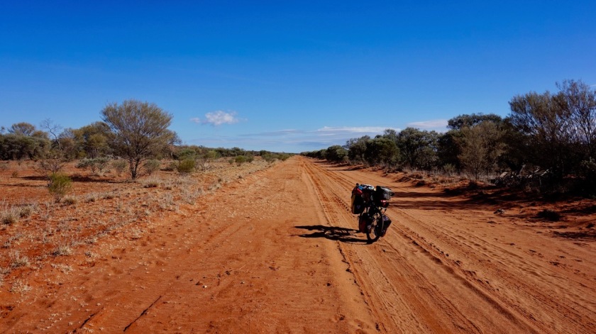


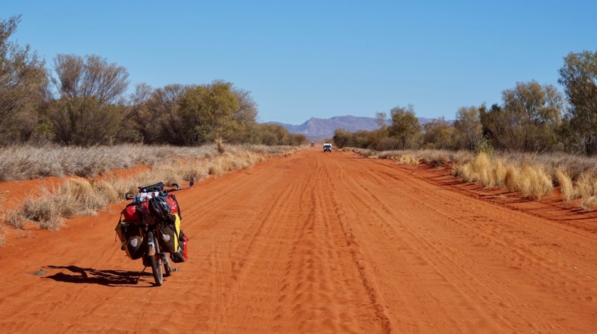
The Plenty Highway is also very sandy and corrugated. But it is so good to be looking at hills again, the Harts Range.
Road works are in progress for seven kilometer east of Atitjere where they’re now asphalting the highway.

Day 130: 17 June 2019
From near Atitjere to near Mount Palmer
14,51 km (Total so far: 6065,59 km) – Altitude climbed: 176 m
Weather: Sunny, moderate side wind
Packed my stuff in the morning and rode the few kilometer to the Aboriginal settlement Atitjere. About two hundred people (and as many friendly dogs) live here. The local general store has all supplies you need.
I stayed the morning in town to recharge some devices and to wash some clothes.
Then rode south on the dirt track towards the Spotted Tiger campground. Had a word with the friendly owners but I wasn’t going to stay. There’s a very rough track leading into the mountains towards Mount Palmer.

It’s pushing your bike here. The scenery is wonderful.
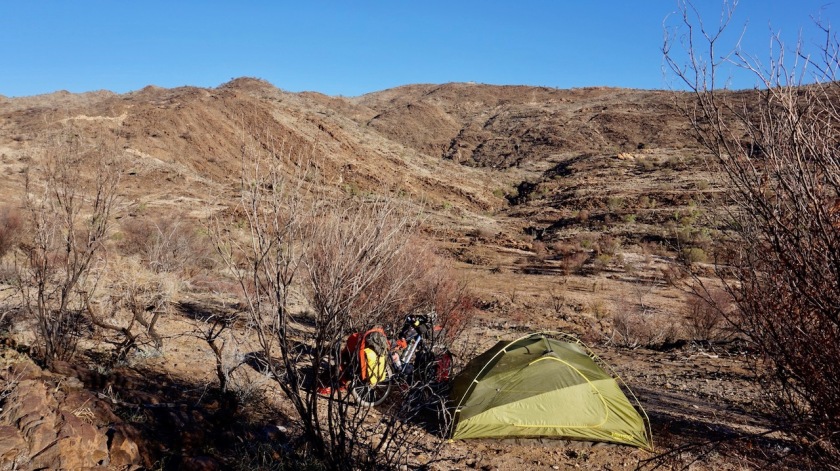
Just before a little pass, I leave the bike to the side of the track and hike further. From the pass, I look down to a very beautiful, deserted valley, more mountains behind it. Contrary to the info I got, the track seems to go down, and not to the top of Mount Palmer (although in hindsight, I think it really does, going around the backside.). I hang around a bit, enjoying the beautiful colors of the late afternoon sun before returning to the bike and make camp.
A pretty windy place but with incredible views tonight and again tomorrow morning.
The full moon rises minuted after the sun has set.
I’m afraid I’m not gonna find this peace in the MacDonnell Ranges.


Day 131: 18 June 2019
From near Mount Palmer to 5 km passed Mount Riddock
44,70 km (Total so far: 44,70 km) – Altitude climbed: 123 m
Weather: Moderate tail, side and head wind
Enjoying the morning in the hills, I rolled (or more accurately pushed) my way back down to Atitjere.
A big 4WD with a boat on top of his roof worked his way up.
He stopped and enquired “why the hell are you driving a pushbike out here ?”.
I bit my lip and didn’t ask why he was dragging a boat up a mountain in the desert, but seriously… such a question from somebody who’s doing that, uhm.
But they were super friendly people.


I heard the shop at the Gem Tree Caravan Park is a one meter wide affair in some sort of coffee shop at the park, so I loaded up on provisions for a week here in Atitjere.
The Plenty Highway is very quiet, good cycling on this paved stretch, only 4 cars in 30 kilometer.
Finished the book ‘Tracks’. Didn’t like it too much.


Day 132: 19 June 2019
From 5 km passed Mount Riddock to 3 km before end of Pinnacles Road
75,59 km (Total so far: 6185,88 km) – Altitude climbed: 289 m
Weather: Sunny, moderate side and head wind
I continued another 39 kilometer on the Plenty Highway. At the turn-off stands a bore with a wind-mill. The water is pumped up by a solar system though and is inaccessible. No worries, just checked if I could take a liter for doing the dishes and washing tonight.
This 40 kilometer long track connecting the Plenty Highway with ‘The Garden’ Road is in reasonably good condition. The scenery is top, riding through the Utnalanama Range. Slowly, slowly the tracks climbs higher.

Good camping spots everywhere. I had a flat rear tire after pushing the bike off the track.
Not something to look forward to in the morning.
Flies are bad again. I’m swaying my arms, my legs, brushing the flies of my hair, more swaying of the limbs, then dive in the tent and try to close it, all in two seconds… it must be quite a sight haha.


Day 133: 20 June 2019
From 3 km before end of Pinnacles Road to Junction old road to Ambalindum
67,51 km (Total so far: 6253,39 km) – Altitude climbed: 304
Weather: Sunny, moderate head wind
A good thing I had put the outer tent back on last night. It got pretty cold, just below zero. The tent and panniers a bit white. Sleeping in only the inner tent wouldn’t be a problem for the cold, but my sleeping bag would be damp in the morning from the dew. We don’t want that.
The cold, and the prospect that I had to fix that rear tire got me slow going this morning, but by 11:00 am I was good to go.
Soon I reach ‘The Garden Road’, named after the cattle station a bit further on. Although the overall profile of the day is more or less downhill, I climb more meters than yesterday. That combined with the head wind, makes it feel like an uphill battle.
But no complaints, the scenery is great. To my right are the East MacDonnell Ranges and to my left I can now see the other side of the Harts Range.


One of the few cars I see today stops while I was taking some pictures. After the usual questions of ‘from where’ and ’where to’ he asks me where I camped last night and whether I saw or heard any dingos and how careful I had to be with them.
People seem to live in constant fear of everything around them here in Australia. All the time they try to project their own fears onto me. If it is not the dingo’s, it’s the snakes, the spiders, hell, I had several people warning me for the danger of kangaroos !
Do you think they ever ask “Were you passed too close by a speeding car today ?”.
I have still 10 liter of water on the bike from Atitjere and take another 1,5 liter from Ambalindum. One can’t have enough and it makes life more relaxed and comfortable.
The friendly lady from Ambalindum offers me to take the short-cut over the old road which in theory is closed now.
While I’m not looking to shorten the ride (it’s 9 km shorter), it sounds good to take it.
Near the end, there is a branch to an older part of the old road, which I take.
I pitch the tent just before the junction with again The Garden Road.
Day 134: 21 June 2019
From Junction old road to Ambalindum to along Arltunga Road
33,01 km (Total so far: 6286,40 km) – Altitude climbed: 309 m
Weather: Sunny, moderate side wind
Cold, cold again last night.
So strange that difference in temperature here, compared to 150 km further north.
I’m still about three kilometer north of the Tropic Of Capricorn.
The biggest disadvantage of that cold is that my Nutella is frozen in the jar in the morning.
I do it relaxedly calm this morning and first finish another Herman Brusselmans book.
A few kilometer into my ride, I can take a left turn towards the Joker Gorge and Joker Mine.
Just as I arrive, a car arrives with people I spoke to at Oodnadatta as well. Together we hike to the top of the hill where there are some holes in the ground where they used to search for gold. Nothing too impressive, but the views from the hill top are nice, with the Harts Range in the distance.
The gorge is a nice little thing, but nothing compared with the gorges coming up a bit further down the road.
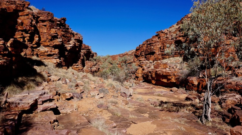
Next was the Arltunga Historical Reserve.
A bit of a disappointment. Few buildings of hundred years old with a new corrugated iron roof.
Nothing historical or impressive from a European point of view.

I bumped further along. The road from where I started this morning all the way to Alice Springs sees more traffic and as a consequence is messed up by them. Nothing but corrugations and deep gravel or sand.
Day 135: 22 June 2019
From along Arltunga Road to Trephina Gorge NP
36,09 km (Total so far: 6322,49 km) – Altitude climbed: 215 m
Weather: Sunny, moderate tail wind
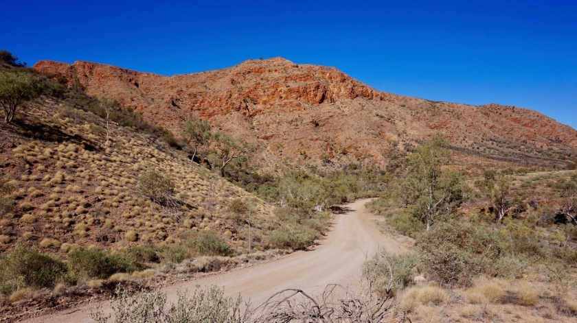
More bumpy road but the scenery is fantastic. Deep red mountains to my left, more greenish to the right. The color of the spinifex grass is changing depending on the slight differences of humidity of the ground it grows on. And also depending on the angle of light it catches from the sun.
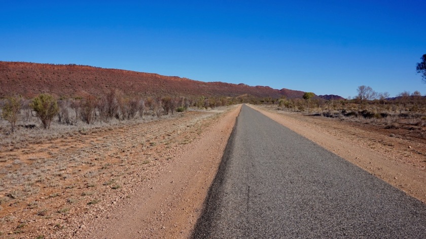
Reaching the Ross Highway, I’m back on pavement.
The entrance of Trephina Gorge National Park is eight kilometer from the main road.
I hike the ‘Trephine Gorge Walk’ and the ‘Panorama Walk’. Both fairly easy, but again very rewarding scenery. If you would do just one of them, choose the Panorama Walk.


Day 136: 23 June 2019
From Trephina Gorge NP to somewhere along Ross Highway
52,10 km (Total so far: 6374,59 km) – Altitude climbed: 203 m
Weather: Sunny, moderate side wind
I was camped in a dry creekbed last night. I don’t know what happened. Is it still humid underneath ? Anyways, for the first time ever I got really cold from the ground.
I have a Therm-a-Rest Z-Lite with the Therm-a-rest NeoAir on top of it. The Z-Lite gives extra protection against punctures and probobly extra insulation as well. It worked well, even with -15°C in the andes. but last night, my mattress was freezing cold.
I also had one or two dingo’s around the tent. I first tried to get rid of them in a friendly way, but eventually I had to use my loud grizzly growl.
The only times I have had issues with dingos so far was in Wilpena Pound, and now here.
In other words, in national parks with many people around. They must be too used to people who are sloppy with there food and/or garbage.
I first ride the very rough track towards ‘John Hayes Rockhole’, where I hike the ‘Chain of Ponds’ walk.
The walk starts by climbing up the hill. You can see the gorge where you’ll walk through on your return first from above now.
All pretty spectacular, especially with these deep red colors.


Day 137: 24 June 2019
From somewhere along Ross Highway to Alice Springs
54,89 km (Total so far: 6429,48 km) – Altitude climbed: 157 m
Weather: Sunny, light side wind
Ride back to Alice Springs with visits to Jessy Gap and Emilie Gap.

Day 138: 25 June 2019
Alice Springs
Laundry, blog updates, arranged permits, bike maintenance, etc, etc….
Below a map of the route. The gpx-track can be downloaded from Wikiloc.

Hoi Koen,
Hoe gaat ‘ie? Al even meer geen updates gehad doch ga er maar vanuit dat je op een lang traject zonder wifi zit. Ben benieuwd naar het vervolg van je reis met alle spannende en leuke gebeurtenissen na Alice Springs. Hoop dat je nu minder last van de vliegen hebt.
Zag dat je nu binnen kookt. Hoe doe je dat zonder je tent vloer te beschadigen – leg je iets onder je brander?
Als je uitrekent/ bedenkt wat je aan eten nodig hebt per stuk wat je wil afleggen – heb je daar dan een vuistregel voor die je gebruikt? En voor je drinkwater – hoe weet je wanneer je weer kunt aanvullen? Ik weet dat op sommige landkaarten staat aangegeven waar je drinkwater zou moeten kunnen vinden – doch ben benieuwd naar hoe jij dat bepaald.
Groetjes,
Inge
LikeLike
Hoi Inge,
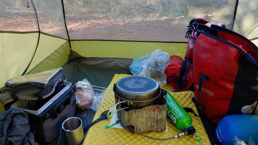
Ik leg een snijplankje en een metalen bescherming die bij het msr windscherm geleverd wordt onder de stoof. Er staat een foto in men laatste verslag.
Water / eten zoek ik a.d.h. van kaart waar verkrijgbaar.
7 ltr / dag als het niet te warm is, 9 ltr bij hoge temperaturen.
Eten: gewoon zo veel mogelijk haha.
Ik heb altijd teveel eten en drinken.
In de outback heb ik op geen enkel moment minder dan 7 ltr water gehad.
En geen zorgen; off-road stoppen de mensen wel om je water aan te bieden.
Maar nooit op asfalt.
De lange, verharde stukken zijn dus eigenlijk moeilijker.
Update website misschien binnen dag of 10, wanneer ik aan de zuidkust ben
Grtn
LikeLike
Hoi Koen,
Ah, dat is de truc – ik had de foto wel gezien maar niet gerealiseerd dat dit voldoende bescherming zou zijn. Zou voor mij inhouden i.v.m. Trangia iets zoeken wat de hitte goed tegen houdt. Of misschien is de snijplank met de metho brander wel voldoende. Geeft in ieder geval weer stof tot nadenken.
Dat is steeds aardig wat extra water meenemen – 7 of 9 liter voor een paar dagen. Goed te weten dat de kaarten handig zijn, maar helaas niet overal verkrijgbaar. Ik nu juist verwacht dat het op asfalt makkelijker zou zijn om aan water te komen – niet dus en dat daardoor de langere en verharde stukken lastiger zijn.
Okidoki – eten zoveel mogelijk :). Kwestie dus van bekijken hoeveel dagen je nodig hebt tussen mogelijke bevoorradingspunten x aantal maaltijden (en snacks) + voor een dag of 2 extra. Klinkt alsof je dan iets van een volle voortas aan eten bij je hebt – voor een dag of 7.
Zie uit naar de volgende update en de vele mooie foto’s – dat wordt vast een heerlijk lange. Ben erg benieuwd naar welke je route je hebt gekozen om naar het zuiden te rijden.
Hoop dat je nu van de vliegen verlost bent en dat je fijne zonnige dagen met een lekkere temperatuur hebt.
Groetjes Inge
LikeLike