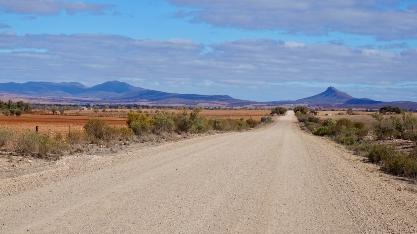
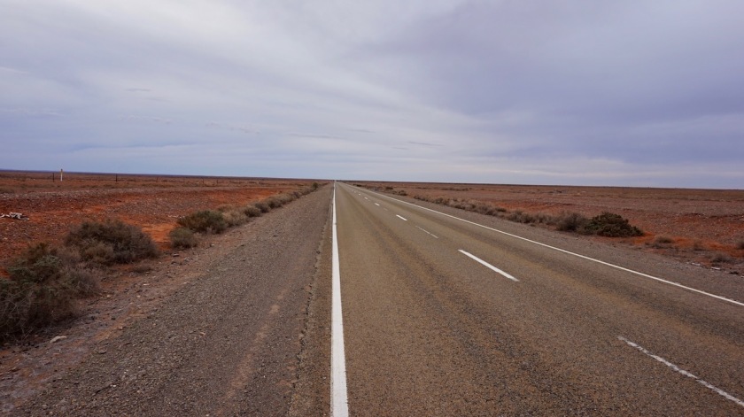
Route: Laura – Quorn – Hawker – Wilpena – Blinman – Parachilna – Leigh Creek – Marree
Below you’ll find part 2 of my experiences on the Mawson Trail, and the route further on from Blinman to Marree.
Day 87: 5 May 2019
From Laura to Melrose
59,10 km (Total so far: 3846,72 km) – Altitude climbed: 926 m
Weather: Sunny, Light side and tail wind
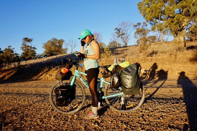
Upon leaving the supermarket in Laura, another cyclist arrives.
“Are you the Belgian guy ?”, she asks.
It is Kristina, a Lithuanian cyclist and will be hosted by Dylan in Melrose, just like me.
Kristina started her trip in Sydney and rode via Melbourne and Adelaide up here.
I just finished breakfast, but she needed a lunch before we could ride on, so with a small delay, we continued on the Mawson.
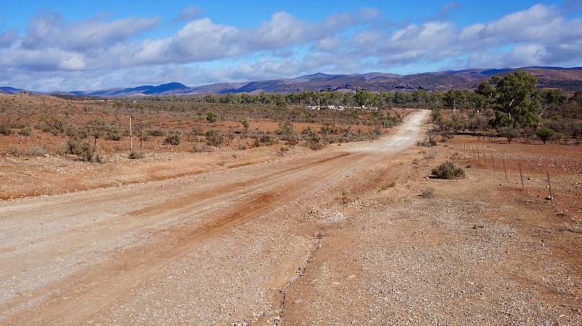
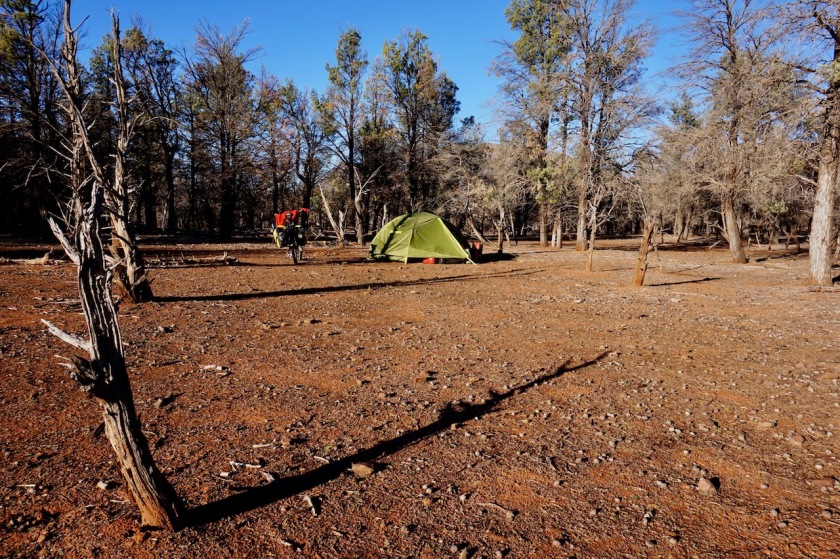
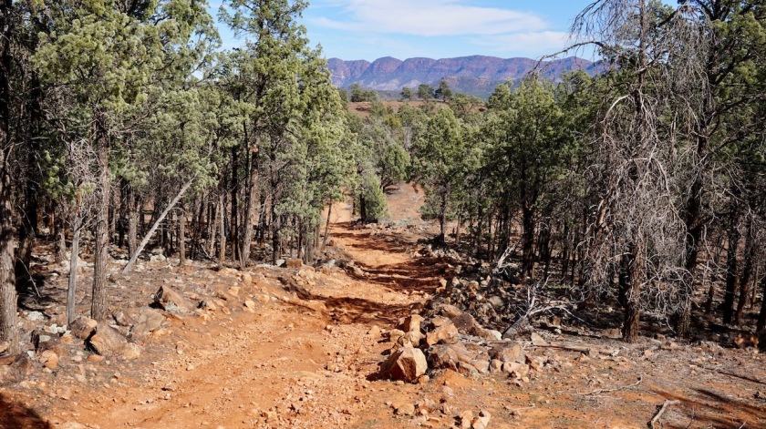
It’s a bit a hillier section through the Wirrabara Forest (plenty of good wild camping opportunities) and I realize soon we won’t make it during daylight hours.
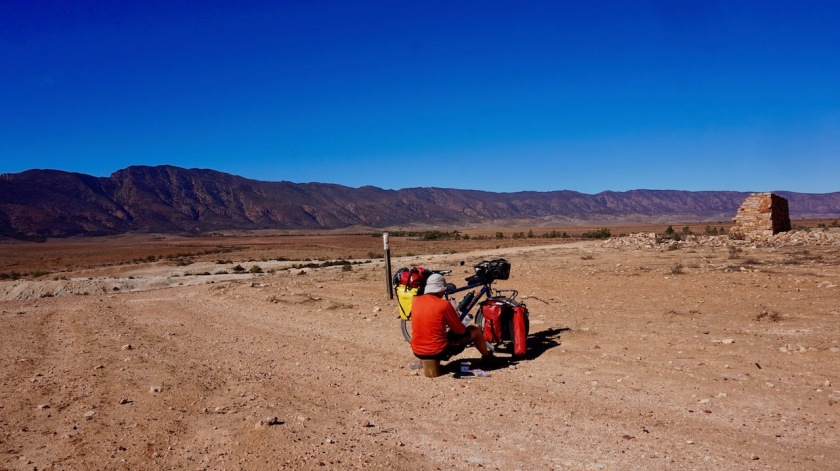
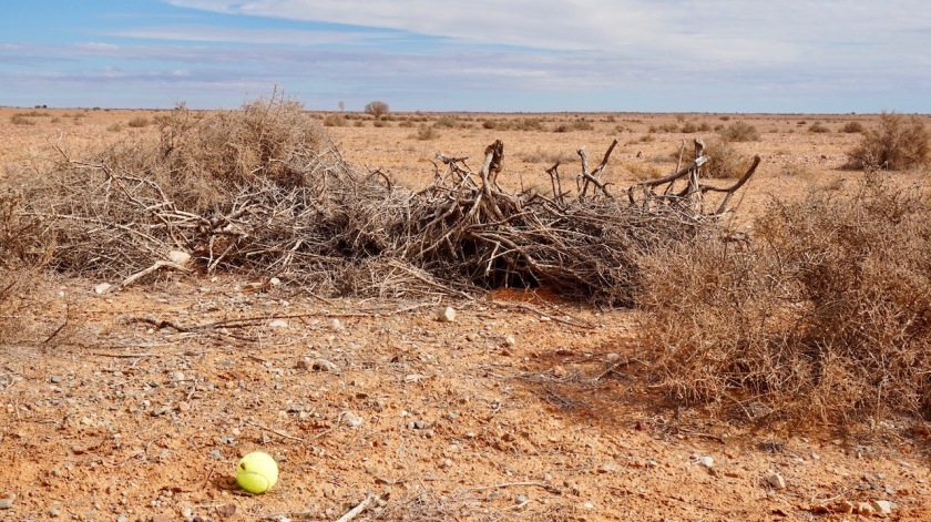
We are further delayed when in some muddy section, this deep, red mud got caked up and stuck in between my wheels and fenders, blocking any possible progression. Nothing to do but to unload the bike, take the wheels off and clean it all out before I could continue.
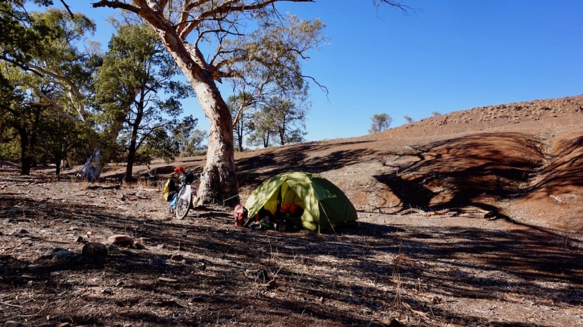
Rather than delaying our appointment with Dylan, we push on a bit and arrive at his place around 7 pm in a pitch dark Melrose but are still warmly welcomed by Dylan who had a pot full of food ready on his stove to please two hungry cyclists.
Day 88: 6 May 2019
Melrose
Weather: Sunny
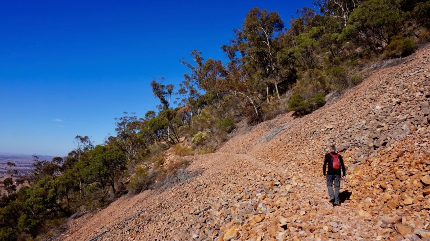
We stay an extra day in Melrose. Together with Kristina, I hike to the top of the 995 meter high Mount Remarkable, the highest bump in the landscape.
It’s a 14 kilometer return hike with good views from the surroundings, all the way to the coast of Fitzgerald Bay. On the way down we spot the remnants of a light airplane which crashed into the mountain in 1980.
No survivors.

Day 89: 7 May 2019
From Melrose to 15 km passed Wilmington
47,57 km (Total so far: 3894,29 km) – Altitude climbed: 348 m
Weather: Sunny, very strong head wind
There are two options to cycle from Melrose to Wilmington. The recently upgraded rail trail, or the Mawson Trail. We chose the Mawson.
Let’s say we ride right into the storm.
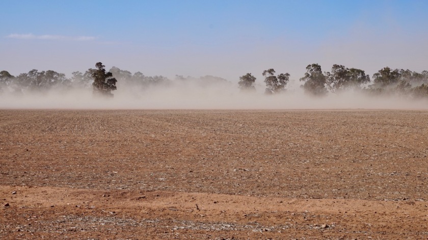
Half a sand storm. The dust is flying at high speed over the land.
We push along at speeds of 9 km/hr on the flats.
A bit before Wilmington we switch to the rail trail. Not faster, definitely not on that loose gravel surface, but a bit shorter.
Mount Remarkable, with its limited altitude hardly a giant, is still making its own weather. Dark grey clouds are forming around it. Luckily, no rain falls.
We are still in quite barren country. A forested area shows up just in time, providing a nicely sheltered spot for the night.

Day 90: 8 May 2019
From 15 km passed Wilmington to near Mount Arden Mine
58,34 km (Total so far: 3952,63 km) – Altitude climbed: 578 m
Weather: Sunny, moderate side wind
After an hours ride today we meet Paul, a cyclist from the north of England, now living in Melbourne. He’s riding the Mawson north to south. He was happy with the winds. “As a hand that was pushing him forward”, he said.
“Yeah, we have like five hands pushing us back”.
But today is not so bad, so no reasons to complain. And we have blue skies again.
The climb over Richmans Gap is a bit rougher and steeper and some pushing is involved.
No worries.
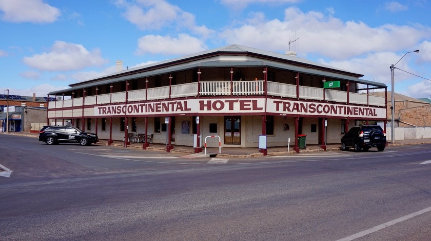
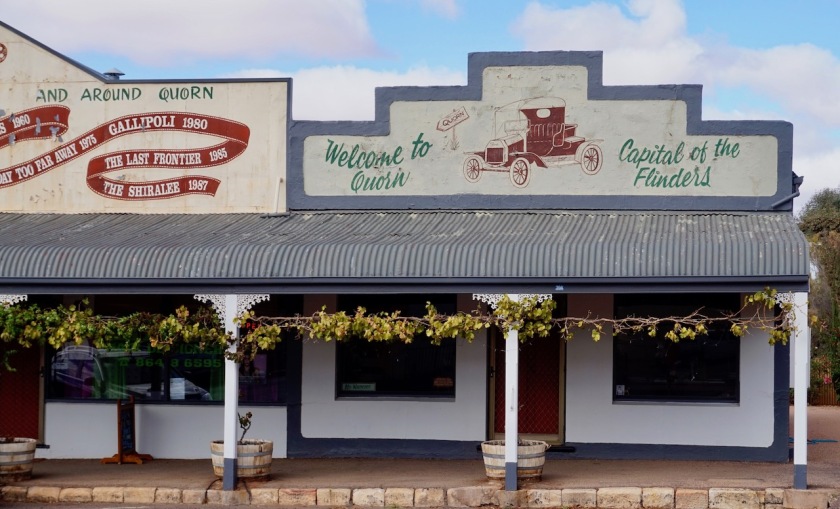
Quorn has the last Iga supermarket for quite some time, so we both stock up pretty well.
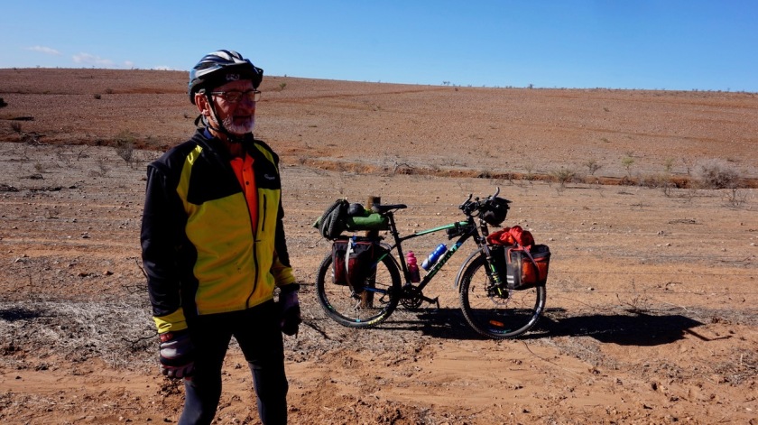
Kristina decides to follow the railway line towards Hawker, or the asphalt if that railway line wouldn’t be possible. I’m in doubt.
The forecast for the next days is bad. A lot of rain, a lot of wind.
Still, I would regret it later not to have ridden these sections through the Flinders Ranges, so here we split. I just hope the rain will not make the tracks unrideable.
There’s a short steep section over Yarrah Vale Gorge before cruising down towards Warren Gorge, which I don’t visit.
Sunset is in less than an hour. There are camping possibilities at the gorge, but I don’t want to take the risk being stuck there for maybe two nights with all the sound and light show from other campers, slamming their doors and trunks hundreds of times, switching on and off those huge head lights they have here.
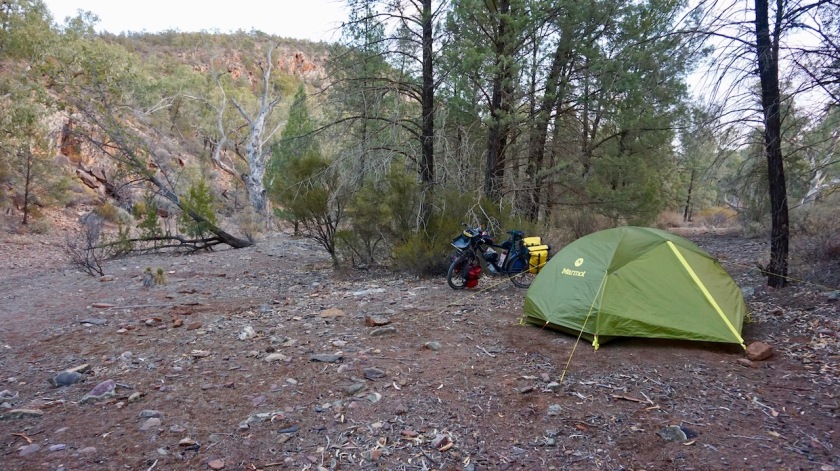
Instead, I find a nice spot, a bit further on alongside a dry Mount Arden Creek, shelter by a rock face on one side, some trees on the other sides.
Day 91: 9 May 2019
Near Mount Arden Mine
Weather: Rain, strong winds
I woke up rather early, at 7 am.
Still dry. But very cloudy.
Even after breakfast at 8 am, it was still dry.
What to do ?
Pack up a dry tent and go ?
But then surely ride all day in the rain.
Or sit it out in the tent ?
Option 2 🙂
There’s enough work to be done.
I hadn’t written down anything the last days and badly needed to make a back up from my pictures as well, put new podcasts on the music player, and also wanted to prepare a bit an alternative route for when this Birdsville Track would remain closed.
It never rains here, but I seem (again) to attract this non-existing situation wherever I go.
Day 92: 10 May 2019
From near Mount Arden Mine to Kanyaka Creek
48,06 km (Total so far: 4000,69 km) – Altitude climbed: 220 m
Weather: Sunny, moderate tail, side and head winds
7:30 am, unzip the tent. Some clouds, but also some patches of blue sky.
8:00 am, totally grey sky
8:15 am, rain
Well, the forecast was like that. Rain in the morning, dry in the afternoon.
But it all improves rather quickly.
After breakfast, a bit after 9 am, I repair my front tyre. Got a puncture from pushing the bike into this place the day before yesterday.
I was all packed up (including a wet tent) and got going by 11:00 am.
Good.
At first the gravel track is surprisingly good. Nice views to the Ragles Range to my right, other hills to the left.
After passing the Wilochra Creek and Simmonston Ruins, it gets muddier again. The tires pick up quite a bit of mud, but never so much it stops progression.
The way this Mawson Trail is established, I have to ride south sometimes to get north. So I get winds from all directions today.
Two 4WD’s, stopping for a chat, give me some extra water. A man and, I guess, mother and daughter in the other car. Enquiring about my route they are very impressed. “All on those skinny legs he…” haha.
Reaching the paved Flinders Ranges Way, I chose to follow it towards Hawker i.o. the Mawson Trail that goes on dirt via the other side of the hills. There are more creeks to pass there, and I see it has rained here severely as well.
The forecast back in Quorn was for dryer weather north of Hawker, so I have good hopes I can rejoin the trail from there.
I pitch the tent in the Kanyaka Creek.
Day 93: 11 May 2019
From Kanyaka Creek to down Mernmerna Hill
39,34 km (Total so far: 4040,03 km) – Altitude climbed: 185 m
Weather: Sunny, moderate tail wind
An easy roll into Hawker.
The gas station might have a bigger selection of groceries than the convenience store.
Despite the sun and despite the tail wind I would have, I force myself to take the time for some urgent tasks. Apart from groceries, I wash my clothes and spend a couple of hours in the post office / coffee shop / bottle shop / grocery store (annex) to reply to mails that have been sitting there far too long, download some podcasts and update the website.
There’s also an ATM to stock up on more cash.
I see the Birdsville Track is still closed.
I get nervous now.
They sell Shellite in the gas station. I buy a liter. Fuel is lighter than water, right ?
I still had 3/4 liter, so now I think I can burn happily away for about six weeks.
Late afternoon, loaded up with 13 liter of water I ride out of town.
As it is that late, I cheat a bit and take the ‘Outback Highway’ the first kilometer i.o. the Mawson Trail which makes a little loop east of that.
Passed Wonoka Hill I rejoin the trail.
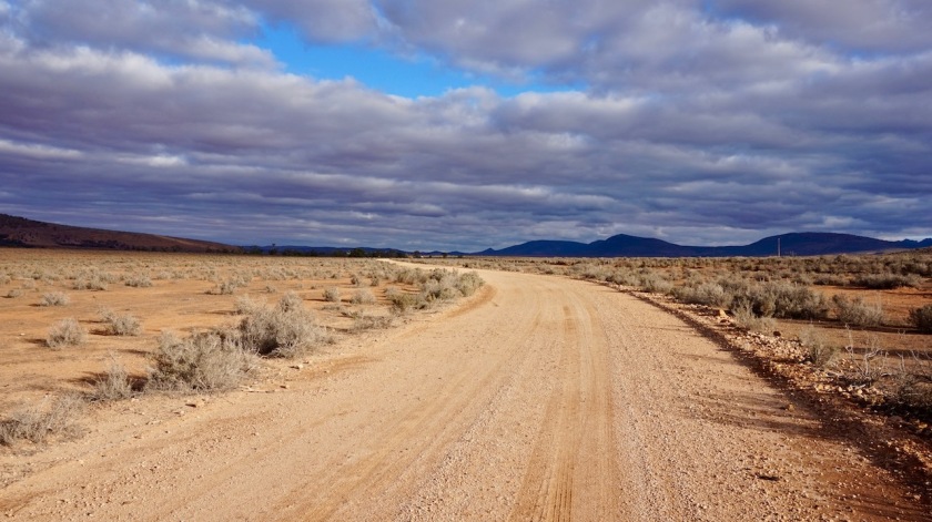
It is quite muddy, this spongy stuff, just dry enough not to stick to the tires, but slowing down progress a lot.
No worries. I’m good. Away from traffic and camping opportunities will arise.
The Mawson Trail suddenly takes a side track of this already unused dirt track.
A short, steep push up.
I can see other cyclists must have struggled here the previous days. Deep tracks in the mud from their tires and shoes. It must have been terrible.
I can’t ride either. The bike would pick up too much mud and get jammed after just a few meters. But pushing it, so lighter weight, I can just continue.

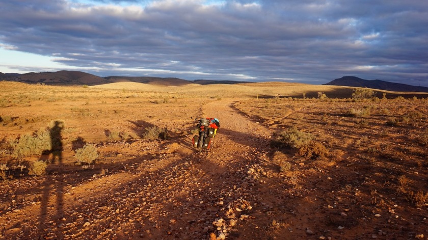
The scenery is really beautiful in this late afternoon sun.
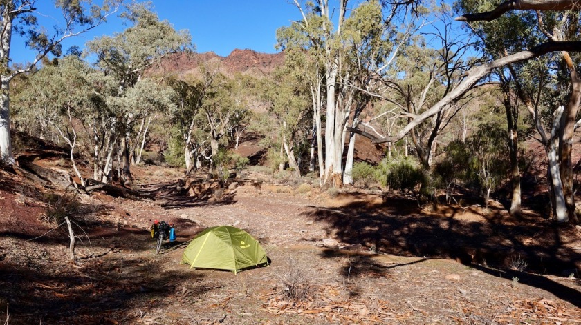
A very steep downhill over a rocky section, where, just before sun set, I see a good place to camp. I clear the sones and all the sharp twigs. Perfectly sheltered in this U-shape of mountains, I hear the wind howling around the hill tops, but I am remarkably wind free in the tent.
Excellent spot.

Day 94: 12 May 2019
From down Mernmerna Hill to Moralana Scenic Drive
56,90 km (Total so far: 4096,93 km) – Altitude climbed: 536 m
Weather: Sunny, Light tail, side and head wind
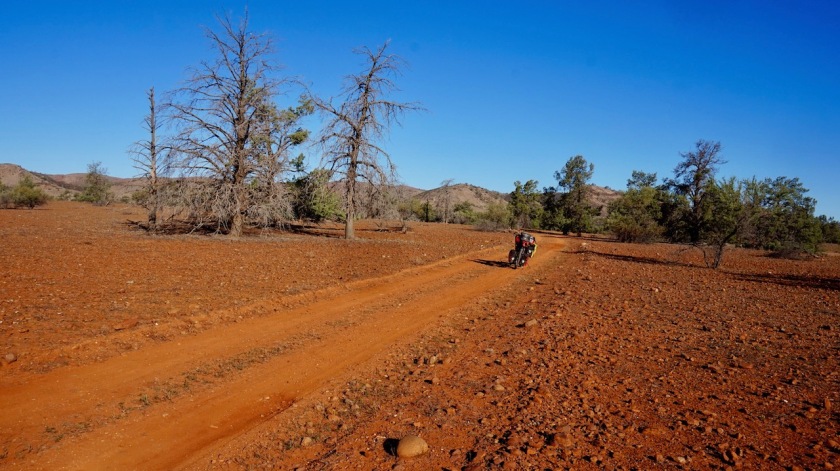
A flat front tyre again. I had unloaded the bike and carried all in yesterday. I guess I must have punctured it whilst riding or pushing the bike late afternoon yesterday. The hard winds had blown a lot of branches and sharp stuff unto the trail.
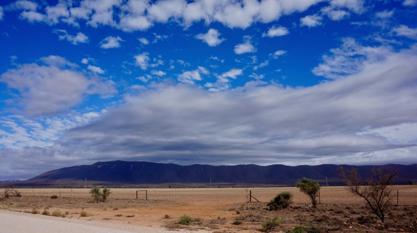
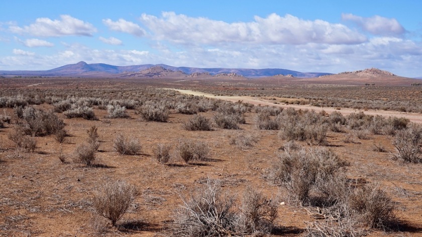
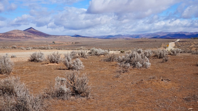
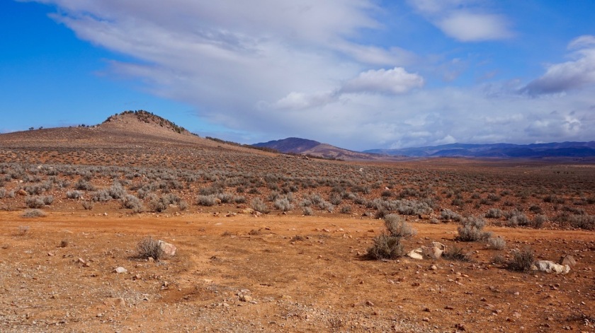
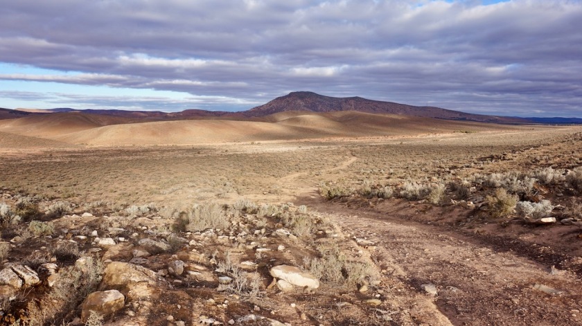
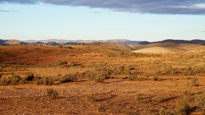
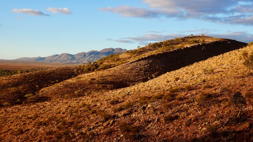
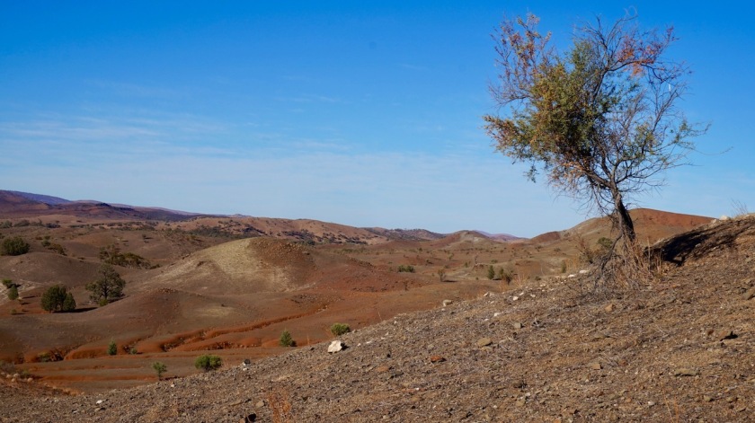
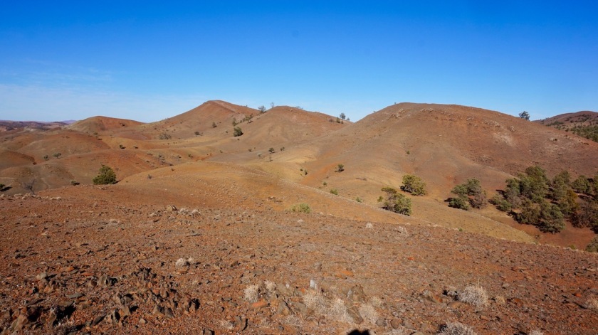
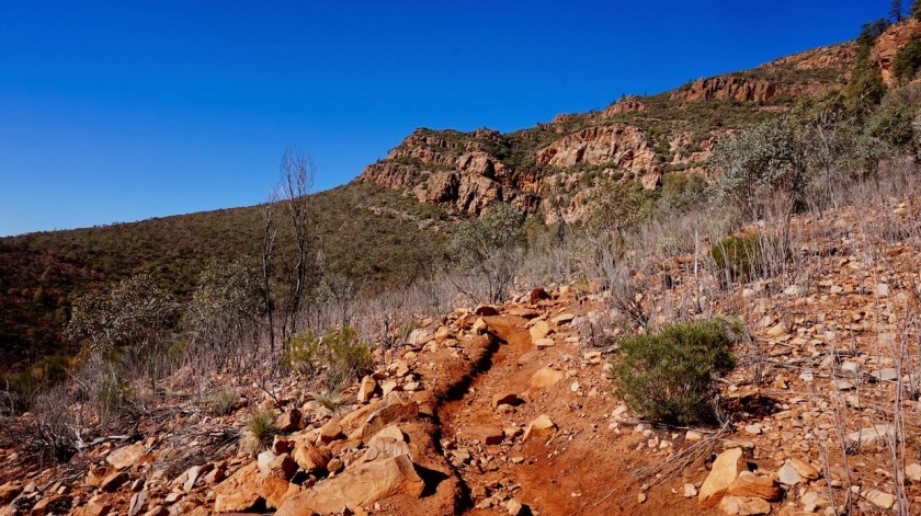
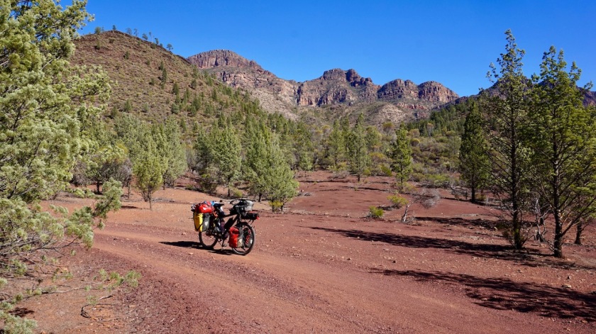
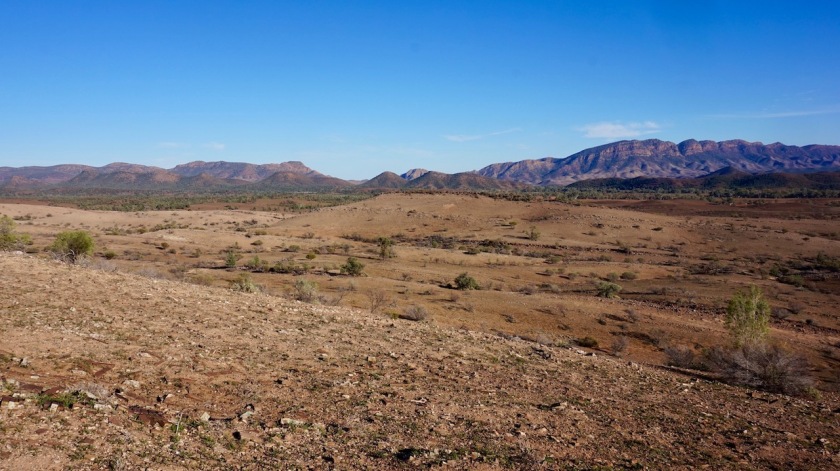
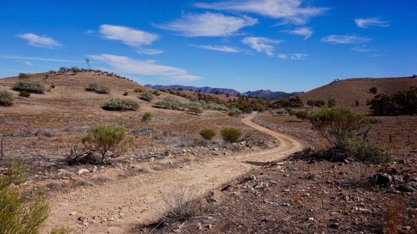
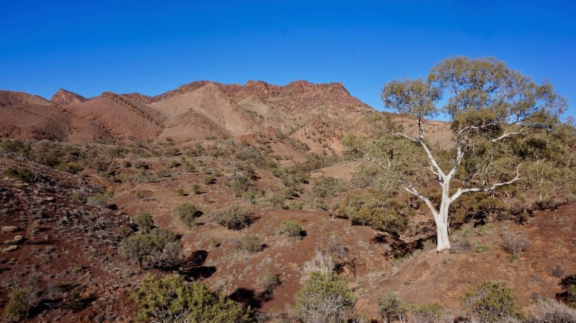
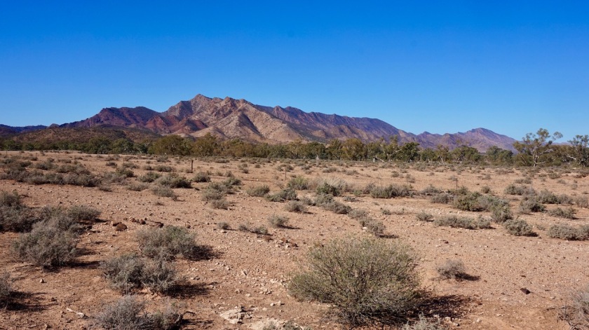
Down at Mount Little Station, I consider returning to the main road again, as it is still all a bit muddy. But I just can’t. I don’t want to miss out on too much of the Mawson, so I ride down towards Mayo Gorge, cross Hookina Creek and ride in some kind of desert like landscape along the impressive Elder Range. A light wind from the north west doesn’t cause too much trouble, but with strong winds, this would be a hard stretch.

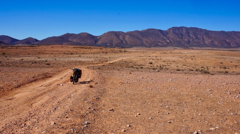
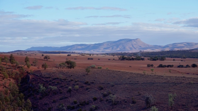
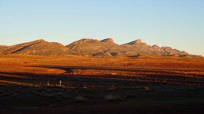
After a short stretch on the Outback Highway, I take a right turn to the Moralana Scenic Drive. Moralana Creek has cut her way here between the Elder Range and the Bunbinyunna Range and the Wilpena Pound Range behind that. With the sun slowly setting towards the west, I have excellent views of this red rocks. All very nice.
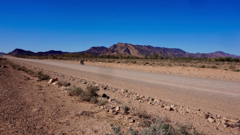
As mentioned on the maps of the Mawson Trail, this Moralana Road is regularly used by ‘adventure 4WD’-ers and as a result there are a lot of continuous corrugations.
They should make this track accessible in one way only for cars and divide the current track in 2/3 for the cars and 1/3 for the cyclists (separated from the cars so they can’t mess it up). That would be fantastic for everybody, but I guess that won’t happen in 4WD-crazy Australia.
As the Mawson Trail goes, I am now riding south again, admiring the other side of the Elder Range to the west and Wilpena Pound Range to the east.
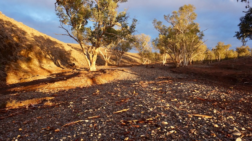
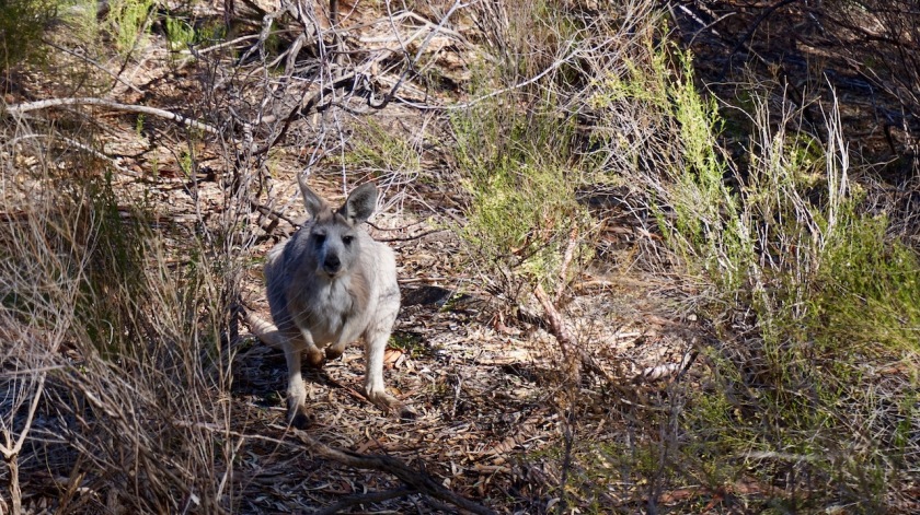
I find again an excellent wild camping place after pushing the bike over a hill, into a dry creek, lined with red gum trees, kangaroos hopping around, Cockatoo’s, Galahs and parrots flying around.
Day 95: 13 May 2019
From Morlana Scenic Drive to few km before Wilpena Pound
40,88 km (Total so far: 4137,81 km) – Altitude climbed: 373 m
Weather: Sunny, light head and side wind
I wake up early (7:30 am).
Man, it’s cold outside. I brew a cup of tea and remain in my tent, merino shirt, a fleece, my down jacket and my down sleeping bag over me. Nice and snug.
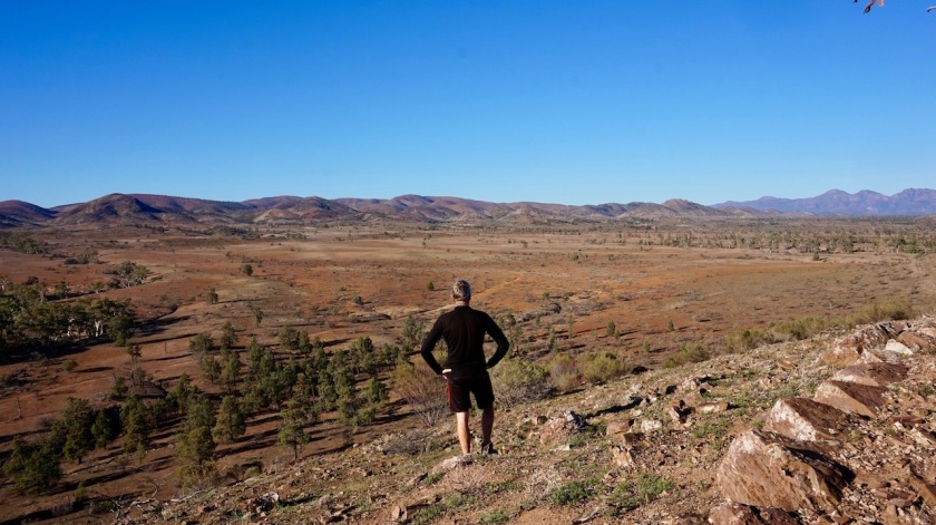
After the sun has warmed it up a bit, I climb to the nearest hill top to get good views of the Wilpena Pound Range on one side and the Elder Range on the other.
How nice, to stand on this non-official, non-touristic view point.
On my way back to the tent, I walk a bit through the dry creek. How magnificent are these red gum trees.
With all this walking around, it’s of course almost 11:00 am before I roll out of my camping spot.
No Problem.
Soon I join the paved Flinders Ranges Way. Time between cars is never too long. Not nice
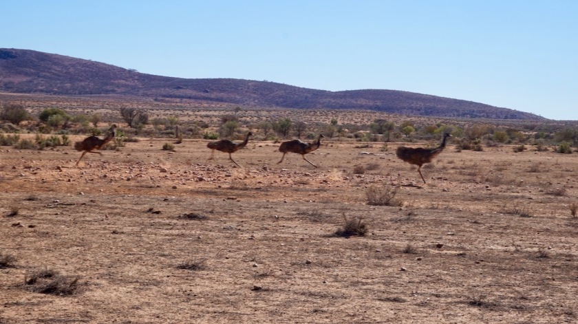
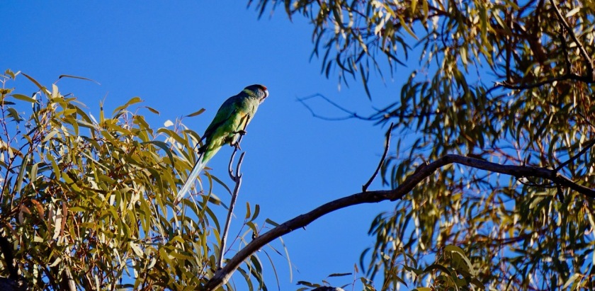
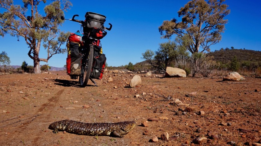
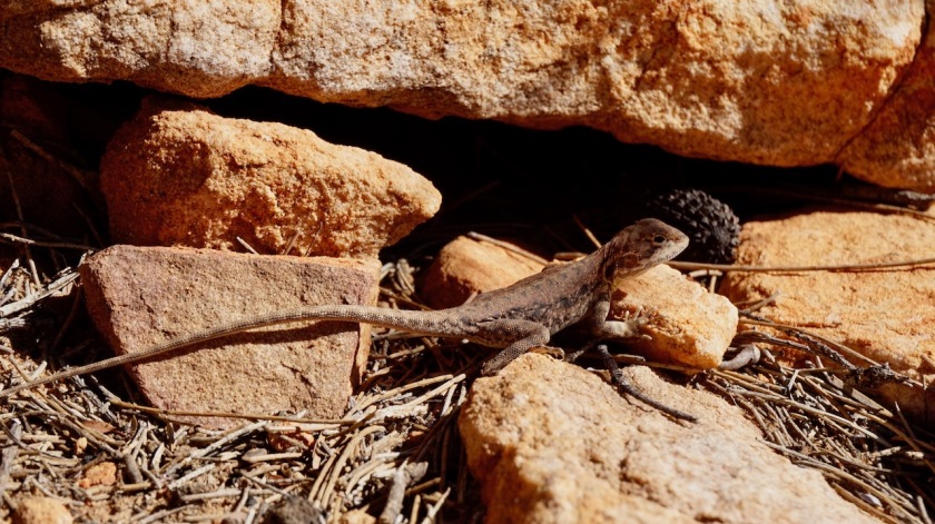
Life is a big joy again when I get off that main road and take the Telegraph Track, which runs close to the Wilpena Pound Range. Beautiful, beautiful hills, blue skies, wallabies and kangaroos hopping in front of my wheels, oops, avoiding that blue tongue lizard bathing in the sun on the trail, look some lorikeets there, and there, an echidna ….. life is sooooo much better without traffic.
I ride into Wilpena Pound, recharge my devices at the tourist information, take a 4 AUD shower at the camp ground, wash my clothes, do some shopping (package of pasta now three times as expensive as further south, and only frozen bread on offer), then ride back to the Telegraph Track to pitch the tent between the trees.
Tomorrow, I want to hike Mount Ohlssen-Bagge.
Day 96: 14 May 2019
Wilpena Pound
24,89 km (Total so far: 4162,70 km) – Altitude climbed: 789 m
Weather: Sunny
I had a brilliant day again.
Woke up early with a layer of ice on the tent and the branches on the ground frozen white.
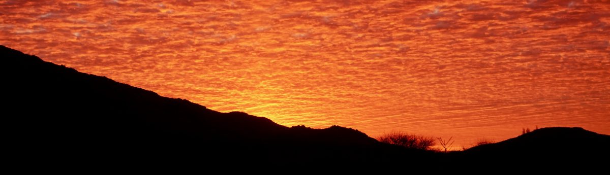
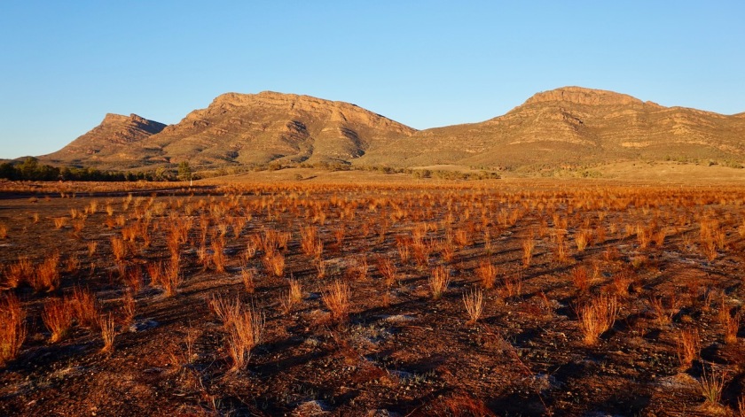
I went out of my little forest to watch the sun illuminate the hills of Willpena Pound. Lluka Peak, Tumburru Peak, Binya Peak and Mount Ohlssen-Bagge, all in an orange glow.
The latter one is my goal for the day.
The dingo’s have been howling all night and the place is teeming with kangaroos, so one would be stupid not to break down the tent and pack up everything. You must pay 10 AUD in the visitor centre for a day pass. A visitor centre which is far from very efficient, I must say.
The hike to Mount Ohlssen-Bagge is a 6,4 km return trip and qualified as ‘difficult’.
There are indeed some steeper parts where you have to clamber over rocky inclines, but I would say, in a normal world, moderate difficulty would be more accurate.
In the shape of the current world, maybe ‘difficult’, yes.

I see people struggling with their nordic walking sticks, trying to use them to climb over rocks. This is of course not the place to use stuff like that, but they bought it, so I guess they want to use it.
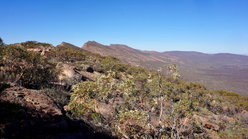
The views up there are spec-ta-cu-lar !
Into the Wilpena Pound, the Wilpena Pound Range all around it, the Elder Range behind that, the lowlands on the other side.
Really worth the effort.
The inside of the pound is now forested but at the end of the 19th century, it was a completely barren place.
People drove 120.000 sheep into the pound and destroyed the place in a decade.
Like they brought the whales around Tasmania to extinction in a couple of years.
Like we’re still doing now, ruining places in record tempo.
Anyways, I enjoyed the views for a while, hiked down and hiked towards the ‘Hill’s Homestead’ (ranked as ‘easy’). I am now inside the Wilpena Pound and this is the house of the family that leased the place end of the 19th century and brought all those sheep inside.
From Hill’s Homestead, I hike a short way up to the ‘Wangarra Lookouts’ (ranked moderate).
More views into the Wilpena Pound.
A very productive day off the bike.
Do these hikes when you’re here. It would be a shame to just drive by the hills and not see more of it.
Day 97: 15 May 2019
From few km before Wilpena Pound to a bit before Middlesight Water Hut
37,52 km (Total so far: 4200,22 km) – Altitude climbed: 500
Weather: Sunny, light head wind
This can’t go on forever, can it ?
Another splendid day.
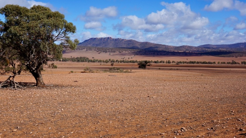
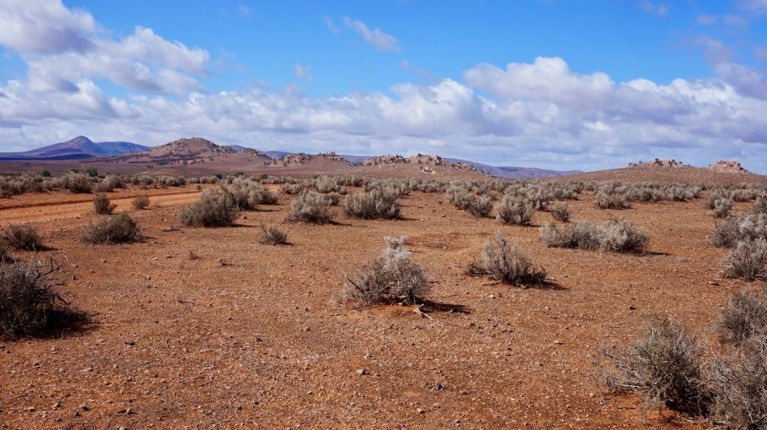
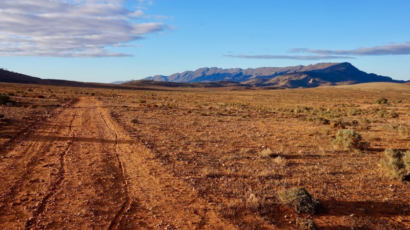
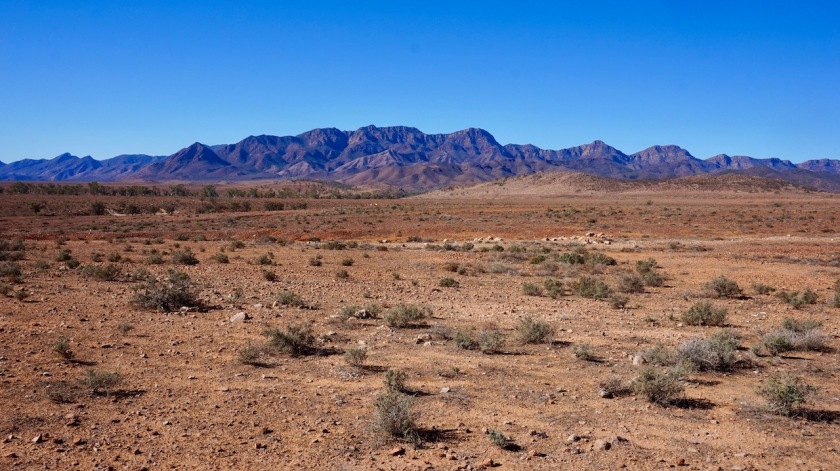
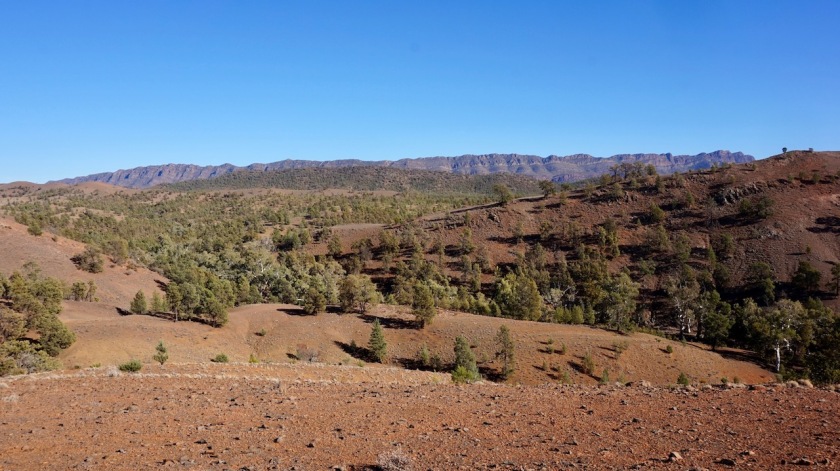
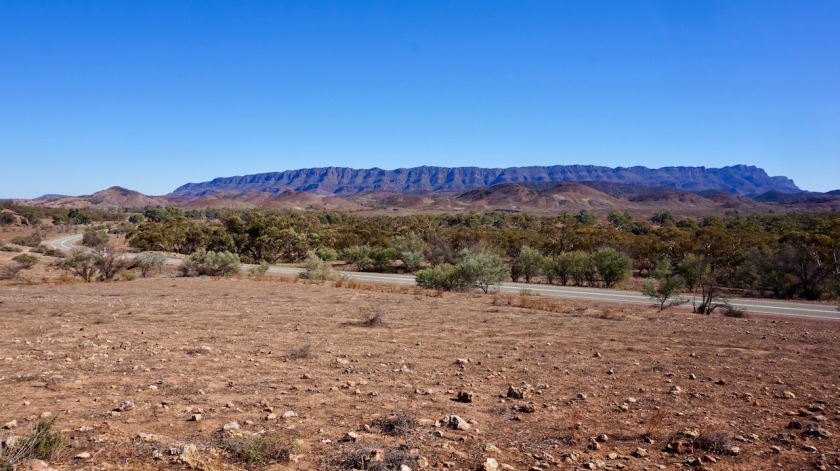
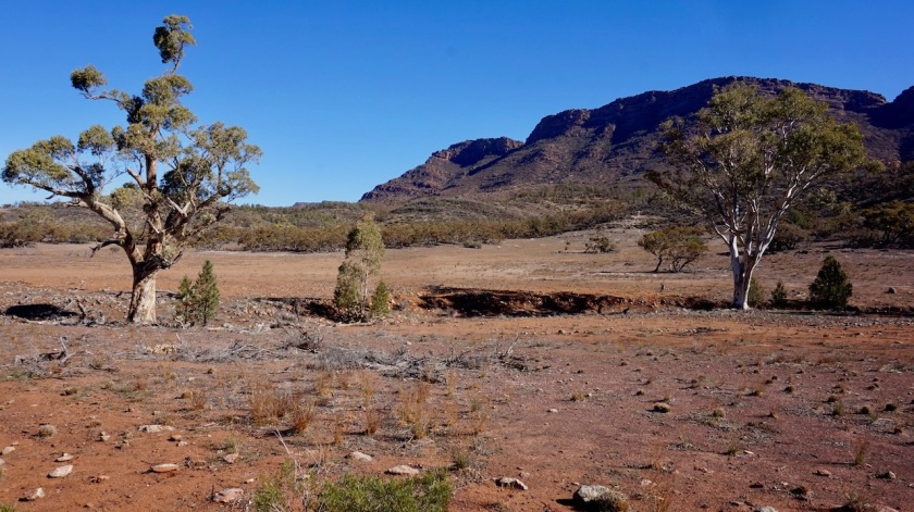
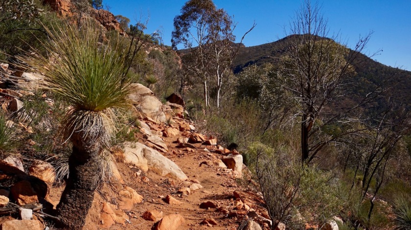
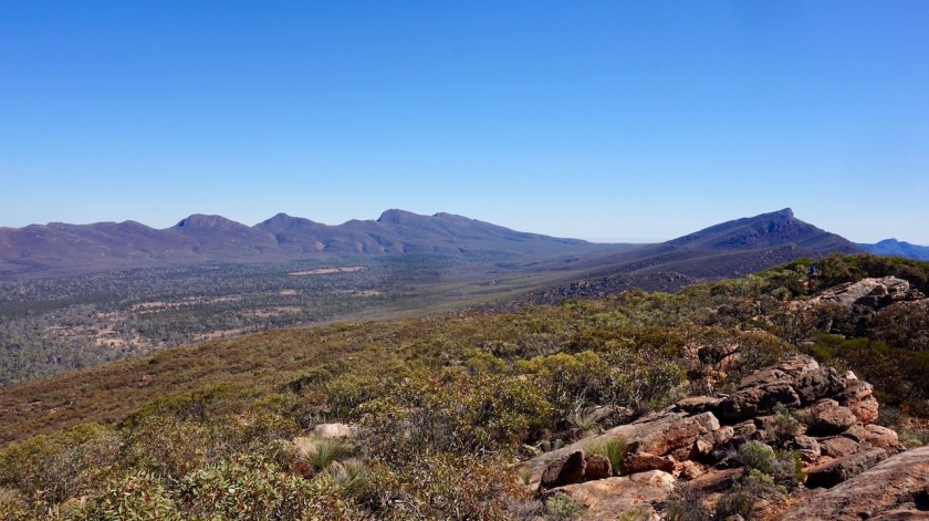
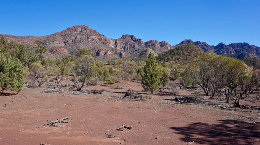
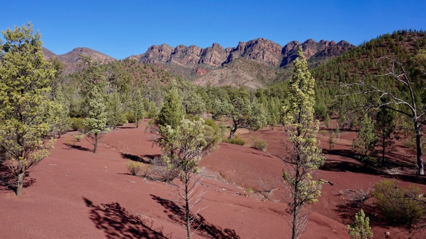
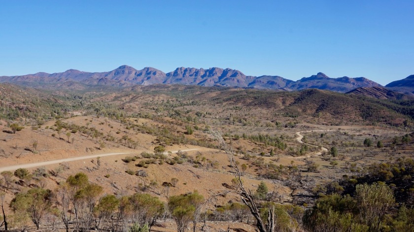
The Mawson Trail is working its way further north along Wilcolo Creek. To my west are the colorful peaks of the Wilpena Pound Range, with the highest one, St. Mary Peak, always in sight. To the east is the lower ‘ABC Range’.
At first I’m on pure single track, later the track becomes wider, but is forbidden for motorized traffic.
I see only three other cyclist out for a day trip from the campground.
Cycling heaven !
There is a short stretch along a dirt road open for cars, Bunyeroo Road.
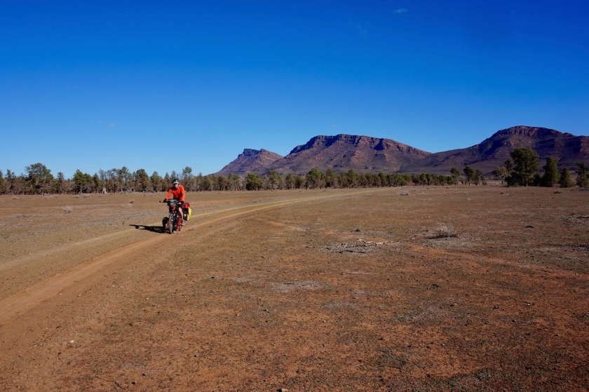
It is brutal. I have to push the bike up inclines of 18 to 20% over the Razorback Ridge. Brilliant last views towards the Wilpena Pound and in the Bunyeroo Valley.
Soon, I’m gonna have to miss all this things when I’m further north in the desert.

The Mawson Trail veers off the Bunyeroo Road. This Yayanna Track is an excellent dirt road, closed to all traffic. Sometimes a dry creek to cross, but otherwise excellent. It flattens out a bit.
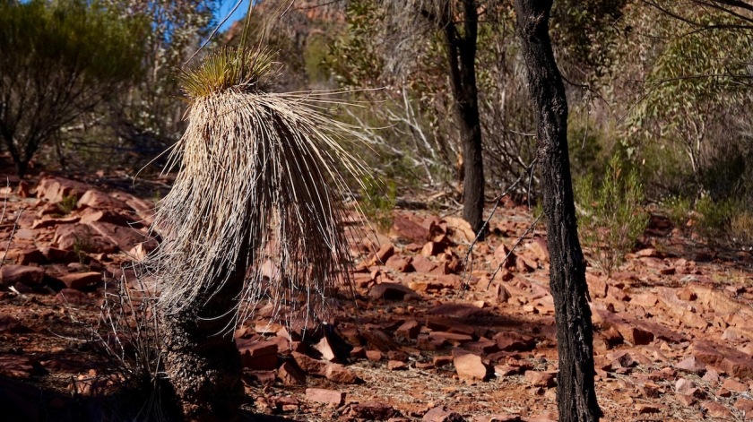
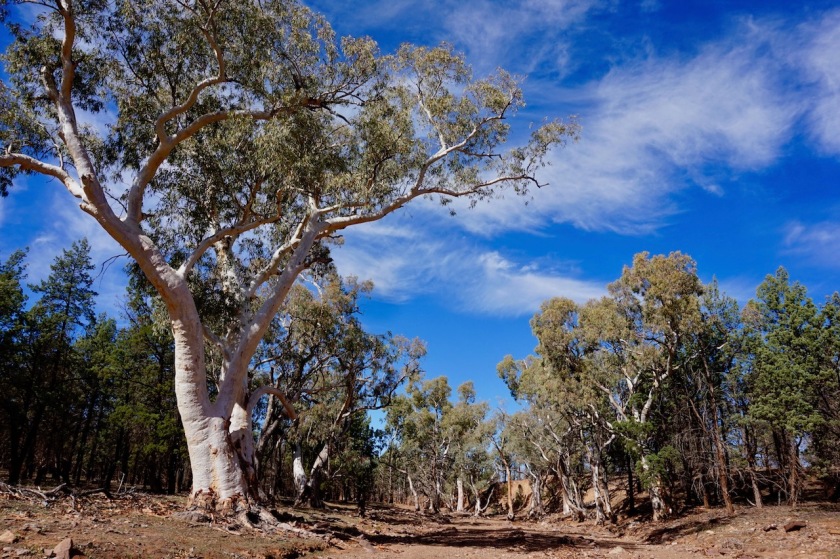
Magnificent big, fat red river gum trees in the creek beds, deep red sand, hills in the distant, a few bush flies…. I’m in Australia ! 🙂
When I arrive at the Middlesight Water Hut, there is already a girl who’s walking the Heysen Trail. I’ll leave her on her own and ride back a few hundred meter to camp under the trees.
The tent had to dry out anyway from all the condens it has every morning now, with this huge temperature differences between day & night and the somewhat humid soil from the recent rains.
Day 98: 16 May 2019
From a bit before Middlesight Water Hut to Parachilan Gorge, near Heysen Trail trailhead
60,40 km (Total so far: 4260,60 km) – Altitude climbed: 849
Weather: Sunny, light head wind
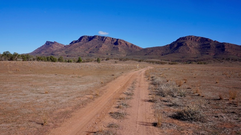
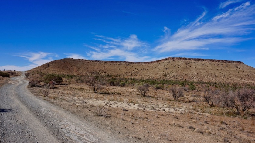
I’ve made it into a habit to climb the nearest hill to my campsite in the morning, to have an overview of the area. Today’s hill especially gave me some spectacular views. To my west lay the ABC Range (the range I crossed yesterday via the Bunyeroo Creek and the steep Razorback Ridge). Behind the ABC the higher Heysen Range. Hans Heysen, an Australian born in Germany, was an artist who became famous for his images of the typical gum trees and the landscapes of the Flinders Ranges..
The 1.200 km long hiking trail between Cape Jervis and Parachilna is named after him, and also this mountain range.
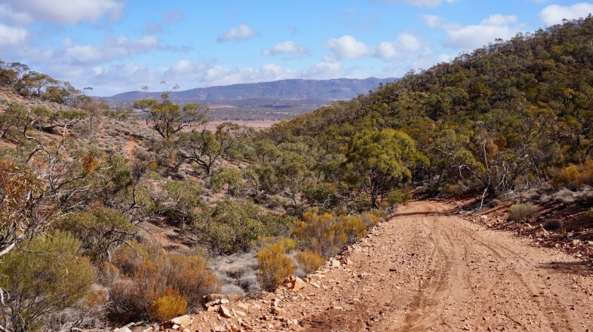
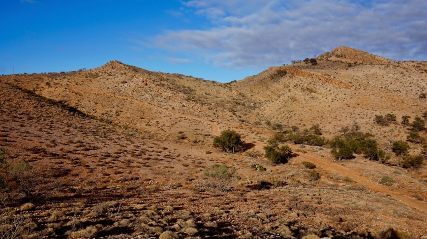
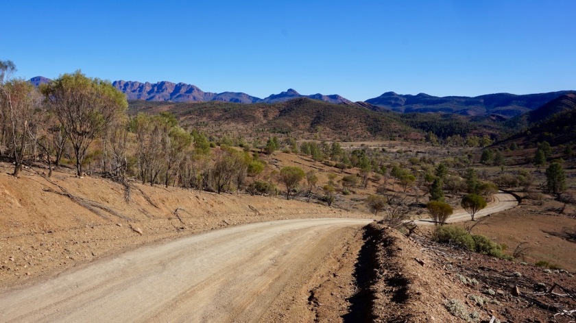
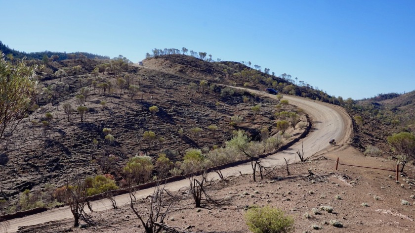
Heading north over the Trezona Track is hard work. Always steep up, a bit down, more up, a bit down. No worries, the views around are great. The steepest part is through Bulls Gap, crossing the Trezona Range. Here I leave the dirt and it’s another 22 kilometer or so via the bitumen of the Flinders Range Way towards Blinman.
One great highlight along that way: The Great Wall Of China (another one, after I visited another ‘Great Wall of China’ in Mungo National Park). It’s worth the effort to ride the dirt road up towards the viewpoint.

Blinman is the end of the asphalt road, the end of the Mawson Trail and it’s also the highest village in the State of South-Australia (we’re about 620 m asl).
According to the girl in the bakery, there are 18 people living here. She’s one of them.
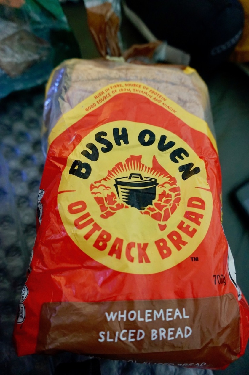
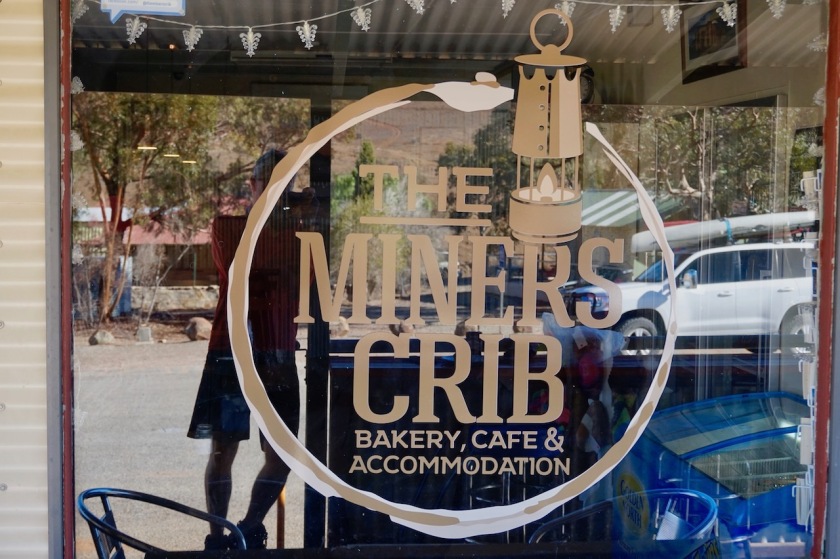
The bakery has some of the best bread I’ve found so far in Australia. The home made bread of Hans and Claudia remains by far the best I’ve had here though.
The bakery doubles as convenience store as well, but it’s quite limited. Some tinned fish & pasta, etc… Do your shopping in Wilpena or Leigh Creek.

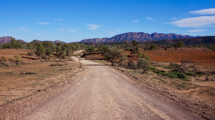
From Blinman I take the Parachilna Gorge Road, unpaved, washboard, into the gorge of the same name. I pitch the tent near the end of the gorge, near the trailhead of the Heysen Trail.
Day 99: 17 May 2019
From Parachilna Gorge, near Heysen Trail trailhead to 25 km before Leigh Creek
58,27 km (Total so far: 4318,89 km) – Altitude climbed: 158 m
Weather: Sunny, moderate tail and head wind
I am leaving the Flinders Ranges behind and descent the last altimeters towards Parachilna at the Outback Highway. For a brief moment, winds do what winds have to do, ‘fall off the mountain’ and push me in the back.
I stop at the famous Prairie Hotel in Parachilna to eat one of their outback burgers, i.e. kangaroo, emu, goat or camel burger. As I’ve seen the three first ones for myself since I’m here and I don’t want to eat them, I choose the camel burger.
I would suggest all cyclists to boycot these premises though. If you eat a full meal for 31 AUD, I think you can fill a couple of bottles with tap water for a cyclist.
They wouldn’t and send me off to the toilet building next to the road.
When I ask if that’s drinkable water, I get a plain answer ‘it’s from the government and their responsability.’
Pfffffff.
Making a 90 degree right turn northwards, I expected a side wind, but during my early lunch break, the wind gods must have noticed, to their horror, I’ve had a bit of a tail wind, so they shifted their machine and it blows full in the face again.
I put the head down, listen to some podcasts ‘The Move’ and ‘Cycling Podcast’ reg. the Giro d’Italia.
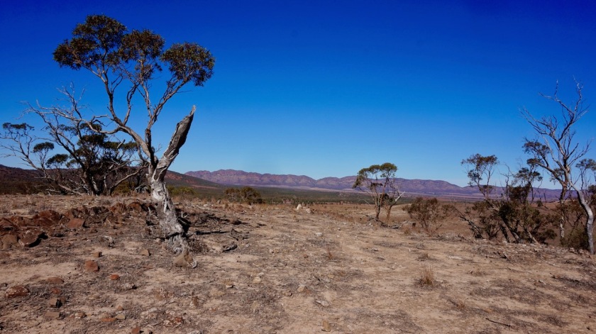
To my east, I stil have the hills of the Northern Flinders Range.
I camp at a reasonably good spot, next to a dry creek. Very, very windy night.
Day 100: 18 May 2019
From 25 km before Leigh Creek to 1 km passed Lyndhurst
67,77 km (Total so far: 4386,66 km) – Altitude climbed: 245 m
Weather: Cloudy, strong head wind
Day hundred in Australia.
You would think the gods would have a little mercy on me this day.
They had not.
Not at all.
At times, I struggled to get the speed up in the double digits on the flat.
It’s been a very, very hard day. One of the least enjoyable.
The bush flies are around in masses. They swarmed me whilst packing up this morning, they did likewise when pitching the tent and stayed around till after the mosquitos came out.
I stopped in Leigh Creek to shop. This will probably be my last supermarket until Alice Springs, more than a thousand kilometer away.
If you cycle this way, note that the shop closes at 12:30 on Saturdays and won’t open again till Monday.
Today was election day in Australia.
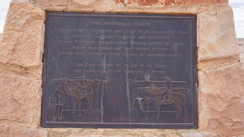
I saw eight wedge-tailed eagles today. Also, I passed the juction with the famous Strzelecki Track.

Day 101: 19 May 2019
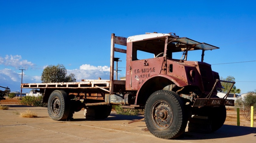
From 1 km passed Lyndhurst to Marree
84,23 km (Total so far: 4470,89 km) – Altitude climbed: 127 m
Weather: Cloudy, strong head wind
I got up real early. The wind is still blowing against me, but I’d like to make it to Marree today.
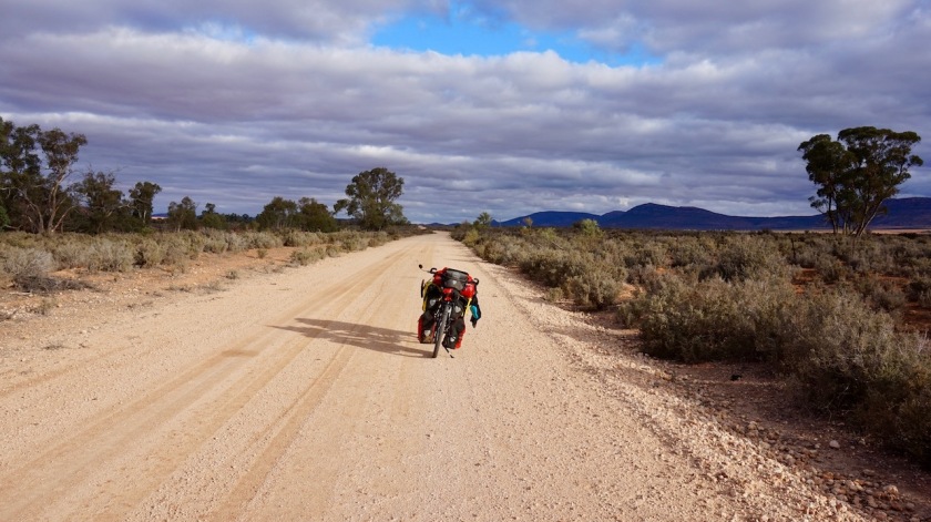
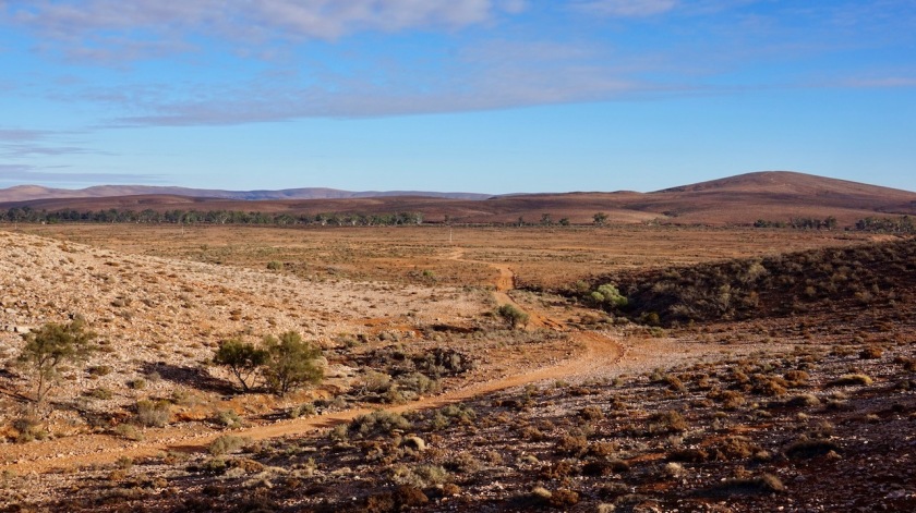
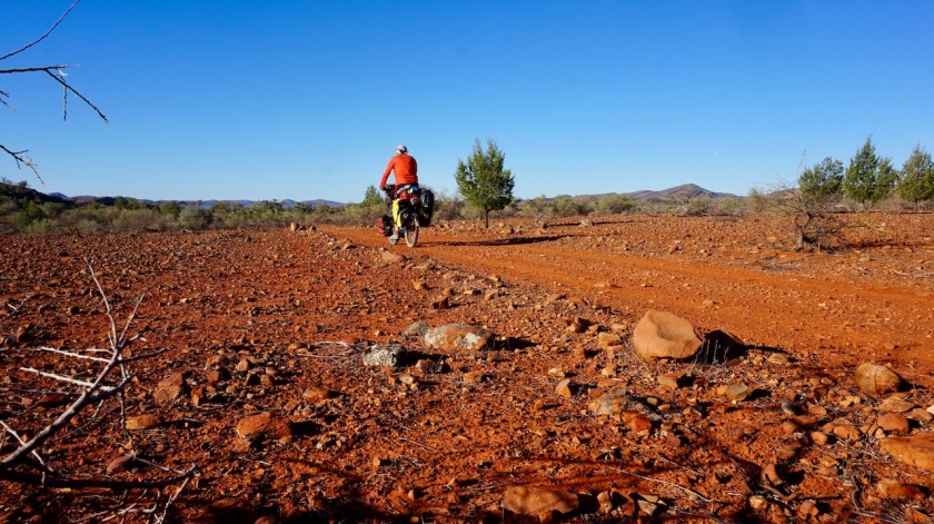
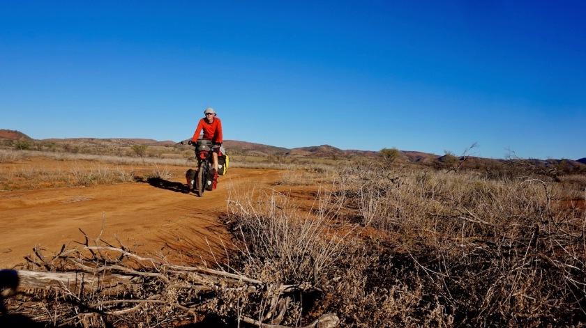
Almost pancake flat, but still this was one of the toughest days here in Australia. A hard battle against that wind, the Outback Highway which turned in a gravel road, minor undulations.
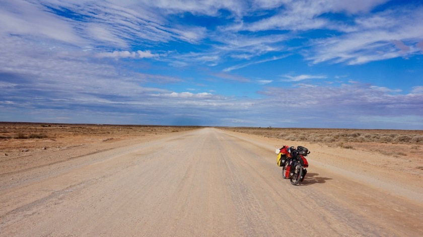
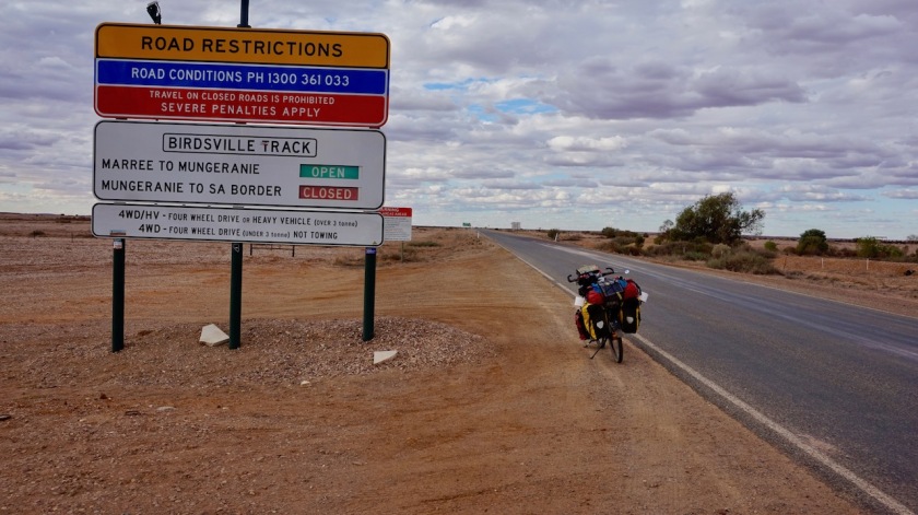
On the entrance of Marree, which is the terminus of the ‘Outback Highway’, and the start of the Birdsville Track. A sign says it’s closed.
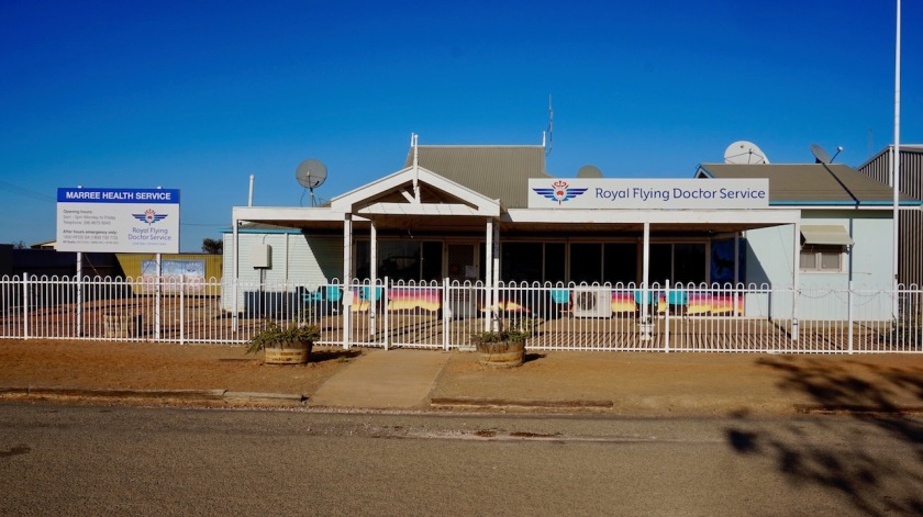
Day 102: 20 May 2019
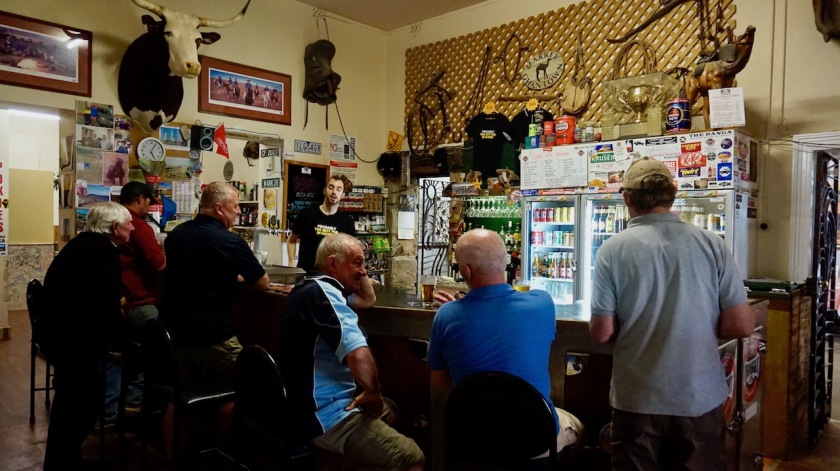
Marree, rest day
A rest day during which I had a lot of work. For a start I went to the police, to enquire about the situation on the Birdsville Track. They only open their shop at 9 am, so I have a chat with the Flying Doctors next door first. They reckon I won’t get through on the Birdsville.
They also say their fellow Australians are crazy. They are all here because Lake Eyre is filling up, which happens only once every few years, but at both lookout points, the lake is still dry according to them.
Me, I don’t understand the fuzz about a lake with water. Isn’t that just a lake ?
I would say it’s much more special when it’s a dry salt lake, more colorful. But, they reply, it’s because it doesn’t happen often it has water. Still, they don’t come over to see it when it’s dry.
Weird.
The police is super friendly and helpful. I was afraid I would be dismissed immediately, because it would be ‘dangerous’ and ‘officially this and that’ and blablabla.
But no, she phoned around, to a station that sits in the middle. They weren’t sure. She phoned to her colleague in Birdsville, but he didn’t answer the phone, she phoned someone else, …
I came back in the afternoon while she kept trying to reach her colleague, but also then no reply. Maybe he had a day off.

Cleaned my bike thoroughly, oiled and tightened the chain, checked whether all bolts were still tight, ….
Late afternoon, Ruth arrives, a 70 year old German lady I saw already on the top of Mount Ohlssen Bagge. She is traveling around Australia in a Toyota Jeep since four years and is incredibly fit and full of good tips about the country.
Next up: The Oodnadatta Track !

Hoi koenie! Ik plofte me in de zetel en genoot van je reisverhaal! Schitterend, magnifiek! Niet altijd evident om vooruit te geraken zo te lezen. Maar dat weegt niet op tg die zalige uitzichten!En die zonsondergangen,echt de max! Ja,ja ik smelt hier weg! Geniet maar! Op naar je volgende avontuur! x zeese groetjes! Enjoy your trip
LikeLike
En dan is er no de winterse sterrenhemel hier. Ook magnifiek.
Groeten 🙂
LikeLike
Fantastic documentation and pictures of your experience! Can’t wait to read more!
Greg
LikeLike
Thanks for your kind words Greg 🙂
LikeLike
Ohhh that’s all cool! such nice memories! 🙂 I am planning another trip for a few weeks in Spain and Portugal, you are obviously an expert on this. Where are you now?
LikeLike
Hi Kristina,
Yes, me too I have very good memories of Australia and I hope to return to the country in the future to see more of it.
I’ve done a lot of cycling in Spain as well indeed. It’s one of the best countries in Europe for a bike trip with so much rural ‘camino’s’ and diverse landscapes. My plan was to spend winter on the Canary Islands, but I got severe knee problems in the Extremadura. I took a long rest, but it didn’t improve, and I returned home. Early January, I can go to the knee specialist here. Let’s hope he can fix me again so I can resume my trip early spring 2021.
Where do you plan to go biking in Spain / Portugal ?
LikeLike
BTW I have also camped on that Kanyaka creek right before the storm (later I found out that you should not camp on creeks in the Australian outback, especially when it is about to rain) and that storm absolutely battered me the next day haha
LikeLike
Yeah, I was also a bit nervous to camp in the creek, but there was absolutely no other alternative. I just re-read this blog post because of your comments. So funny how much we forget after a while. Thinking back to my Australia trip, I didn’t remember the freezing cold nights, the winds….
Those few days on the Mawson Trail certainly were among the wettest in Australia.
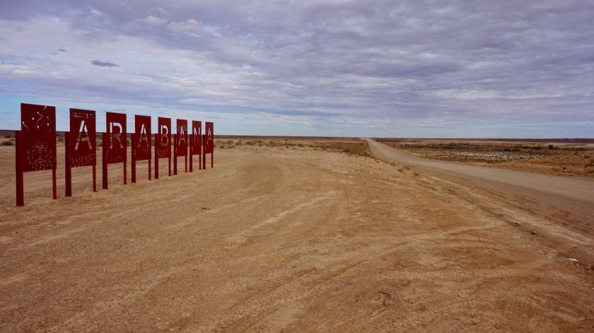
I definitely have to go back to Maree to ride the Birdsville Track.
LikeLike